 English
 Spanish
 French
 Chinese
 Russian
 Portuguese
 Последняя Активация
Charter activations
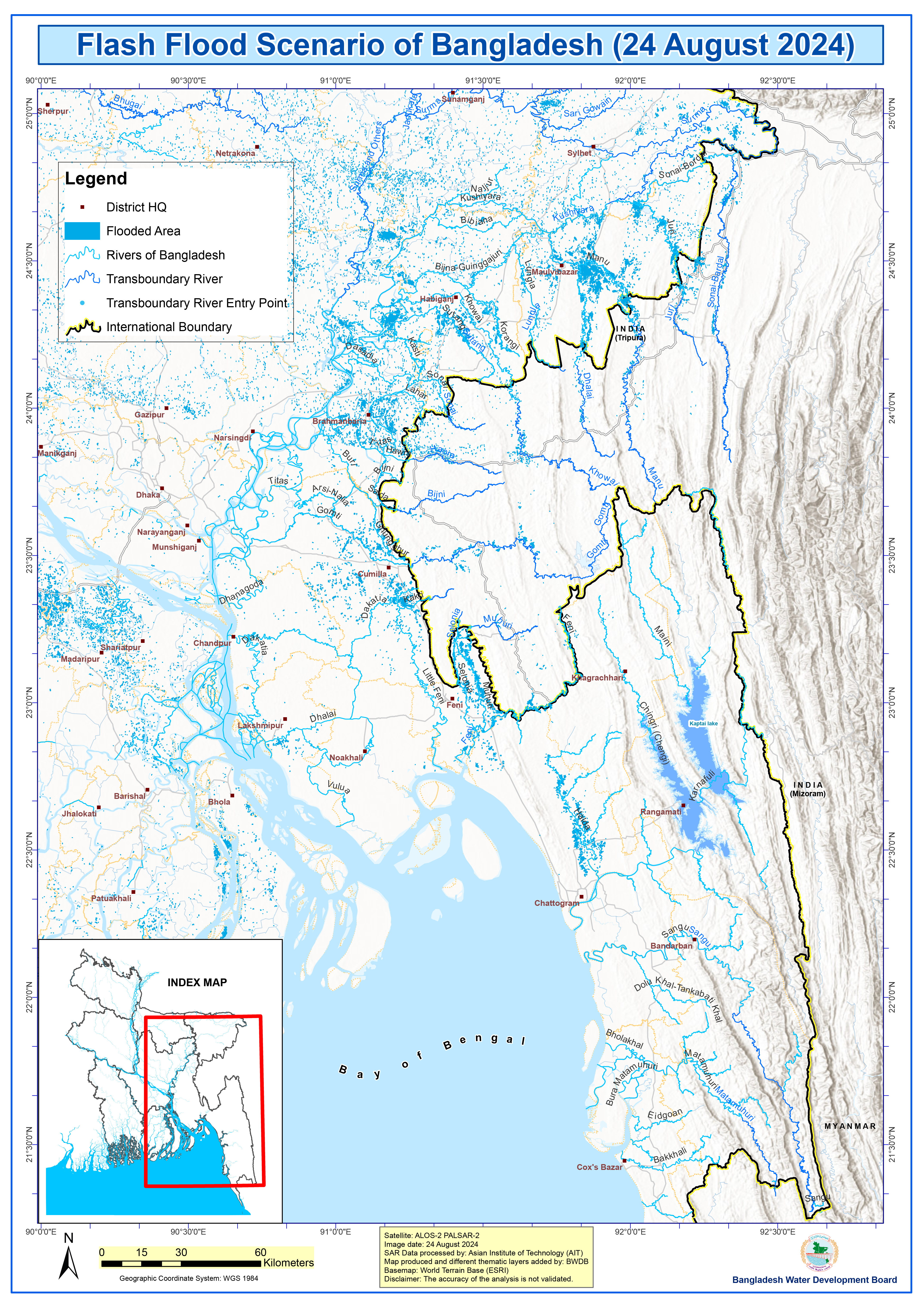
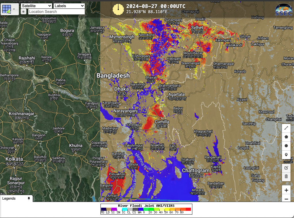
Flood in Bangladesh
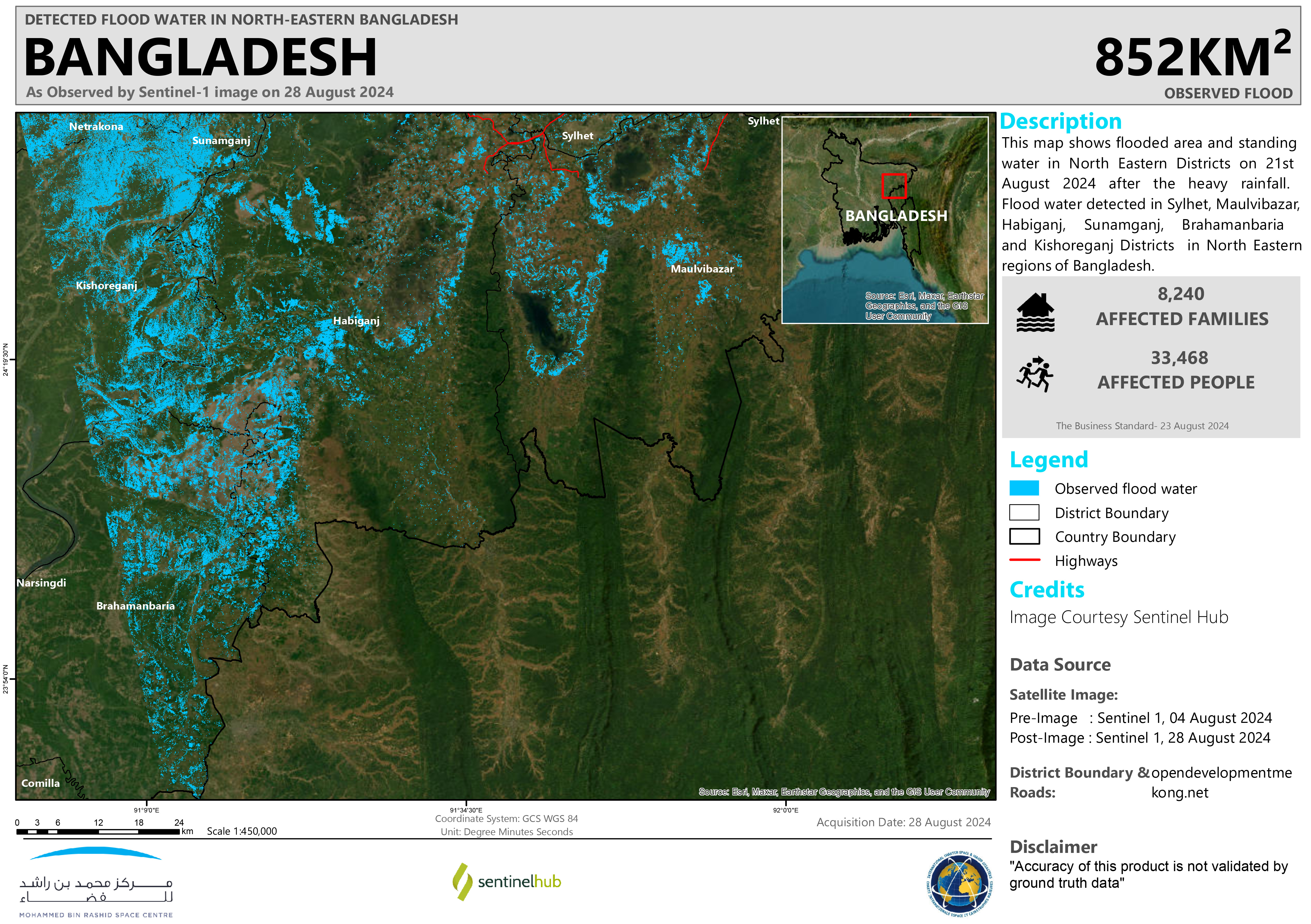
North and South Eastern Bangladesh has been severely affected by flash flooding due to prolonged and heavy monsoon rains between 21 – 25 August.
307,000 people are in shelters and more than 5.2 million have been affected by the floods. Currently the number of fatalities is at 18, it was reported.
311,419 hectares of land has been submerged. The flooding has impacted rural roads, agricultural fields, and aquacultural fishponds. Communication and coordination have been impacted due to power outages and limited connectivity. As of 24 August, nearly 928,000 people remained without power. 7,000 schools across the impacted districts have had to close.
Rescue teams, which also included military and navy forces, are bringing aid to those who have lost their homes. Disaster Management Minister reported that the flood situation is improving as the flood water has started to recede.
Related Resources:
UNOSAT Flood Monitoring Dashboard for the Floods in Bangladesh
| Тип события: | Flood |
| Место события: | Bangladesh |
| Date of Charter Activation: | 2024-08-27 |
| Время активации Хартии: | 19:19 |
| TЧасовой пояс в районе активации Хартии: | UTC+07:00 |
| Запрос на активацию поступил от: | UNOSAT on behalf of UNOCHA (ROAP) |
| Номер активации: | 905 |
| Менеждер проекта от: | Suwanan Sateiandee (UNOSAT) |
| act-value-adders: | NOAA Konstantin Homenkov (Geoniformation systems) SERTIT Rapid Mapping Service (SERTIT Rapid Mapping Service) Alia Mohammad Al Mekhyat (Mohammed Bin Rashid Space Centre) A M Mustofa Sorwar (Bangladesh Water Development Board (BWDB)) |
Products
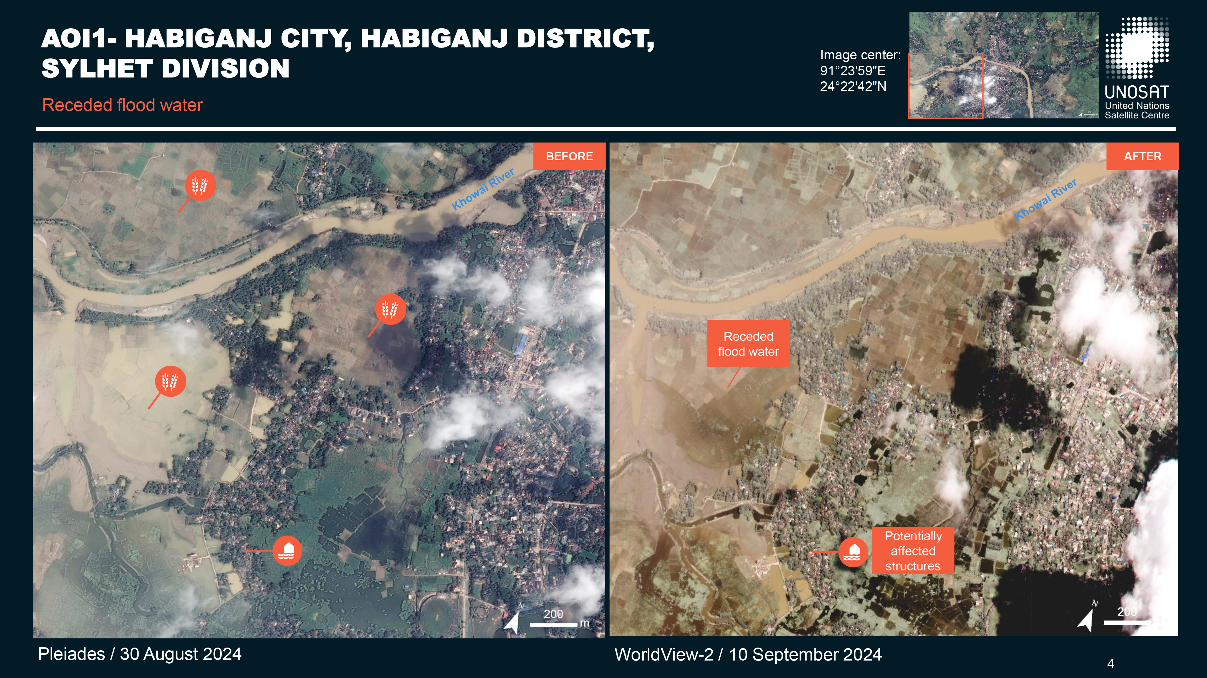
Preliminary Satellite-derived Flood Impact Assessment,Brahmanbaria City, Brahmanbaria District, Chattogram Division and Habiganj City, Habiganj District, Sylhet Division - Bangladesh
Download full report
Авторские права: Includes Pleiades material © CNES (2024), Distribution Airbus DS.
© (2024) DigitalGlobe, Inc., Longmont CO USA 80503. DigitalGlobe and the DigitalGlobe logos are trademarks of DigitalGlobe, Inc. The use and/or dissemination of this data and/or of any product in any way derived there from are restricted.
Map produced by UNITAR / UNOSAT
Information about the Product
Получено: Pleiades: 30/08/2024 / 04/09/2024
WorldView-2: 10/09/2024
Источник: Pleiades / WorldView-2
Категория: Dossier
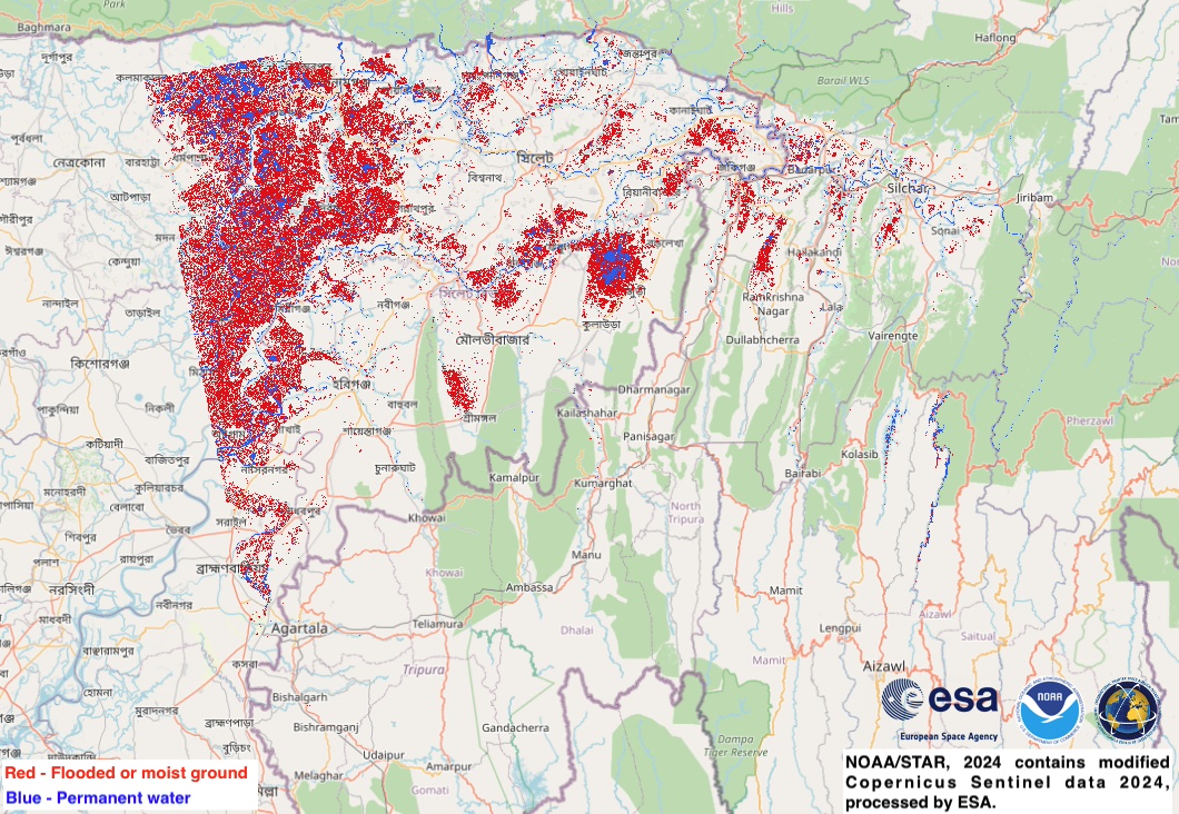
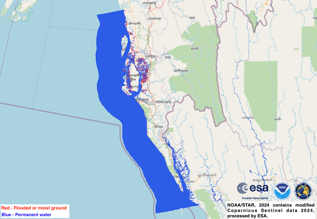

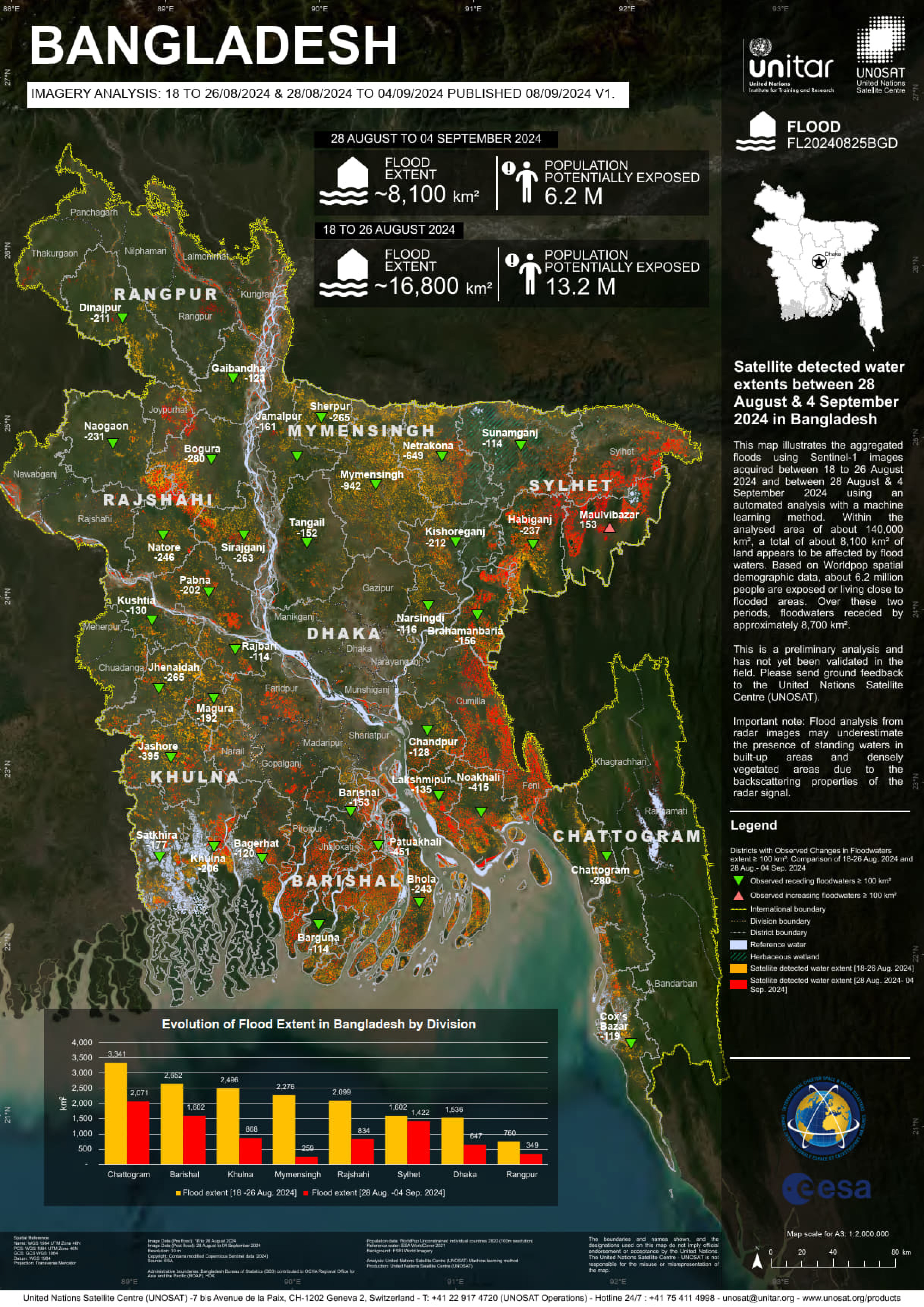
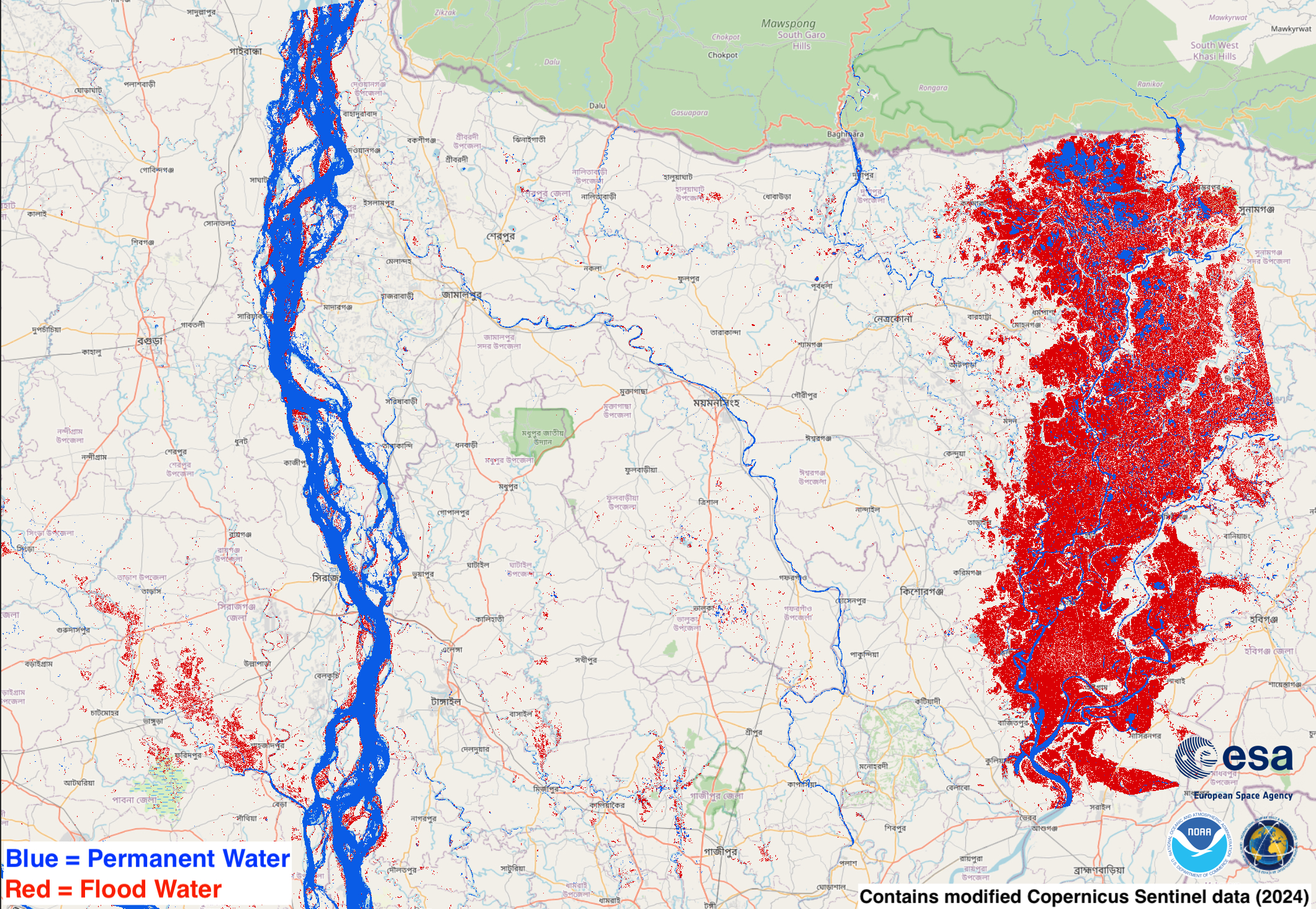
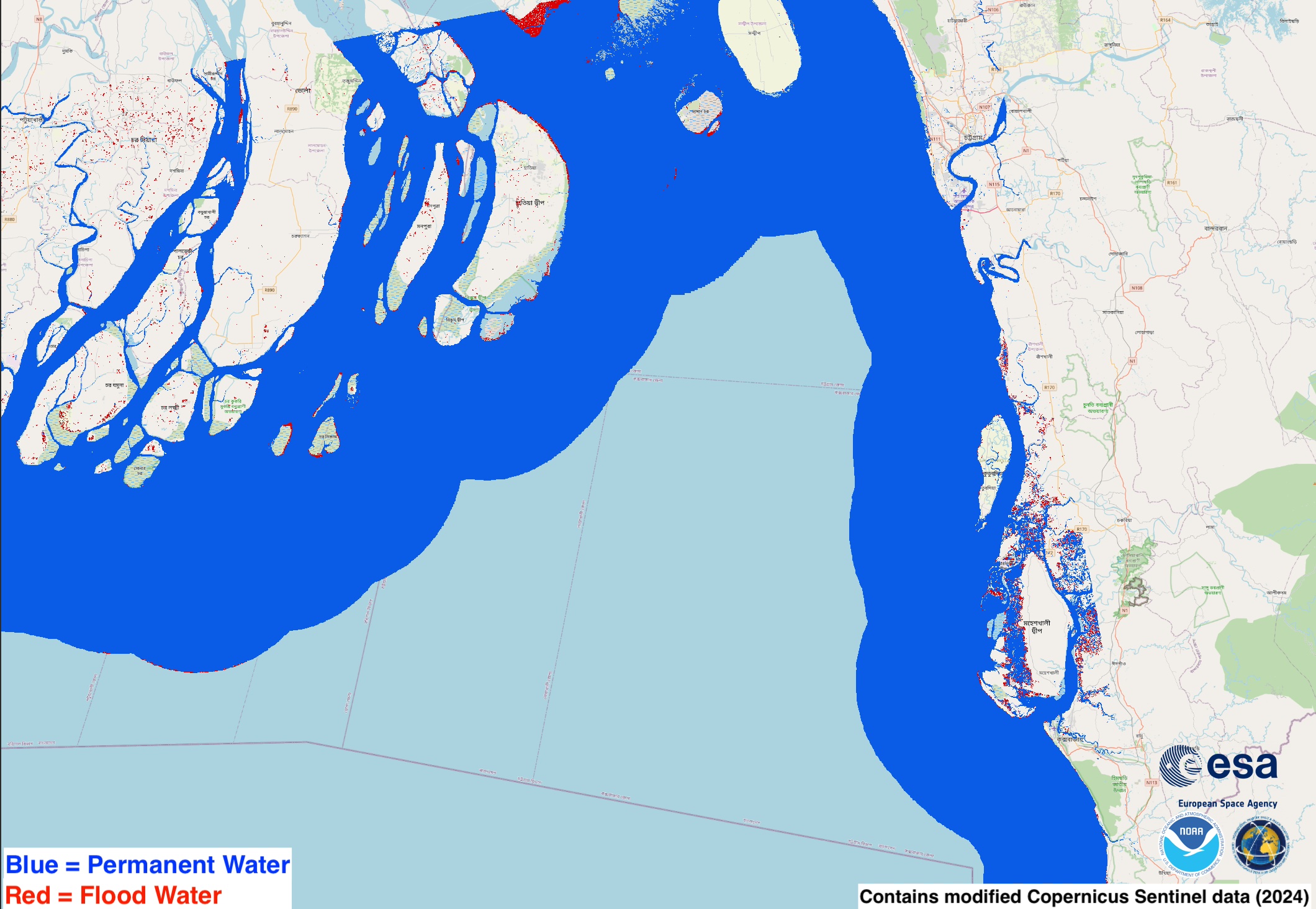
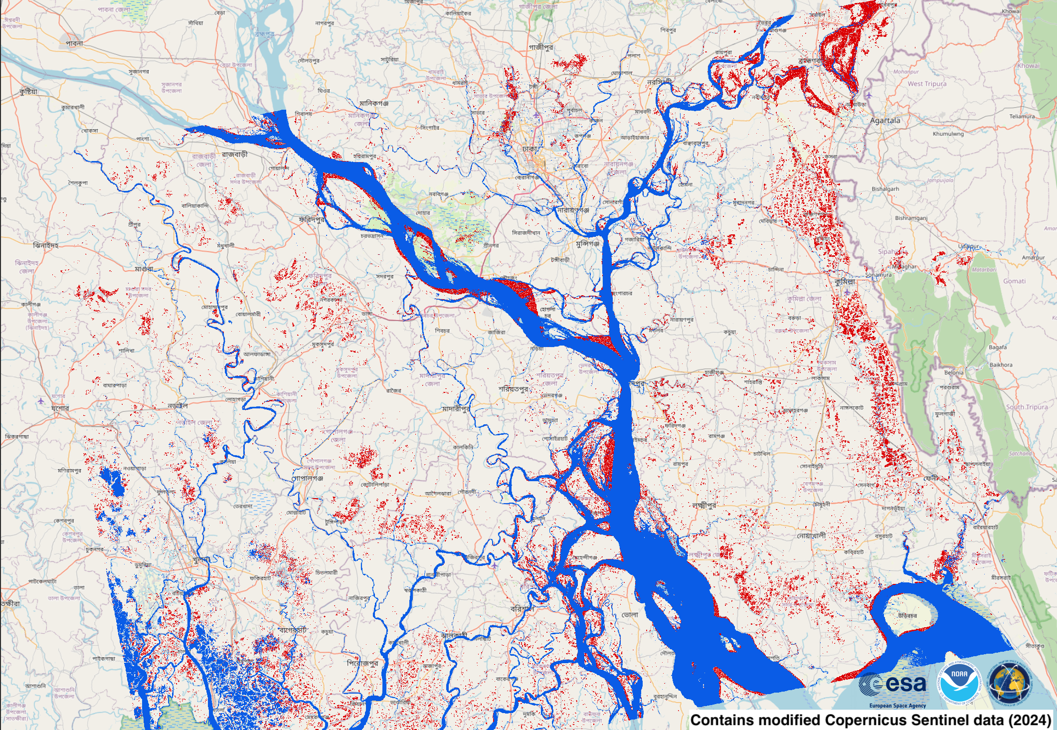
Satellite detected water extents in Bangladesh
Авторские права: Contains modified Copernicus Sentinel data (2024)
Map produced bu UNITAR / UNOSAT
Information about the Product
Получено: 28/08/2024 /18/08/2024 / 02/09/2024 / 23/08/2024 / 04/09/2024 / 30/08/2024
Источник: Sentinel-1
Категория: Delineation Map
Preliminary satellite-derived flood impact assessment, Noakhali City, Noakhali District; Chattogram City, Chattogram District & Cox's Bazar City, Cox's Bazar District, Chattogram Division - Bangladesh
Download full report
Авторские права: © KARI (2024).
Includes Pleiades material © CNES (2024), Distribution Airbus DS.
Report produced by UNITAR / UNOSAT
Information about the Product
Получено: KOMPSAT3: 29/08/2024 / 29/08/2024
Pleiades : 04/09/2024 / 30/08/2024
Источник: KOMPSAT-3 / Pleiades
Категория: Dossier
Preliminary satellite-derived flood impact assessment, Dighinala City, Khagrachhari District, Chattogram Division, Bangladesh
Download full report
Авторские права: Includes Pleiades material © CNES (2024), Distribution Airbus DS.
Information about the Product
Получено: 04/09/2024
Источник: Pleiades
Категория: Dossier
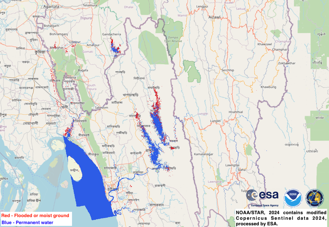
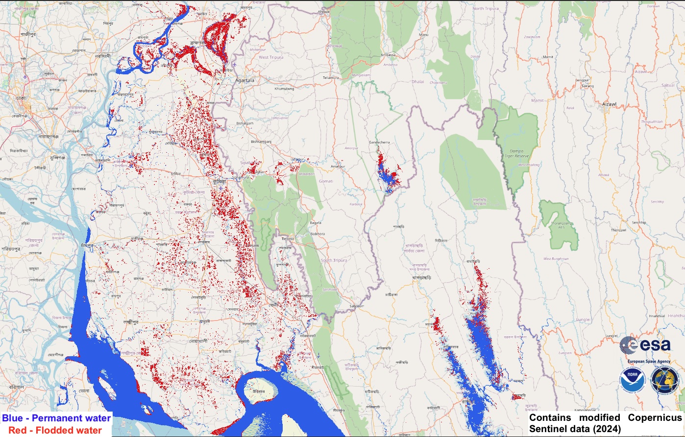
Flood situation in Feni, Bangladesh
Авторские права: Contains modified Copernicus Sentinel data (2024)
Includes Pleiades material © CNES (2024), Distribution Airbus DS.
Map produced by UE "Geoinformation systems"
Information about the Product
Получено: Sentinel-1: 17/05/2024 / 02/09/2024
Pleiades : 29/08/2024
Источник: Sentinel-1 / Pleiades
Категория: Reference Map
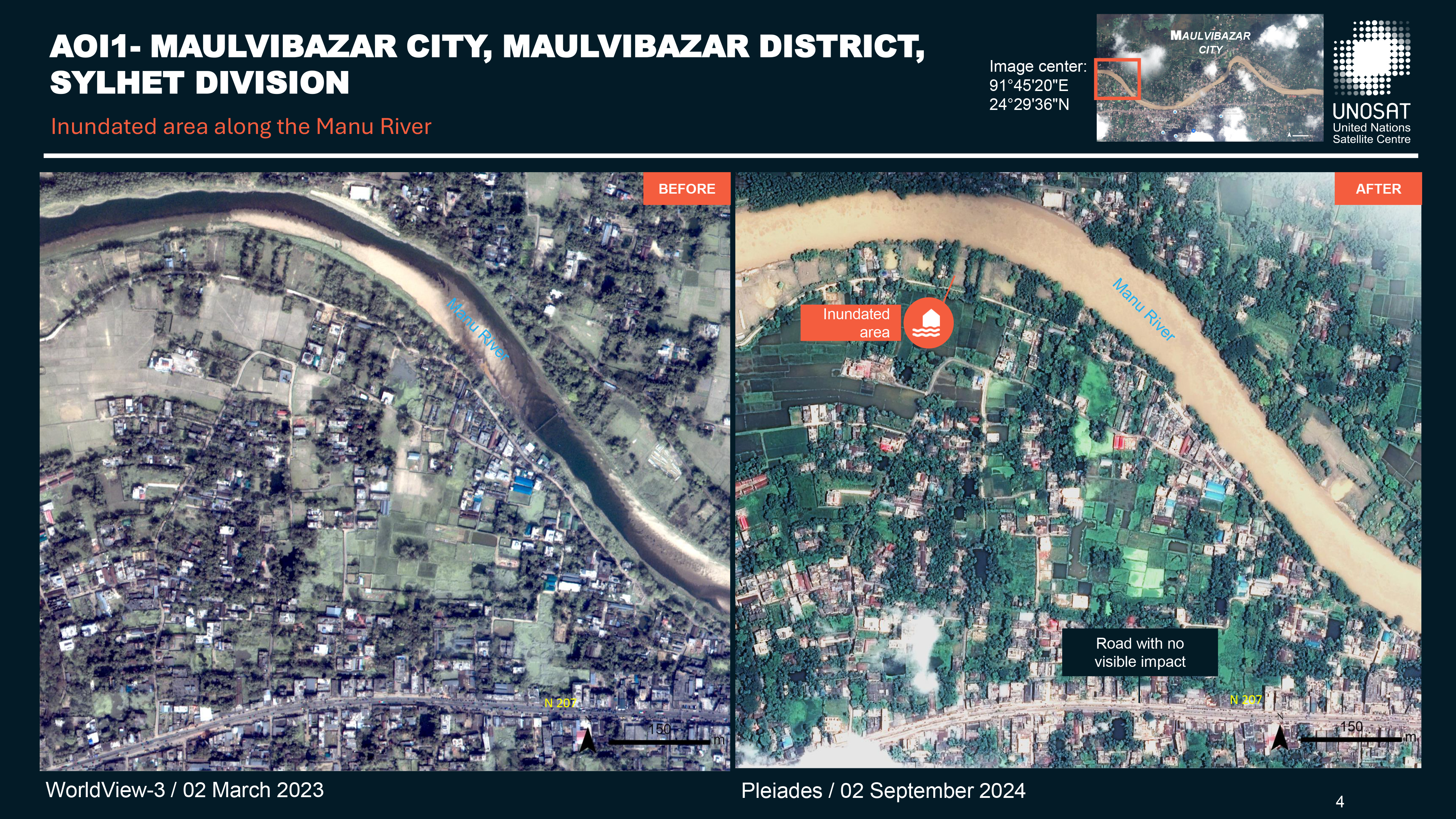
Preliminary satellite-derived flood impact assessment, Maulvibazar City, Maulvibazar District, Sylhet Division, Bangladesh
Download full report
Авторские права: Includes Pleiades material © CNES (2024), Distribution Airbus DS.
Report produced by UNITAR / UNIOSAT
Information about the Product
Получено: 02/09/2024
Источник: Pleiades
Категория: Dossier
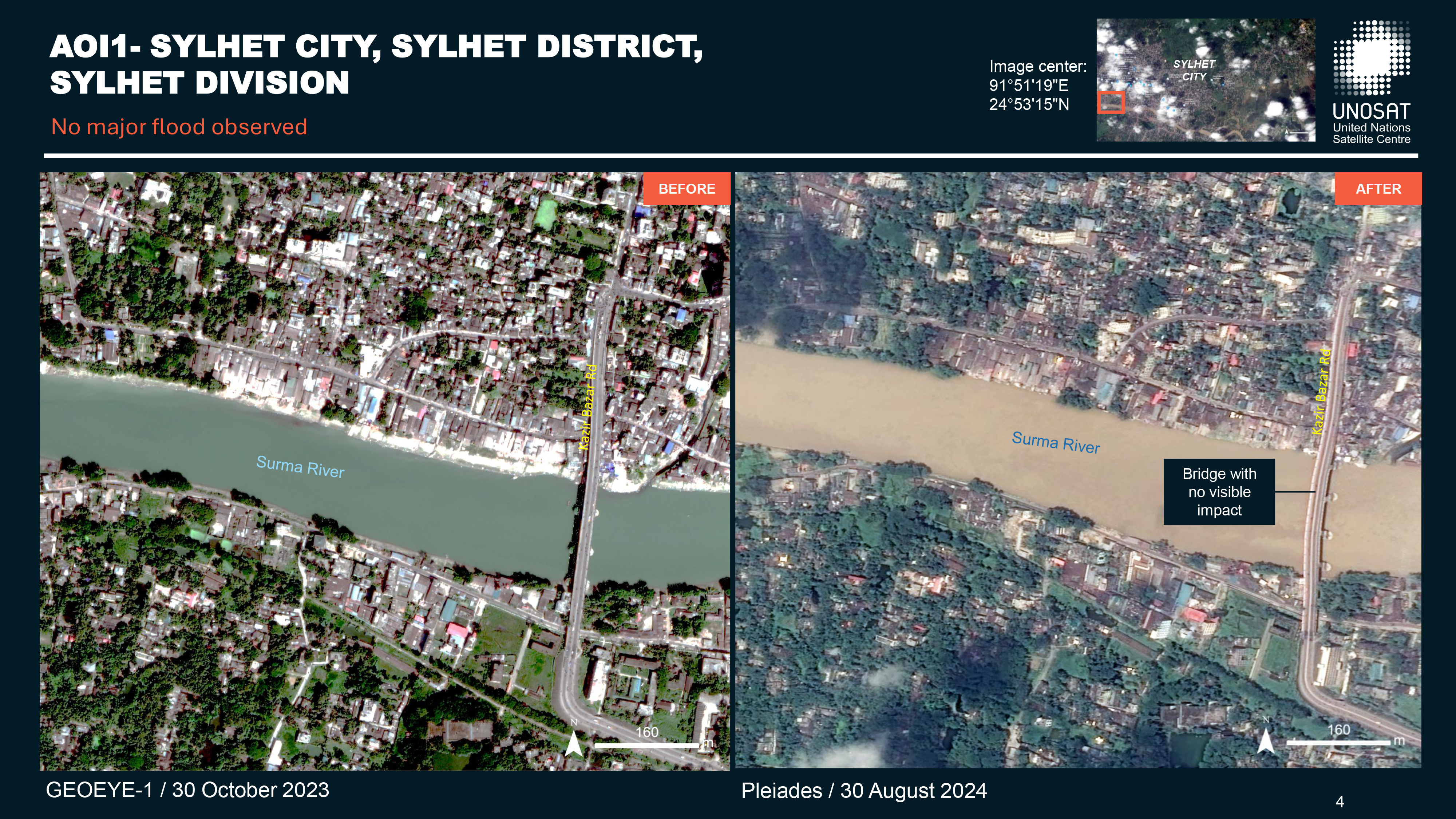
Preliminary satellite-derived flood impact assessment, Sylhet City, Sylhet District, Sylhet Division, Bangladesh
Download full report
Авторские права: Includes Pleiades material © CNES (2024), Distribution Airbus DS.
Report produced by UNITAR / UNOSAT
Information about the Product
Получено: 30/08/2024 / 02/09/2024
Источник: Pleiades
Категория: Dossier
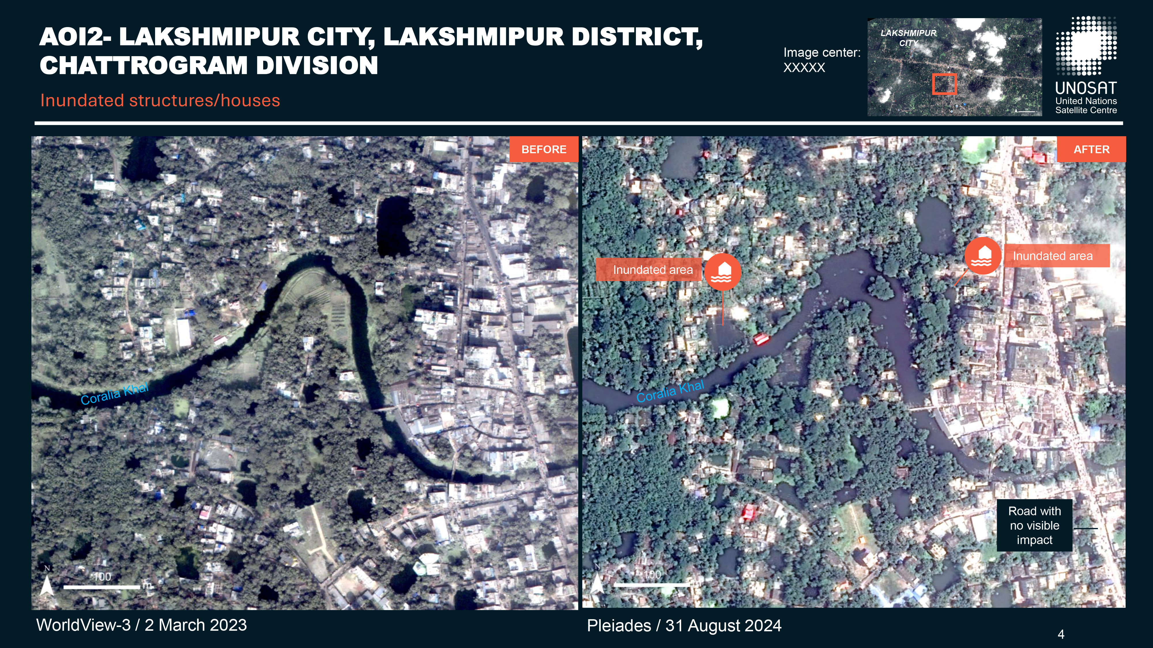
Preliminary Satellite-Derived Flood Impact Assessment Lakshmipur City, Lakshmipur District, Chattogram Division, Bangladesh.
Download full report
Авторские права: Includes Pleiades material © CNES (2024), Distribution Airbus DS.
Report produced by UNITAR / UNOSAT
Information about the Product
Получено: 01/09/2024
Источник: Pleiades
Категория: Dossier
Preliminary satellite-derived flood impact assessment, Cumilla City, Cumilla district, Chattogram Division, Bangladesh
Download full report
Авторские права: Includes Pleiades material © CNES (2024), Distribution Airbus DS.
Report produced by UNITAR / UNOSAT
Information about the Product
Получено: 29/08/2024
Источник: Pleiades
Категория: Dossier
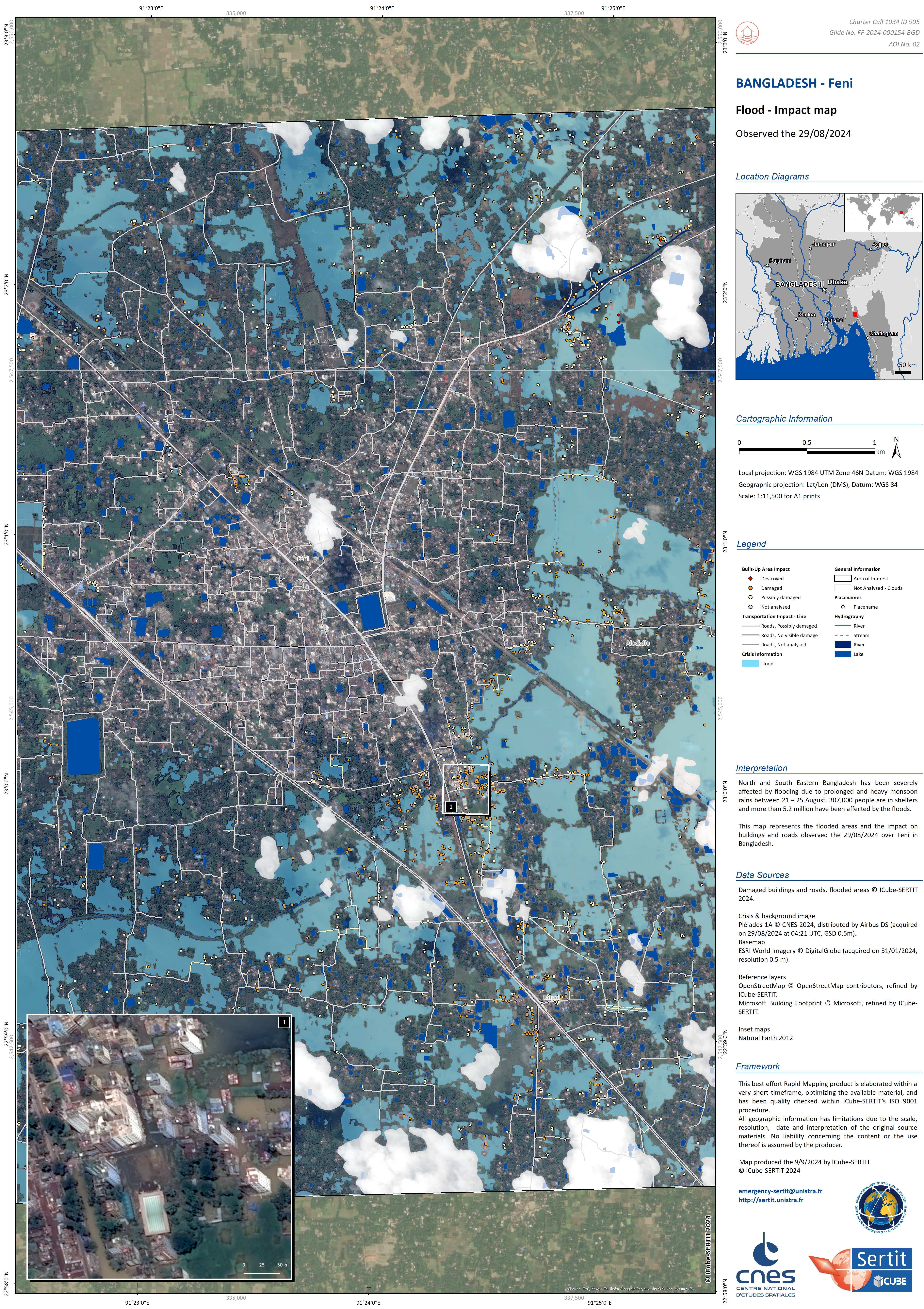
Preliminary Satellite-derived Flood Impact Assessment, Feni City, Feni district, Chattogram Division, Bangladesh
Download full report
Авторские права: Includes Pleiades material © CNES (2024), Distribution Airbus DS.
Report produced by UNITAR / UNOSAT
Information about the Product
Получено: 29/08/2024
Источник: Pleiades
Категория: Dossier
 Вернуться к полному архиву активаций

