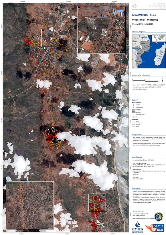
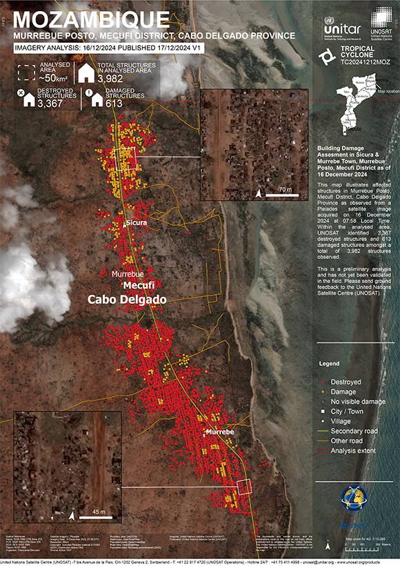
Charter activations
Cyclone Chido in Mozambique
After passing through, Madagascar, Mayotte Island and Comoros Island, tropical cyclone Chido made landfall in Pemba, the capital of Mozambique's Cabo Delgado province on 15 Decemeber.
Many homes, schools and health facilities have been destroyed, and some partially affected. Organisation UNICEF have reported that they are working closely with the government to ensure essential basic services are continued.
Related Resources:
| Tipo de evento: | Cyclone |
| Local do evento: | Mozambique |
| Data da Ativação da Carta: | 2024-12-13 |
| Tempo de Ativação da Carta: | 15:08 |
| Zona de Tempo da Ativação da Carta: | UTC+01:00 |
| Requisitante da Carta: | UNOSAT on behalf of United Nations Office for the Coordination of Humanitarian Affairs (OCHA) |
| ID da Ativação: | 936 |
| Gerenciamento de projeto: | Teodoro Hunger (UNITAR/UNOSAT) |
| act-value-adders: | Copernicus EMS (Copernicus EMS) SERTIT Rapid Mapping Service (SERTIT Rapid Mapping Service) |
 | Activation handled in collaboration with Copernicus Emergency Management Service |
Products
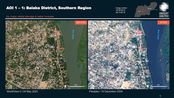
Preliminary satellite-derived damage assessment - Balake, Machinga & Nsanje Districts, Southern Region, Malawi
Download full report
Direitos autorais: Includes Pleiades material © CNES (2024), Distribution Airbus DS.
Report prepared by UNITAR / UNOSAT
Information about the Product
Adquirida: 19/12/2024
Fonte: Pleiades
Categoria: Reference Map
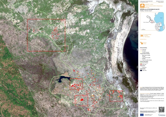
Grading Product with the damage grade assessment over Metuge
Download full image
Direitos autorais: © Maxar Technologies, Inc. (2024). Copernicus EMS (© 2021 European Union). Map produced by Copernicus EMS
Information about the Product
Adquirida: 19/12/2024
Fonte: GeoEye,
Categoria: Grading Map
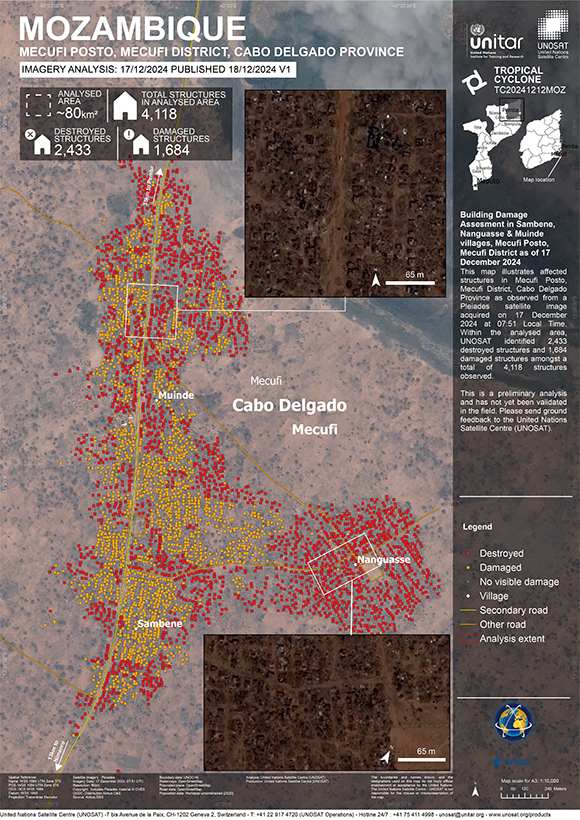
Building Damage Assesment in Sambene, Nanguasse & Muinde villages, Mecufi Posto, Mecufi District
Direitos autorais: Includes Pleiades material © CNES (2024), Distribution Airbus DS.
Map produced by UNOSAT/ UNITAR
Information about the Product
Adquirida: 17/12/2024
Fonte: Pleiades
Categoria: Reference Map
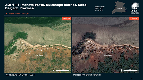
Preliminary satellite-derived damage assessment, Quissanga, Montepuez & Metuge Districts, Cabo Delgado Province, Mozambique
Download full report
Direitos autorais: Includes Pleiades material © CNES (2024), Distribution Airbus DS.
Map produced by UNOSAT/ UNITAR
Information about the Product
Adquirida: 17/12/2024
/ 18/12/2024
Fonte: Pleiades
Categoria: Reference Map
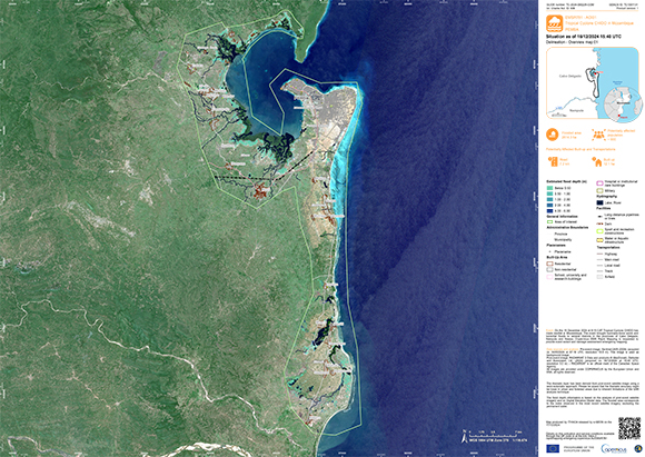
Delineation Product with the identification of the affected areas over Pemba, Mozambique
Download full product
Direitos autorais: RADARSAT-2 Data and Products © Maxar Technologies Ltd. (2024) – All Rights Reserved
RADARSAT is an official mark of the Canadian Space Agency
Map produced by Copernicus
Information about the Product
Adquirida: 16/12/2024
Fonte: RADARSAT-2
Categoria: Delineation Map
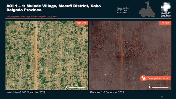
Preliminary satellite-derived damage assessment, Mecufi and Cidade de Pemba Districts, Cabo Delgado Province, Mozambique
Download full report
Direitos autorais: Includes Pleiades material © CNES (2024), Distribution Airbus DS.
Report produced by UNITAR / UNOSAT
Information about the Product
Adquirida: 16/12/2024
Fonte: Pleiades
Categoria: Delineation Map
 Voltar ao arquivo completo da Ativação

 English
 Spanish
 French
 Chinese
 Russian
 Portuguese
