 English
 Spanish
 French
 Chinese
 Russian
 Portuguese
 最新宪章启动
Charter activations
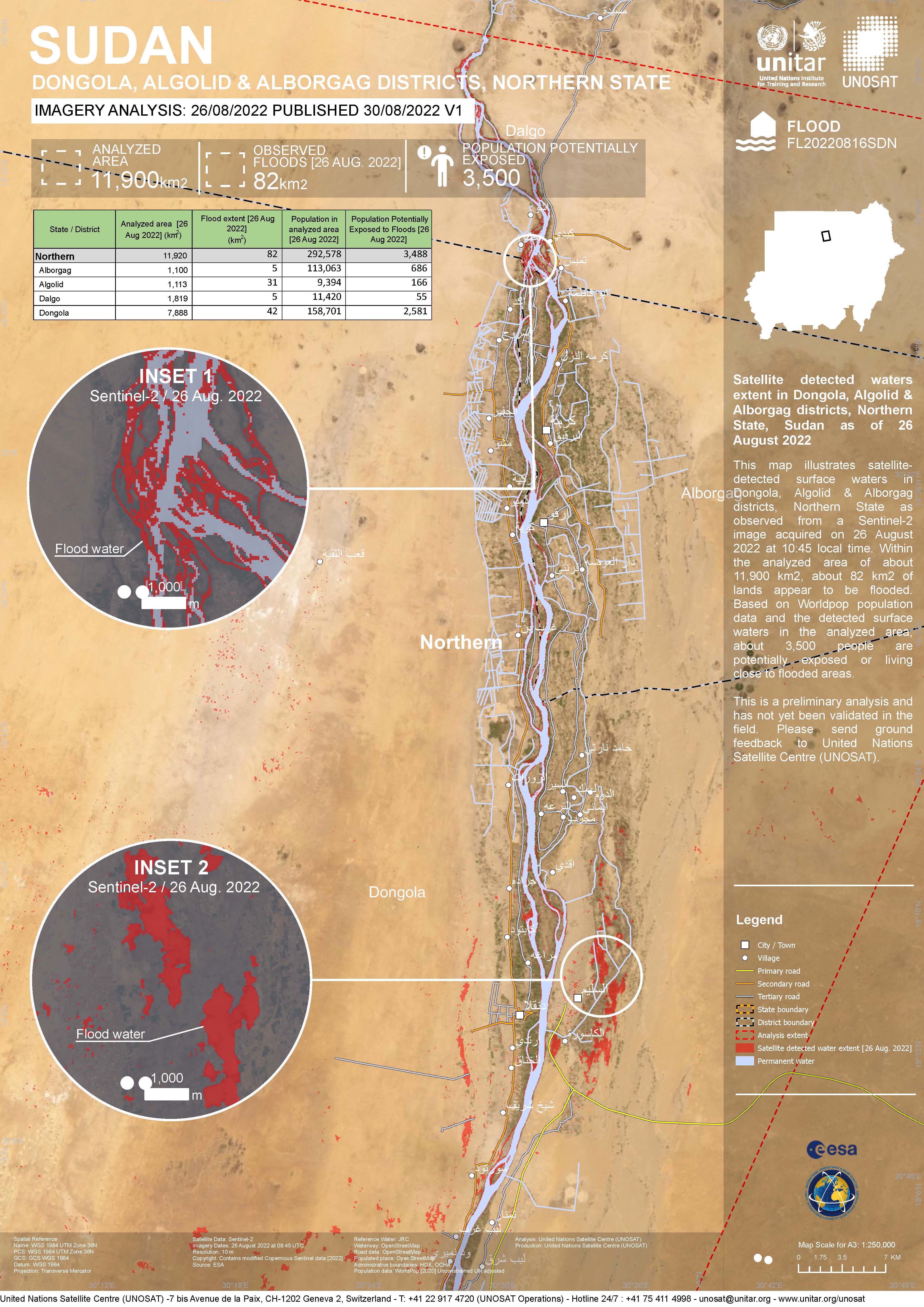
Flood in Sudan
Large parts of Sudan have been flooded due to heavy rain. More than 75 people have been killed and thousands of buildings have been destroyed. Most affected areas include Al-Jazirah, North Kordofan, South Kordofan, South Darfur and the river Nile.
| 事件类型: | Floods |
| 事件地点: | Sudan |
| 启动宪章的日期: | 2022-08-21 |
| 宪章启动时间: | 10:02 |
| 宪章启动时区: | UTC+02:00 |
| 宪章要求者: | Ministry of Agriculture and Natural Resources in Sudan |
| 启动ID: | 769 |
| 项目经理: | UNITAR/UNOSAT |
Products

Flood situation in Dongola, Sudan
版权: WorldView-3 © (2022) DigitalGlobe, Inc., Longmont CO USA 80503. DigitalGlobe and the DigitalGlobe logos are trademarks of DigitalGlobe, Inc. The use and/or dissemination of this data and/or of any product in any way derived there from are restricted. Unauthorized use and/or dissemination is prohibited.
Landsat data and products © NASA/USGS (2022) - All Rights Reserved
Map produced by UE GeoInformation Systems
Information about the Product
已获得: WorldView-3: 14/09/2022
Landsat 9: 29/08/2022, 14/09/2022
源: WorldView-3, Landsat 9
类别: Delineation Monitoring Maps

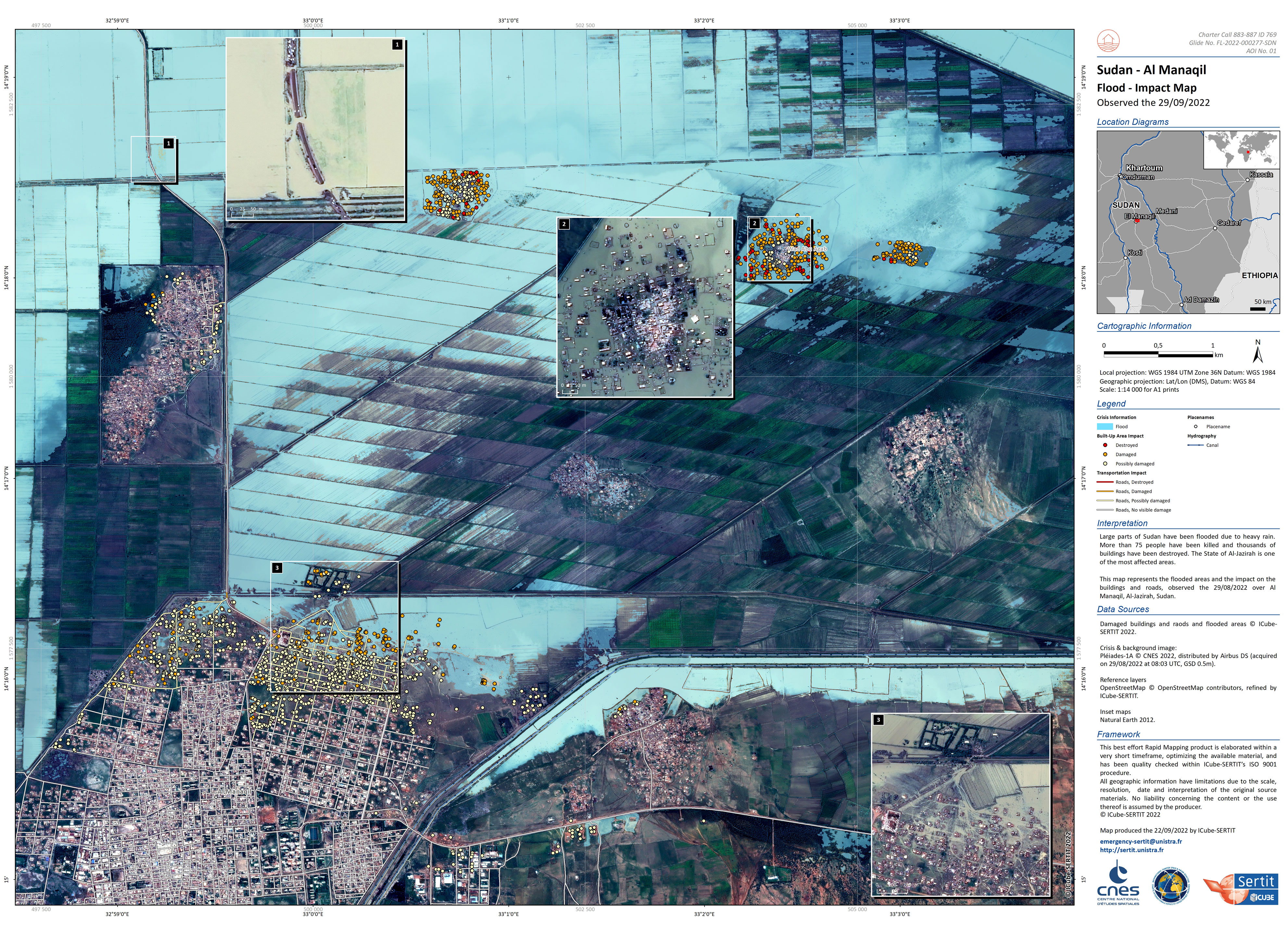
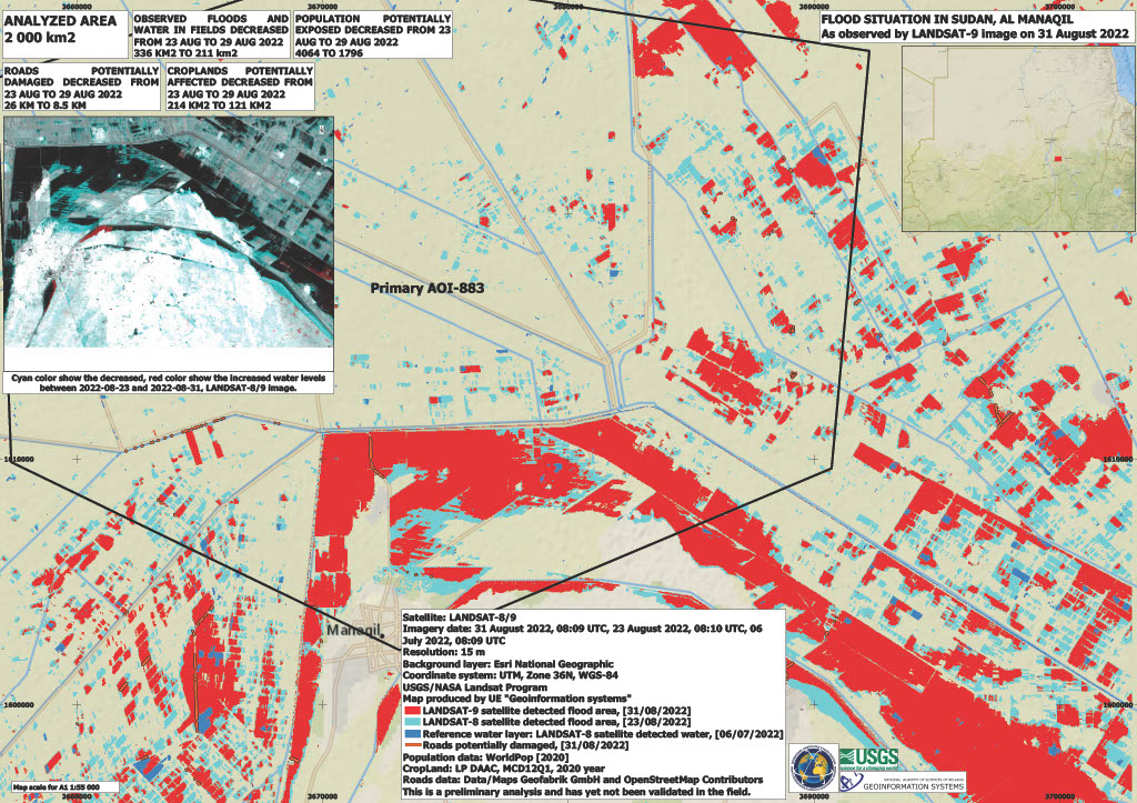
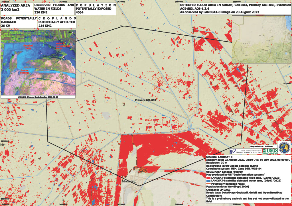
Flood situation in Sudan, Al Manaqil
版权: VRSS-2 © ABAE (2022). All Rights Reserved
Landsat 9 © Landsat data and products © NASA/USGS (2022) - All Rights Reserved
Map produced by UE Geoinformation Systems
Information about the Product
已获得: VRSS-2: 06/09/2022
Landsat 9: 31/08/2022
源: VRSS-2 / Landsat 9
类别: Delineation Monitoring Maps

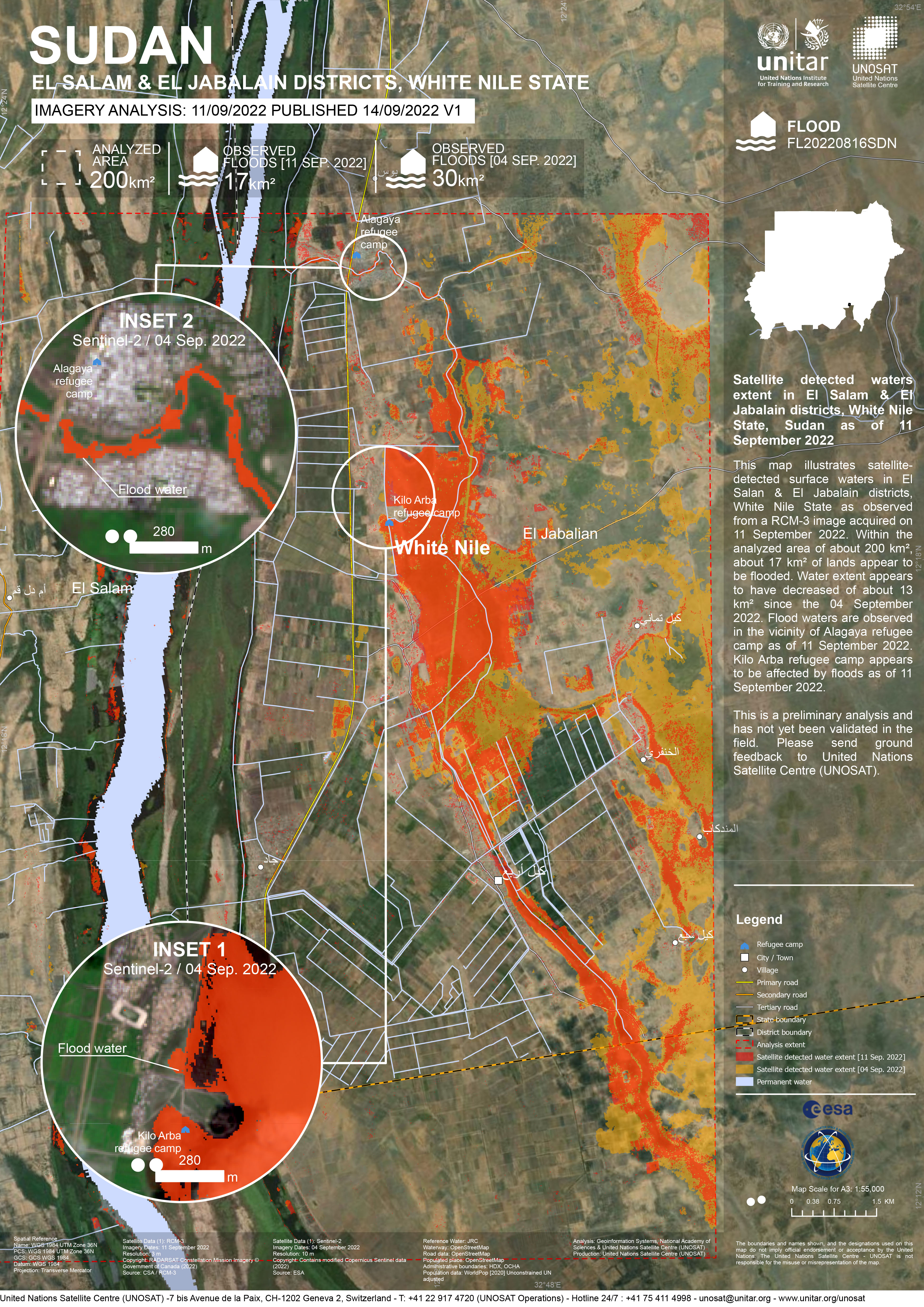
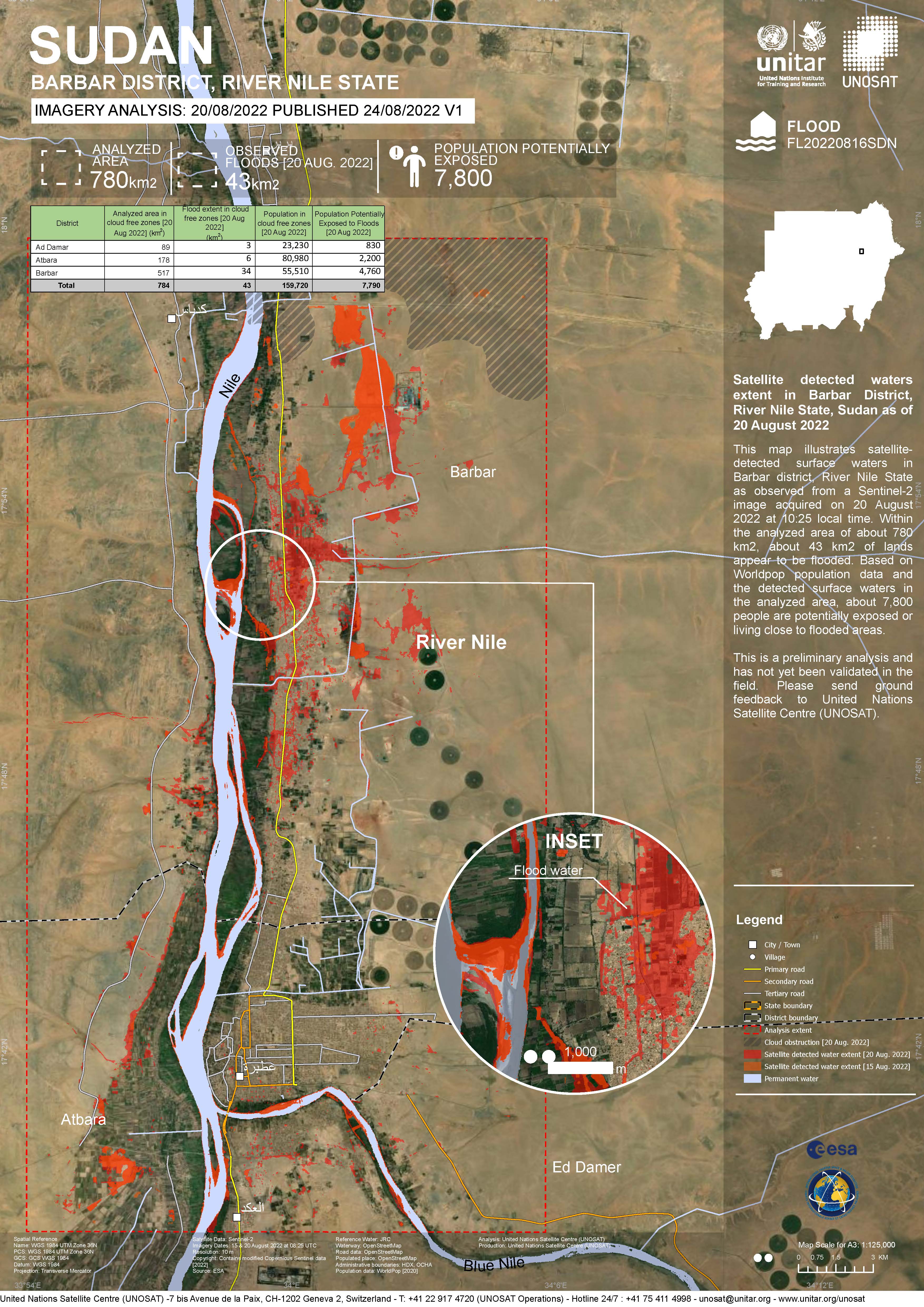
Flood in Sudan
版权: Contains modified Copernicus Sentinel data (2022)
RADARSAT Constellation Mission Imagery © Government of Canada
Map produced by UE "Geoinformation systems"
Information about the Product
已获得: Sentinel-2: 04/09/2022, 06/07/2022
RCM: 11/09/2022
源: Sentinel-2 / RCM
类别: Delineation Monitoring Maps
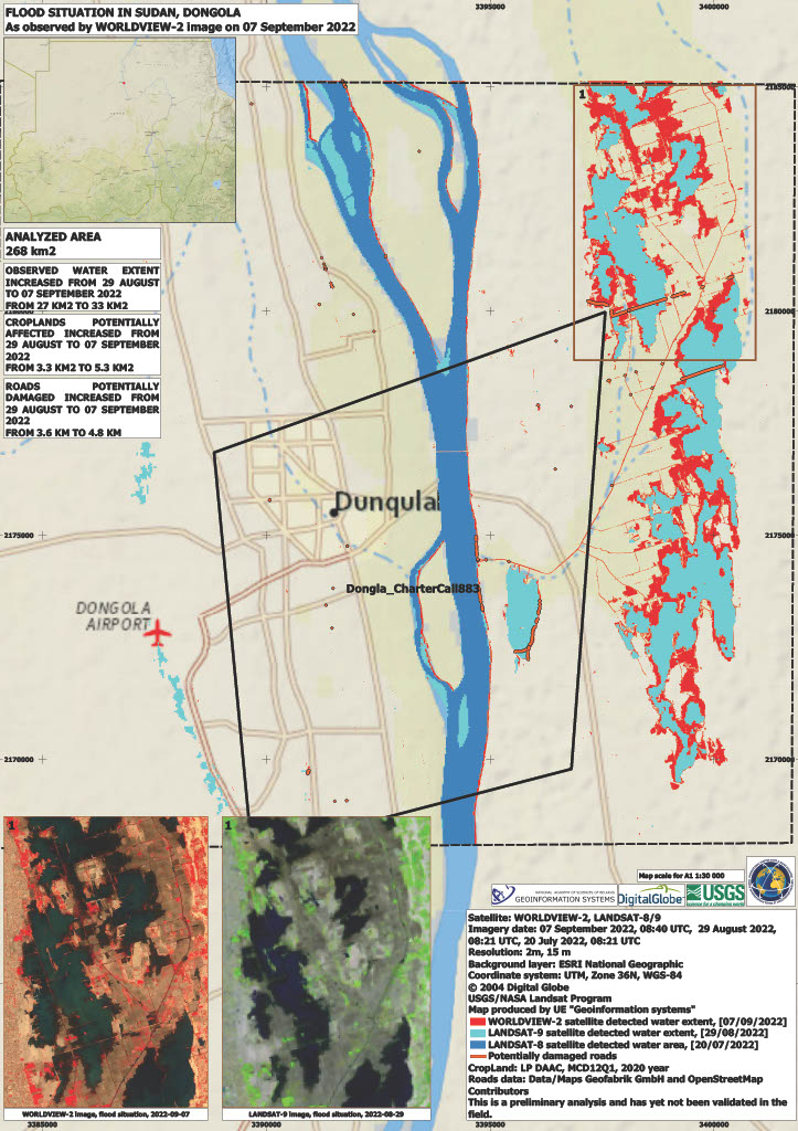
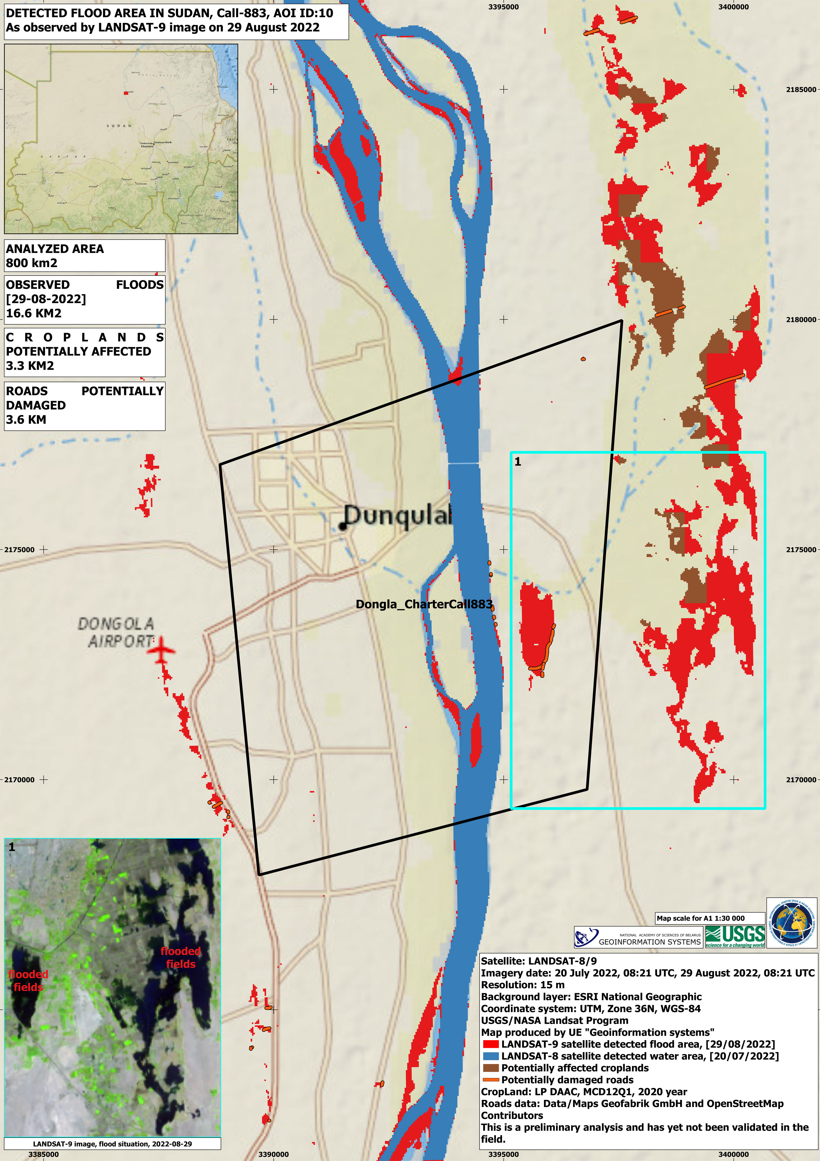
Flood situation on Sudan, Dongola
版权: WorldView-2 © (2022) DigitalGlobe, Inc., Longmont CO USA 80503. DigitalGlobe and the DigitalGlobe logos are trademarks of DigitalGlobe, Inc. The use and/or dissemination of this data and/or of any product in any way derived there from are restricted. Unauthorized use and/or dissemination is prohibited.
Landsat data and products © NASA/USGS (2022) - All Rights Reserved.
Map produced by UE GeoInformation Systems
Information about the Product
已获得: WorldView-2: 07/09/2022
Landsat 8: 20/07/2022
Landsat 9: 29/08/2022
源: WorldView-2, Landsat 8, Landsat 9
类别: Delineation Monitoring Maps
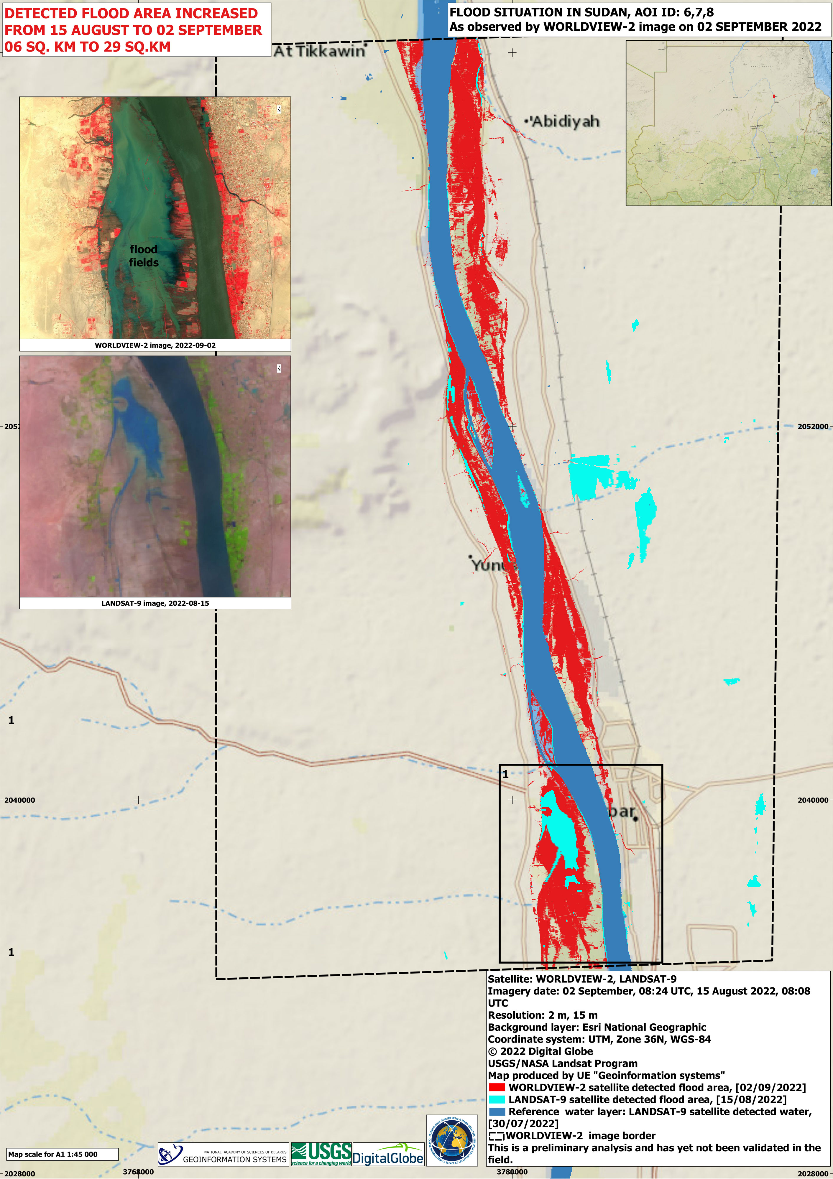
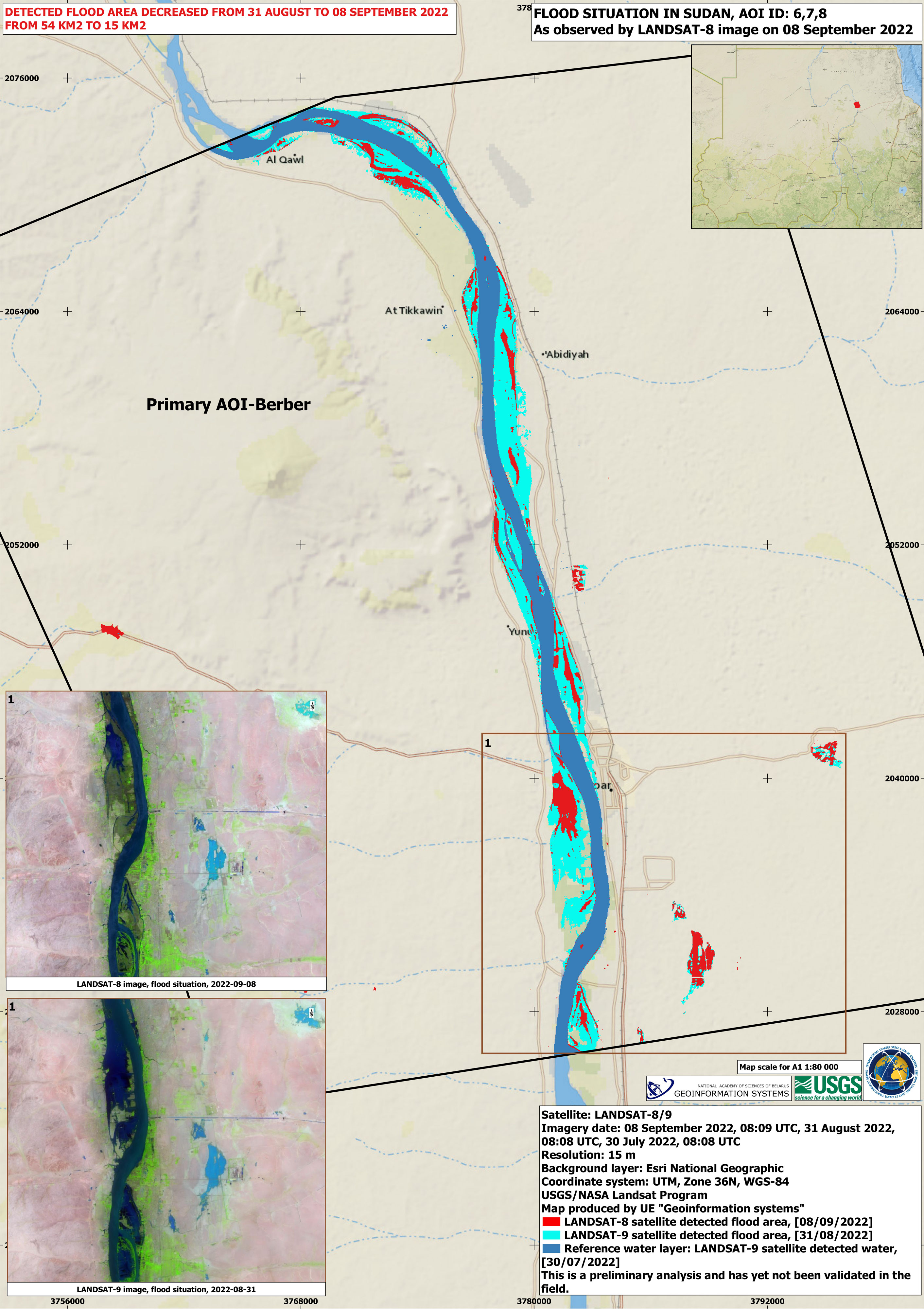
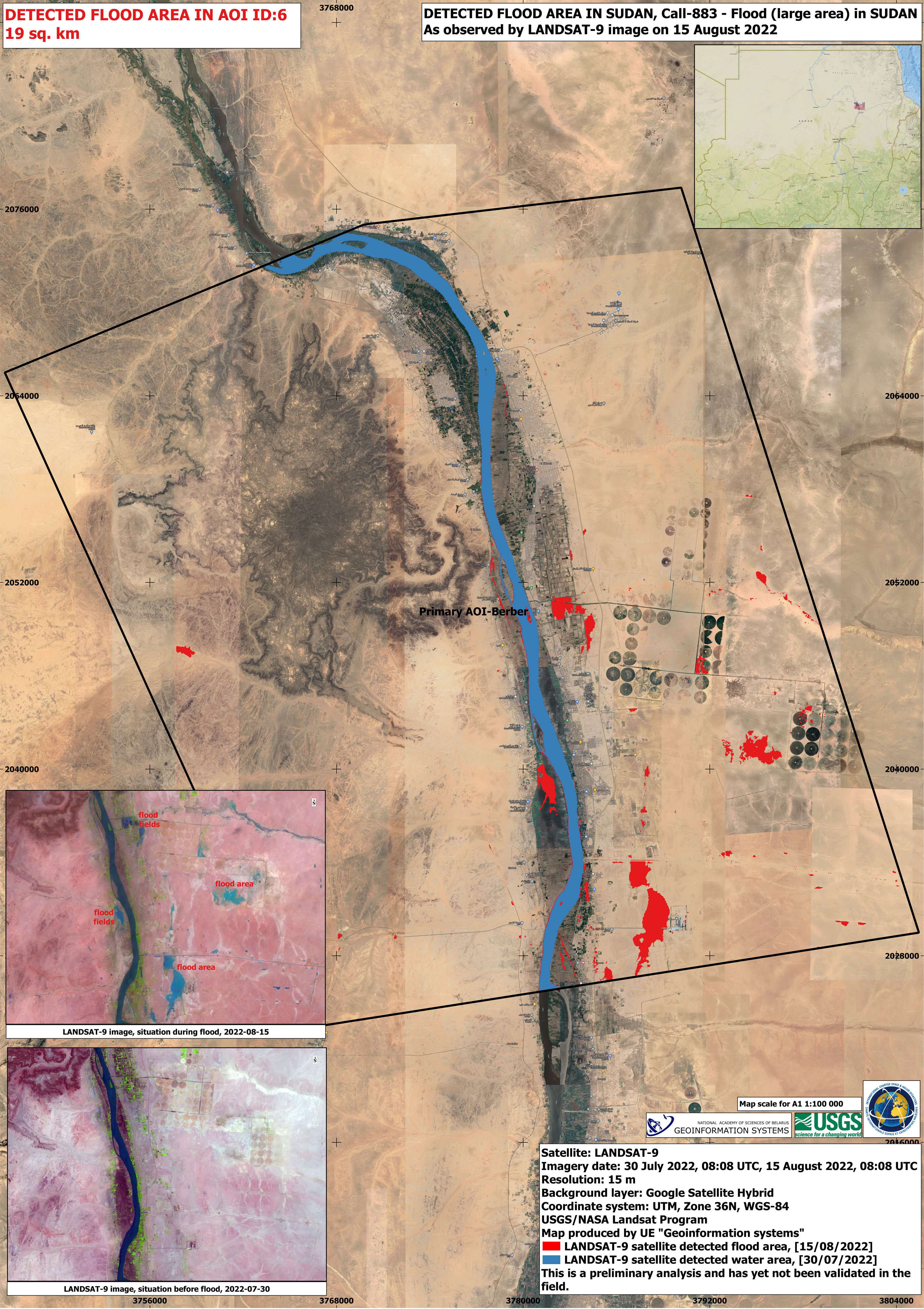
Flood situation in Sudan
版权: Landsat 9 © Landsat data and products © NASA/USGS (2022) - All Rights Reserved
WorldView-2 © (2022) DigitalGlobe, Inc., Longmont CO USA 80503. DigitalGlobe and the DigitalGlobe logos are trademarks of DigitalGlobe, Inc. The use and/or dissemination of this data and/or of any product in any way derived there from are restricted. Unauthorized use and/or dissemination is prohibited.
Map produced by UE "Geoinformation systems"
Information about the Product
已获得: Landsat 9: 30/07/2022, 15/08/2022
WorldView-2: 02/09/2022
源: Landsat 9 / WorldView-2
类别: Delineation Monitoring Maps
Flood situation in Sudan, Al Manaqil
版权: Landsat data and products © NASA/USGS (2022) - All Rights Reserved
Map produced by UE Geo-information Systems
Information about the Product
已获得: Landsat 8: 06/07/2022, 23/08/2022
Landsat 9: 31/08/2022
源: Landsat 8 and Landsat 9
类别: Delineation Monitoring Maps
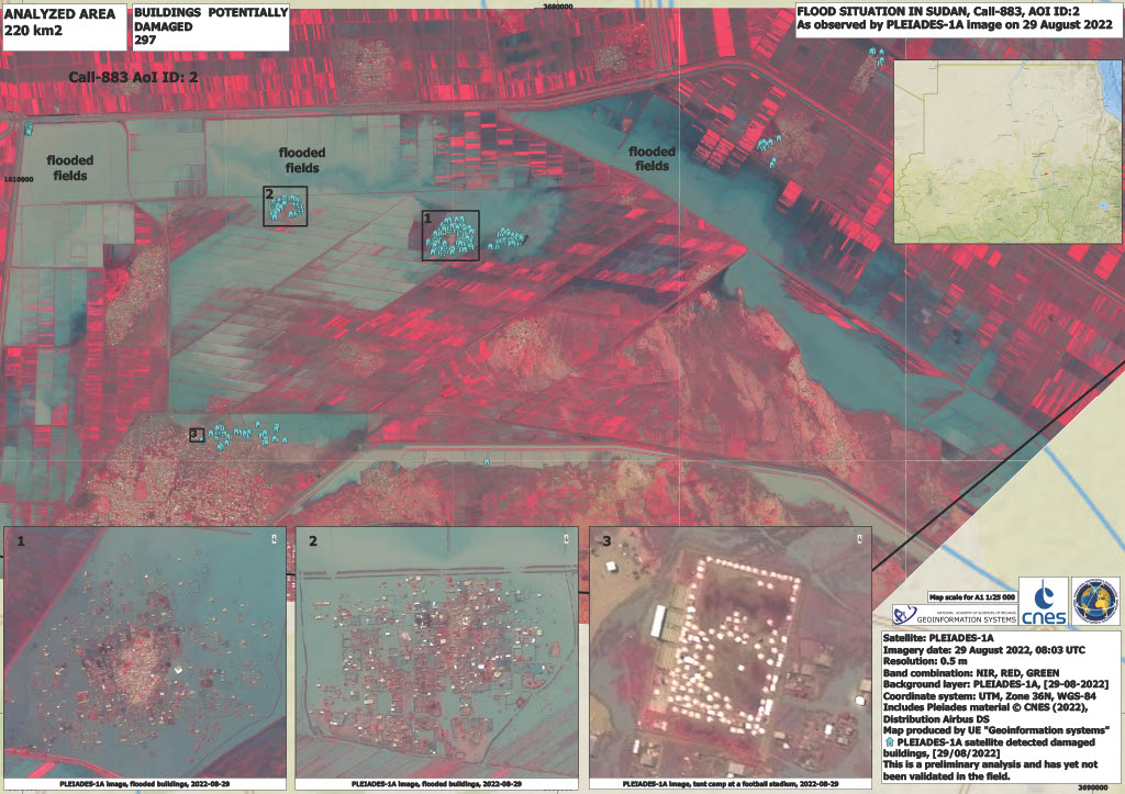

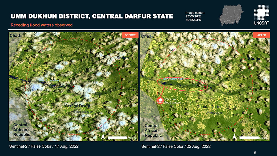
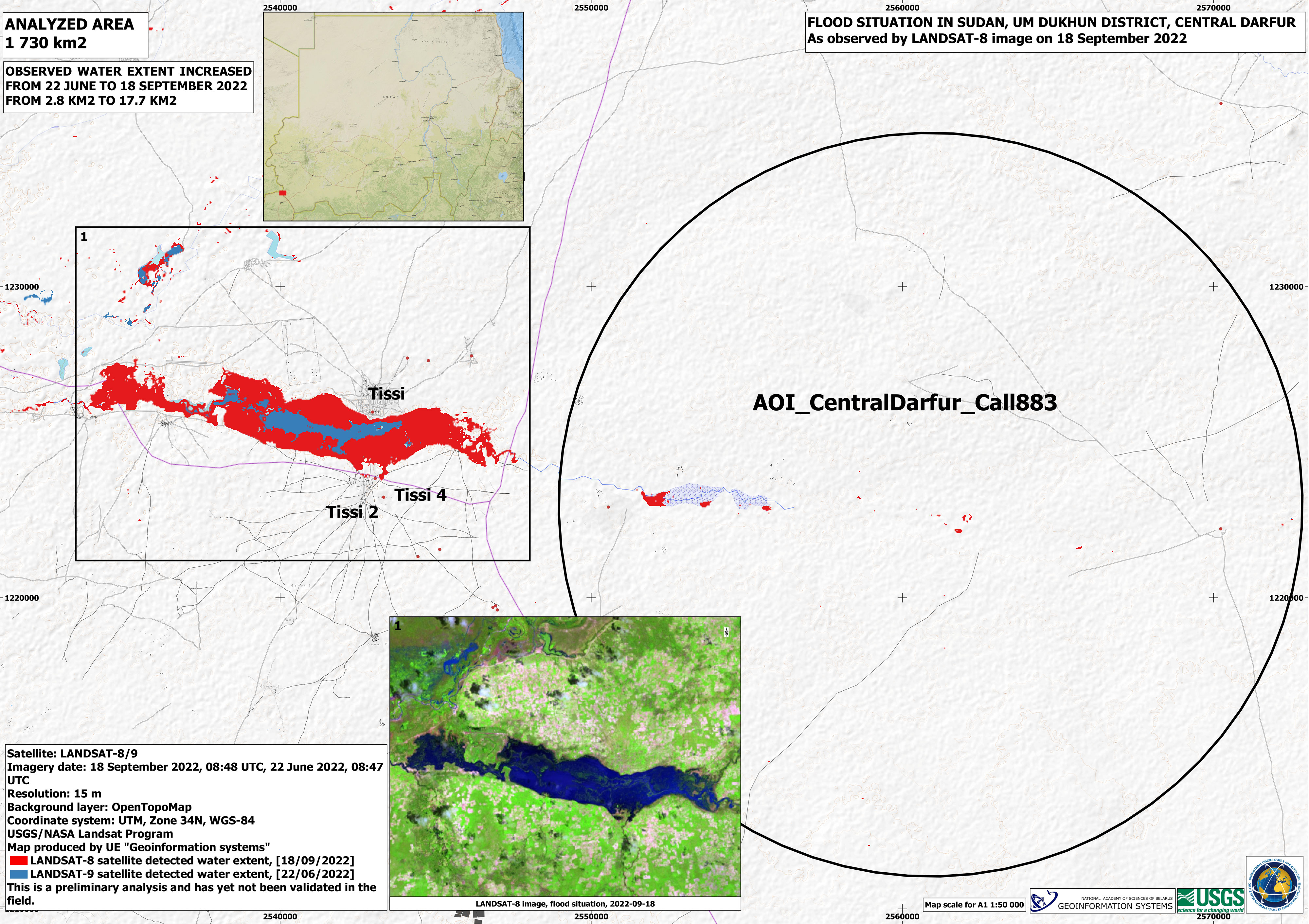
Flood assessment, Umm Dukhun District, Central Darfur, Sudan
Download full report
版权: Contains modified Copernicus Sentinel data (2022)
Report produced by UNITAR/UNOSAT
Information about the Product
已获得: 22/08/2022
源: Sentinel-2
类别: Delineation Map
 返回完整的响应档案

