 English
 Spanish
 French
 Chinese
 Russian
 Portuguese
 最新宪章启动
Charter activations
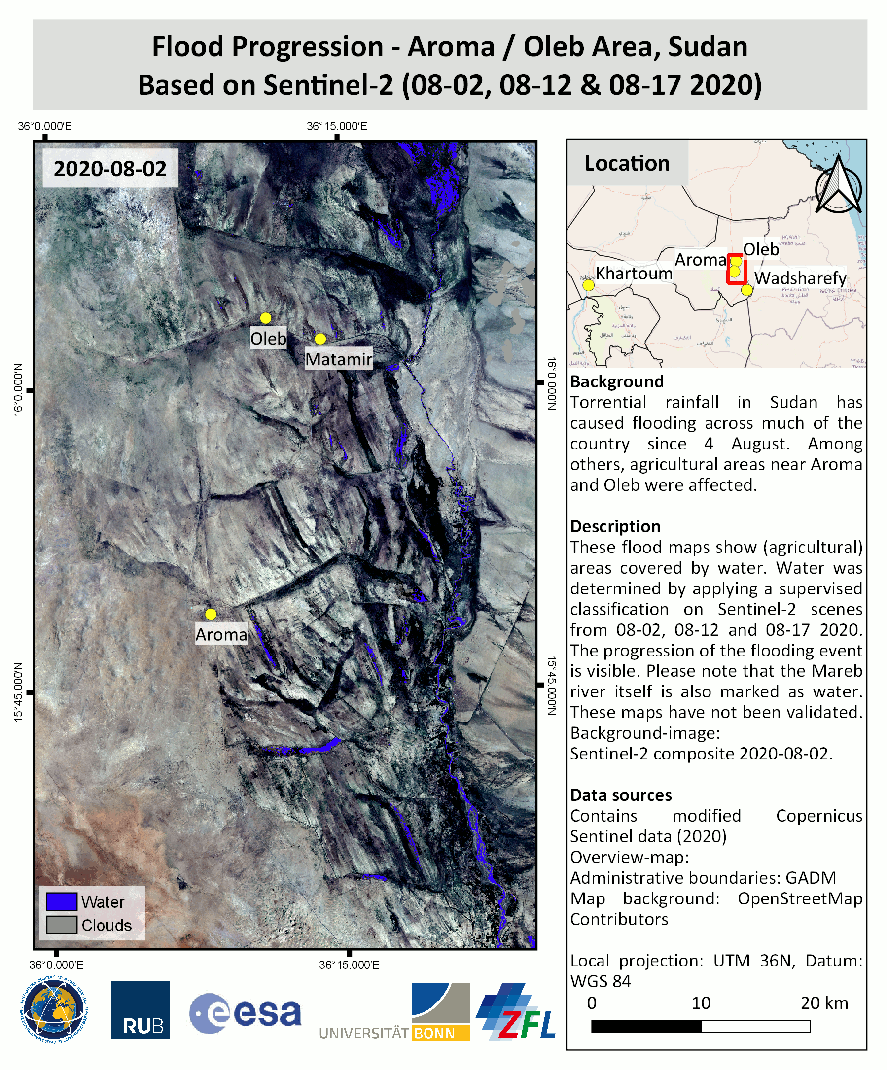
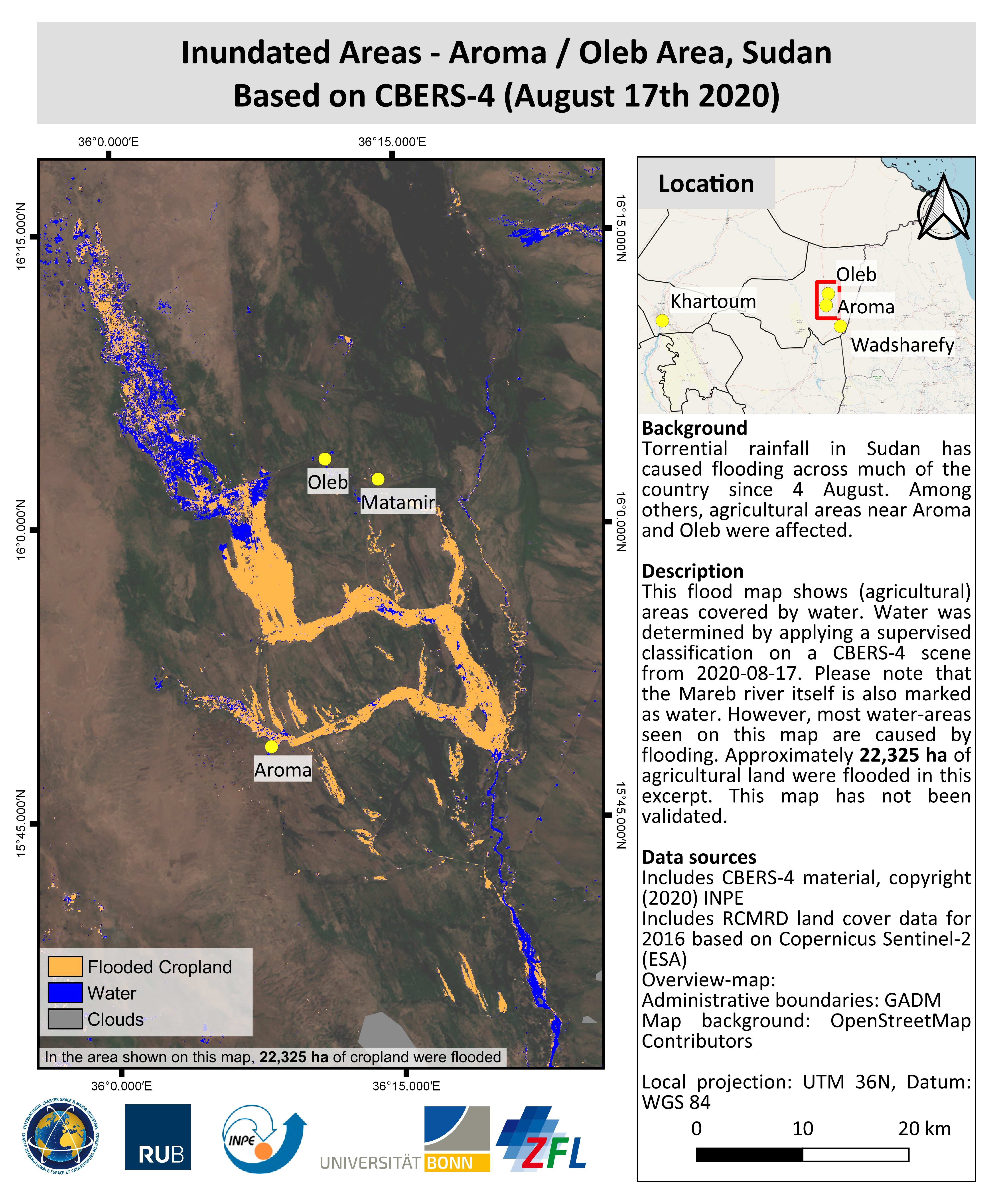
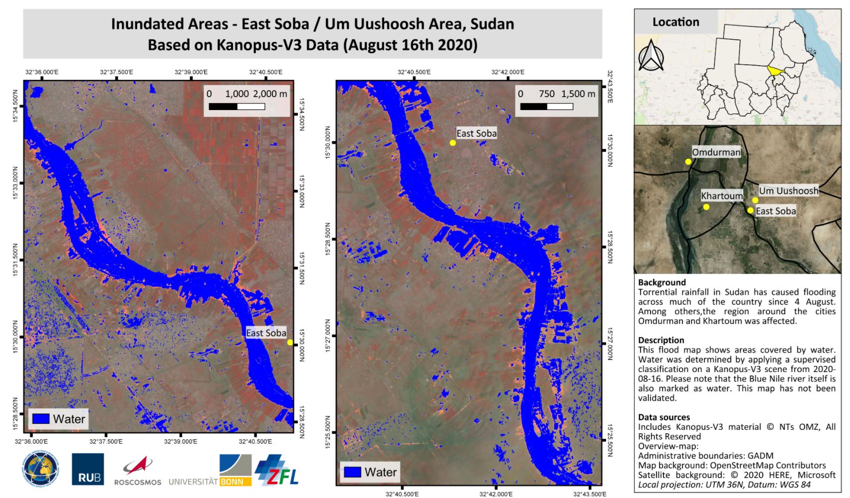
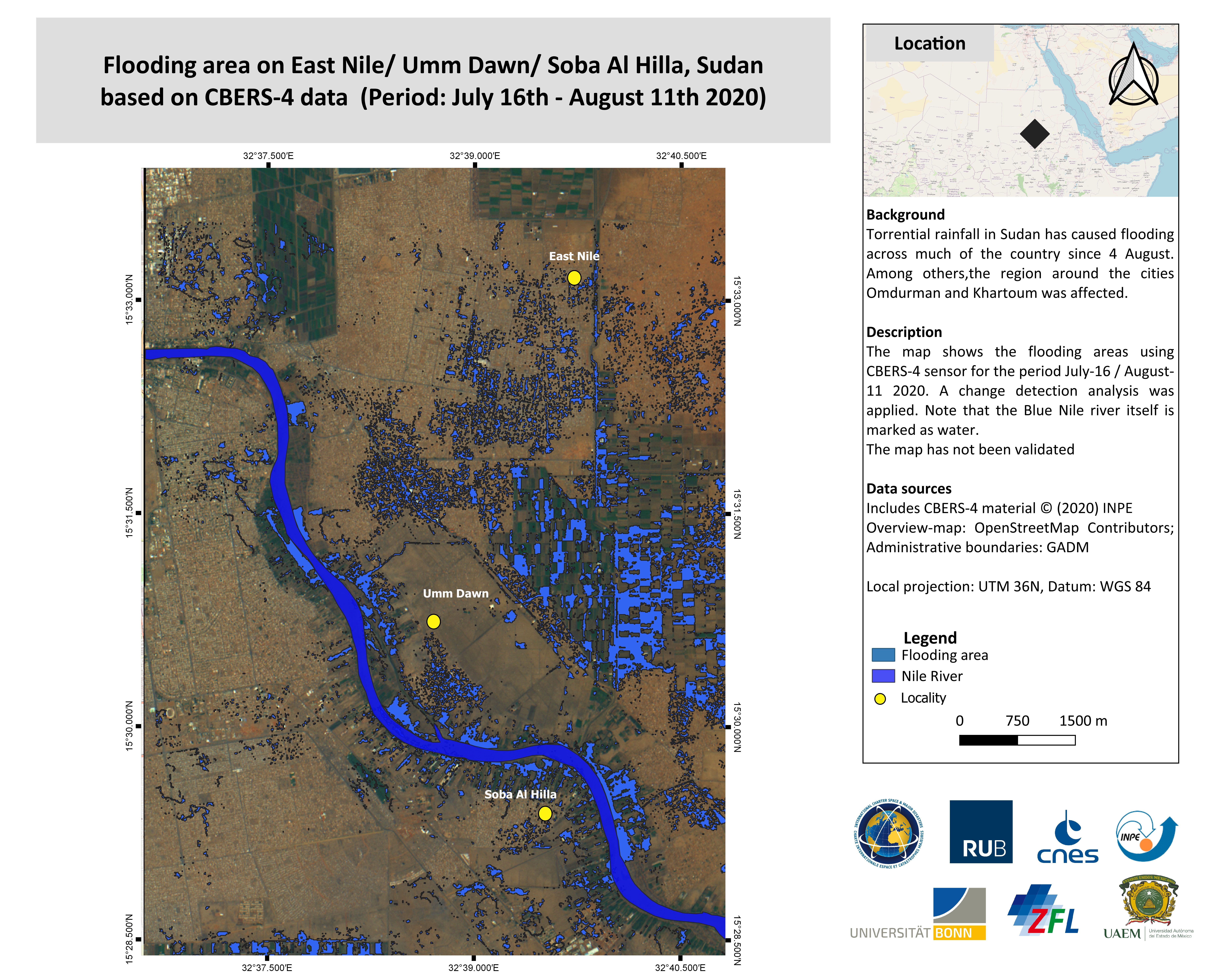
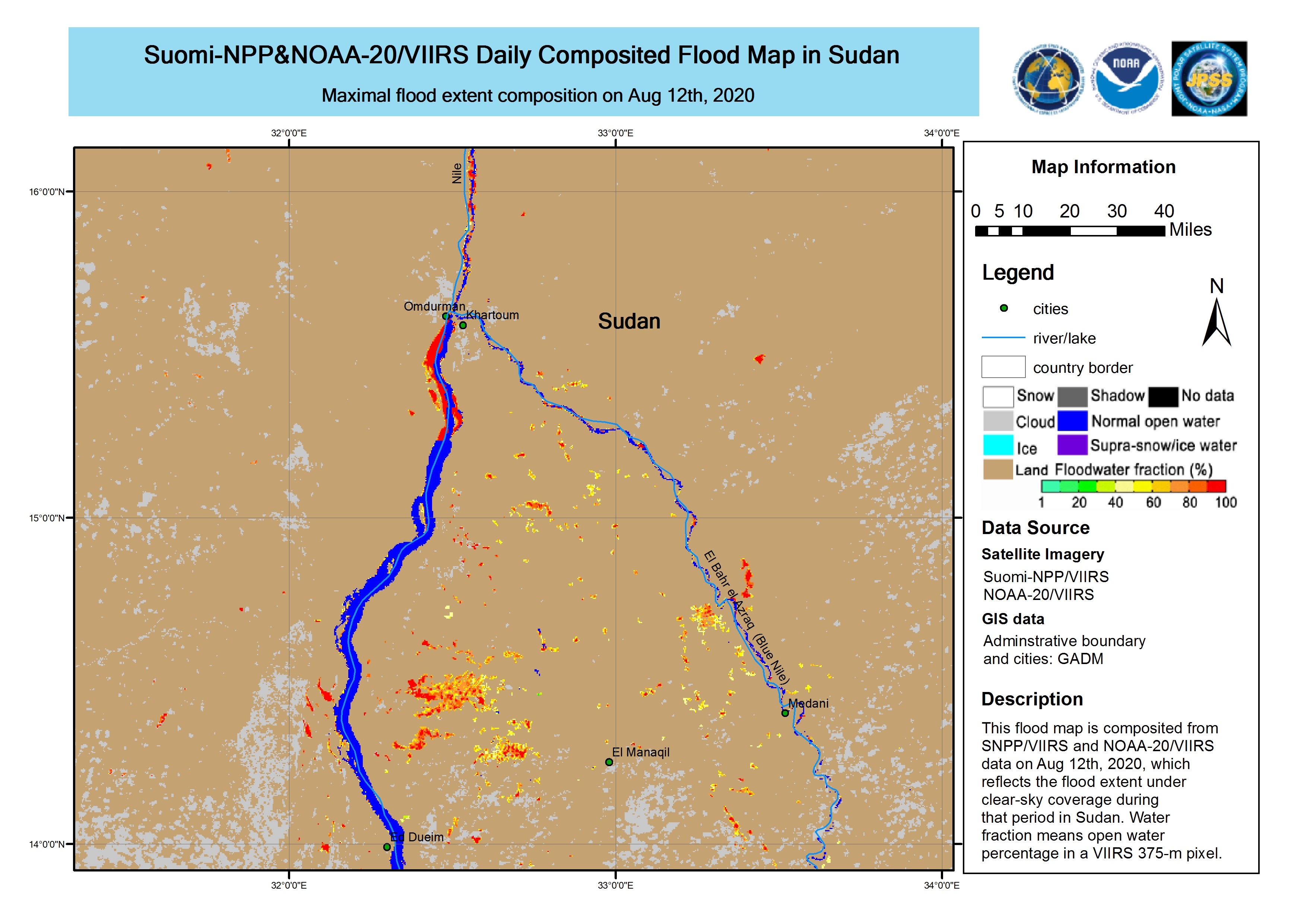
Flood in Sudan
Torrential rainfall in Sudan has caused flooding across much of the country since 4 August.
The UN Office for the Coordination of Humanitarian Affairs (OCHA) reported that 14 of the nation's 18 states have experienced flooding, affecting more than 134,000 people. 14 people have been reported killed in the most recent floods in Kassala, El Gedaref, and River Nile States.
Areas on the Nile Basin have particularly been affected by the floods, and it is expected the water levels will continue to rise as the rain continues.
| 事件类型: | Flood |
| 事件地点: | Sudan |
| 启动宪章的日期: | 2020-08-13 |
| 宪章启动时间: | 15:49 |
| 宪章启动时区: | UTC+02:00 |
| 宪章要求者: | UNOOSA/UN-SPIDER on behalf of Ministry of Agriculture and Natural Resources in Sudan |
| 启动ID: | 667 |
| 项目经理: | Ruhr-University Bochum |
Products
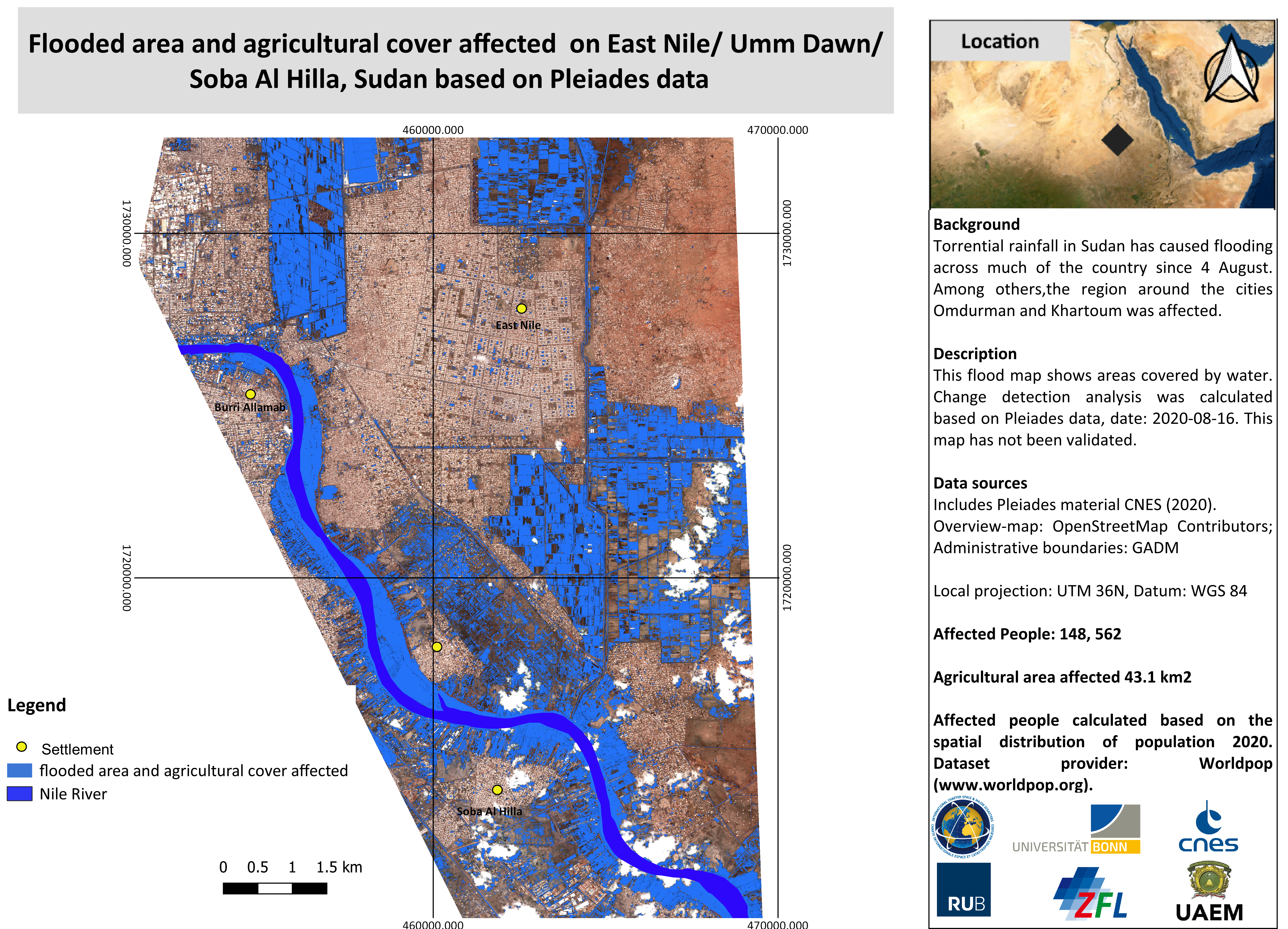
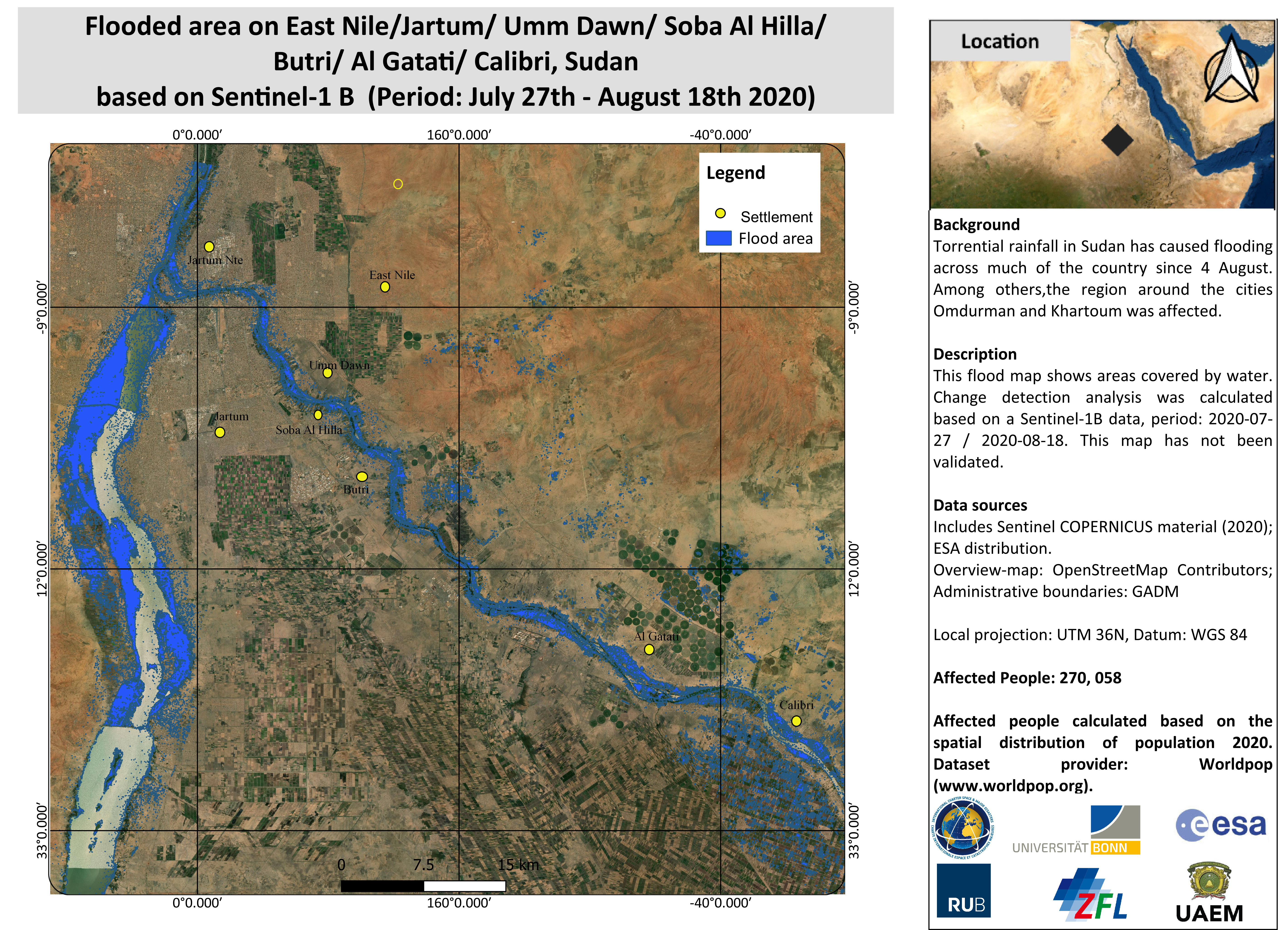
Flooded area on East Nile/Jartum/ Umm Dawn/ Soba Al Hilla/ Butri/ Al Gatati/ Calibri, Sudan (Period: 27 July - 18 August).
版权: Contains modified Copernicus Sentinel data (2020)
Map produced by Ruhr-University Bochum and University of Bonn / ZFL
Information about the Product
已获得: 18/08/2020
源: Sentinel-1


 返回完整的响应档案

