 English
 Spanish
 French
 Chinese
 Russian
 Portuguese
 Latest Activation
Charter activations
Flood in Sudan
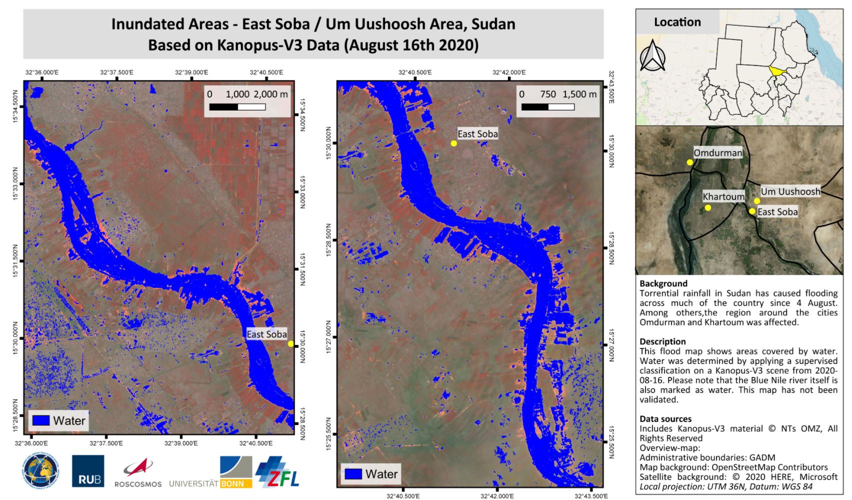
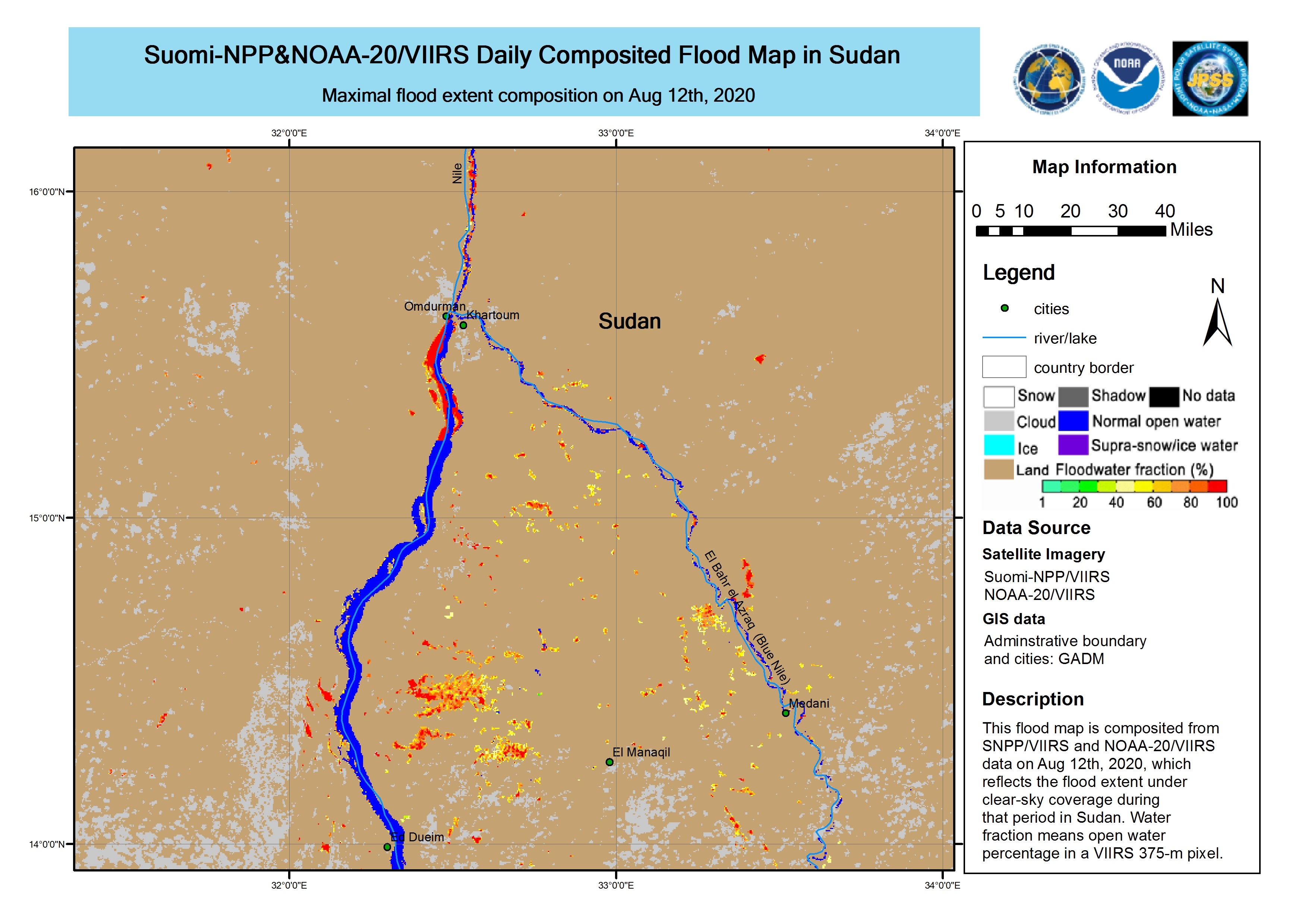
Torrential rainfall in Sudan has caused flooding across much of the country since 4 August.
The UN Office for the Coordination of Humanitarian Affairs (OCHA) reported that 14 of the nation's 18 states have experienced flooding, affecting more than 134,000 people. 14 people have been reported killed in the most recent floods in Kassala, El Gedaref, and River Nile States.
Areas on the Nile Basin have particularly been affected by the floods, and it is expected the water levels will continue to rise as the rain continues.
| Tipo de evento: | Flood |
| Local do evento: | Sudan |
| Data da Ativação da Carta: | 2020-08-13 |
| Tempo de Ativação da Carta: | 15:49 |
| Zona de Tempo da Ativação da Carta: | UTC+02:00 |
| Requisitante da Carta: | UNOOSA/UN-SPIDER on behalf of Ministry of Agriculture and Natural Resources in Sudan |
| ID da Ativação: | 667 |
| Gerenciamento de projeto: | Ruhr-University Bochum |
Products
Estimated Number of People Directly Affected by the Flood: Al Jazirah, Al Qadarif, Kassala, Khartoum, Sennar and White Nile States.
Direitos autorais: Contains data from NOAA
Map produced by Ruhr-University Bochum and University of Bonn / ZFL
Information about the Product
Adquirida: 22/08/2020
Fonte: NOAA-VIIRS
Flood progression - Red Sea State Near Tokar, Sudan
Direitos autorais: Contains modified Copernicus Sentinel data (2020)
Map produced by Ruhr-University Bochum and University of Bonn / ZFL
Information about the Product
Adquirida: Sentinel-2B: 23/06/2020, 09/08/2020, 19/08/2020
Sentinel-2A: 14/08/2020
Fonte: Sentinel-2
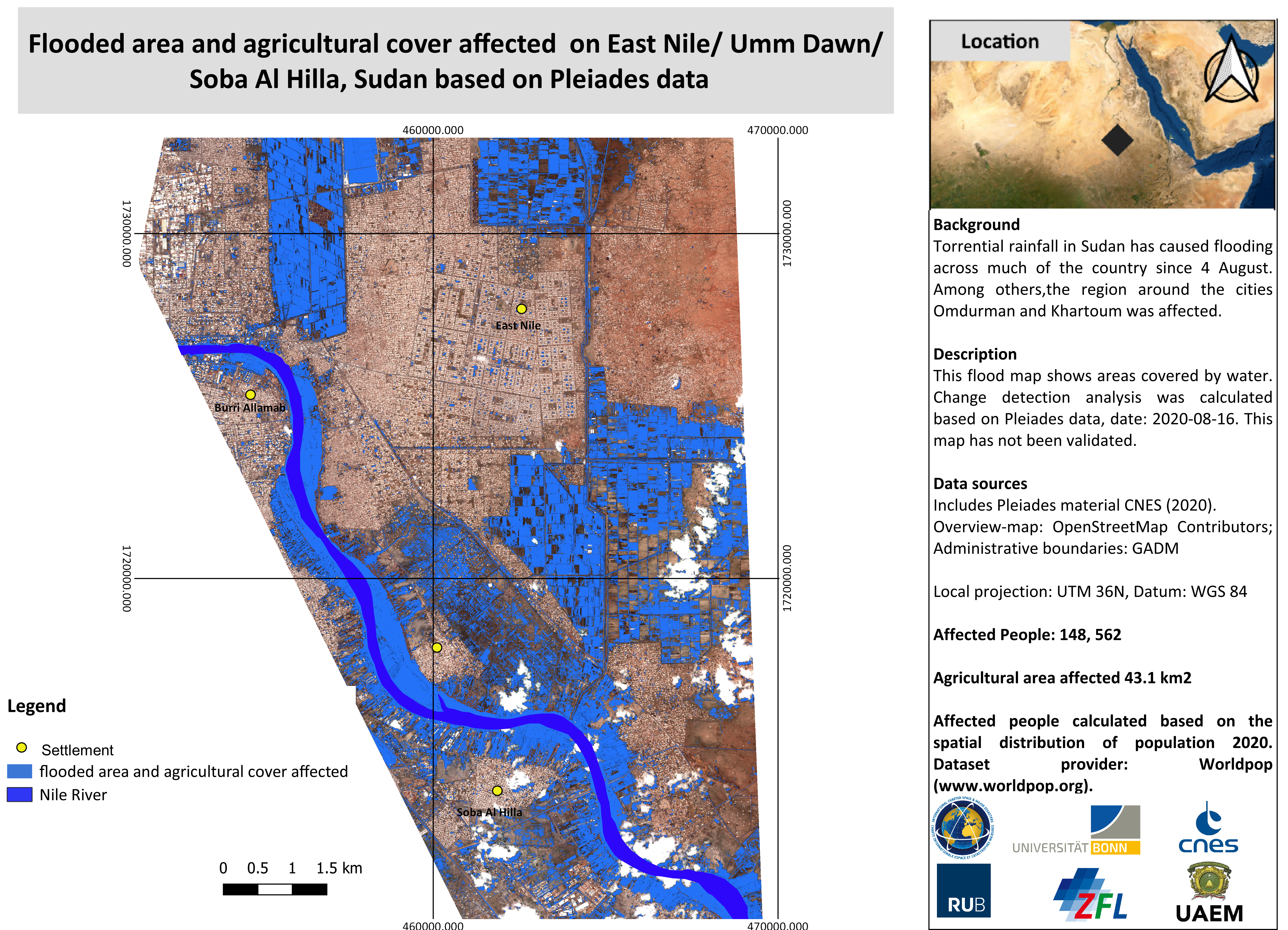
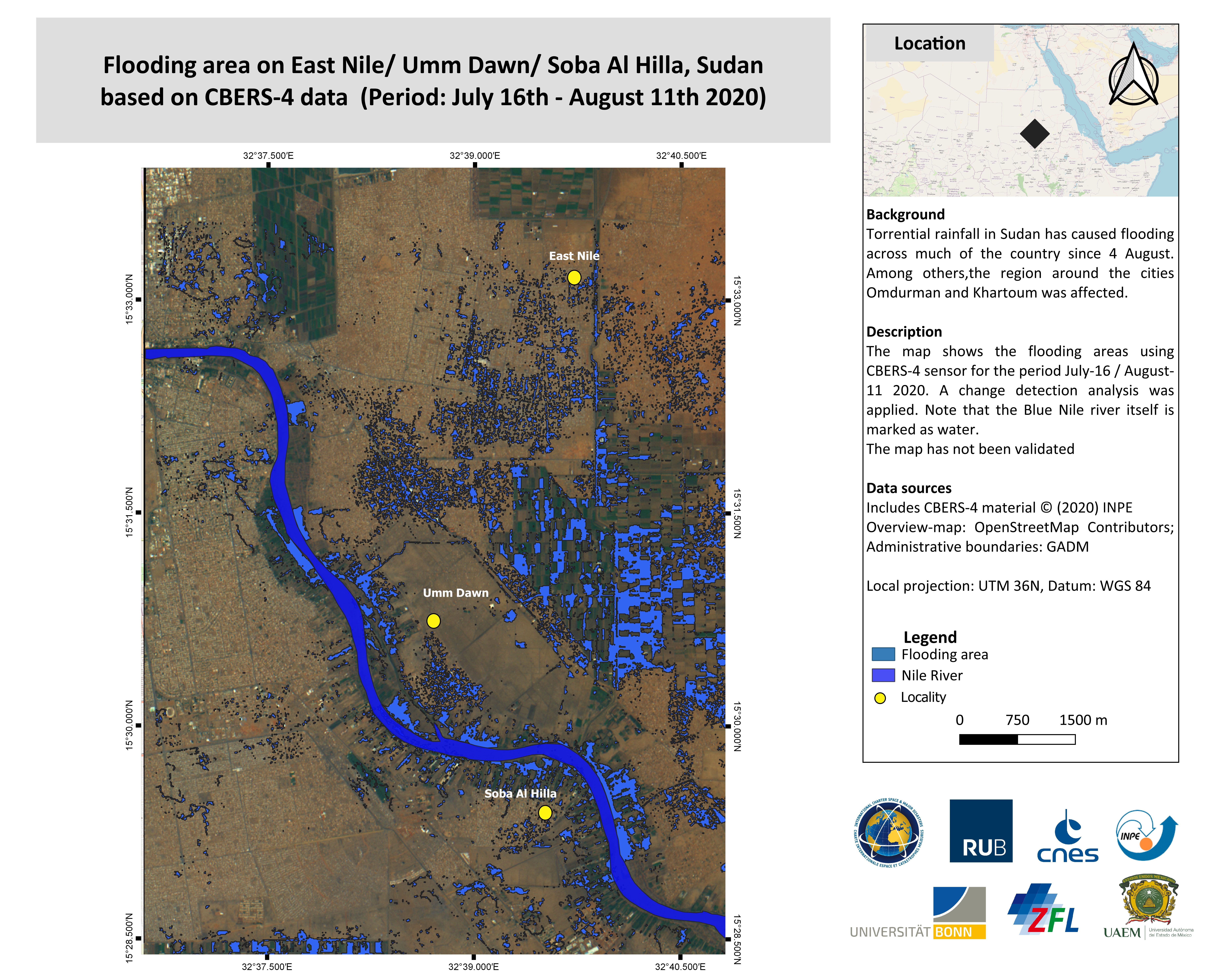
Flooded area and agricultural cover affected on East Nile/ Umm Dawn/ Soba Al Hilla, Sudan.
Direitos autorais: Includes Pleiades material © CNES (2020), Distribution Airbus DS.
Map produced by Ruhr-University Bochum and University of Bonn / ZFL
Information about the Product
Adquirida: 16/08/2020
Fonte: Pleiades
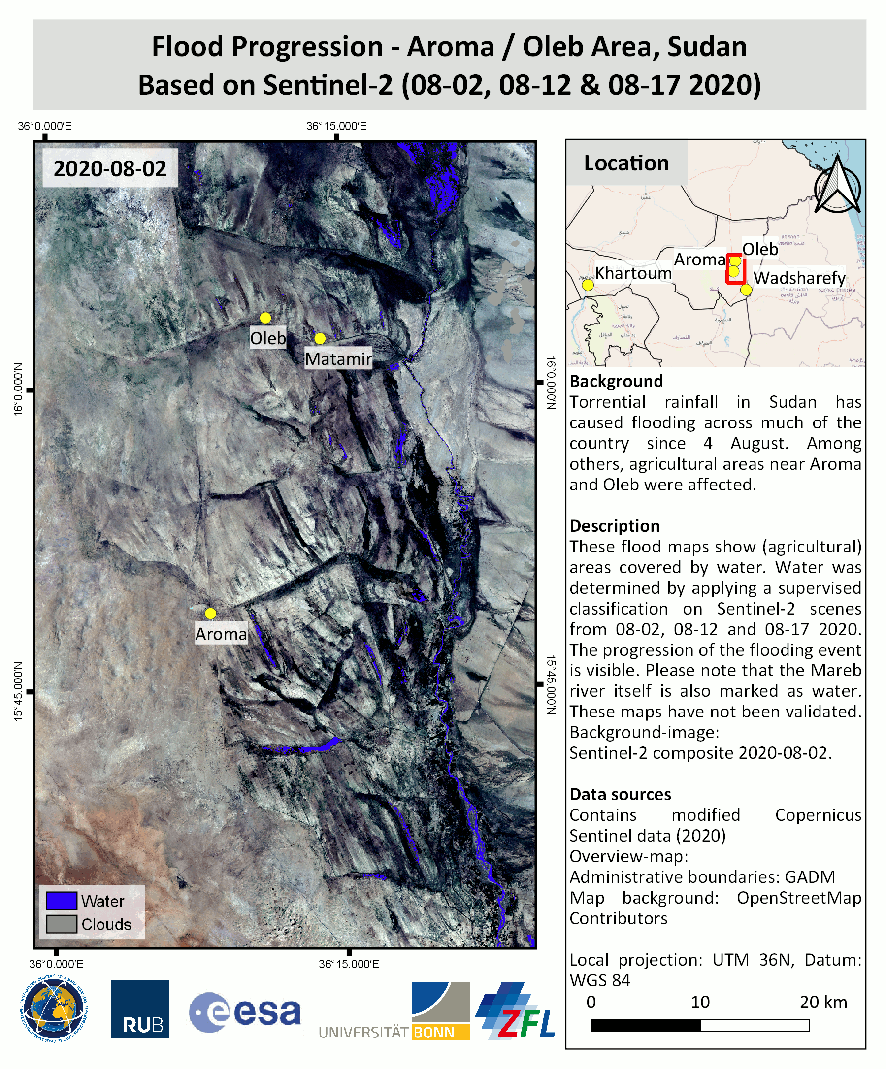
Flood progression - Aroma / Oleb Area, Sudan
Direitos autorais: Contains modified Copernicus Sentinel data (2020)
Map produced by Ruhr-University Bochum and University of Bonn / ZFL
Information about the Product
Adquirida: Sentinel-2B: 02/08/2020 and 12/08/2020
Sentinel-2A: 17/08/2020
Fonte: Sentinel-2
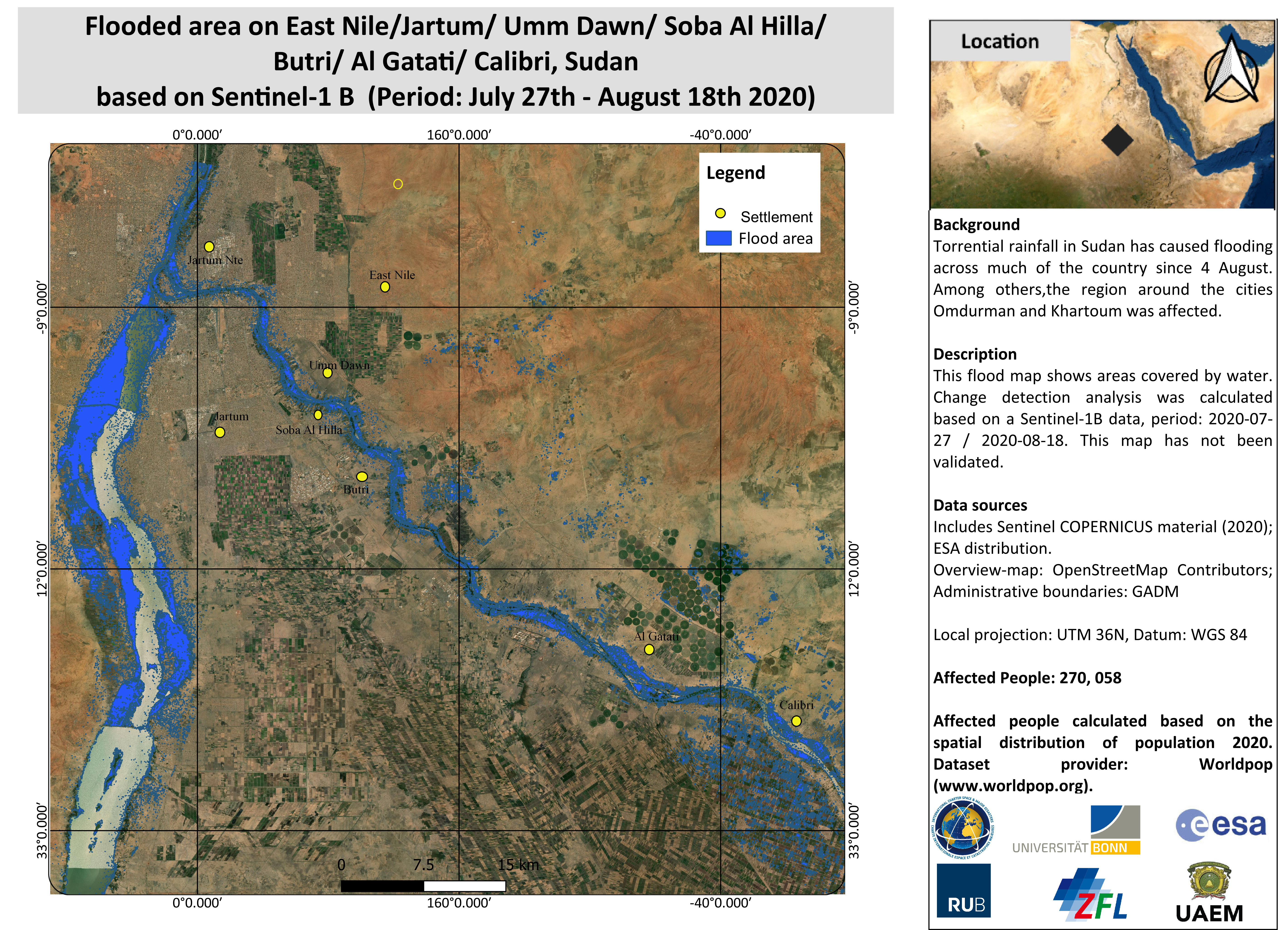
Flooded area on East Nile/Jartum/ Umm Dawn/ Soba Al Hilla/ Butri/ Al Gatati/ Calibri, Sudan (Period: 27 July - 18 August).
Direitos autorais: Contains modified Copernicus Sentinel data (2020)
Map produced by Ruhr-University Bochum and University of Bonn / ZFL
Information about the Product
Adquirida: 18/08/2020
Fonte: Sentinel-1


Flood affected Areas, Soba Al Hilla / Sawba At Tayyib, Sudan. Scene from 15 Aug 2020.
Direitos autorais: Includes Pleiades material © CNES (2020), Distribution Airbus DS.
Map produced by Ruhr-University Bochum and University of Bonn / ZFL
Information about the Product
Adquirida: 15/08/2020
Fonte: Pleiades
 Voltar ao arquivo completo da Ativação

