 English
 Spanish
 French
 Chinese
 Russian
 Portuguese
 Latest Activation
Charter activations
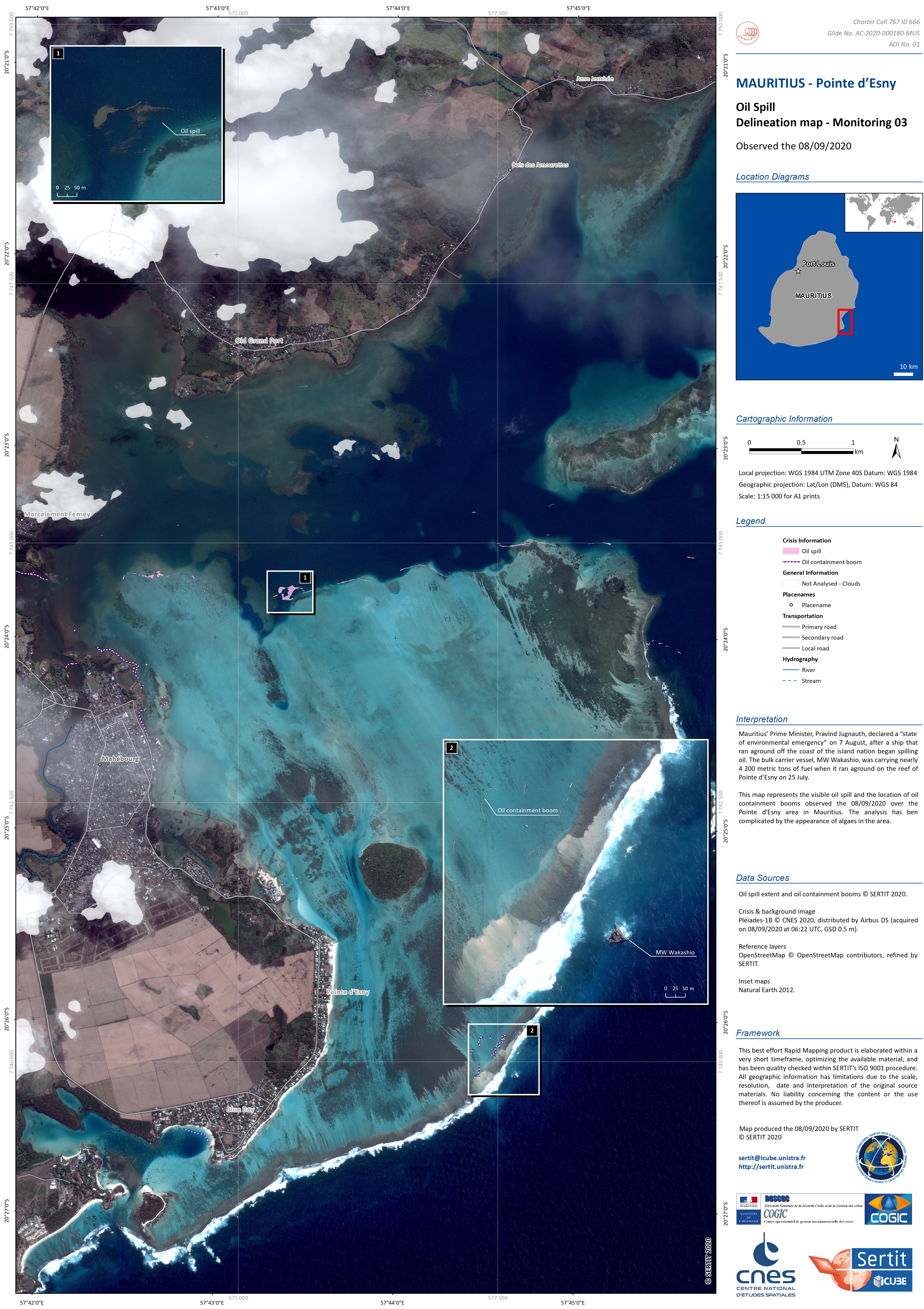
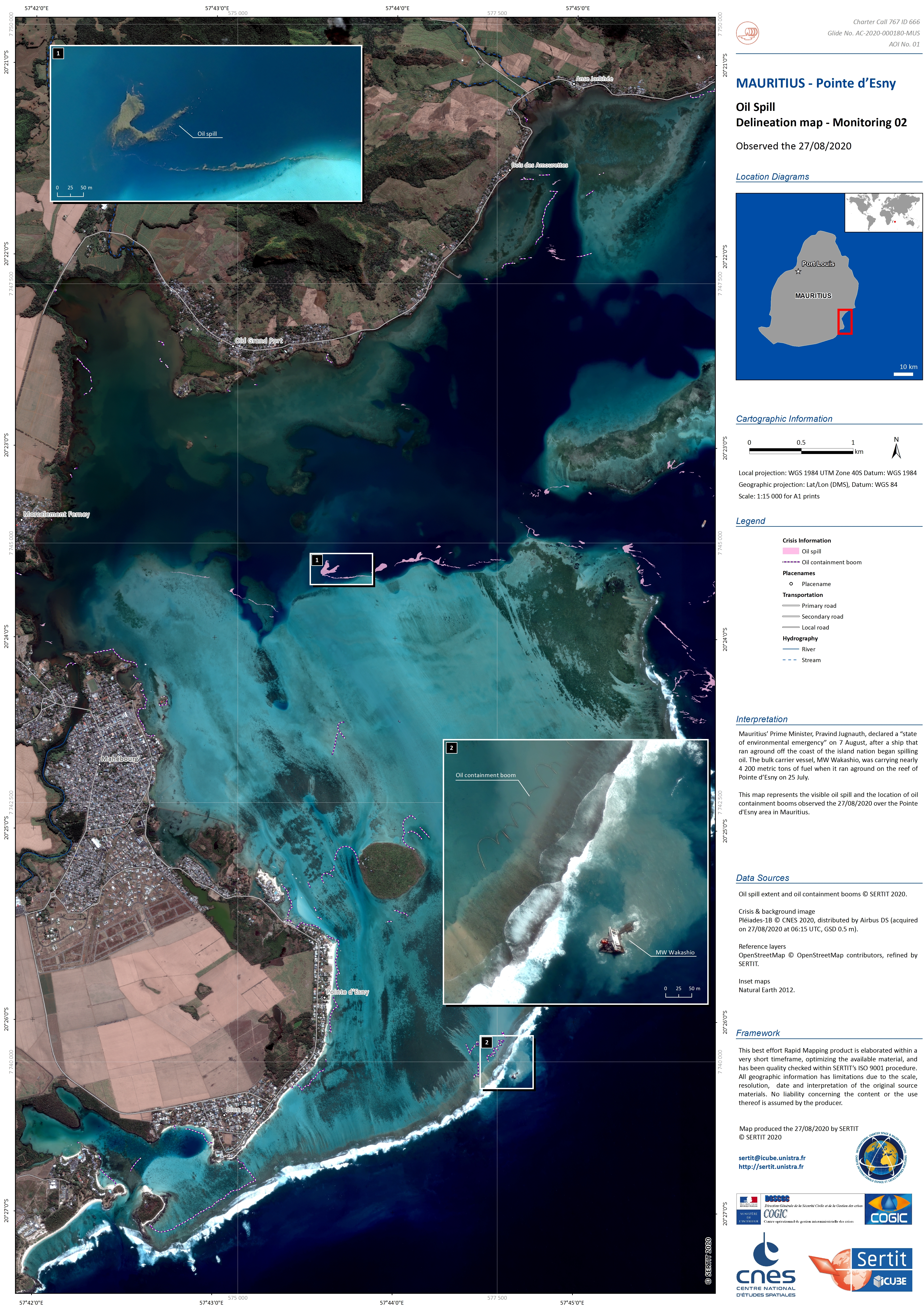
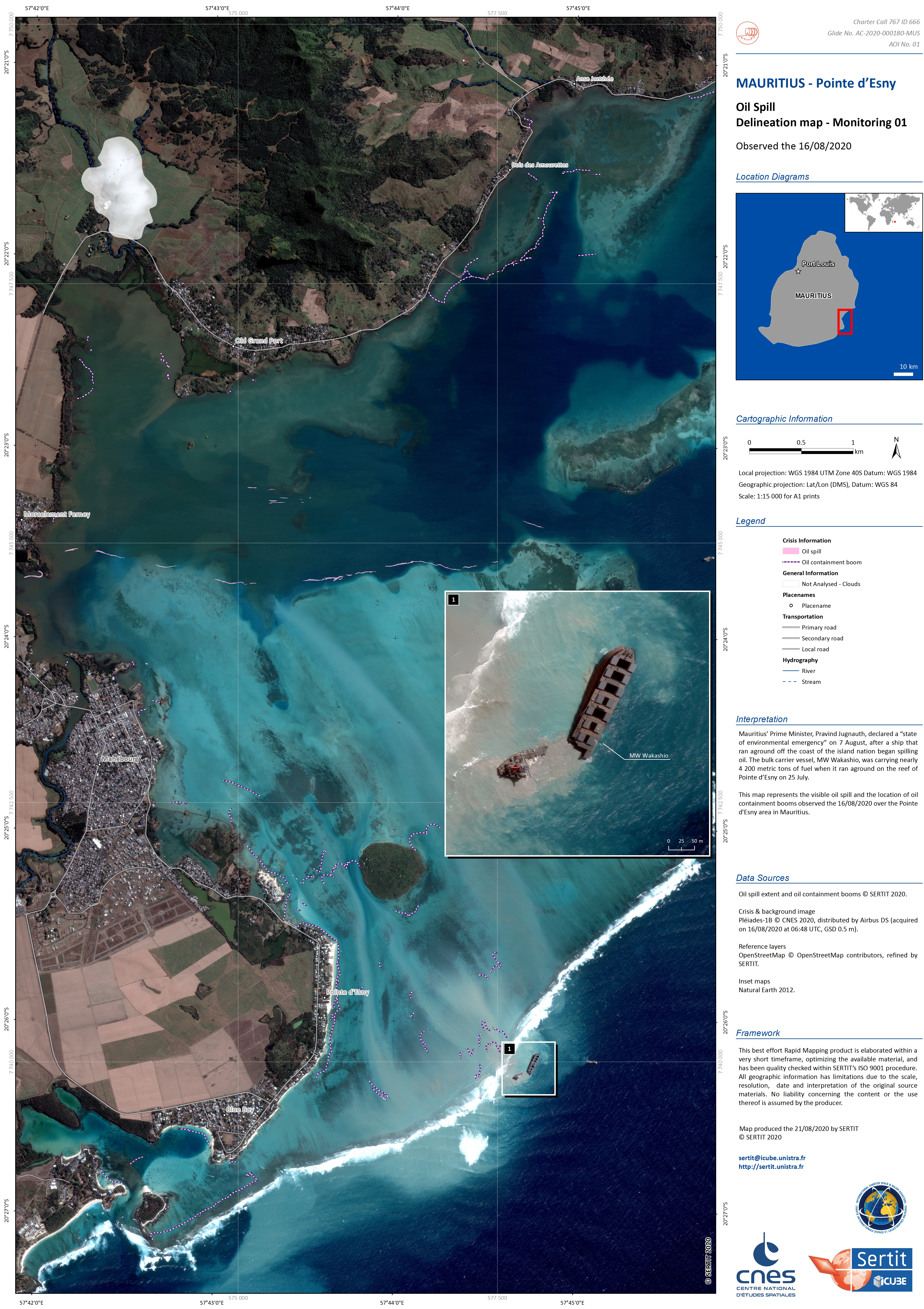
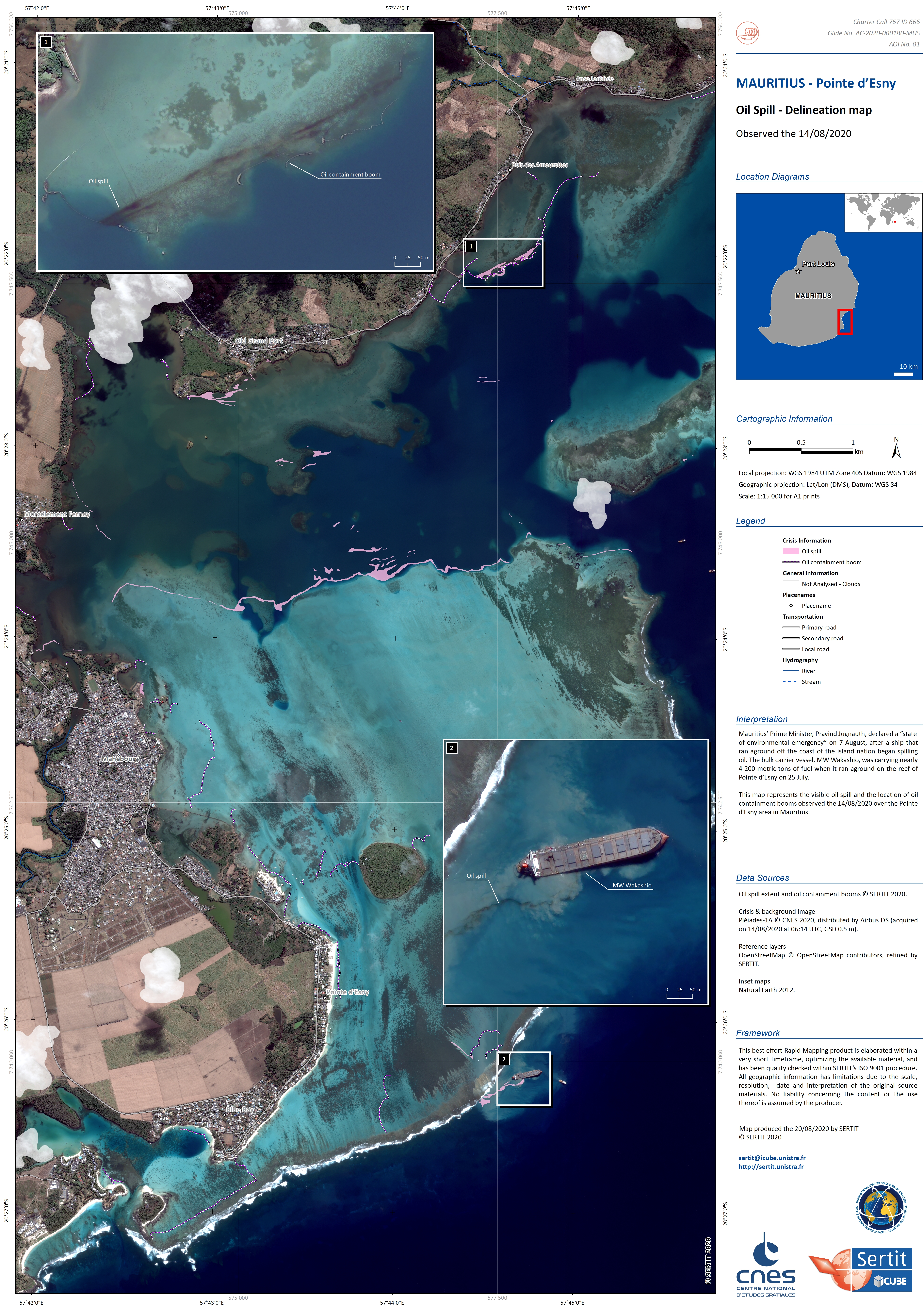
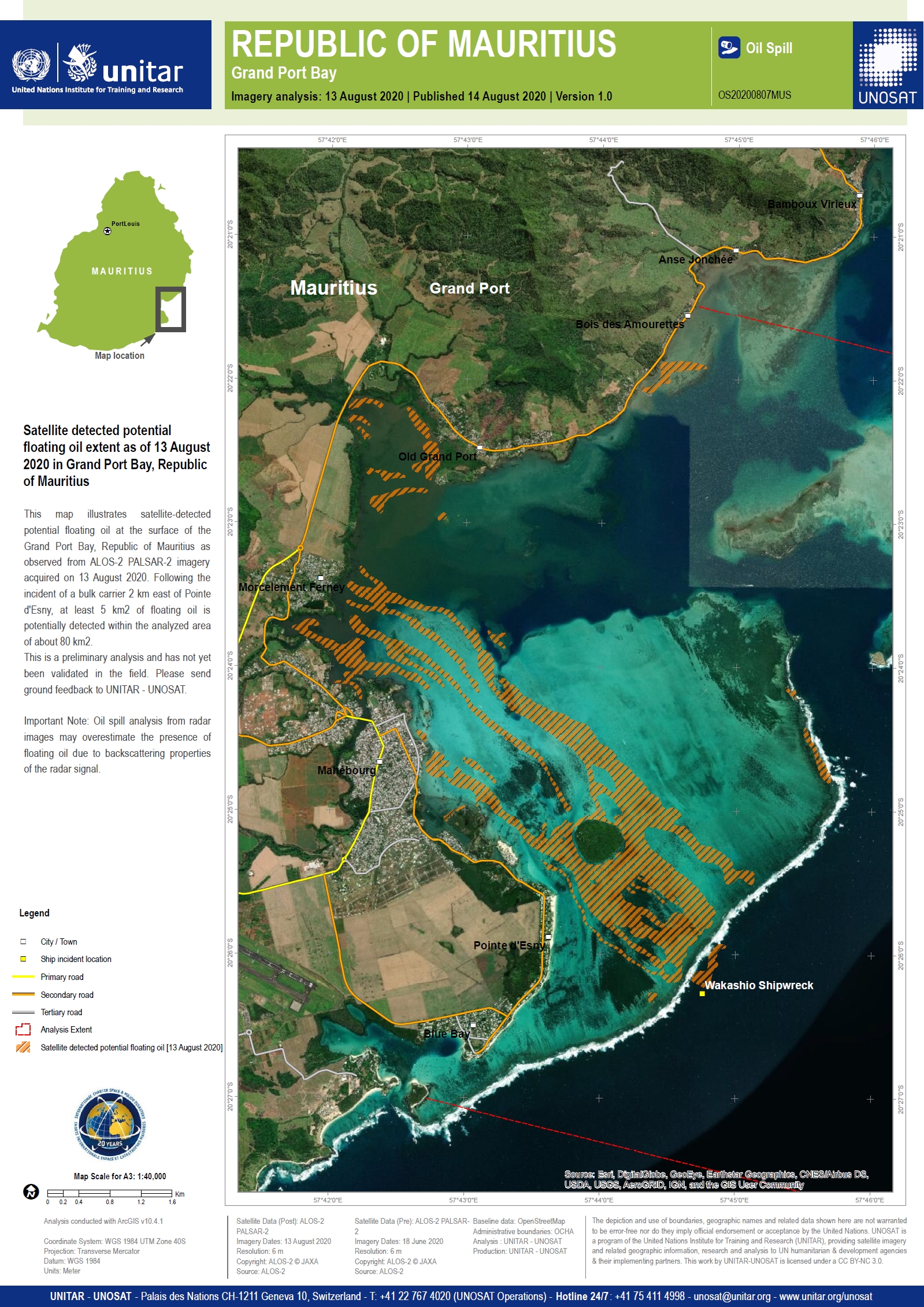
Oil spill in Mauritius
An oil carrier vessel ran aground on a coral reef in the Indian Ocean on 25 July and began leaking oil into waters off the island of Mauritius.
The MV Wakashio was stranded close to Pointe d'Esny, an area of wetland recognised by UNESCO as a protected site. The vessel was trapped on the coral reef and the side of the vessel was breached.
Helicopters have removed the ships crew and began removing some of the 4000 tonnes of fuel and oil from the ship, though it is thought that 1000 tonnes of oil has already leaked into the sea.
Local authorities and hundreds of volunteers have scrambled to help with the clean-up and protect the local beaches and coral reefs.
The Mauritian Prime Minister declared a state of emergency and appealed for help. France and Japan have deployed teams with pollution control equipment. Bad weather is forecast in the coming days which is predicted to make the clean-up efforts more difficult.
Related News and Resources
| Tipo de evento: | Oil Spill |
| Local do evento: | Mauritius |
| Data da Ativação da Carta: | 2020-08-08 |
| Tempo de Ativação da Carta: | 16:59 |
| Zona de Tempo da Ativação da Carta: | UTC+02:00 |
| Requisitante da Carta: | UNITAR on behalf of UN Office for the Coordination of Humanitarian Affairs (OCHA), and Centre Opérationnel de Gestion Interministérielle des Crises (COGIC) |
| ID da Ativação: | 666 |
| Gerenciamento de projeto: | UNITAR/UNOSAT |
Products

Analysis of the oil spill in Mauritius
Download the full report
Direitos autorais: WorldView © (2020) DigitalGlobe, Inc., Longmont CO USA 80503. DigitalGlobe and the DigitalGlobe logos are trademarks of DigitalGlobe, Inc. The use and/or dissemination of this data and/or of any product in any way derived there from are restricted. Unauthorized use and/or dissemination is prohibited.
Contains modified Copernicus Sentinel data (2020)
ALOS-2 © JAXA (2020)
GeoEye-1 © 2004 GeoEye NextView License
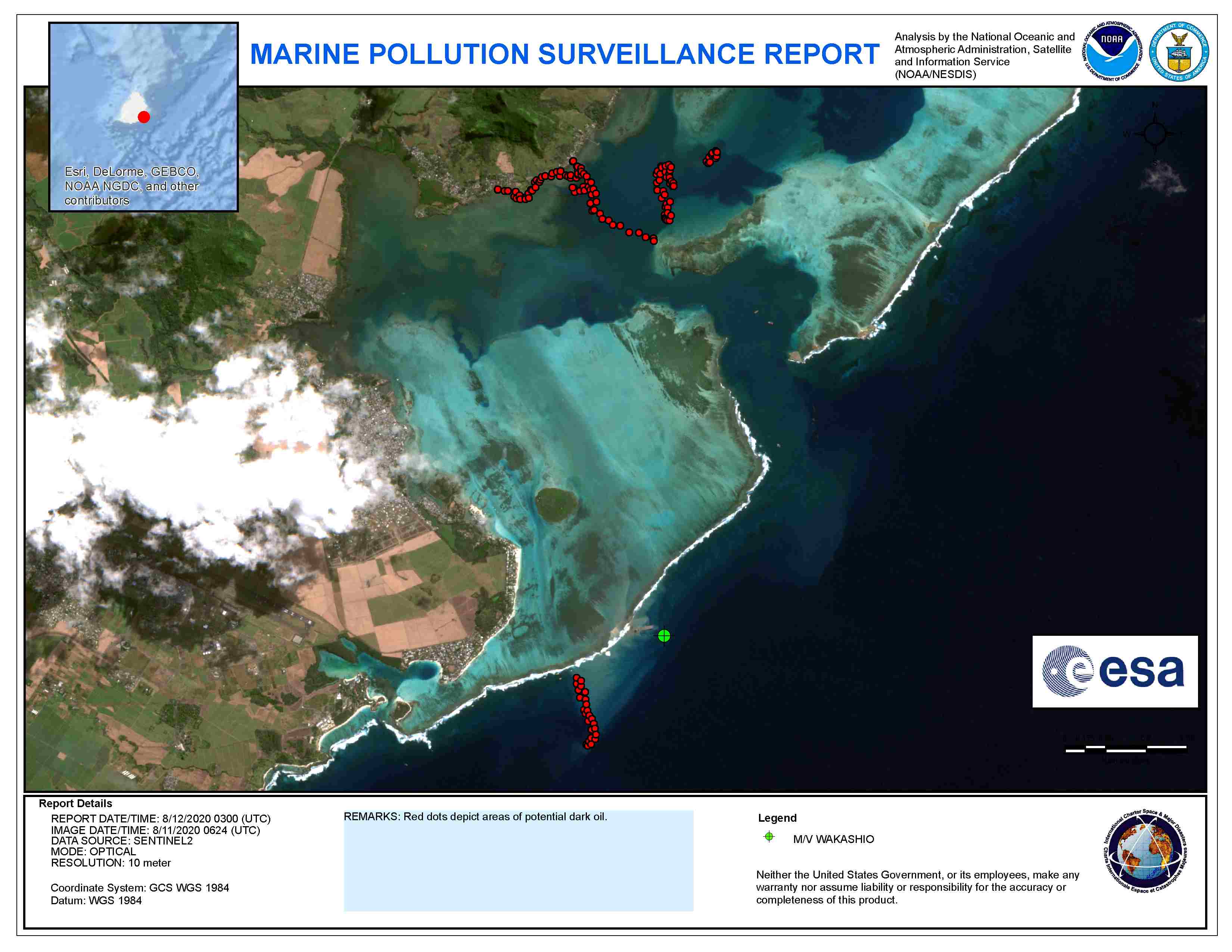
Report produced by NOAA
Information about the Product
Adquirida: WorldView-3: 13/08/2020 and 07/08/2020
WorldView-2: 09/08/2020
Sentinel-2: 11/08/2020
ALOS-2: 13/08/2020
GeoEye-1: 12/08/2020 and 15/08/2020
Fonte: WorldView-3 / WorldView-2 / Sentinel-2 / ALOS-2 / GeoEye-1

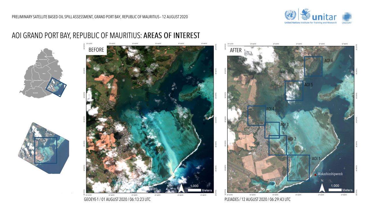
Preliminary satellite based oil spill assessment, Grand Port Bay, Republic of Mauritius
Download the full report
Direitos autorais: Includes Pleiades material © CNES (2020), Distribution Airbus DS.
GeoEye-1 © 2004 GeoEye NextView License
Map prepared by UNOSAT
Information about the Product
Adquirida: Pleiades:11/08/2020, 12/08/2020
GeoEye-1: 01/08/2020
Fonte: Pleiades / GeoEye-1
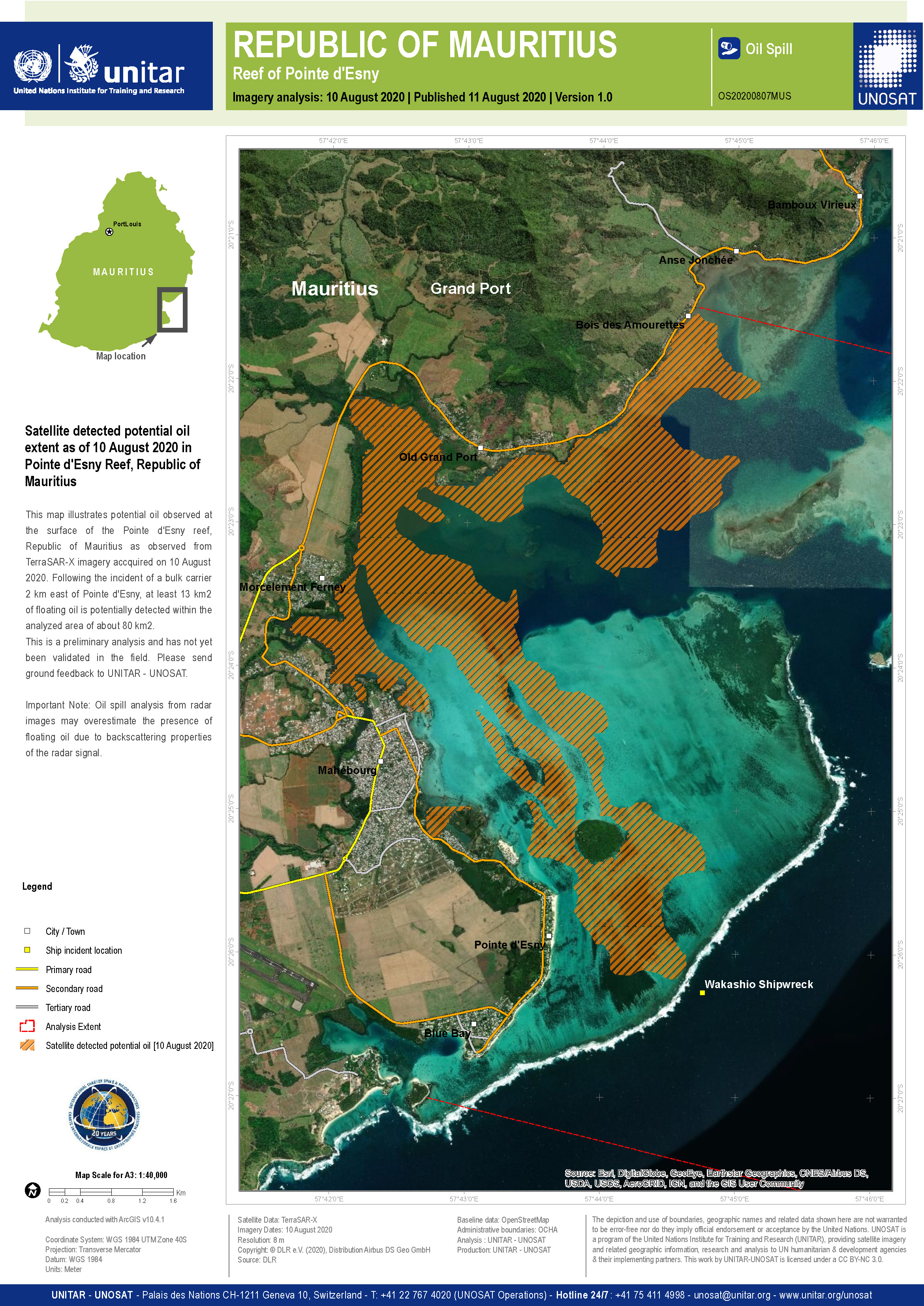
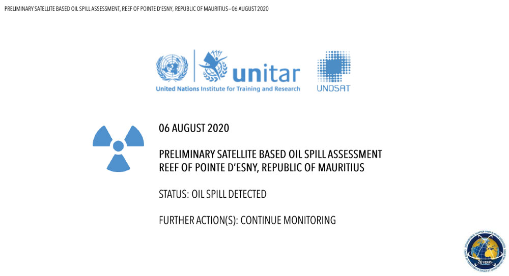
Preliminary satellite based oil spill assessment, Reef of Pointe d'Esny, Republic of Mauritius
Download full report
Direitos autorais: Contains modified Copernicus Sentinel data (2020)
Report produced by UNITAR/UNOSAT
Information about the Product
Adquirida: 06/08/2020
Fonte: Sentinel-2
 Voltar ao arquivo completo da Ativação

