 English
 Spanish
 French
 Chinese
 Russian
 Portuguese
 Dernière activation
Charter activations
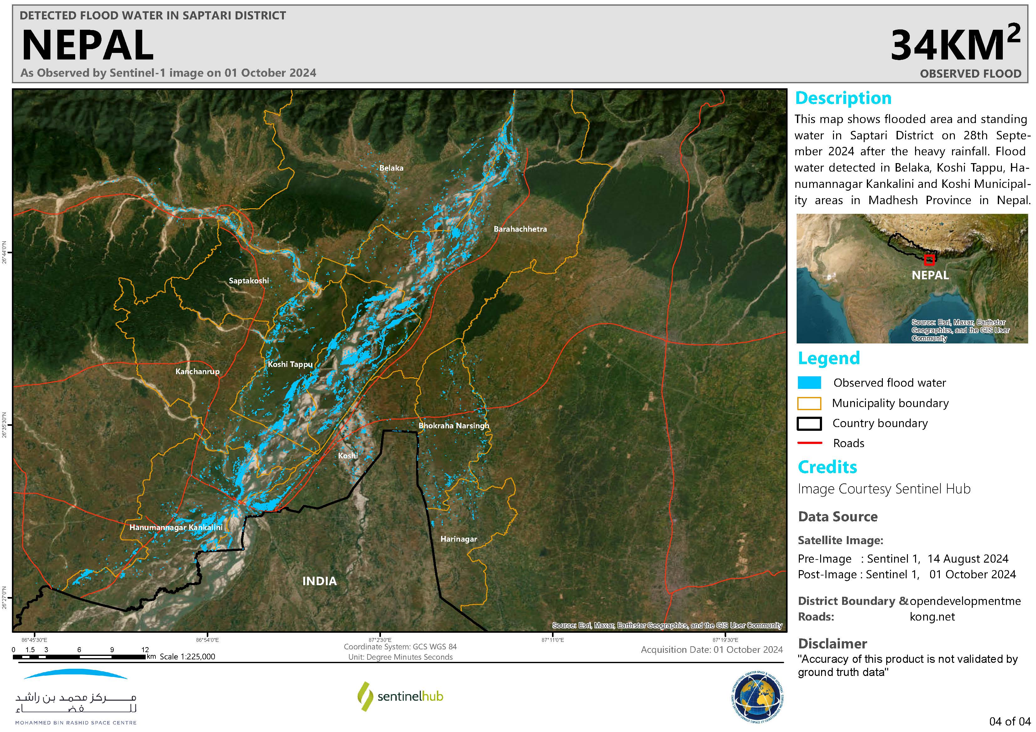
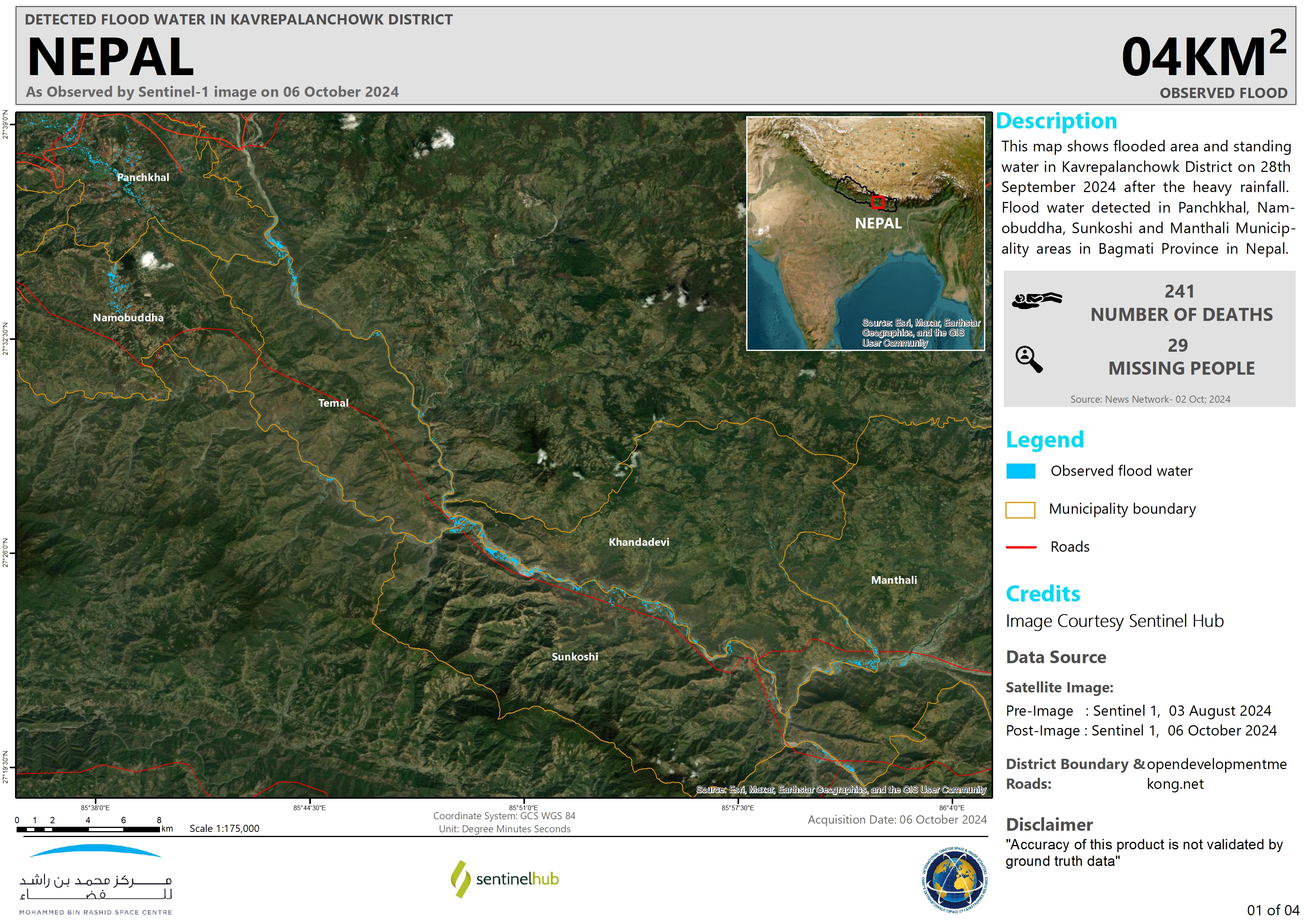
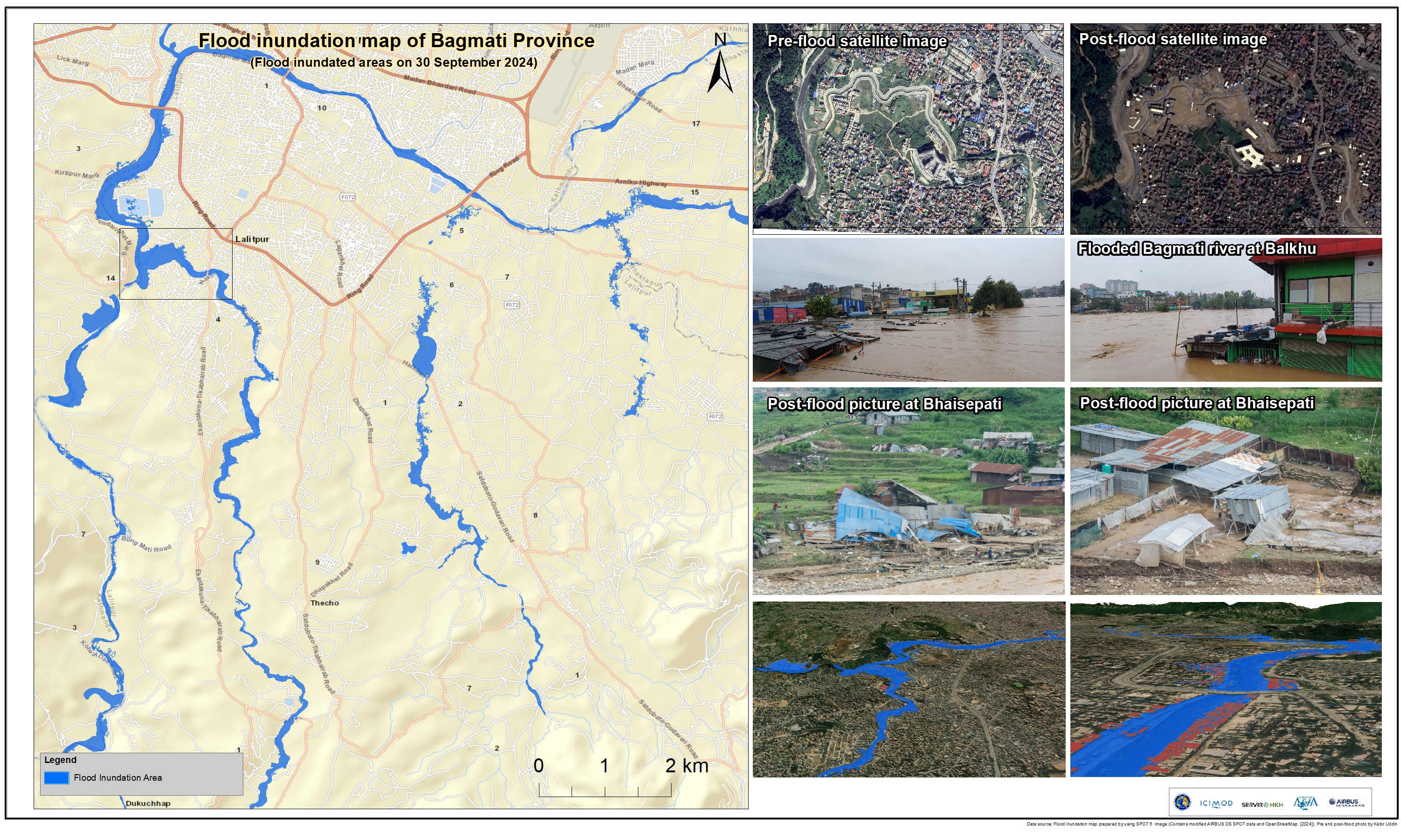
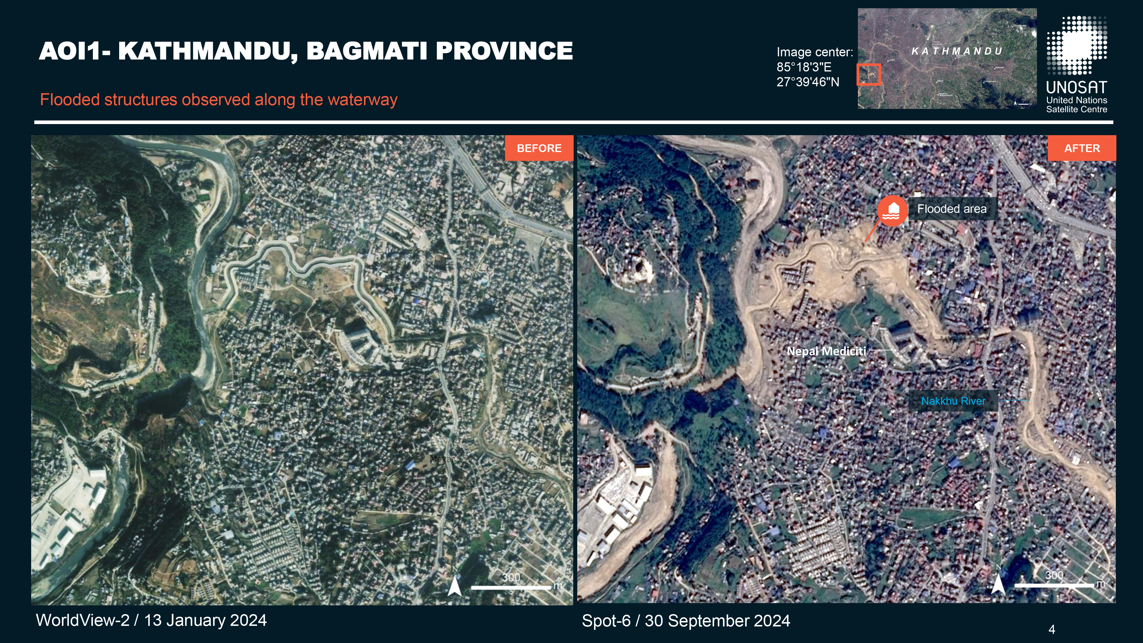
Flood in Nepal
Flooding and landslides were triggered by the highest rainfall recorded in Nepal. Three days of persistent rainfall had inundated the Himalayan country, causing widespread flash floods.
The death toll has reached up to 193, many of the deaths were in the capital city of Kathmandu. 31 people reported still missing and 96 people injured across the Himalayan nation. People were also killed in their homes as some houses were crushed by landslides.
65 highways have been obstructed, and the risk of landslides has increased in 42 districts due to rain. One landslide blocked a highway situated 10 miles from the Kathmandu city, this killed three dozen people and buried at least three buses and other vehicles. Workers were able to temporarily open up the key Prithvi highway, removing rocks, mud and trees that had been swept down from the mountains.
Schools and colleges in the Himalayan nation had to close temporarily as students and their parents faced difficulties due to damaged infrastructure.
The government hopes to build temporary shelters for people who lost their homes.
| Type of Event: | Flood |
| Location of Event: | Nepal |
| Date of Charter Activation: | 2024-09-29 |
| Time of Charter Activation: | 12:27 |
| Time zone of Charter Activation: | UTC+09:00 |
| Charter Requestor: | ADRC on behalf of Department of Hydrology and Meteorology (DHM), Nepal |
| Activation ID: | 919 |
| Project Management: | Kabir Uddin (International Centre for Integrated Mountain Development (ICIMOD)) |
| act-value-adders: | Suwanan Sateiandee (UNOSAT) Shaikha Ahmed Albesher (Mohammed Bin Rashid Space Centre) |
Products
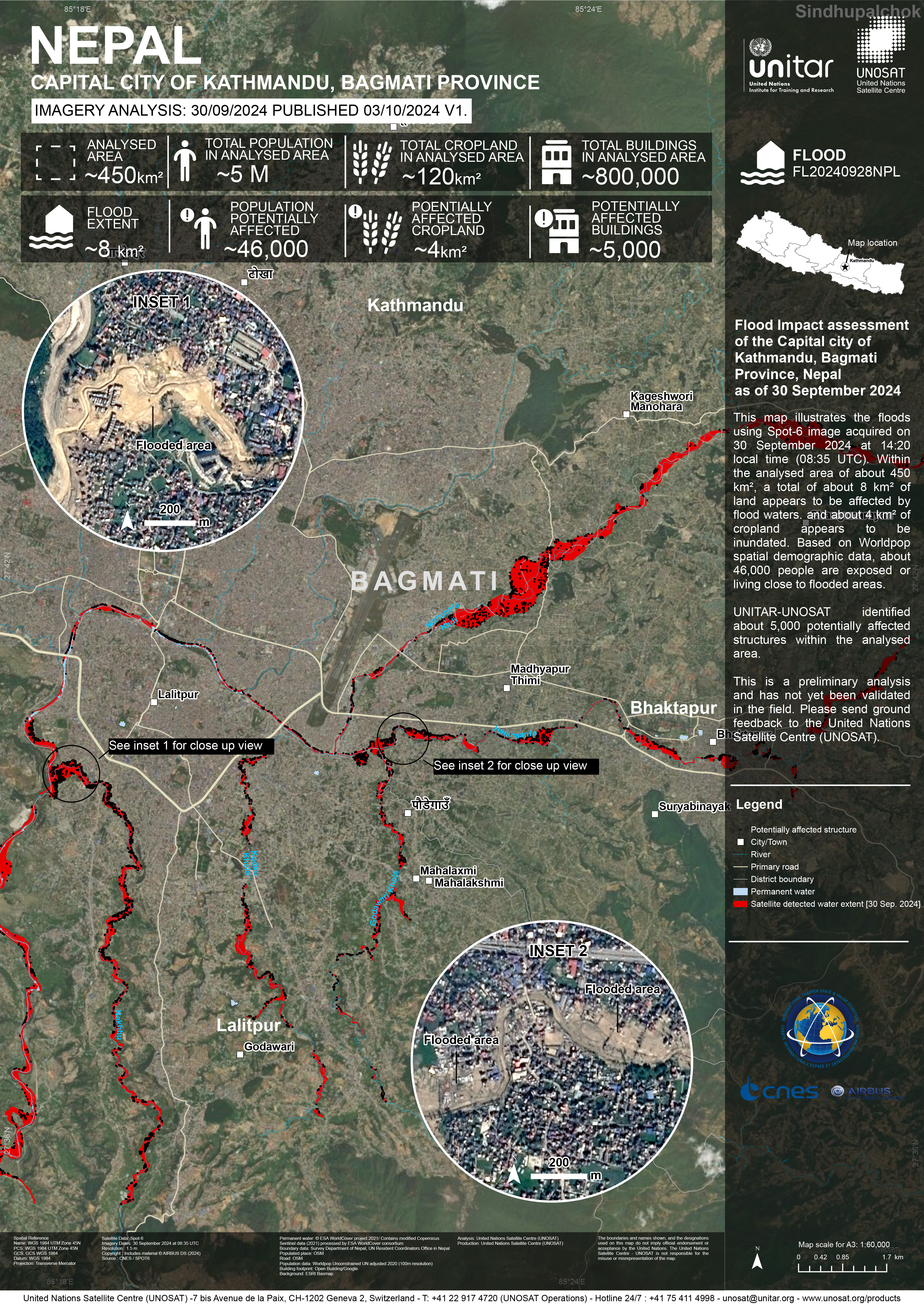
Preliminary Satellite-derived Flood Impact Assessment, Capital city of Kathmandu, Bagmati Province, Nepal
Download full report
Copyright: Includes material © AIRBUS DS (2024)
Map produced by UNITAR / UNOSAT
Information about the Product
Acquired: 30/09/2024
Source: SPOT-6
Category: Dossier
 Back to the full activation archive

