Charter activations
Earthquake and landslide in Nepal and India
A 7.8 magnitude earthquake struck Nepal at 11:56 (local time) on 25 April 2015.
The devastating earthquake has killed over seven thousand people in Nepal, and more than 70 in neighbouring India.
The epicentre of the earthquake was in central Nepal at 28 degree north latitude and 84 degrees east longitude. It has been described as the worst disaster to affect Nepal in 80 years and the latest reports list a total of 7566 casualties, with twice that number injured. More than eight million people are affected by the earthquake.
The death toll is expected to increase, as rescue workers sift through the wreckage of remote villages and towns in the region, some of which have been entirely buried by landslides.
The capital city of Nepal, Kathmandu, which was 80 km away from the epicentre suffered in the disaster, with a toll of at least one thousand victims. Several locations of historical importance in the city also suffered severe damage. Kathmandu is providing shelter for thousands of victims in the region, with emergency tents and medical resources.
Recovery efforts are hindered by lack of communications and access to many locations, caused by damage from the earthquake and landslides blocking roads and severing communications lines. Helicopters are the only way to reach some of these areas, and Nepal has only a small number of aircraft available.
Northern India, which borders Nepal, suffered damage in the earthquake with the states of Bihar and Sikkim particularly affected. The current death toll stands at 78 in India, with most of the casualties in Bihar. Authorities have advised people to avoid older structures in the area due to concerns of collapse following the earthquake.
The earthquake also caused avalanches on Mount Everest, which killed 18 people and left hundreds of mountain climbers stranded on the mountain when they lost their climbing gear in the avalanches. The mountain is located in eastern Nepal, in the Himalayas, and is a popular attraction for mountain climbers. Rescue efforts are underway to retrieve the stranded mountain climbers, and over 200 have been recovered so far. But many of them are missing; their location unknown.
Over 35 aftershocks have been recorded since the initial earthquake struck, the most powerful of which was at magnitude 6.7 on 26 April. This caused further damage in Nepal and India. International aid is being sent to Nepal, including help from the neighbouring countries of India and China, which have both suffered from the disaster, as well.
It is expected to be a long and difficult recovery for Nepal.
| Type of Event: | Earthquake, Landslide |
| Location of Event: | Nepal and India |
| Date of Charter Activation: | 25 April 2015 |
| Time of Charter Activation: | 11:24:00 |
| Time zone of Charter Activation: | UTC+02:00 |
| Charter Requestor: | Disaster Management Support (DMS) Programme Office, Indian Space Research Organisation (ISRO) UNITAR/UNOSAT on behalf of UNICEF |
| Project Management: | NRSC/ISRO |
Products
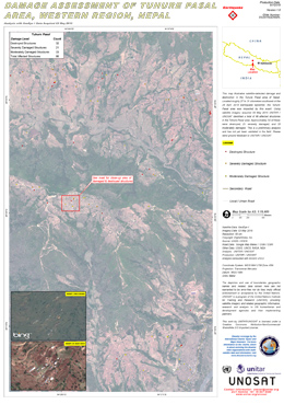
Damage assessment of Tuhure Pasal Area, in the Western Region of Nepal
Copyright: DigitalGlobe Inc.
Map produced by UNITAR/UNOSAT
Information about the Product
Acquired: 03/05/2015
Source: GeoEye-1
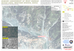
Damage assessment of West Sundar Bazar Area, in the Western Region of Nepal
Copyright: DigitalGlobe Inc.
Map produced by UNITAR/UNOSAT
Information about the Product
Acquired: 29/04/2015
Source: WorldView-1
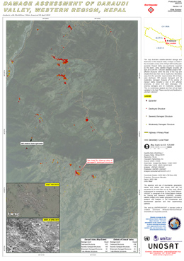
Damage assessment of Daraudi Valley, in the Western Region of Nepal
Copyright: DigitalGlobe Inc.
Map produced by UNITAR/UNOSAT
Information about the Product
Acquired: 29/04/2015
Source: WorldView-1
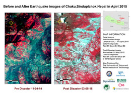
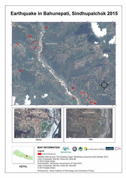
Before and after earthquake images of Chaku, Sindhupalchowk, Nepal
Copyright: Landsat 8 data and products © USGS (2015) - All rights reserved
WorldView © DigitalGlobe Inc. 2015
Map produced by University of Tokyo and Asian Institute of Technology
Information about the Product
Acquired: Landsat 8: 11/04/2014
WorldView: 03/05/2015
Source: Landsat 8 OLI / WorldView
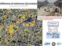
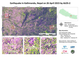
JAXA difference of coherence analysis in Kathmandu and Bhaktapur, with damage assessment
Download the full report
Copyright: Data and analysis produced by JAXA
Information about the Product
Acquired: 02/05/2015, 21/02/2015 and 04/10/2014
Source: ALOS-2 - PALSAR-2

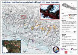
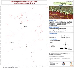
Landslide inventory mapping from the British Geological Survey, Durham University and other agencies
Copyright: WorldView © DigitalGlobe Inc.
UK-DMC2 © UKSA 2015
SPOT © CNES 2015
Pleiades © CNES 2015
RADARSAT-2 Data and Products © MacDonald, Dettwiler and Associates Ltd. (2015) - All Rights Reserved. RADARSAT is an official trademark of the Canadian Space Agency.
Map produced by British Geological Survey
Information about the Product
Source: WorldView / UK-DMC2 / SPOT / Pleiades / RADARSAT-2
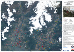
Earthquake damage assessment of Sindhulpalchok district, Nepal
Copyright: Pleiades © CNES 2015 - Distribution: Airbus Defence and Space, all rights reserved
Landsat-8 data and products © USGS (2014) - All rights reserved
Map produced by SERTIT
Information about the Product
Acquired: Pleiades-1B: 04/05/2015
Landsat 8: 11/04/2014
Source: Pleiades-1B / Landsat 8
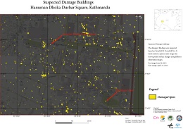
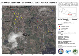
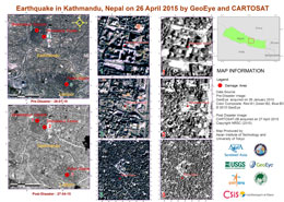
Suspected damage to buildings in Hanuman Dhoka Square, Kathmandu
Copyright: German Aerospace Center (DLR), 2015 Airbus Defence and Space / Infoterra GmbH
Map produced by University of Tokyo and Asian Institute of Technology
Information about the Product
Acquired: Pre-disaster: 30/06/2013
Post-disaster: 27/04/2015
Source: TerraSAR-X
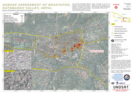
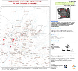
Damage assessment of Bhaktapur, Kathmandu Valley, in Nepal
Copyright: DigitalGlobe Inc.
Map produced by UNITAR/UNOSAT
Information about the Product
Acquired: 27/04/2015
Source: WorldView-3
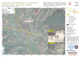
Damage assessment of Banepa, Kathmandu Valley, in Nepal
Copyright: DigitalGlobe Inc.
Map produced by UNITAR/UNOSAT
Information about the Product
Acquired: 27/04/2015
Source: WorldView-3
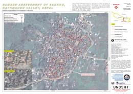
Damage assessment of Sankhu, Kathmandu Valley, in Nepal
Copyright: DigitalGlobe Inc.
Map produced by UNITAR/UNOSAT
Information about the Product
Acquired: 27/04/2015
Source: WorldView-3

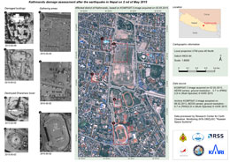
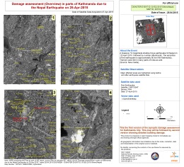
Report on damage and displaced persons visible in satellite imagery. Kathmandu, Nepal
Download the report
Copyright: CNES 2015 - Distribution: Airbus Defence and Space
Report produced by UNITAR/UNOSAT
Information about the Product
Acquired: 27/04/2015
Source: Pleiades
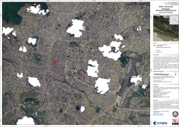
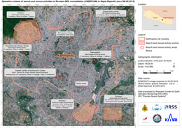
Situation overview map showing spontaneous population gatherings observed on 27/04/2015 in Kathmandu following the earthquake.
Copyright: CNES 2015 - Distribution: Airbus Defence and Space, all rights reserved
Map produced by SERTIT
Information about the Product
Acquired: 27/04/2015
Source: Pleiades
 Back to the full activation archive

 English
 Spanish
 French
 Chinese
 Russian
 Portuguese
