 English
 Spanish
 French
 Chinese
 Russian
 Portuguese
 最新宪章启动
Charter activations
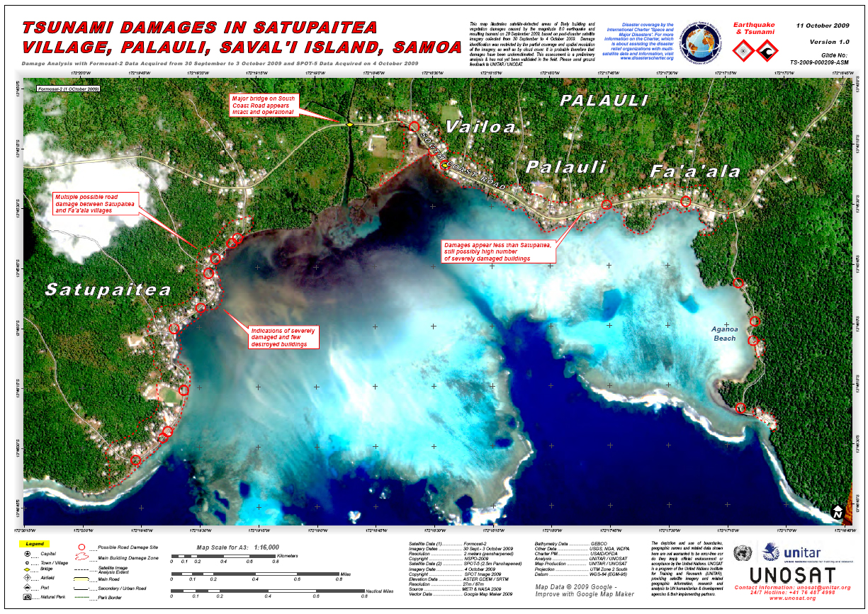
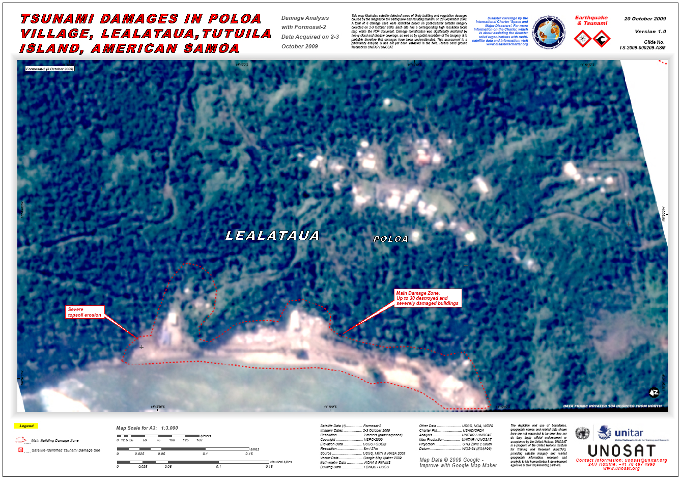
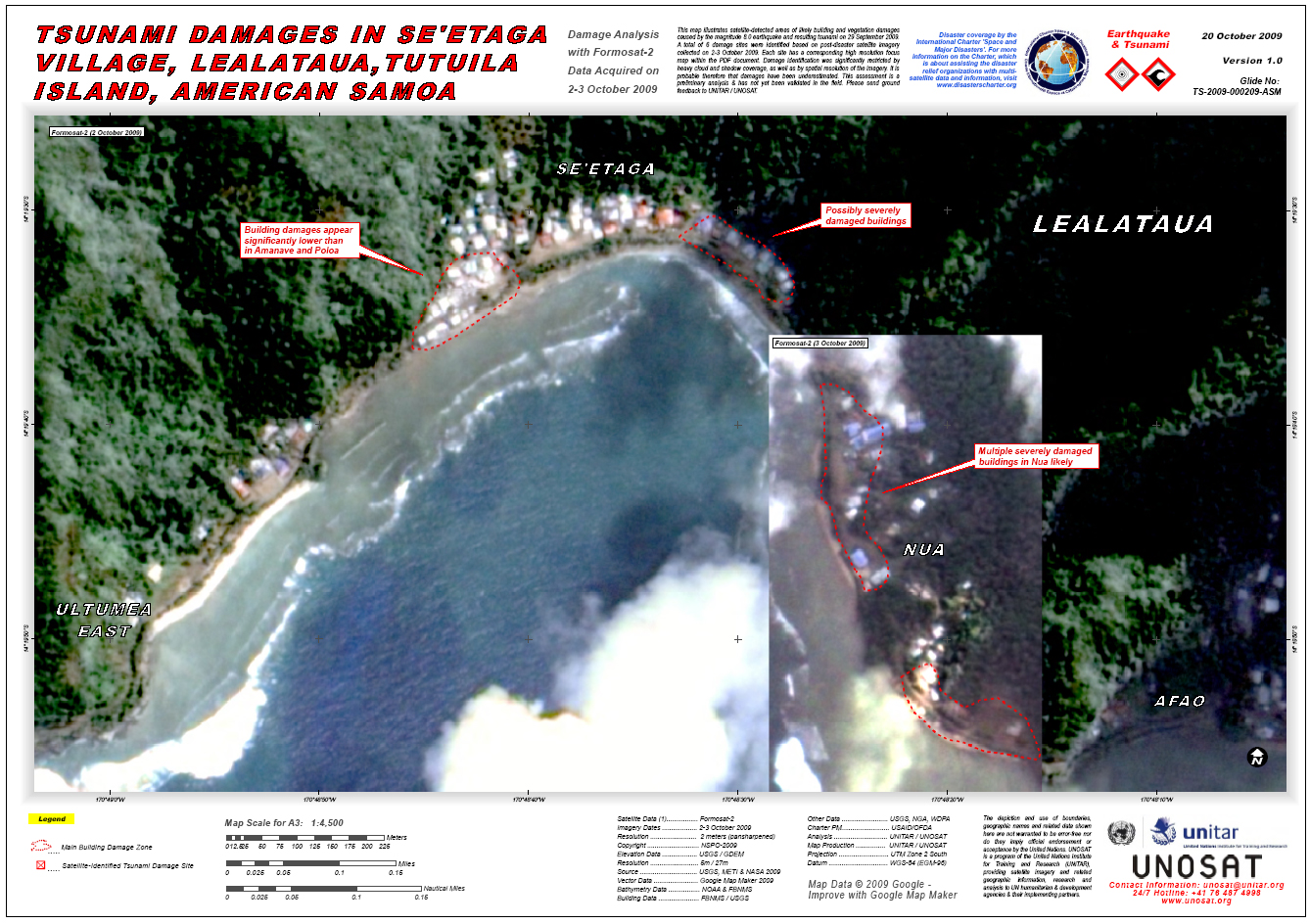
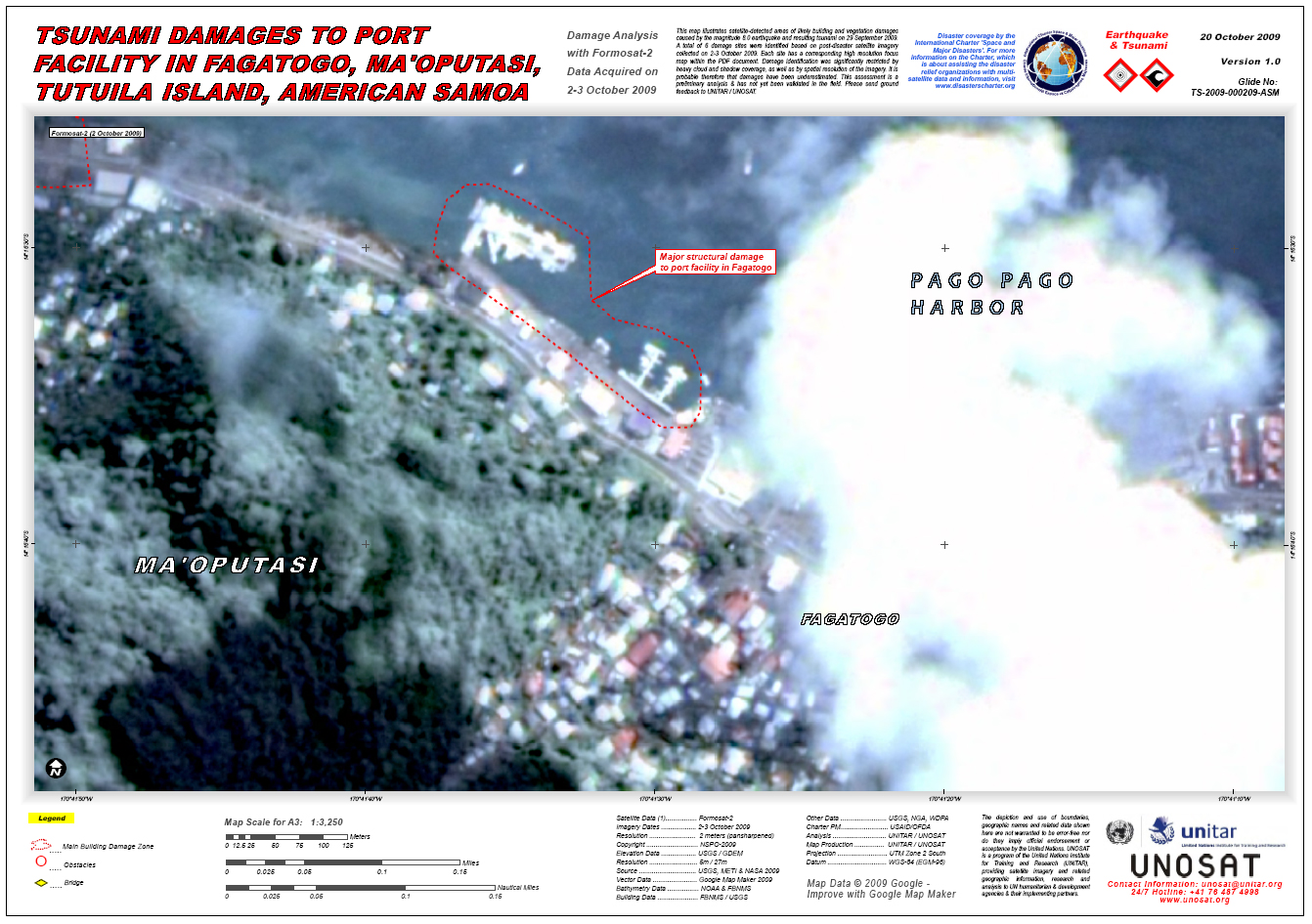
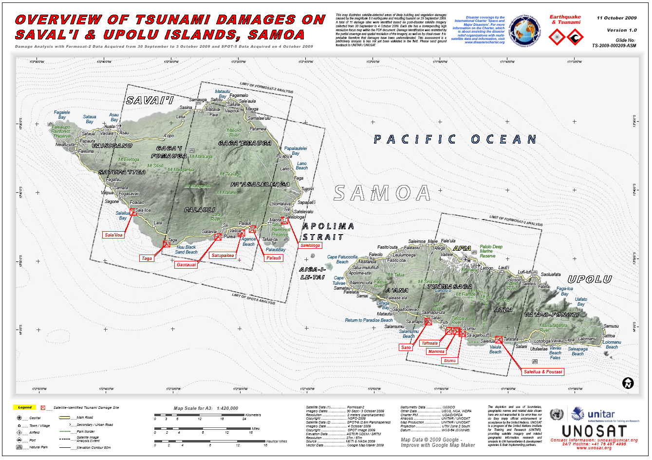
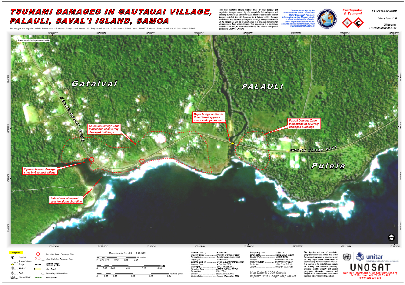
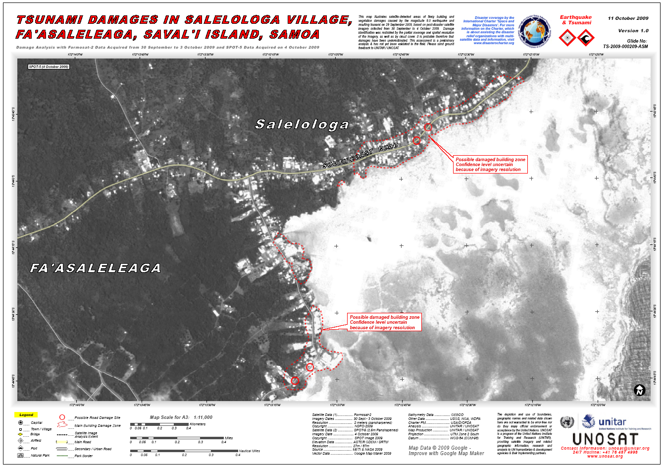
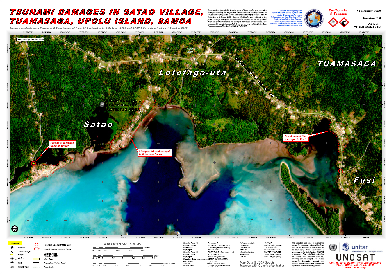
萨摩亚群岛海啸
由8级地震引起的海啸席卷南太平洋,造成120多人死亡。
萨摩亚主岛乌波卢的南部沿海遭到极大破坏。
| 事件类型: | 海啸 |
| 事件地点: | 萨摩亚群岛 |
| 启动宪章的日期: | 2009年9月30日 |
| 宪章要求者: | UNOOSA代表UNOCHA/Pacific |
| 项目经理: | 美国对外灾害援助办公室 |
Products

 返回完整的响应档案
最新宪章启动
返回完整的响应档案
最新宪章启动
由8级地震引起的海啸席卷南太平洋,造成120多人死亡。
萨摩亚主岛乌波卢的南部沿海遭到极大破坏。
| 事件类型: | 海啸 |
| 事件地点: | 萨摩亚群岛 |
| 启动宪章的日期: | 2009年9月30日 |
| 宪章要求者: | UNOOSA代表UNOCHA/Pacific |
| 项目经理: | 美国对外灾害援助办公室 |
返回完整的响应档案

