斐济天气中心警告“极具破坏力的飓风级风力”和浪高达11米(36英尺)的“海有极巨浪”袭击拉罗汤加主岛和马奈阿附近地区。旋风摧毁了岛上的房屋、中断了电力并刮倒了树木,但没有伤亡报道。官方报道说米娜气旋的风速达到了255公里/小时(160英里/小时)。
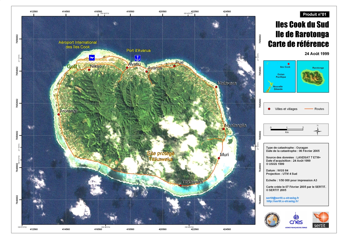
Reference Map of Rarotonga Island (Southern Cook Islands).
版权: Map created by SERTIT on 07 Feb 2005.
Information about the Product
已获得: 24 August 1999.
源: LANDSAT 7 ETM+ Scale: 1:50.000.
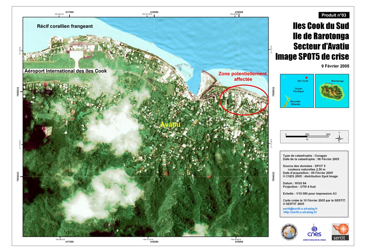
Crisis Satellite map of Rarotonga - Avatiu
版权: Map produced 10/02/2005 by SERTIT
已获得: 09/02/05
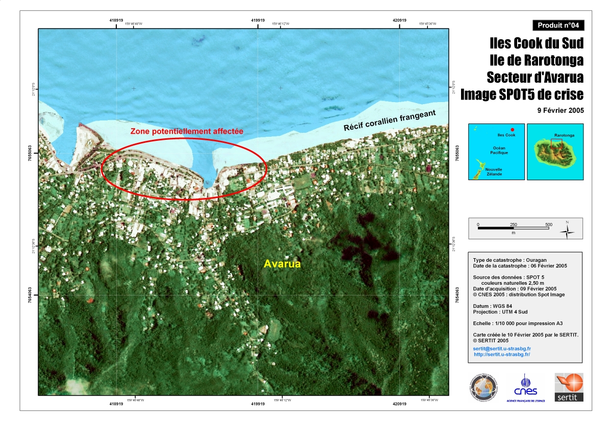
源: SPOT 5, 2.5 m Scale 1:10,000
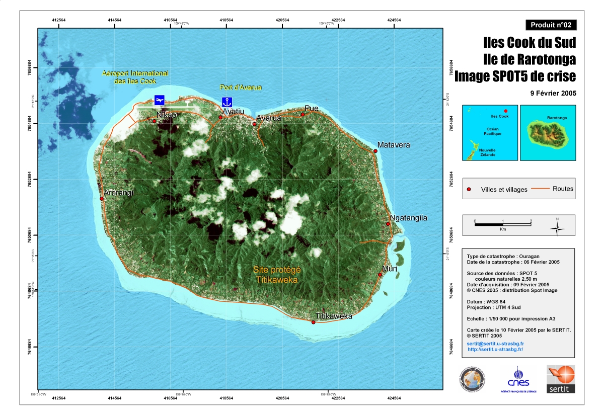
Crisis Satellite map of Rarotonga
源: SPOT 5, 2.5 m Scale 1:50,000
Crisis Satellite map of Rarotonga - Avarua
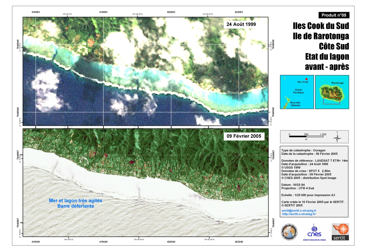
Rarotonga south coast: state of the lagoon, before and after
已获得: 24/08/1999 and 09/02/05
源: Landsat 7 ETM+, 14m (24/08/1999) Spot 5 2.5 m (09/02/05) Scale 1:25,000
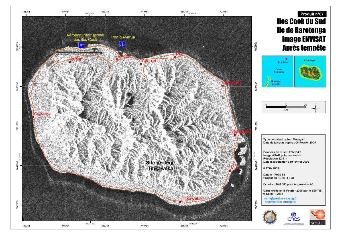
Crisis Map of Rarotonga
版权: Map created 15 February by SERTIT
已获得: 10 February 2005
源: Envisat data Image ASAR polarisation HH Resolution: 12.5m Scale 1:40.000
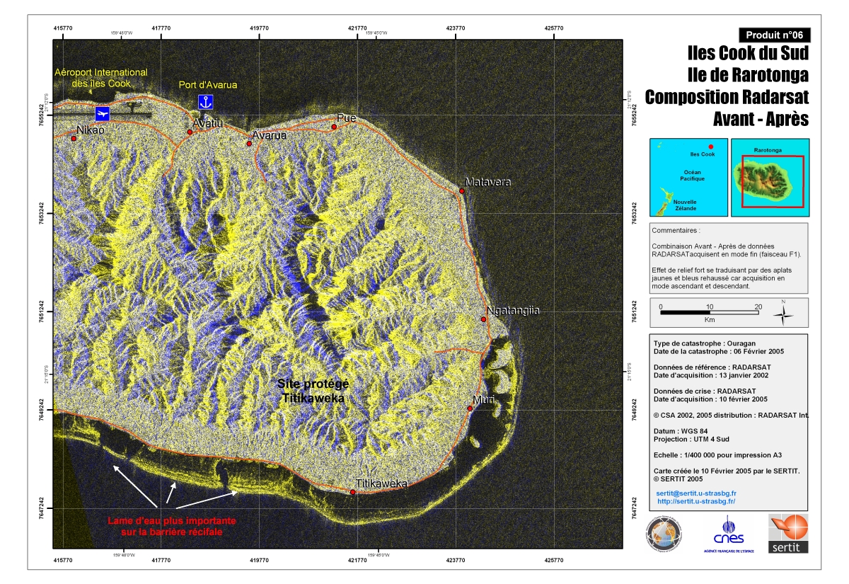
Crisis Satellite map of Rarotonga before, after
已获得: 13/01/02 and 10/02/05
源: Radarsat Scale 1:50,000
 English
 Spanish
 French
 Chinese
 Russian
 Portuguese
 返回完整的响应档案

