Minimizar Latest Activation

Charter activations

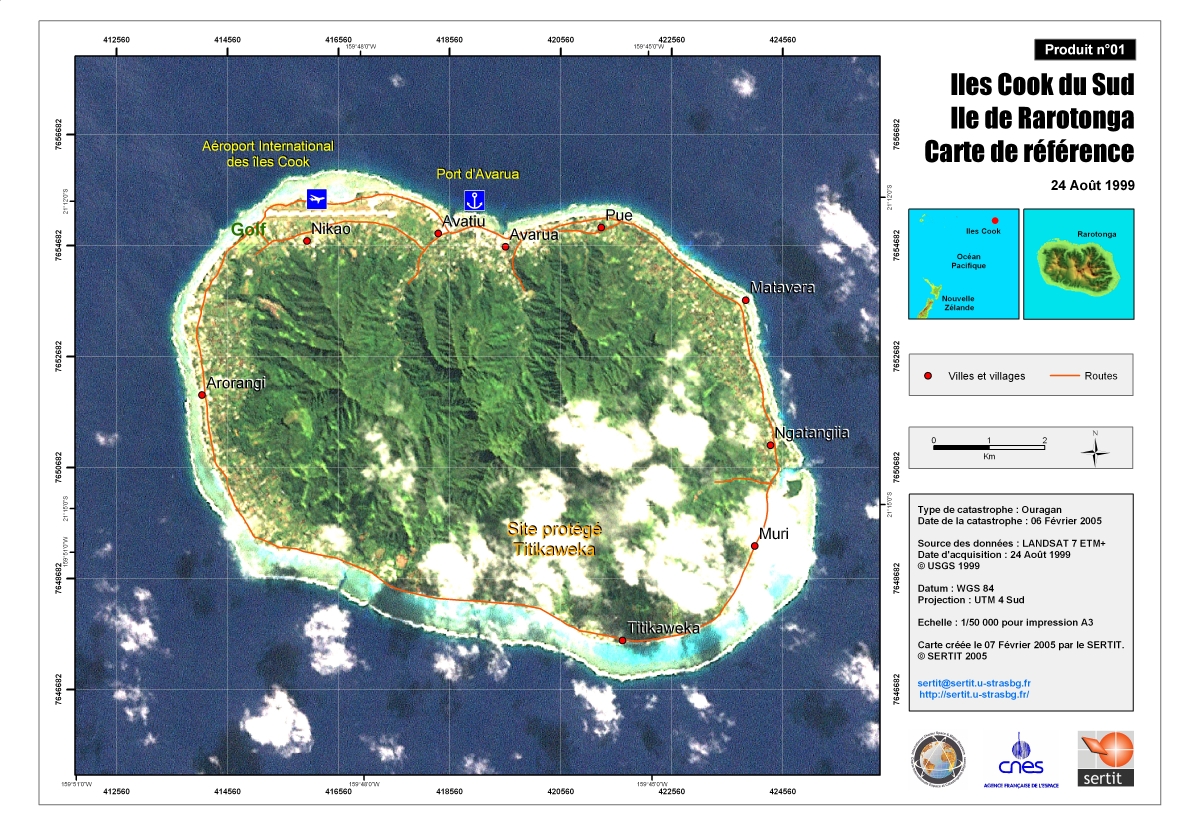
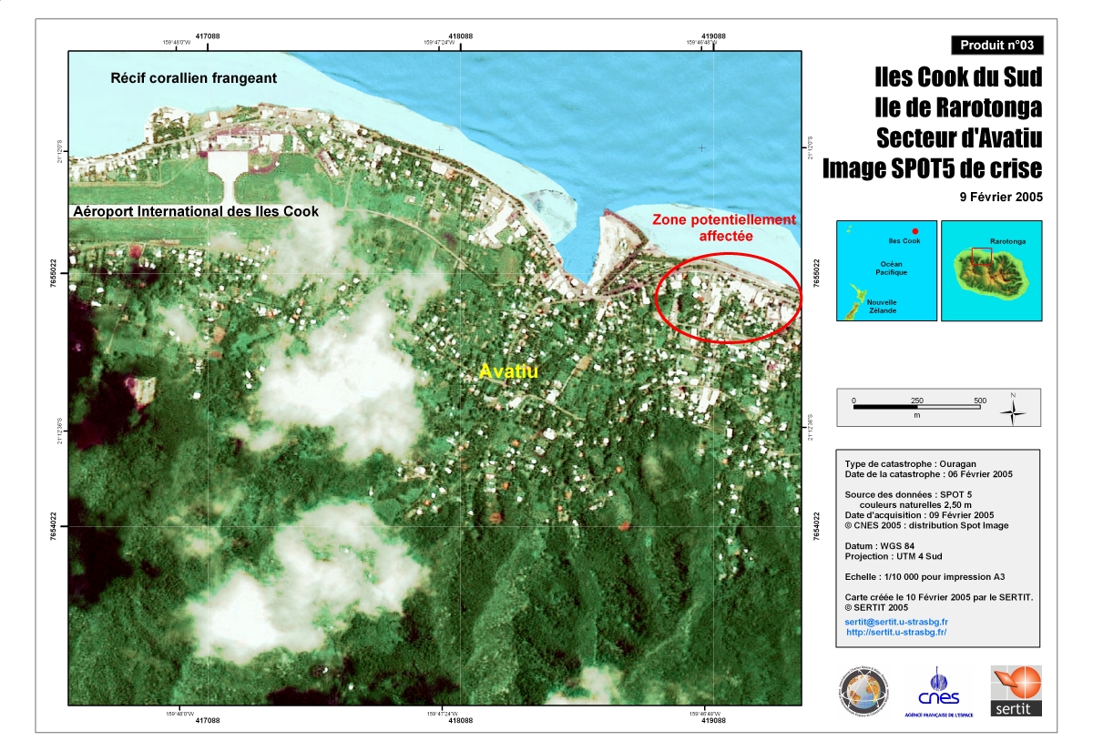
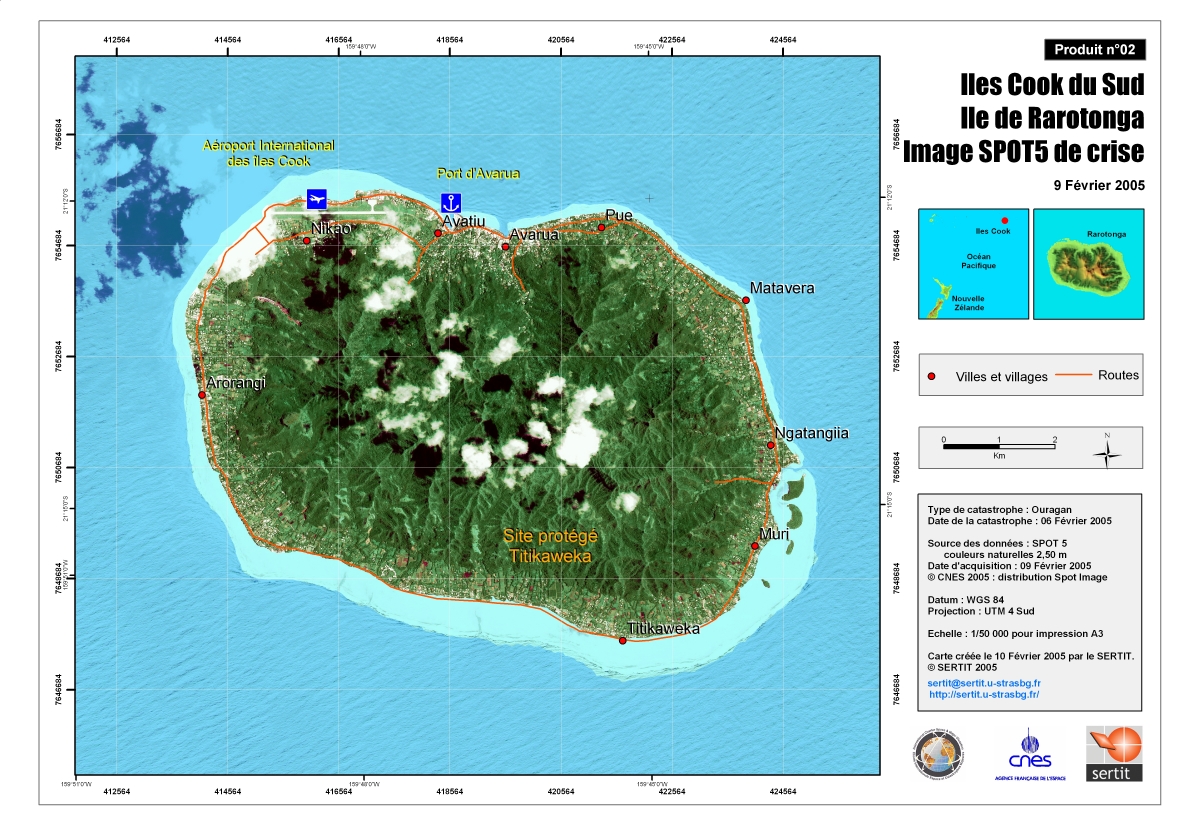
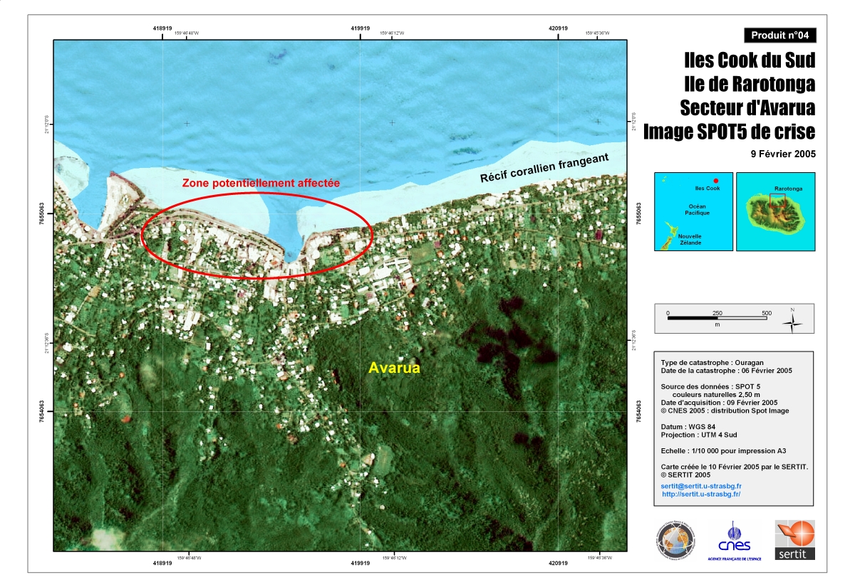
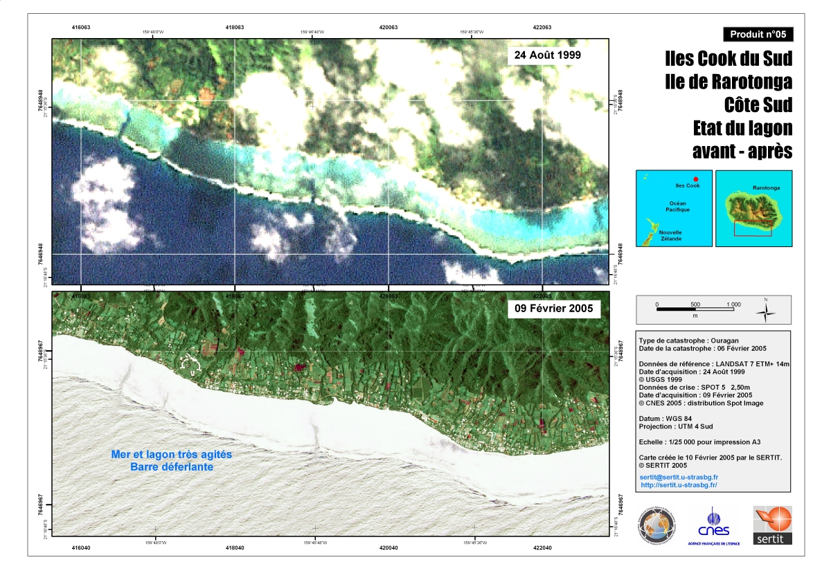
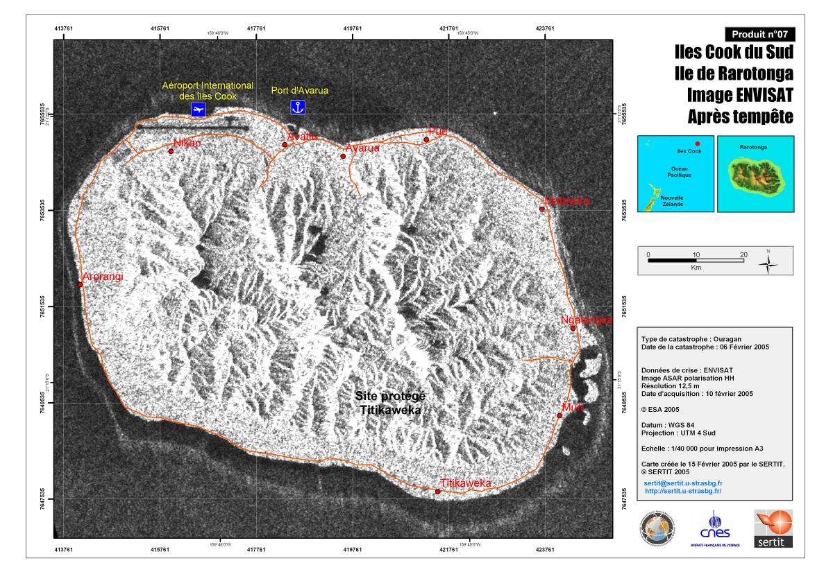
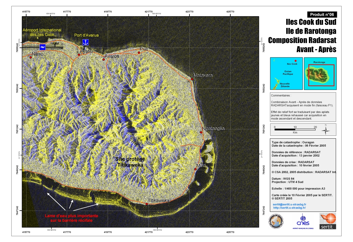
Hurricane on Rarotonga Island - Cook Islands

The Fiji weather center warned of "very destructive hurricane-force winds" and "phenomenal seas" with waves up to 11 meters (36 feet) striking areas round the main island of Rarotonga and nearby Manaia. The cyclone battered houses on the islands, cut power and brought down trees but there were no reports of injury. Cyclone Meena is characterized by winds gusting to 255 kph (160 mph), officials reported.

Tipo de evento:Hurricane
Local do evento:Rarotonga Island - Cook Islands
Data da Ativação da Carta:05/02/2005
Requisitante da Carta:Direction de la Défense et de la Sécurité Civile
Gerenciamento de projeto:CNES

Products

Reference Map of Rarotonga Island (Southern Cook Islands).

Direitos autorais: Map created by SERTIT on 07 Feb 2005.

Information about the Product

Adquirida: 24 August 1999.

Fonte: LANDSAT 7 ETM+
Scale: 1:50.000.

Crisis Satellite map of Rarotonga - Avatiu

Direitos autorais: Map produced 10/02/2005 by SERTIT

Information about the Product

Adquirida: 09/02/05

Fonte: SPOT 5, 2.5 m
Scale 1:10,000

Crisis Satellite map of Rarotonga

Direitos autorais: Map produced 10/02/2005 by SERTIT

Information about the Product

Adquirida: 09/02/05

Fonte: SPOT 5, 2.5 m
Scale 1:50,000

Crisis Satellite map of Rarotonga - Avarua

Direitos autorais: Map produced 10/02/2005 by SERTIT

Information about the Product

Adquirida: 09/02/05

Fonte: SPOT 5, 2.5 m
Scale 1:10,000

Rarotonga south coast: state of the lagoon, before and after

Direitos autorais: Map produced 10/02/2005 by SERTIT

Information about the Product

Adquirida: 24/08/1999 and 09/02/05

Fonte: Landsat 7 ETM+, 14m (24/08/1999)
Spot 5 2.5 m (09/02/05)
Scale 1:25,000

Crisis Map of Rarotonga

Direitos autorais: Map created 15 February by SERTIT

Information about the Product

Adquirida: 10 February 2005

Fonte: Envisat data
Image ASAR polarisation HH
Resolution: 12.5m
Scale 1:40.000

Crisis Satellite map of Rarotonga before, after

Direitos autorais: Map produced 10/02/2005 by SERTIT

Information about the Product

Adquirida: 13/01/02 and 10/02/05

Fonte: Radarsat
Scale 1:50,000

Voltar ao arquivo completo da Ativação