9月6-7日在法国加尔省和埃罗省的暴雨在法国南部引发洪灾。主要的高速公路中断,Lunel和Montpellier镇被淹。
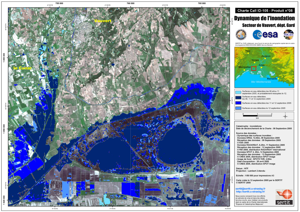
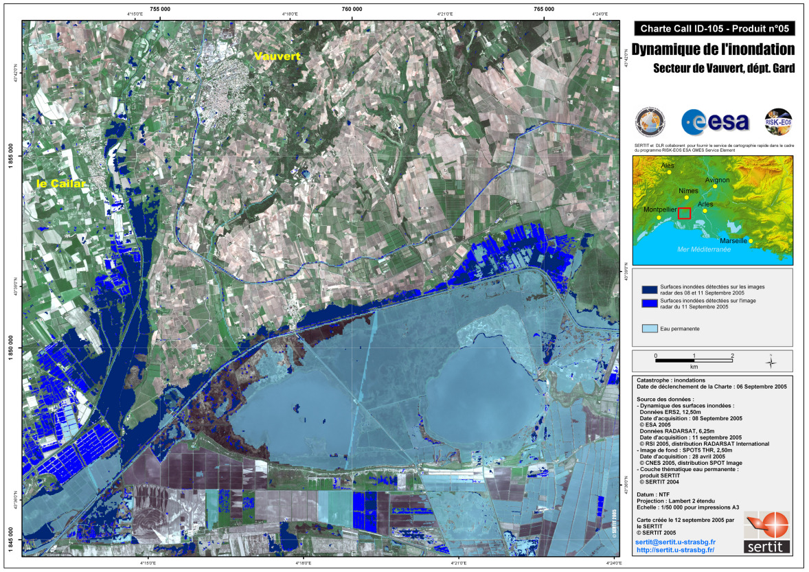
Dynamic Satellite Map Vauvert
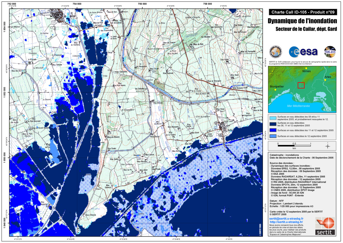
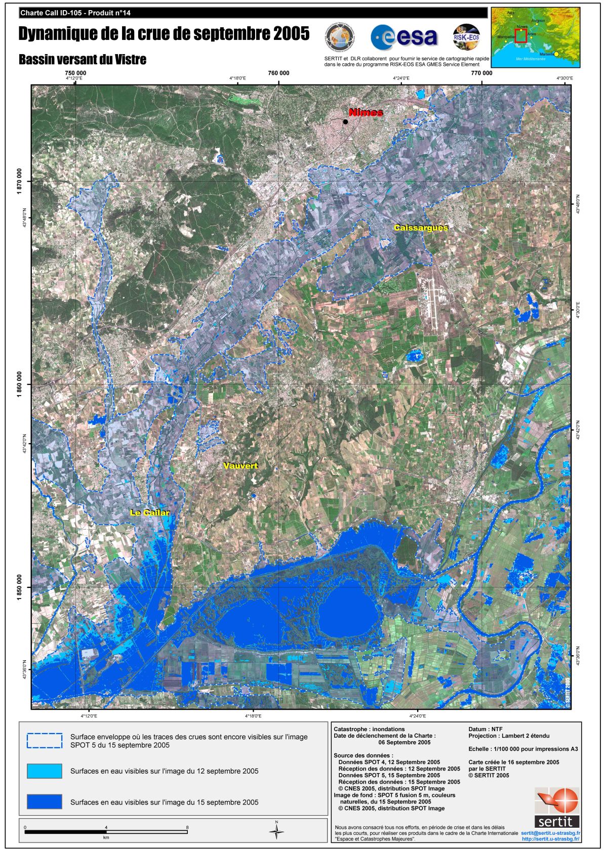
版权: ESA 2005, CNES 2005, CSA 2005 Image processing, map created 12/09/2005 by SERTIT
Information about the Product
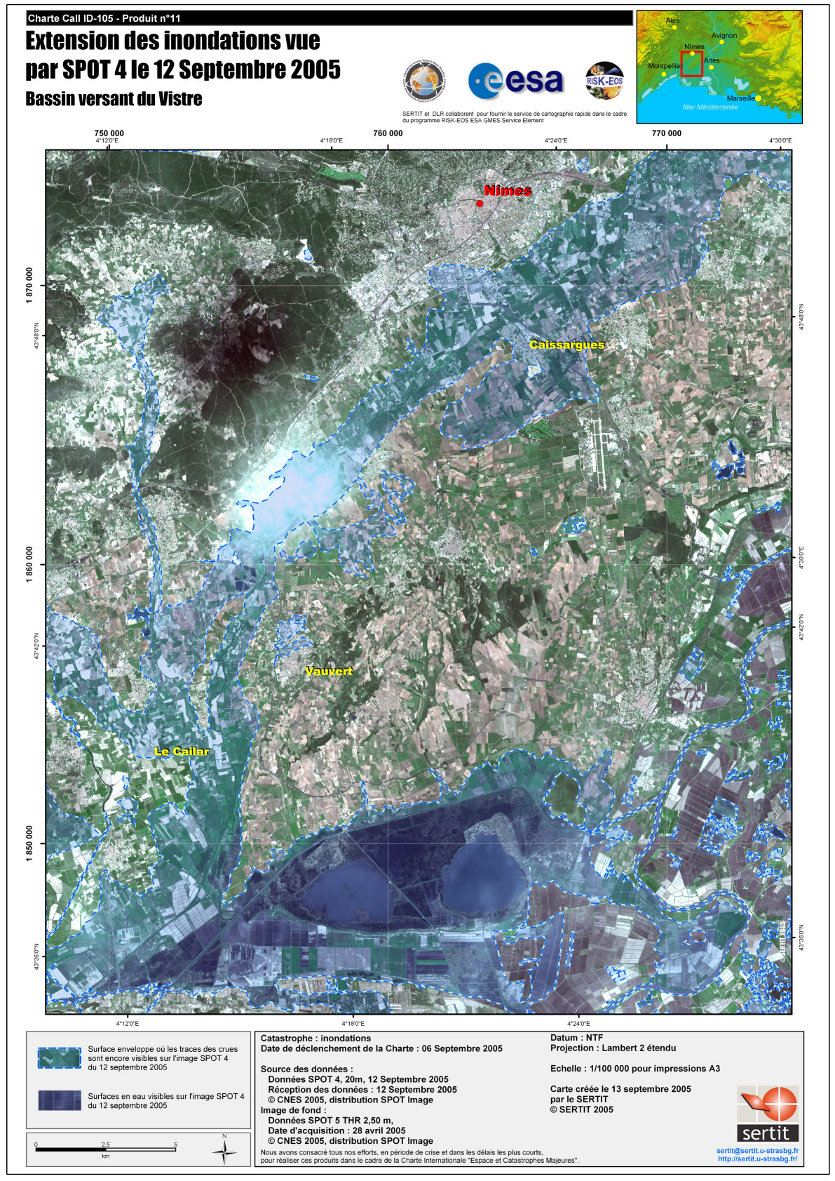
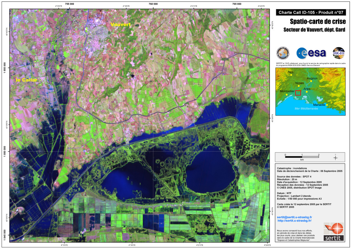
已获得: 8-9-11-12/09/2005
源: Spot 4, ERS-2, Radarsat
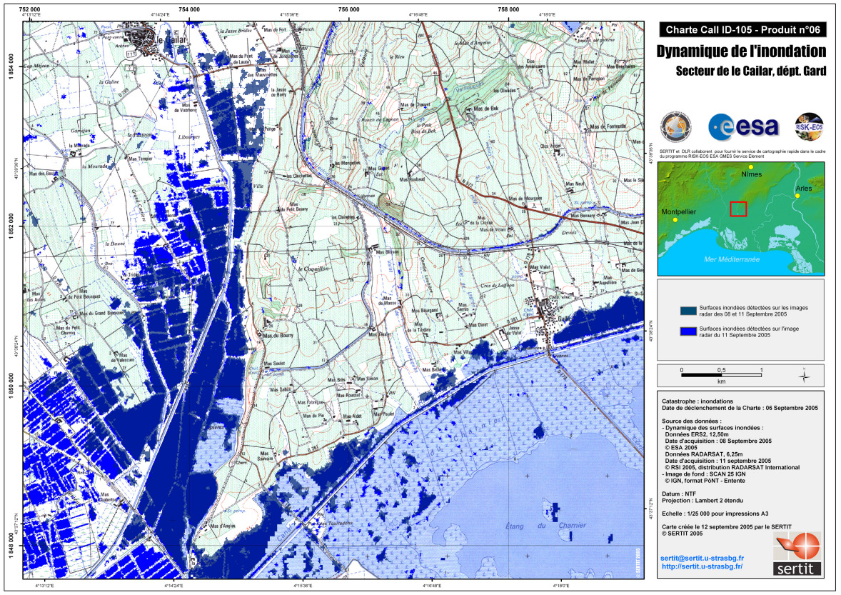
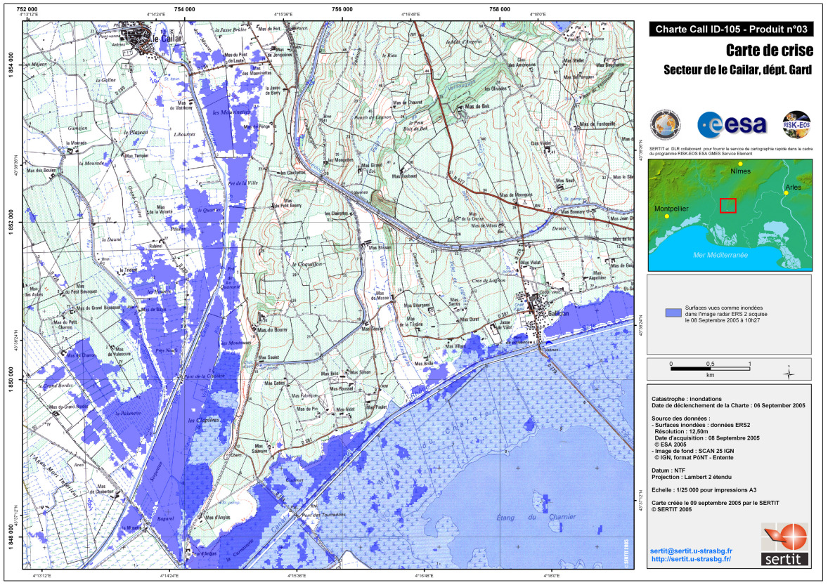
Dynamic Satellite Map Le Cailar Flooded areas, overlay on IGN SCAN 25 base map.
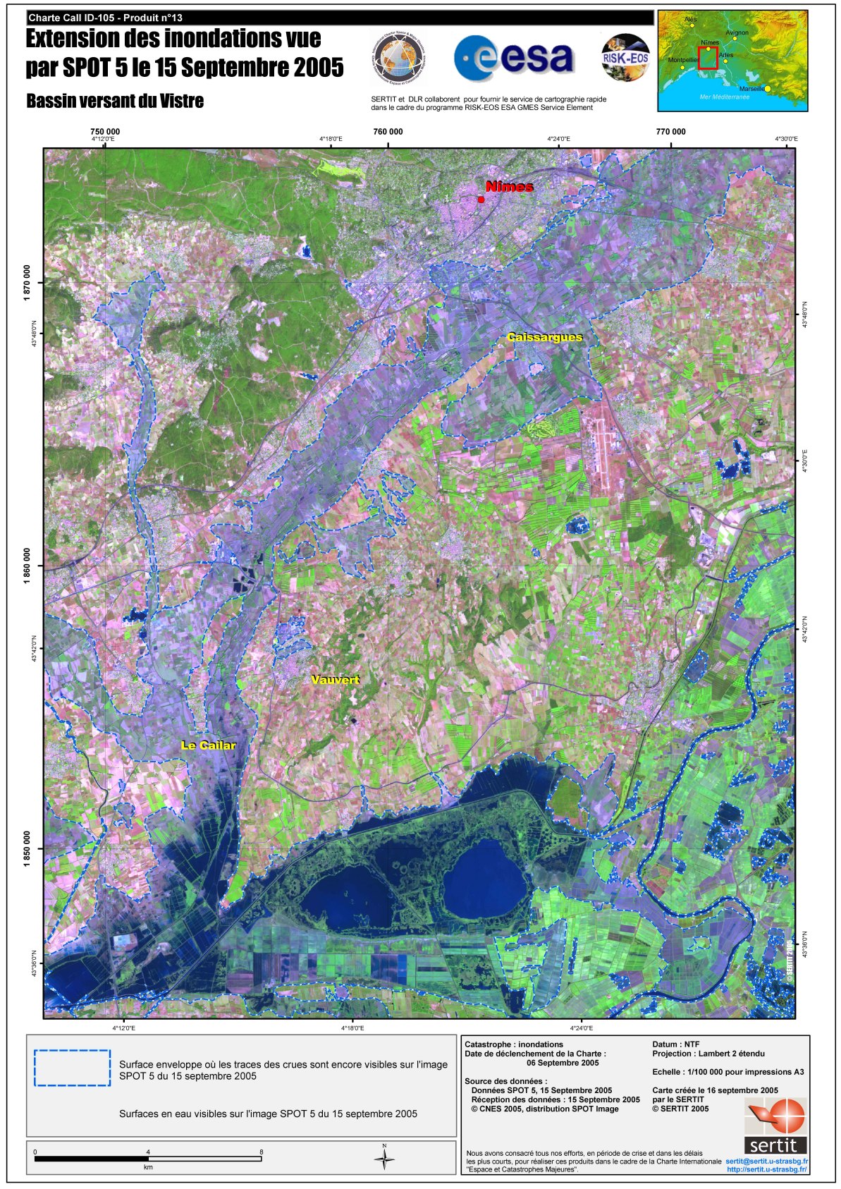
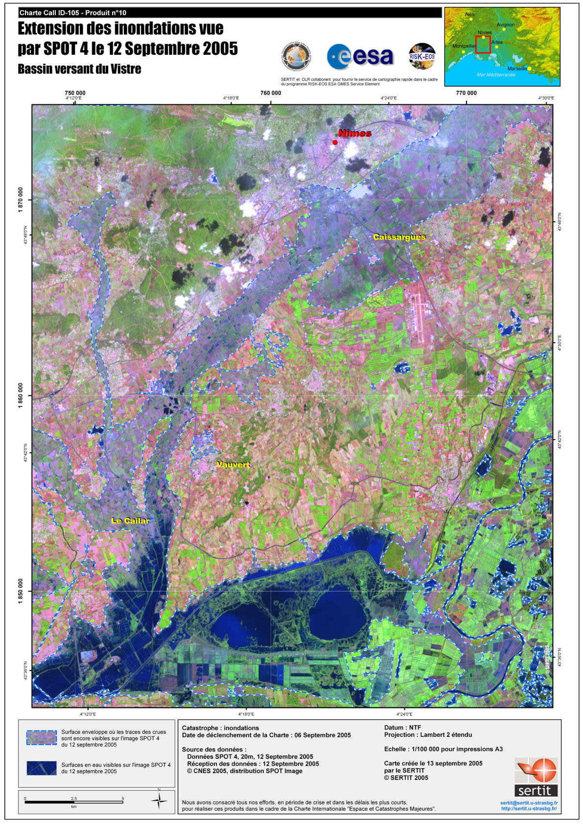
Satellite Map Flood Extension, Vistre
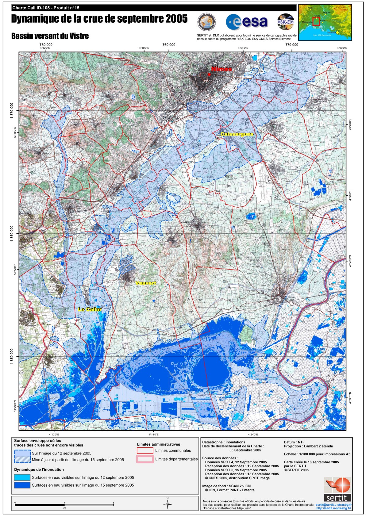
版权: CNES 2005 Image processing, map created 16/09/2005 by SERTIT
已获得: 15/09/2005
源: Spot 5
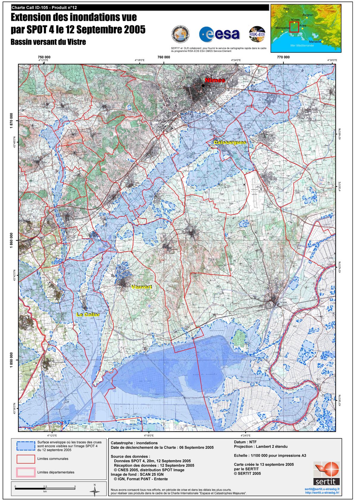
Satellite Map Flood Extension, Vistre Flooded areas, overlay on IGN SCAN 25 base map.
源: Spot 4
已获得: 12 e 15/09/2005
源: Spot 4, Spot 5
Satellite Map Flood Extension, Vistre , Natural Colours
版权: CNES 2005 Image processing, map created 13/09/2005 by SERTIT
已获得: 12/09/2005
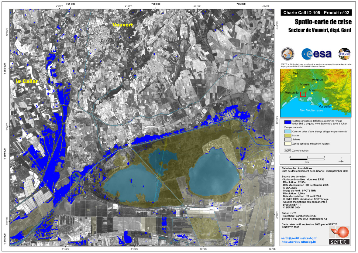
版权: ESA 2005, CSA 2005 Image processing, map created 12/09/2005 by SERTIT
已获得: 08/09/2005, 11/09/2005
源: ERS-2, Radarsat
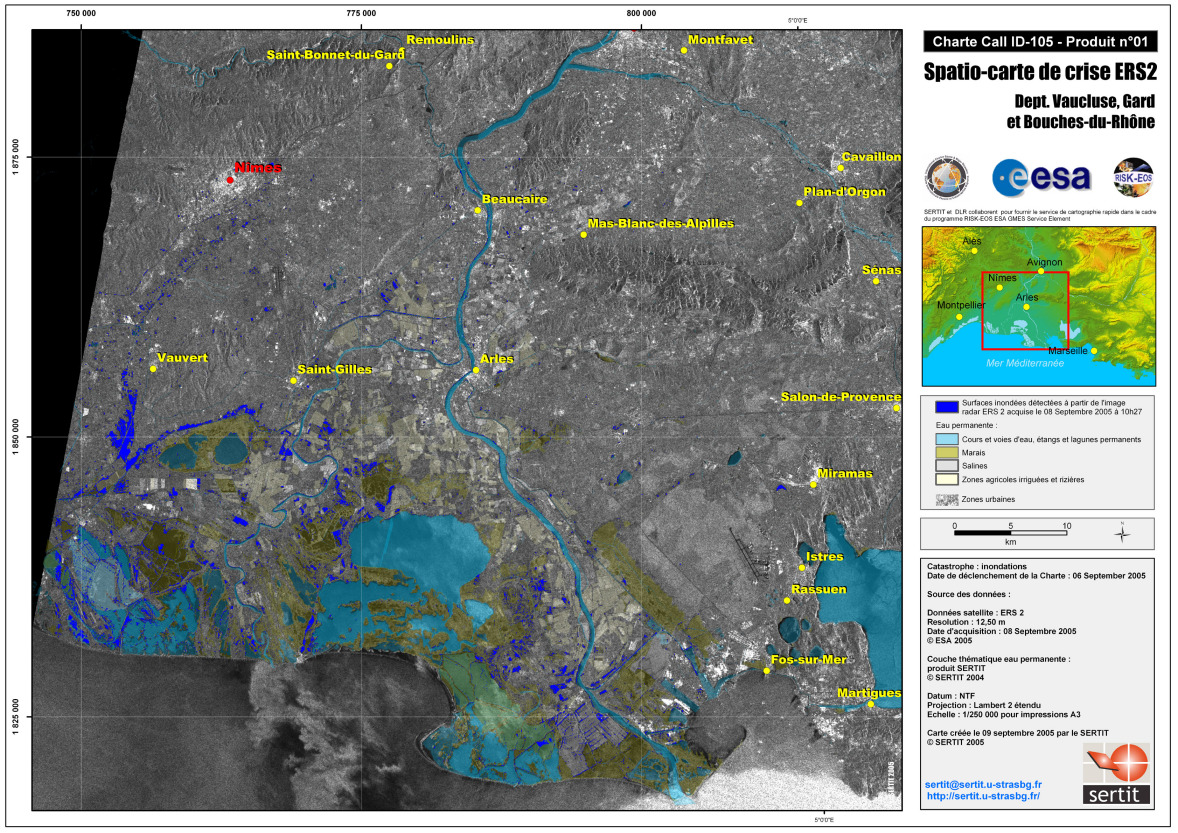
Satellite Map ERS-2
版权: ESA 2005 Image processing, map created 09/09/2005 by SERTIT
已获得: 08/09/2005
源: ERS-2
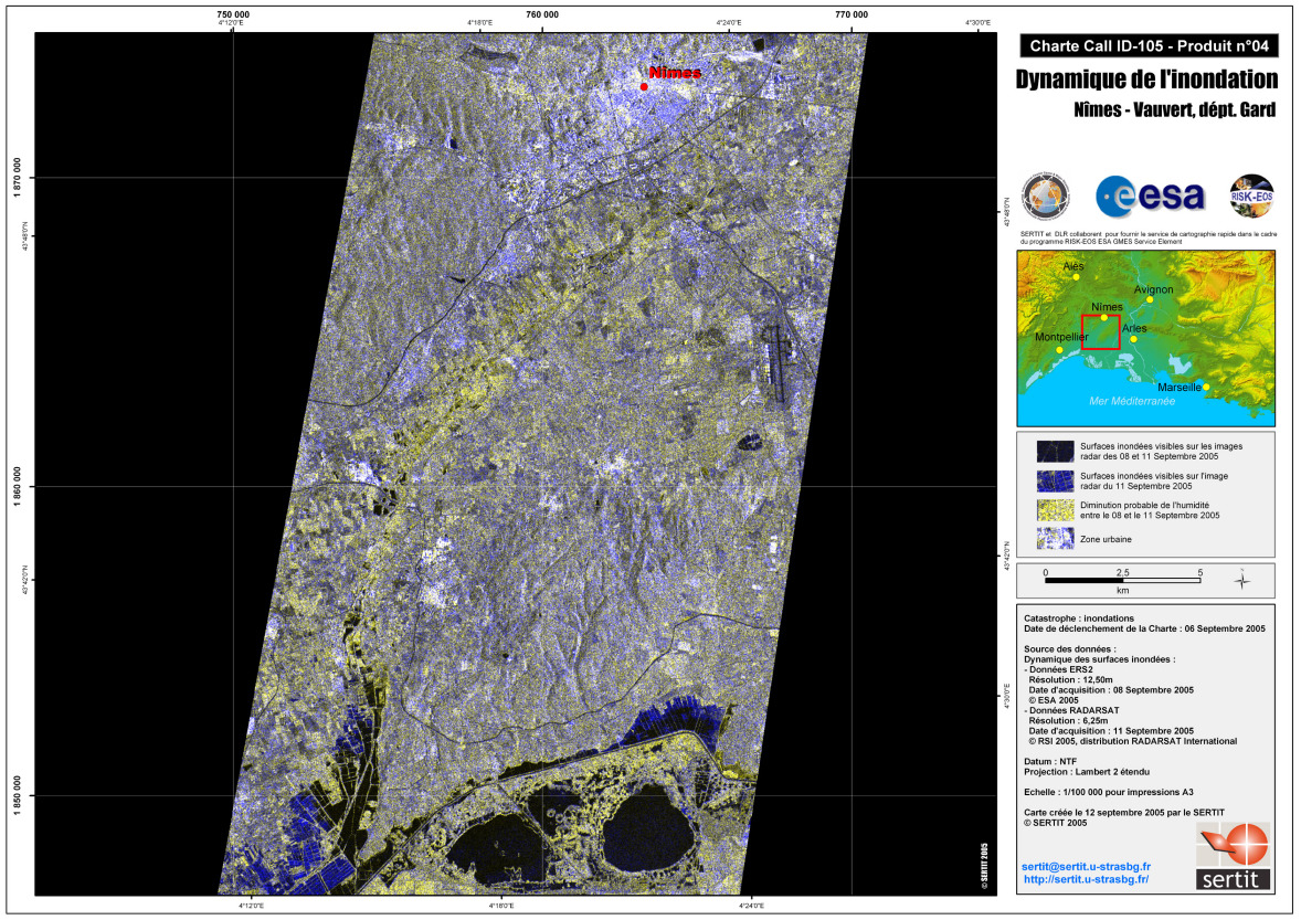
Dynamic Satellite Map ERS-2 Radarsat Nimes
Satellite Map Spot4 Vauvert
版权: ESA 2005, CNES 2005 Image processing, map created 12/09/2005 by SERTIT
Satellite Map Le Cailac Flooded areas, overlay on IGN SCAN 25 base map.
Satellite Map ERS-2 Vauvert
 English
 Spanish
 French
 Chinese
 Russian
 Portuguese
 返回完整的响应档案

