Свернуть Последняя Активация

Charter activations

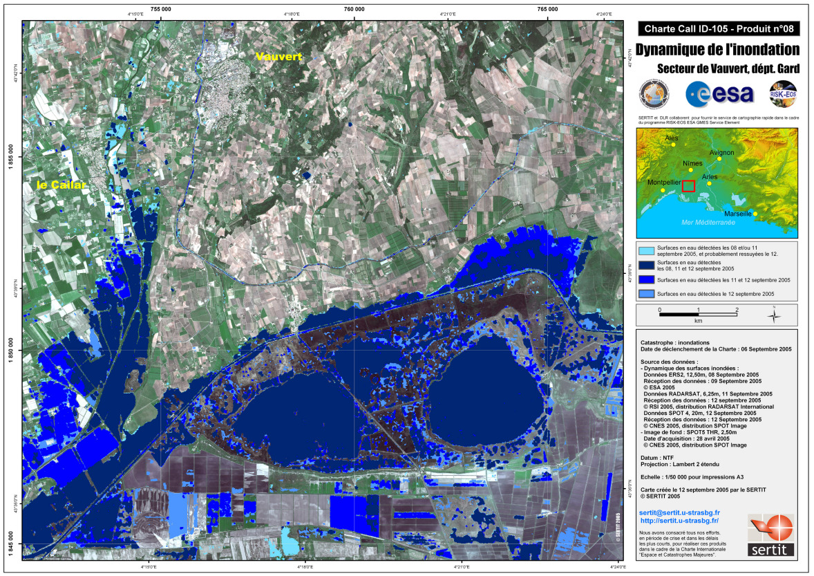
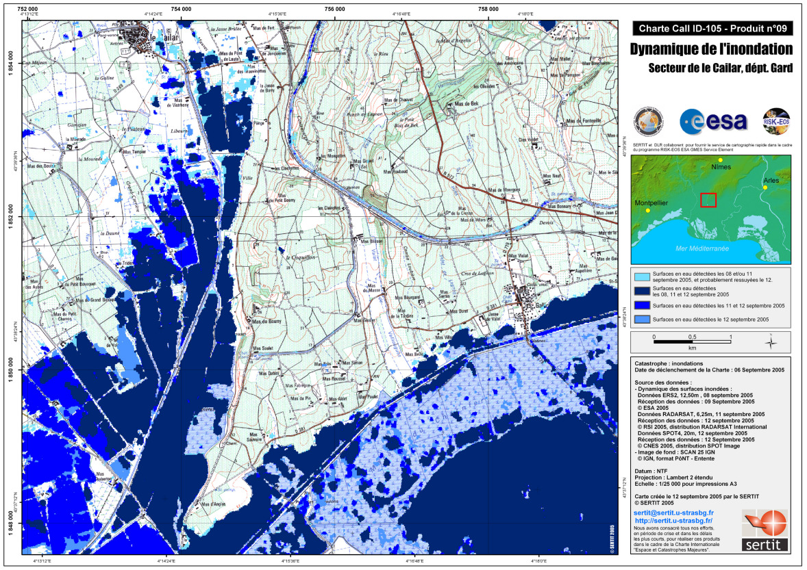
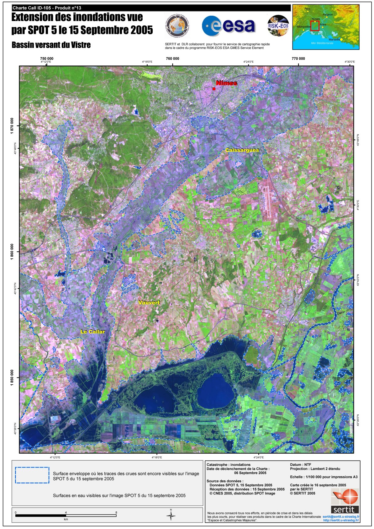
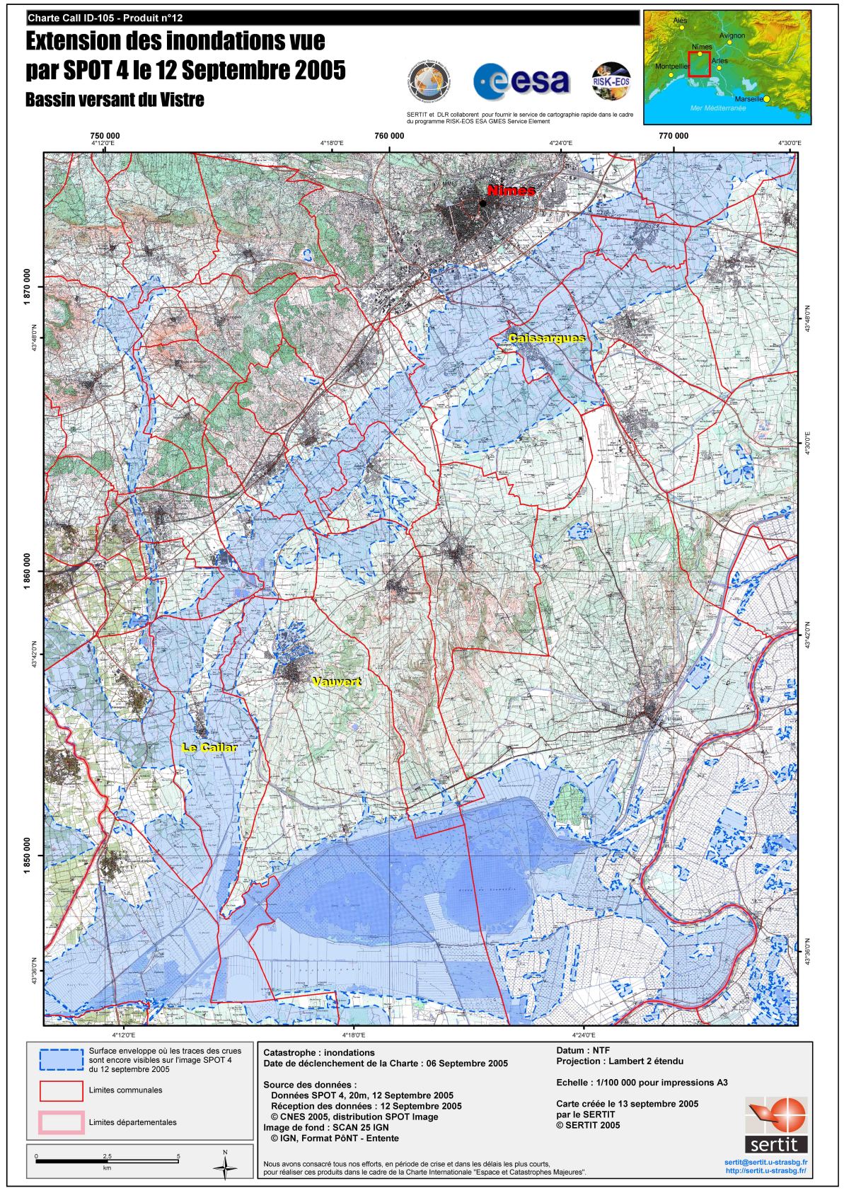
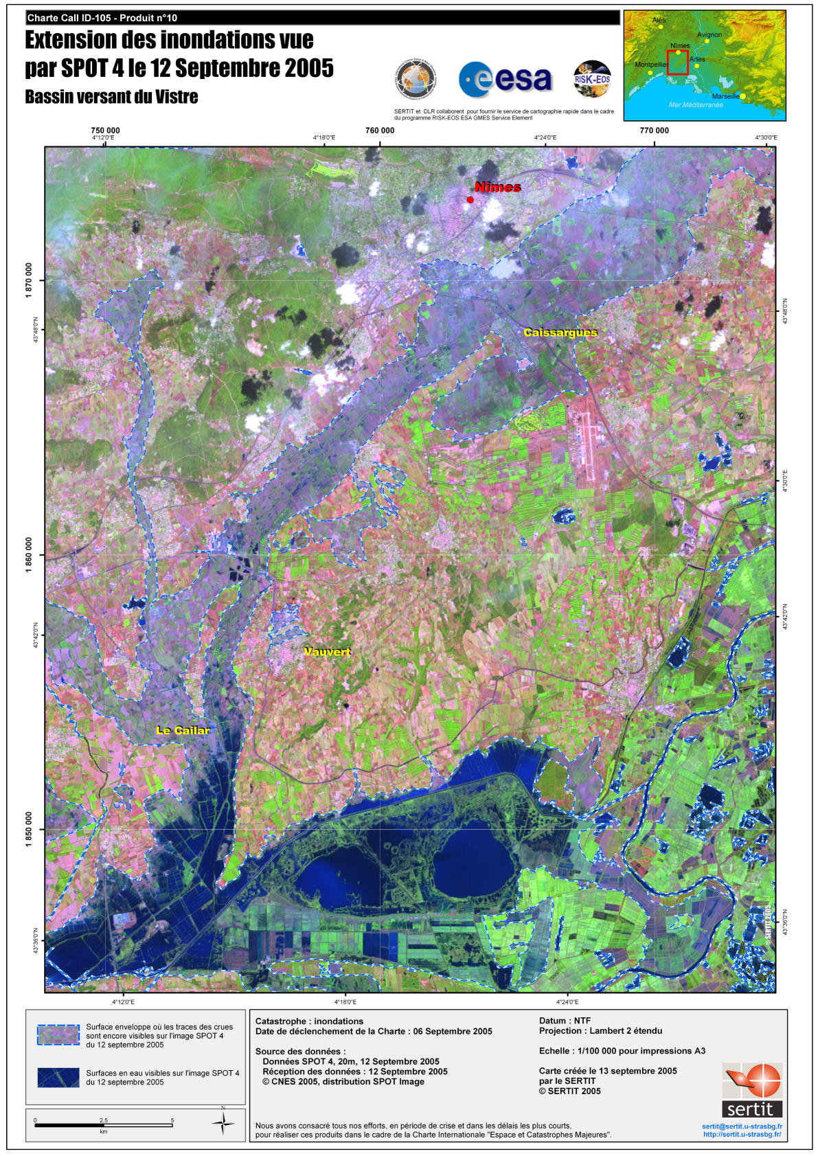
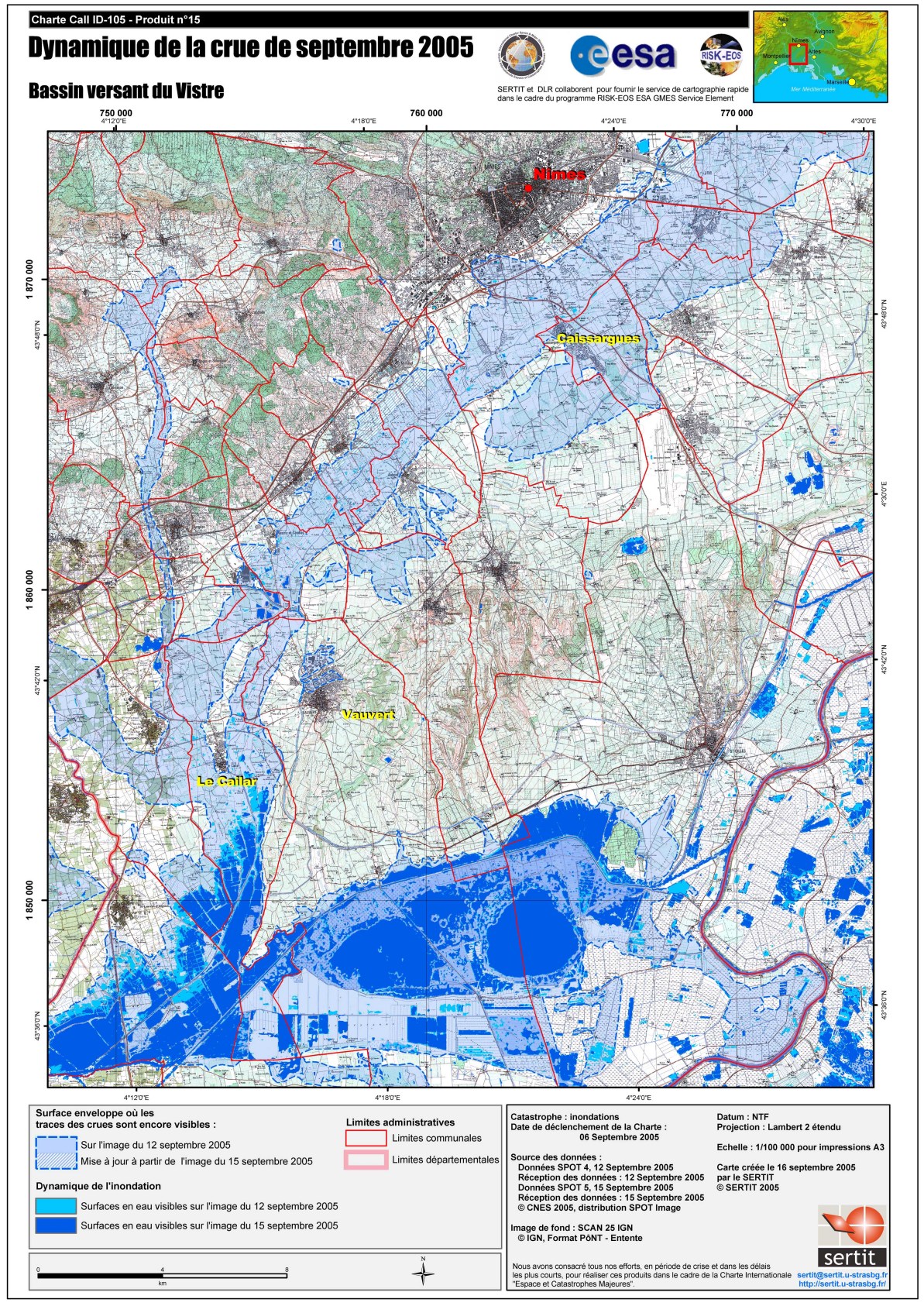
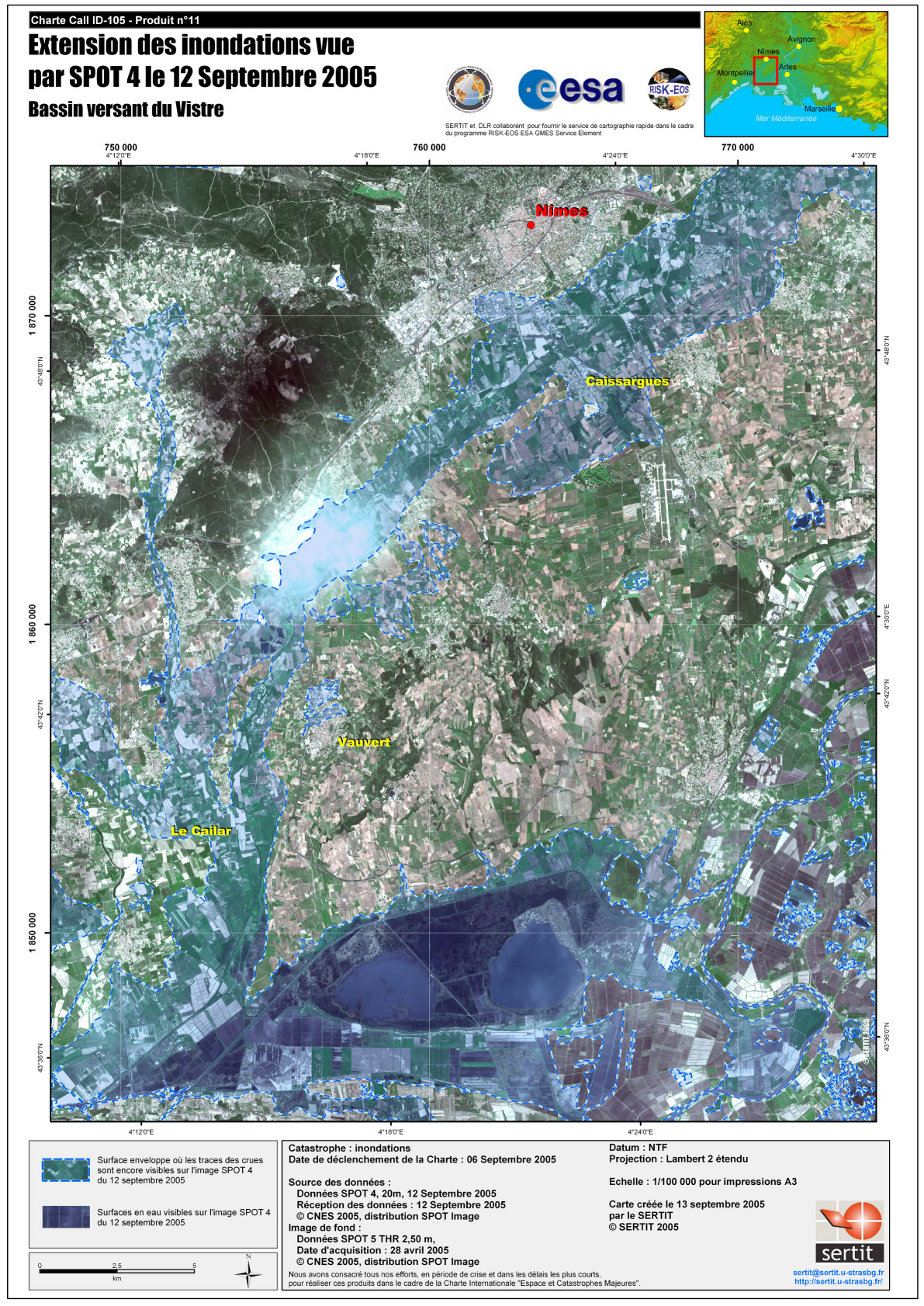
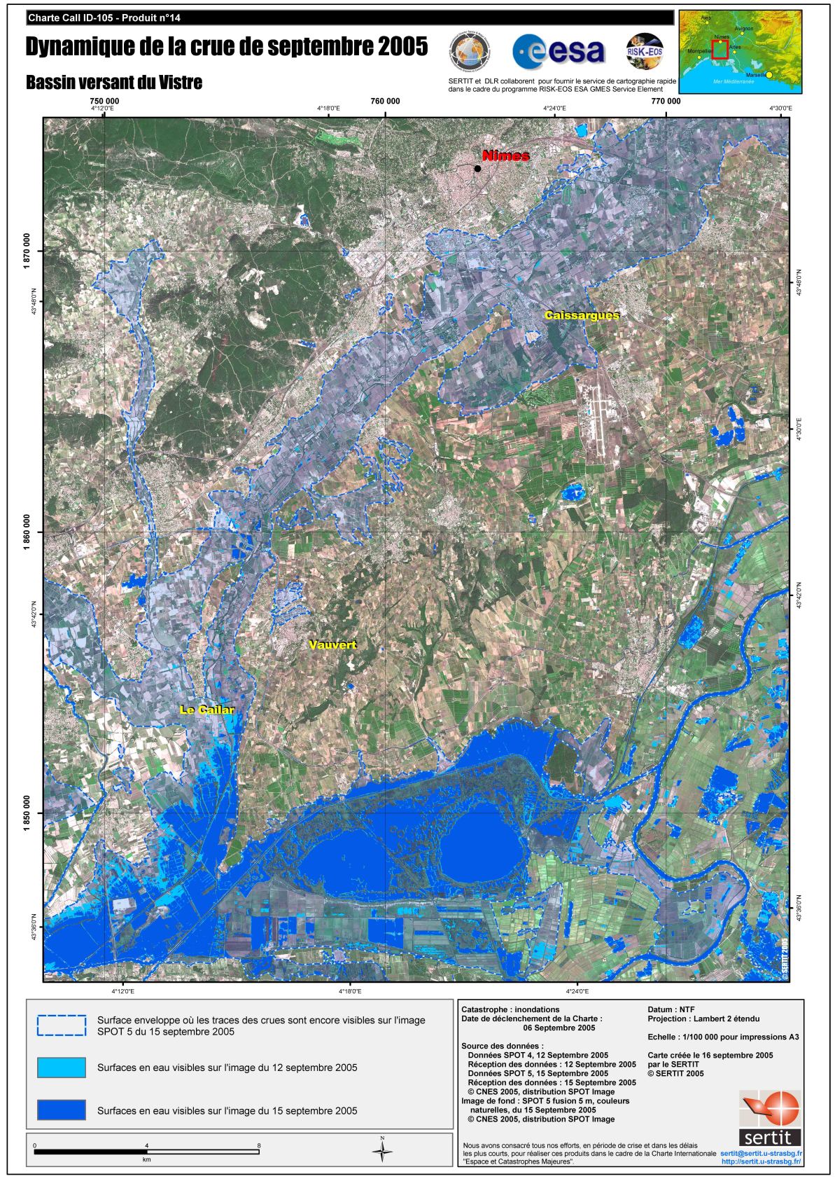
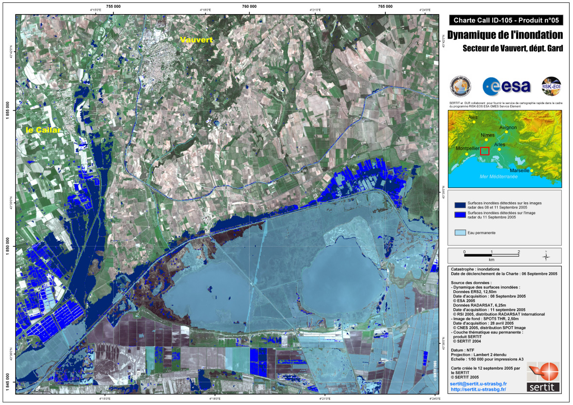
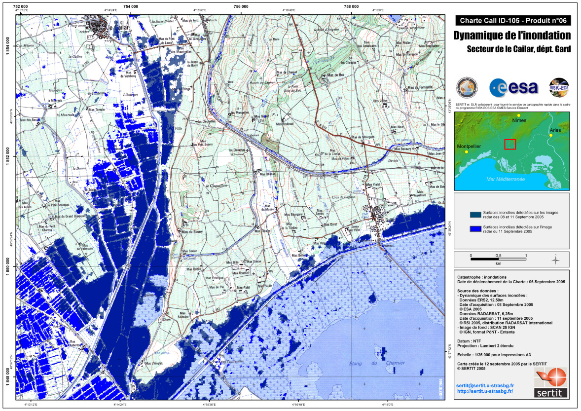
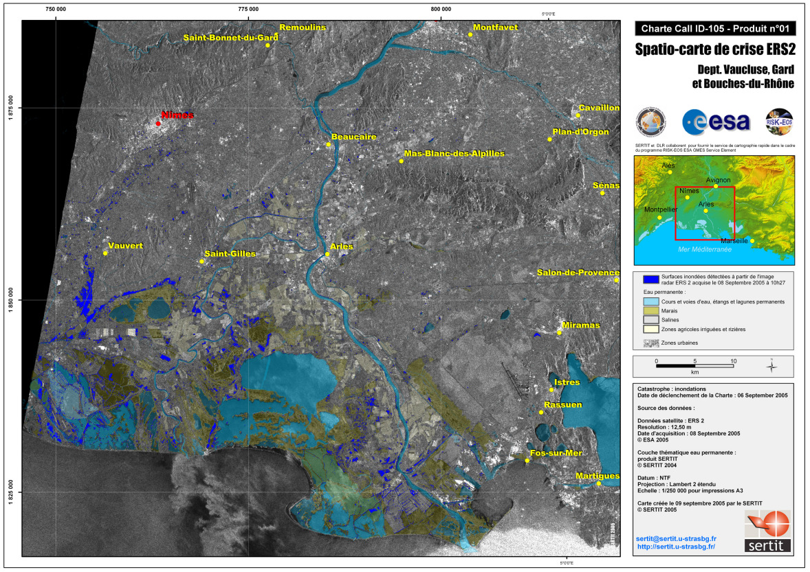
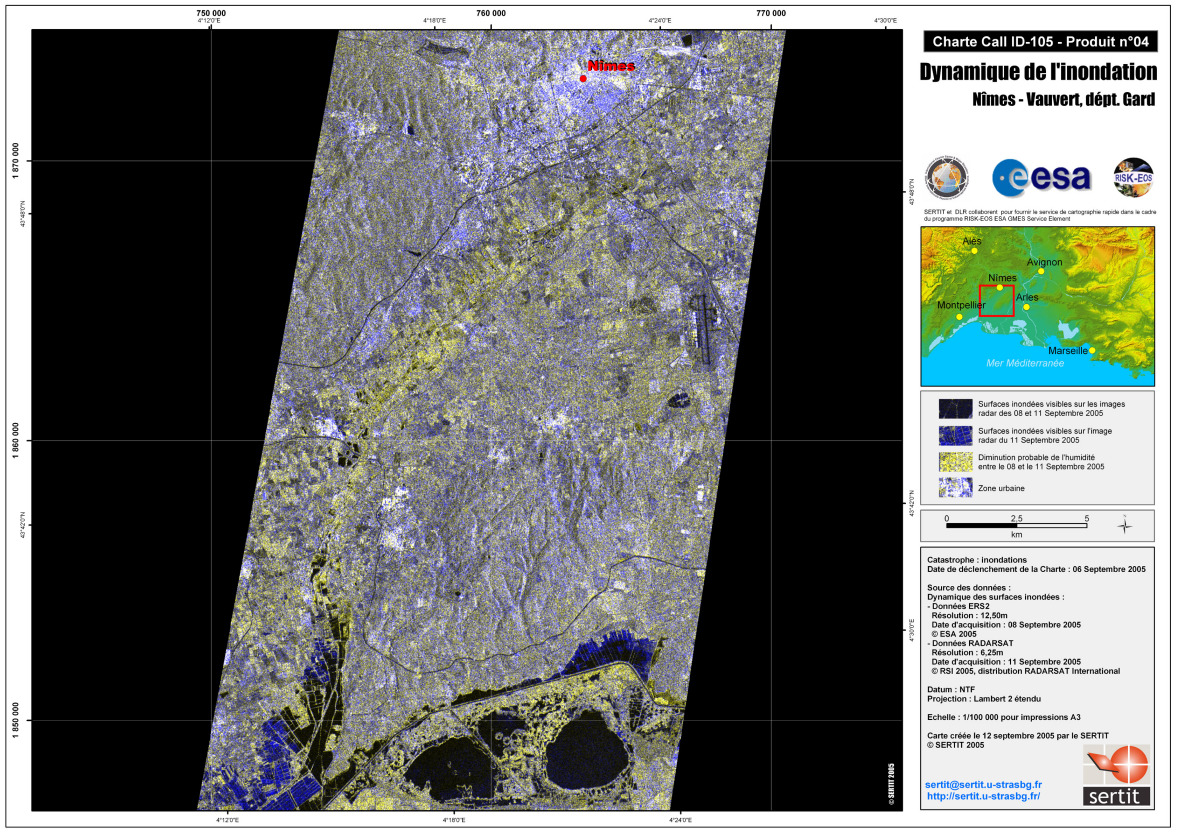
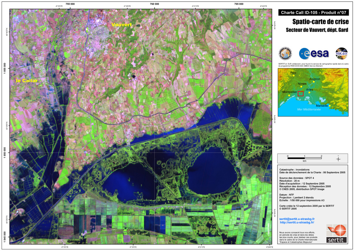
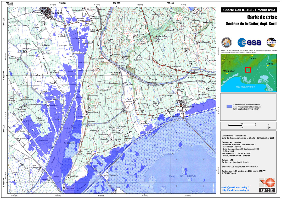
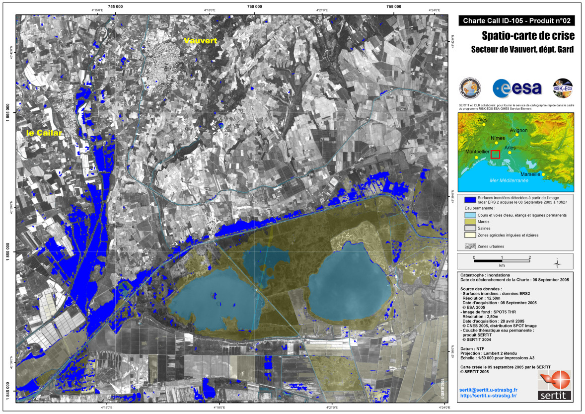
Heavy rains, flooding in the south of France

Heavy rains caused flooding in southern France, in the French departments of Gard and Hérault, on the 6th and 7th September. Three major highways were cut off and the towns of Lunel and Montpellier were in part flooded.

Тип события:Floods
Место события:South of France: Gard, Hérault
Date of Charter Activation:06/09/2005
Запрос на активацию поступил от:French Civil Protection
Менеждер проекта от:ESA

Products

Dynamic Satellite Map Vauvert

Авторские права: ESA 2005, CNES 2005, CSA 2005 Image processing, map created 12/09/2005 by SERTIT

Information about the Product

Получено: 8-9-11-12/09/2005

Источник: Spot 4, ERS-2, Radarsat

Dynamic Satellite Map Le Cailar Flooded areas, overlay on IGN SCAN 25 base map.

Авторские права: ESA 2005, CNES 2005, CSA 2005 Image processing, map created 12/09/2005 by SERTIT

Information about the Product

Получено: 8-9-11-12/09/2005

Источник: Spot 4, ERS-2, Radarsat

Satellite Map Flood Extension, Vistre

Авторские права: CNES 2005 Image processing, map created 16/09/2005 by SERTIT

Information about the Product

Получено: 15/09/2005

Источник: Spot 5

Satellite Map Flood Extension, Vistre Flooded areas, overlay on IGN SCAN 25 base map.

Information about the Product

Источник: Spot 4

Satellite Map Flood Extension, Vistre

Information about the Product

Источник: Spot 4

Satellite Map Flood Extension, Vistre Flooded areas, overlay on IGN SCAN 25 base map.

Авторские права: CNES 2005 Image processing, map created 16/09/2005 by SERTIT

Information about the Product

Получено: 12 e 15/09/2005

Источник: Spot 4, Spot 5

Satellite Map Flood Extension, Vistre , Natural Colours

Авторские права: CNES 2005 Image processing, map created 13/09/2005 by SERTIT

Information about the Product

Получено: 12/09/2005

Источник: Spot 4

Satellite Map Flood Extension, Vistre , Natural Colours

Авторские права: CNES 2005 Image processing, map created 16/09/2005 by SERTIT

Information about the Product

Получено: 12 e 15/09/2005

Источник: Spot 4, Spot 5

Dynamic Satellite Map Vauvert

Авторские права: ESA 2005, CSA 2005 Image processing, map created 12/09/2005 by SERTIT

Information about the Product

Получено: 08/09/2005, 11/09/2005

Источник: ERS-2, Radarsat

Dynamic Satellite Map Le Cailar Flooded areas, overlay on IGN SCAN 25 base map.

Авторские права: ESA 2005, CSA 2005 Image processing, map created 12/09/2005 by SERTIT

Information about the Product

Получено: 08/09/2005, 11/09/2005

Источник: ERS-2, Radarsat

Satellite Map ERS-2

Авторские права: ESA 2005 Image processing, map created 09/09/2005 by SERTIT

Information about the Product

Получено: 08/09/2005

Источник: ERS-2

Dynamic Satellite Map ERS-2 Radarsat Nimes

Авторские права: ESA 2005, CSA 2005 Image processing, map created 12/09/2005 by SERTIT

Information about the Product

Получено: 08/09/2005, 11/09/2005

Источник: ERS-2, Radarsat

Satellite Map Spot4 Vauvert

Авторские права: ESA 2005, CNES 2005 Image processing, map created 12/09/2005 by SERTIT

Information about the Product

Получено: 12/09/2005

Источник: Spot 4

Satellite Map Le Cailac Flooded areas, overlay on IGN SCAN 25 base map.

Авторские права: ESA 2005 Image processing, map created 09/09/2005 by SERTIT

Information about the Product

Получено: 08/09/2005

Источник: ERS-2

Satellite Map ERS-2 Vauvert

Авторские права: ESA 2005 Image processing, map created 09/09/2005 by SERTIT

Information about the Product

Получено: 08/09/2005

Источник: ERS-2

Вернуться к полному архиву активаций