 English
 Spanish
 French
 Chinese
 Russian
 Portuguese
 最新宪章启动
Charter activations
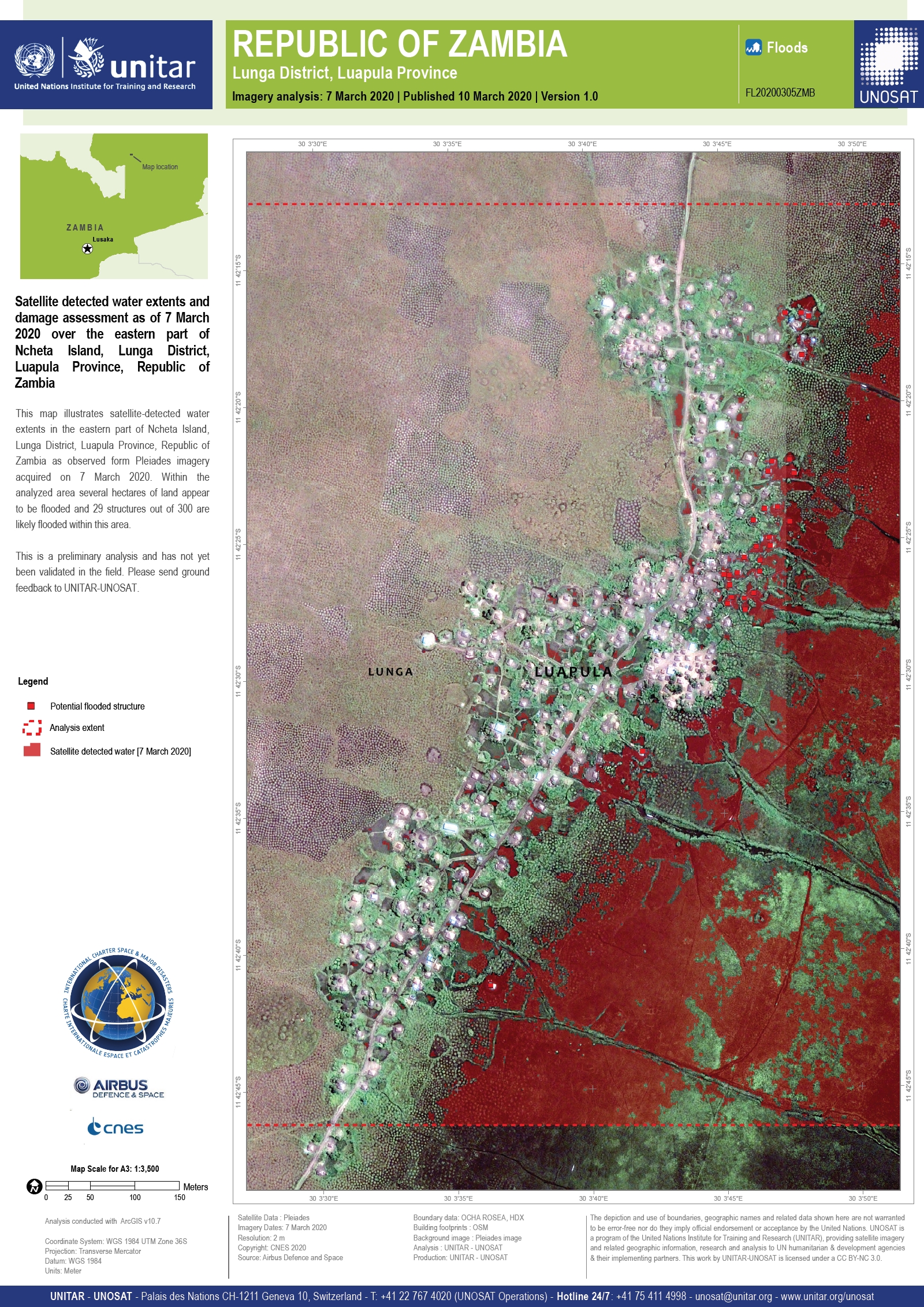
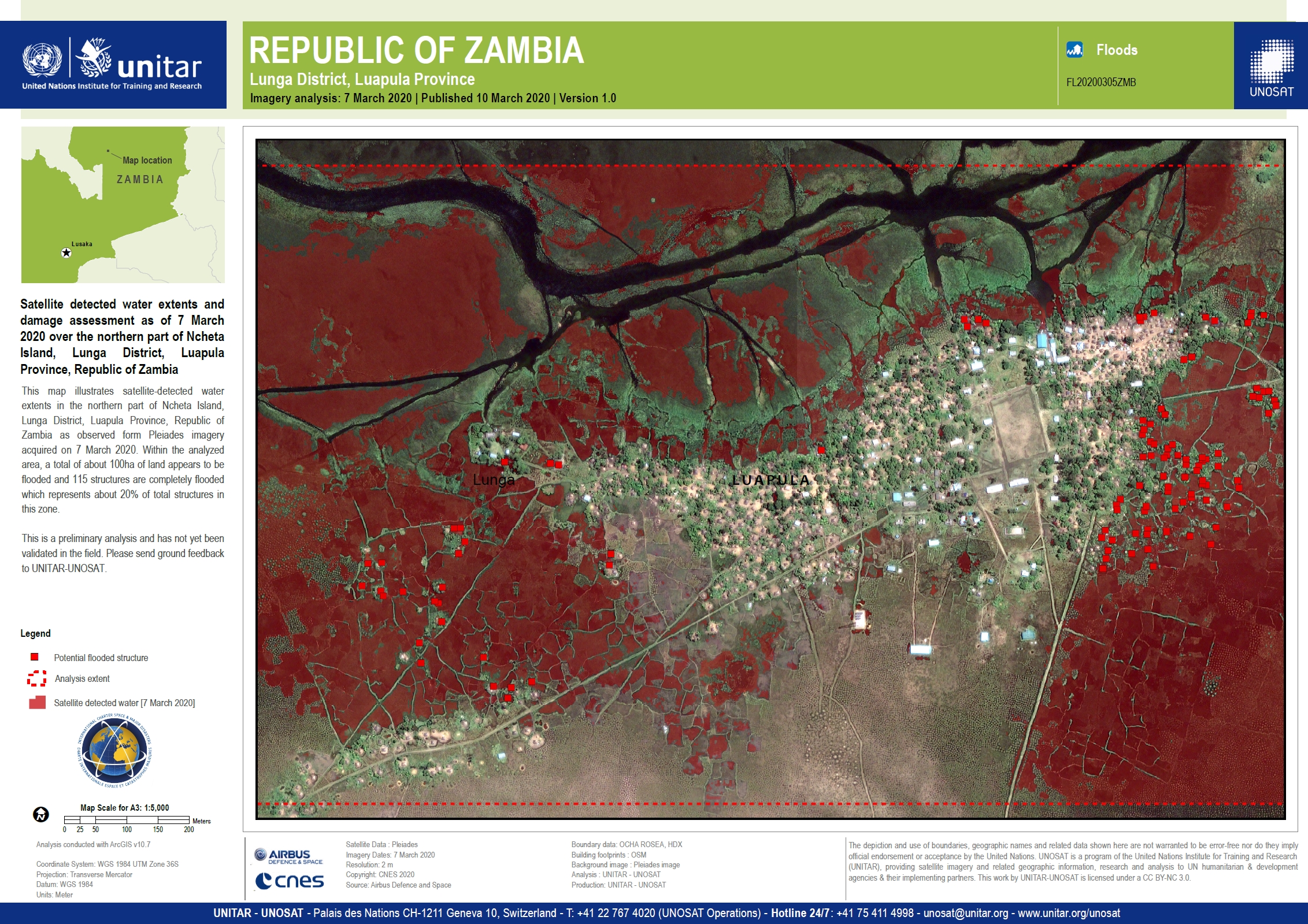
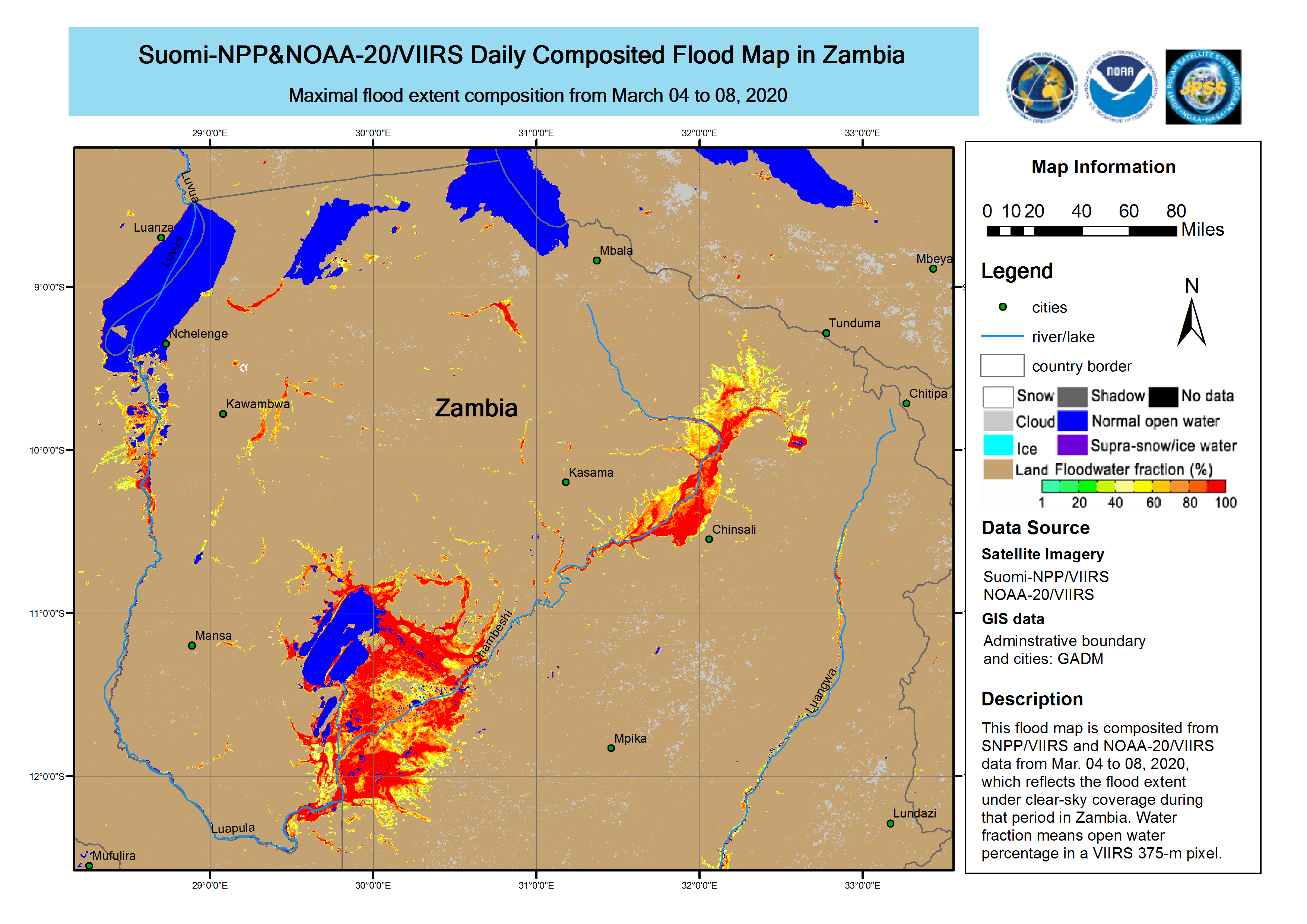
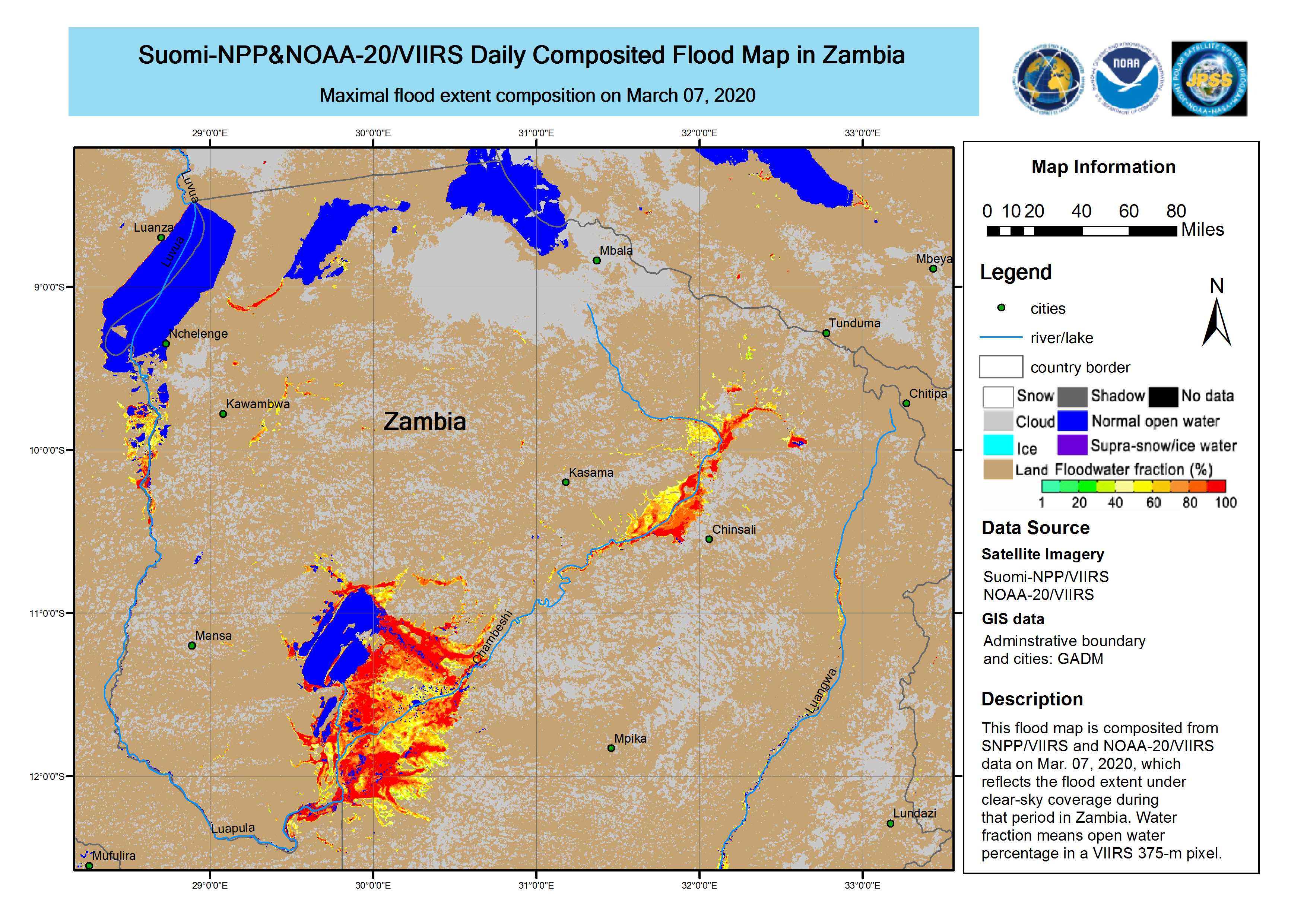
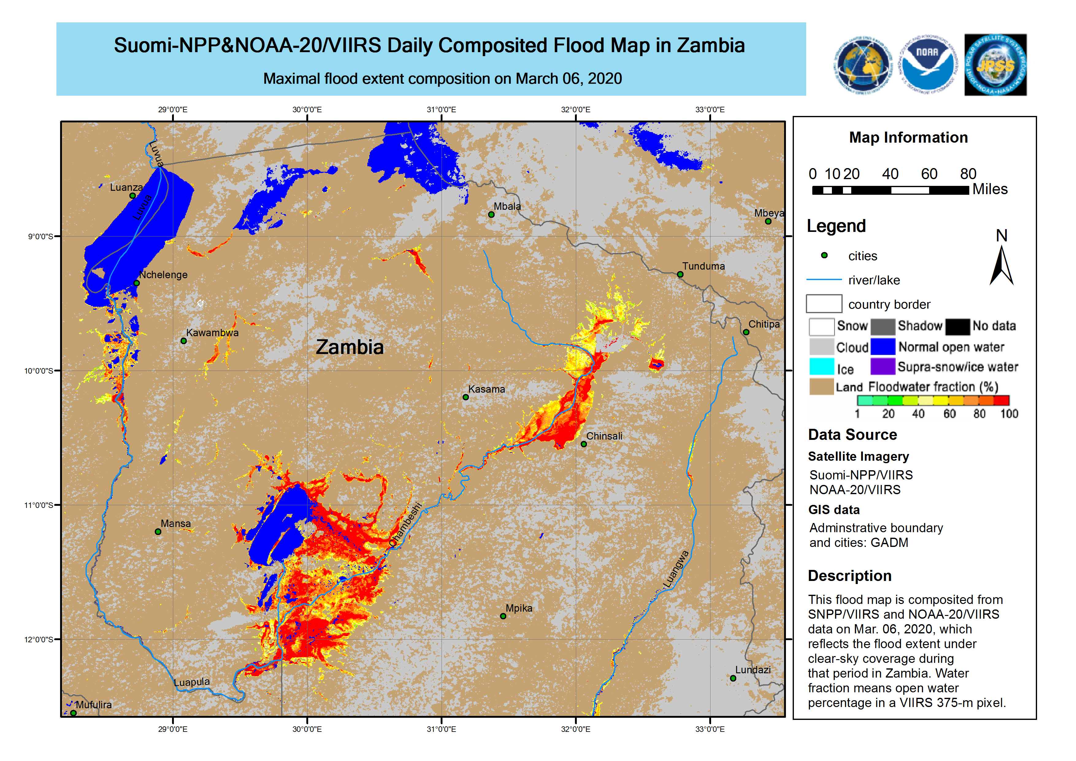
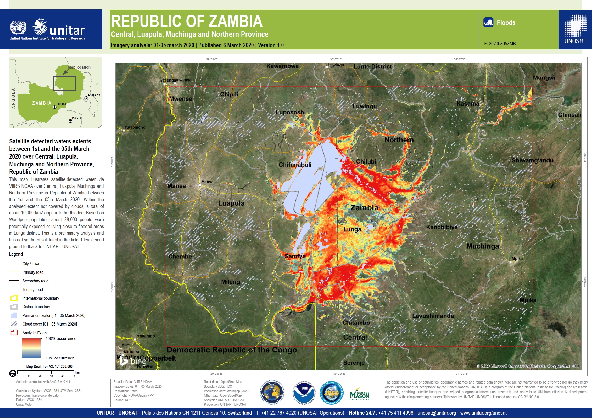
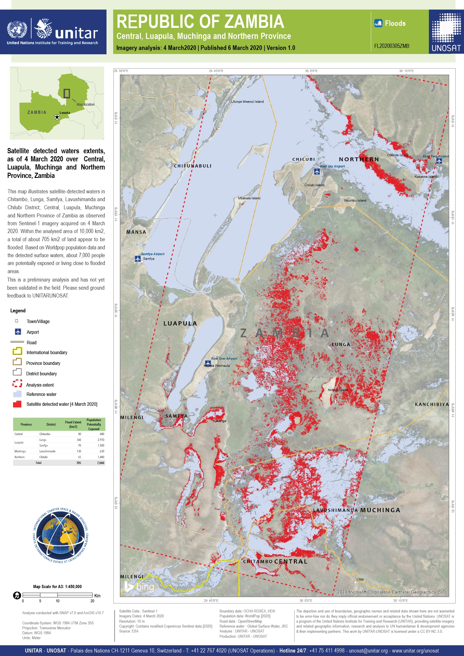
Flood in Zambia
Heavy rainfall has caused extensive flooding across the Lunga District of Zambia. 8 thousand homes have been flooded and more than 80,000 people have been affected.
Displaced people have moved to safe areas and food has been delivered to households that are isolated. Five schools with damaged roofs have hade resources and manpower allocated so they can reopen.
The government has assembled a team of 400 people to help unblock canals and allow the waters to recede. Dredging equipment and other resources have been mobilised to assist the recovery effort.
Although weather conditions have improved the area remains on high alert as any further rainfall could fall on saturated ground and cause further flash flooding.
| 事件类型: | Floods |
| 事件地点: | Zambia |
| 启动宪章的日期: | 2020-03-06 |
| 宪章启动时间: | 15:25 |
| 宪章启动时区: | UTC+01:00 |
| 宪章要求者: | UNITAR on behalf of OCHA / RCO Zambia |
| 启动ID: | 646 |
| 项目经理: | UNITAR/UNOSAT |
Products
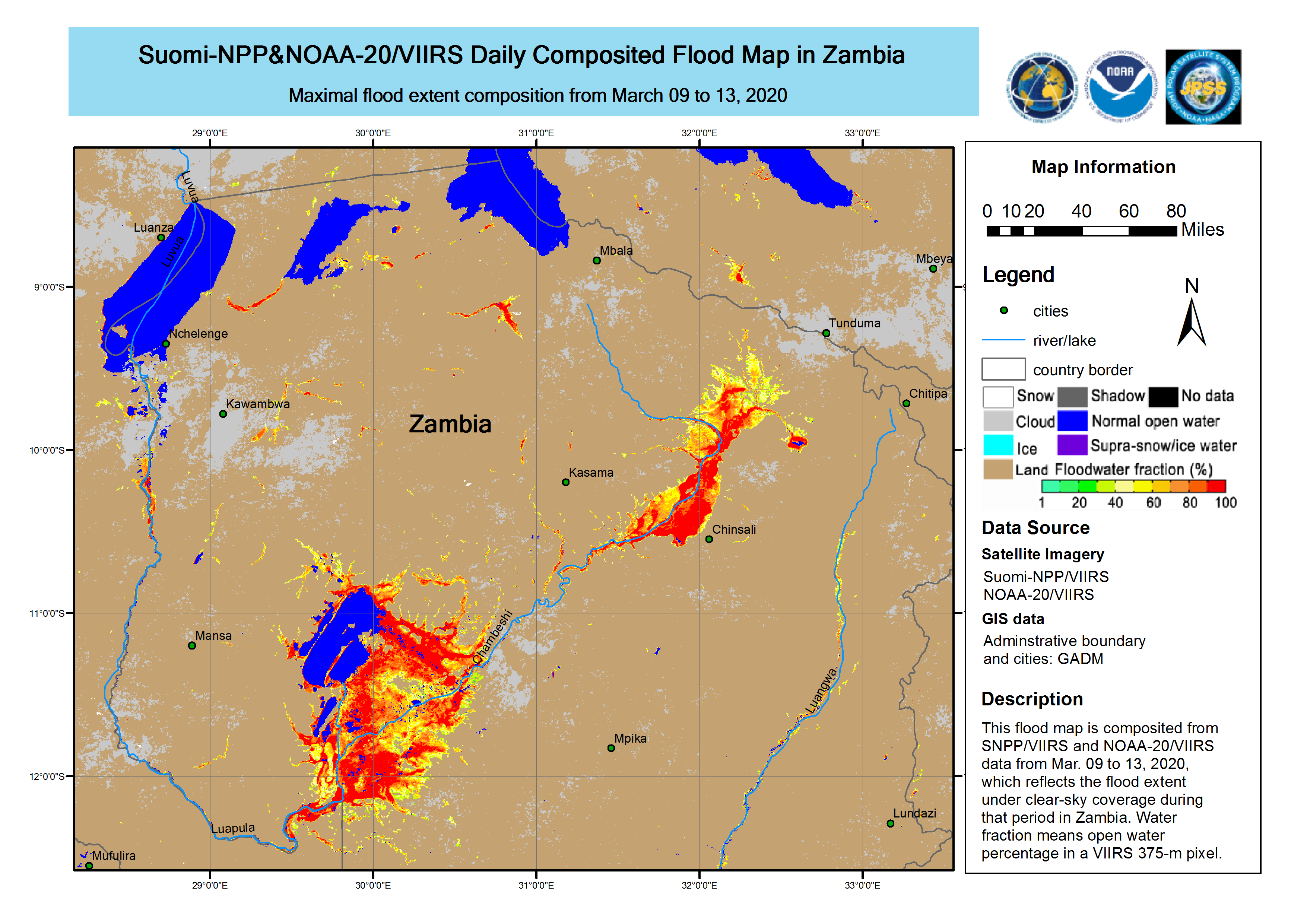
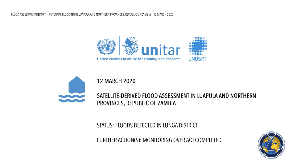
Flood assessment of Luapula and Northern Provinces of Zambia on 12 March 2020
Download the full report
版权: © CNES (2020) - Distribution: Airbus Defence and Space, all rights reserved
Report produced by UNITAR/UNOSAT
Information about the Product
已获得: 07/03/2020 - 10/03/2020
源: Pleiades


 返回完整的响应档案

