 English
 Spanish
 French
 Chinese
 Russian
 Portuguese
 Latest Activation
Charter activations
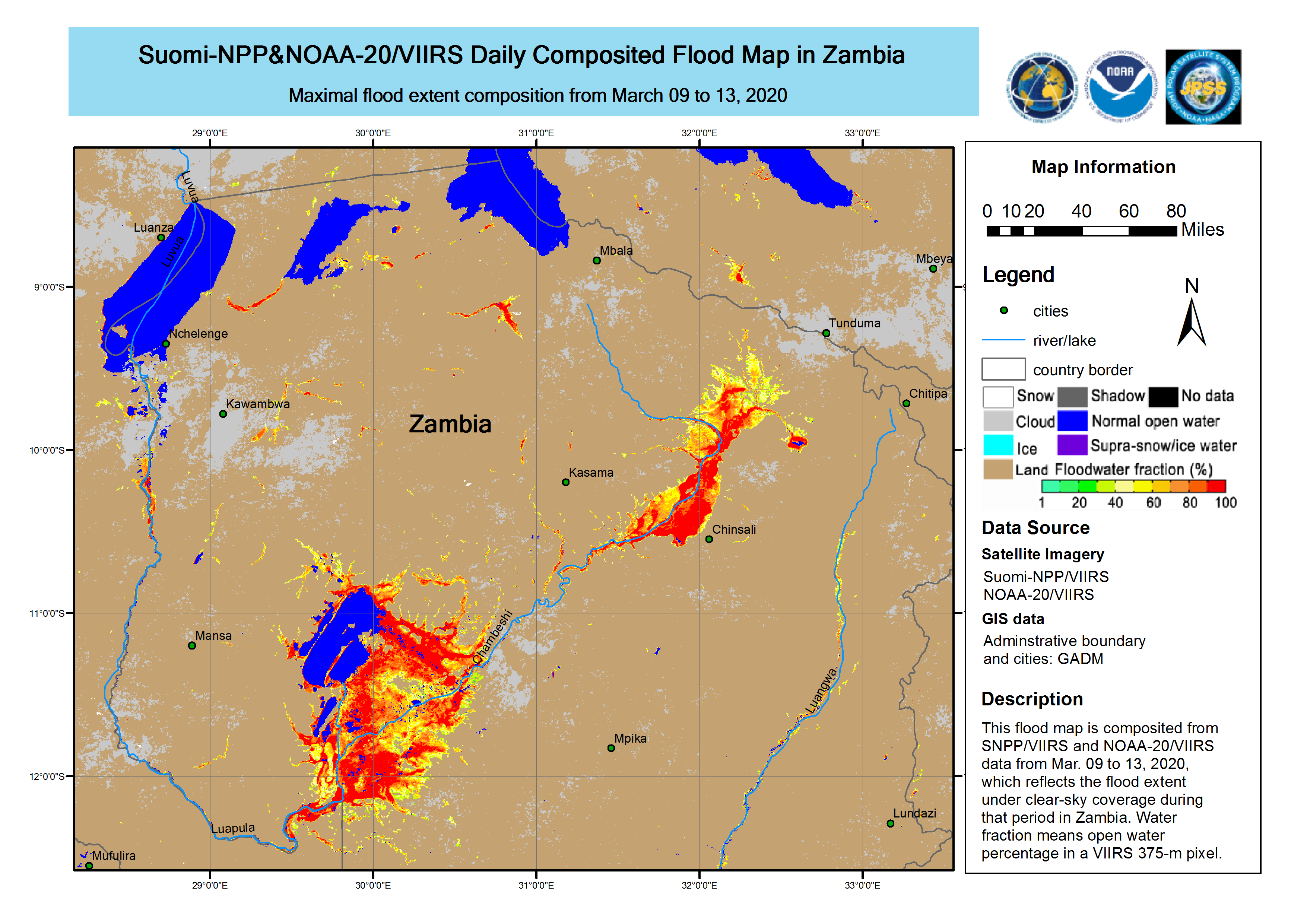
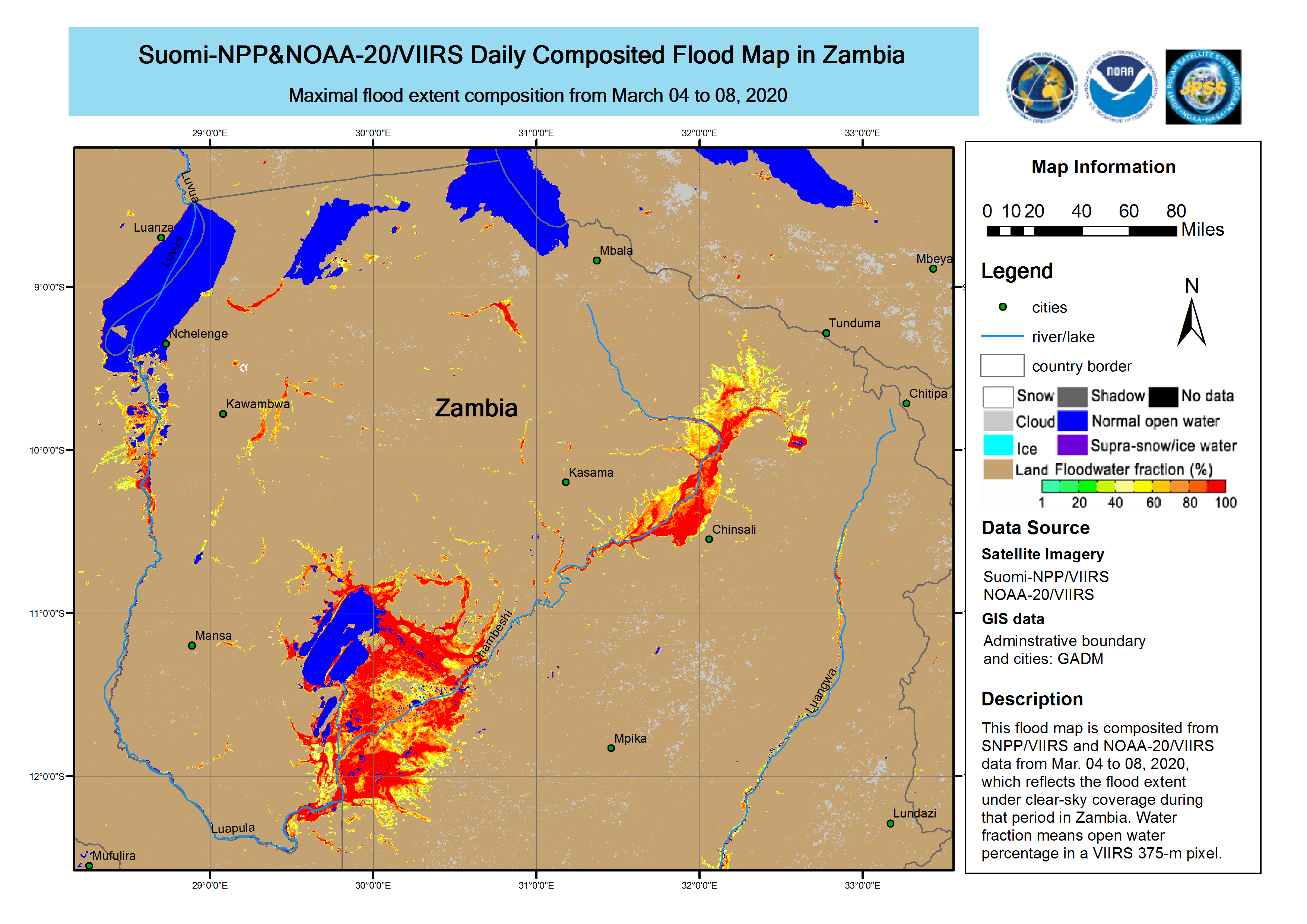
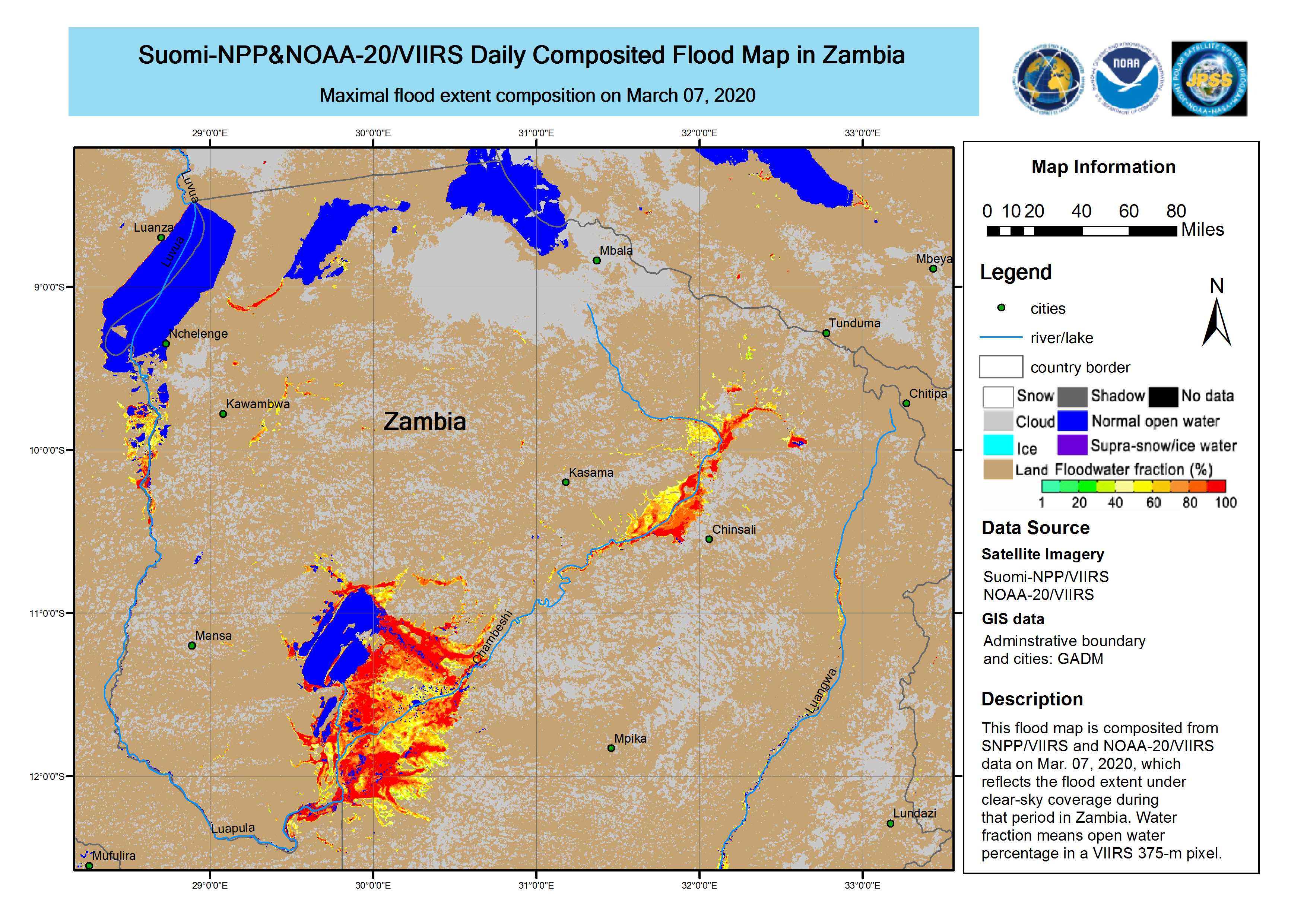
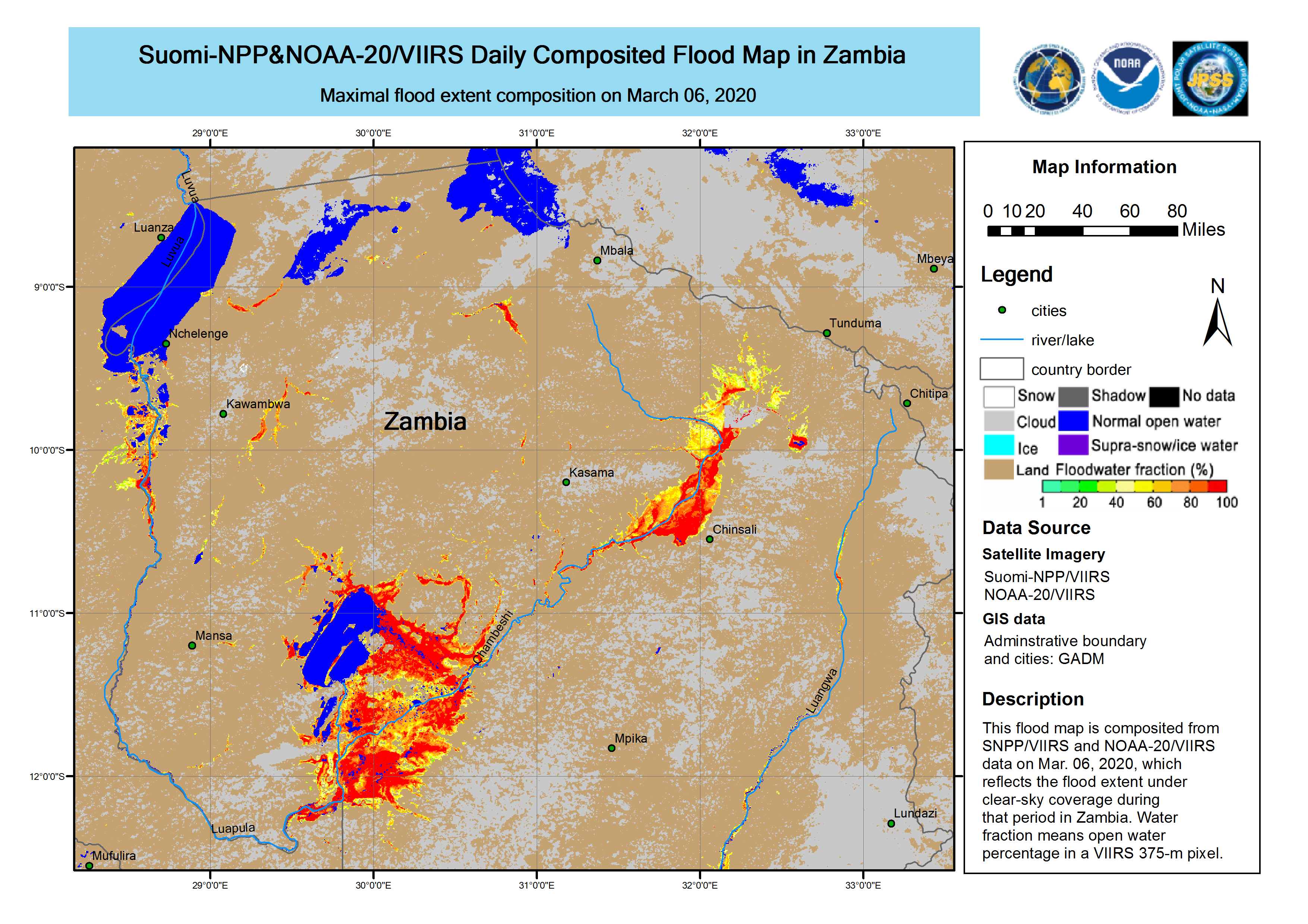
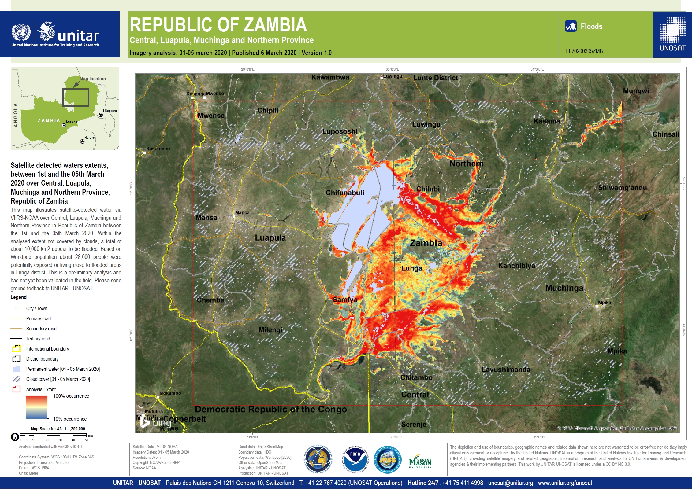
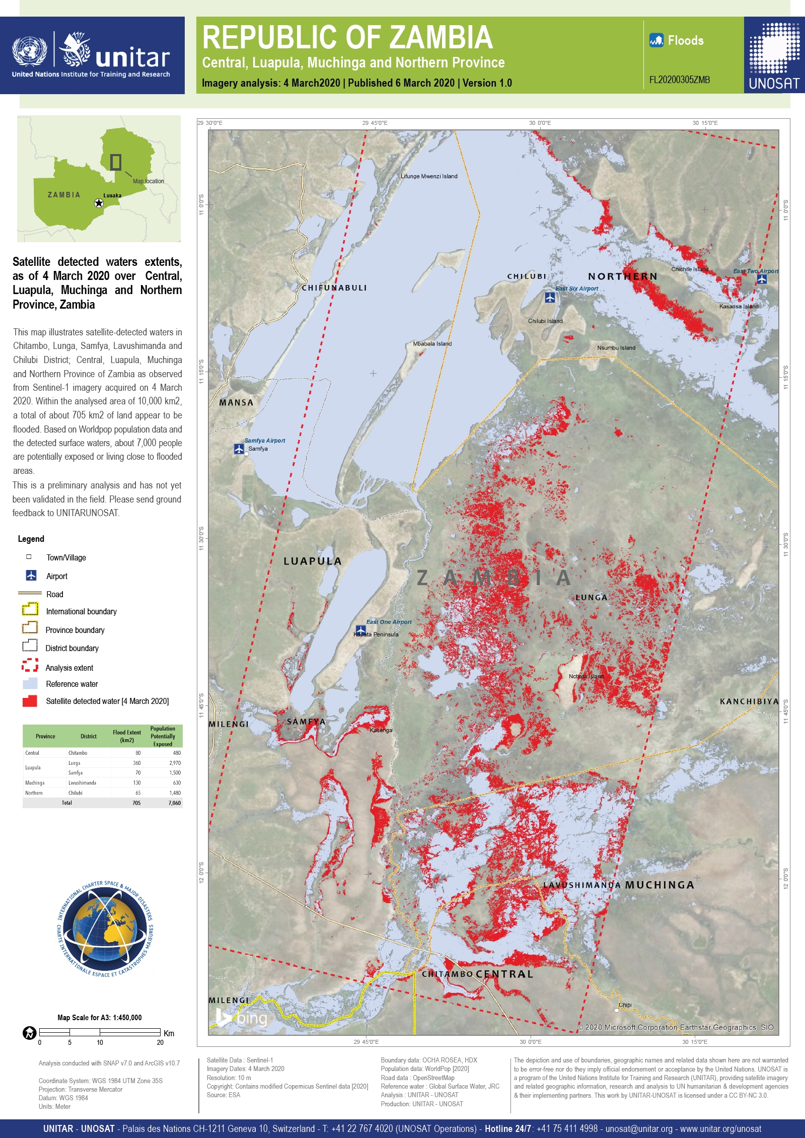
Flood in Zambia
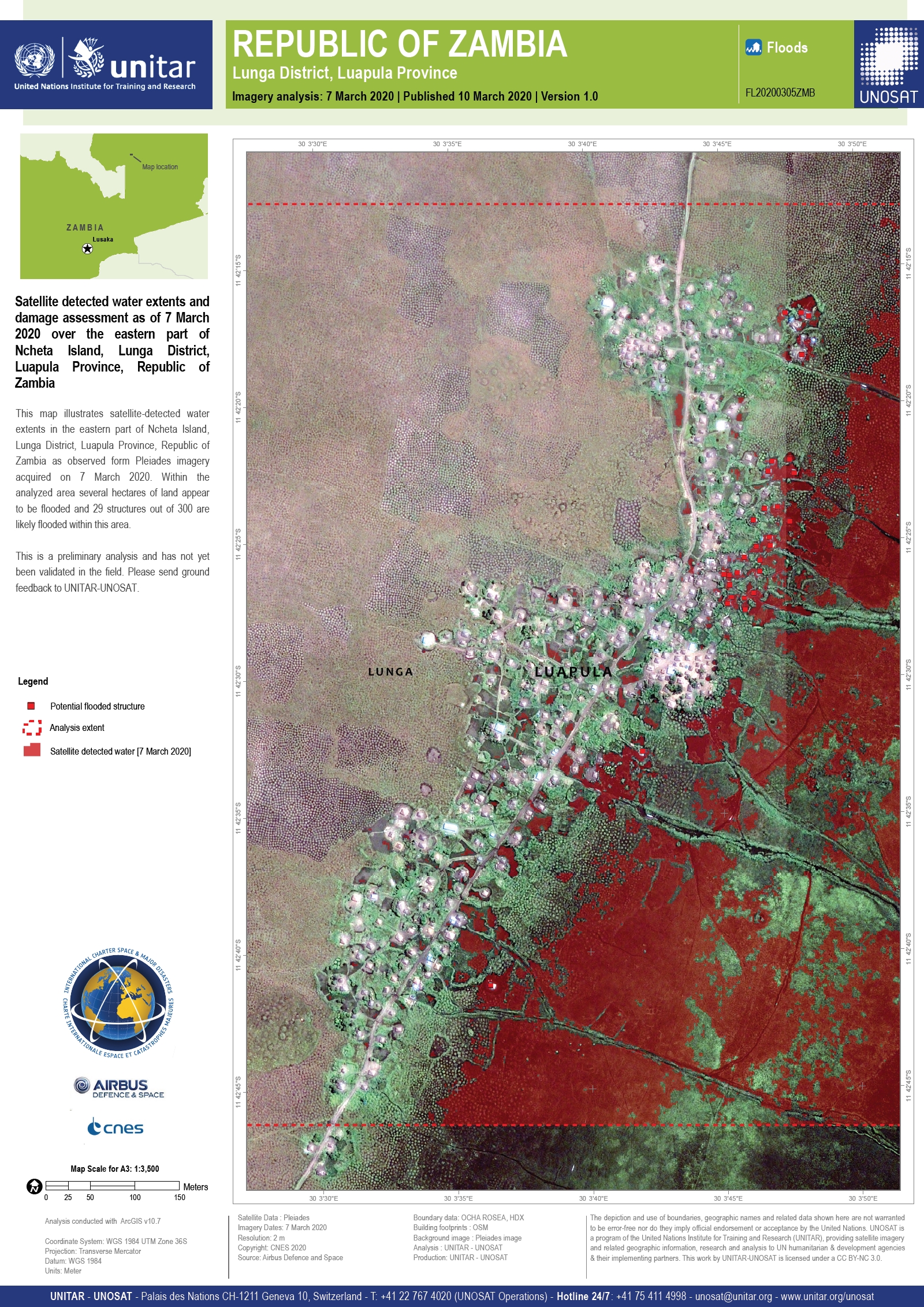
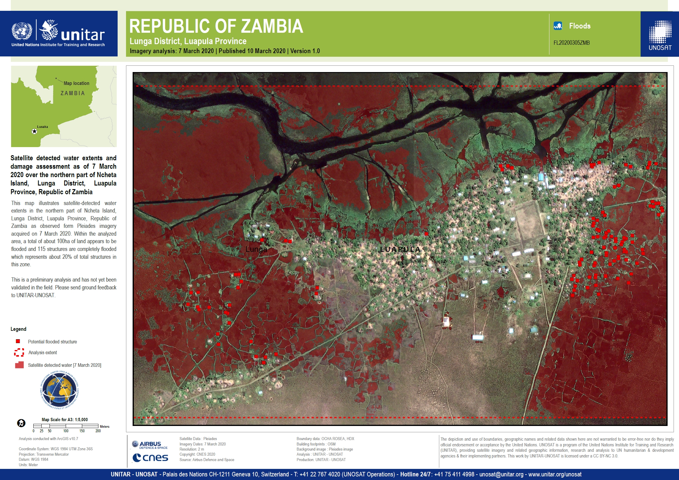
Heavy rainfall has caused extensive flooding across the Lunga District of Zambia. 8 thousand homes have been flooded and more than 80,000 people have been affected.
Displaced people have moved to safe areas and food has been delivered to households that are isolated. Five schools with damaged roofs have hade resources and manpower allocated so they can reopen.
The government has assembled a team of 400 people to help unblock canals and allow the waters to recede. Dredging equipment and other resources have been mobilised to assist the recovery effort.
Although weather conditions have improved the area remains on high alert as any further rainfall could fall on saturated ground and cause further flash flooding.
| Tipo de evento: | Floods |
| Local do evento: | Zambia |
| Data da Ativação da Carta: | 2020-03-06 |
| Tempo de Ativação da Carta: | 15:25 |
| Zona de Tempo da Ativação da Carta: | UTC+01:00 |
| Requisitante da Carta: | UNITAR on behalf of OCHA / RCO Zambia |
| ID da Ativação: | 646 |
| Gerenciamento de projeto: | UNITAR/UNOSAT |
Products
Flood assessment of Luapula and Northern Provinces of Zambia on 12 March 2020
Download the full report
Direitos autorais: © CNES (2020) - Distribution: Airbus Defence and Space, all rights reserved
Report produced by UNITAR/UNOSAT
Information about the Product
Adquirida: 07/03/2020 - 10/03/2020
Fonte: Pleiades


 Voltar ao arquivo completo da Ativação

