 English
 Spanish
 French
 Chinese
 Russian
 Portuguese
 最新宪章启动
Charter activations
Flood in Thailand
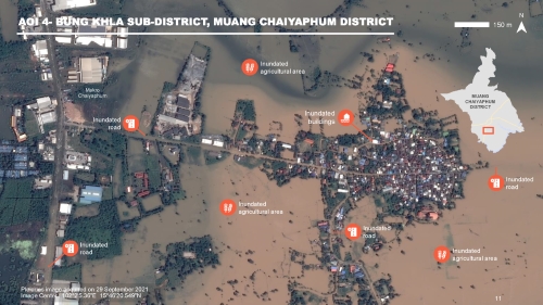
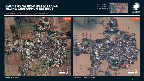
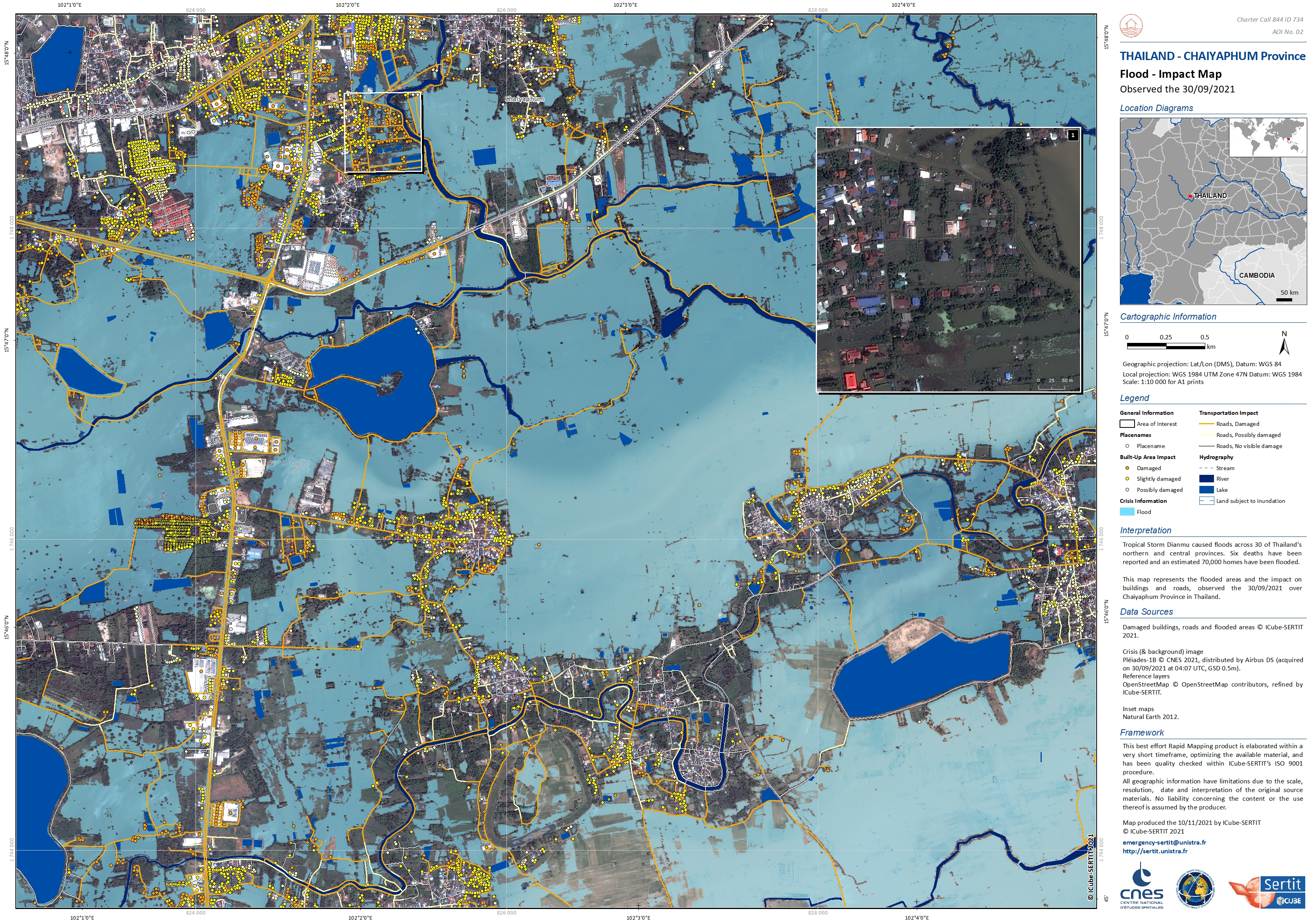
Tropical Storm Dianmu caused floods across 30 of Thailand's northern and central provinces. Six deaths have been reported and an estimated 70,000 homes have been flooded.
Some areas had recently experienced flooding earlier in the month following heavy rain.
There are concerns the flooding will grow worse as the Chao Praya River water level is rising following dam releases upstream. Flood prevention methods are being taken to try to protect against further floods.
Pleiades imagery acquired through the Charter demonstrates the extent of the flooding:
See further imagery and maps in the products and reports below:
Related News and Resources
| 事件类型: | Flood |
| 事件地点: | Thailand |
| 启动宪章的日期: | 2021-09-28 |
| 宪章启动时间: | 16:31 |
| 宪章启动时区: | UTC+07:00 |
| 宪章要求者: | UNITAR on behalf of United Nations Office for the Coordination of Humanitarian Affairs (OCHA) |
| 启动ID: | 734 |
| 项目经理: | UNITAR/UNOSAT |
Products
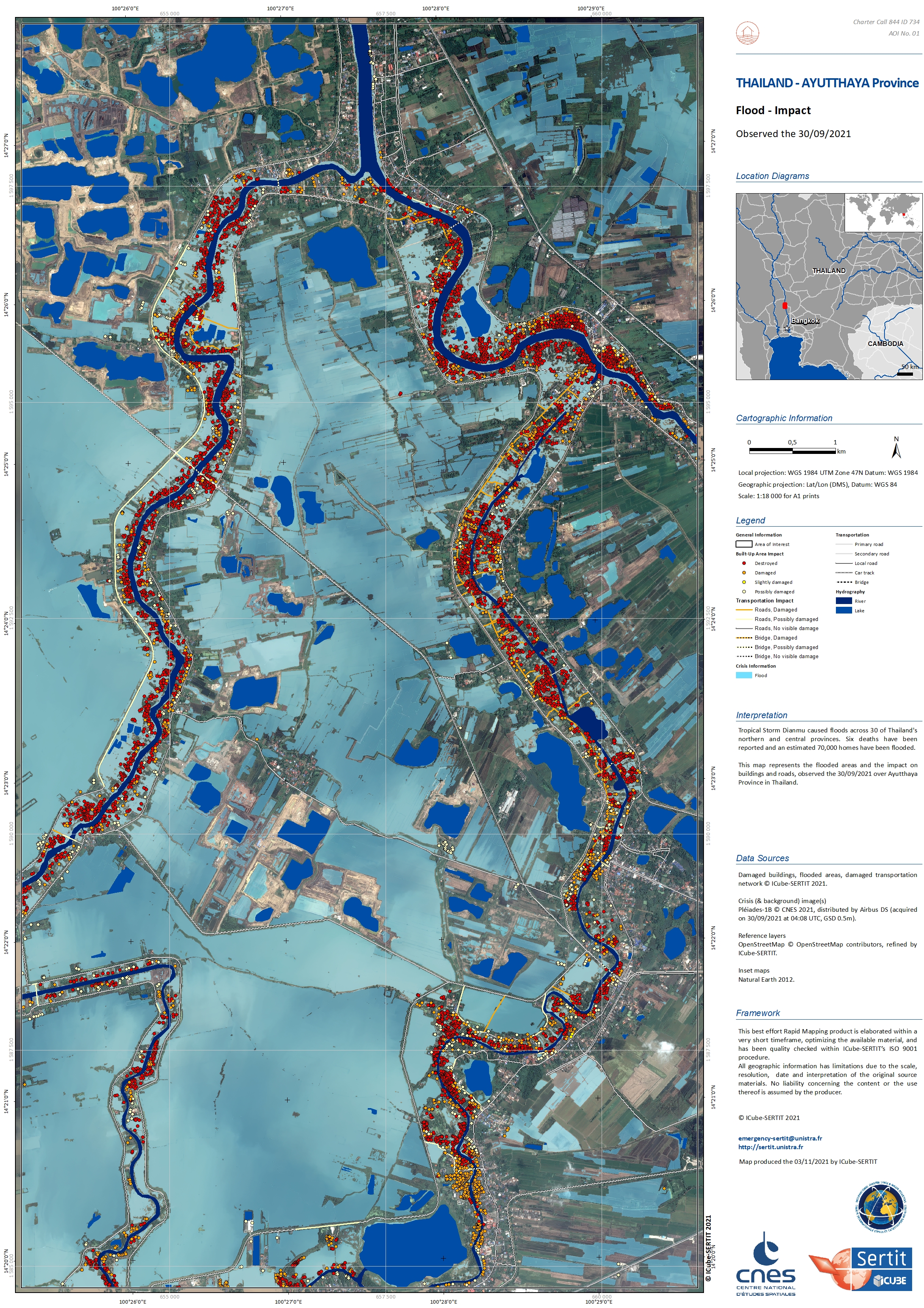
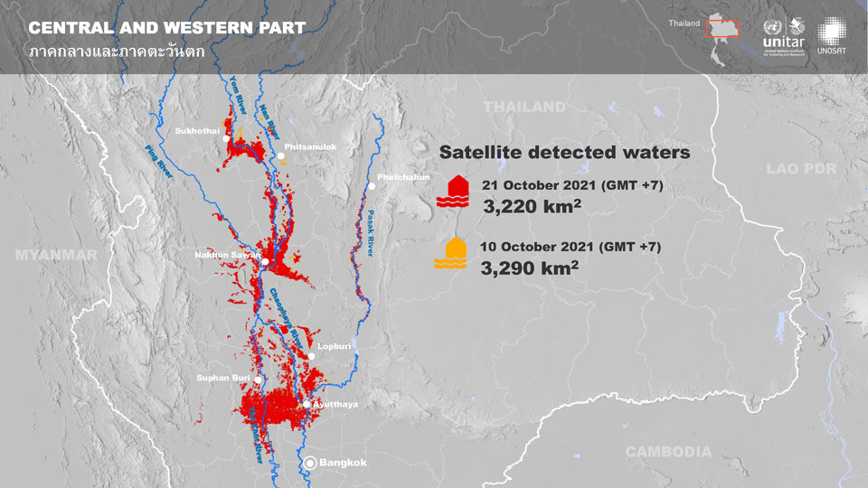
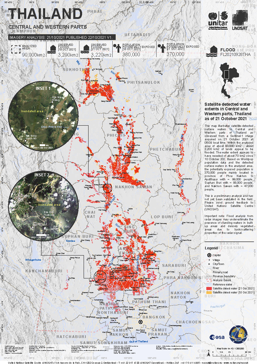
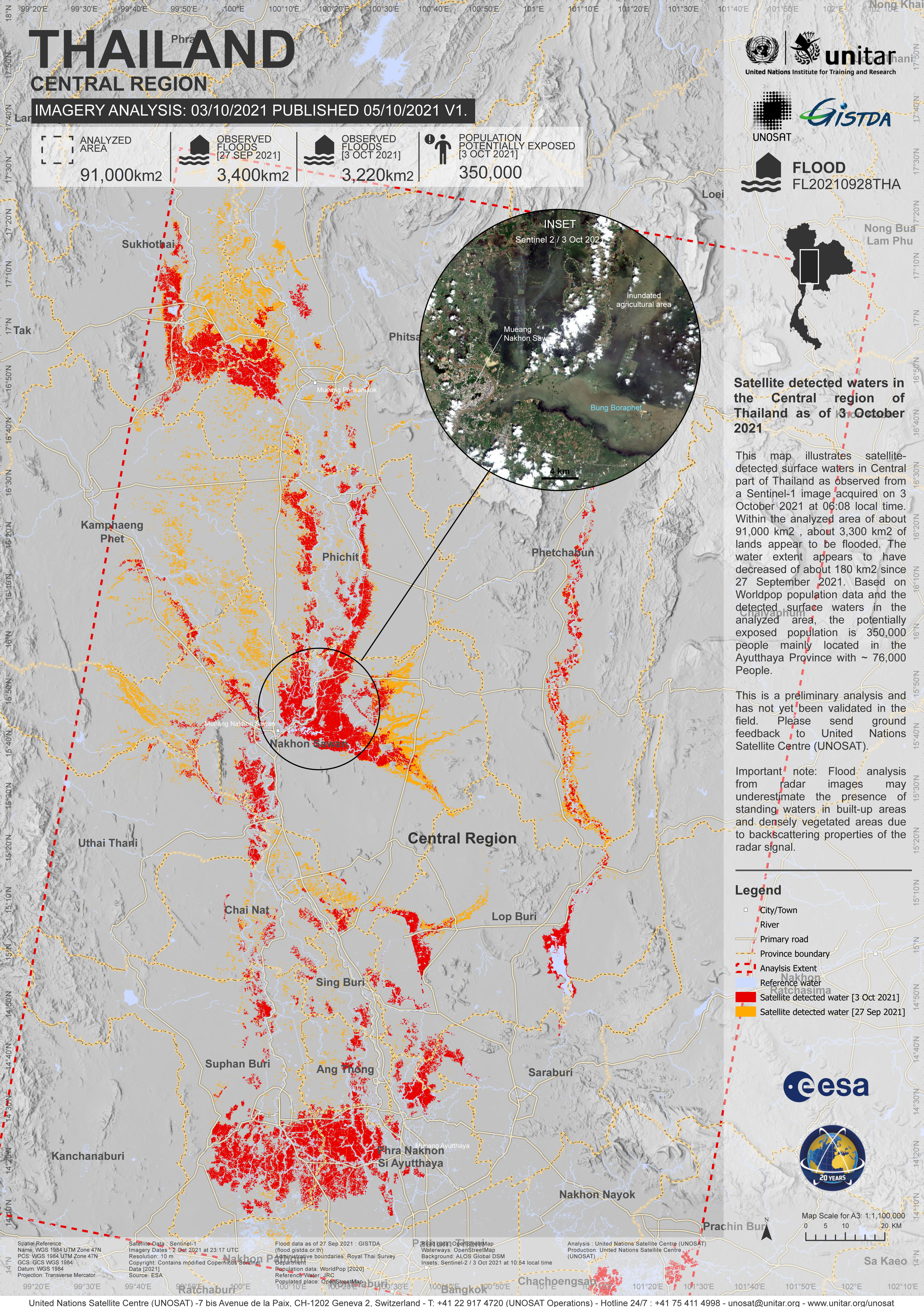
Flood assessment of Central and Western Thailand
Download the full report
版权: Contains modified Copernicus Sentinel data (2021)
Report produced by UNITAR/UNOSAT
Information about the Product
已获得: 10/10/2021 and 20/10/2021
源: Sentinel-1
类别: Delineation Map
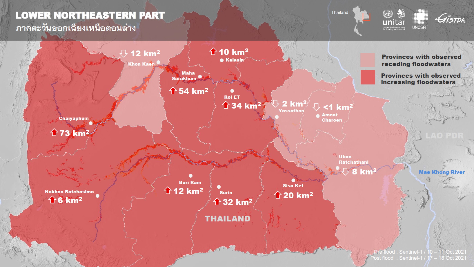
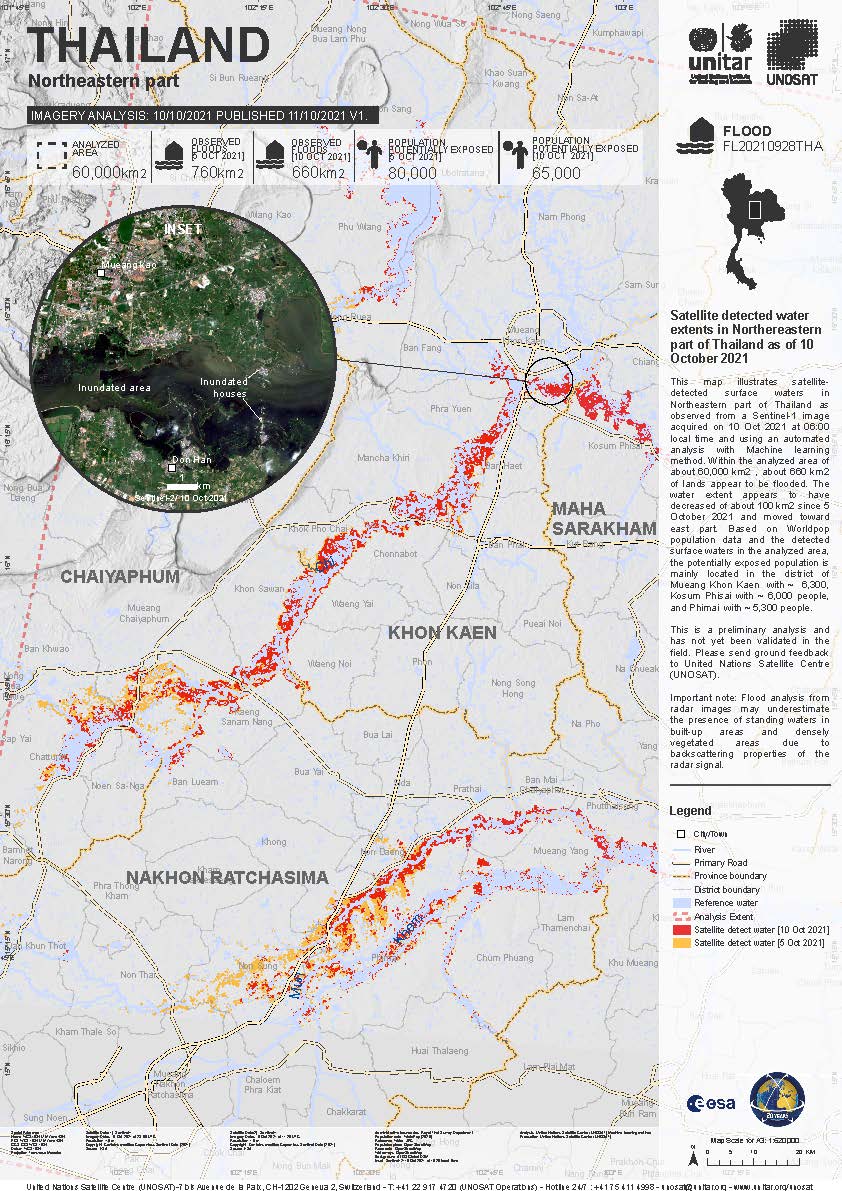
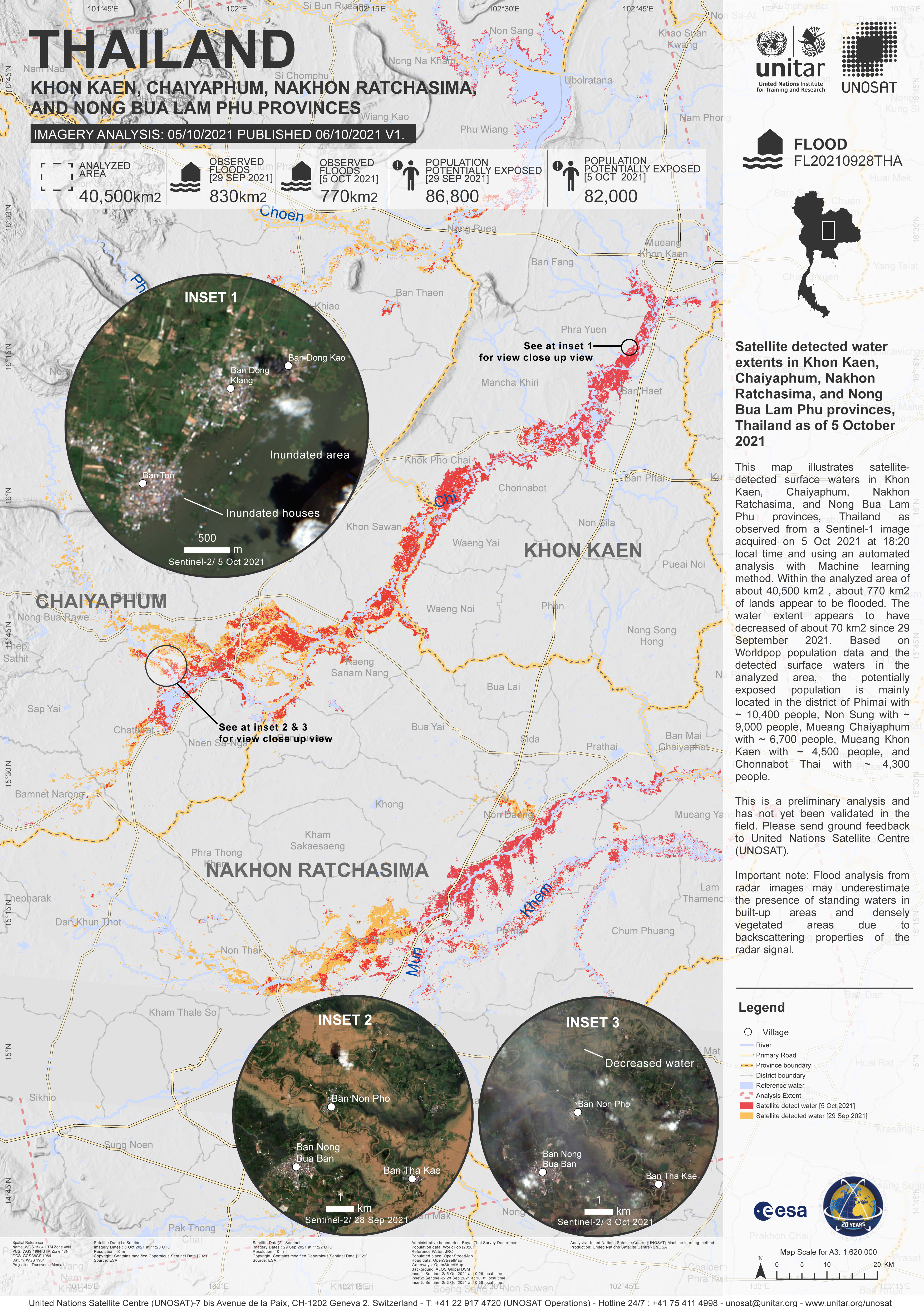
Preliminary satellite-derived flood assessment in the Lower Northeastern part of Thailand
Download the full report
版权: Contains modified Copernicus Sentinel data (2021)
Map produced by UNITAR / UNOSAT
Information about the Product
已获得: 09/10/2021 / 10/10/2021 / 17/10/2021 / 18/10/2021
源: Sentinel-1
类别: Delineation Map
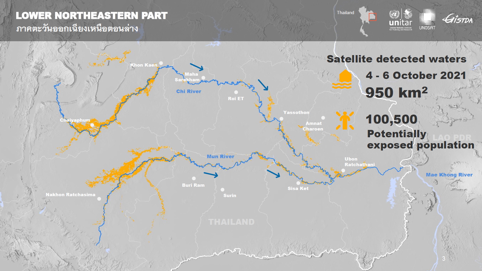
Preliminary satellite-derived flood assessment in Lower North-Eastern Part of Thailand
Download the full report
版权: Contains modified Copernicus Sentinel data (2021)
Map produced by UNITAR / UNOSAT
Information about the Product
已获得: 03/10/2021 - 06/10/2021 - 10/10/2021 - 11/10/2021
源: Sentinel-1
类别: Dossier
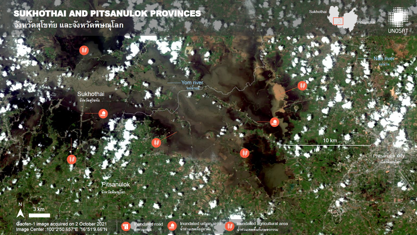
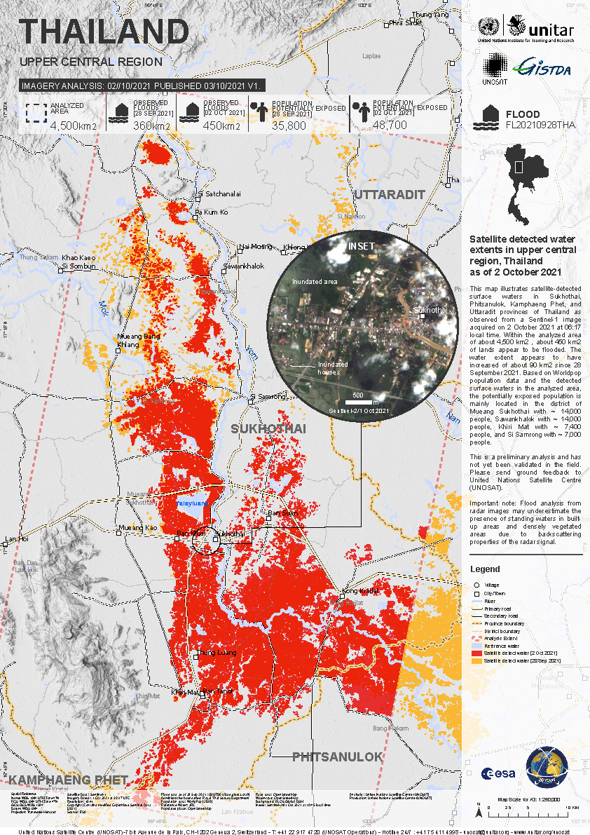
Preliminary satellite-derived flood assessment in Upper Central part of Thailand
Download the full report
版权: © CNSA/CRESDA (2021)
Contains modified Copernicus Sentinel Data [2021]
Map produced by UNITAR / UNOSAT
Information about the Product
已获得: Gaofen-1: 02/10/2021, 06/10/2021
Sentinel-2: 03/10/2021
源: Gaofen-1 (GF1) / Sentinel-2
类别: Dossier
Preliminary satellite - derived flood assessment in Mueang district, Nakhon Sawan province of Thailand
Download the full report
版权: Includes Pleiades material © CNES (2021), Distribution Airbus DS.
Map produced by UNITAR / UNOSAT
Information about the Product
已获得: 03/10/2021
源: Pleiades
类别: Reference Map
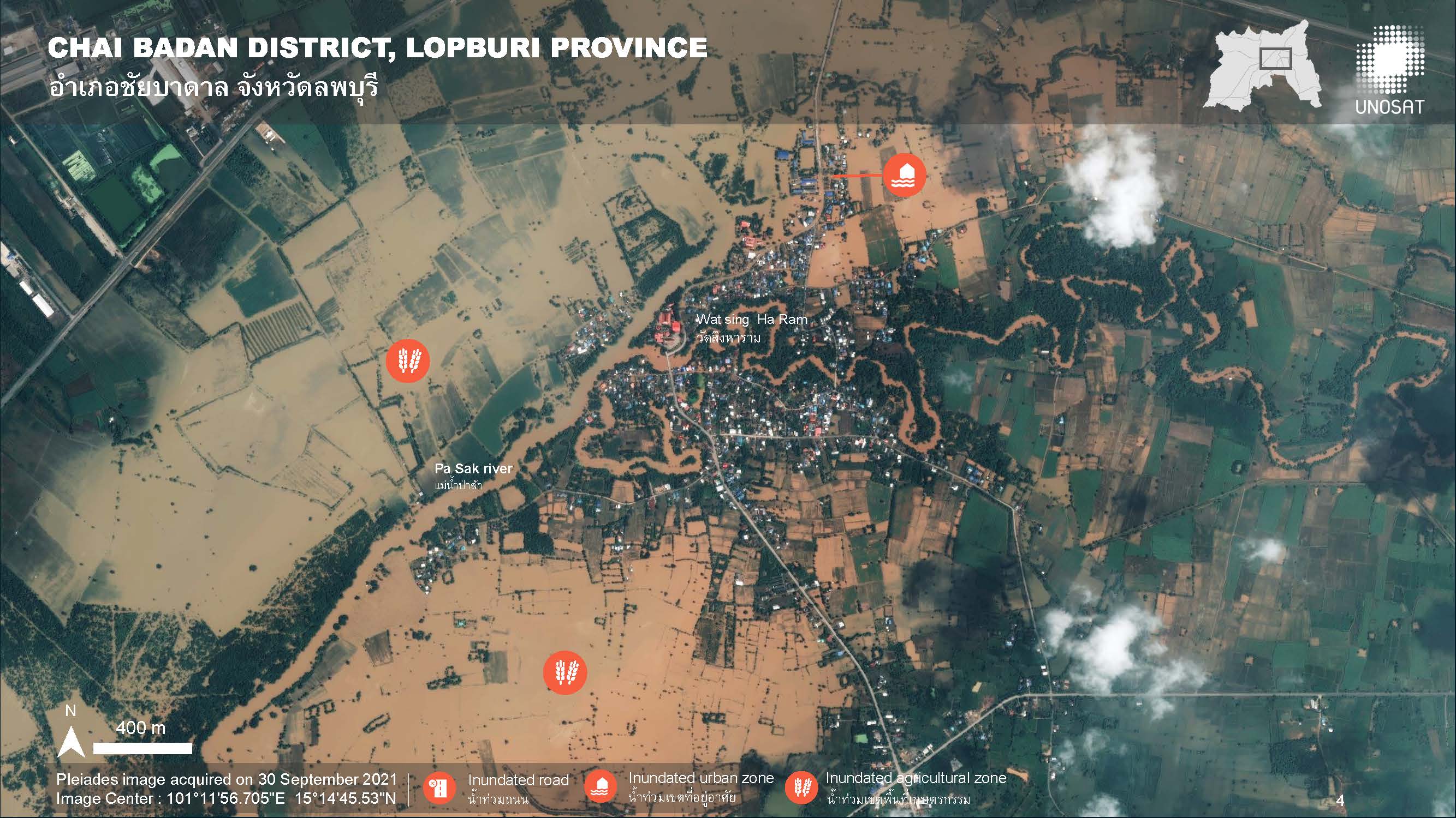
Preliminary satellite-derived flood assessment in Chai Badan District, Lop Buri Province of Thailand
Download the full report
版权: Includes Pleiades material © CNES (2021), Distribution Airbus DS.
Map produced by UNITAR / UNOSAT
Information about the Product
已获得: 30/09/2021, 01/10/2021
源: Pleiades
类别: Reference Map
Preliminary satellite-derived flood assessment in Central and Northeastern part of Thailand
Download the full report
版权: Kanopus-V © NTs OMZ, All Rights Reserved
Includes Pleiades material © CNES (2021), Distribution Airbus DS.
NOAA
Report produced by UNITAR/UNOSAT
Information about the Product
已获得: Kanopus-V: 30/10/2021
Pleiades: 30/09/2021
NOAA: 25/10/2021
源: Kanopus-V / Pleiades / NOAA
类别: Reference Map
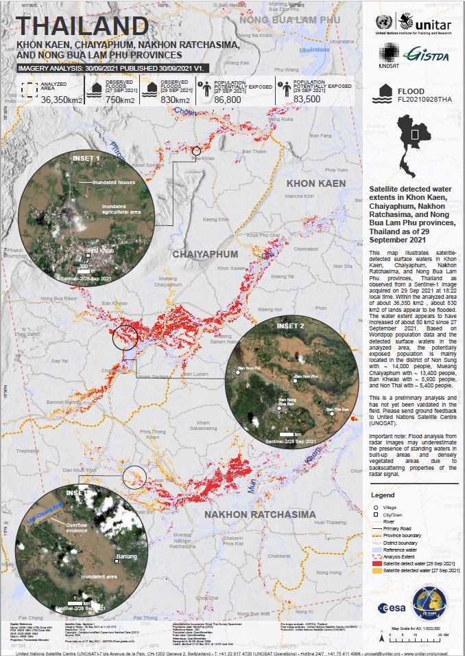
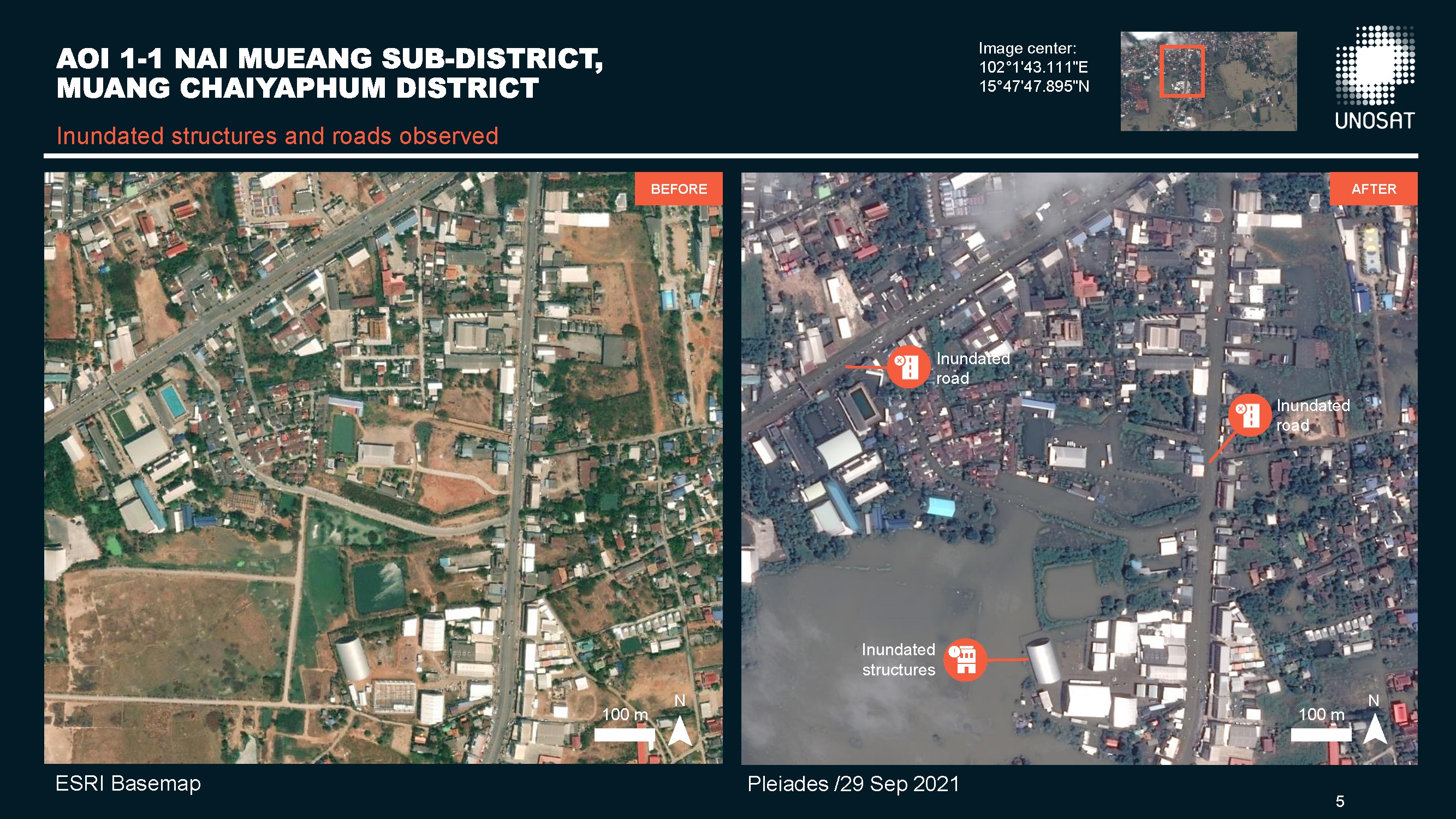
Preliminary flood assessment in Mueang district, Chaiyaphum province, Thailand
Download the full report
版权: Includes Pleiades material © CNES (2021), Distribution Airbus DS.
NOAA/Suomi NPP
Report produced by UNITAR/UNOSAT
Information about the Product
已获得: NOAA: 24/09/2021
Pleiades: 29/09/2021
源: Pleiades / NOAA
类别: Reference Map
 返回完整的响应档案

