 English
 Spanish
 French
 Chinese
 Russian
 Portuguese
 最新宪章启动
Charter activations
西非/尼日利亚洪水(巴耶尔萨州)
目前已达到危机程度的尼日利亚洪水灾情也影响了巴耶尔萨州。几乎所有尼日尔河和贝努埃河沿岸的社区都遭遇洪水侵袭,一些已经被淹没。
巴耶尔萨州位于尼日利亚海岸地带,河流在该处注入大海,当地的自然地貌为平缓的湿地。
据报道,本次尼日利亚洪水是50年来最严重的。尽管巴耶尔萨州已经布设了人工拦阻和预警设施,但洪水冲垮了它们。数千人无家可归,民居和公共建筑被毁。洪水还切断了通往一些社区的道路,并对农业生产造成破坏,引发对来年潜在的饥荒风险的担忧。
当地居民继续与灾情斗争,已从家中转移, 在一些受灾最严重的地区面临疫病的风险。Sagbama和Odi等社区已经建立了救助营地。
| 事件类型: | 洪水 |
| 事件地点: | 西非/尼日利亚(巴耶尔萨州) |
| 启动宪章的日期: | 2012年10月10日 |
| 宪章要求者: | 尼日利亚国家应急管理局(NEMA) |
Products
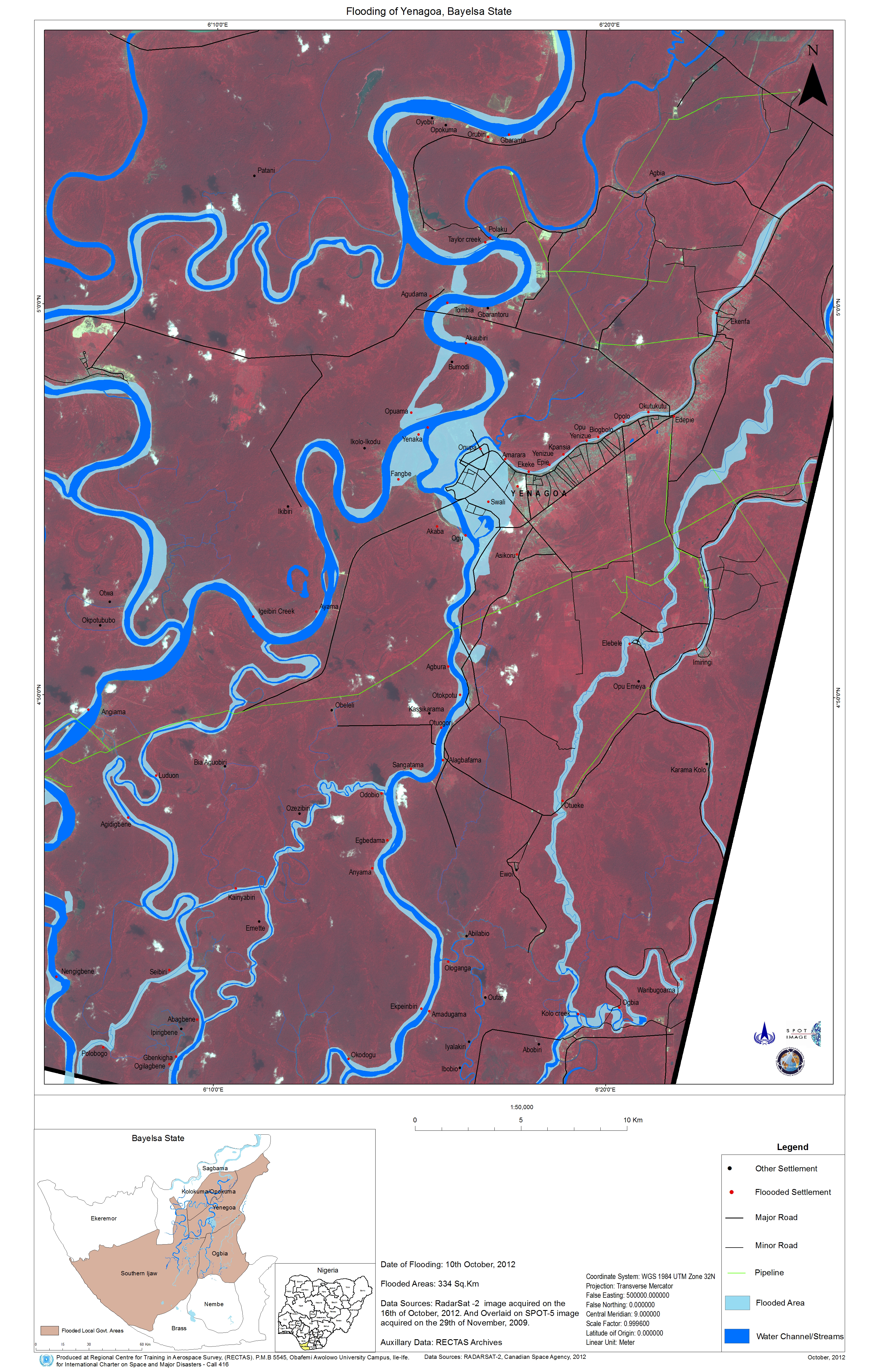
Flooding of Yenagoa, Bayelsa State
版权: RADARSAT-2 Data and Products © MacDonald, Dettwiler and Associates Ltd. (2012) - All Rights Reserved. RADARSAT is an official trademark of the Canadian Space Agency.
Spot Image
Map produced by Regional Centre for Training in Aerospace Survey (RECTAS)
Information about the Product
已获得: SPOT-5: 29/11/2009
RADARSAT-2: 16/10/2012
源: RADARSAT-2 / SPOT-5
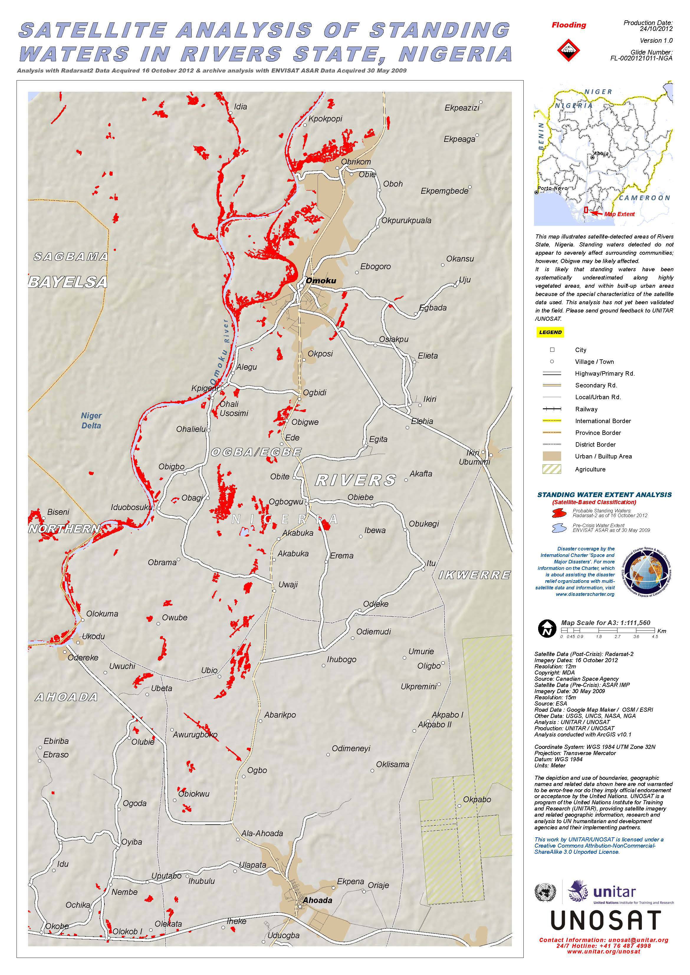
This map illustrates satellite-detected standing waters in Rivers State, Nigeria.
版权: RADARSAT-2 Data and Products © MacDonald, Dettwiler and Associates Ltd. (2012) - All Rights Reserved. RADARSAT is an official trademark of the Canadian Space Agency.
European Space Agency (ESA)
Map produced by UNITAR/UNOSAT
Information about the Product
已获得: Envisat: 30/05/2009
RADARSAT-2: 16/10/2012
源: RADARSAT-2
Envisat - ASAR data
 返回完整的响应档案

