 English
 Spanish
 French
 Chinese
 Russian
 Portuguese
 Latest Activation
Charter activations
Flood in West Africa / Nigeria (Bayelsa State)
The flood situation in Nigeria, now reported as being at crisis proportions, has also affected Bayelsa State. Virtually all of the communities along the Niger and Benue Rivers have been flooded, and some have been submerged.
Bayelsa State is located on the coast of Nigeria, where the rivers empty out into the ocean, and the natural terrain in the area is flat and swamp-land.
The flooding in Nigeria has been reported as the worst in 50 years, and though artificial barriers and precautions were in place in Bayelsa State, the flood waters have overwhelmed them. Thousands of people have been left homeless, with both residential and public buildings destroyed. The flood waters have cut off roads to some communities and agriculture has been ravaged by the flood waters, leading to concerns of potential starvation next year.
The local population continue to struggle with the situation, displaced from their homes and at risk from disease in some of the worst affected areas. Relief camps have been set up in the Sagbama and Odi communities.
| Tipo de evento: | Flood |
| Local do evento: | West Africa / Nigeria (Bayelsa State) |
| Data da Ativação da Carta: | 10 October 2012 |
| Requisitante da Carta: | National Emergency Management Agency (NEMA) |
| Gerenciamento de projeto: | Regional Centre for Training in Aerospace Survey |
Products
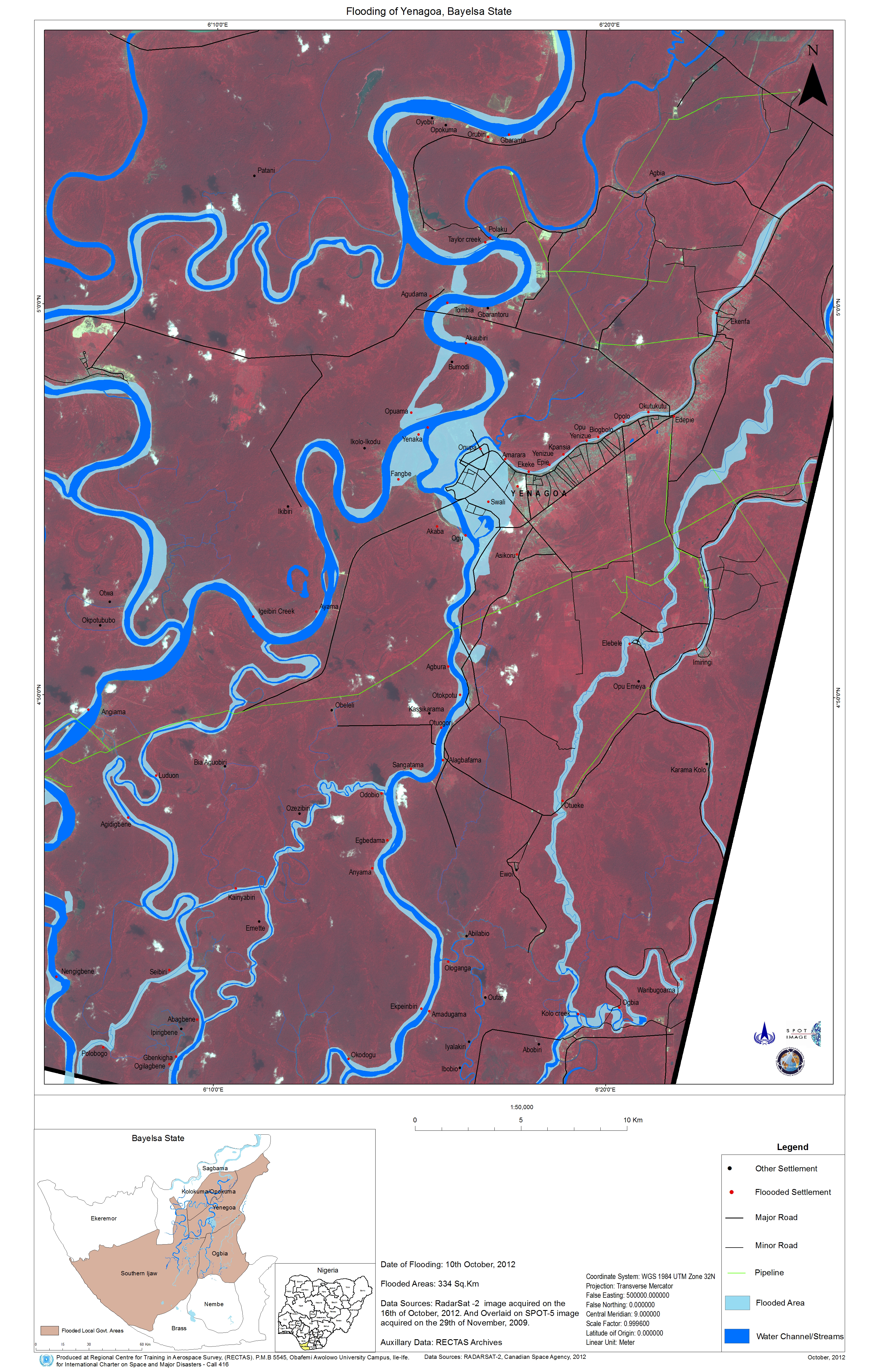
Flooding of Yenagoa, Bayelsa State
Direitos autorais: RADARSAT-2 Data and Products © MacDonald, Dettwiler and Associates Ltd. (2012) - All Rights Reserved. RADARSAT is an official trademark of the Canadian Space Agency.
Spot Image
Map produced by Regional Centre for Training in Aerospace Survey (RECTAS)
Information about the Product
Adquirida: SPOT-5: 29/11/2009
RADARSAT-2: 16/10/2012
Fonte: RADARSAT-2 / SPOT-5
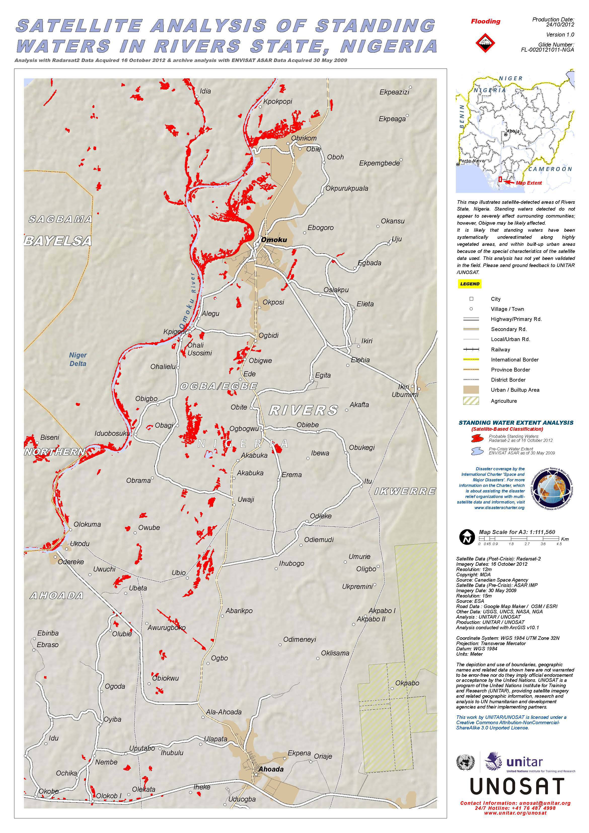
This map illustrates satellite-detected standing waters in Rivers State, Nigeria.
Direitos autorais: RADARSAT-2 Data and Products © MacDonald, Dettwiler and Associates Ltd. (2012) - All Rights Reserved. RADARSAT is an official trademark of the Canadian Space Agency.
European Space Agency (ESA)
Map produced by UNITAR/UNOSAT
Information about the Product
Adquirida: Envisat: 30/05/2009
RADARSAT-2: 16/10/2012
Fonte: RADARSAT-2
Envisat - ASAR data
 Voltar ao arquivo completo da Ativação

