 English
 Spanish
 French
 Chinese
 Russian
 Portuguese
 最新宪章启动
Charter activations
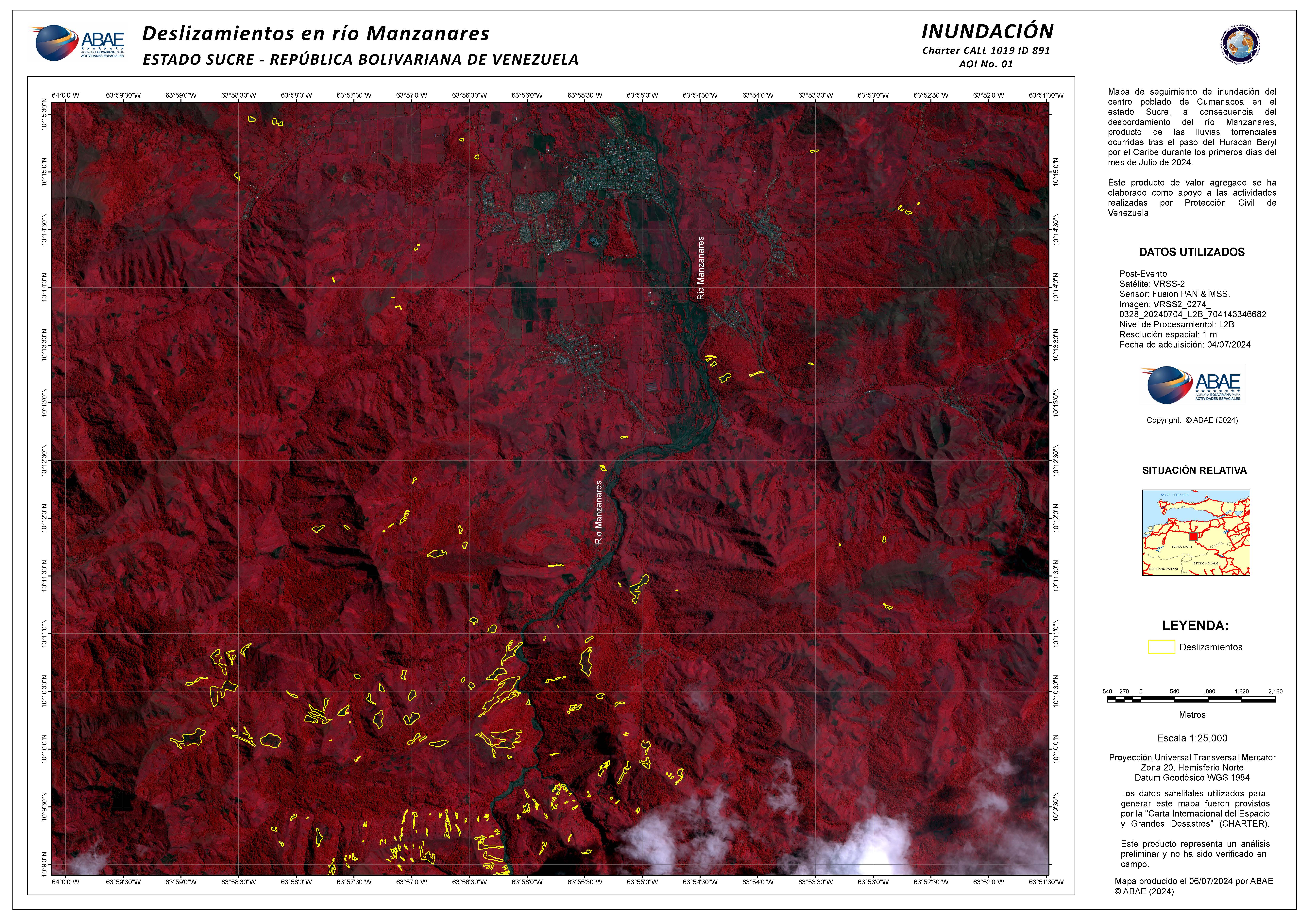
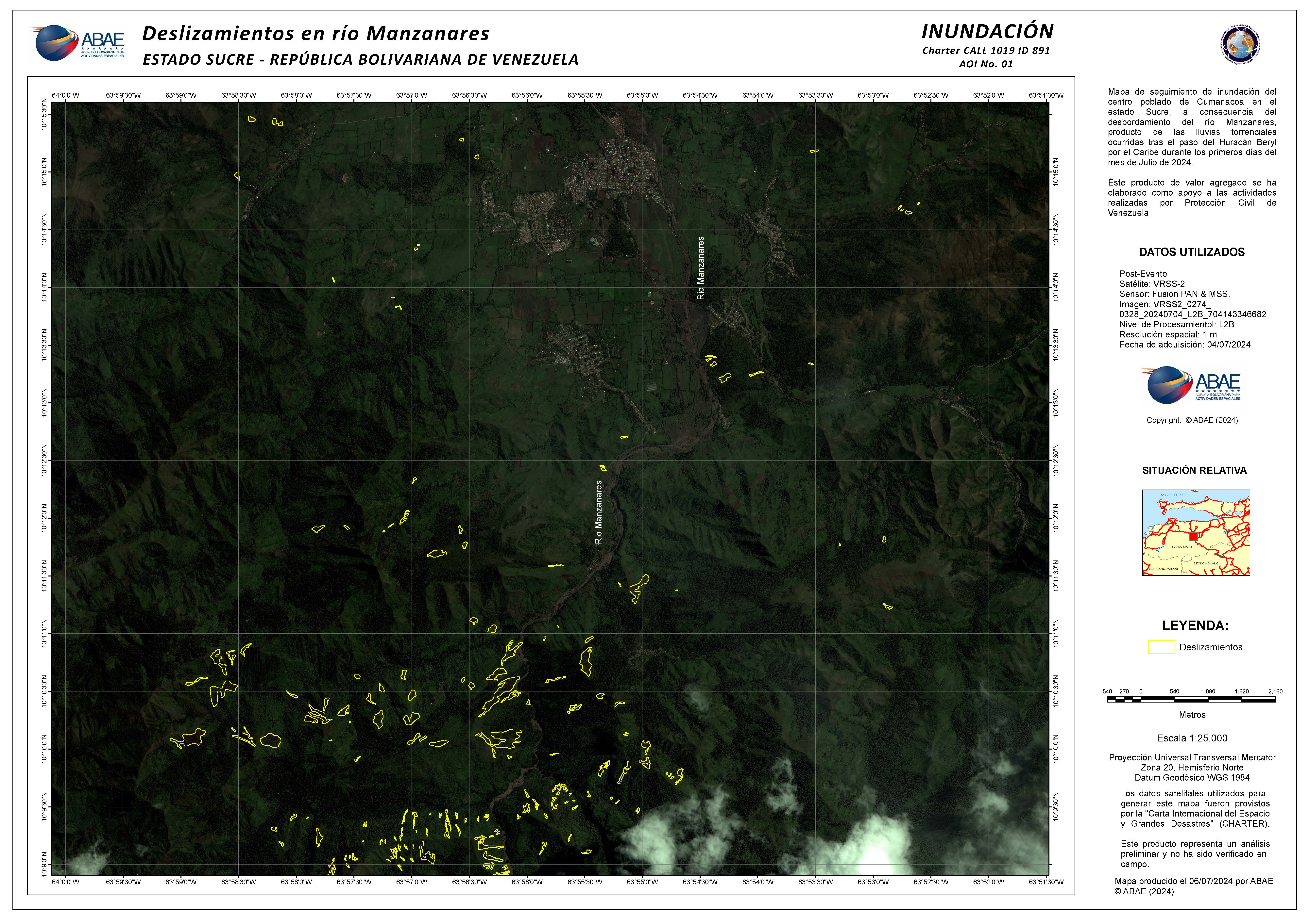
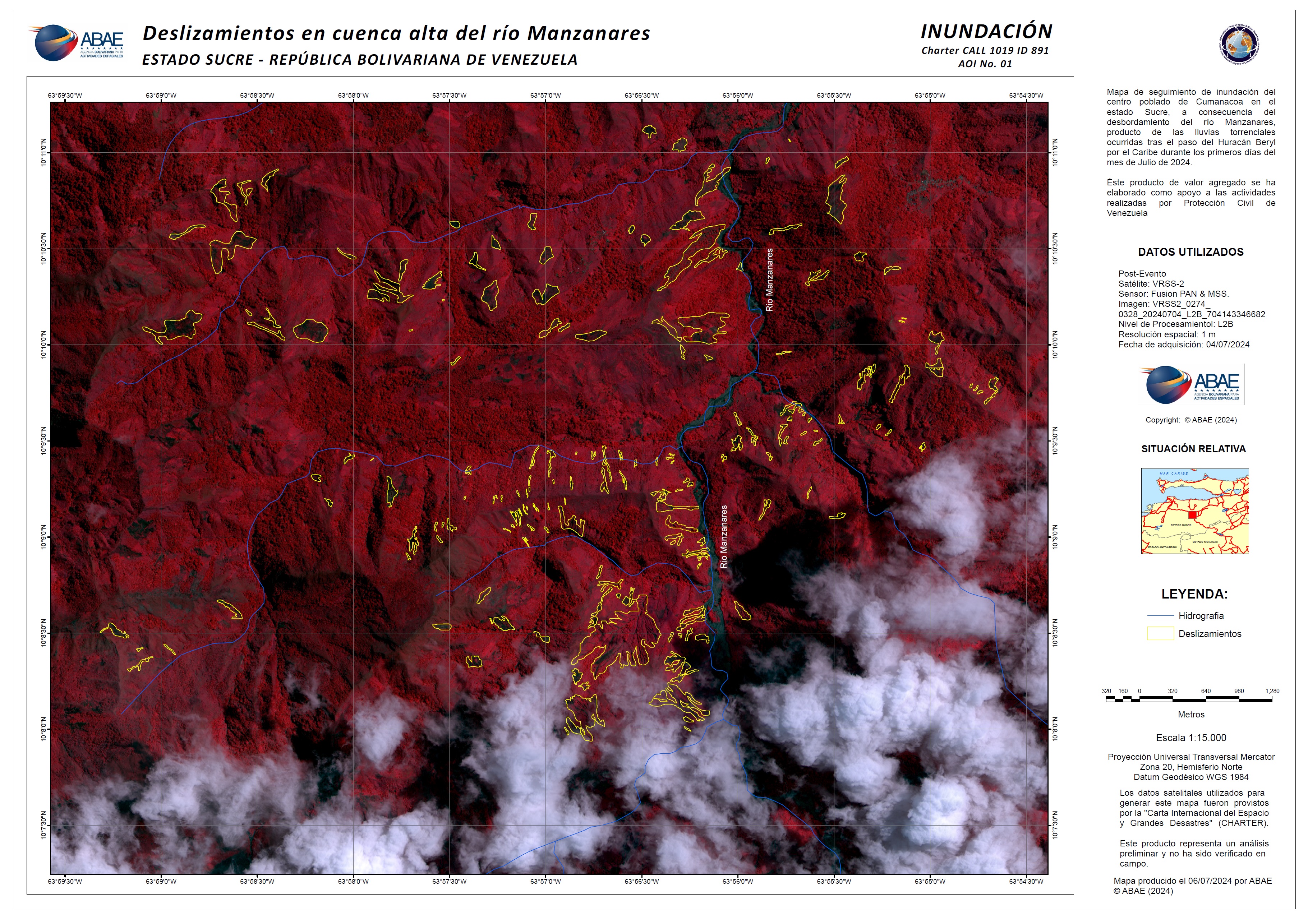
Hurricane Beryl in Venezuela
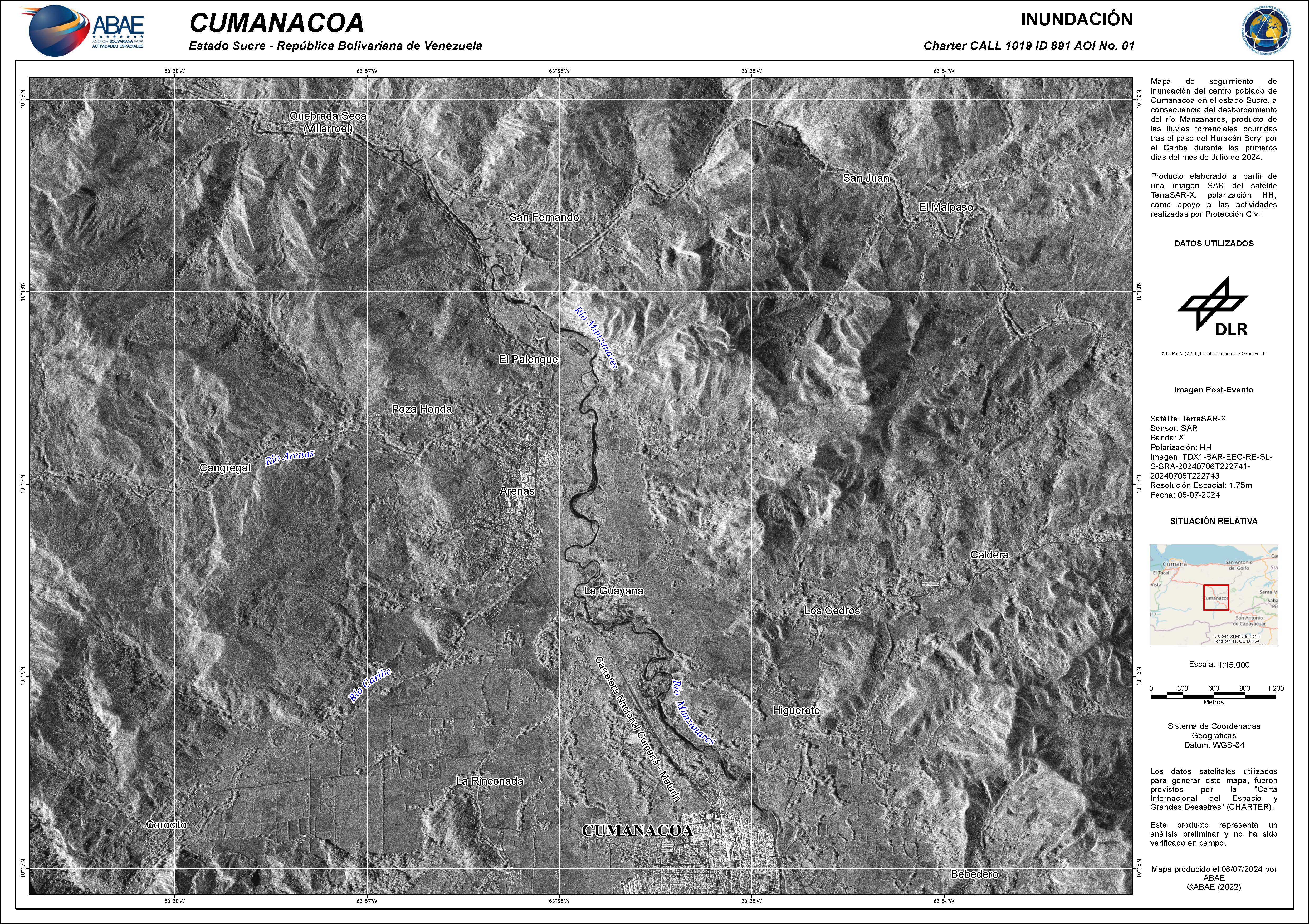
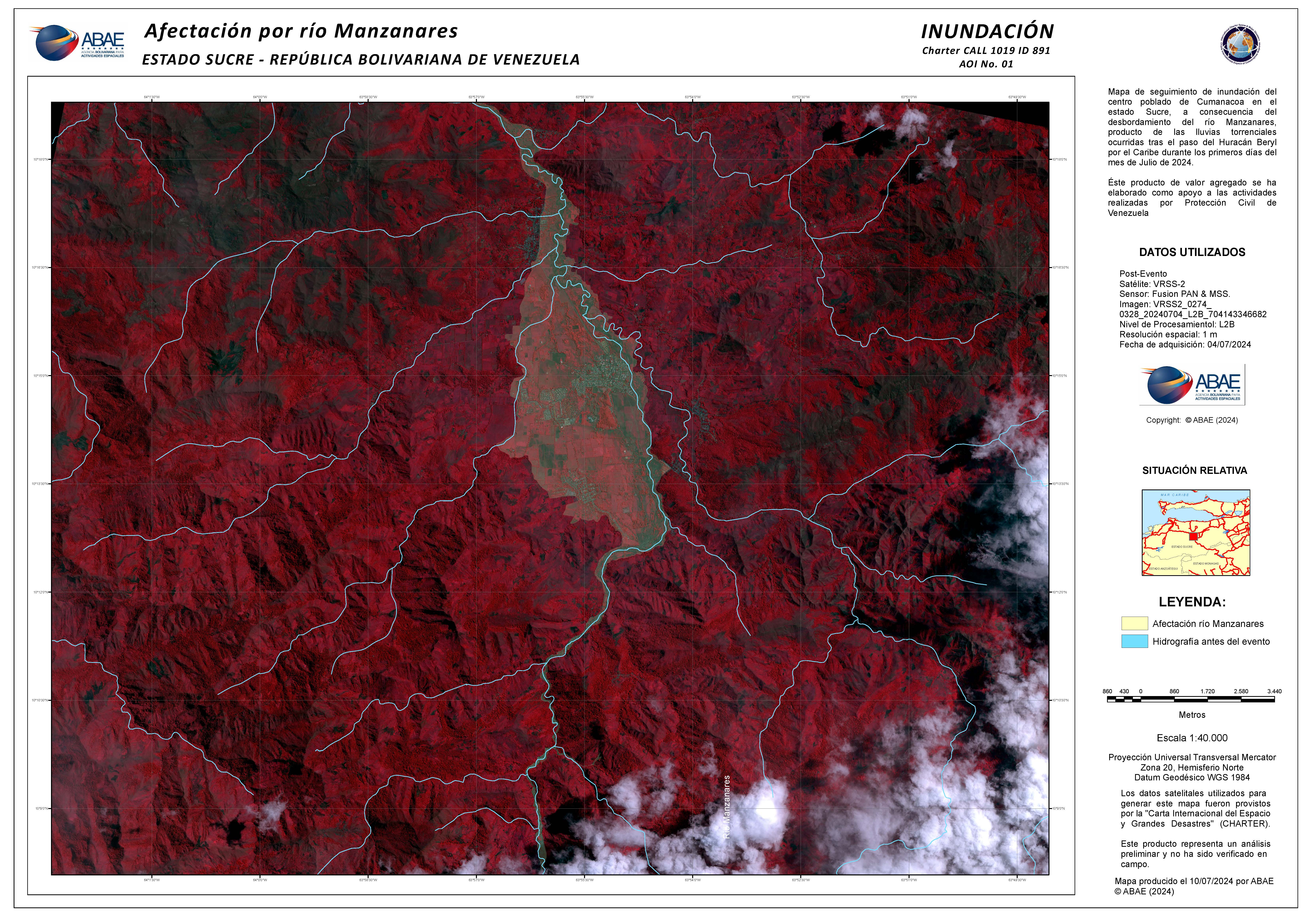
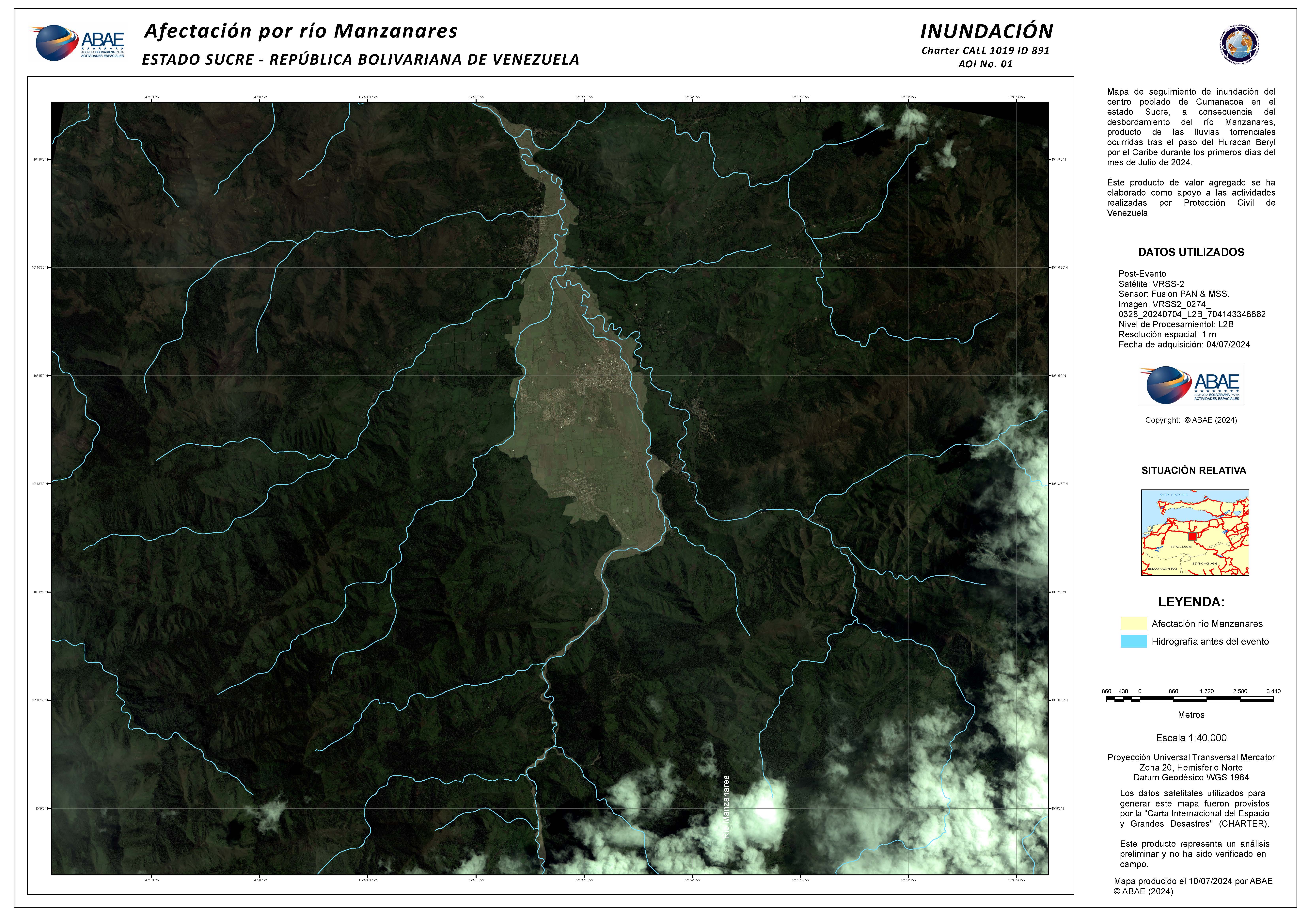
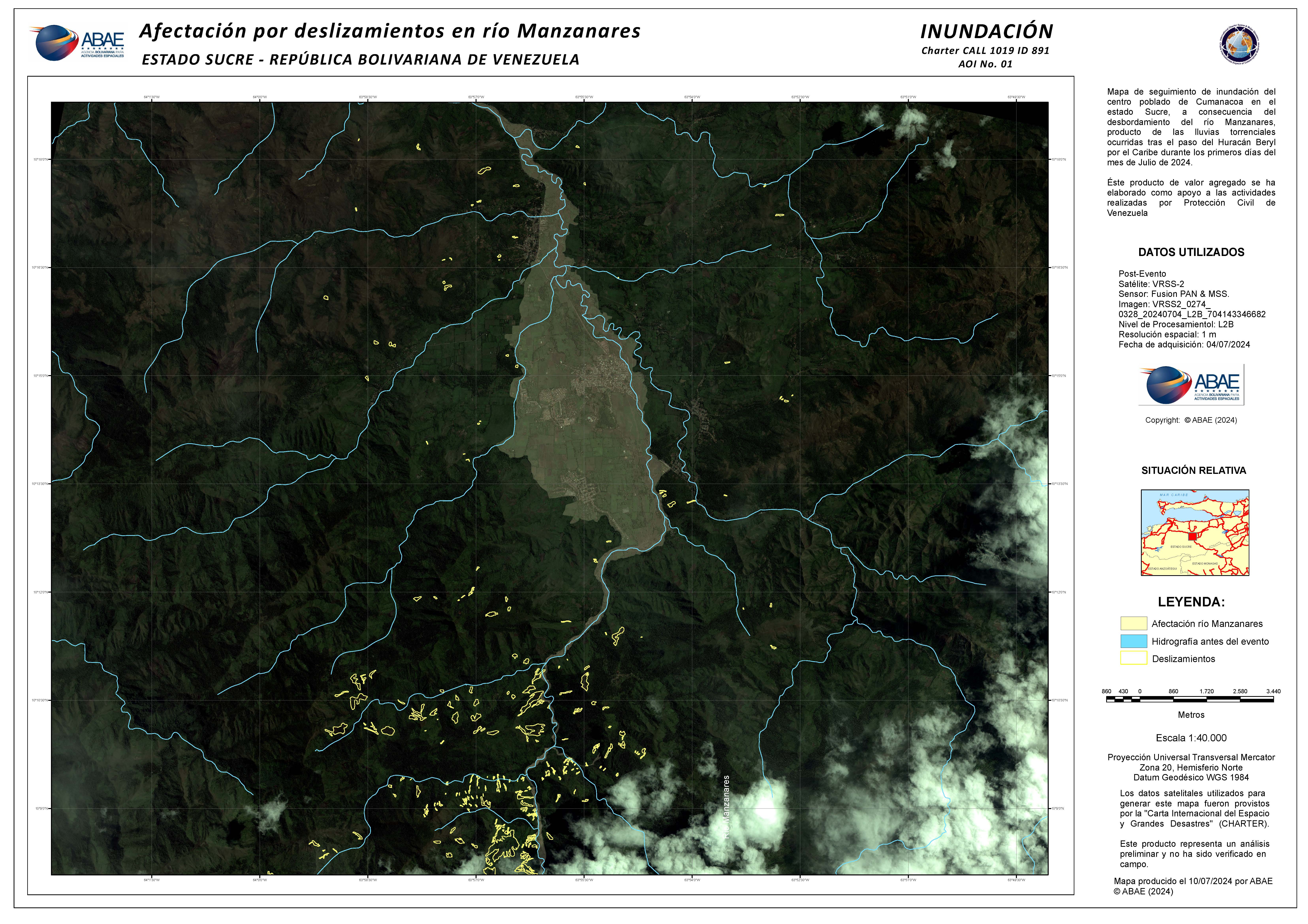
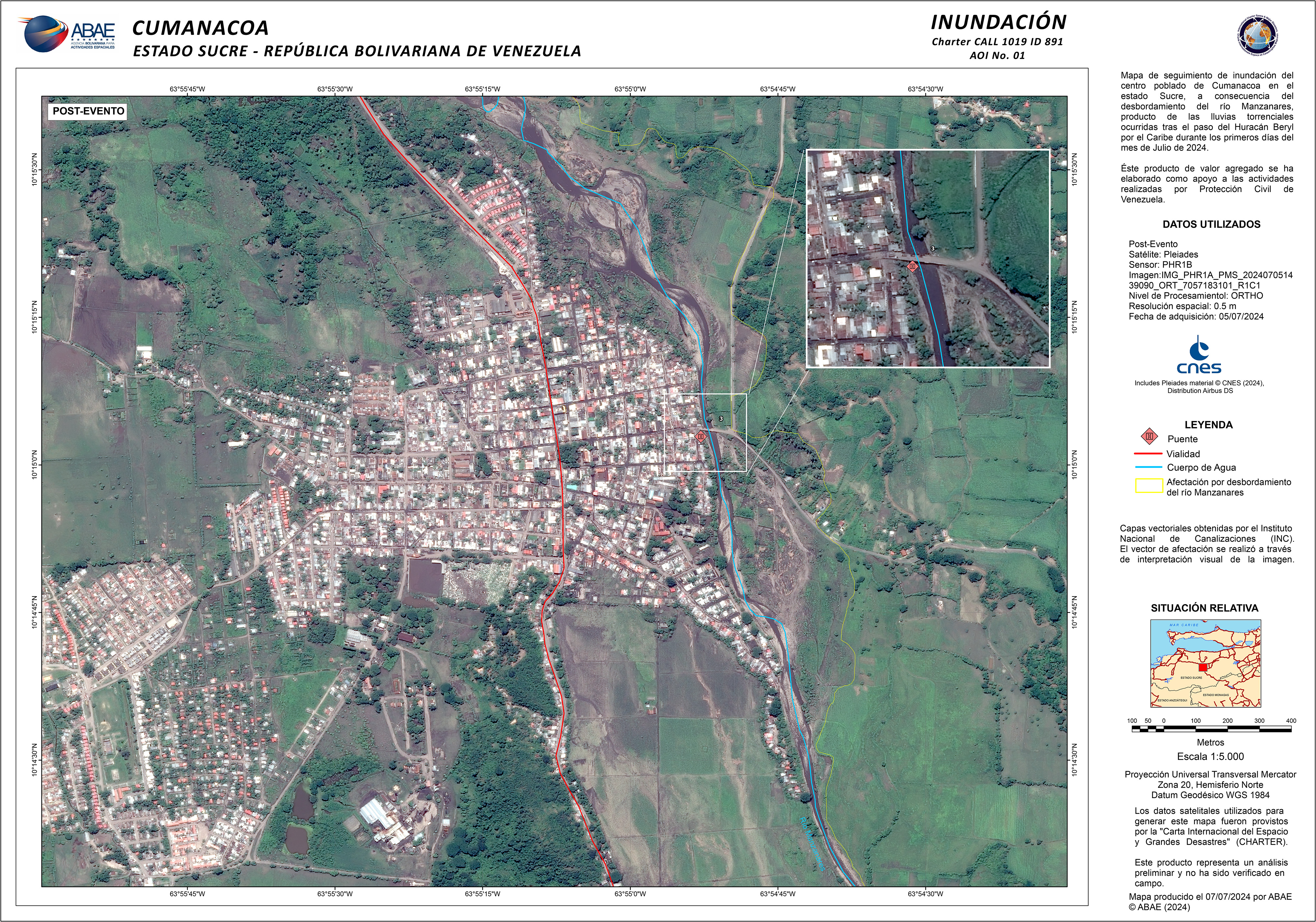
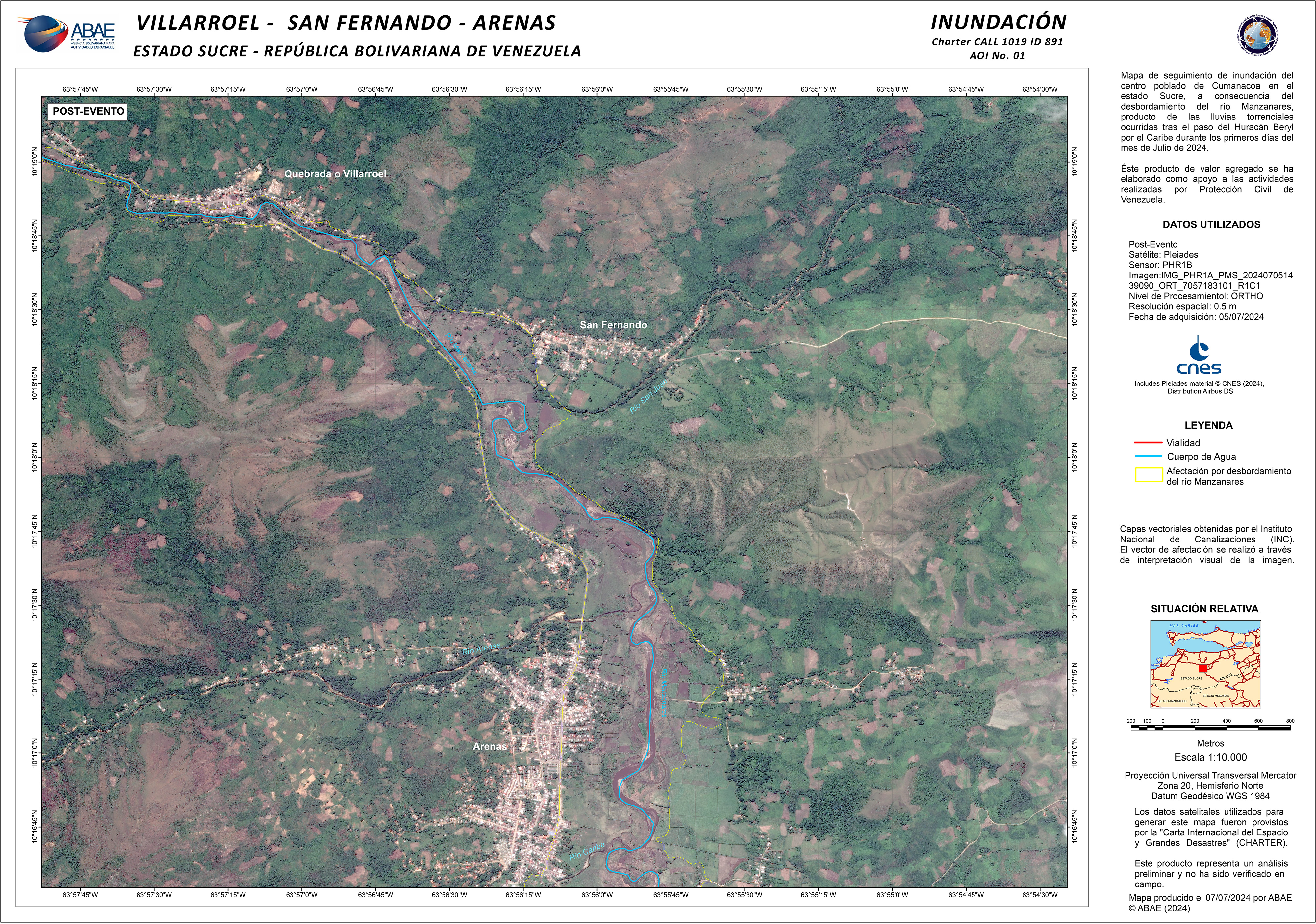
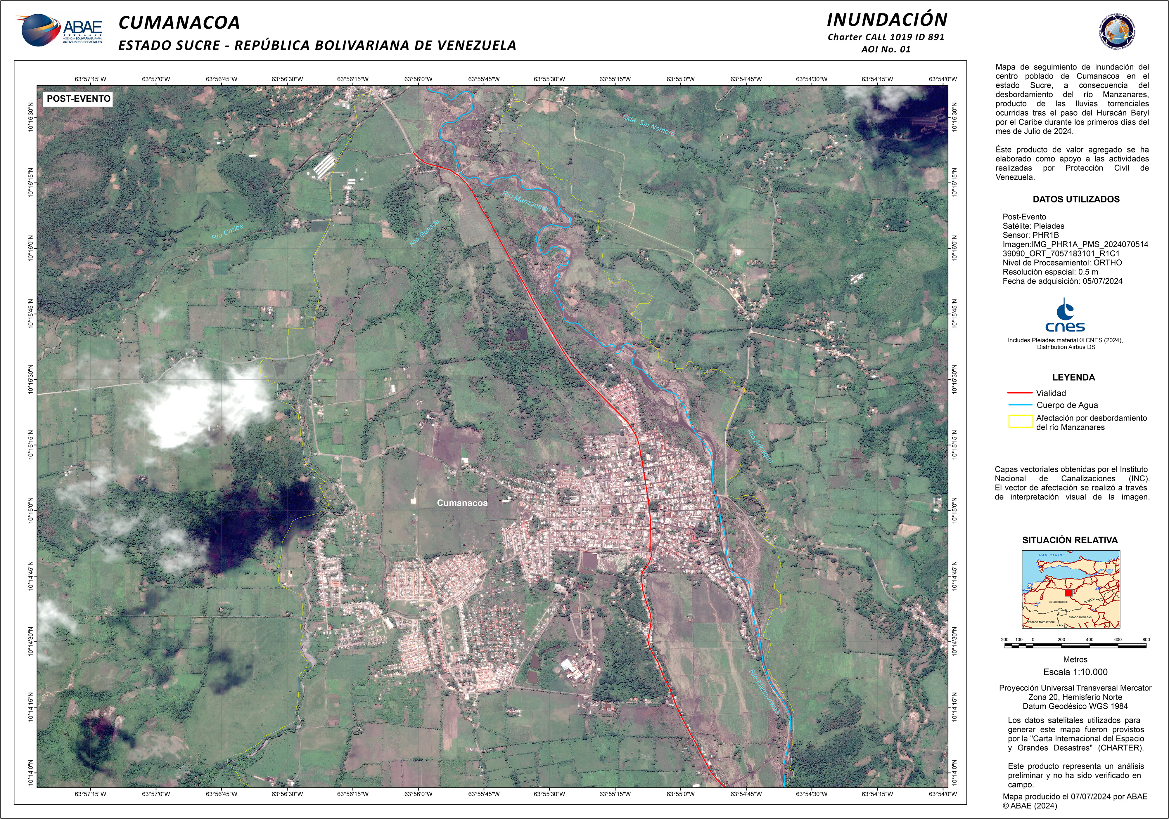
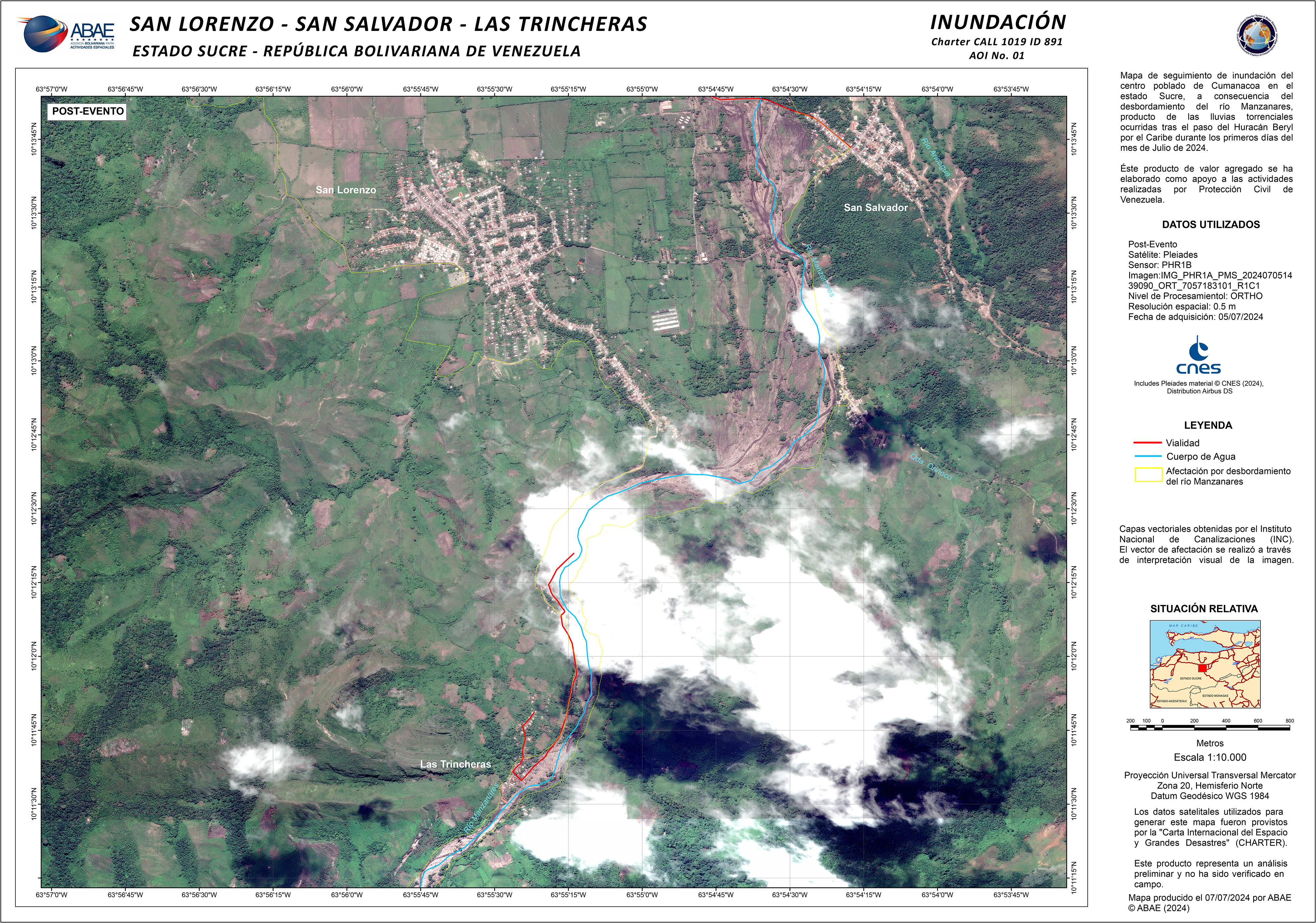
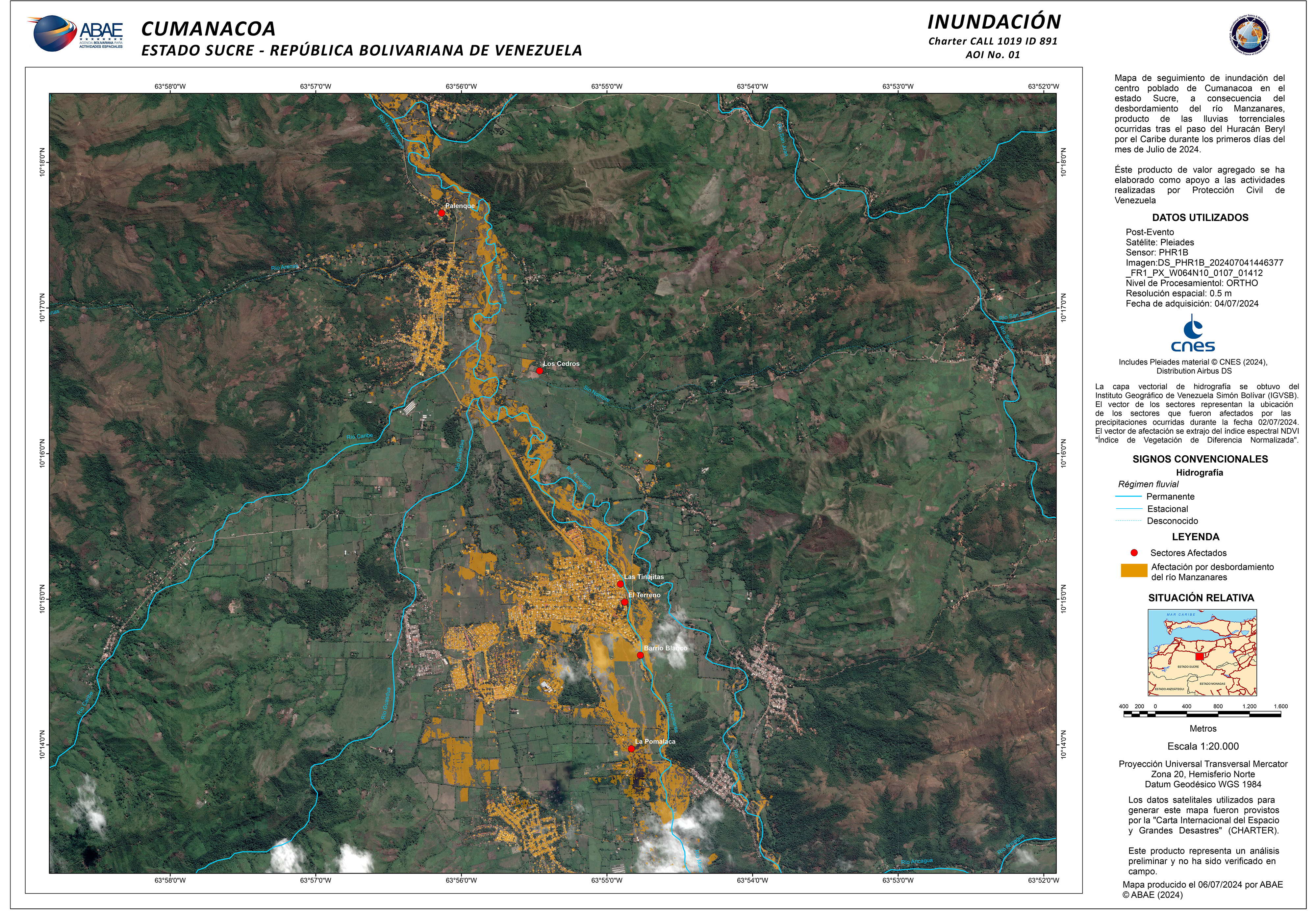
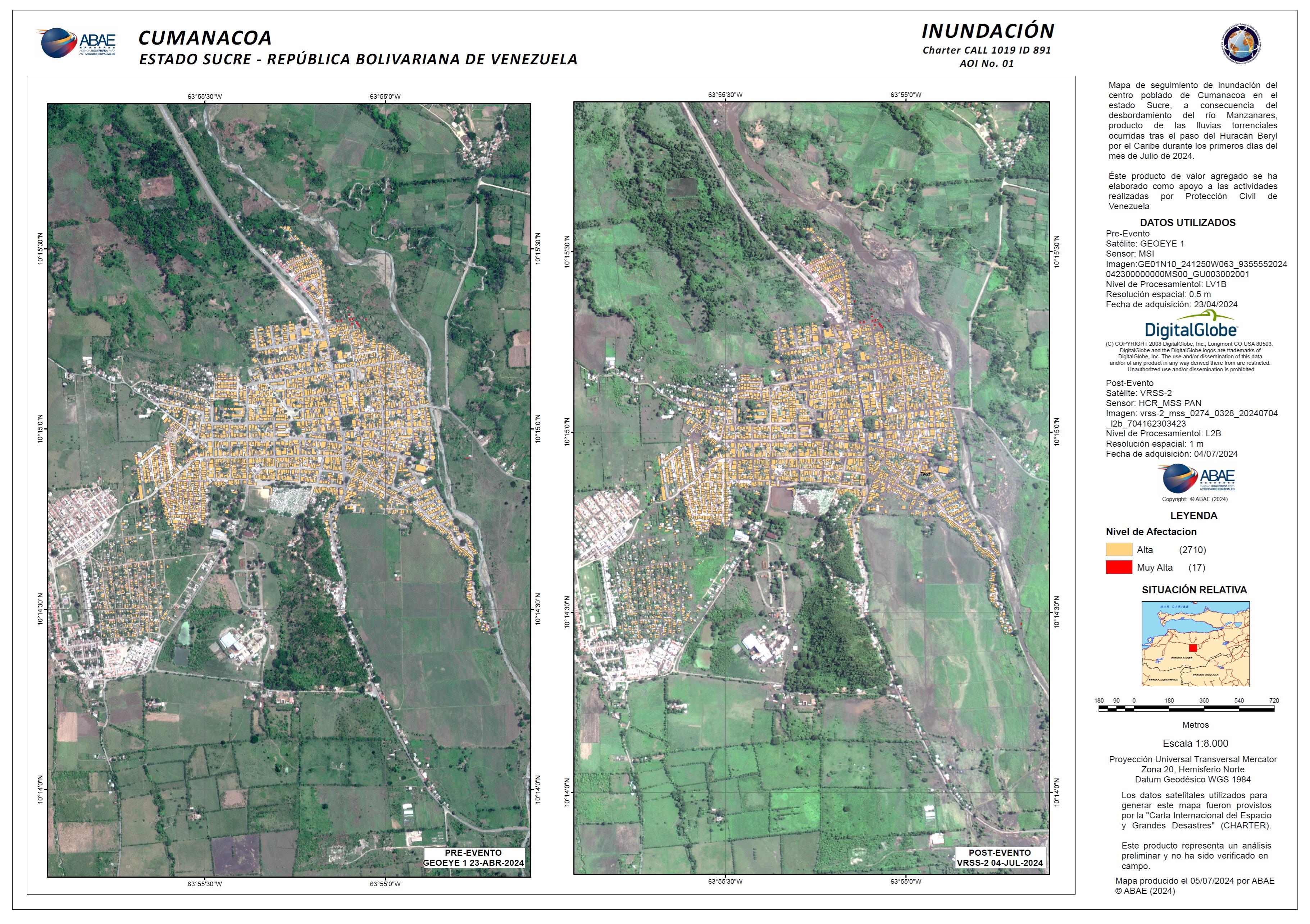
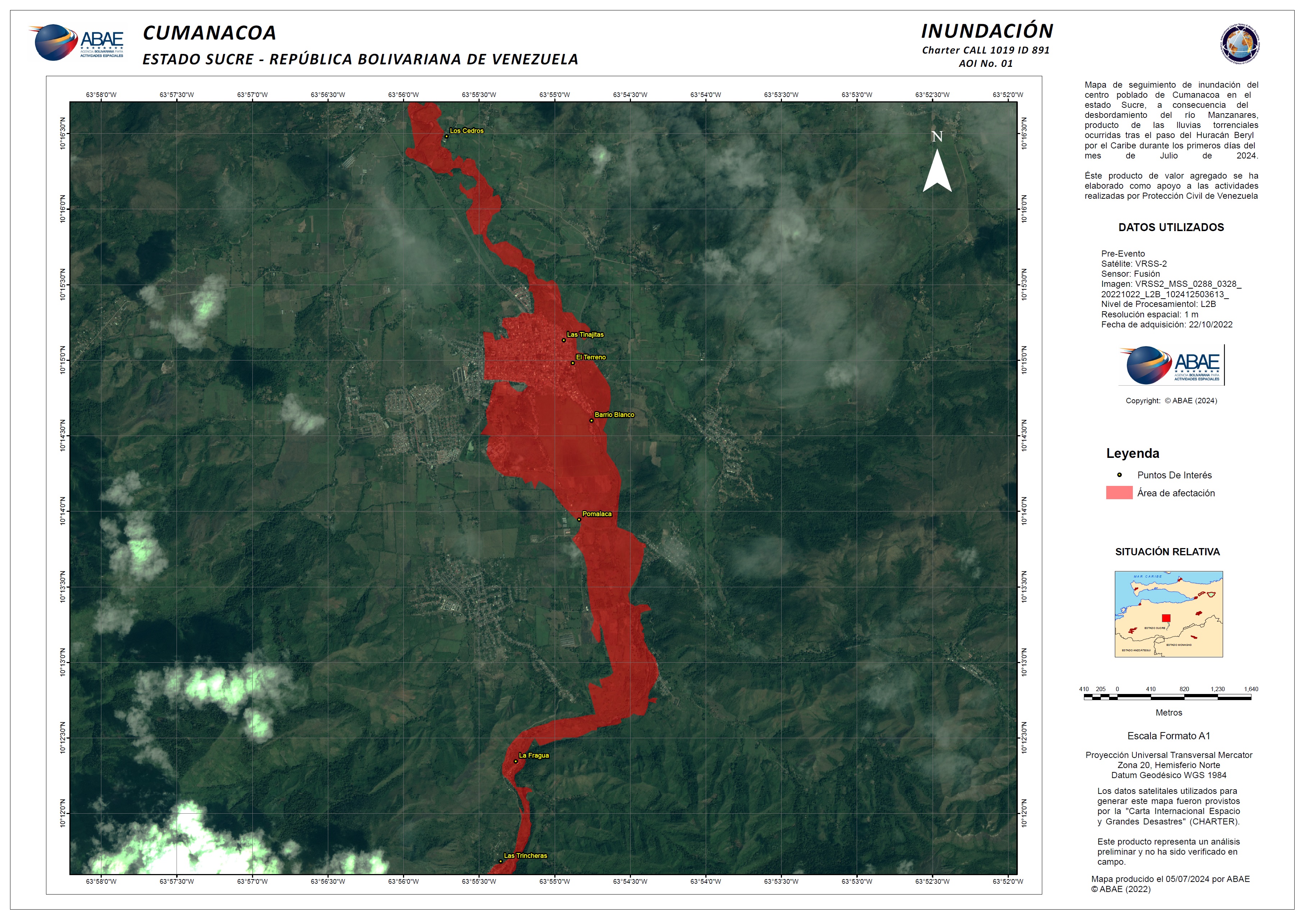
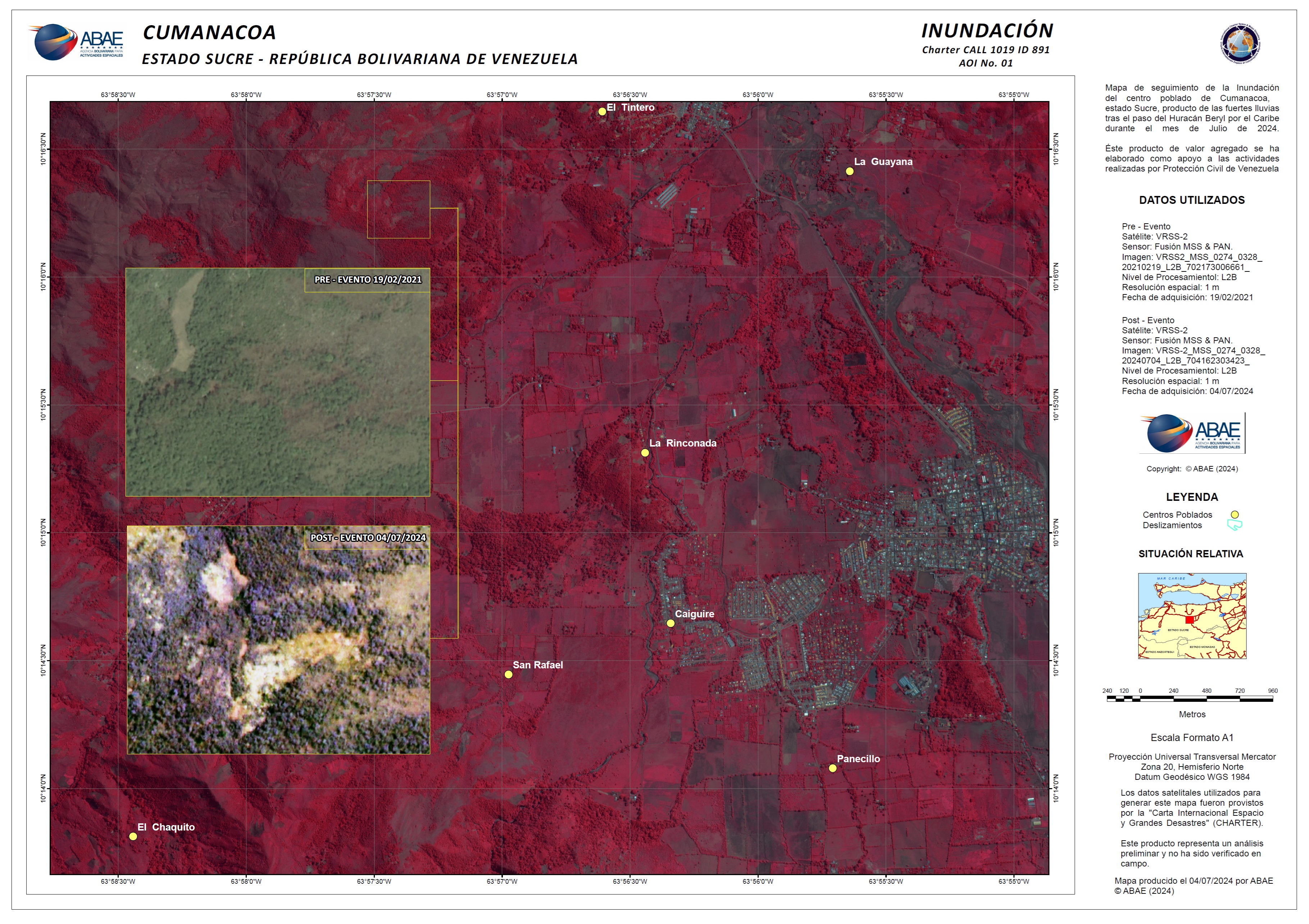
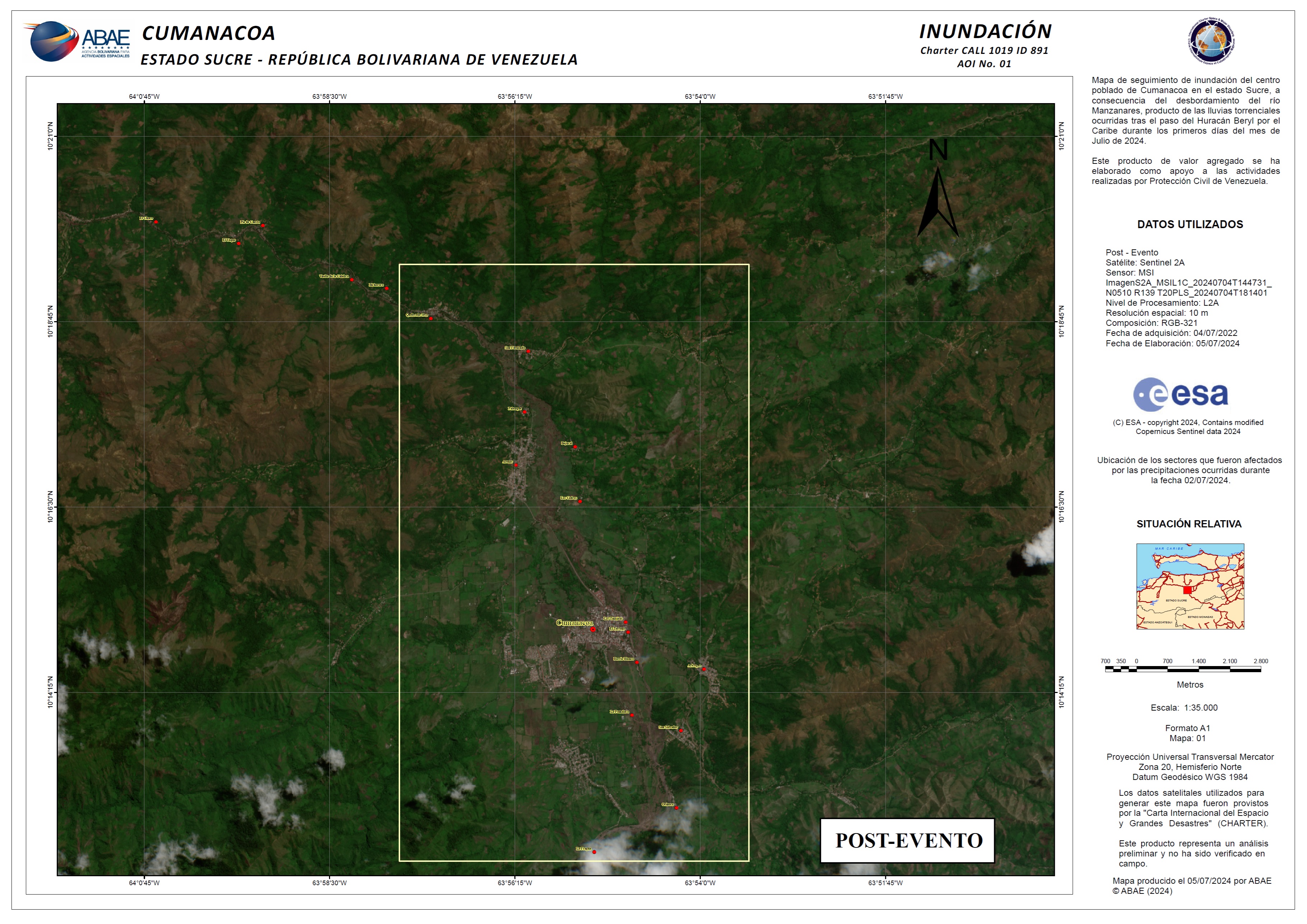
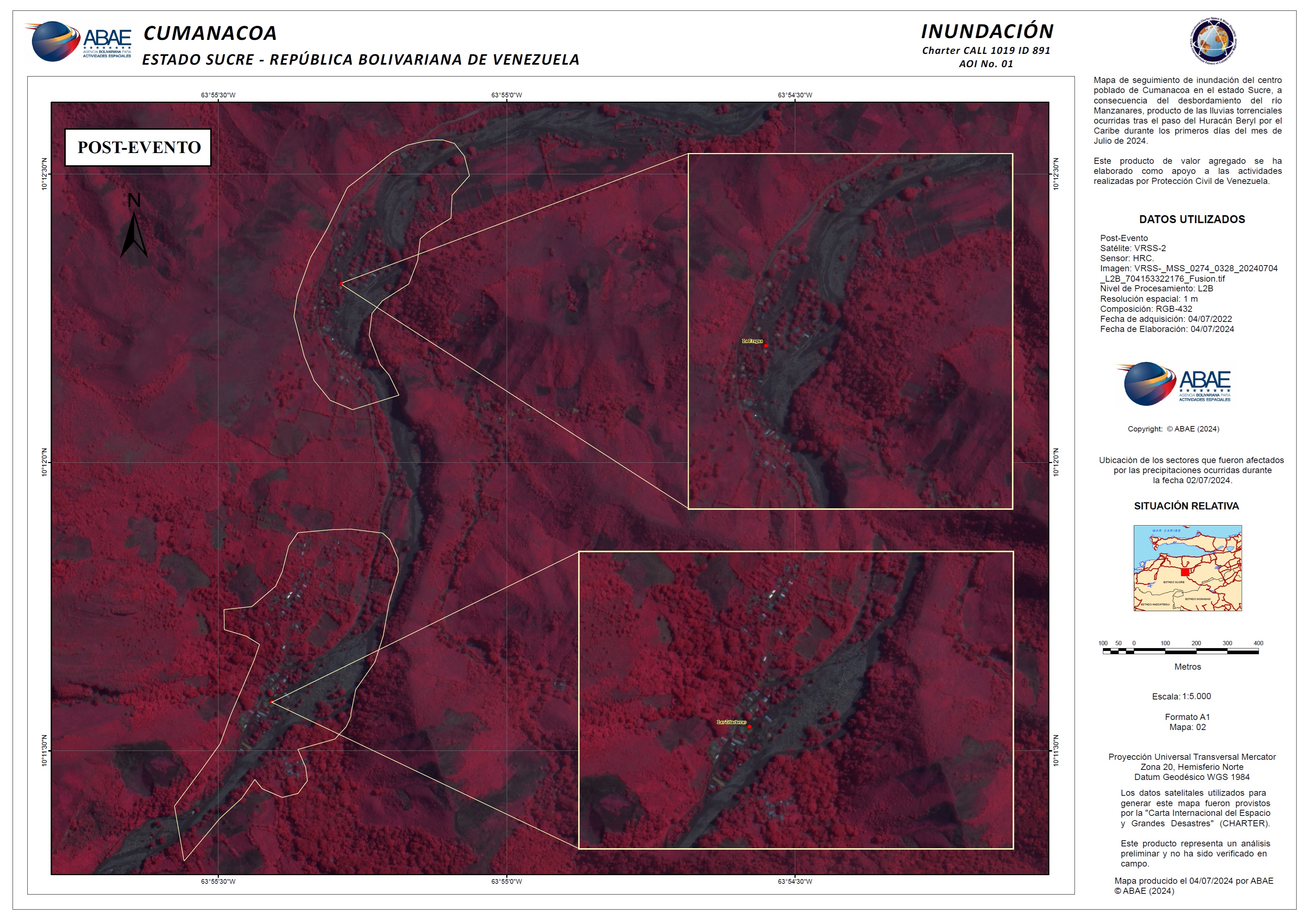
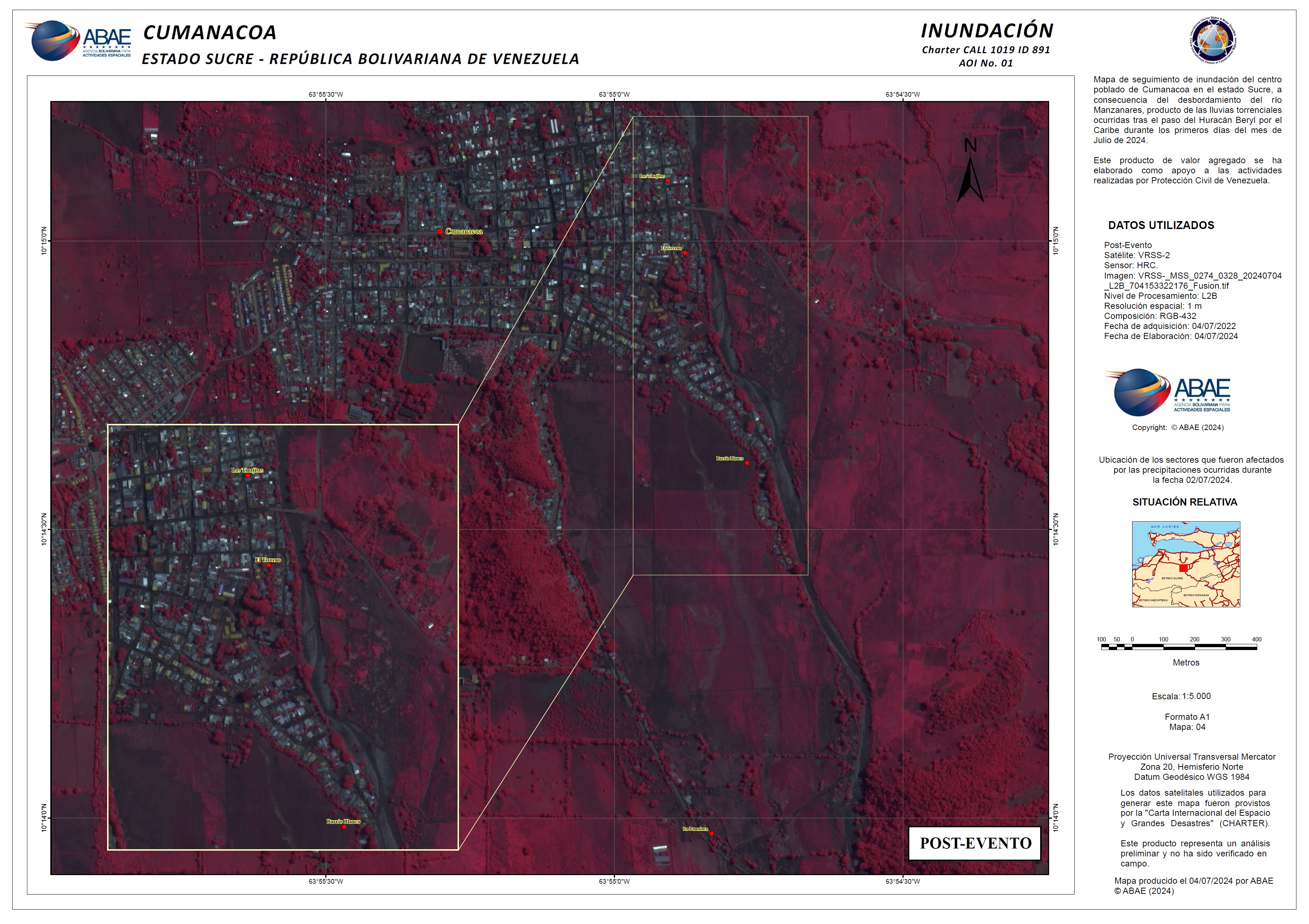
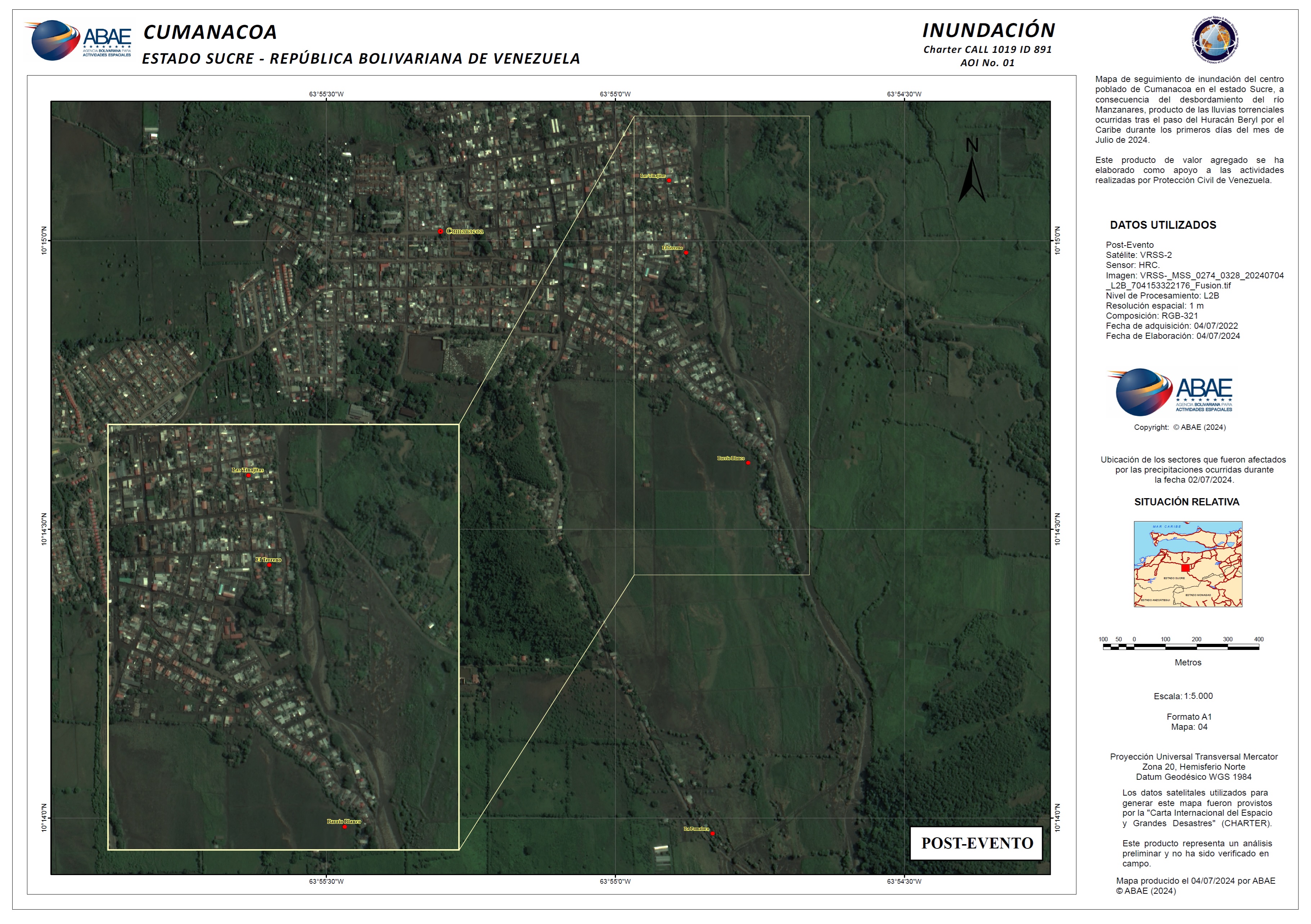
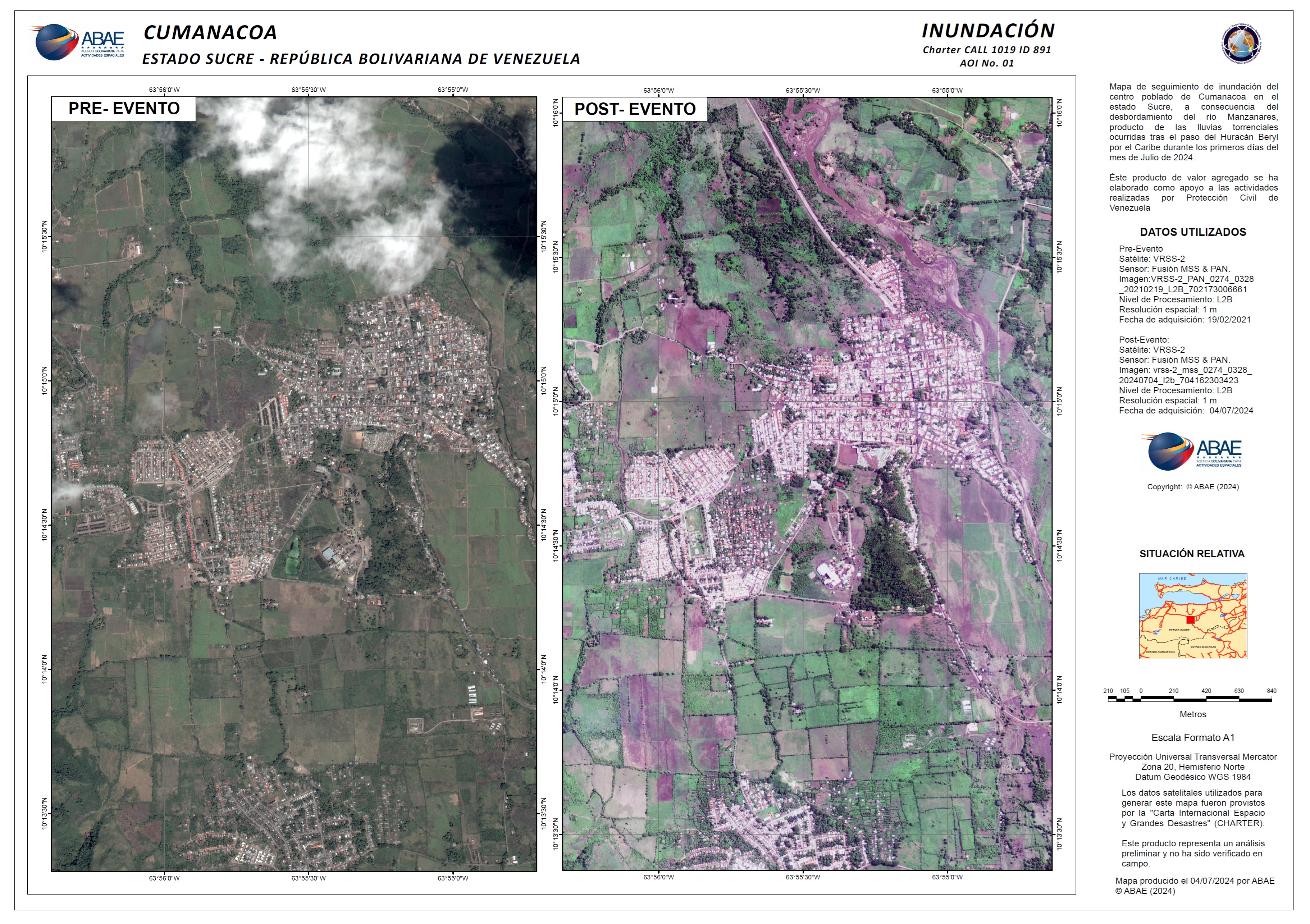
Flooding has occurred in the city of cumanacoa, sucre state due to heavy rainfall as a result of Hurricane Beryl causing the area's Manzanares River to overflow.
So far officials are reporting two deaths, five missing, 25,000 people affected and another 10 areas (barrio blanco, la pomalaca, las trincheras, las fraguas, las tinajitas, avenida antonio josé de sucre, el terrero and guatapanare) badly impacted.
The category 5 hurricane had maximum sustained winds of 270 km per hour as it moved at 35 km per hour across Venezuela and other parts of the Caribbean.
Related Resources:EUMETSAT case study of Hurricane Beryl
| 事件类型: | Flood |
| 事件地点: | Venezuela, Bolivarian Republic Of |
| 启动宪章的日期: | 2024-07-02 |
| 宪章启动时间: | 11:18 |
| 宪章启动时区: | UTC-04:00 |
| 宪章要求者: | Civil Protection of Venezuela |
| 启动ID: | 891 |
| 项目经理: | Dafherlym Briceño (ABAE) |
| act-value-adders: | Bolivarian Agency for space Activities ABAE Natalia Rojas (Bolivarian Agency for space Activities ABAE) Manuel Aguiar (Bolivarian Agency for Space Activities ABAE) Carlos Zerpa (ABAE) |
Products
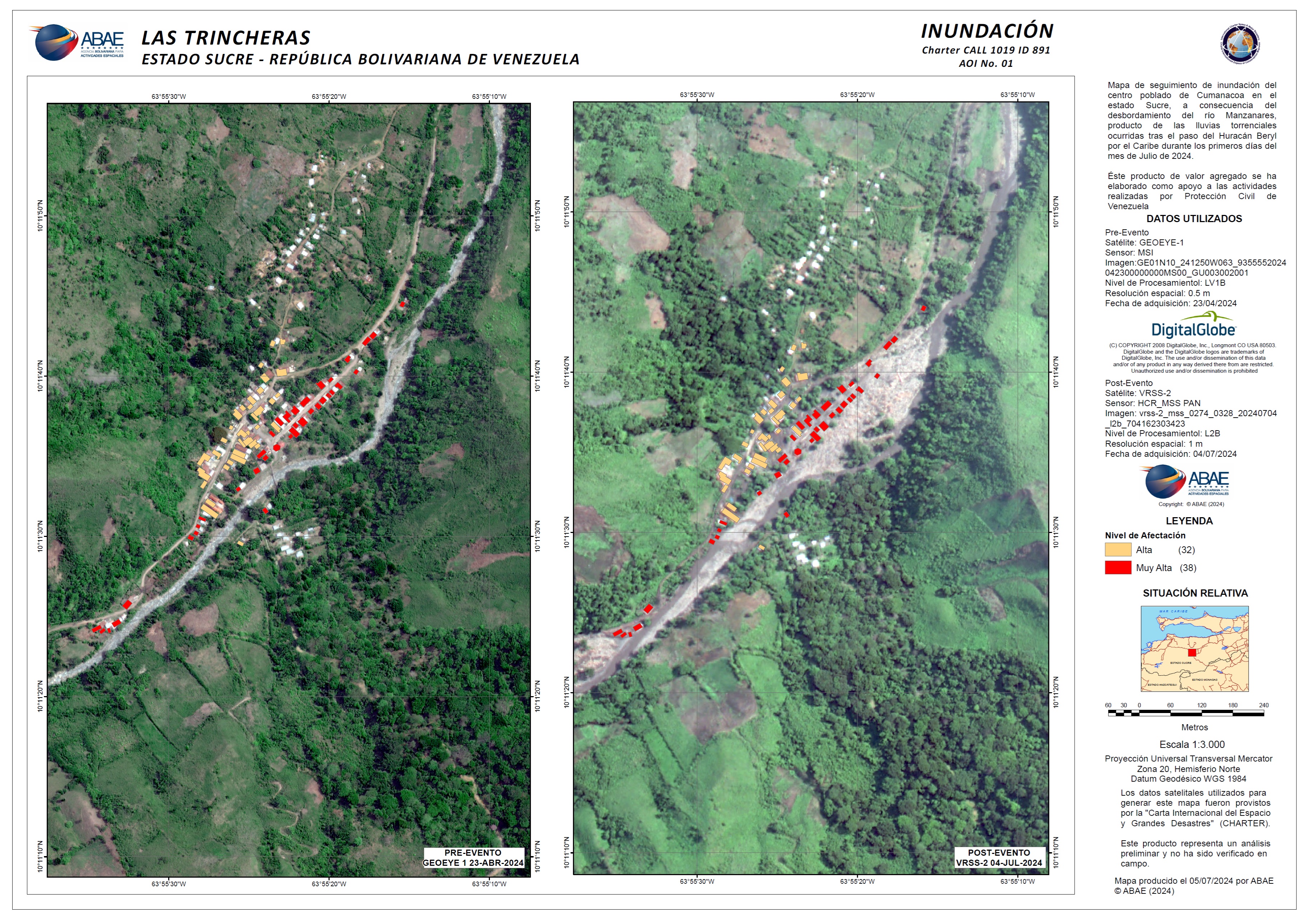
Post-event map of buildings affected by Flood in Las Trincheras, Cumanacoa, Sucre State
版权: GeoEye-1 © 2004 GeoEye NextView License
VRSS-2 © ABAE (2024). All Rights Reserved
Map produced by ABAE
Information about the Product
已获得: GeoEye-1: 23/04/2024
VRSS-2: 04/07/2024
源: GeoEye-1, VRSS-2
类别: Delineation Map
Post-event map of buildings affected by Flood in La Fragua, Cumanacoa, Sucre State
版权: GeoEye-1 © 2004 GeoEye NextView License
VRSS-2 © ABAE (2024). All Rights Reserved
Map produced by ABAE
Information about the Product
已获得: GeoEye: 23/04/2024
VRSS2: 04/07/2024
源: GeoEye-1, VRSS-2
类别: Delineation Map


 返回完整的响应档案

