 English
 Spanish
 French
 Chinese
 Russian
 Portuguese
 Latest Activation
Charter activations
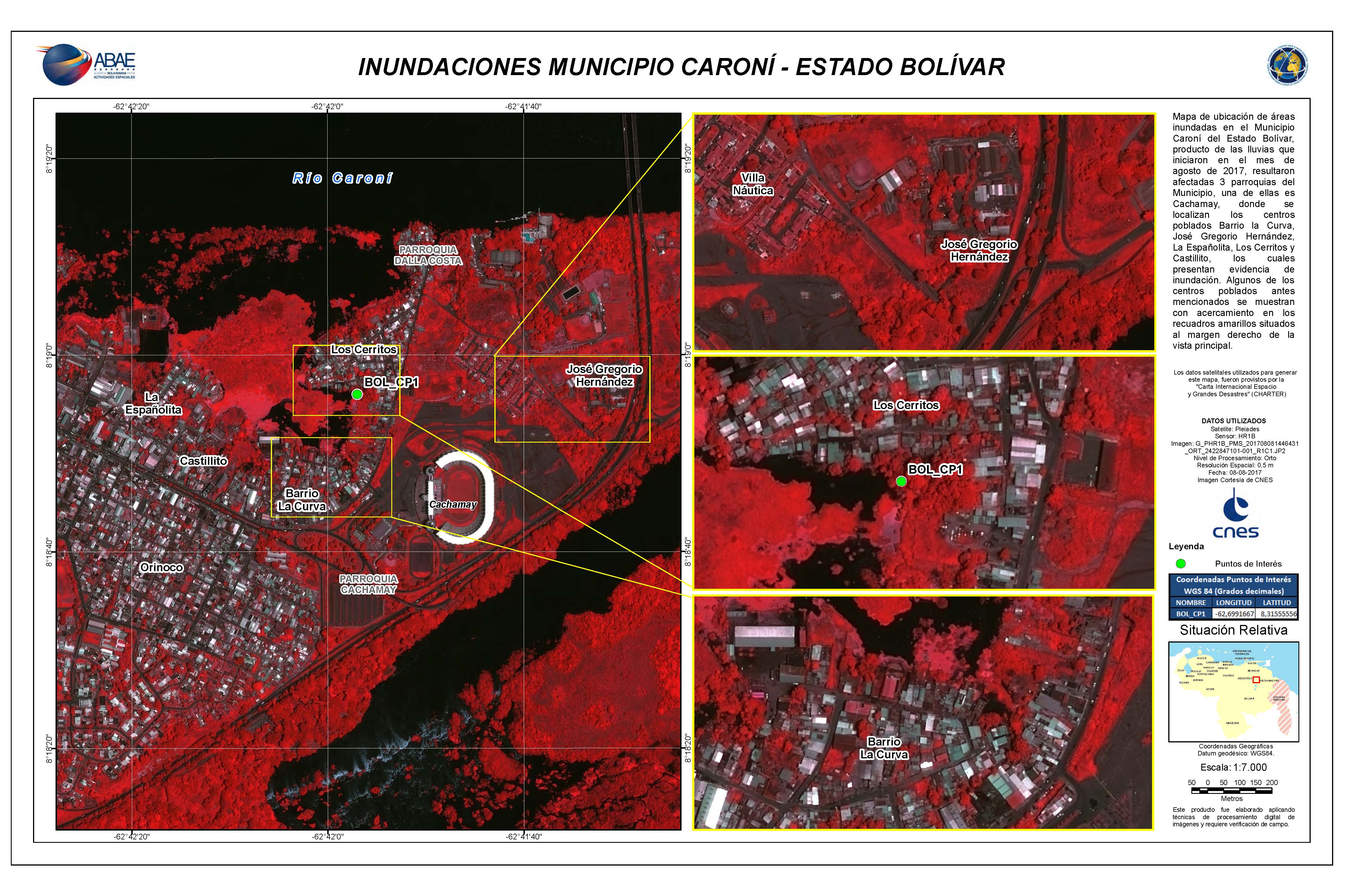
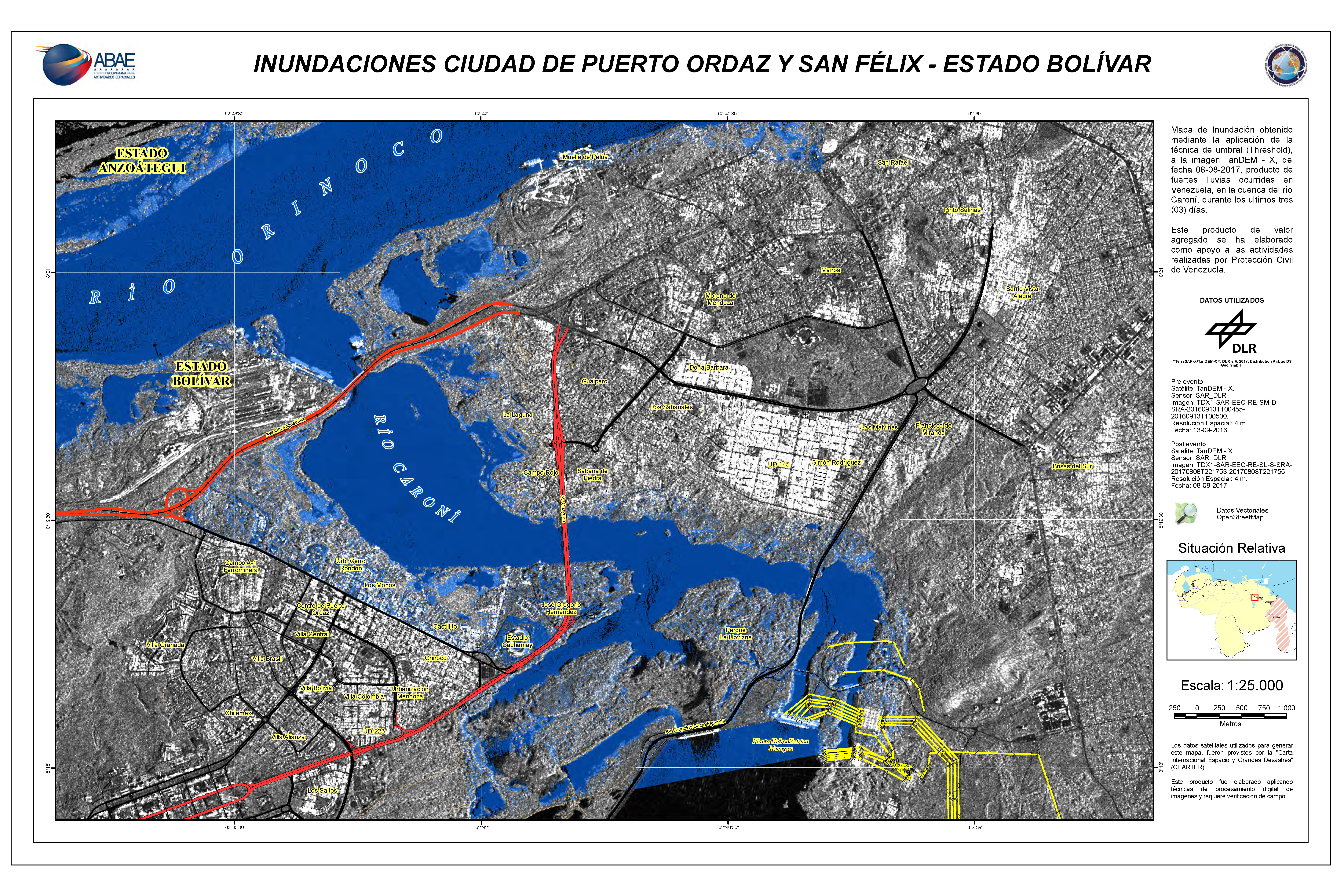
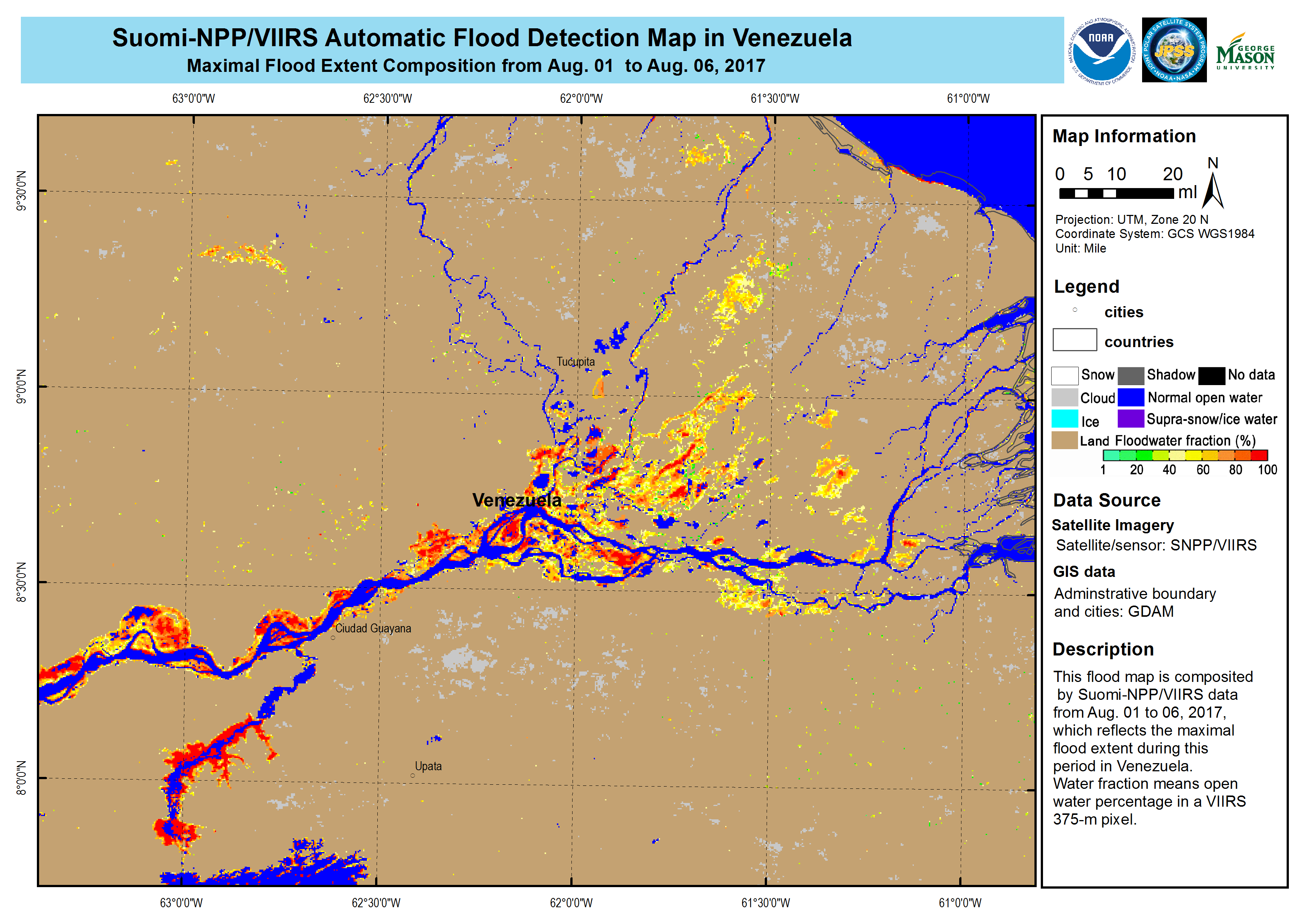
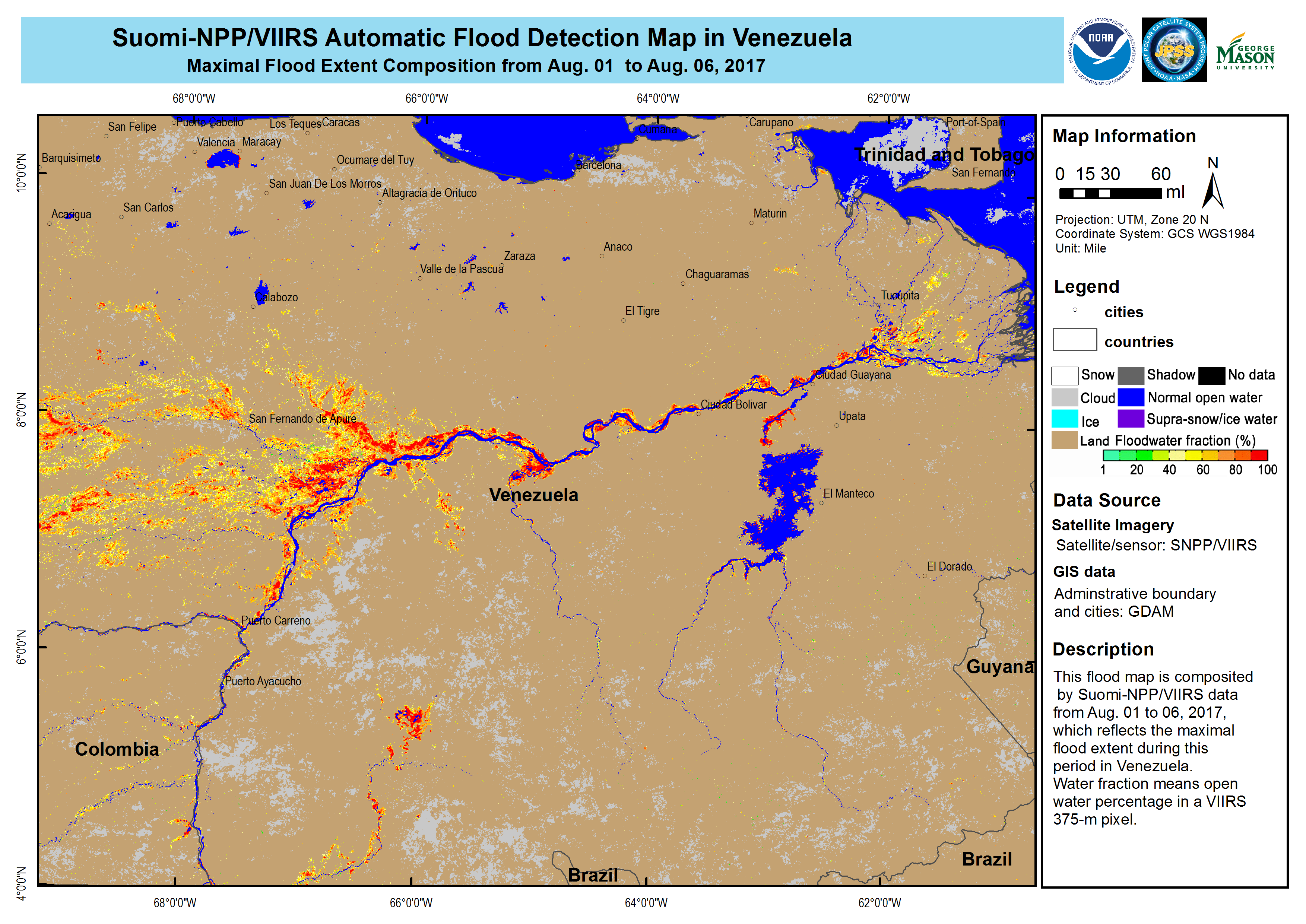
Flood in Venezuela
Heavy rains fell for several days across eastern parts of Venezuela causing widespread flooding.
The floods are affecting an estimated number of 15,000 people and 500 have been forced to evacuate their homes. Largely affected areas are the states of Delta Amacuro, Bolivar and Merida.
The water level in the Orinoco and Caroni River's have risen, causing flooding to nearby residential areas.
The Civil Protection Agency of Venezuela raised alert levels to the highest level and provided support to people in the worst affected areas.
| Type of Event: | Flood |
| Location of Event: | Venezuela |
| Date of Charter Activation: | 6 August 2017 |
| Time of Charter Activation: | 22:04:00 |
| Time zone of Charter Activation: | UTC-04:00 |
| Charter Requestor: | ABAE on behalf of Civil Protection of Venezuela |
| Activation ID: | 541 |
| Project Management: | ABAE |
Products
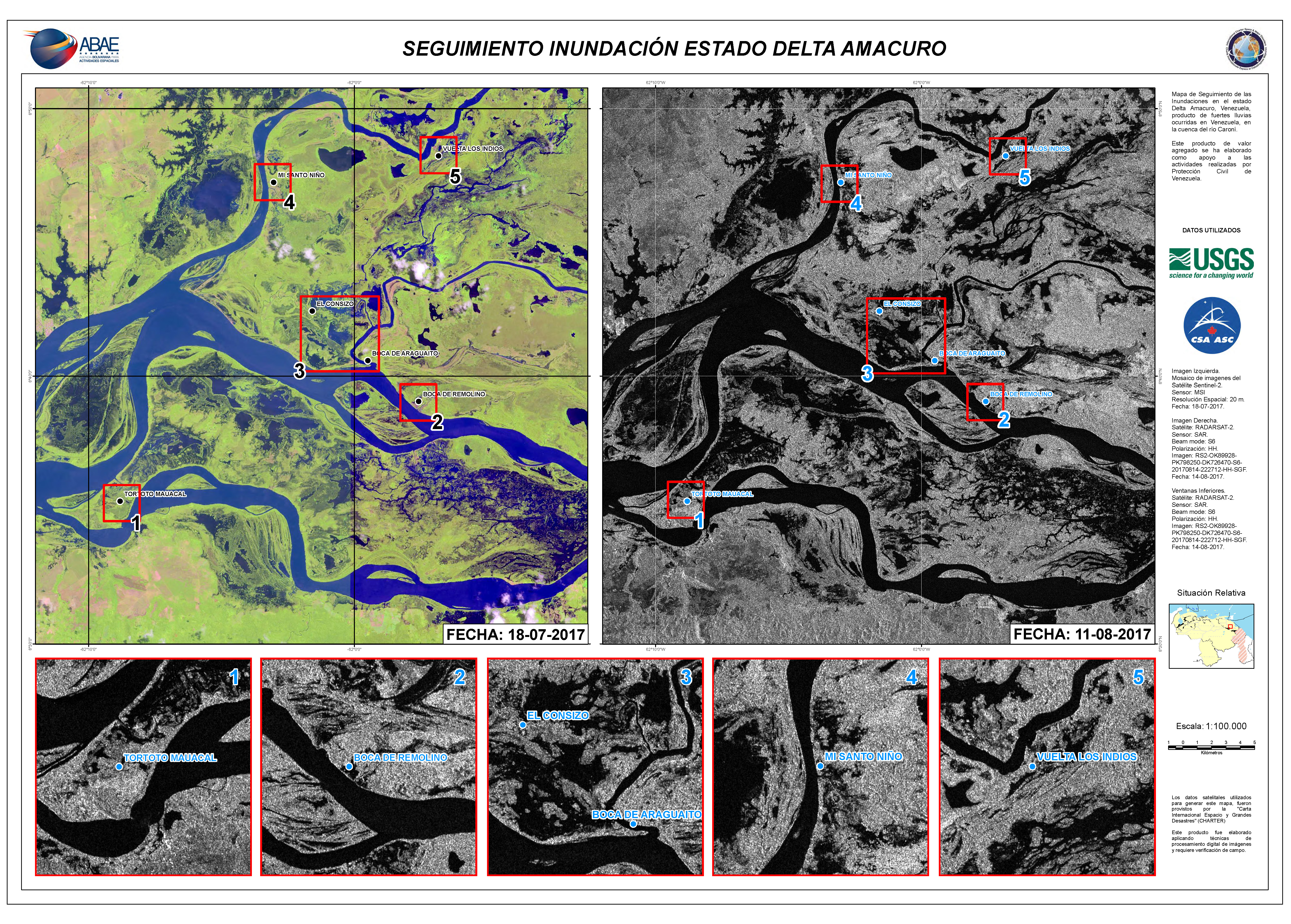
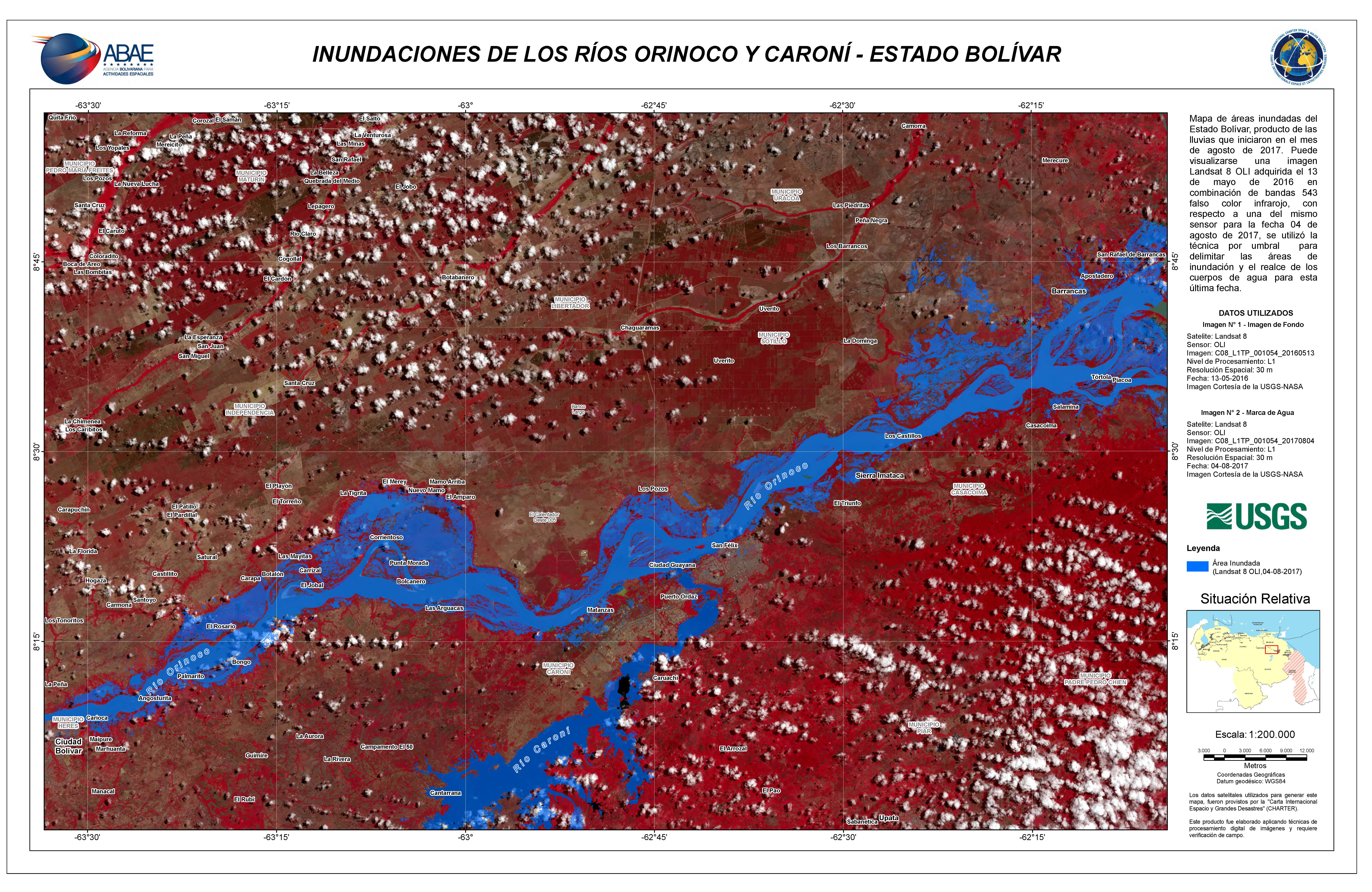
Flooding in Delta Amacuro State
Copyright: RADARSAT-2 Data and Products © MacDonald, Dettwiler and Associates Ltd. (2017) - All Rights Reserved. RADARSAT is an official trademark of the Canadian Space Agency.
Sentinel-2 © Copernicus Sentinel data (2017)
Map produced by ABAE
Information about the Product
Acquired: Sentinel-2: 18/07/2017
RADARSAT-2: 11/08/2017
Source: Sentinel-2 / RADARSAT-2
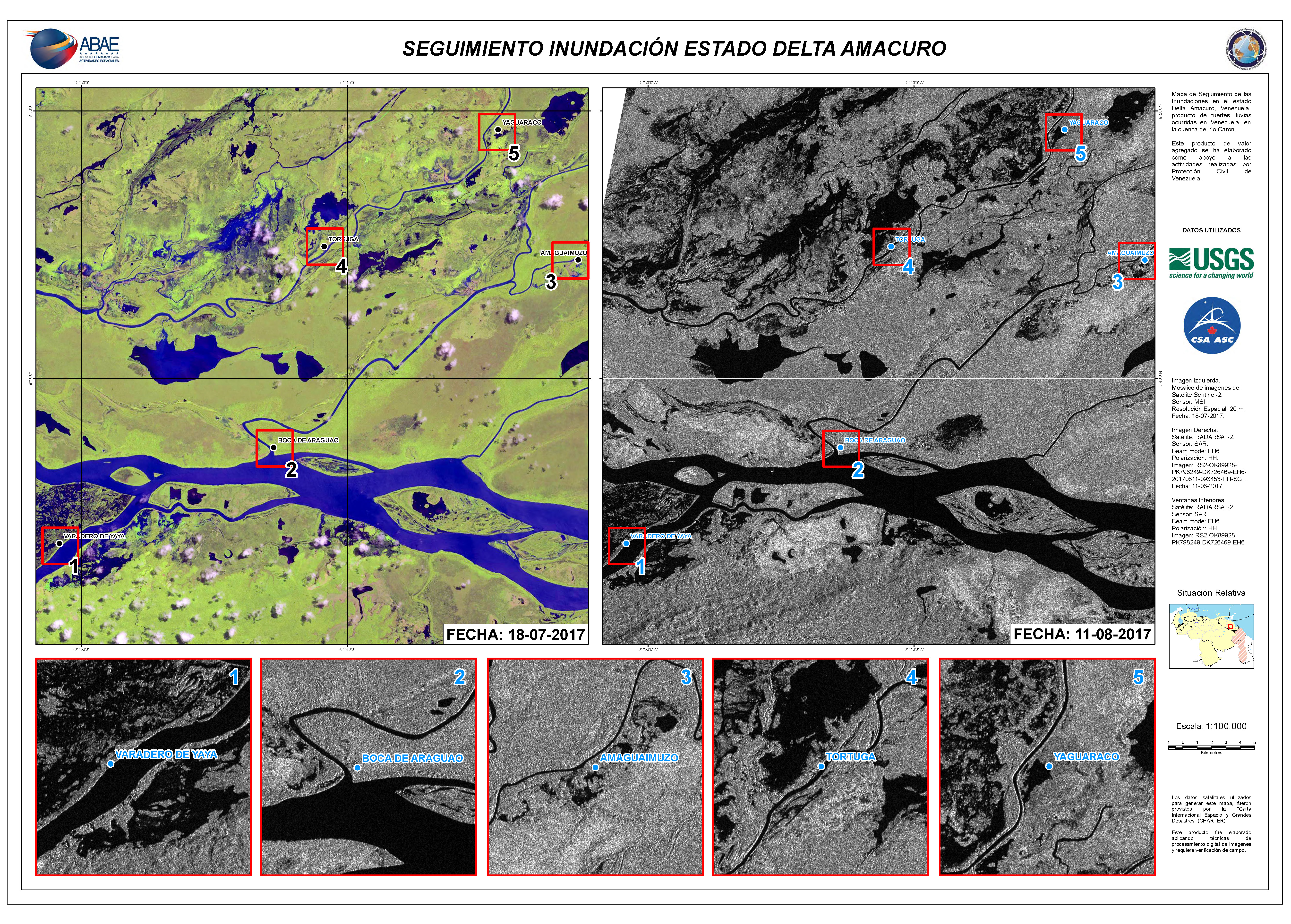
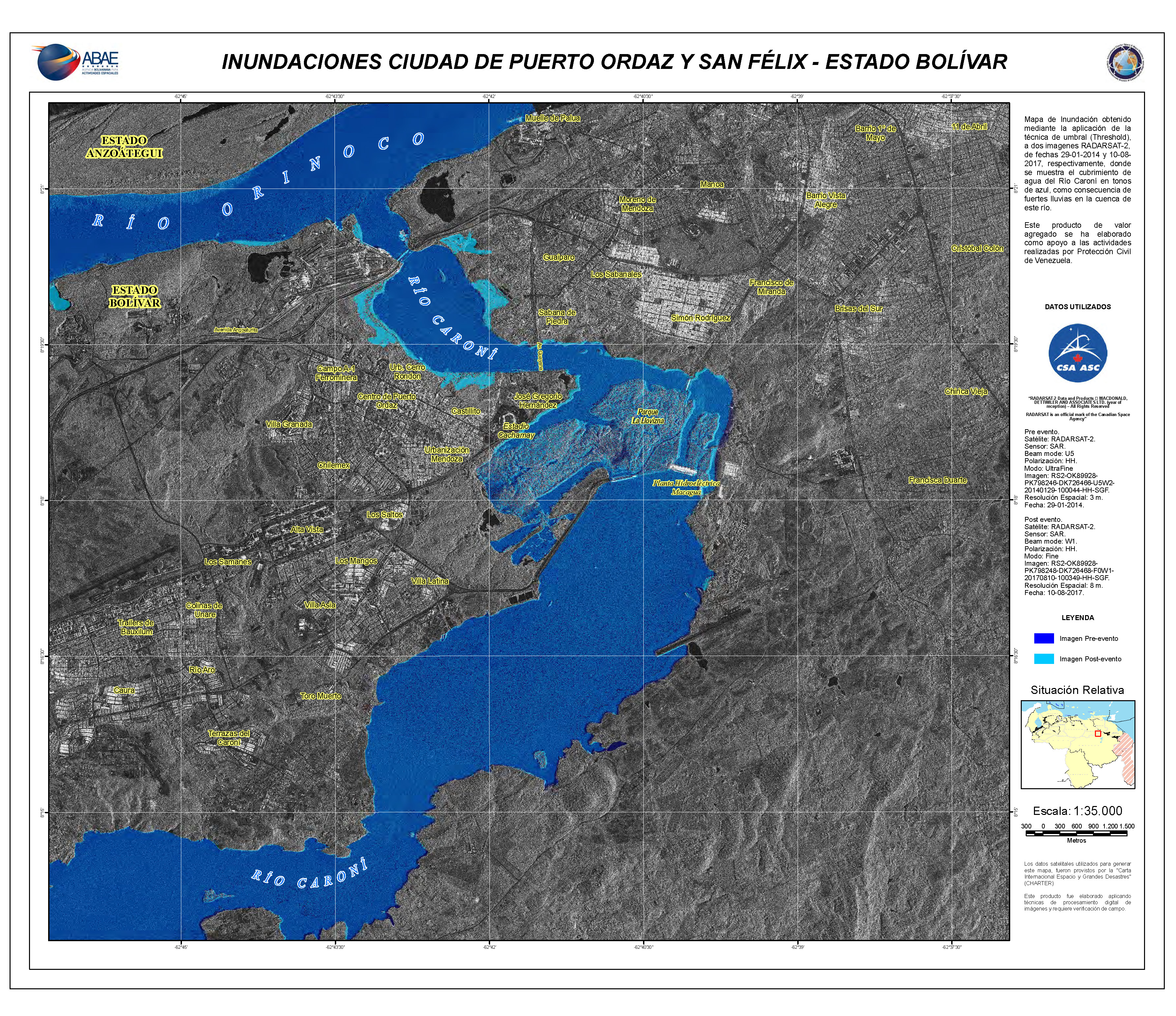
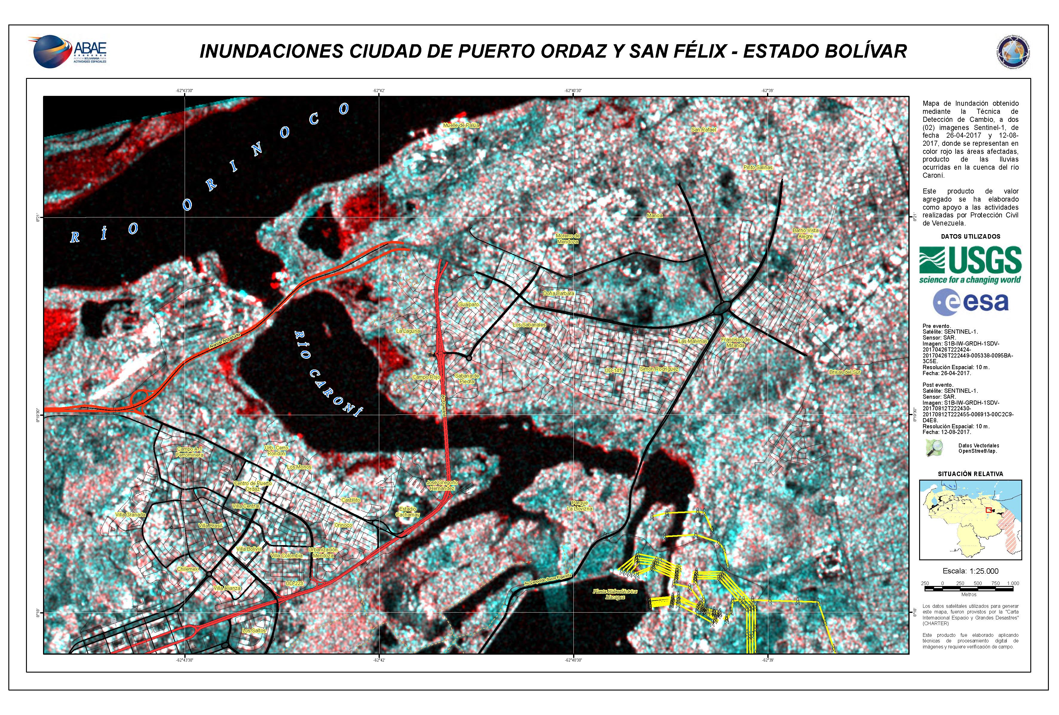
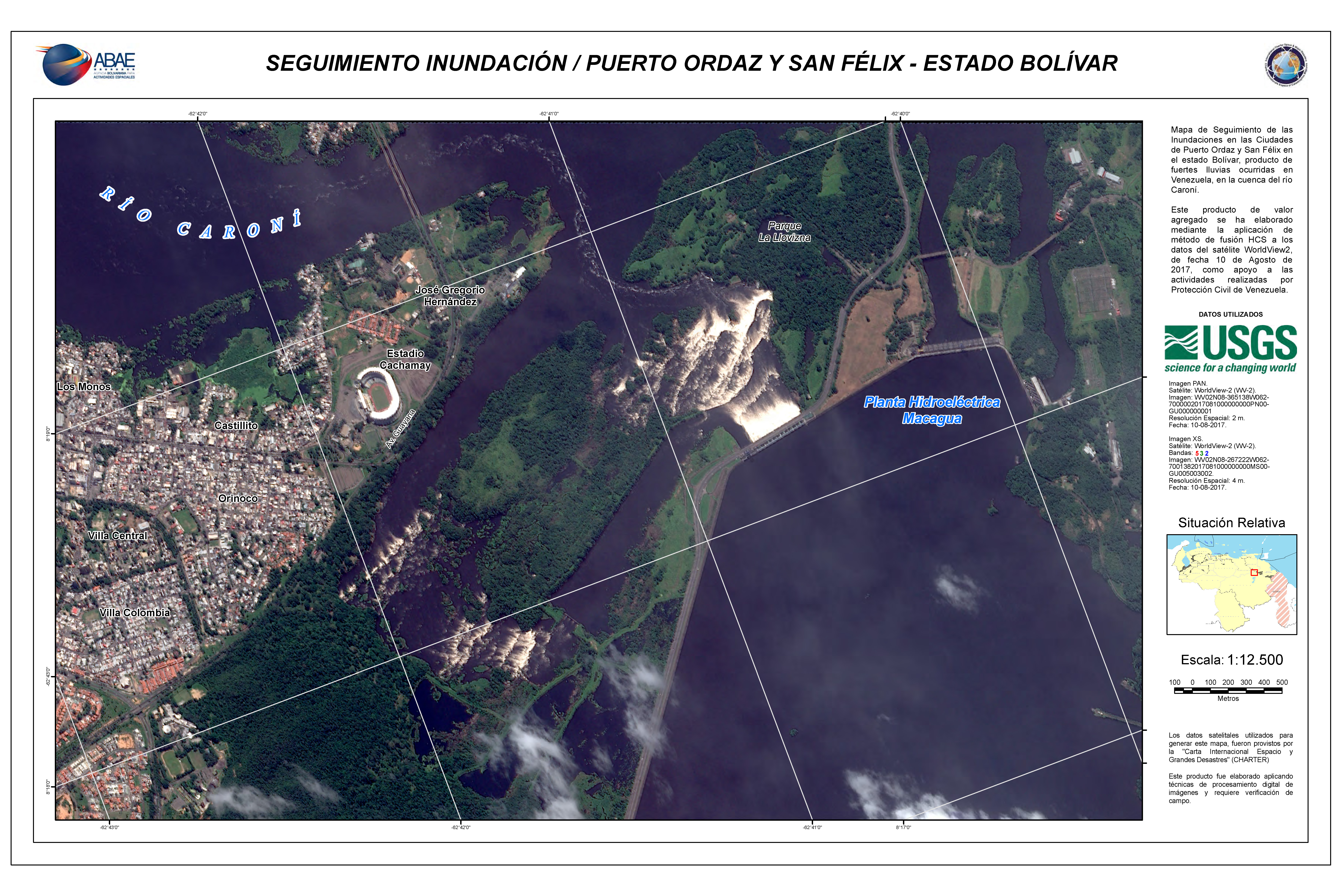
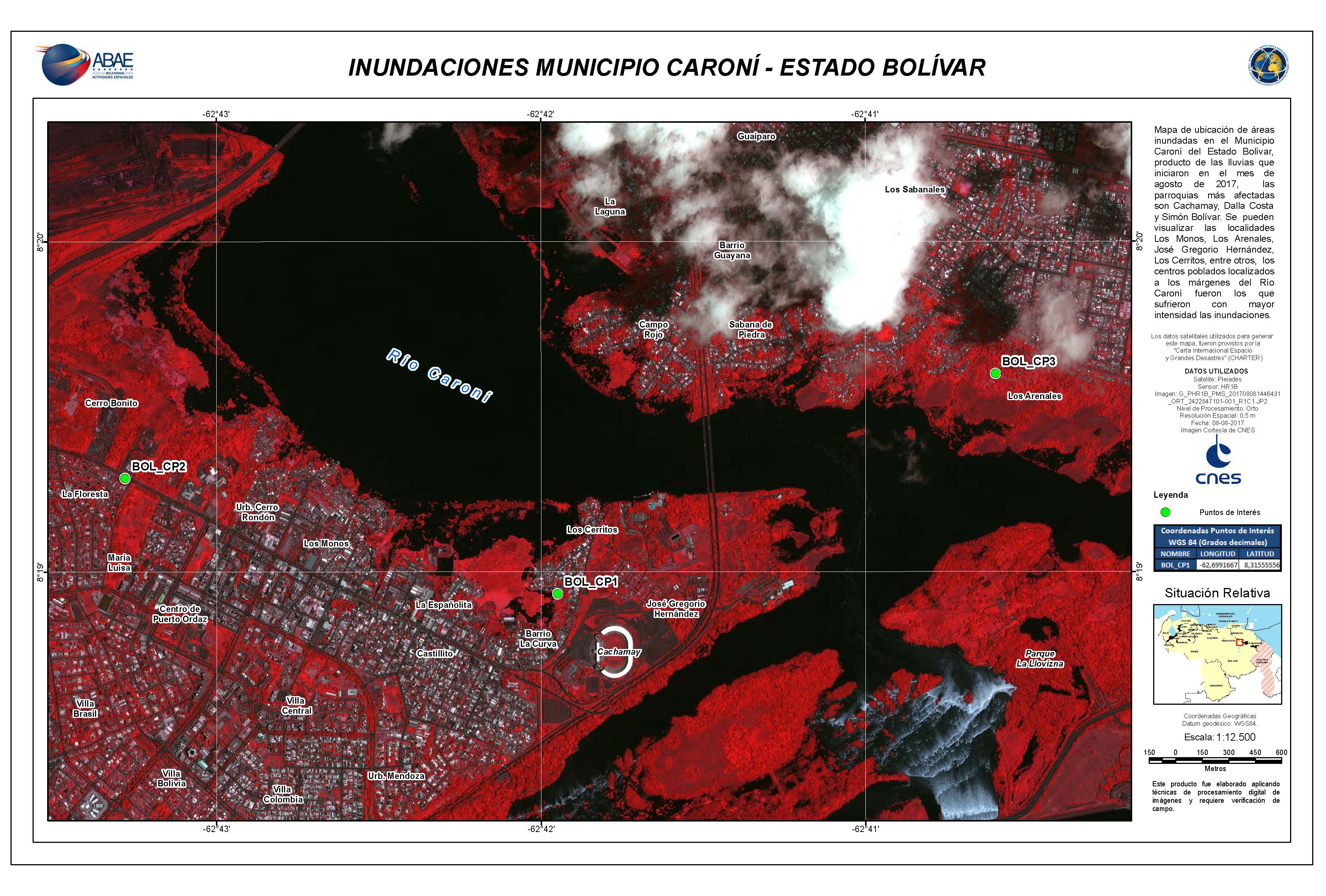
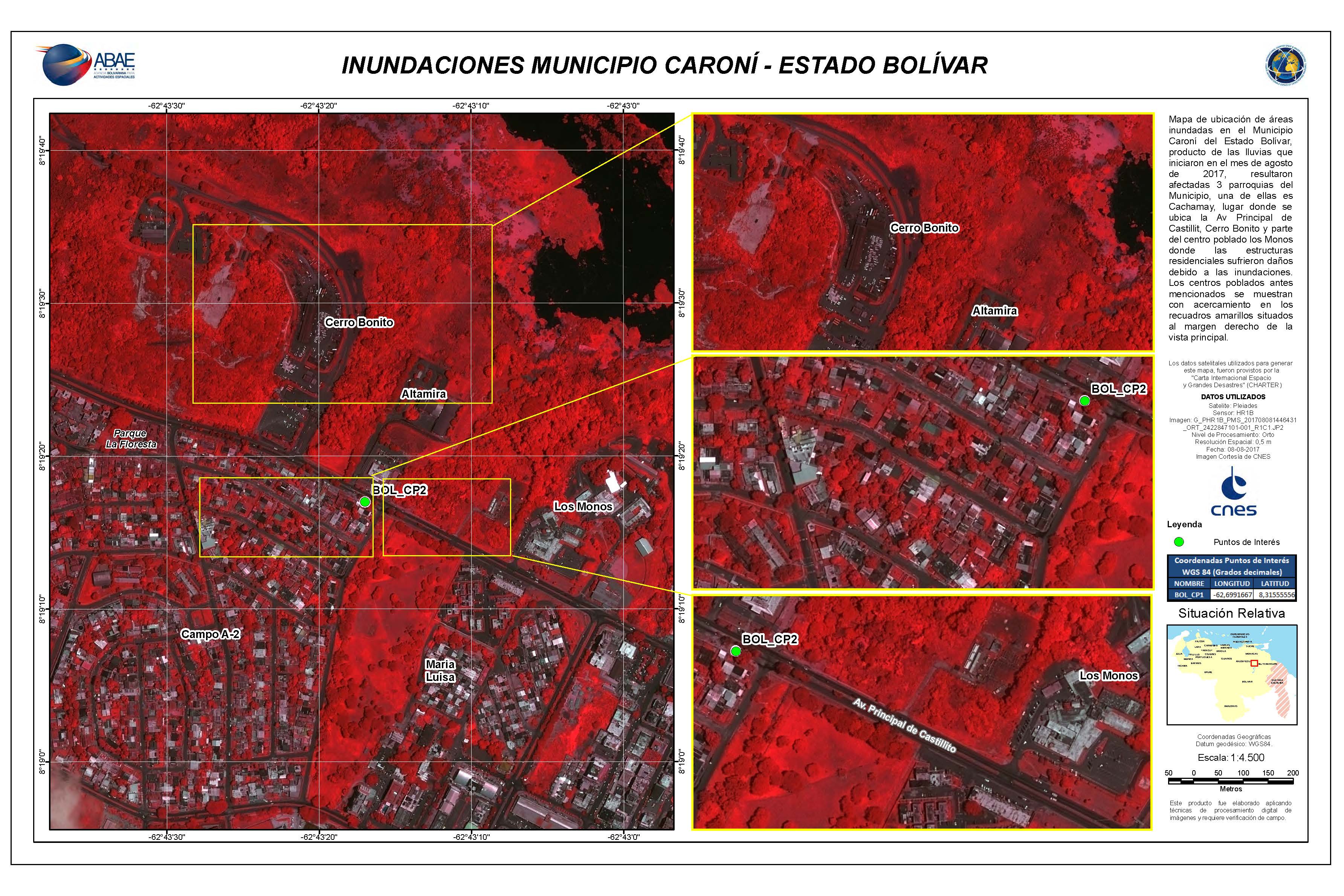
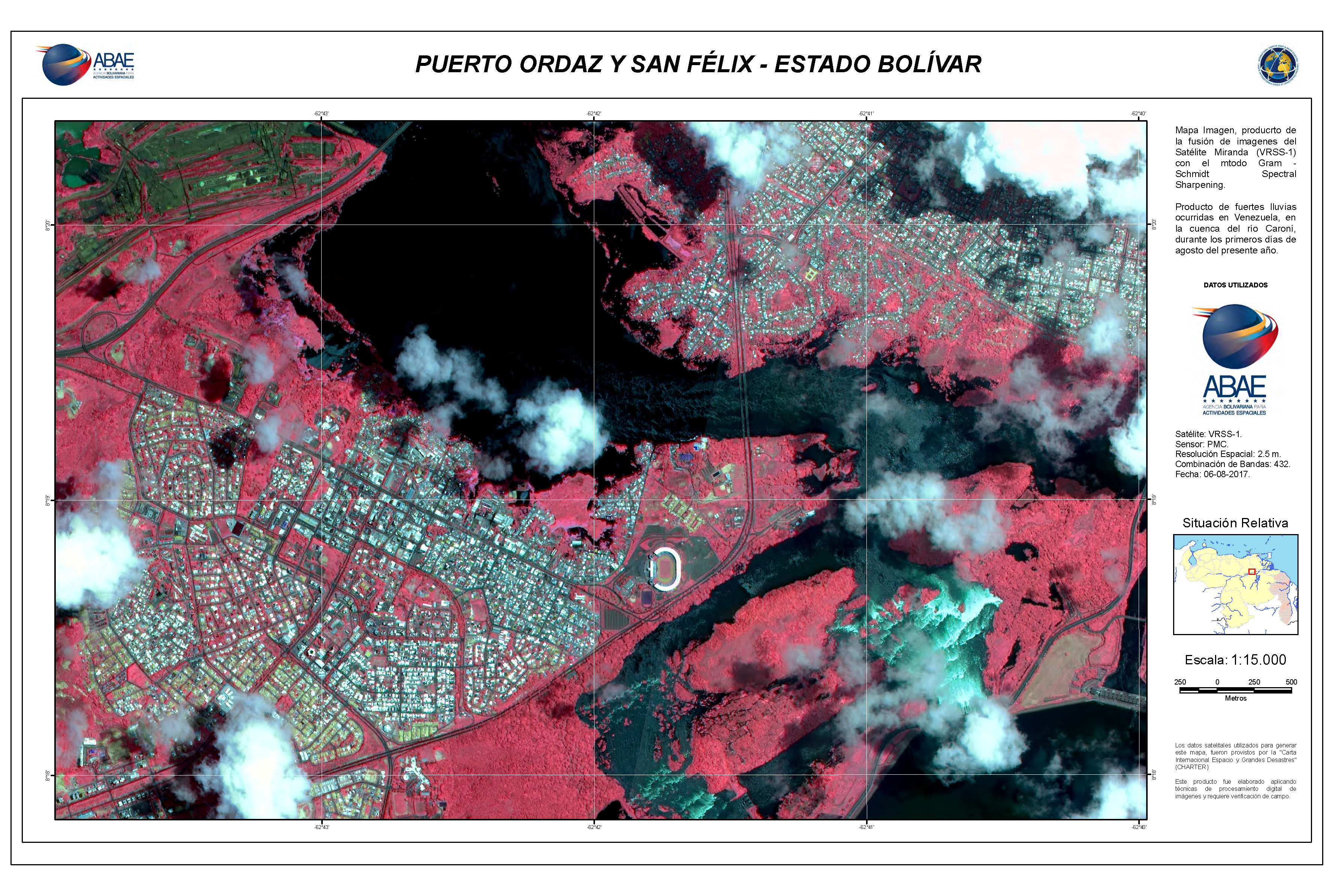
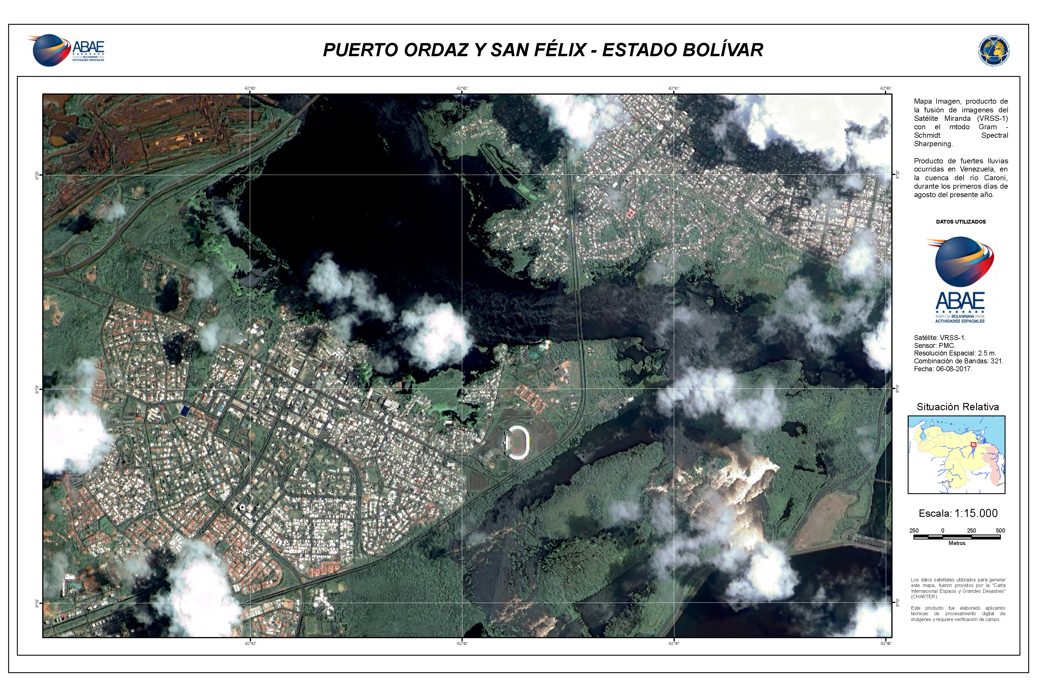
Flooding in Puerto Ordaz and San Felix, Bolivar State
Copyright: RADARSAT-2 Data and Products © MacDonald, Dettwiler and Associates Ltd. (2017) - All Rights Reserved. RADARSAT is an official trademark of the Canadian Space Agency.
Map produced by ABAE
Information about the Product
Acquired: Pre-disaster: 29/01/2014
Post-disaster: 10/08/2017
Source: RADARSAT-2


 Back to the full activation archive

