 English
 Spanish
 French
 Chinese
 Russian
 Portuguese
 最新宪章启动
Charter activations
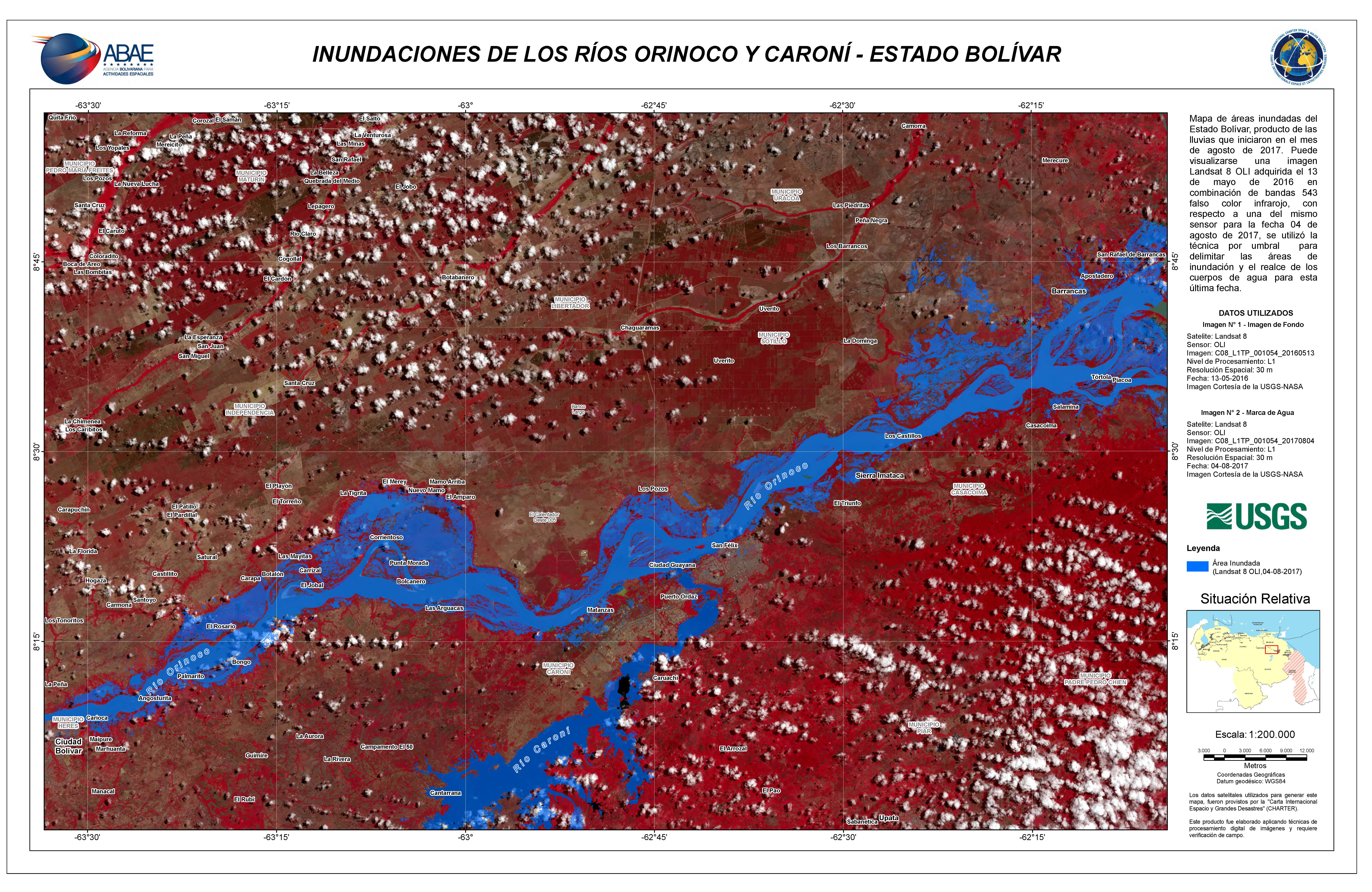
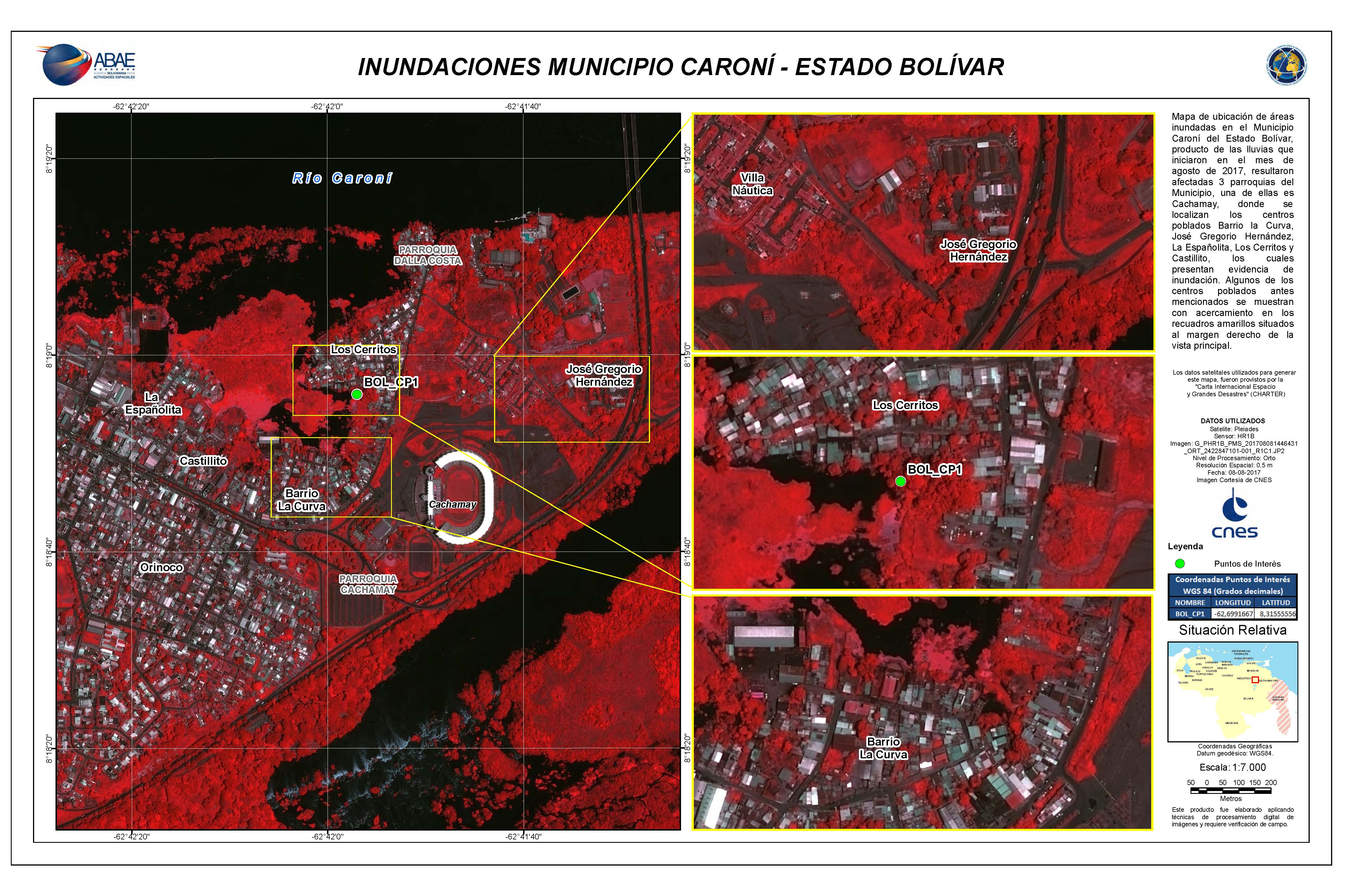
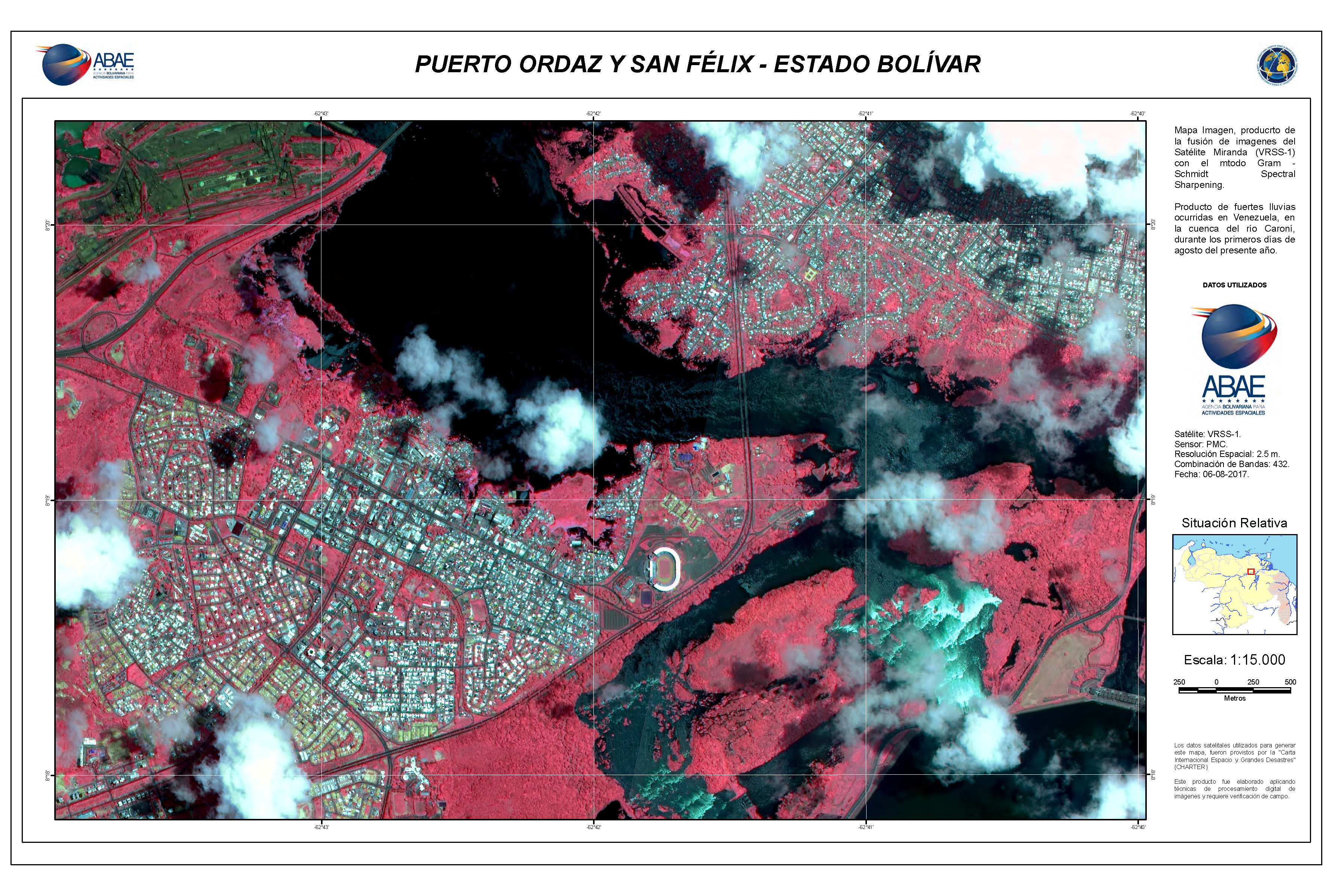
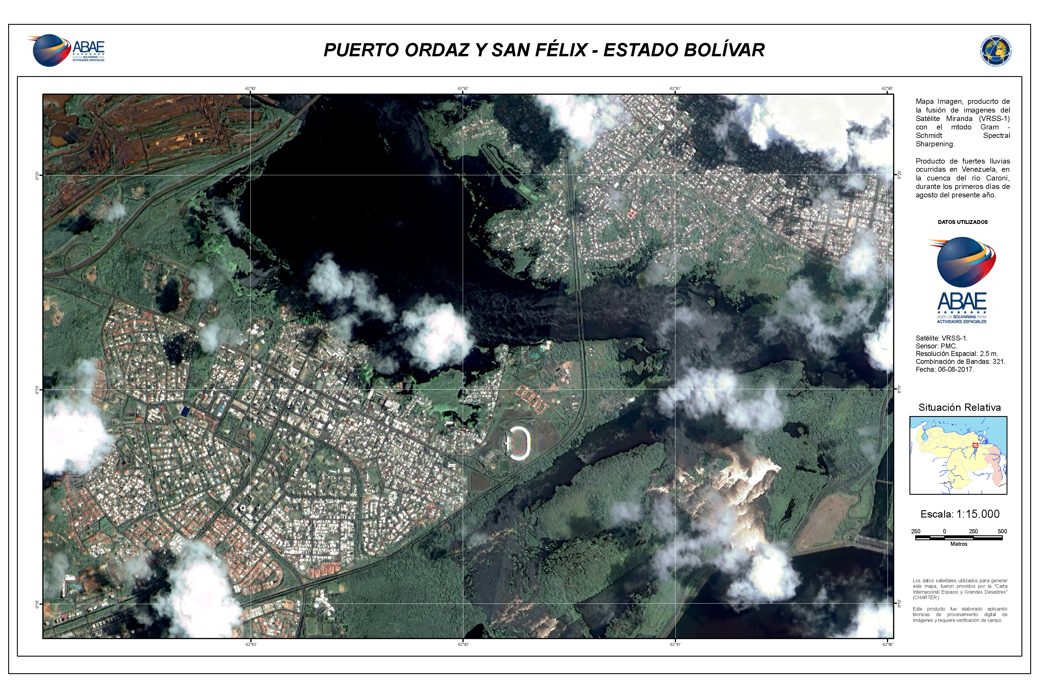
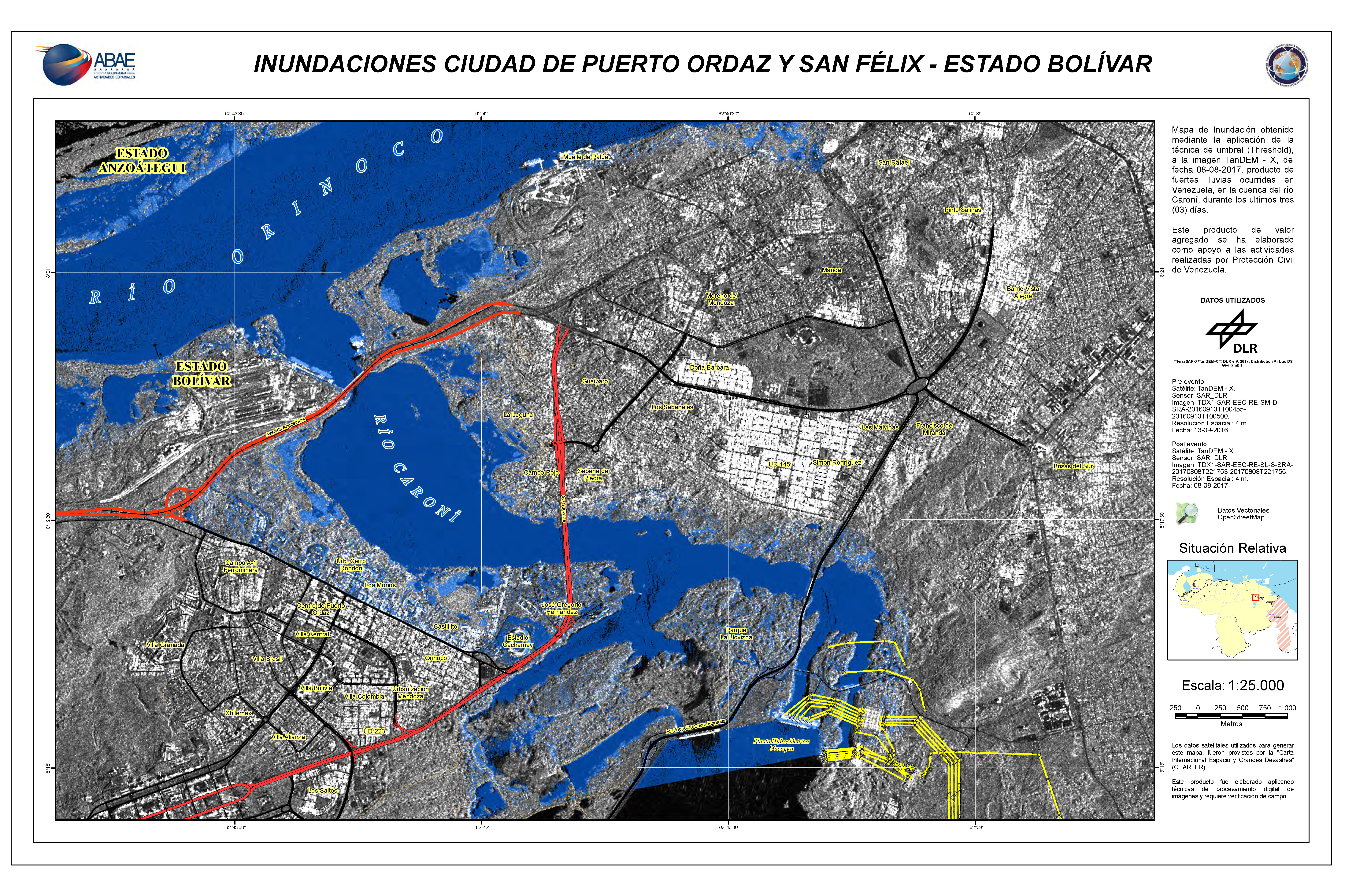
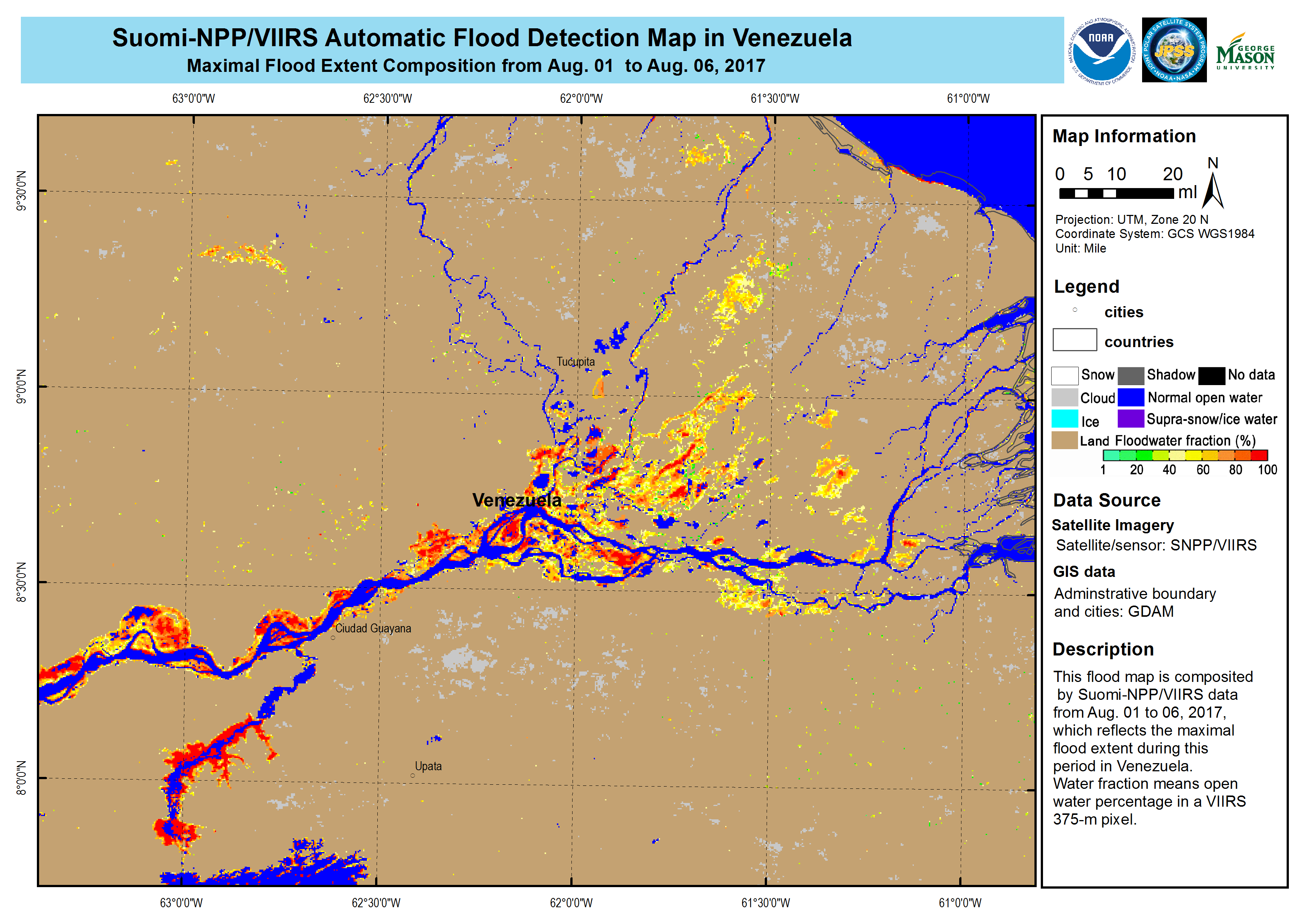
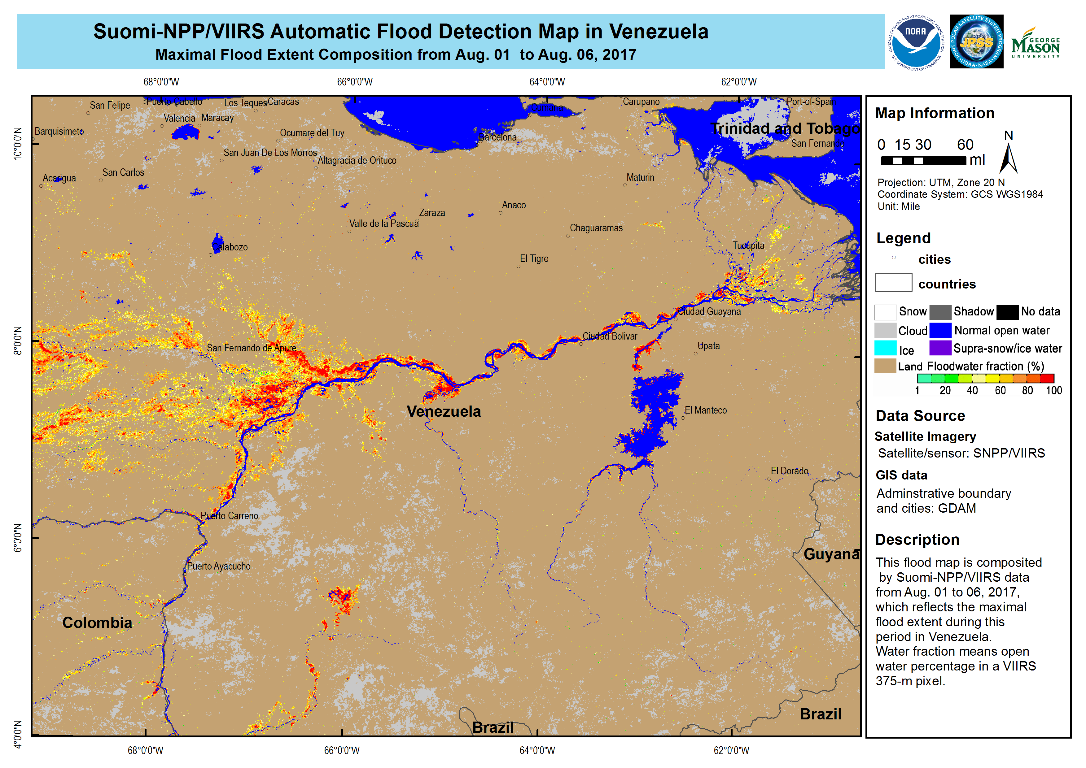
Flood in Venezuela
委内瑞拉东部连日来屡降暴雨,造成了洪水泛滥。
这场洪水正在导致大约1.5万人遭受影响,有500人被迫撤离家园。受灾较为严重的地区是阿马库罗三角洲州、玻利瓦尔州和梅里达州。
奥里诺科河和卡罗尼河的水位已经上涨,造成附近居民区洪涝灾害。
委内瑞拉国家民防局将警戒水平提高至最高水平,并为受灾最严重地区的人民提供了支持。
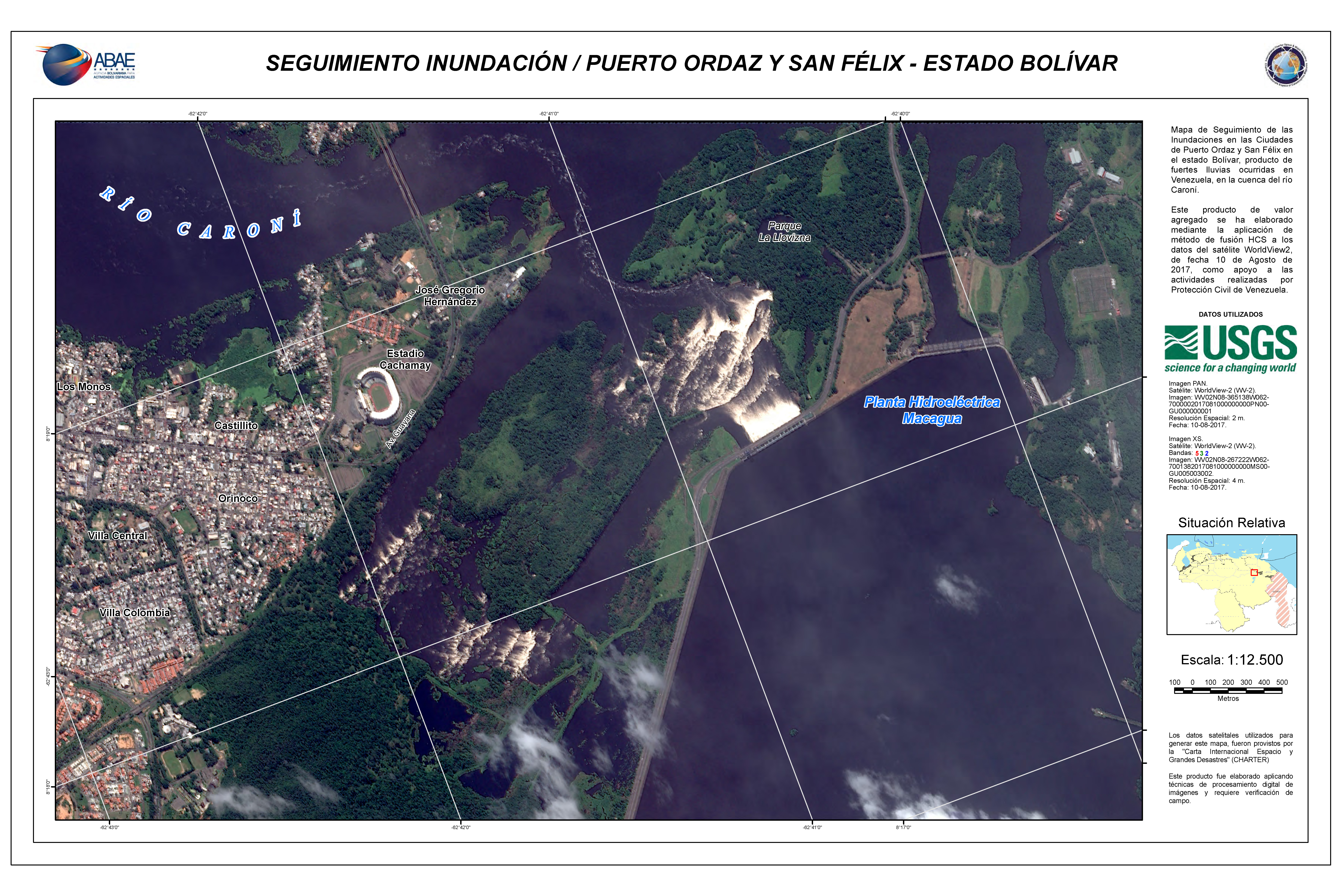
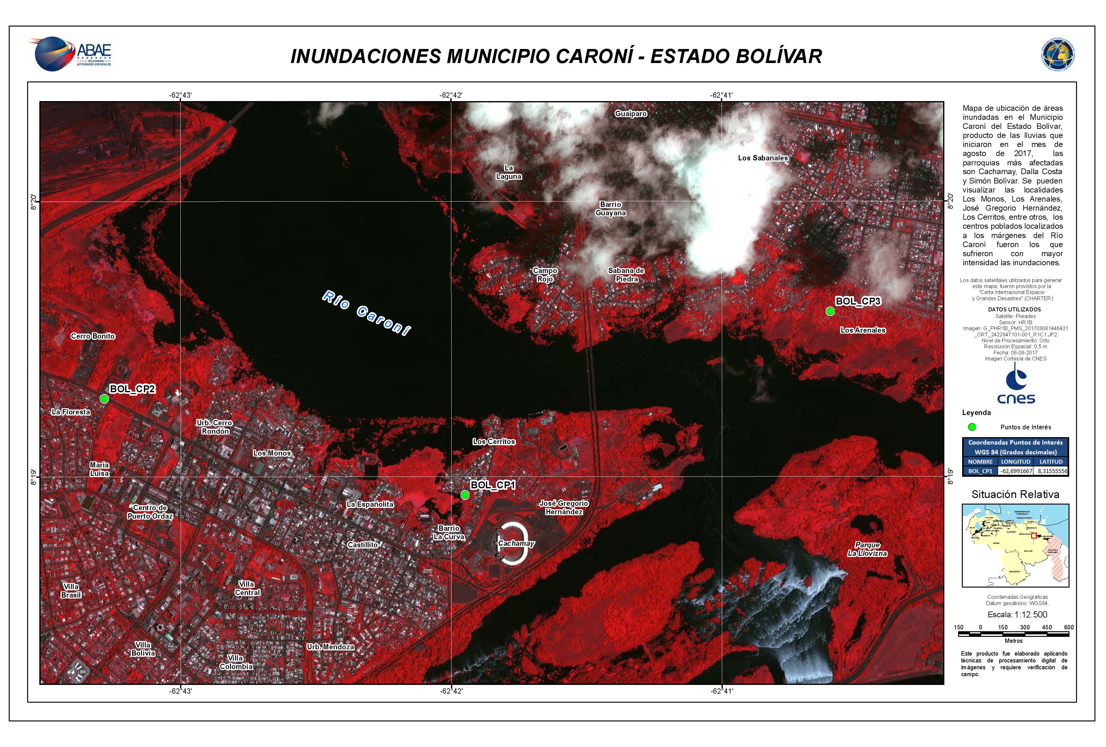
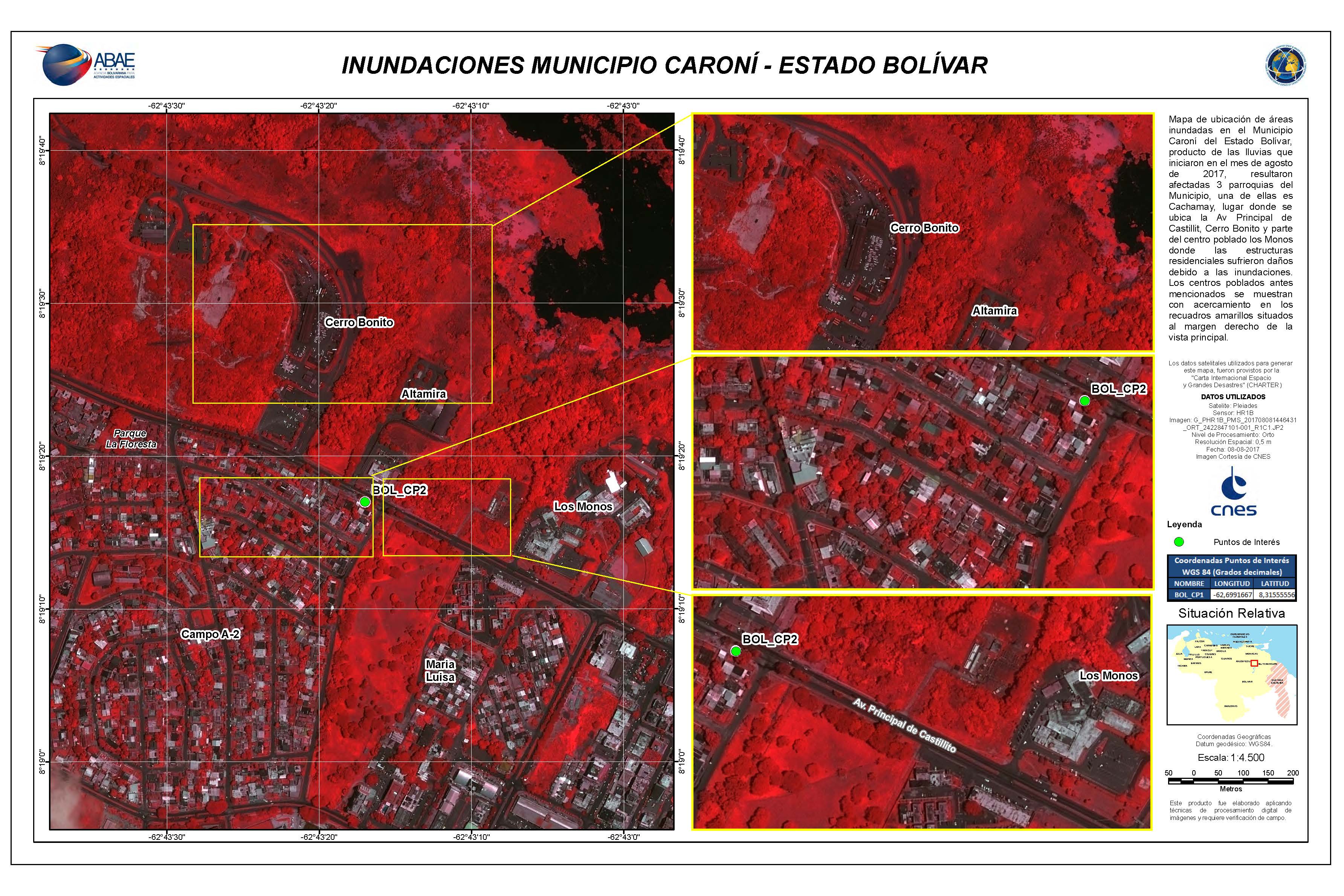
奥尔达斯港和圣费利克斯、玻利瓦尔州洪水泛滥。
| 事件类型: | 洪水 |
| 事件地点: | 委内瑞拉 |
| 启动宪章的日期: | 2017年8月6日 |
| 宪章启动时间: | 22:04:00 |
| 宪章启动时区: | UTC-04:00 |
| 宪章要求者: | 玻利瓦尔空间活动机构(ABAE)代表委内瑞拉民事防护部门 |
| 启动ID: | 541 |
| 项目经理: | ABAE(玻利瓦尔空间活动机构) |
Products
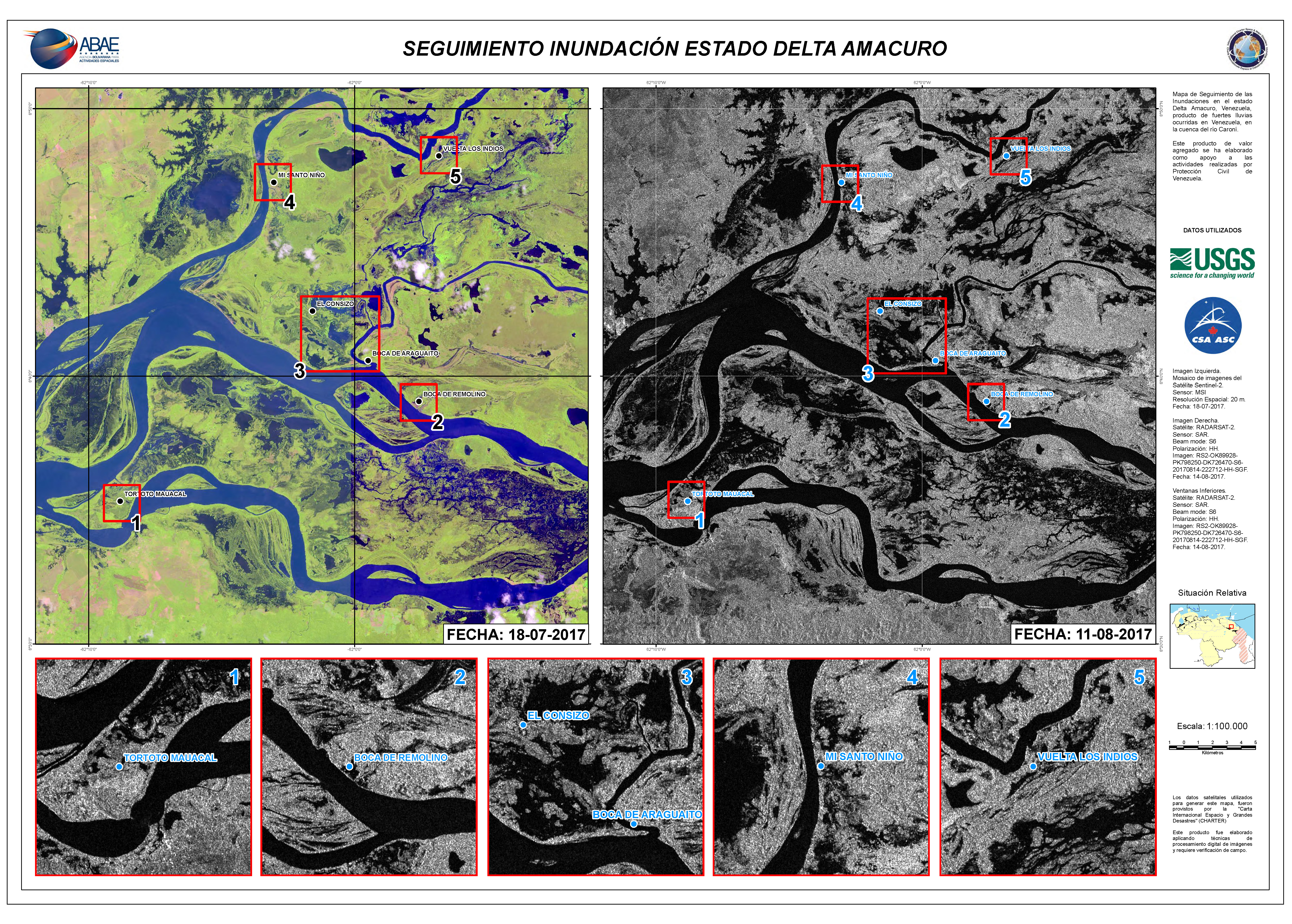
Flooding in Delta Amacuro State
版权: RADARSAT-2 Data and Products © MacDonald, Dettwiler and Associates Ltd. (2017) - All Rights Reserved. RADARSAT is an official trademark of the Canadian Space Agency.
Sentinel-2 © Copernicus Sentinel data (2017)
Map produced by ABAE
Information about the Product
已获得: Sentinel-2: 18/07/2017
RADARSAT-2: 11/08/2017
源: Sentinel-2 / RADARSAT-2
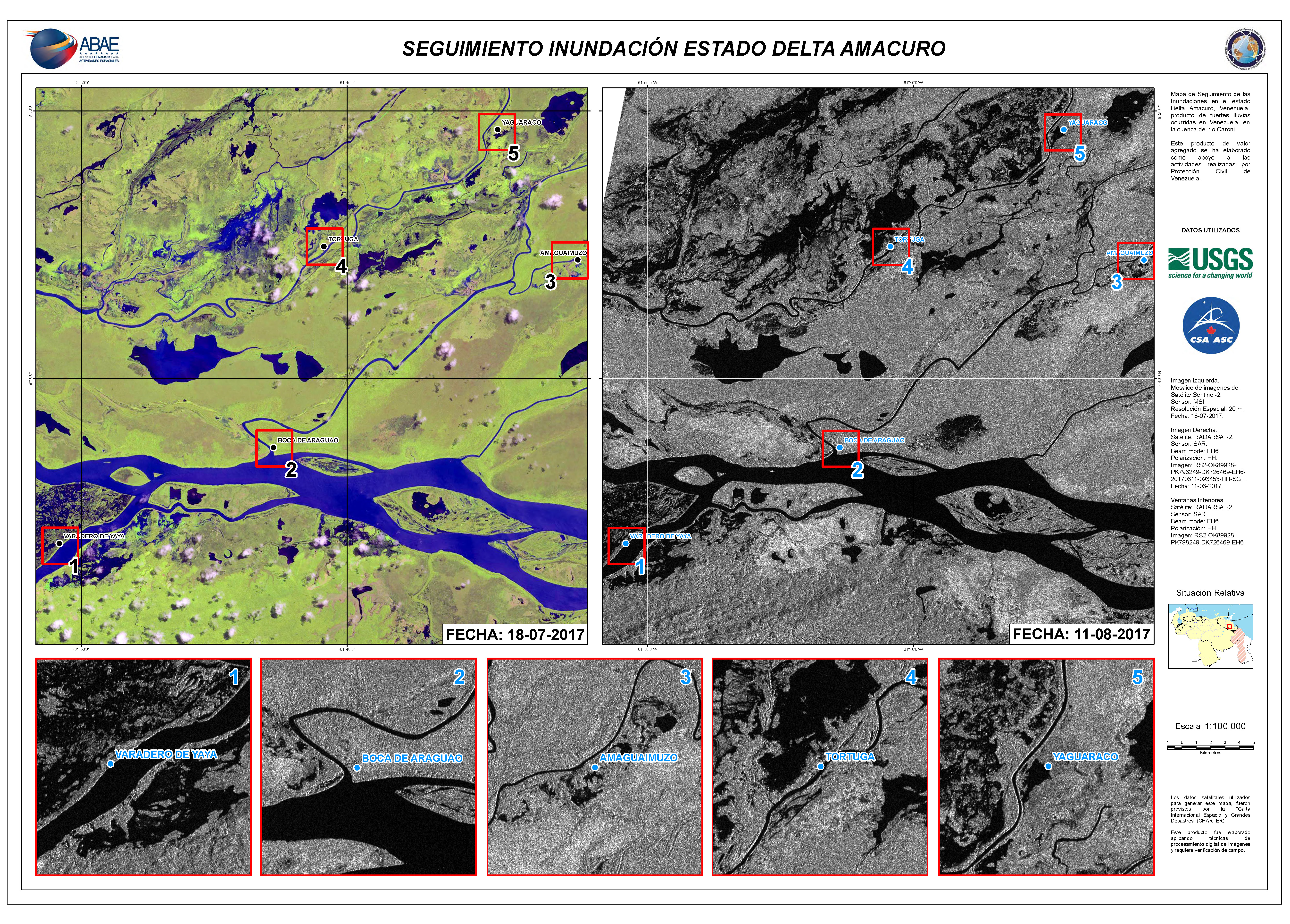
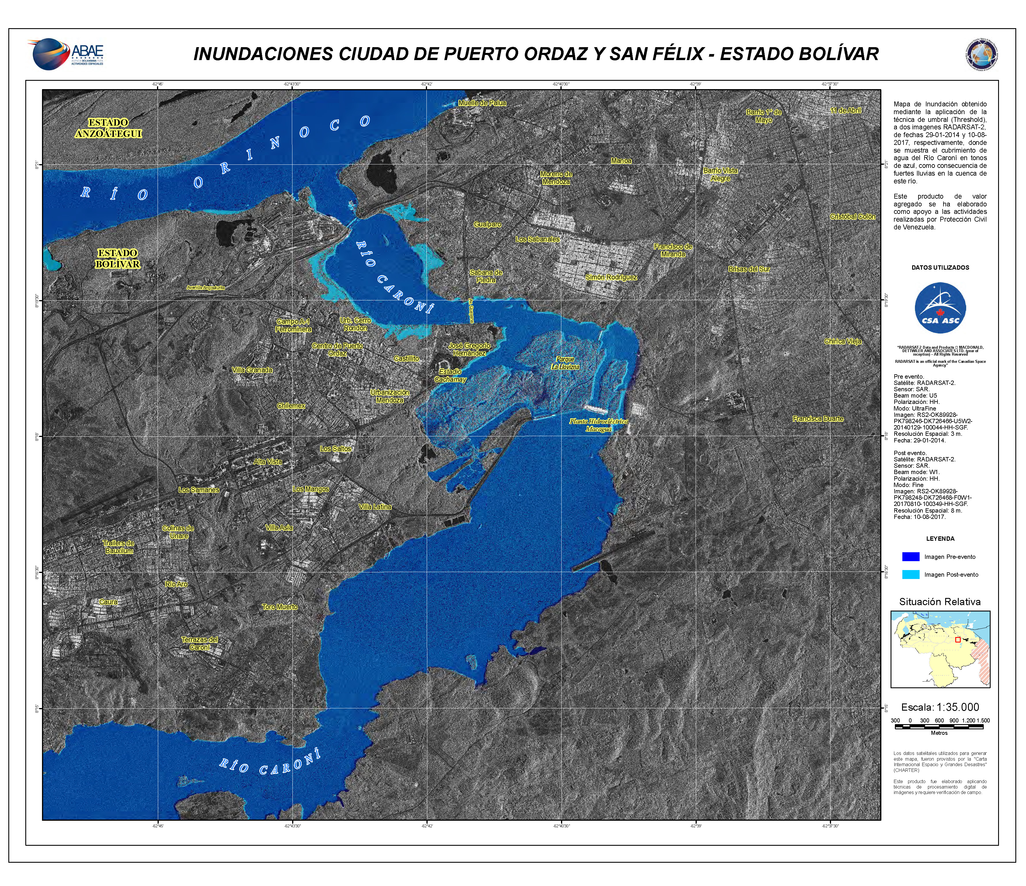
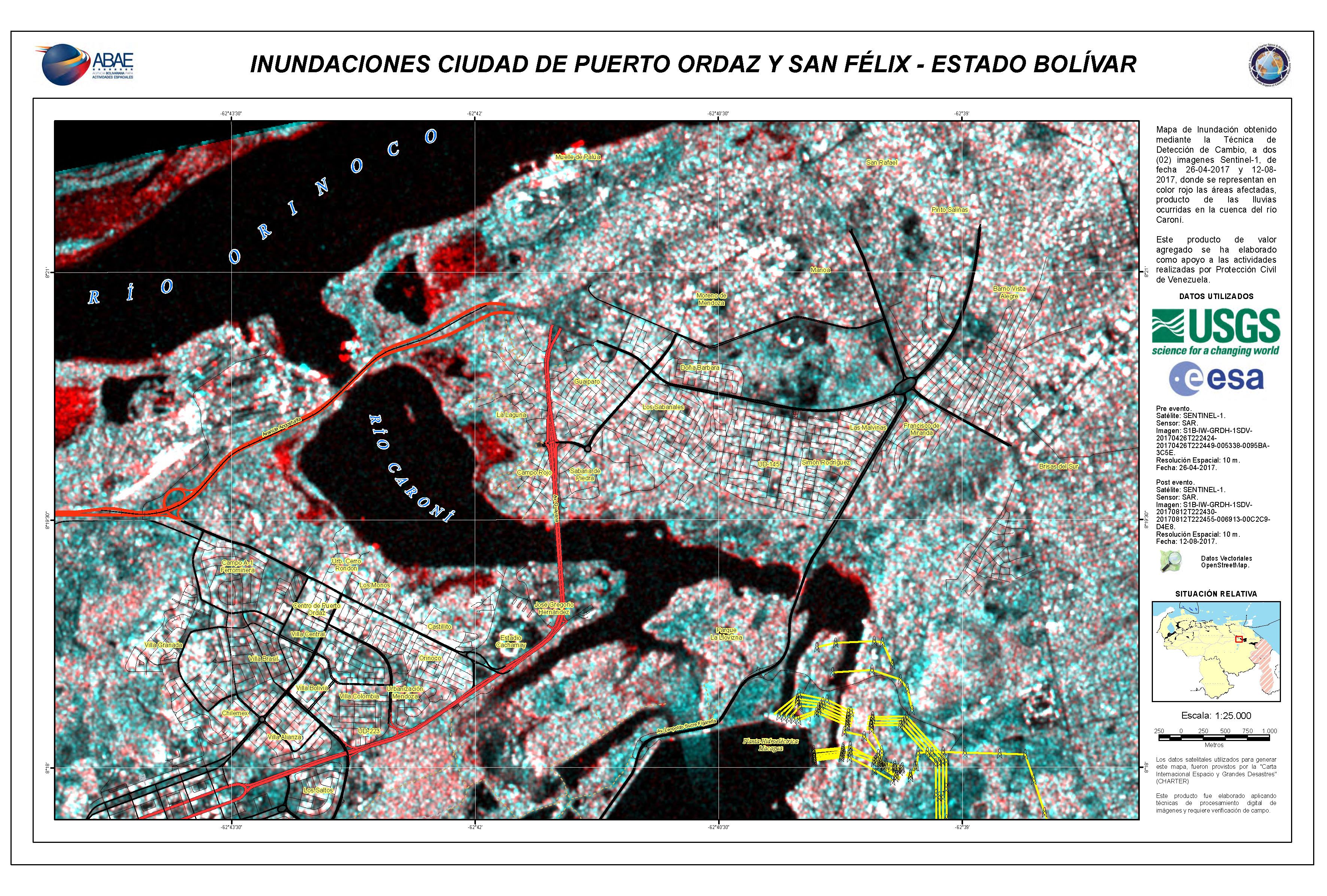
Flooding in Puerto Ordaz and San Felix, Bolivar State
版权: RADARSAT-2 Data and Products © MacDonald, Dettwiler and Associates Ltd. (2017) - All Rights Reserved. RADARSAT is an official trademark of the Canadian Space Agency.
Map produced by ABAE
Information about the Product
已获得: Pre-disaster: 29/01/2014
Post-disaster: 10/08/2017
源: RADARSAT-2


 返回完整的响应档案

