 English
 Spanish
 French
 Chinese
 Russian
 Portuguese
 最新宪章启动
Charter activations
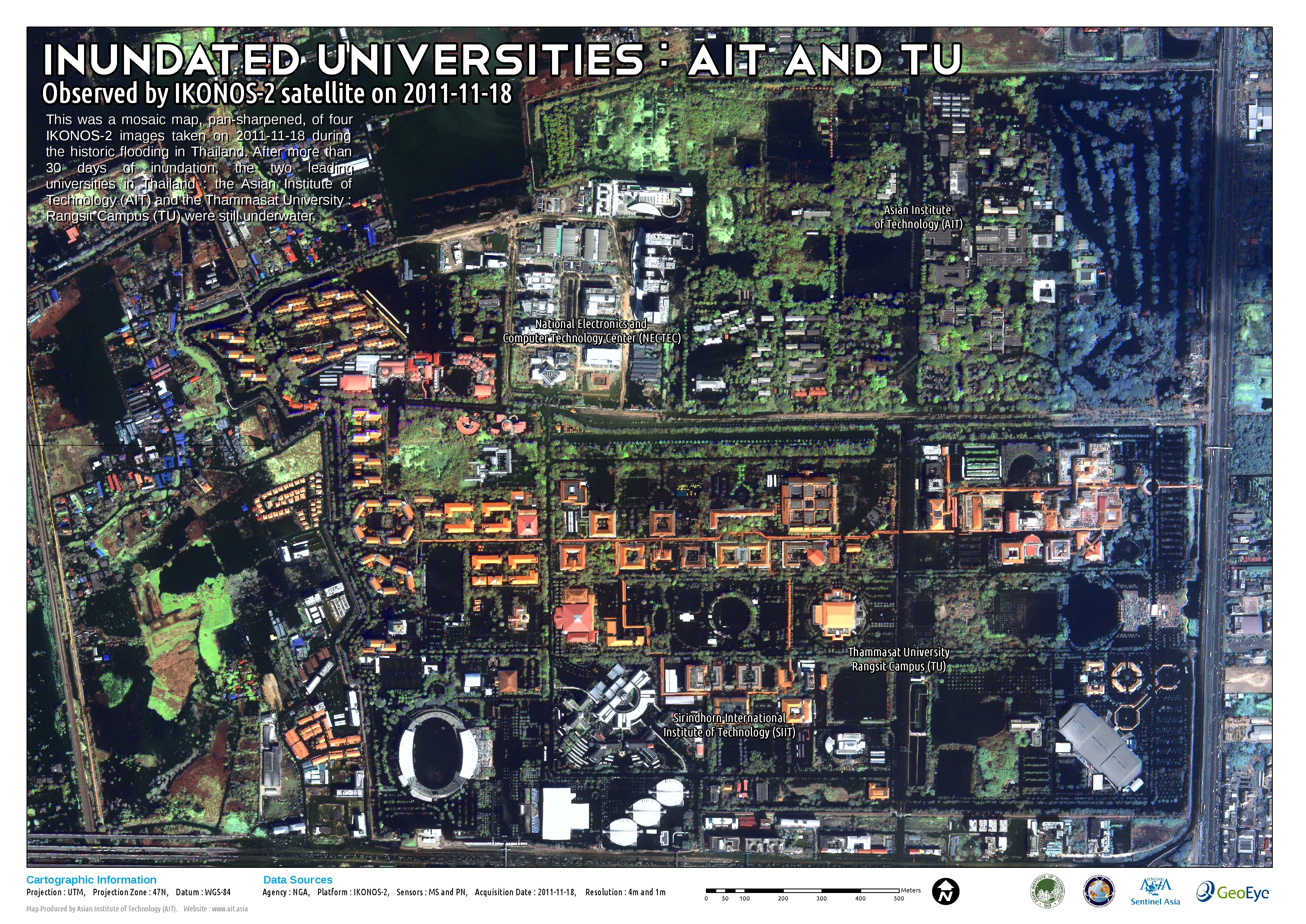
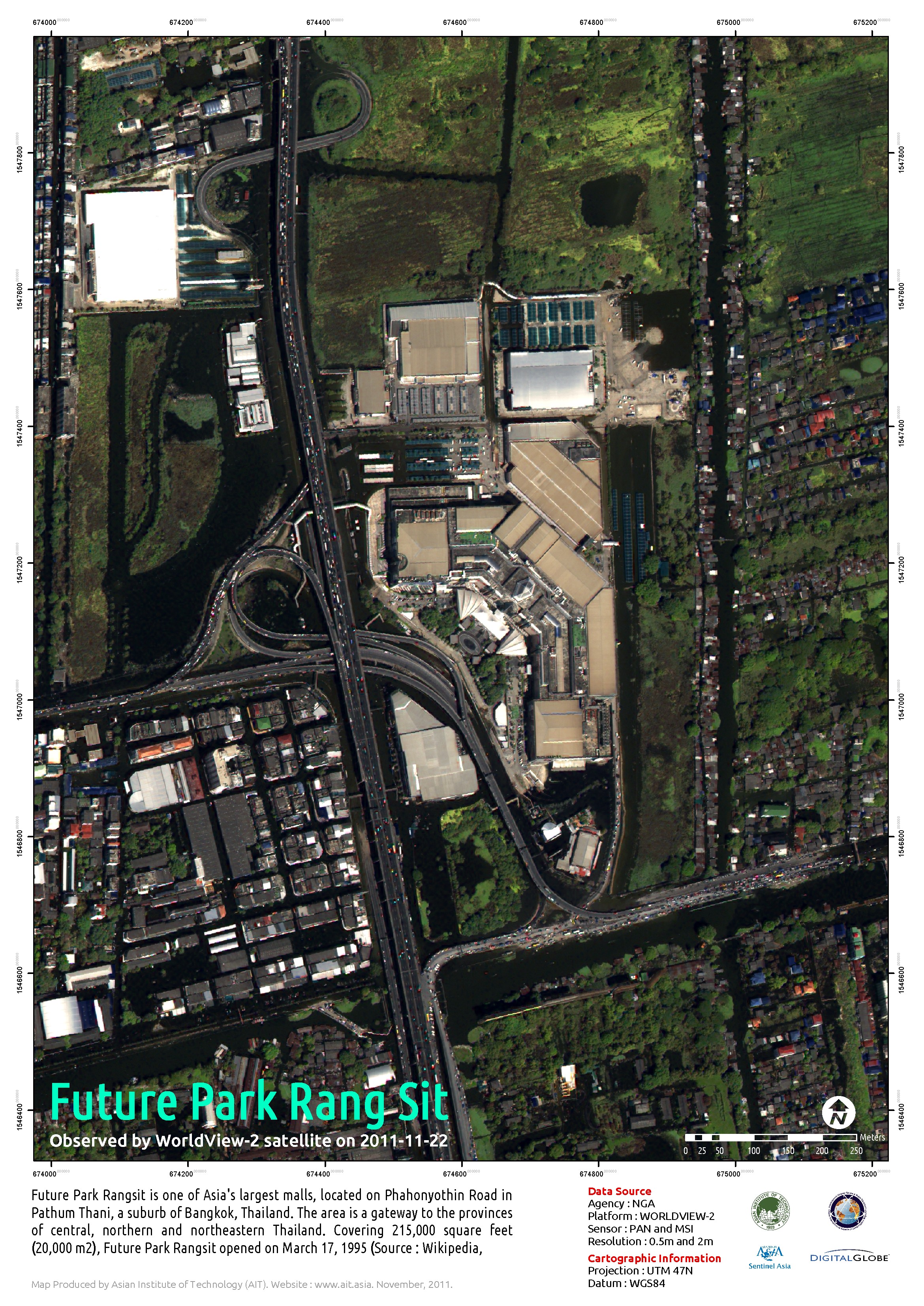
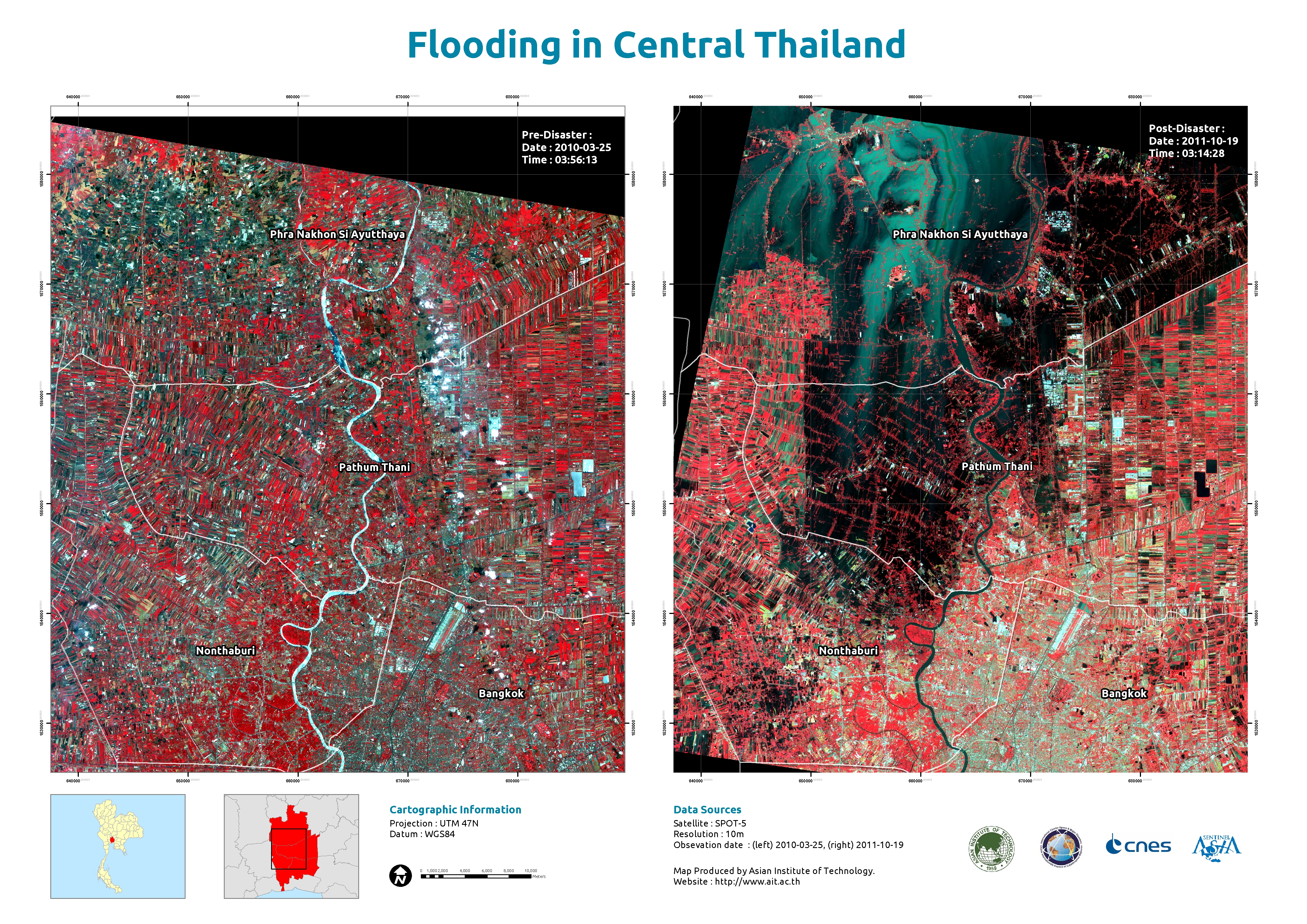
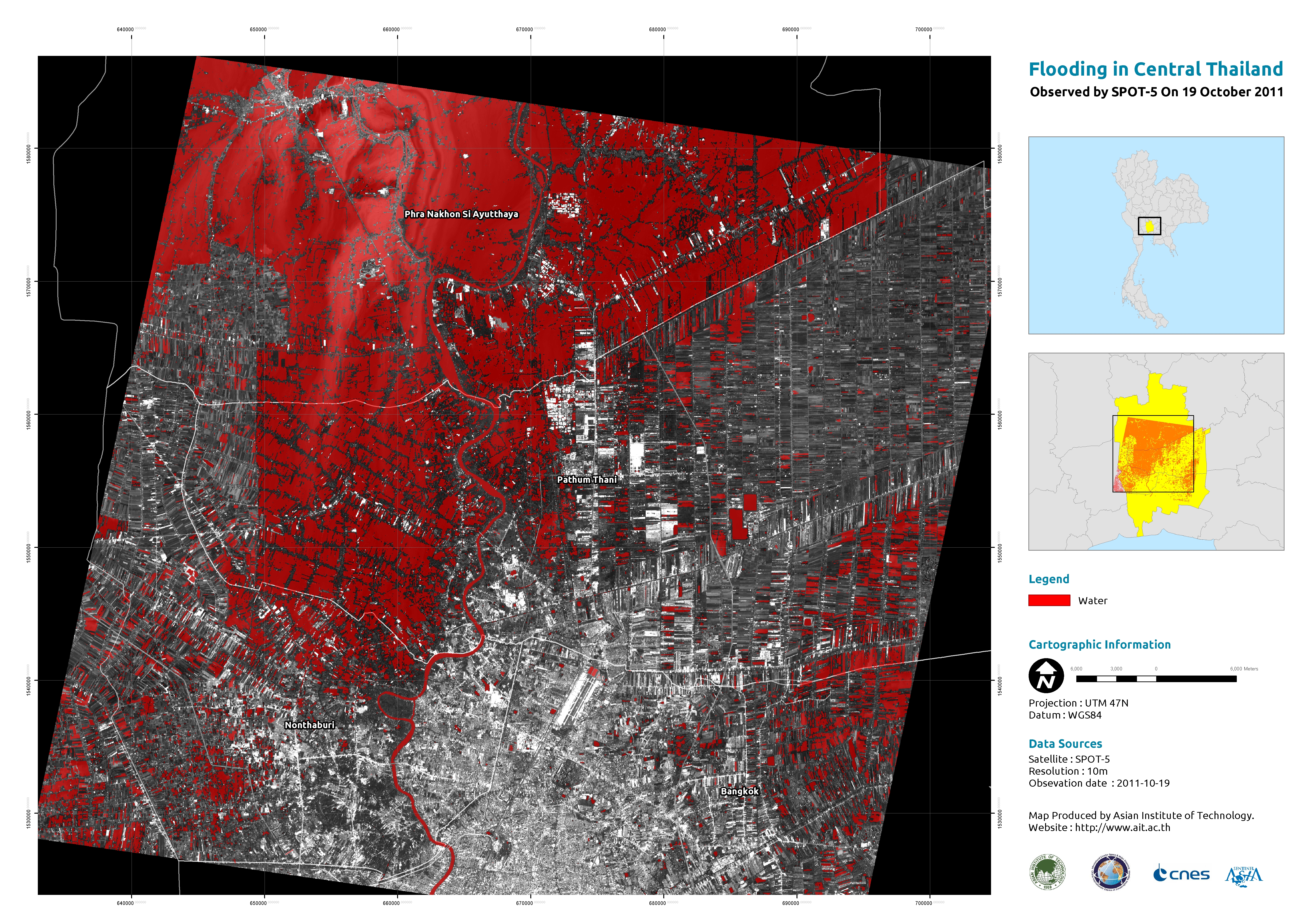
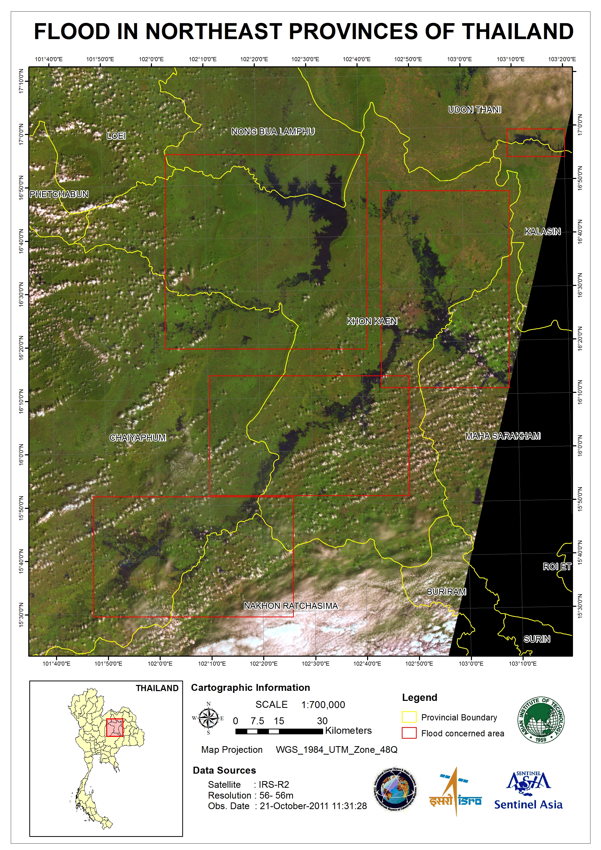
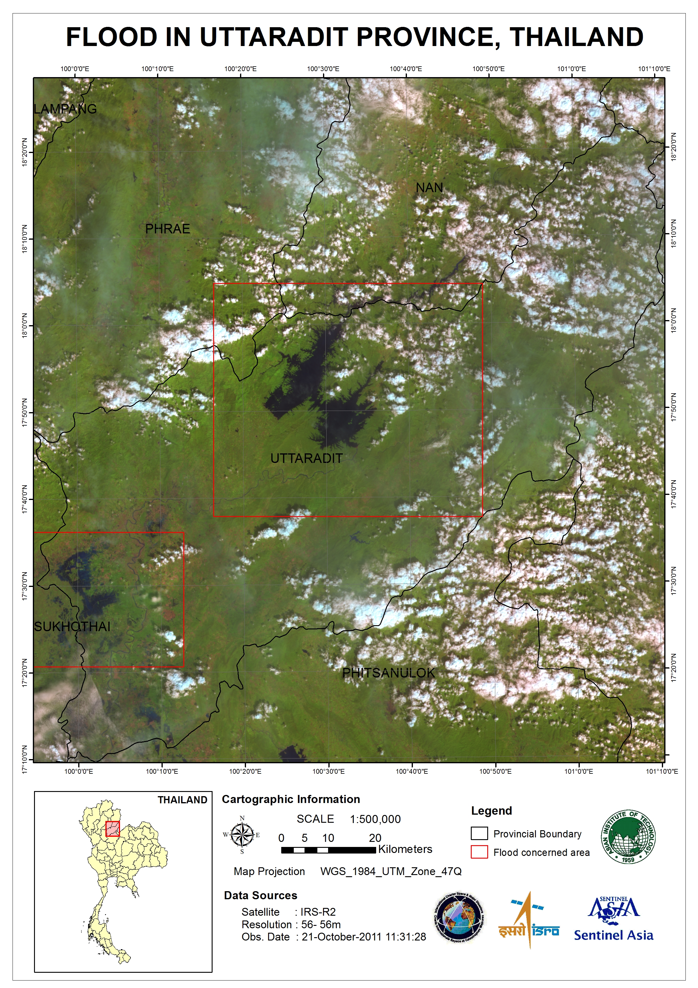
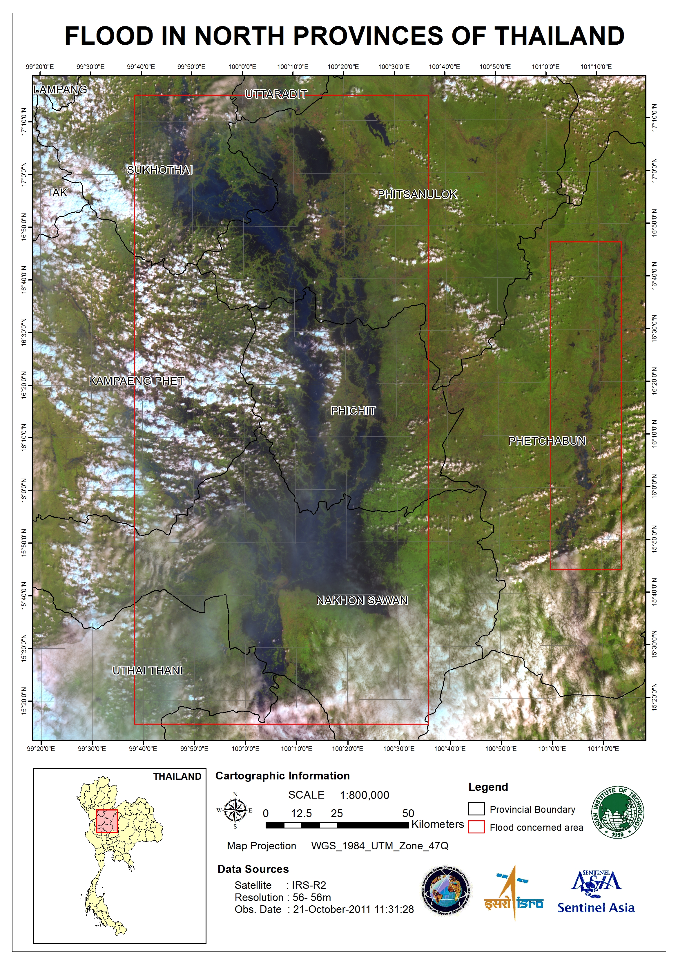
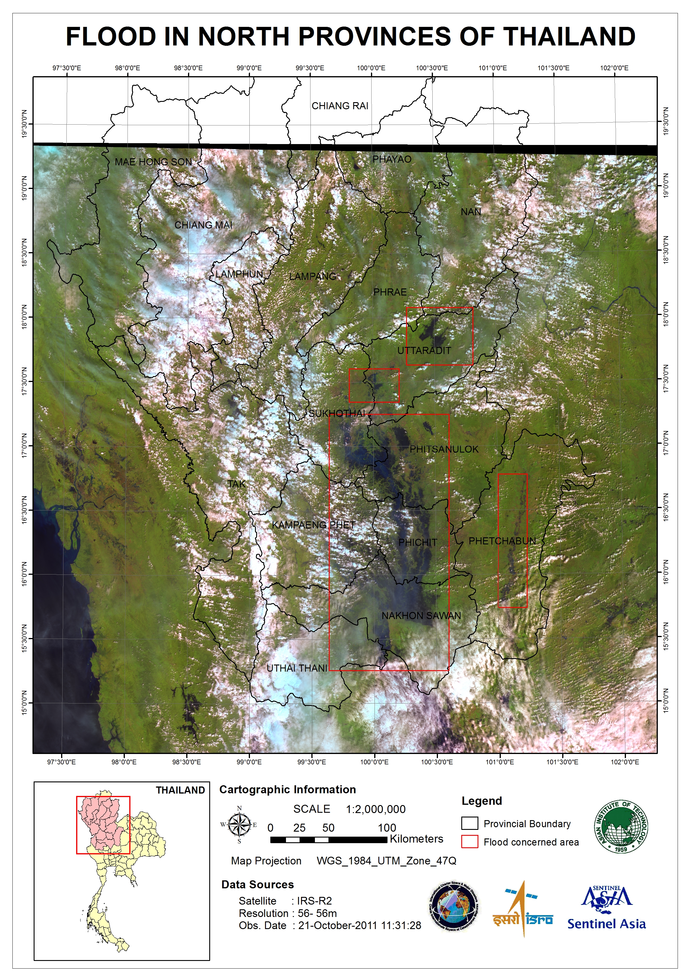
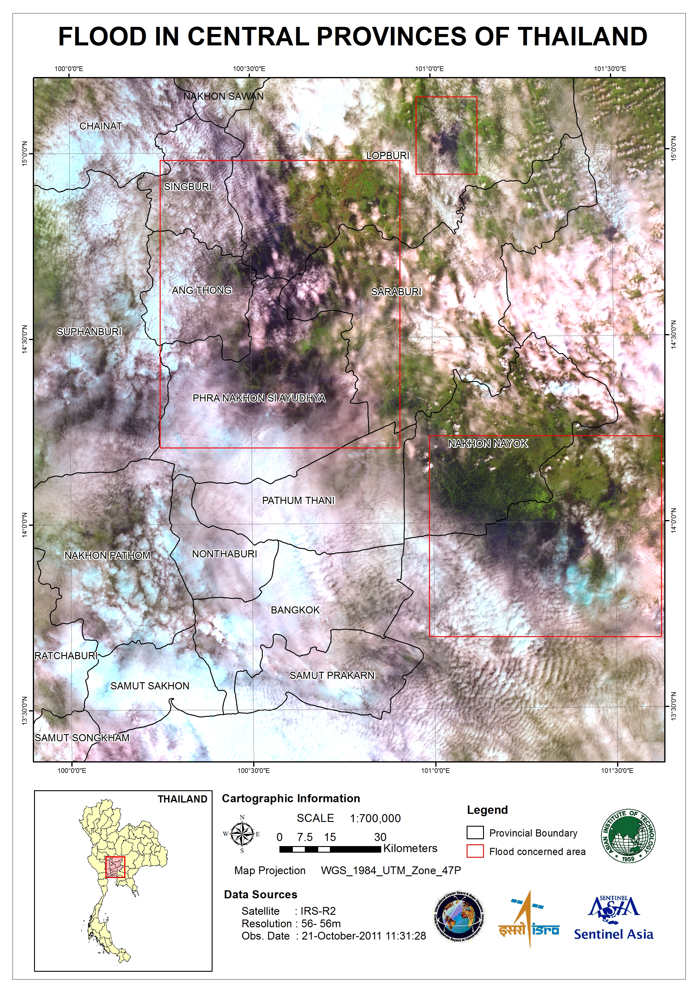
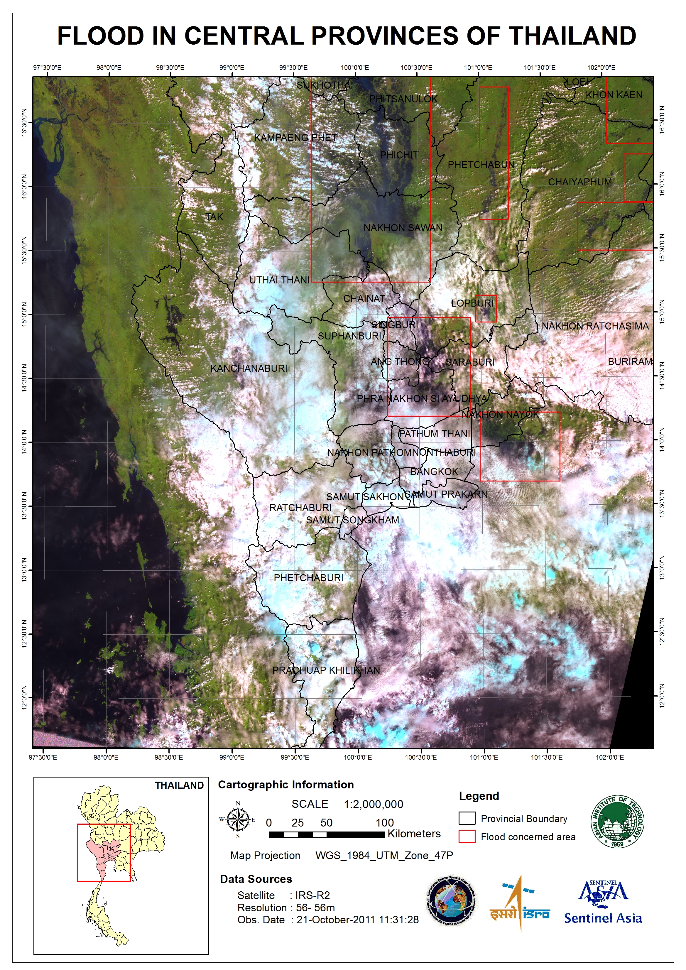
泰国洪水
7月以来,泰国三分之二的地区遭受洪灾,已经造成300多人死亡。洪水影响到200多万人,许多人撤到疏散避难场所。
首都曼谷北部的省份受灾最严重。曼谷仍然保持在高度警戒,因为水位处于危险状态,有一些防洪设施已被冲毁。
| 事件类型: | 洪水 |
| 事件地点: | 泰国 |
| 启动宪章的日期: | 2011年10月17日 |
| 宪章要求者: | 亚洲减灾中心(ADRC) |
| 项目经理: | 亚洲理工学院(AIT) |
Products
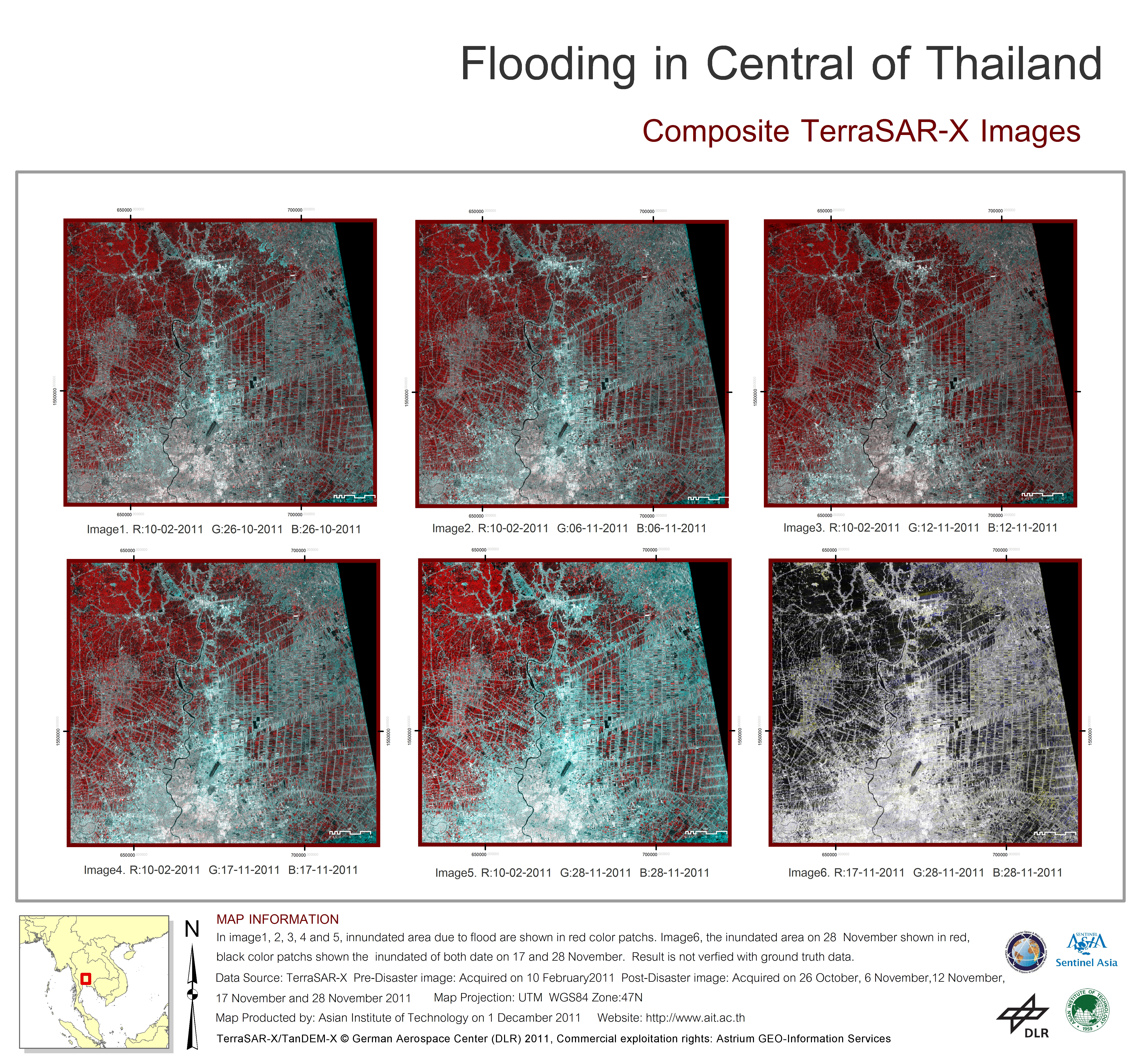
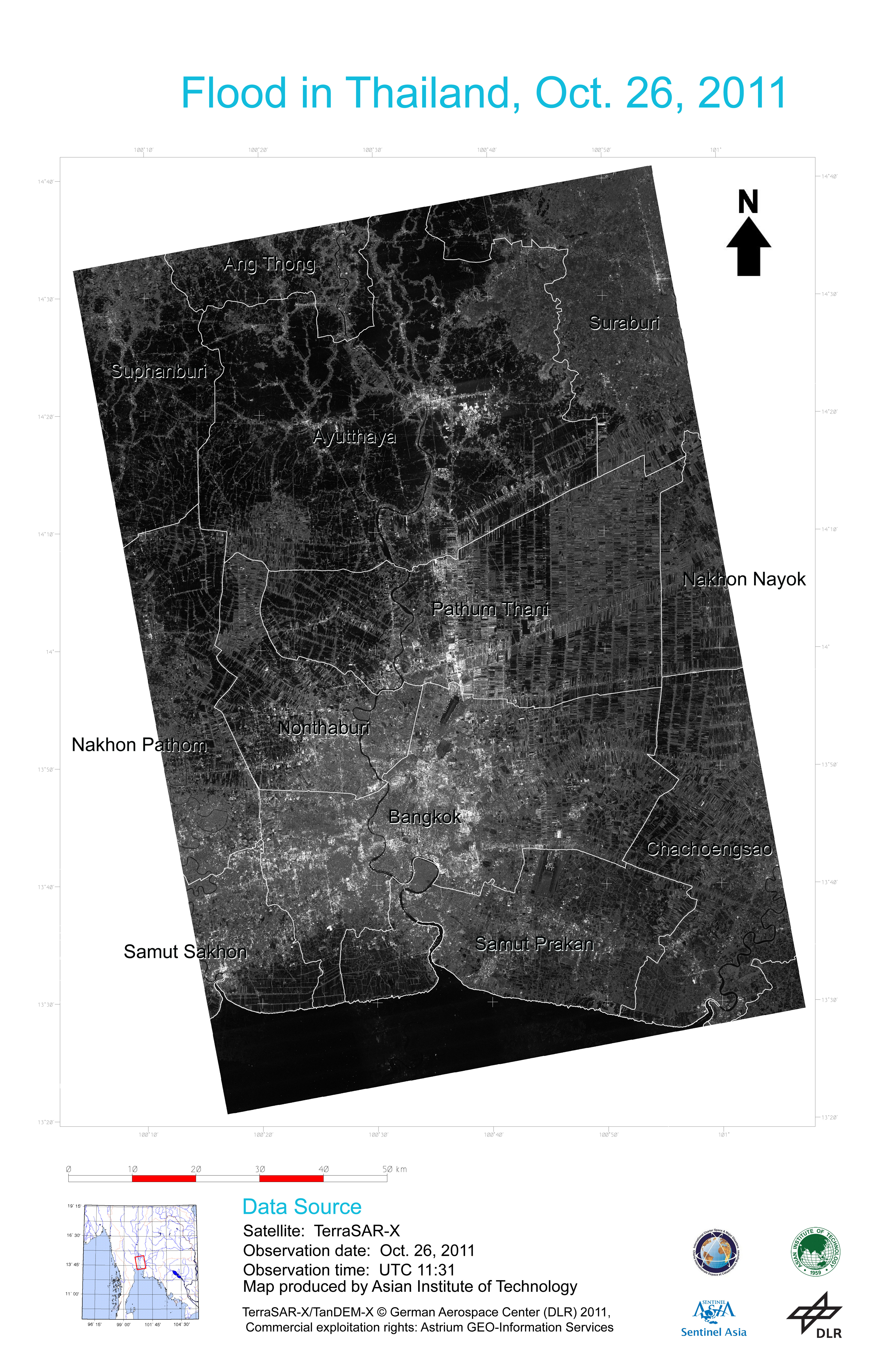
Flooding in central Thailand
Composite TerraSAR-X images
版权: German Aerospace Center (DLR) 2011
Commercial exploitation rights: Astrium GEO-Information Services
Map produced by Asian Institute of Technology (AIT)
Information about the Product
已获得: Pre-disaster: 10/02/11
Post-disaster: 26/10/11, 06/11/11, 12/11/11, 17/11/11 and 28/11/11
源: TerraSAR-X
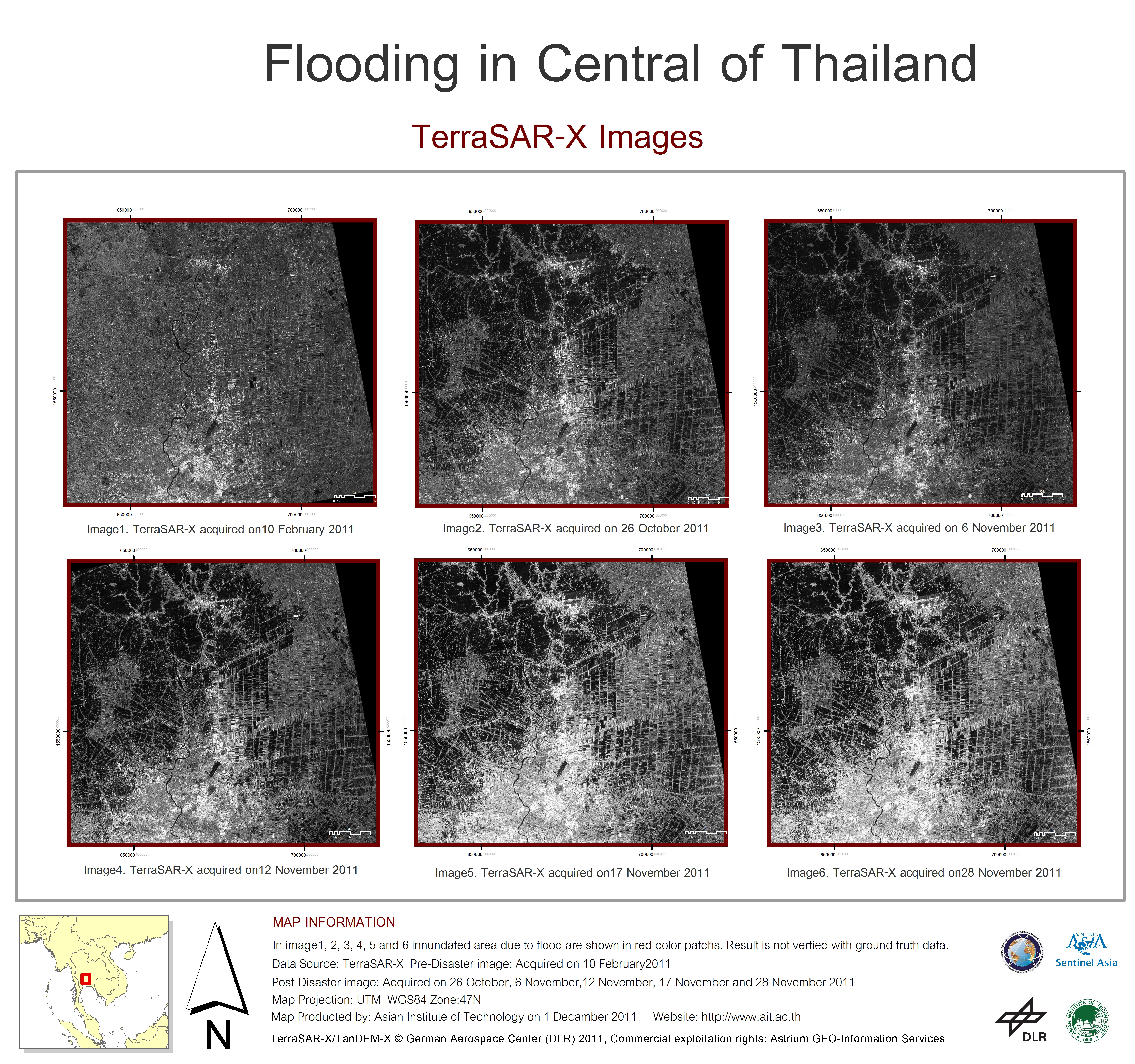
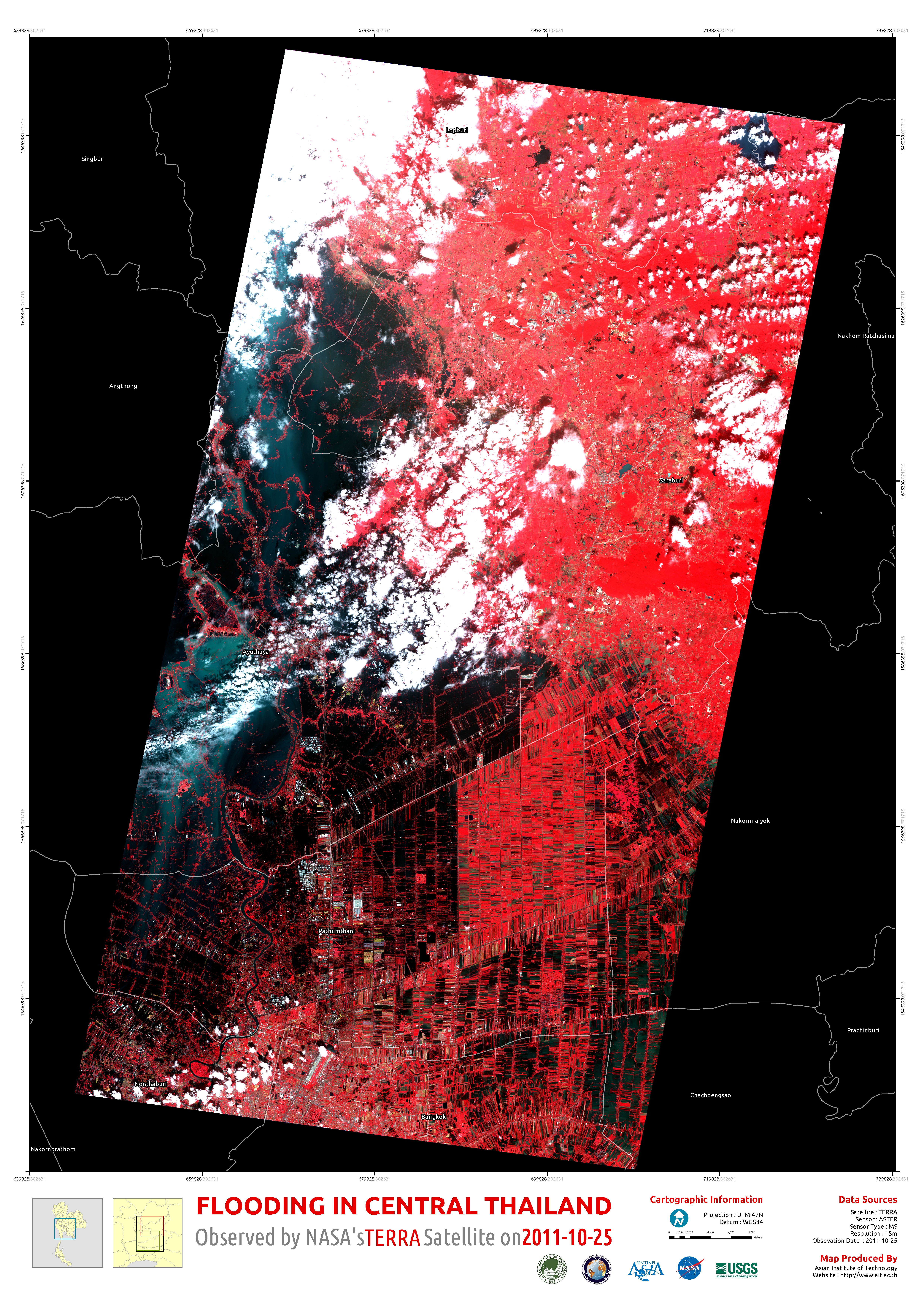
Flooding in central Thailand
版权: German Aerospace Center (DLR) 2011
Commercial exploitation rights: Astrium GEO-Information Services
Map produced byAsian Institute of Technology (AIT)
Information about the Product
已获得: Pre-disaster: 10/02/11
Post-disaster: 26/10/11, 06/11/11, 12/11/11, 17/11/11 and 28/11/11
源: TerraSAR-X
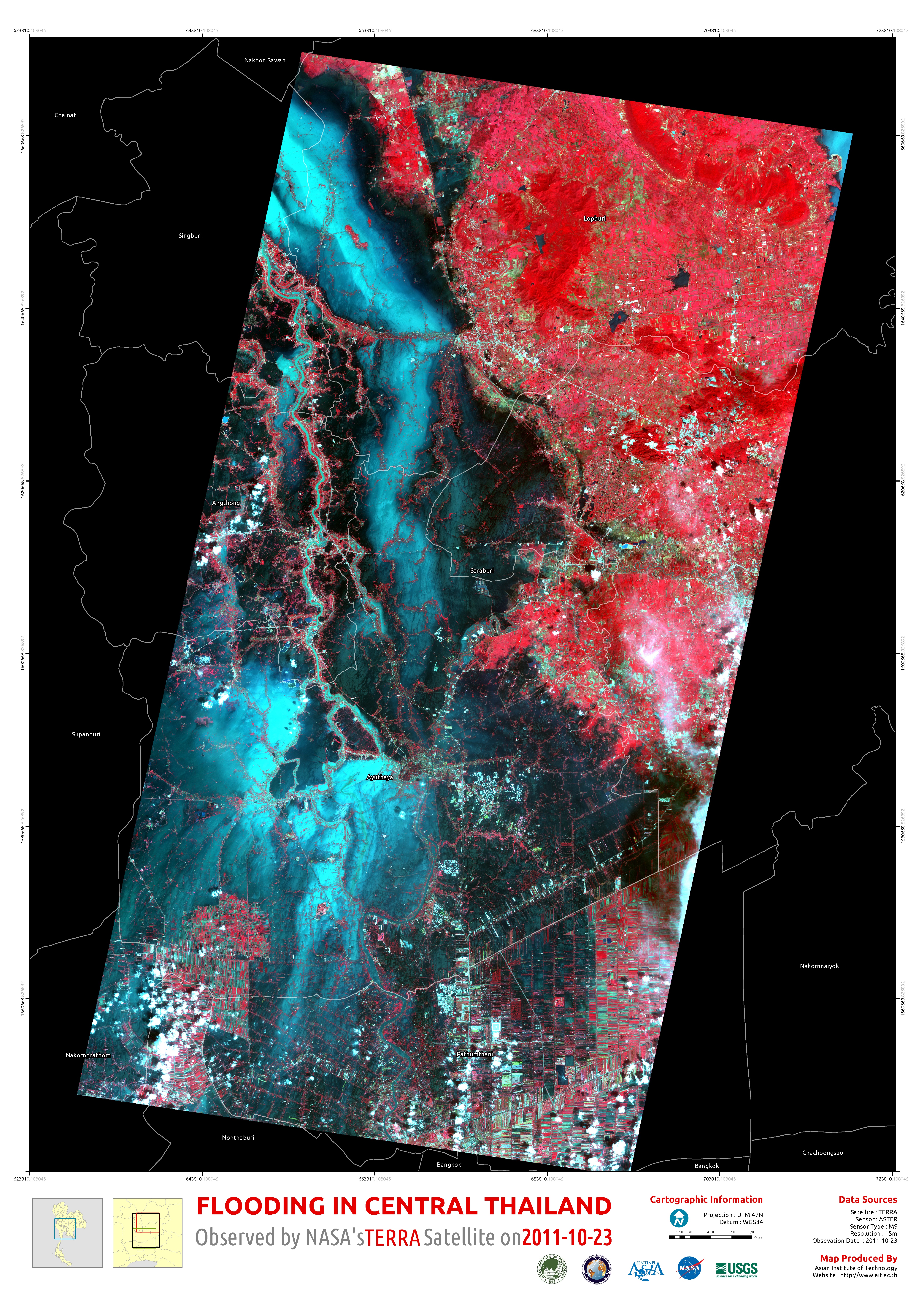
Flooding in central Thailand
Composite TerraSAR-X images
版权: German Aerospace Center (DLR) 2011
Commercial exploitation rights: Astrium GEO-Information Services
Map produced by Asian Institute of Technology (AIT)
Information about the Product
已获得: Pre-disaster: 10/02/11
Post-disaster: 26/10/11, 06/11/11, 12/11/11, and 17/11/11
源: TerraSAR-X
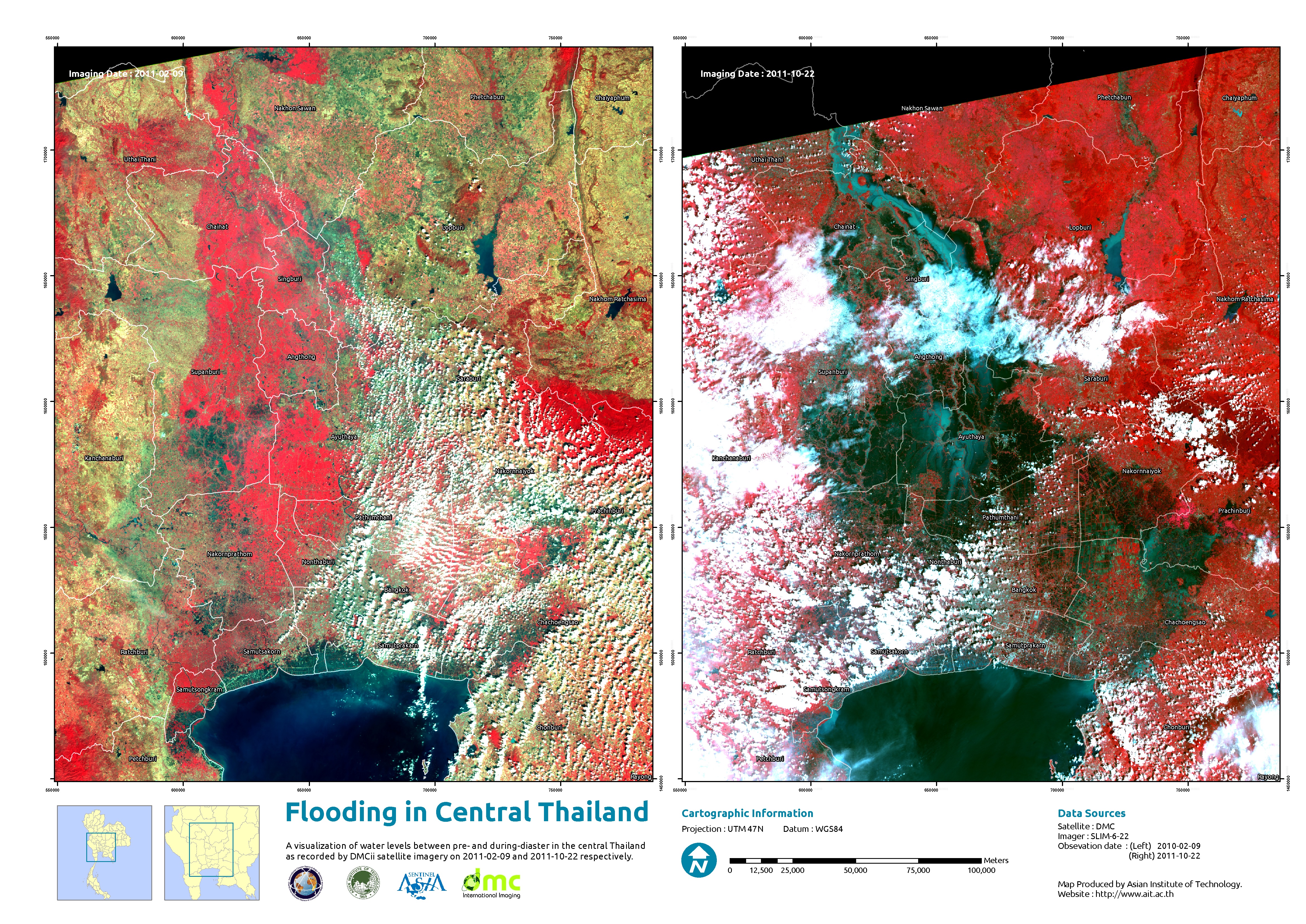
Flooding in central Thailand
版权: German Aerospace Center (DLR) 2011
Commercial exploitation rights: Astrium GEO-Information Services
Map produced by Asian Institute of Technology (AIT)
Information about the Product
已获得: Pre-disaster: 10/02/11
Post-disaster: 26/10/11, 06/11/11, 12/11/11, and 17/11/11
源: TerraSAR-X
Flooding in central Thailand
Composite TerraSAR-X images
版权: German Aerospace Center (DLR) 2011
Commercial exploitation rights: Astrium GEO-Information Services
Map produced by Asian Institute of Technology (AIT)
Information about the Product
已获得: Pre-disaster: 10/02/11
Post-disaster: 26/10/11, 06/11/11 and 12/11/11
源: TerraSAR-X
Flooding in central Thailand
版权: German Aerospace Center (DLR) 2011
Commercial exploitation rights: Astrium GEO-Information Services
Map produced by Asian Institute of Technology (AIT)
Information about the Product
已获得: Pre-disaster: 10/02/11
Post-disaster: 26/10/11, 06/11/11 and 12/11/11
源: TerraSAR-X

 返回完整的响应档案

