 English
 Spanish
 French
 Chinese
 Russian
 Portuguese
 Последняя Активация
Charter activations
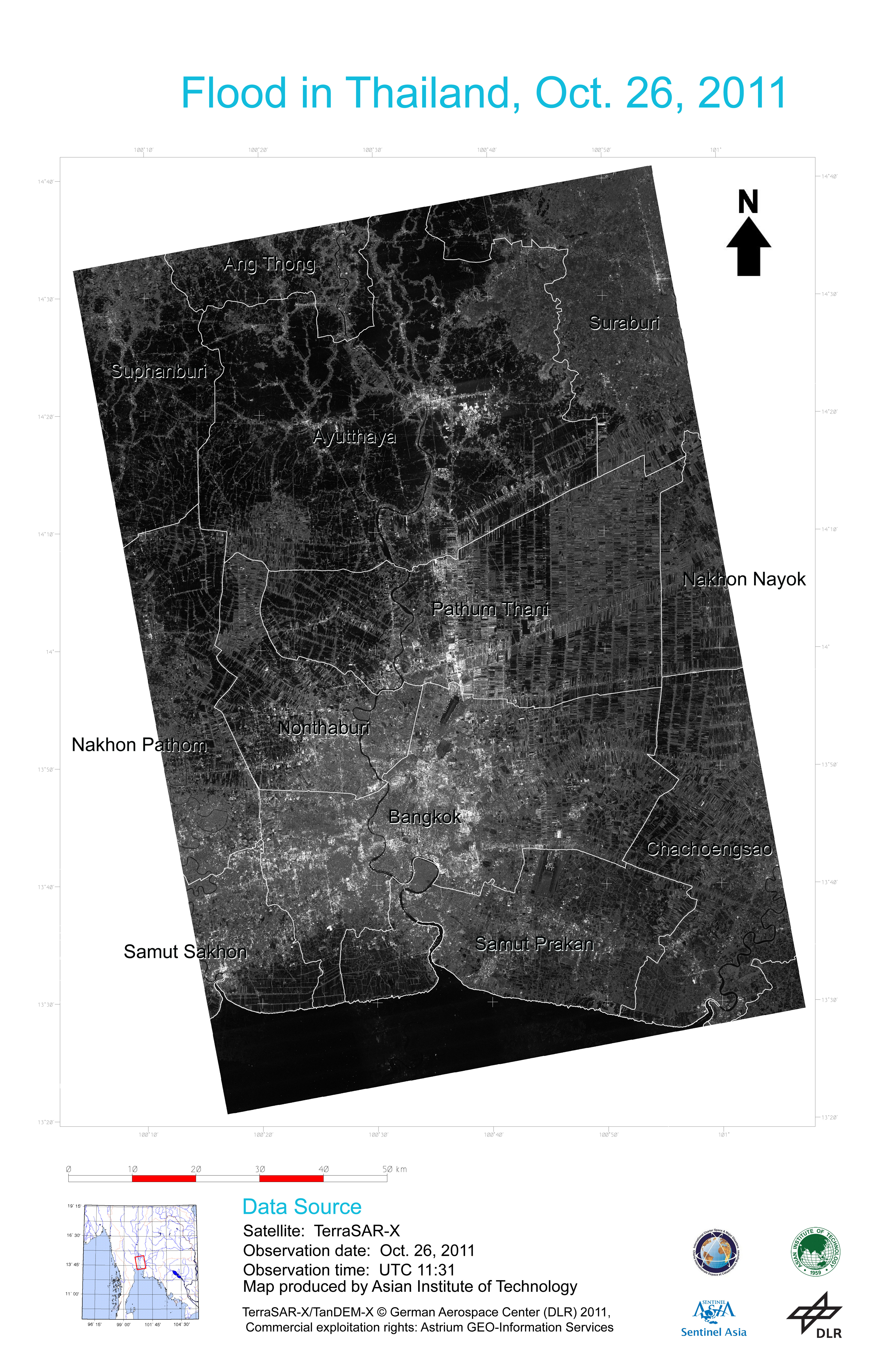
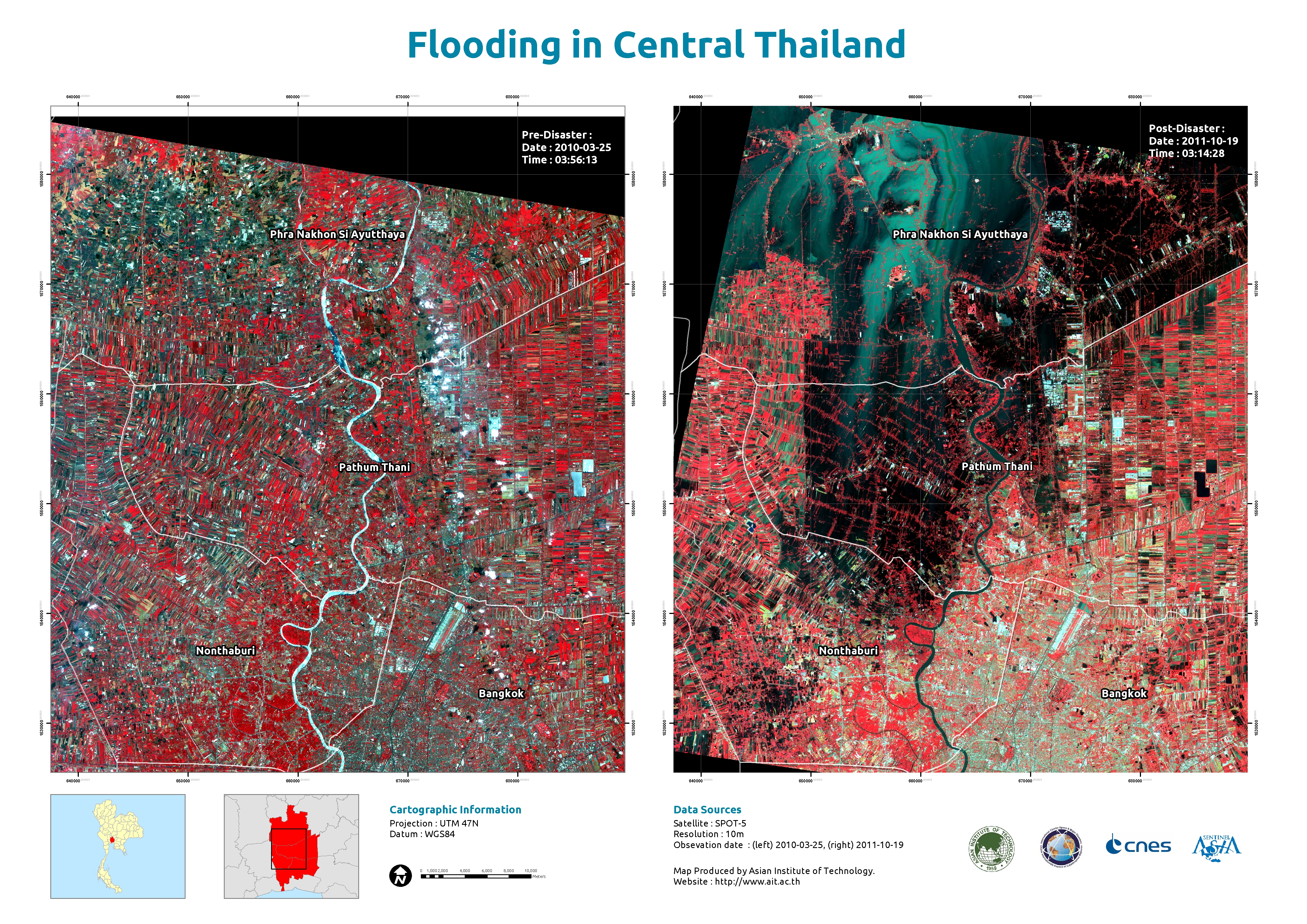
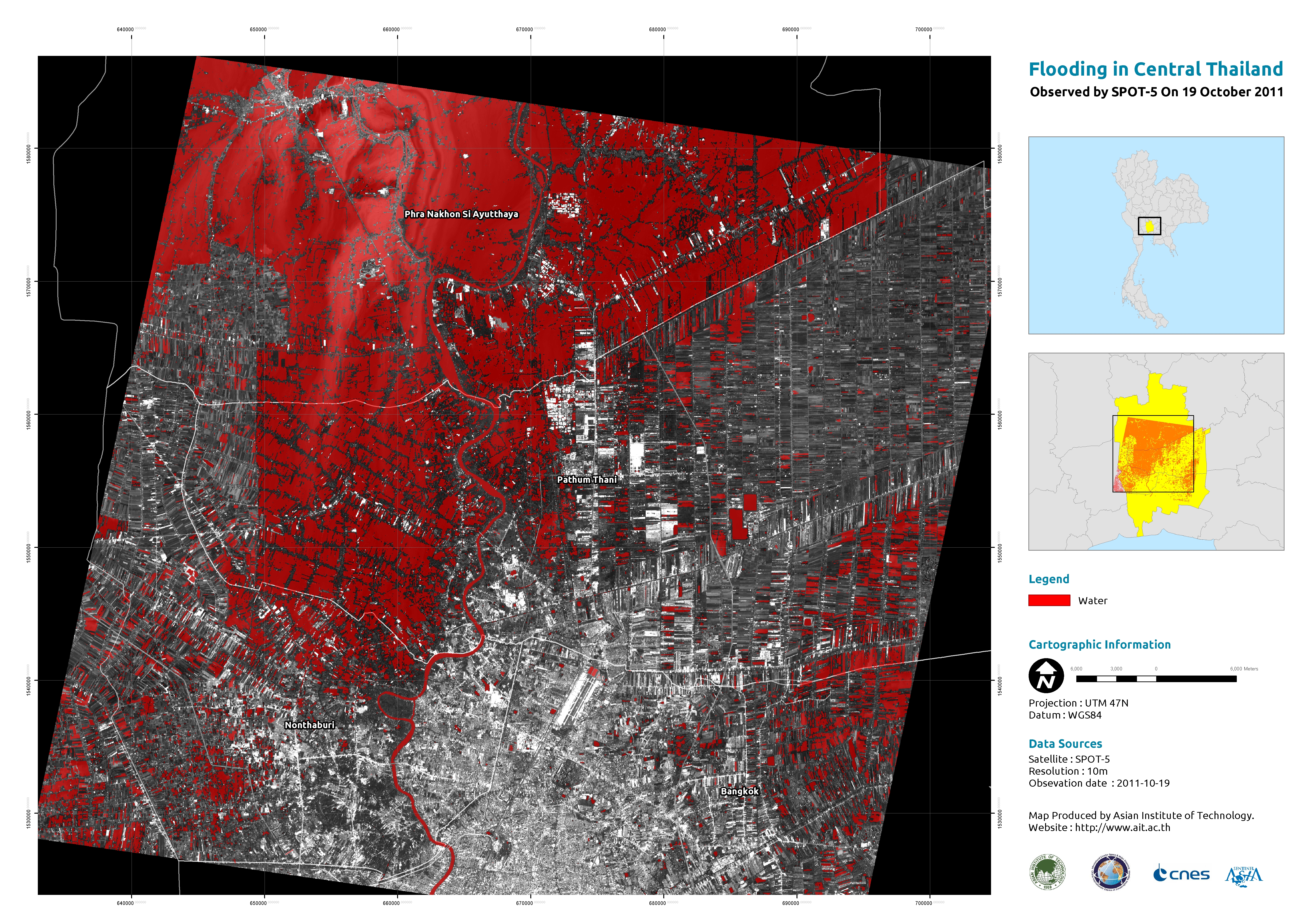
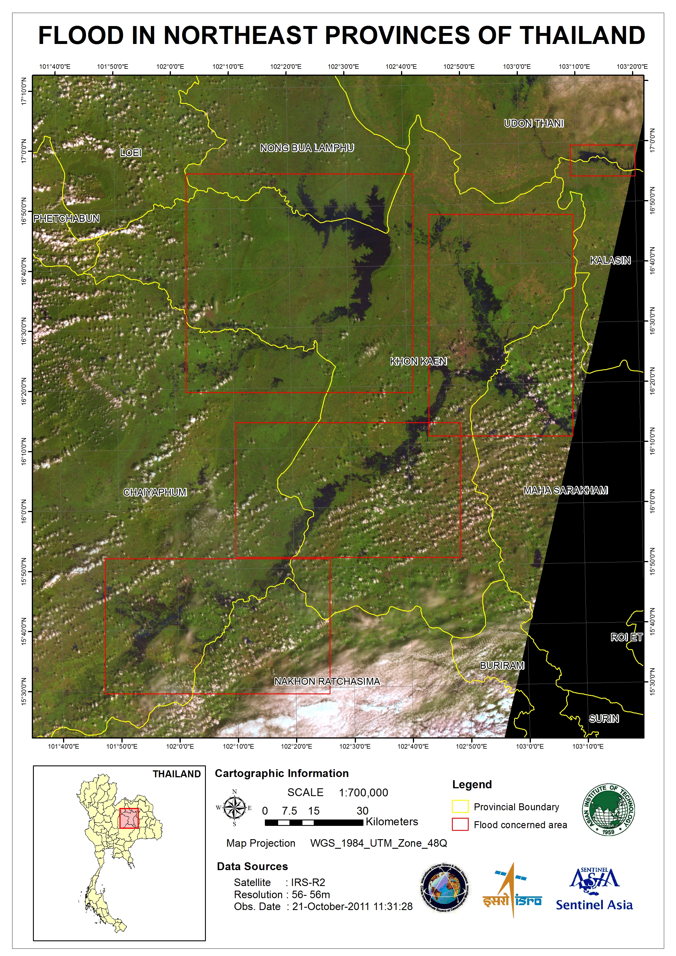
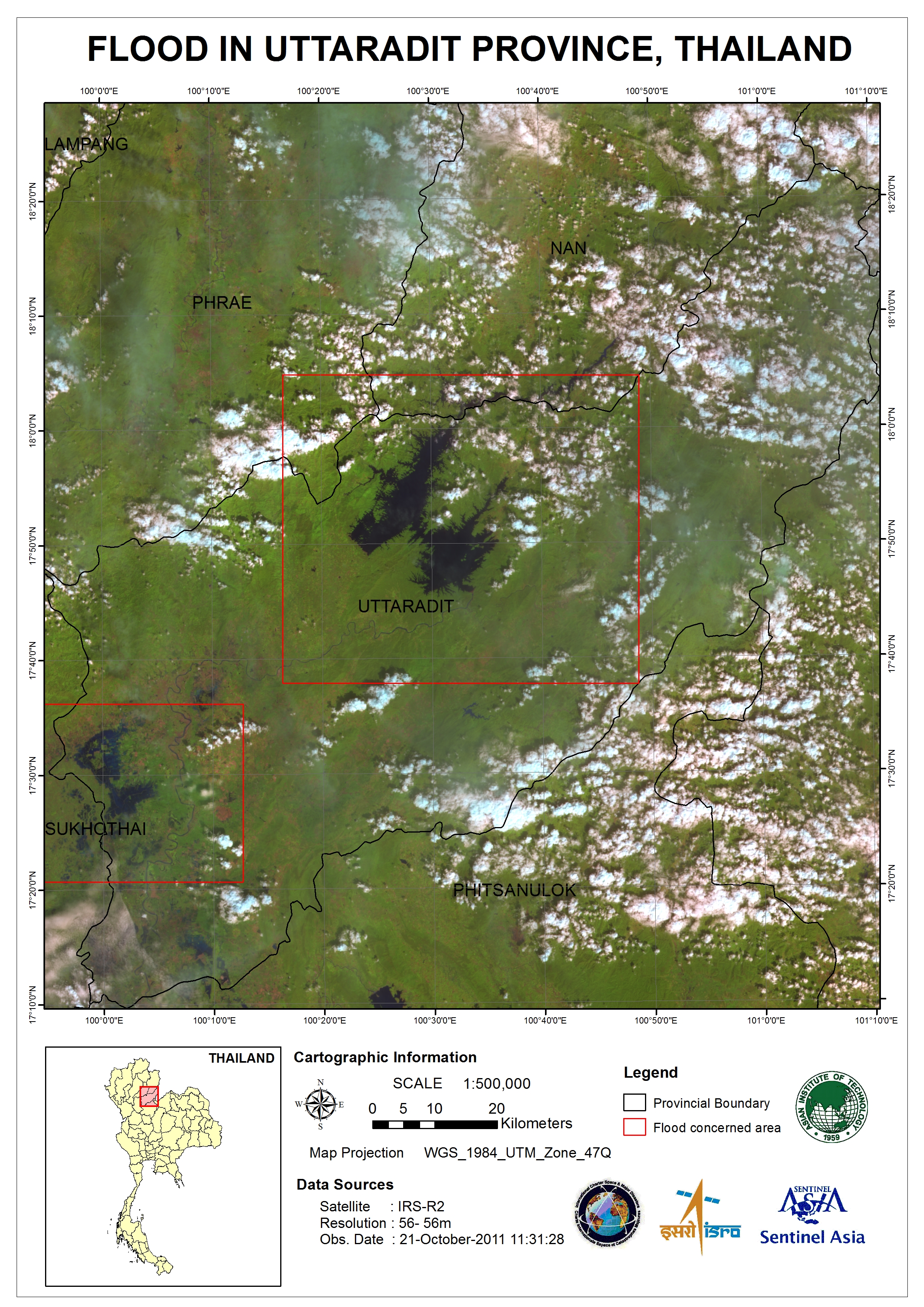
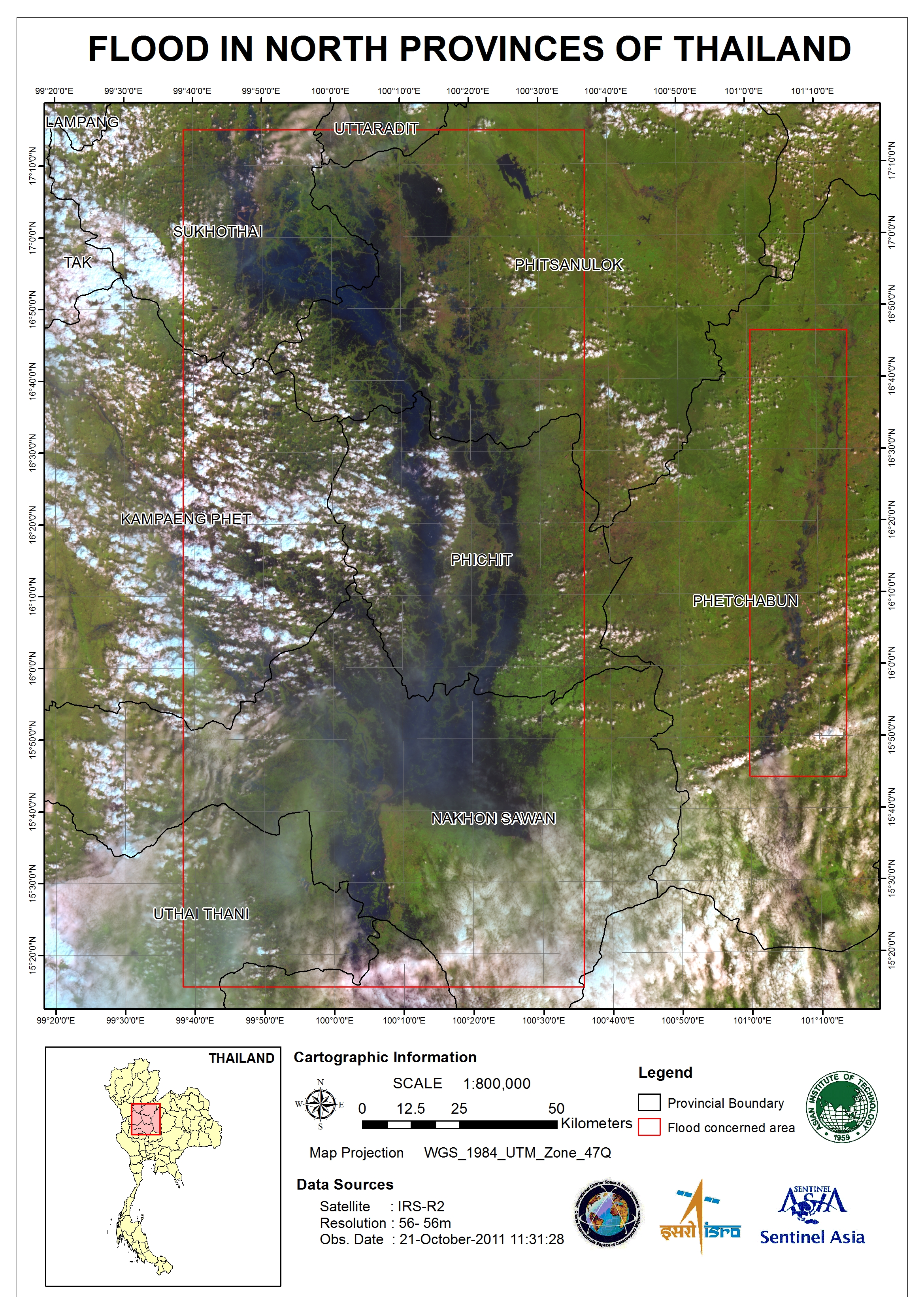
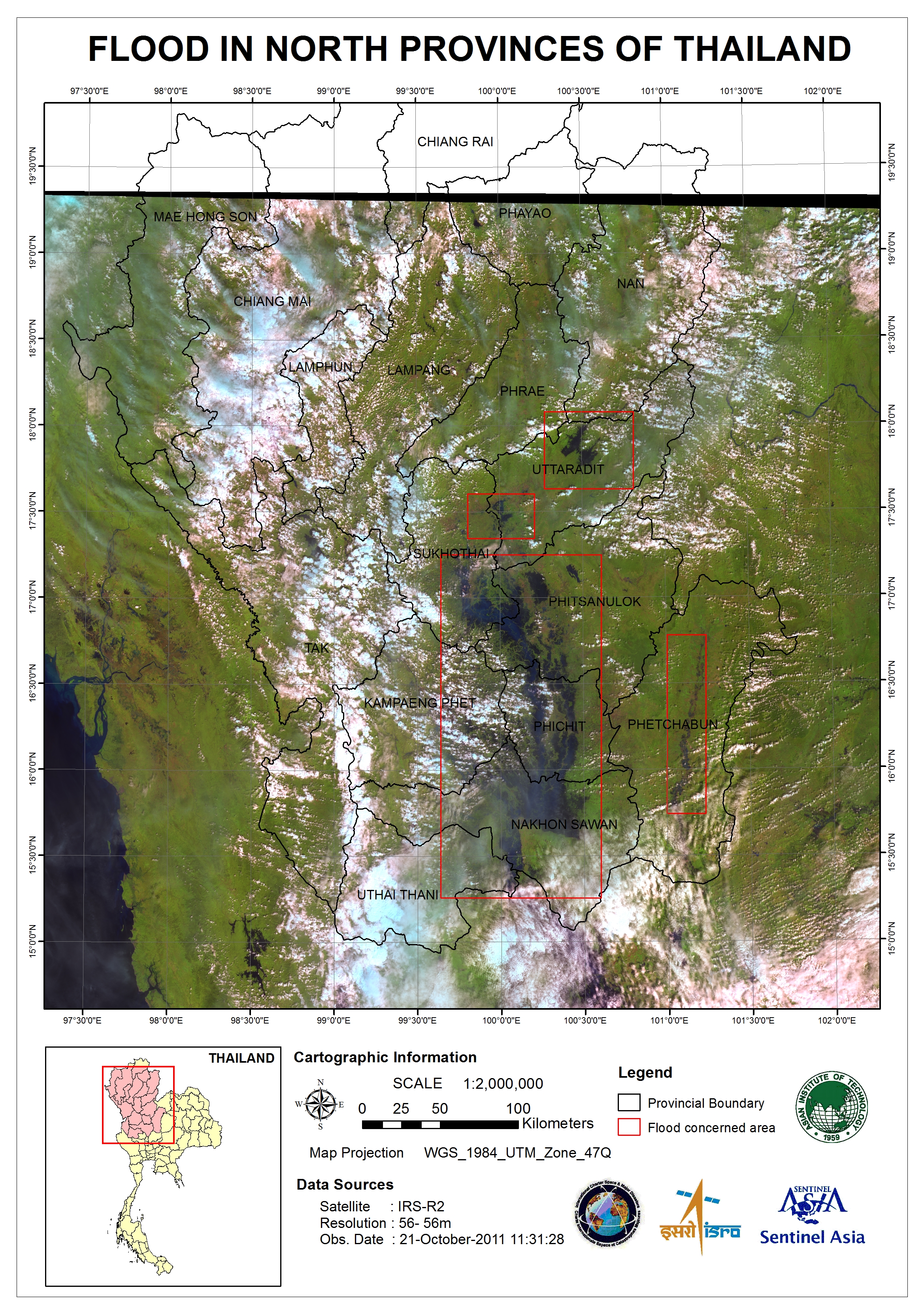
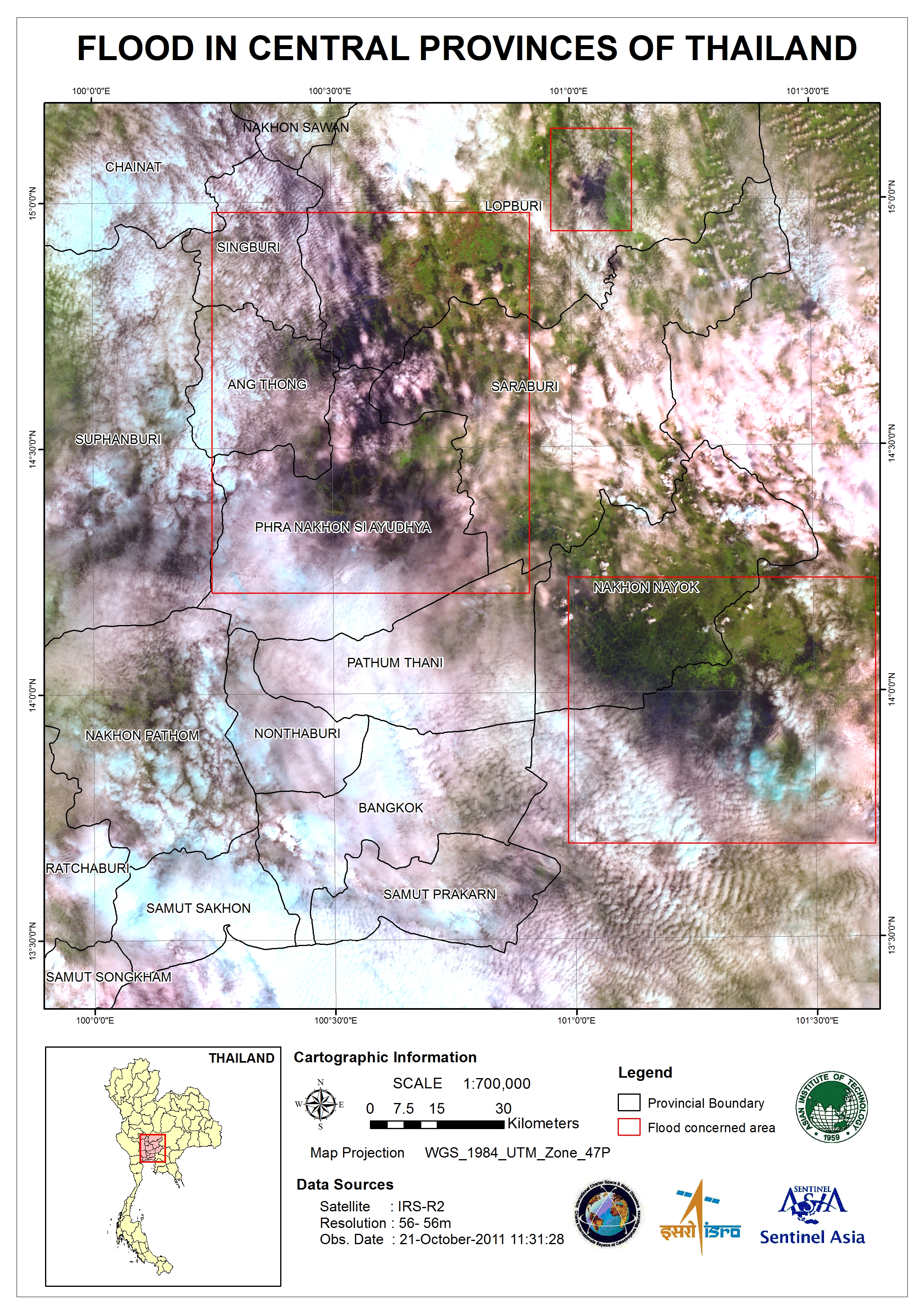
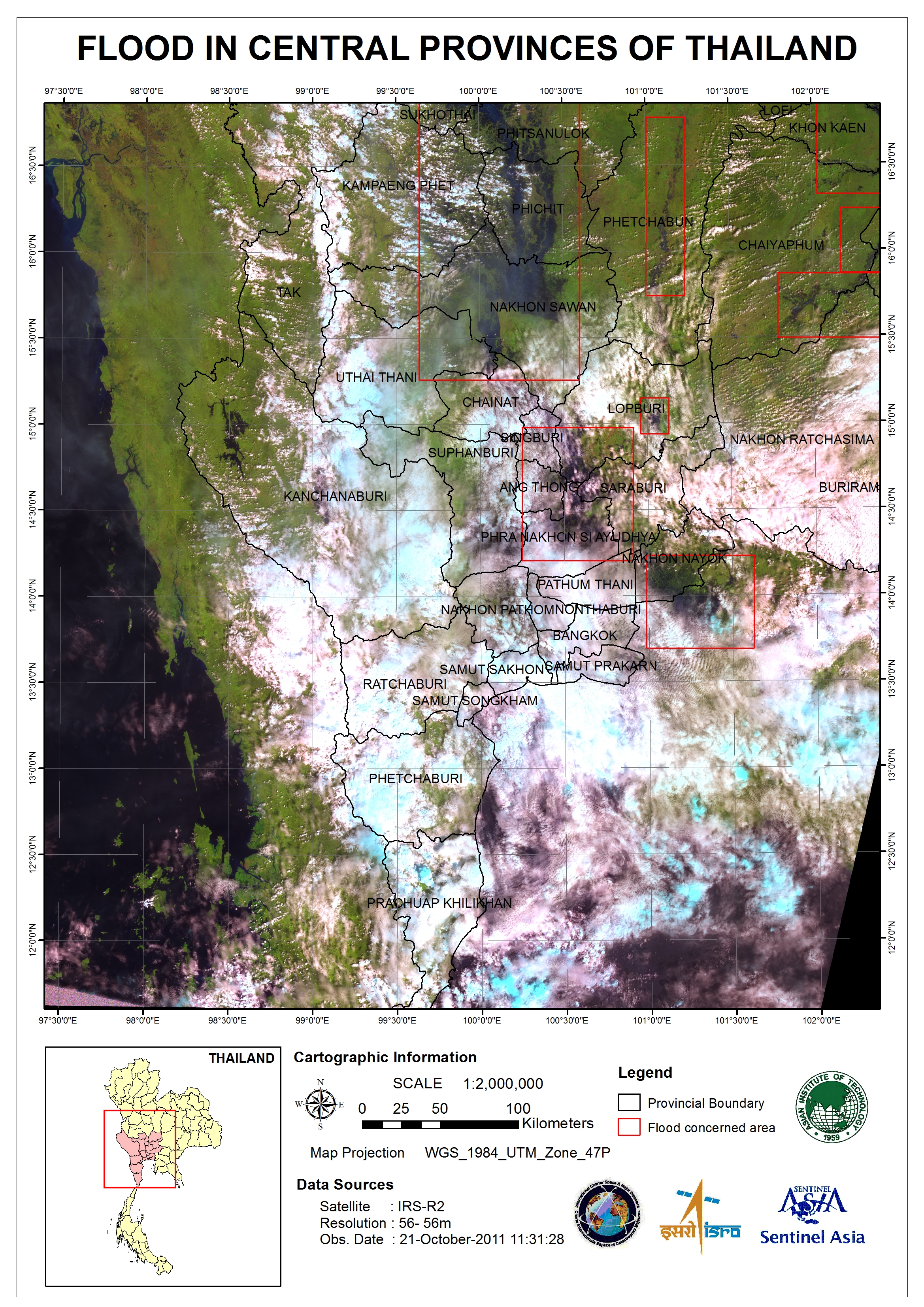
Flood in Thailand
Flooding has affected two thirds of Thailand and has killed over 300 people since July. The floods have affected more than two million people, with many moving to evacuation shelters.
Provinces north of the capital Bangkok have been worst hit by the floods. Bangkok still remains on high alert, as water levels remain dangerously high with some flood defences breached.
| Тип события: | Flood |
| Место события: | Thailand |
| Date of Charter Activation: | 17/10/2011 |
| Запрос на активацию поступил от: | Asia Disaster Reduction Center (ADRC) |
| Менеждер проекта от: | Asian Institute of Technology (AIT) |
Products
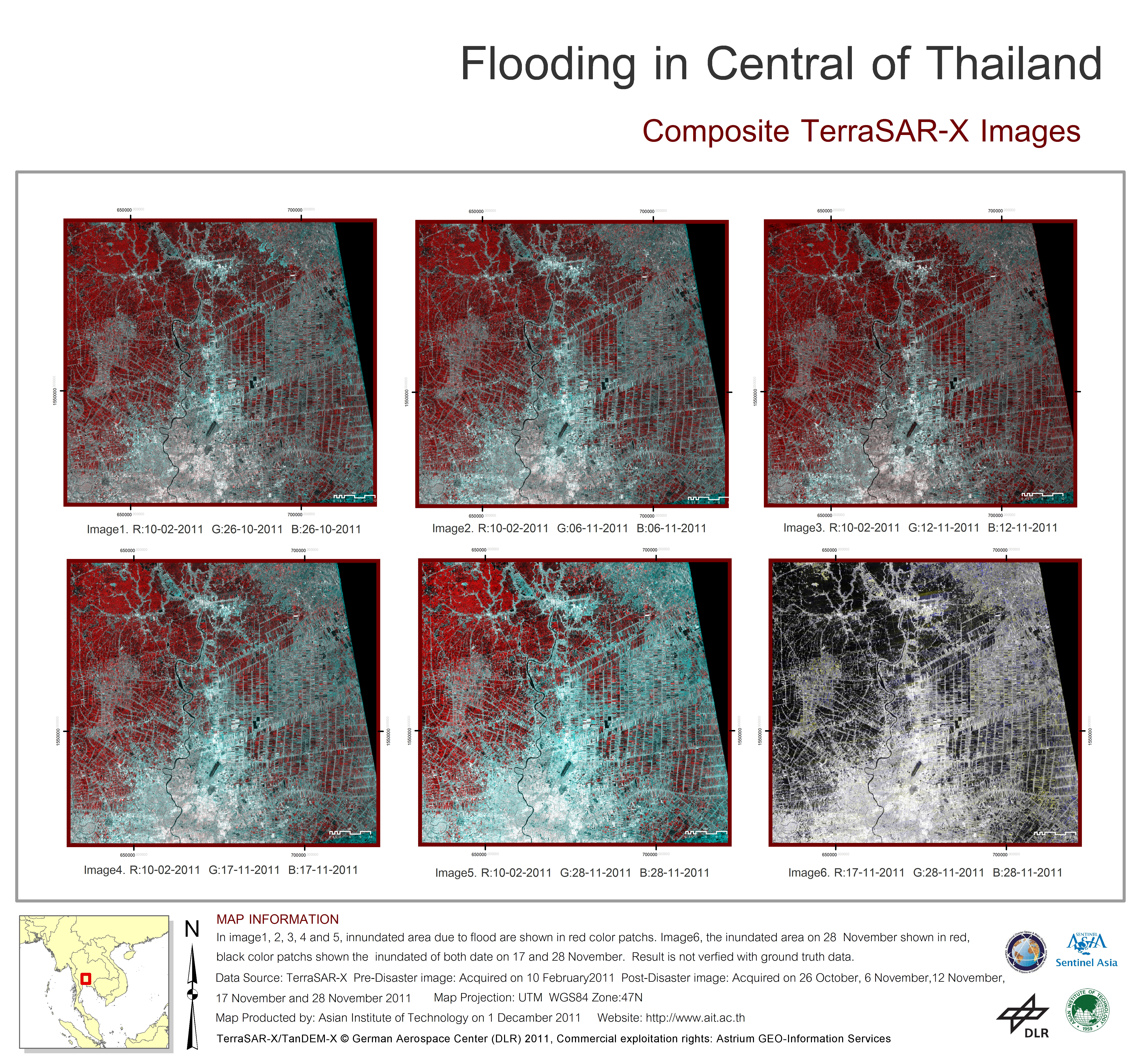
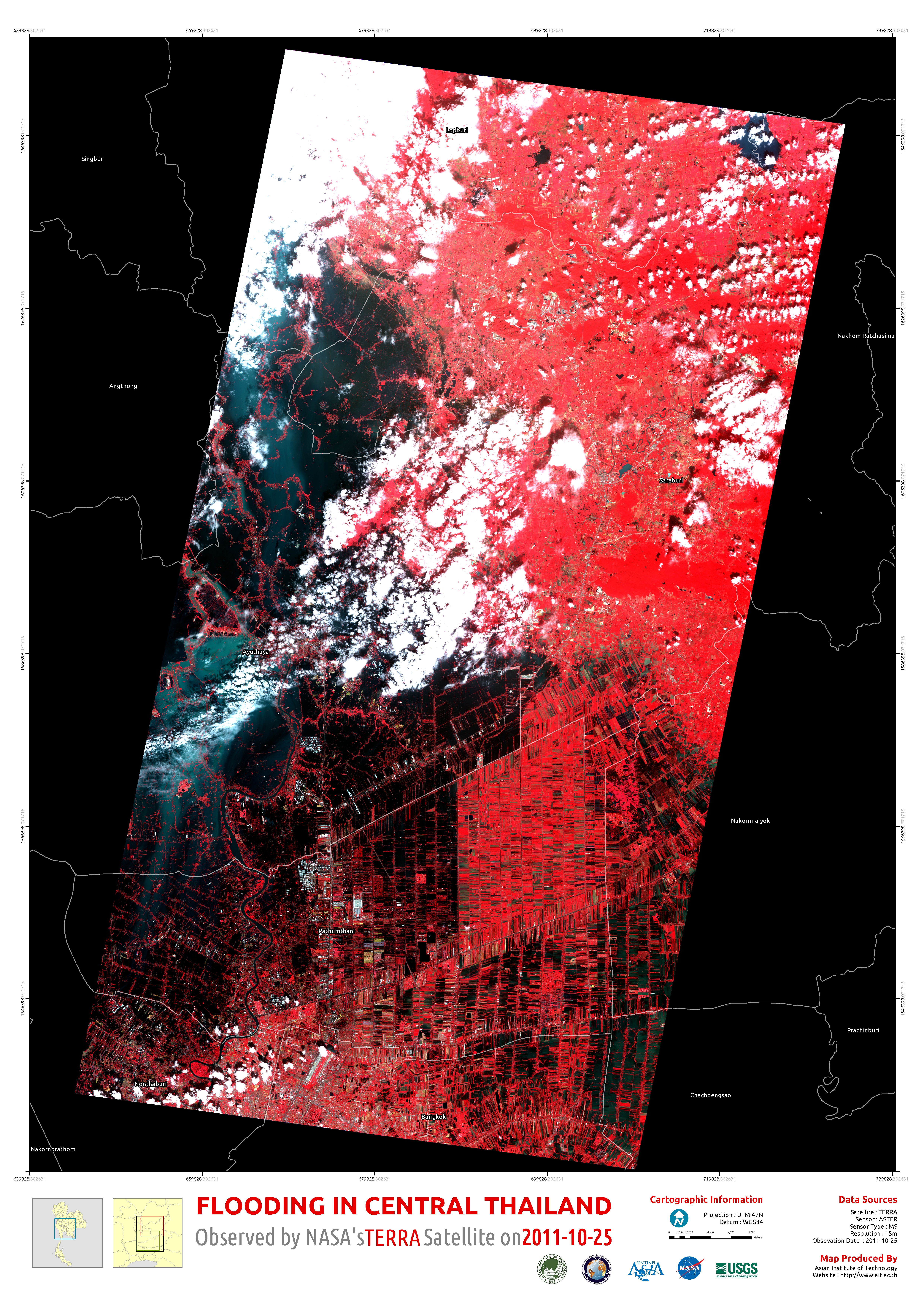
Flooding in central Thailand
Composite TerraSAR-X images
Авторские права: German Aerospace Center (DLR) 2011
Commercial exploitation rights: Astrium GEO-Information Services
Map produced by Asian Institute of Technology (AIT)
Information about the Product
Получено: Pre-disaster: 10/02/11
Post-disaster: 26/10/11, 06/11/11, 12/11/11, 17/11/11 and 28/11/11
Источник: TerraSAR-X
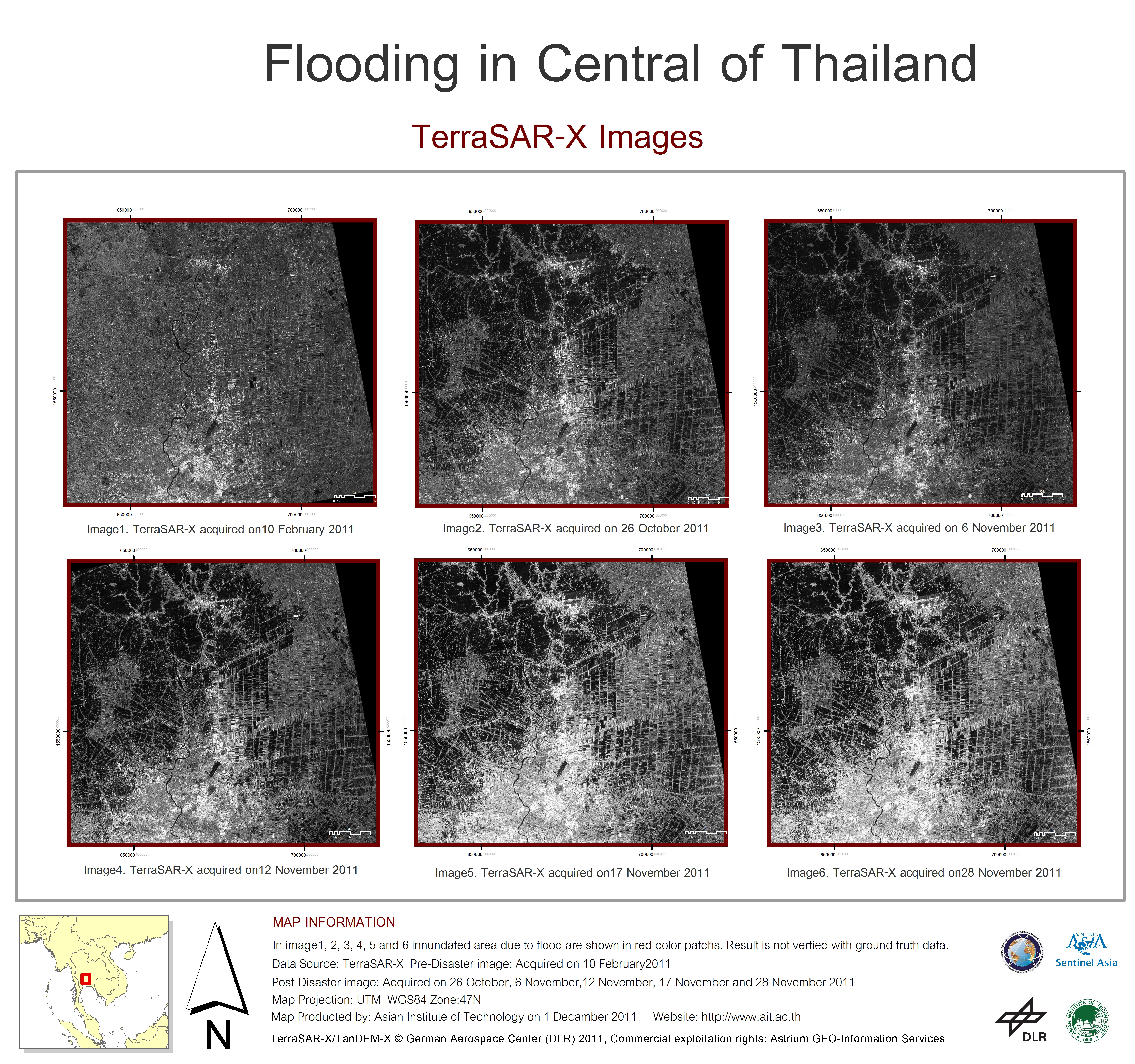
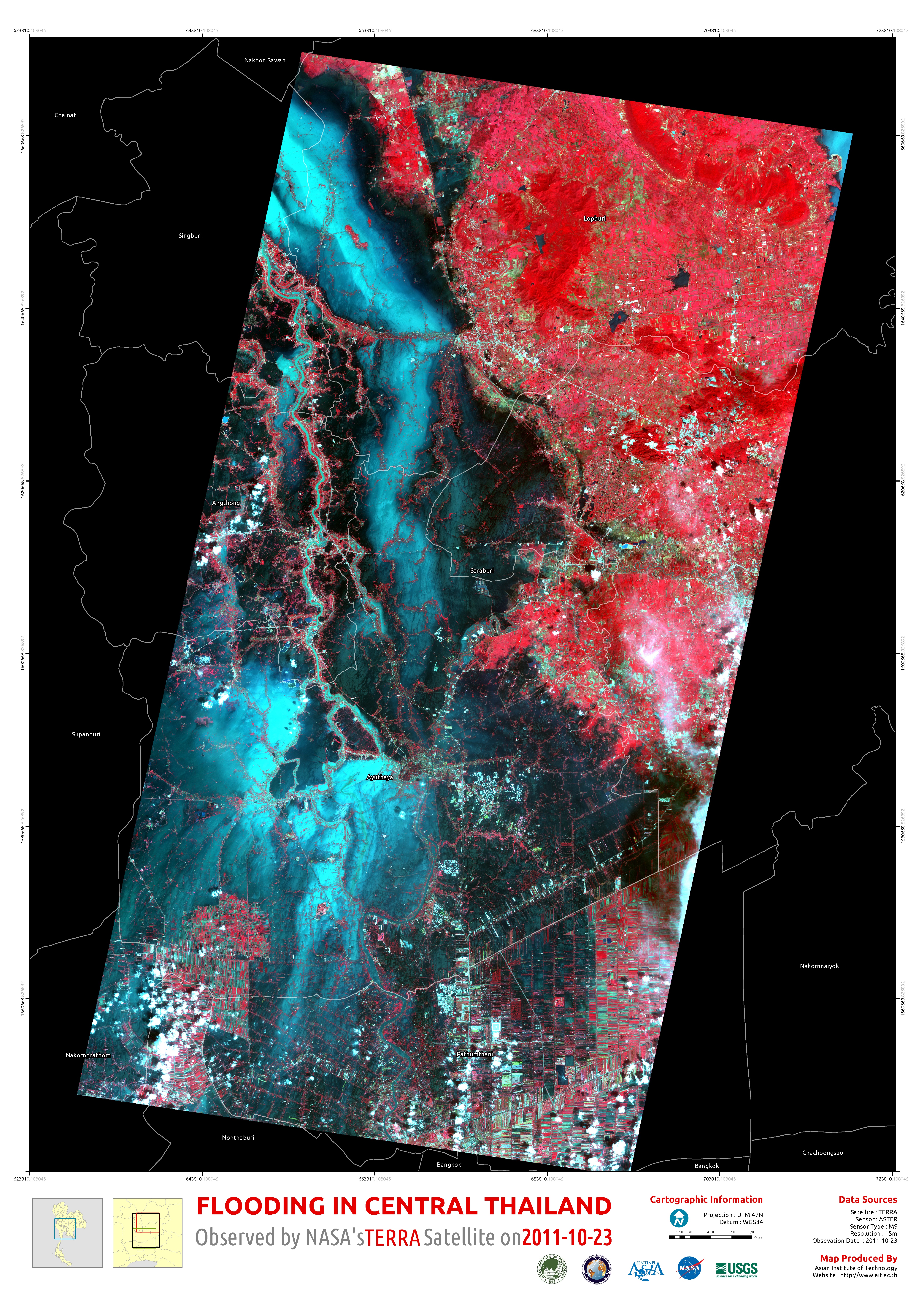
Flooding in central Thailand
Авторские права: German Aerospace Center (DLR) 2011
Commercial exploitation rights: Astrium GEO-Information Services
Map produced byAsian Institute of Technology (AIT)
Information about the Product
Получено: Pre-disaster: 10/02/11
Post-disaster: 26/10/11, 06/11/11, 12/11/11, 17/11/11 and 28/11/11
Источник: TerraSAR-X
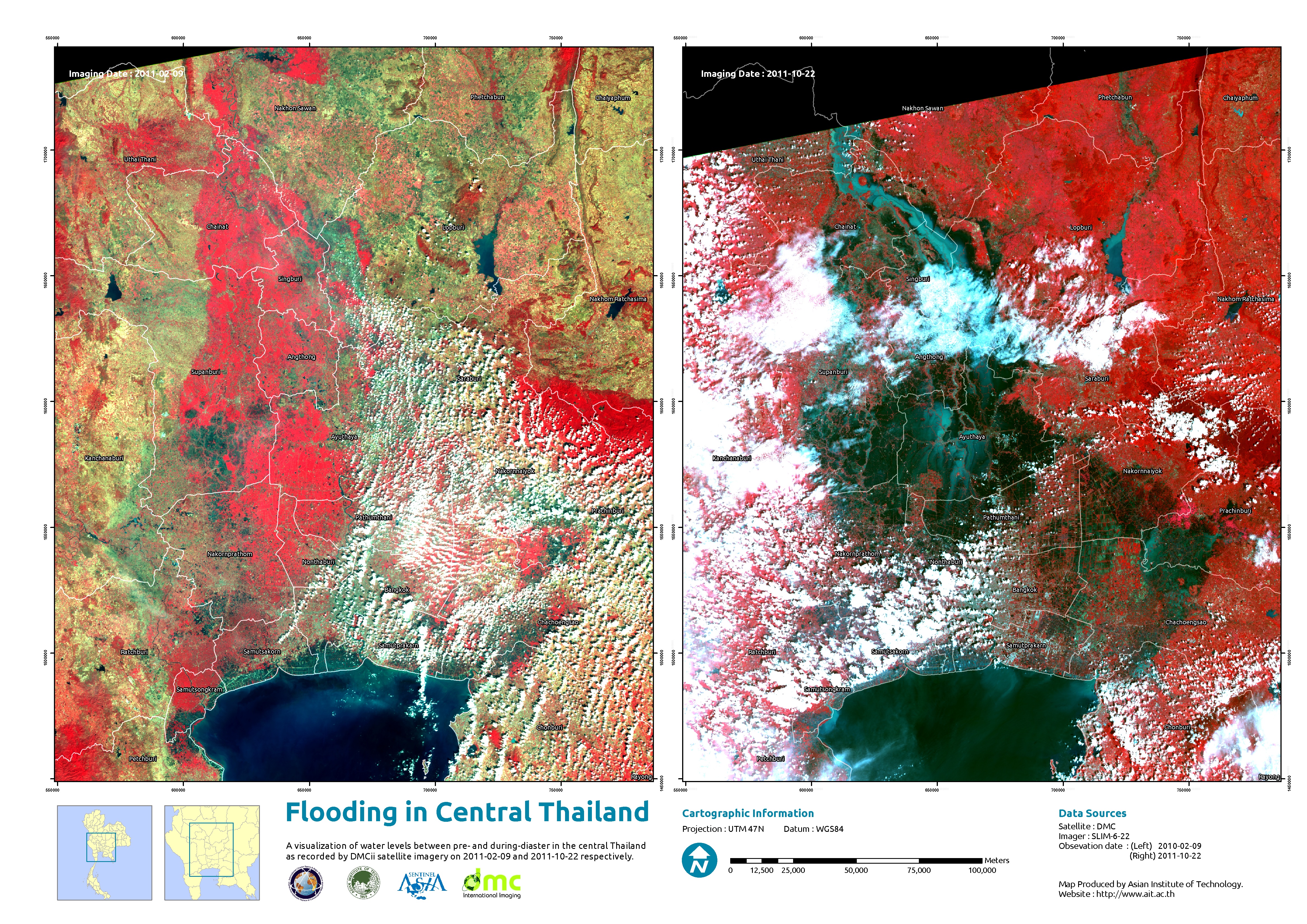
Flooding in central Thailand
Composite TerraSAR-X images
Авторские права: German Aerospace Center (DLR) 2011
Commercial exploitation rights: Astrium GEO-Information Services
Map produced by Asian Institute of Technology (AIT)
Information about the Product
Получено: Pre-disaster: 10/02/11
Post-disaster: 26/10/11, 06/11/11, 12/11/11, and 17/11/11
Источник: TerraSAR-X
Flooding in central Thailand
Composite TerraSAR-X images
Авторские права: German Aerospace Center (DLR) 2011
Commercial exploitation rights: Astrium GEO-Information Services
Map produced by Asian Institute of Technology (AIT)
Information about the Product
Получено: Pre-disaster: 10/02/11
Post-disaster: 26/10/11, 06/11/11 and 12/11/11
Источник: TerraSAR-X
Flooding in central Thailand
Авторские права: German Aerospace Center (DLR) 2011
Commercial exploitation rights: Astrium GEO-Information Services
Map produced by Asian Institute of Technology (AIT)
Information about the Product
Получено: Pre-disaster: 10/02/11
Post-disaster: 26/10/11, 06/11/11 and 12/11/11
Источник: TerraSAR-X

 Вернуться к полному архиву активаций

