 English
 Spanish
 French
 Chinese
 Russian
 Portuguese
 最新宪章启动
Charter activations
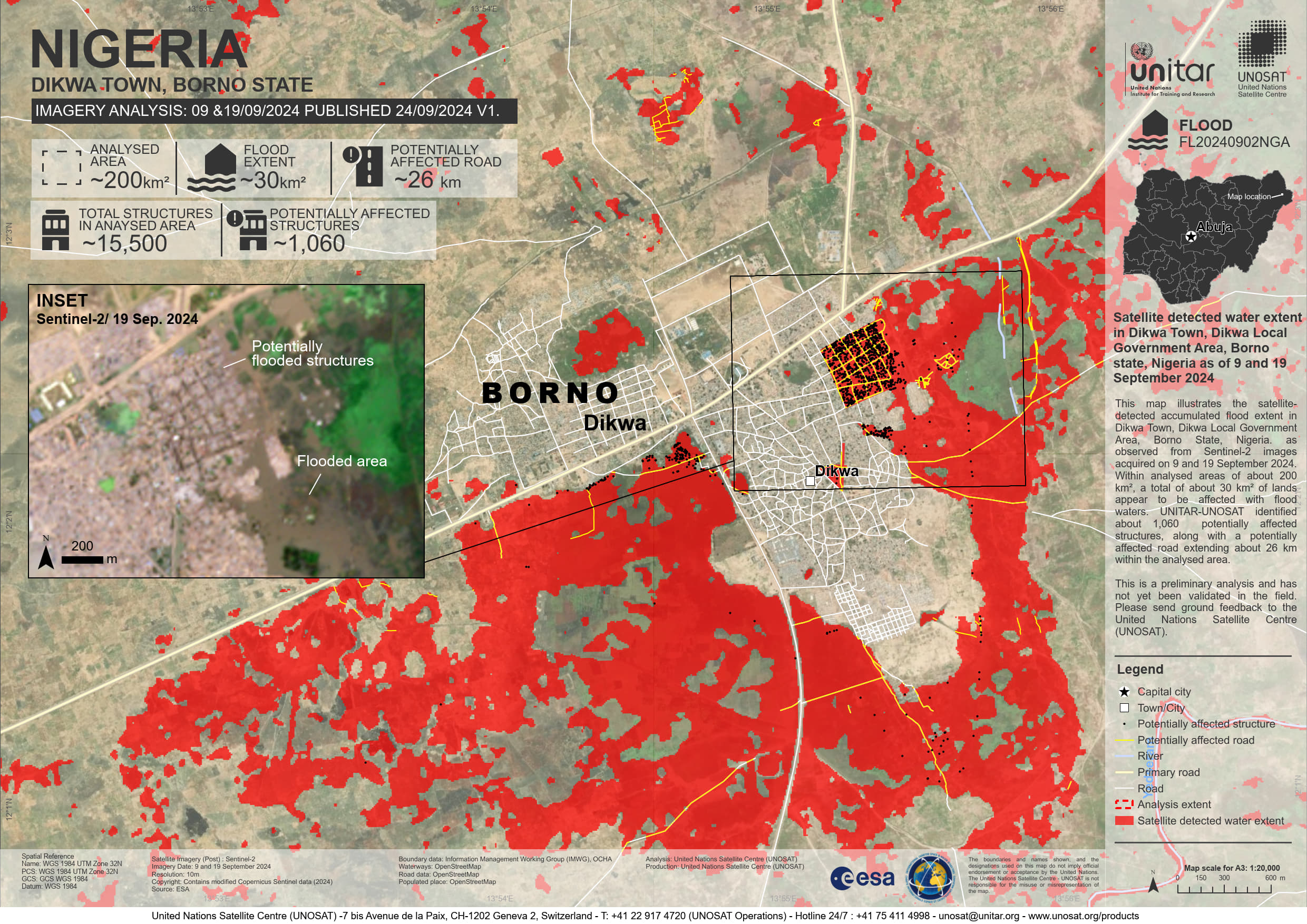
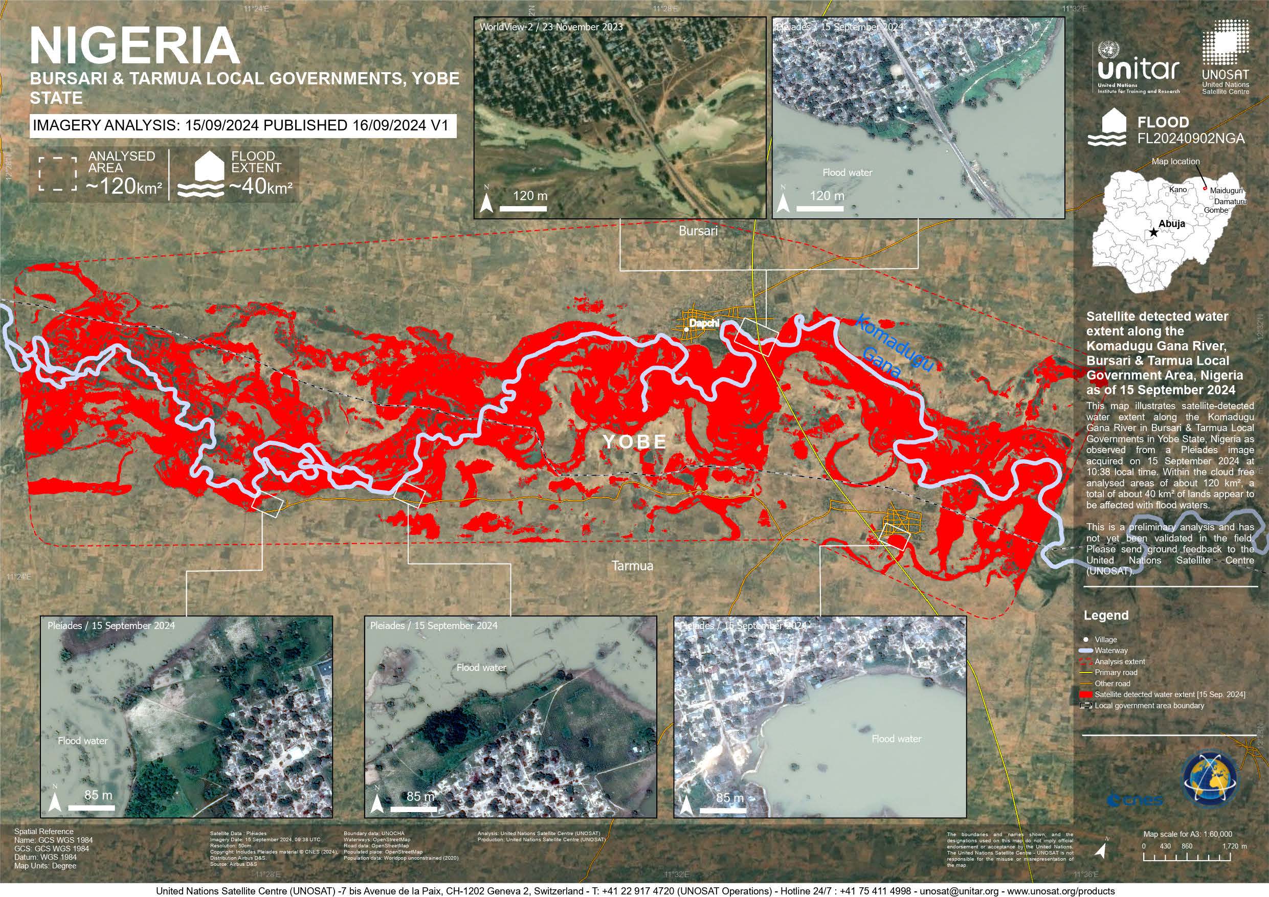
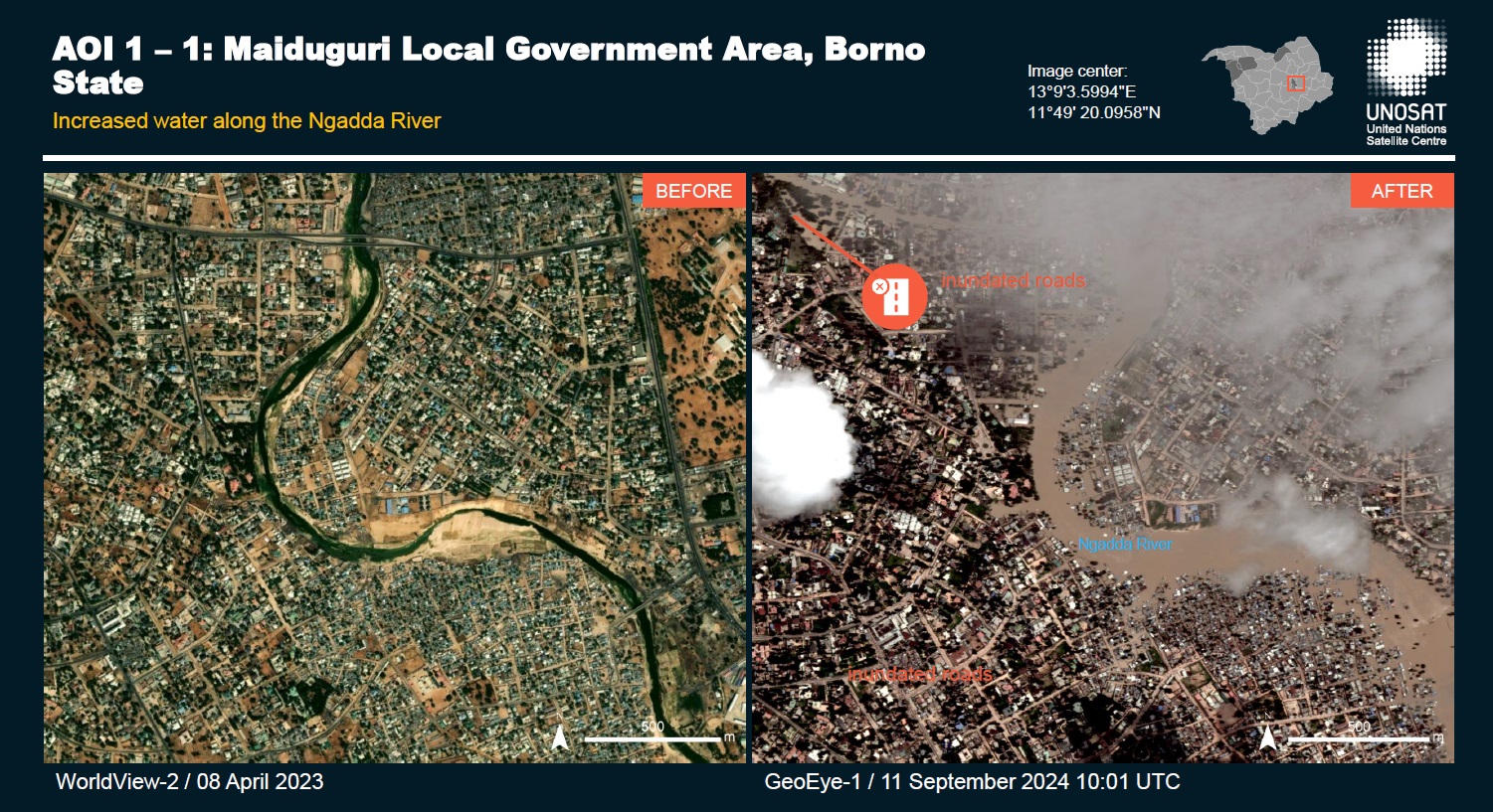
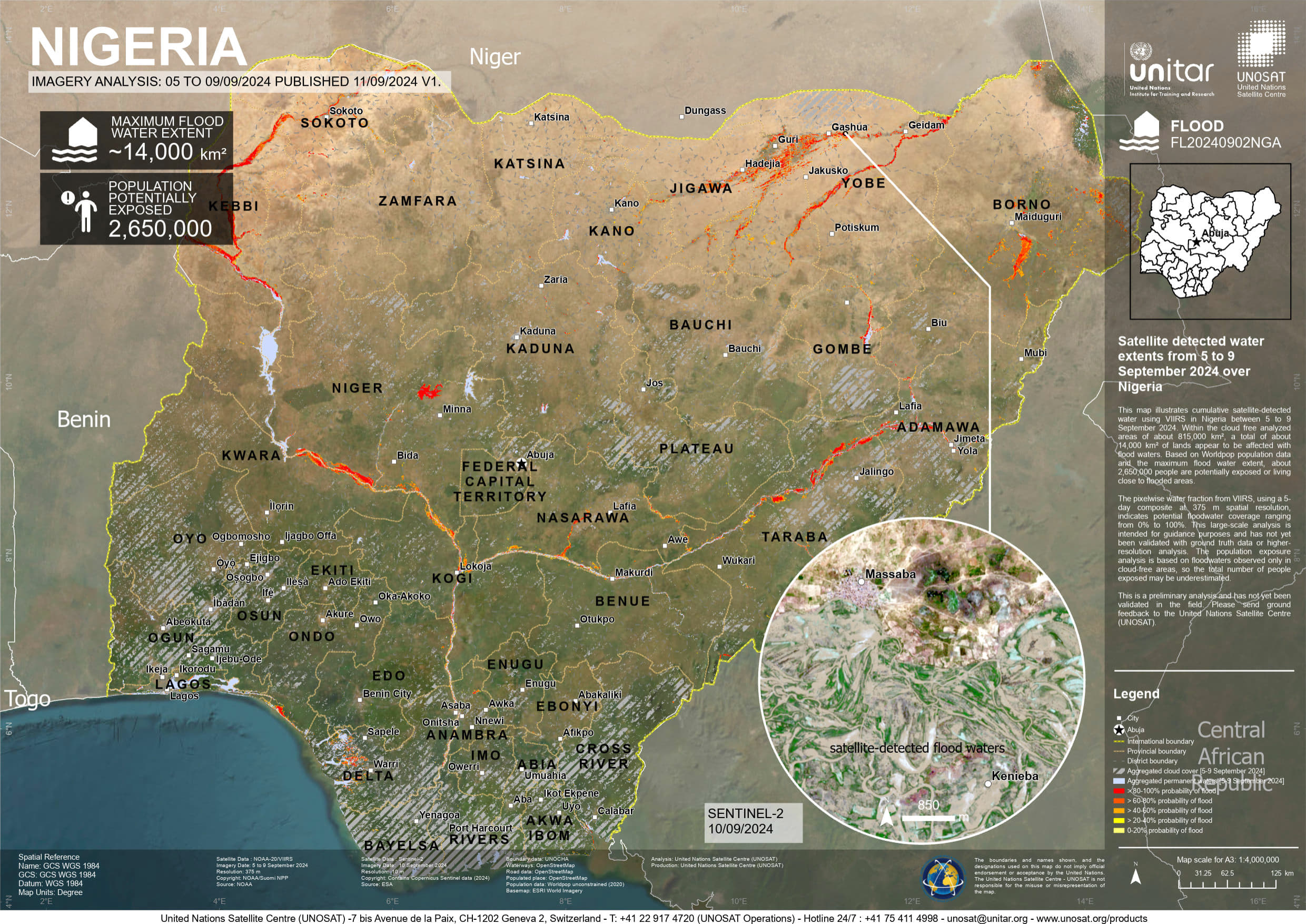
Flood in Nigeria
Nigeria is currently experiencing severe flooding across multiple states, particularly in the northern regions. Intense rainfall and overflowing rivers have resulted in extensive damage.
The flooding has destroyed homes, forced communities to evacuate, and washed away thousands of hectares of agricultural farmland, exacerbating food supplies, a critical concern in the nation.
The circumstances are anticipated to worsen, as September and October generally mark the height of the rainy season.
Related Resourses:
| 事件类型: | Flood |
| 事件地点: | Nigeria |
| 启动宪章的日期: | 2024-09-11 |
| 宪章启动时间: | 17:18 |
| 宪章启动时区: | UTC+07:00 |
| 宪章要求者: | UNOSAT on behalf of World Meteorological Organization |
| 启动ID: | 910 |
| 项目经理: | Teodoro Hunger (UNITAR/UNOSAT) |
Products
Preliminary satellite-derived flood assessment - Yobe & Borno State, Nigeria Download full report
版权: Includes Pleiades material © CNES (2024), Distribution Airbus DS.
© 2004 GeoEye
NextView License
Report produced by UNITAR / UNOSAT
Information about the Product
已获得: GeoEye: 11/09/2024, Pleiades: 13/09/2024
源: Pleiades, GeoEye
类别: Reference Map
 返回完整的响应档案

