 English
 Spanish
 French
 Chinese
 Russian
 Portuguese
 Latest Activation
Charter activations
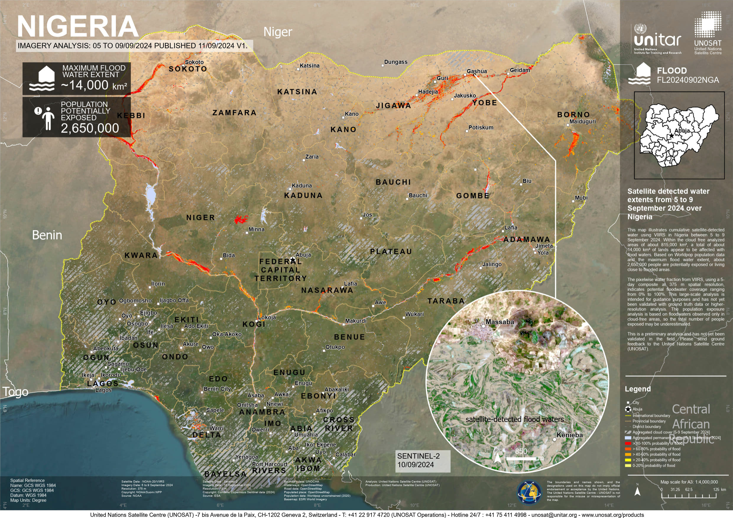
Flood in Nigeria
Nigeria is currently experiencing severe flooding across multiple states, particularly in the northern regions. Intense rainfall and overflowing rivers have resulted in extensive damage.
The flooding has destroyed homes, forced communities to evacuate, and washed away thousands of hectares of agricultural farmland, exacerbating food supplies, a critical concern in the nation.
The circumstances are anticipated to worsen, as September and October generally mark the height of the rainy season.
Related Resourses:
| Tipo de evento: | Flood |
| Local do evento: | Nigeria |
| Data da Ativação da Carta: | 2024-09-11 |
| Tempo de Ativação da Carta: | 17:18 |
| Zona de Tempo da Ativação da Carta: | UTC+07:00 |
| Requisitante da Carta: | UNOSAT on behalf of World Meteorological Organization |
| ID da Ativação: | 910 |
| Gerenciamento de projeto: | Teodoro Hunger (UNITAR/UNOSAT) |
Products
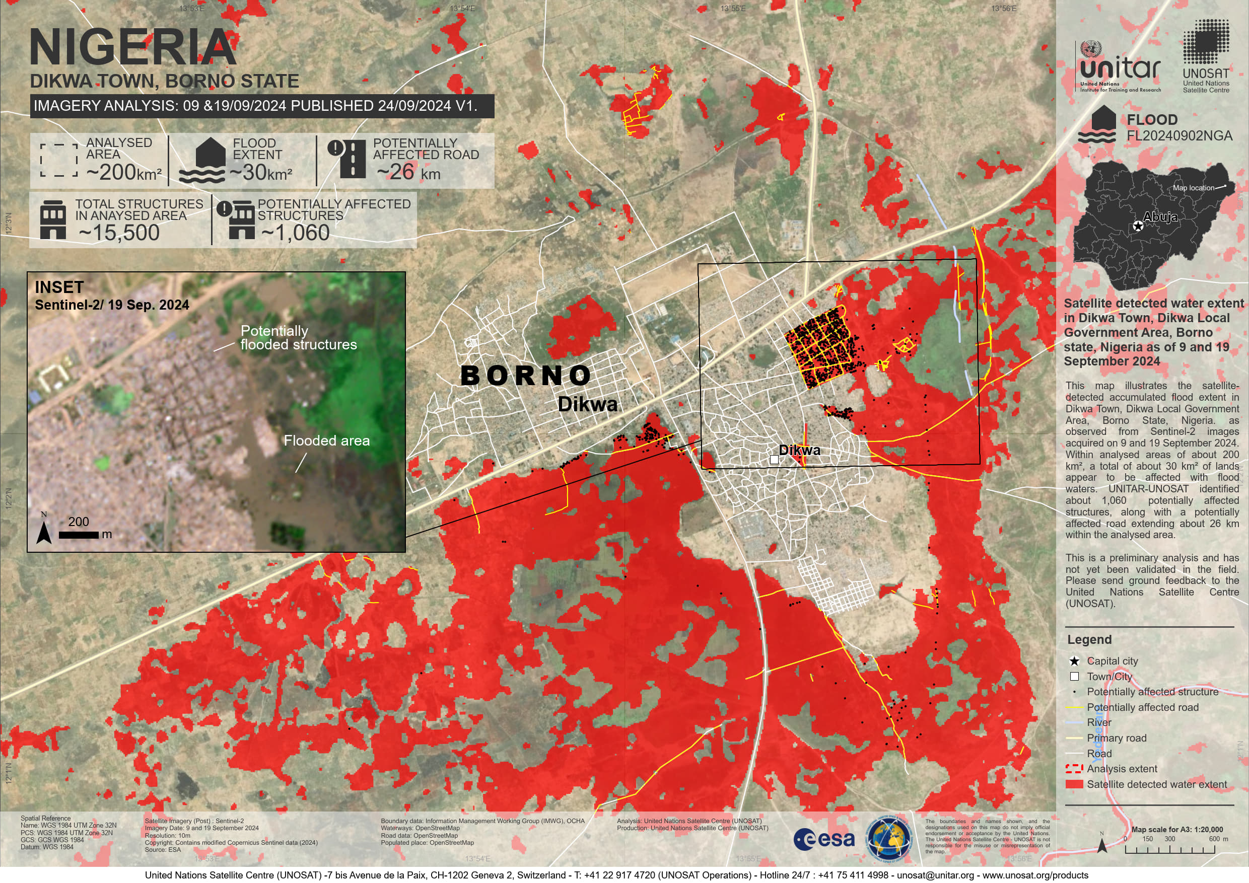
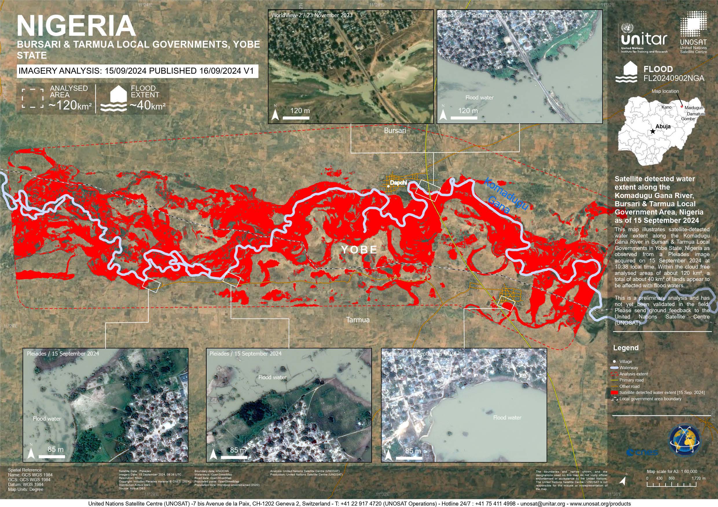
Satellite detected water extent along the Komadugu Gana River, Bursari & Tarmua Local Government Area, Nigeria
Direitos autorais: Includes Pleiades material © CNES (2024), Distribution Airbus DS.
Map produced by UNITAR/ UNOSAT
Information about the Product
Adquirida: 15/09/2024
Fonte: Pleiades
Categoria: Reference Map
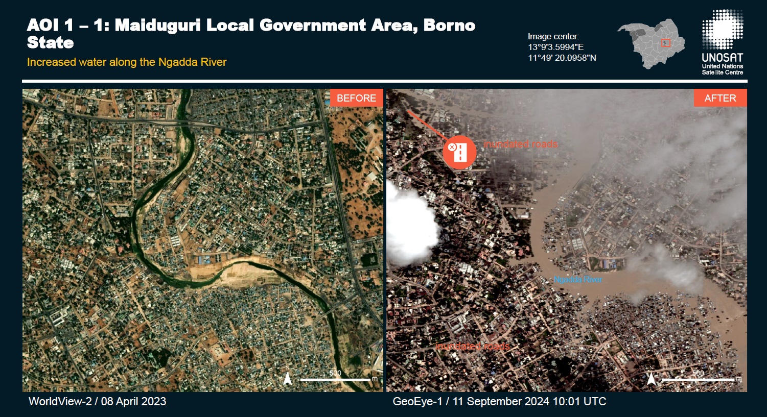
Preliminary satellite-derived flood assessment - Yobe & Borno State, Nigeria Download full report
Direitos autorais: Includes Pleiades material © CNES (2024), Distribution Airbus DS.
© 2004 GeoEye
NextView License
Report produced by UNITAR / UNOSAT
Information about the Product
Adquirida: GeoEye: 11/09/2024, Pleiades: 13/09/2024
Fonte: Pleiades, GeoEye
Categoria: Reference Map
 Voltar ao arquivo completo da Ativação

