Charter activations
Mount Lewotobi Laki-laki Volcano Eruption in Indonesia
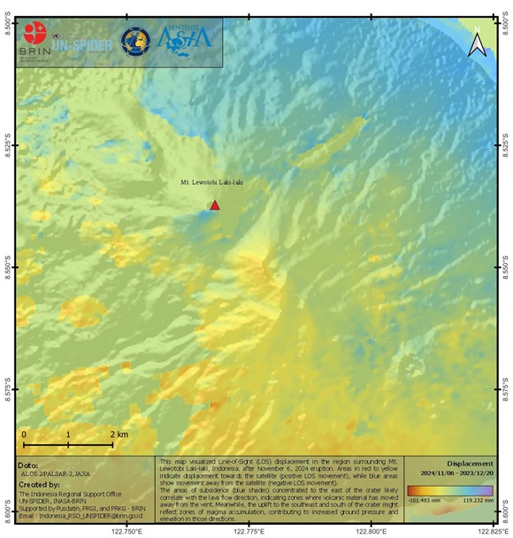
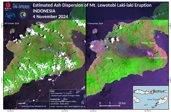
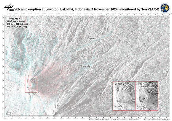
On the remote island of Flores, Indonesia, Mount Lewotobi Laki-laki erupted on 03 November at 22:57 UTC+7.
The 1,584-meter (5,197-foot) volcano unleashed a thick coloum of ash into the sky. A second larger eruption was reported on 07 November. The eruption was recorded on a seismograph with a maximum amplitude of 47.3 mm and a duration of 1,450 seconds. Volcanic materials, including smoldering rocks, lava and hot, thumb-size gravel and ash were thrown up to 7 kilometers (4.3 miles) from its crater on 04 November.
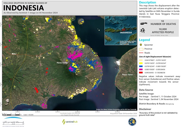
The first eruption affected more than 10,000 people in 10 villages, 10 deaths have been reported so far. Emergency response operations are still ongoing following the eruption of Lewotobi Laki-laki. Search and rescue efforts are ongoing to ensure all victims are evacuated from the affected locations.
The government has declared an Emergency Response Status starting from 03 November until 31 December 2024. There are concerns that high intensity rain may cause lahars (volcanic sediment washed down the mountain by the flood) in rivers that originate at the peak of Mount Lewotobi Laki-laki, especially in the Dulipali, Padang Pasir and Nobo areas.
About 4,400 villagers moved into makeshift emergency shelters after the eruption, which destroyed seven schools, nearly two dozen houses and a convent on the majority-Catholic island.
Related Resources:
Sentinel Asia activation for Mount Lewotobi Laki-laki Volcano Eruption in Indonesia
| Тип события: | Volcano Eruptions and Earthquakes |
| Место события: | Indonesia |
| Date of Charter Activation: | 2024-11-07 |
| Время активации Хартии: | 18:12 |
| TЧасовой пояс в районе активации Хартии: | UTC+09:00 |
| Запрос на активацию поступил от: | ADRC on behalf of BRIN |
| Номер активации: | 927 |
| Менеждер проекта от: | National Research and Innovation Agency (BRIN) |
| act-value-adders: | SERTIT Rapid Mapping Service Yenni Vetrita (National Research and Innovation Agency (BRIN)) Shaikha Ahmed Albesher (Mohammed Bin Rashid Space Centre) |
Products
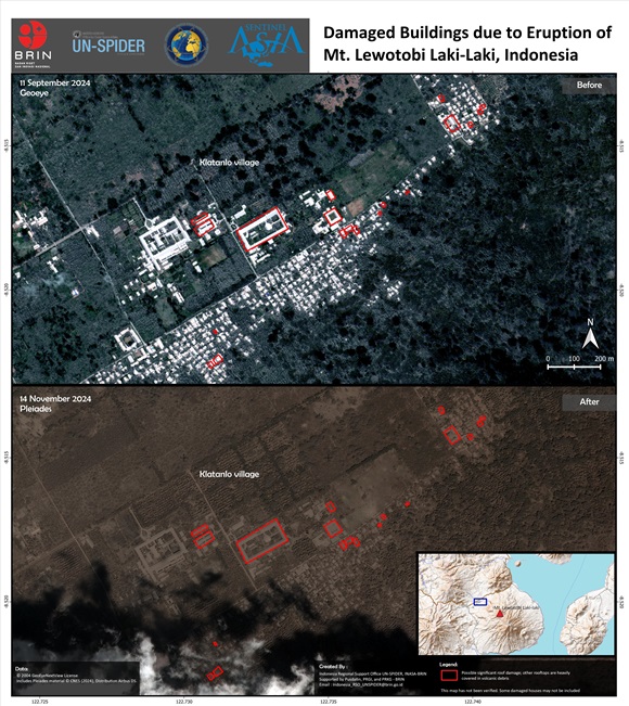
Damaged Buildings due to Eruption of Mt. Lewotobi Laki-Laki, Indonesia
Авторские права: Includes Pleiades material © CNES (2024), Distribution Airbus DS.
© 2004 GeoEye NextView License
Map produced by UN-SPIDER
Information about the Product
Получено: GeoEye: 11/09/2024, Pleiades: 14/11/2024
Источник: GeoEye
Категория: Grading Map
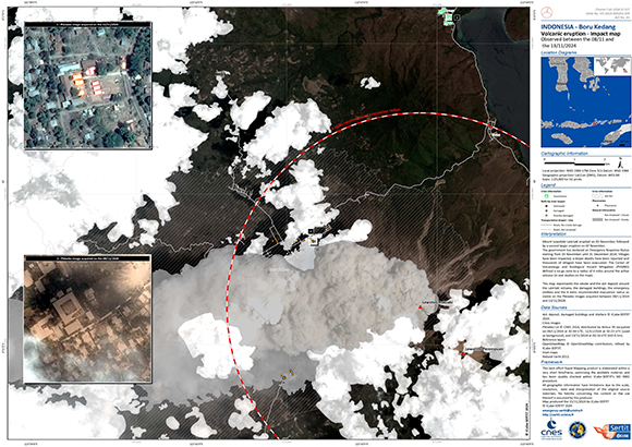
Impact map of the Mount Lewotobi Laki-laki volcanic eruption in Boru Kedang, Indonesia
Авторские права: Includes Pleiades material © CNES (2024), Distribution Airbus DS.
Map produced by ICube -SERTIT
Information about the Product
Получено: 13/11/2024
08/11/2024
12/11/2024
Источник: Pleiades
Категория: Grading Map
 Вернуться к полному архиву активаций

 English
 Spanish
 French
 Chinese
 Russian
 Portuguese
