 English
 Spanish
 French
 Chinese
 Russian
 Portuguese
 Последняя Активация
Charter activations
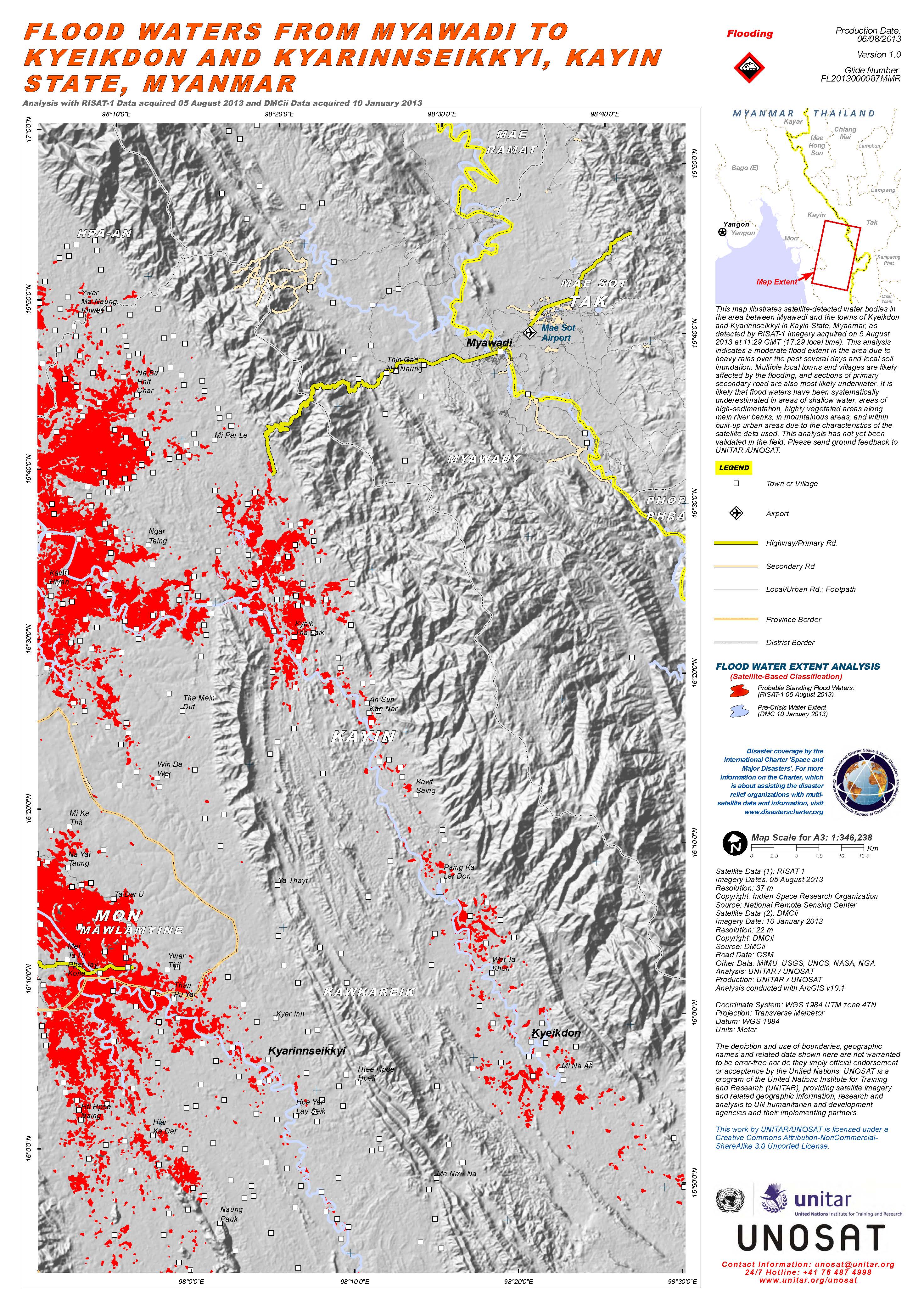
Floods in Myanmar
Flash floods swept across eastern Myanmar on Friday, following days of heavy rain. Three people were killed, up to 38,000 others have been evacuated into relief camps and one person is missing, according to state media reports.
The worst affected areas are; Kayin and Mon states. In Mon State, 4,700 people were displaced from their homes during heavy floods. Since Friday, heavy rains and landslides have damaged roads and 245 schools have been closed.
The United Nations, UNICEF and Save the Children organisations have distributed food, water and medical aid into relief camps including water purification tablets and Non-Food Items (NFI) kits. The Government has also delivered food and aid packages to people in Kayin and Mon states.
Further heavy rains have been forecasted in the western region near the Irrawaddy Delta River, local people have been issued advanced warning to take preventive measures.
Myanmar experiences the monsoon season every year in the month of July, which lasts until October.
| Тип события: | Floods |
| Место события: | Myanmar |
| Date of Charter Activation: | 2 August 2013 |
| Запрос на активацию поступил от: | UNITAR/UNOSAT on behalf of UNDP |
| Менеждер проекта от: | UNITAR / UNOSAT |
Products
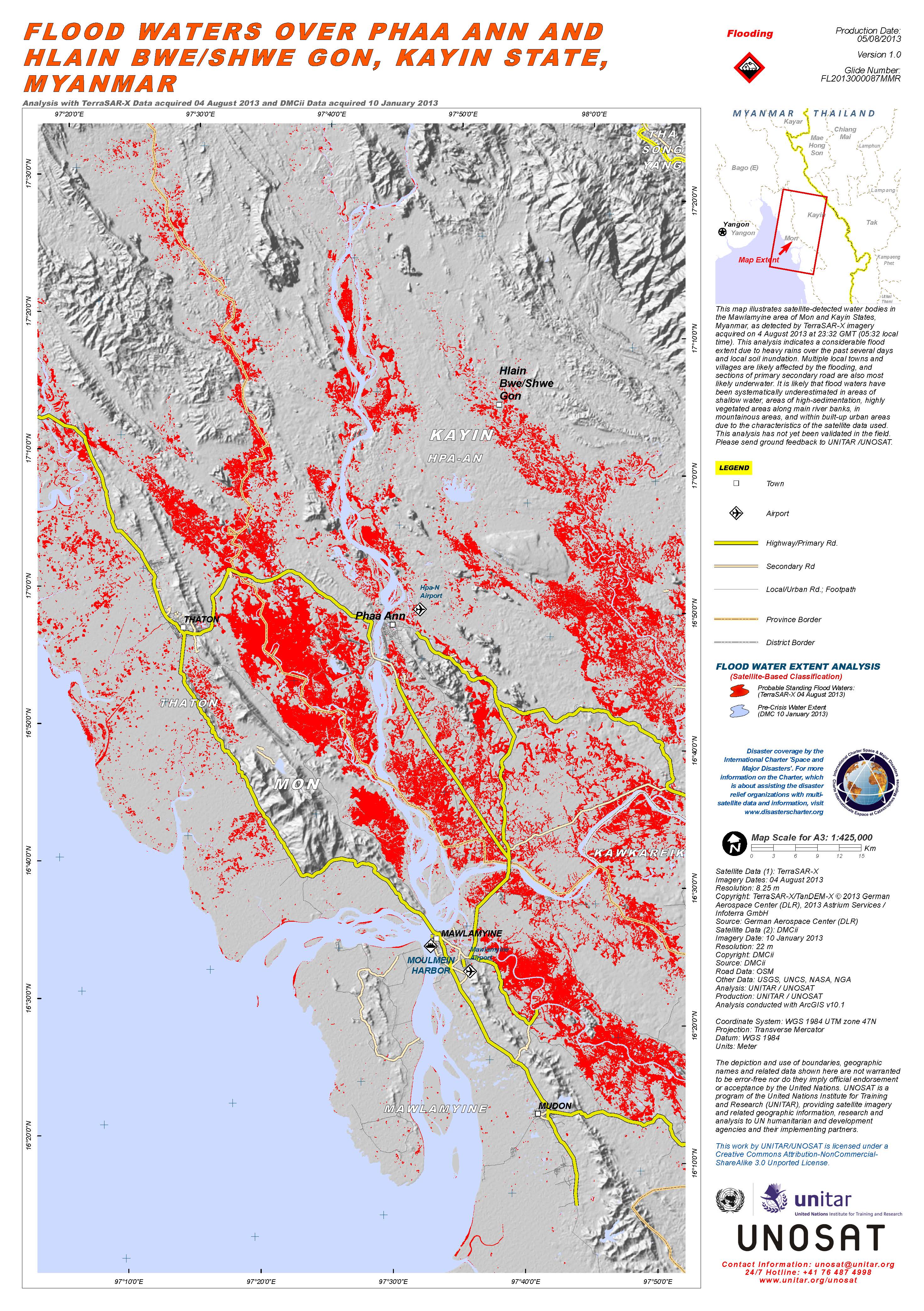
Flood Waters over Phaa Ann and Hlain Bwe/Shwe Gon, Kayin State, Myanmar
Авторские права: TerraSAR-X/TanDEM-X © 2013 German Aerospace Center (DLR), 2013 Astrium Services / Infoterra GmbH
UKSA
Map produced by UNITAR / UNOSAT
Information about the Product
Получено: Post-crisis: 04/08/2013
Pre-crisis: 10/01/2013
Источник: TerraSAR-X
UKSA
 Вернуться к полному архиву активаций

