Charter activations
Typhoon Yagi in Myanmar
After hitting Vietnam, Typhoon Yagi swept inland and poured heavy rain on Tuesday, 10 September 2024. Floodwaters as high as five meters (15 feet) submerged parts of Myanmar's capital, Naypyidaw. Flooding swept away houses and trapped thousands of residents.
Rising waters have affected Myanmar's northern regions, leaving residents without electricity or phone service. Further south, the Thaungyin River burst its banks, resulting in several neighbouring residential areas being flooded. People had no time to take their belongings, as the water level rose rapidly. Residents have since taken shelter at monasteries and schools. In Tachileik town, it was reported that many people were stuck at their offices and could not leave. One death was caused by a landslide triggered by flooding in Hopong Township in eastern Shan State.
The military announced the temporary stop of train transport between Yangon and Mandalay as a railway bridge in Mandalay swept away by floods.
Currently, 17 deaths were been reported by the fire department. At least 5,000 people were impacted by flooding caused by the Typhoon.
| Type of Event: | Flood |
| Location of Event: | Myanmar |
| Date of Charter Activation: | 2024-09-12 |
| Time of Charter Activation: | 13:03 |
| Time zone of Charter Activation: | UTC+09:00 |
| Charter Requestor: | ADRC on behalf of MIMU |
| Activation ID: | 911 |
| Project Management: | Suwanan Sateiandee (UNOSAT) |
| Value Adding: | Meera AlShamsi (MBRSC) |
Products

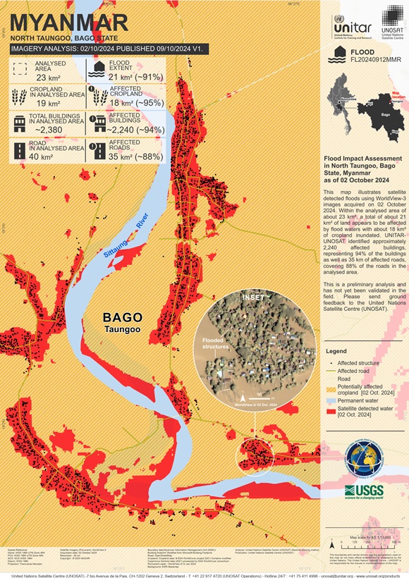
Flood Impact Assessment in North Taungoo, Bago State, Myanmar
Copyright: © (2024) DigitalGlobe, Inc., Longmont CO USA 80503. DigitalGlobe and the DigitalGlobe logos are trademarks of DigitalGlobe, Inc. The use and/or dissemination of this data and/or of any product in any way derived there from are restricted. Unauthorized use and/or dissemination is prohibited
Map produced by UNITAR / UNOSAT
Information about the Product
Acquired: 02/10/2024
Source: WorldView-3
Category: Delineation Map

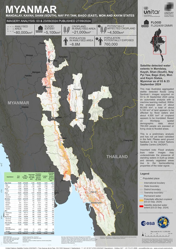
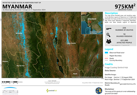
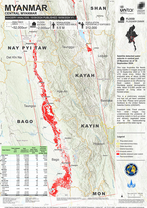
Areas affected by flooding in Mandalay, Kayah, Shan (South), Nay Pyi Taw, Bago (Est), Mon and Kayin States, Myanmar
Copyright: Contains modified Copernicus Sentinel data (2024)
Map produced by UNITAR / UNOSAT
Information about the Product
Acquired: 04/09/2024, 08/09/2024, 11/09/2024, 16/09/2024, 20/09/2024,
Source: Sentinel-1
Category: Delineation Map
 Back to the full activation archive

 English
 Spanish
 French
 Chinese
 Russian
 Portuguese


