 English
 Spanish
 French
 Chinese
 Russian
 Portuguese
 Последняя Активация
Charter activations
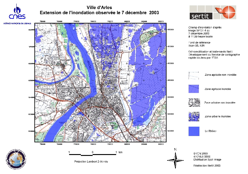
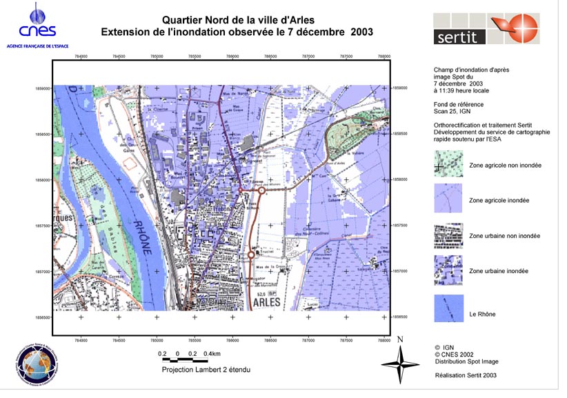
Flooding in Arles, France
Severe rains started on December 1st, 2003 over Southern France, causing rivers such as Rhone and Gard to flood country and towns such as Arles. In total more than 30,000 people were evacuated or brought to safe places, 7 people lost their lives. Around 80 roads and thousands of phone and power lines were cut. Waters would remain for several days. 800 rescue staff from Germany and squads from Belgium, Italy and Czech republic assisted their French colleagues.
The Charter was activated by the French Civil Protection on December 4 with RADARSAT, SPOT, ERS, and ENVISAT satellites being re-tasked. The Project management was assigned to CNES. At the same time, DLR and EUSI provided at their initiative and in coordination with the Charter satellite image maps from the IKONOS satellite to support to the French and German relief workers.
| Тип события: | Flood |
| Место события: | Arles, France |
| Date of Charter Activation: | December 4, 2003 |
| Запрос на активацию поступил от: | French Civil Protection Agency |
| Менеждер проекта от: | CNES |
 Вернуться к полному архиву активаций

