 English
 Spanish
 French
 Chinese
 Russian
 Portuguese
 Последняя Активация
Charter activations
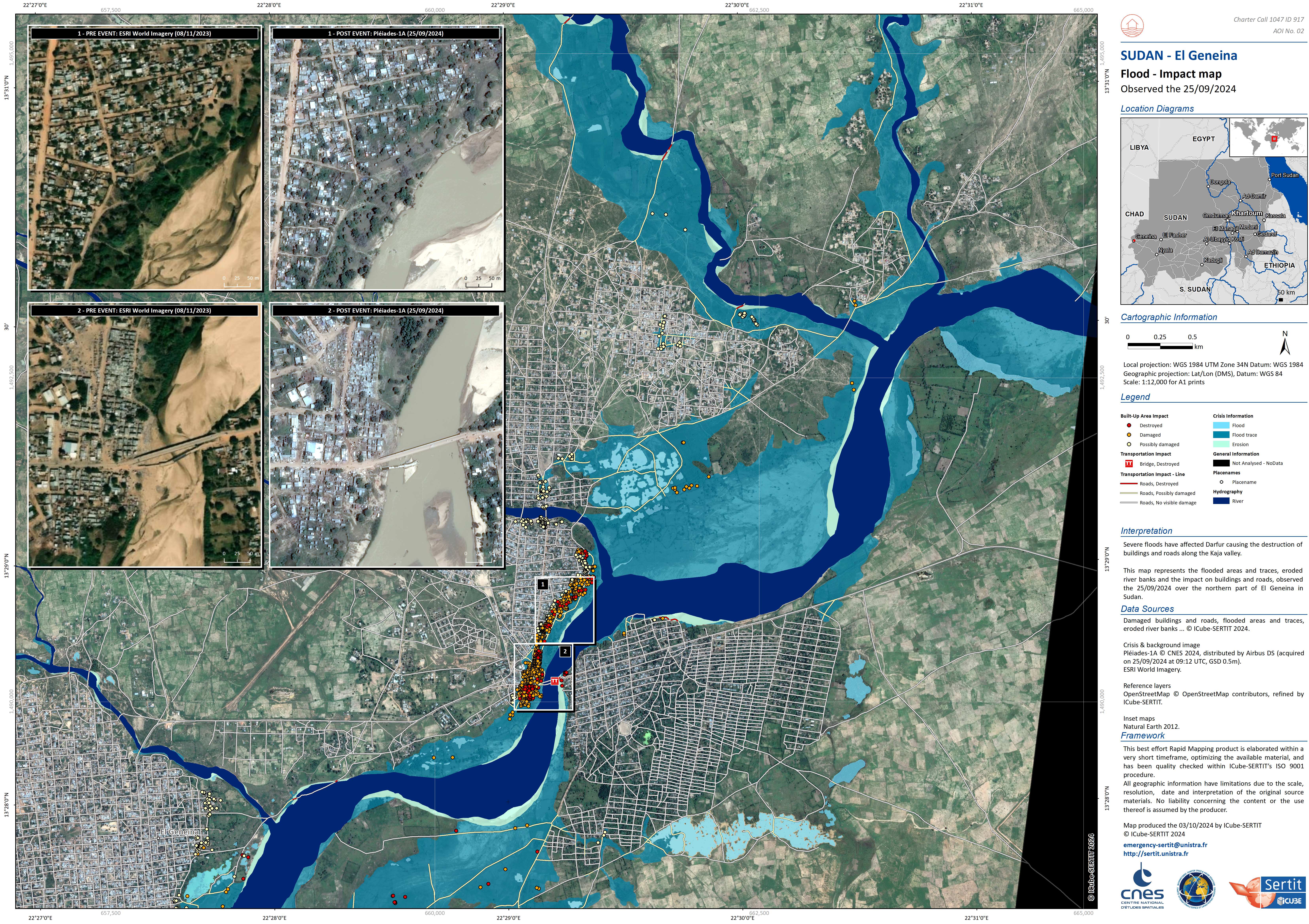
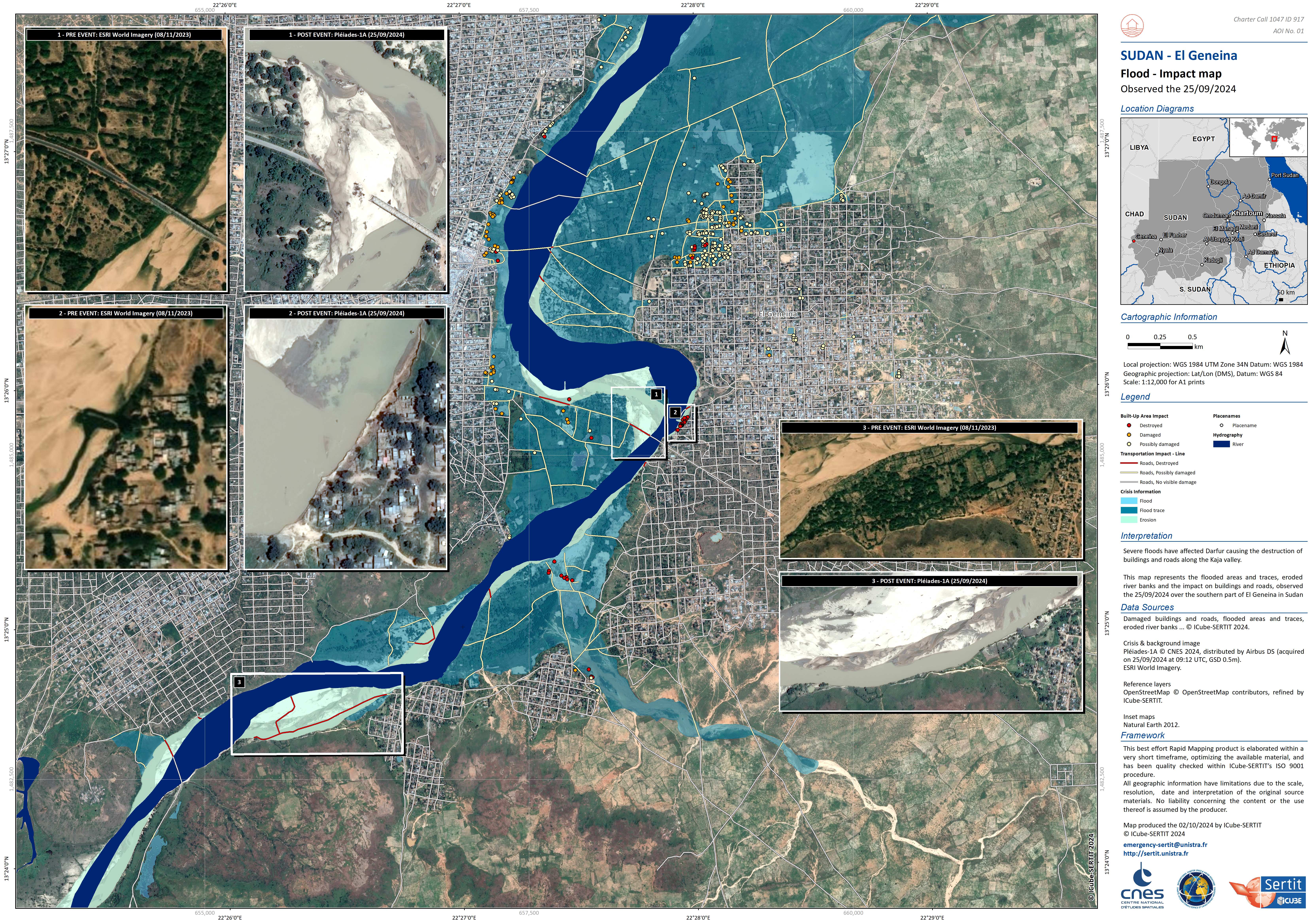
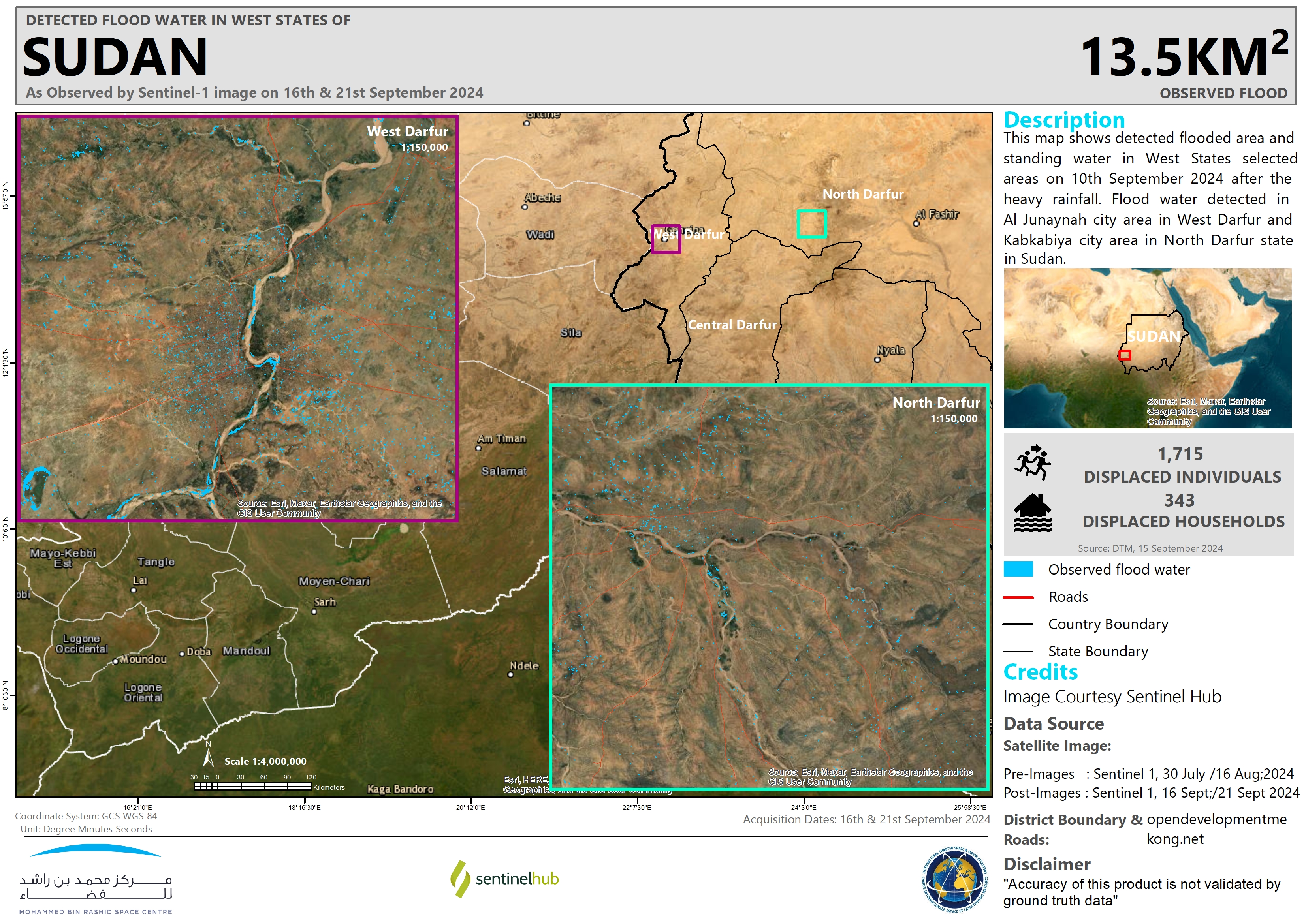
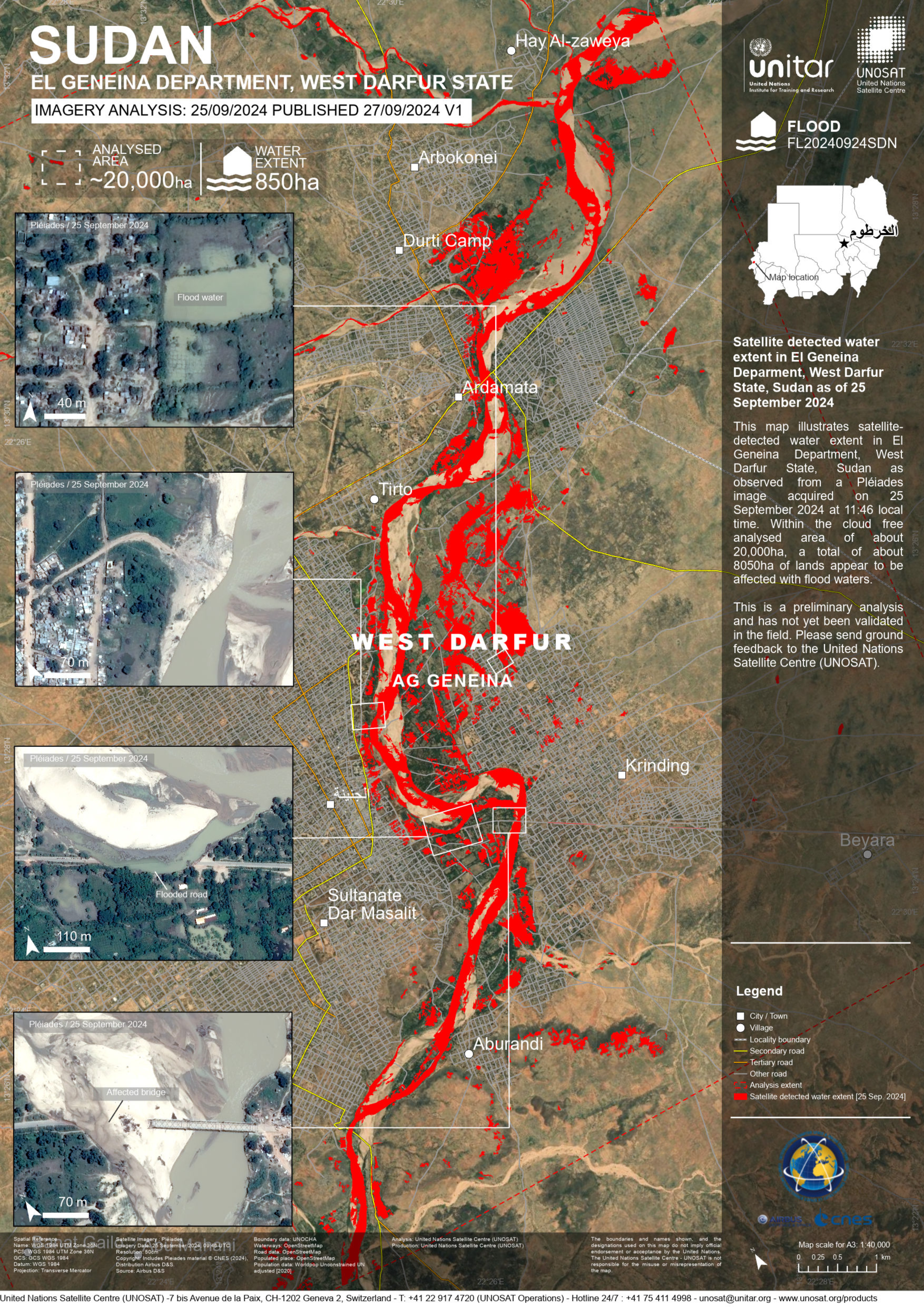
Flood in Sudan
Severe floods have affected Darfur and areas along the Nile affecting several local communities and cultural heritage sites.
Essential infrastuctural links have been washed away, particularly the Azum Valley Bridge over Wadi Barei at Mali, 50 kilometres east of Murnei in West Darfur, which forms a critical logistic link between West, Central, and South Darfur and the collapse of the Arbaat Dam, 20 kilometres north of Port Sudan.
The collapse of the bridges has had a major impact on the delivery of humanitarian aid to all parts of Darfur, because it has separated West Darfur State from the rest of the states of the region, and therefore there is no way to deliver aid to Central, South, East and North Darfur.
Flooding is an annual challenge in Sudan in August and September. Around that time each year, monsoon rains pour into the Ethiopian Highlands and flow down to the Blue Nile and White Nile. As the rivers wind their way north through Sudan and South Sudan, floodwaters often swamp riverside communities.
| Тип события: | Flood |
| Место события: | Sudan |
| Date of Charter Activation: | 2024-09-24 |
| Время активации Хартии: | 12:26 |
| TЧасовой пояс в районе активации Хартии: | UTC+02:00 |
| Запрос на активацию поступил от: | UNITAR on behalf of UNESCO |
| Номер активации: | 917 |
| Менеждер проекта от: | Samir Belabbes (UNITAR) |
| act-value-adders: | SERTIT Rapid Mapping Service (SERTIT Rapid Mapping Service) Shaikha Ahmed Albesher (Mohammed Bin Rashid Space Centre) |
Products
 Вернуться к полному архиву активаций

