Charter activations
Flood in Sri Lanka
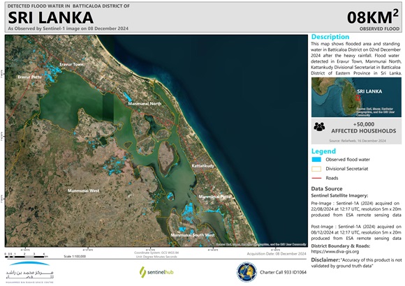
Heavy rainfall from a storm system, developed into a cyclone, caused severe flooding and landslides in Sri Lanka. Cyclone Fengal caused flooding in the Tamil Nadu state and the Puducherry region, after crossing India's southern coast from the Bay of Bengal on 30 November.
The latest data from the Disaster Management Centre in Colombo showed at least 16 fatalities, including children, and over 138,944 people were forced to evacuate. Northern and Eastern regions of the country were particularly hard-hit, with extensive damage to homes and infrastructure. The Puducherry region experienced 24-hour rainfall, while the southern city of Chennai was swamped with water.
Emergency services, including the Sri Lankan army, were mobilized. As roads were completely flooded, boats were used in rescue and relief efforts.
| Тип события: | Flood |
| Место события: | Sri Lanka |
| Date of Charter Activation: | 2024-12-02 |
| Время активации Хартии: | 10:39 |
| TЧасовой пояс в районе активации Хартии: | UTC+07:00 |
| Запрос на активацию поступил от: | UNOSAT on behalf of United Nations Population Fund (UNFPA) Sri Lanka Country Office |
| Номер активации: | 933 |
| Менеждер проекта от: | Jakrapong Tawala (UNITAR) |
| act-value-adders: | SERTIT Rapid Mapping Service (SERTIT Rapid Mapping Service) CSA Mohammed Bin Rashid Space Centre |
Products

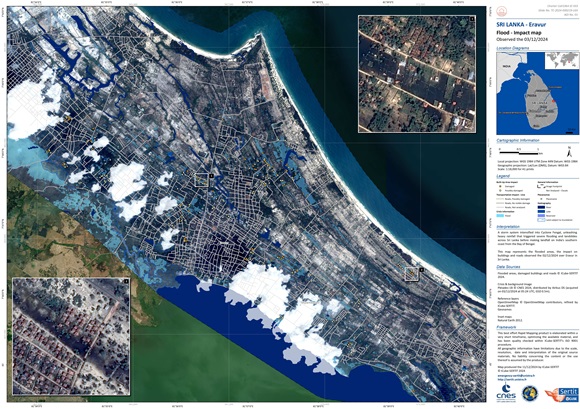
Flood impact assessment, Sri Lanka
Авторские права: RADARSAT Constellation Mission Imagery © Government of Canada (2024) - RADARSAT is an official mark of the Canadian Space Agency
Map produced by the Canadian Space Agency
Information about the Product
Получено: 28/11/2024
Источник: RCM
Категория: Reference Map
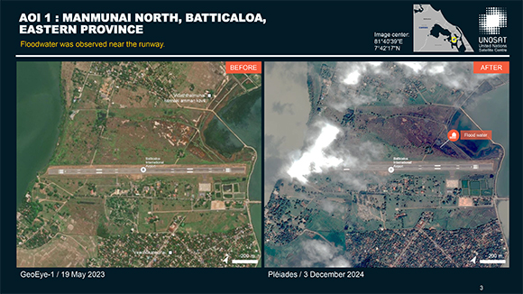
Preliminary satellite-derived flood impact assessment in the Batticaloa District, Eastern Province, Sri Lanka
Download full report
Авторские права: Includes Pleiades material © CNES (2024), Distribution Airbus DS.
Report produced by UNITAR / UNOSAT
Information about the Product
Получено: 03/12/2024
Источник: Pleiades
Категория: Dossier
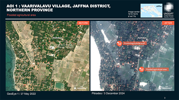
Preliminary satellite-derived flood impact assessment in the Jaffna District, Northern Province, Sri Lanka
Download full report
Авторские права: Includes Pleiades material © CNES (2024), Distribution Airbus DS.
Map produced by UNITAR / UNOSAT
Information about the Product
Получено: 03/12/2024
Источник: Pleiades
Категория: Dossier
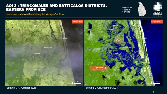
Preliminary satellite-derived flood impact assessment in the North Central Province and the Eastern Province, Sri Lanka
Download full report
Авторские права: Contains modified Copernicus Sentinel data (2024)
Report prepared by UNITAR / UNOSAT
Information about the Product
Получено: 02/12/2024
Источник: Sentinel-2
Категория: Dossier
 Вернуться к полному архиву активаций

 English
 Spanish
 French
 Chinese
 Russian
 Portuguese
