Свернуть Последняя Активация

Charter activations

Earthquake in Iran

An earthquake of a 6.4 magnitude on the Richter scale hit the southwest of Iran on Tuesday, 22 February. According to initial reports, the powerful earthquake has left at least 170 people dead and 5,000 injured in the province of Kerman. Nine villages in the region have been affected. At the end of May 2004, an earthquake hit the the north of Iran and Tehran causing the deaths of 35 people and leaving 220 injured.

Тип события:Earthquake
Место события:Iran
Date of Charter Activation:22/02/2005
Запрос на активацию поступил от:European Monitoring and Information Centre, French Civil Protection Agency, United Nations Office for Outer Space Affairs (UNOOSA)
Менеждер проекта от:ESA

Products

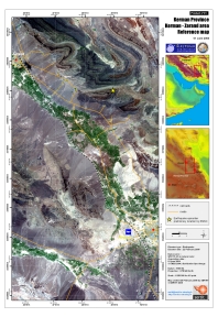
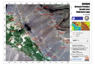
Kerman Province - Kerman Zarand Area, Iran

Авторские права: SERTIT
Location Map Mosaic Spot
Map produced 25/02/2005 by SERTIT

Information about the Product

Получено: 1 June 2004

Источник: SPOT 5 2.5 m natural colour
Datum: WGS 84
Projection: UTM Zone 40 N
Scale 1:250,000

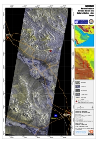
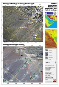
Kerman Province, Iran, before-after image.

Авторские права: CSA, Radarsat International.
Radarsat Change Overview
Map produced 25/02/2005 by SERTIT

Information about the Product

Получено: 28 April 2004

Источник: Radarsat 6.25 m resolution.
Scale: 1:250,000.

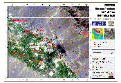
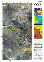
Kerman Province - Zarand Area, Iran

Авторские права: ISRO 2004.
Map produced 28/02/2005 by SERTIT

Information about the Product

Получено: 27 Aug & 8 Sept 2004

Источник: Scale 1:75,000.

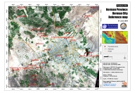
Kerman Province, Iran

Авторские права: CNRS 2004.
Map produced 25/02/2005 by SERTIT

Information about the Product

Получено: 1 June 2004.

Источник: SPOT 5
2.5 m resolution
Scale 1:75,000.

Kerman Province, Iran

Авторские права: CNRS 2004.
Map produced 25/02/2005 by SERTIT

Information about the Product

Получено: 1 June 2004.

Источник: SPOT 5
2.5m resolution
Scale 1:75,000

Deh Asghar, Iran, before-after image

Авторские права: CSA, Radarsat International.
Map produced 25/02/2005 by SERTIT

Information about the Product

Получено: 28/04/1998 and 25/02/2005.

Источник: Radarsat 6.25 m resolution
Scale: 1:50,000.

Kerman Province -Dahu'iyeh Region, Iran, Before-After

Авторские права: ISRO 2004/5.
Map produced 03/03/2005 by SERTIT

Information about the Product

Получено: 29 August 2004

Источник: IRS
Scale 1/10 000.

Kerman Province - Ravar Area, Iran

Авторские права: ISRO 2004.

Information about the Product

Получено: 05 August 2004

Источник: Map produced 28/02/2005 by SERTIT Scale 1:400,000.

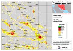
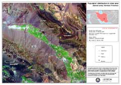
Zadang Population density

Information about the Product

Источник: LandScan 2002
Resolution: 1km
Datum: WGS84
Projection: UTM Zone 40 N

Zadang Landsat Pre-disaster

Information about the Product

Получено: 7 August 2000

Источник: Landsat ETM+
Resolution: 30m
Datum: WGS84
Projection: UTM Zone 40 N

Вернуться к полному архиву активаций