Latest Activation
Charter activations
Typhoon Megi in the Philippines
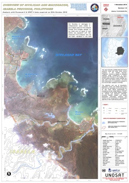
Typhoon Megi (locally named Juan) made landfall as a category 5 typhoon in the mountain range of sierra Madre, Isabella Province, Cagayan region (Region II) at 11:25 am on 18 October 2010. At least 10 people have been killed in the Philippines by the typhoon which hit the north of the country. Communication channels have been cut and access prevented due to stormy weather and roads blocked by small landslides.
Typhoon Megi weakened after landfall and made a West-South-West path across northern Luzon Island at 19km per hour.
| Tipo de evento: | Typhoon, Floods |
| Local do evento: | Philippines |
| Data da Ativação da Carta: | 20/10/2010 |
| Requisitante da Carta: | UNITAR/UNOSAT |
| Gerenciamento de projeto: | UNITAR |
 Voltar ao arquivo completo da Ativação

 English
 Spanish
 French
 Chinese
 Russian
 Portuguese


