Minimizar Latest Activation

Charter activations

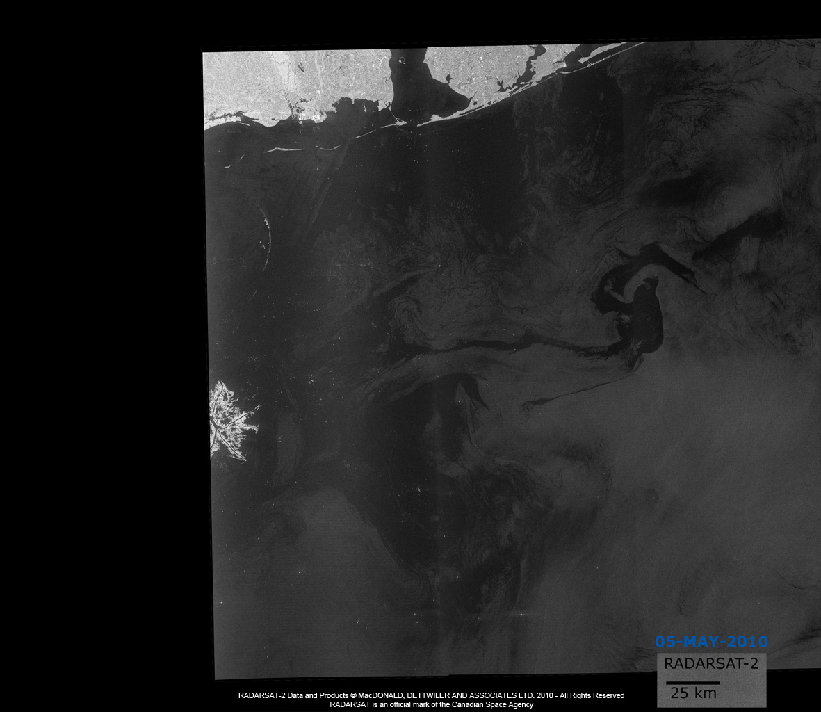
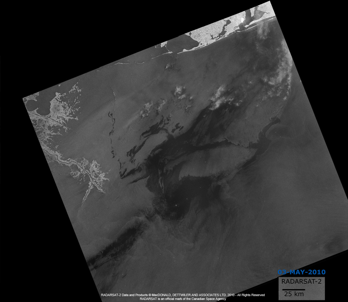
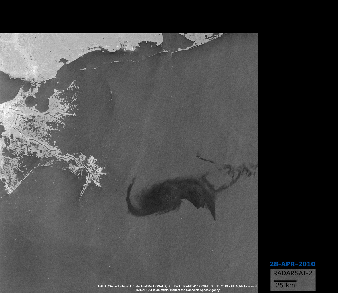
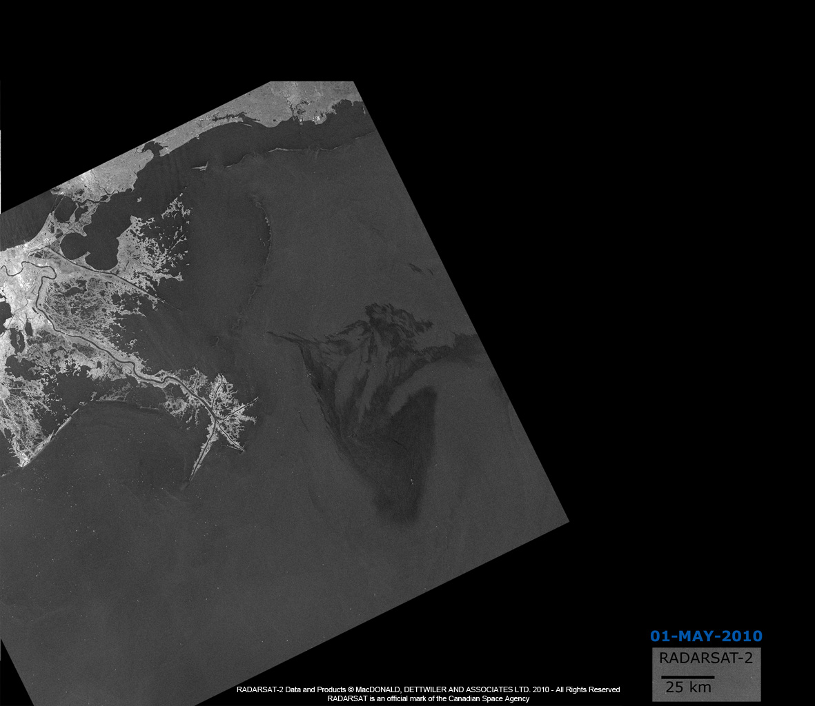
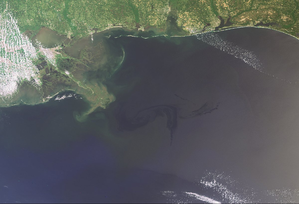
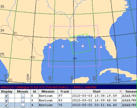
Deepwater Horizon oil spill in the Gulf of Mexico

An explosion occurred on the Deepwater Horizon oil platform, 70 km off the coast of Louisiana on 20 April 2010.

The disaster was the result of a wellhead blowout, which killed 11 people and after two days of fires, caused the platform to sink on 22 April.

Oil from the platform spilled into the Gulf of Mexico, causing the largest oil spill in U.S. history.

Tipo de evento:Oil Spil
Local do evento:Gulf of Mexico - USA
Data da Ativação da Carta:22/04/2010
Requisitante da Carta:USGS on behalf of US Coast Guard
Gerenciamento de projeto:NOAA

Products

Oil Spill in the Gulf of Mexico

Direitos autorais: CSA,RADARSAT-2, MACDONALD, DETTWILER & ASSOCIATES LTD

Information about the Product

Adquirida: 05/05/2010

Fonte: RADARSAT-2

Oil Spill in the Gulf of Mexico

Direitos autorais: CSA,RADARSAT-2, MACDONALD, DETTWILER & ASSOCIATES LTD

Information about the Product

Adquirida: 03/05/2010

Fonte: RADARSAT-2

Oil Spill in the Gulf of Mexico

Direitos autorais: CSA,RADARSAT-2, MACDONALD, DETTWILER & ASSOCIATES LTD

Information about the Product

Adquirida: 28/04/2010

Fonte: RADARSAT-2

Oil Spill in the Gulf of Mexico

Direitos autorais: CSA,RADARSAT-2, MACDONALD, DETTWILER & ASSOCIATES LTD

Information about the Product

Adquirida: 01/05/2010

Fonte: RADARSAT-2

Oil Spill in the Gulf of Mexico

Direitos autorais: CSA,RADARSAT-2, MACDONALD, DETTWILER & ASSOCIATES LTD

Information about the Product

Adquirida: 27/04/2010

Fonte: RADARSAT-2

Oil Spill in the Gulf of Mexico

Direitos autorais: CSA

Information about the Product

Adquirida: 26/04/2010

Fonte: RADARSAT-1

Oil Spill in the Gulf of Mexico

Direitos autorais: European Space Agency
Image processing by ESA

Information about the Product

Adquirida: 02/05/2010

Fonte: Envisat MERIS FR

Oil Spill in the Gulf of Mexico

Direitos autorais: European Space Agency
Image processing by ESA

Information about the Product

Adquirida: 25/04/2010

Fonte: Envisat MERIS FR

Oil Spill in the Gulf of Mexico

Direitos autorais: European Space Agency
Image processing by ESA

Information about the Product

Adquirida: 09/05/2010

Fonte: Envisat ASAR WSM

Oil Spill in the Gulf of Mexico

Direitos autorais: European Space Agency
Image processing by ESA

Information about the Product

Adquirida: 29/04/2010

Fonte: Envisat ASAR Wide Swath

Oil Spill in the Gulf of Mexico

Direitos autorais: European Space Agency
Image processing by ESA

Information about the Product

Adquirida: 02/05/2010

Fonte: Envisat ASAR WSM

Oil Spill in the Gulf of Mexico

Direitos autorais: European Space Agency
Image processing, map created by ESA

Information about the Product

Adquirida: 29/04/2010

Fonte: Envisat MERIS FR

Oil Spill in the Gulf of Mexico

Direitos autorais: European Space Agency
Image processing, map created by ESA

Information about the Product

Adquirida: 26/04/2010

Fonte: Envisat ASAR Wide Swath

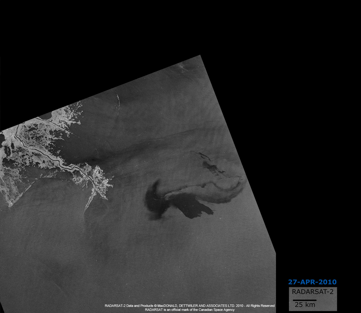
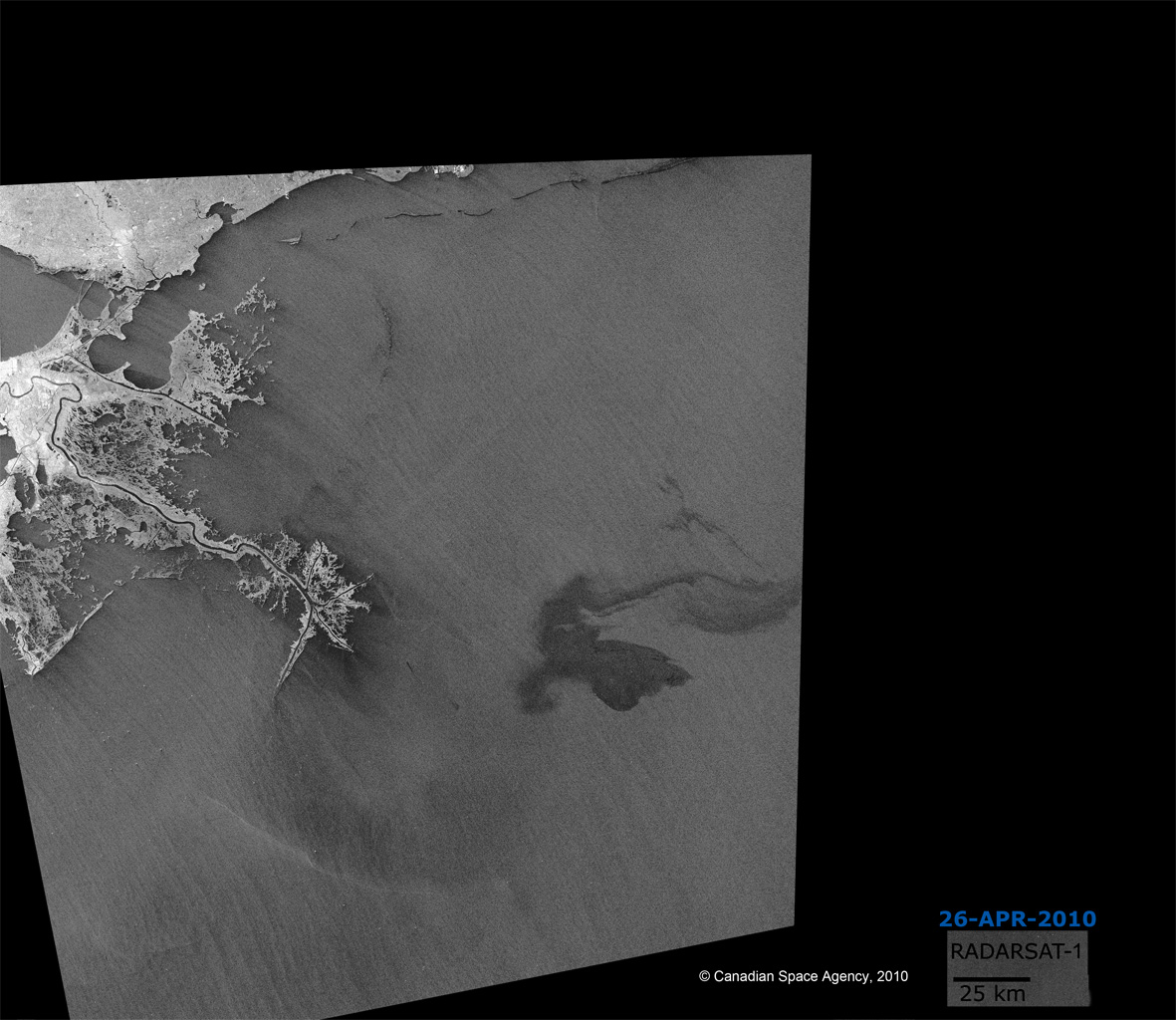
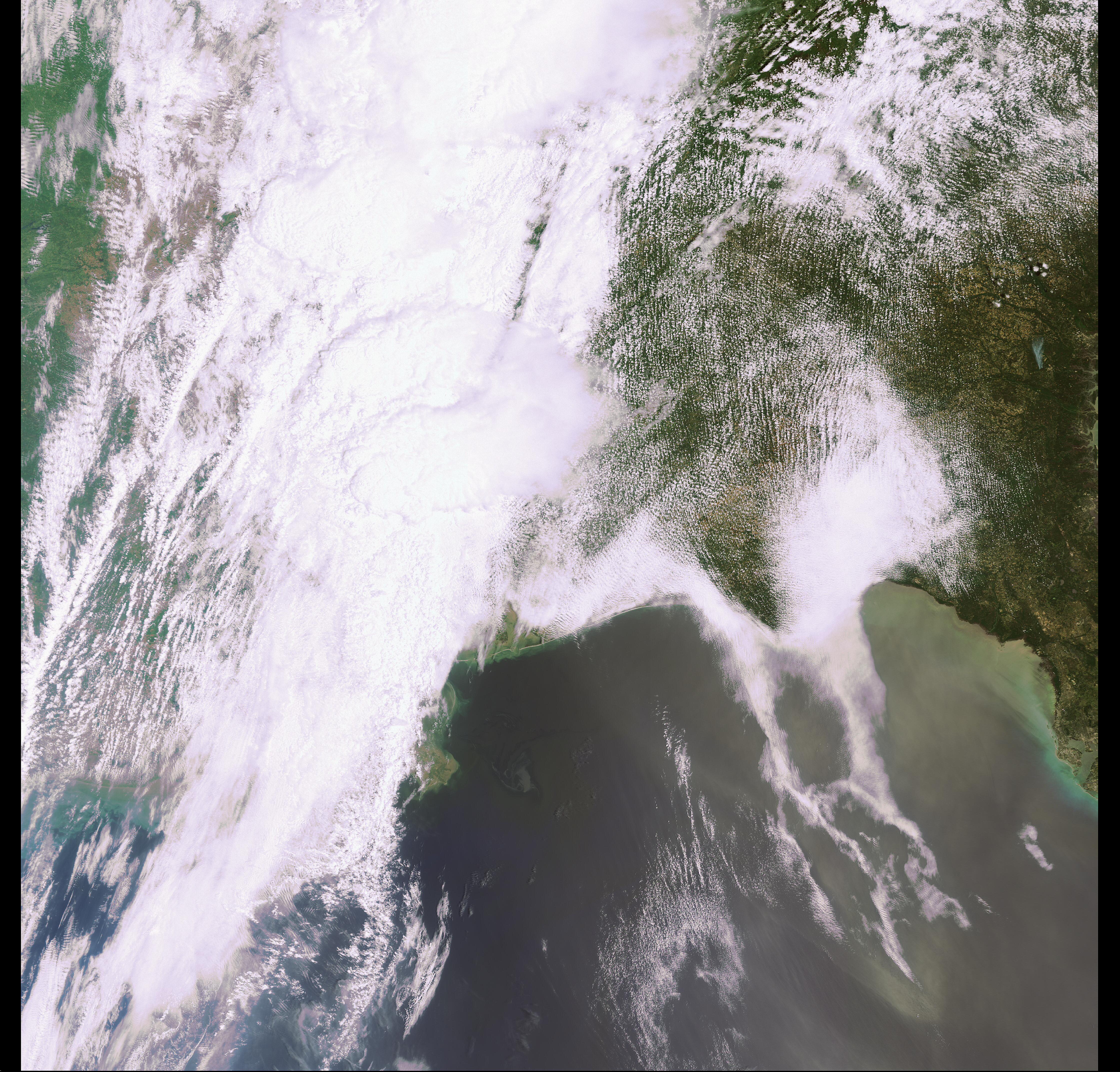
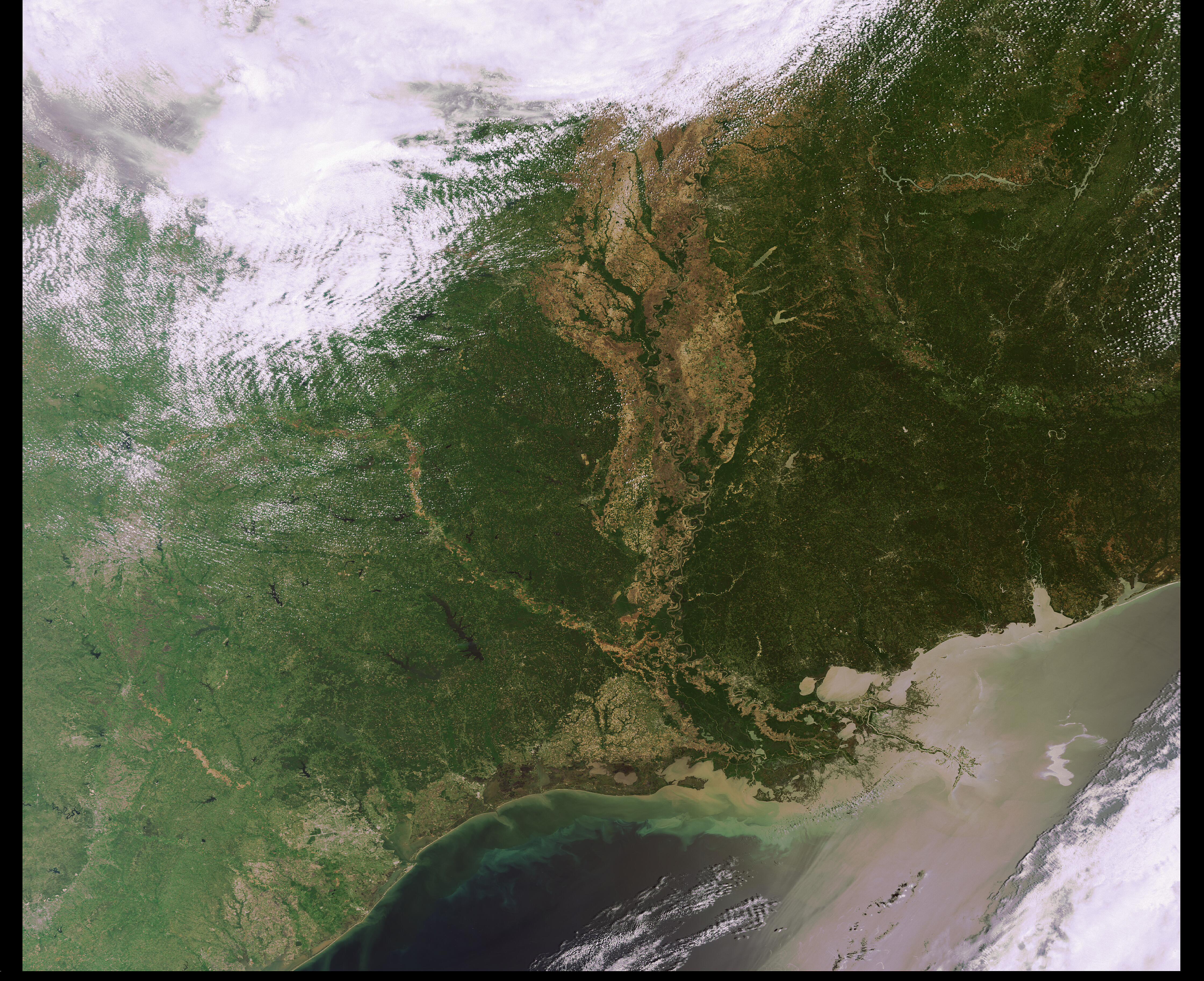
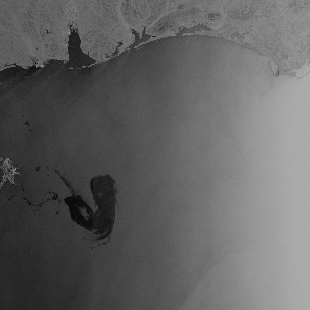
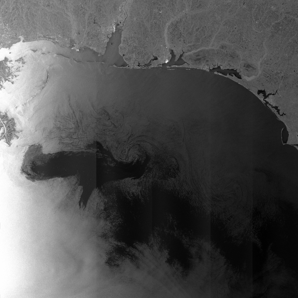
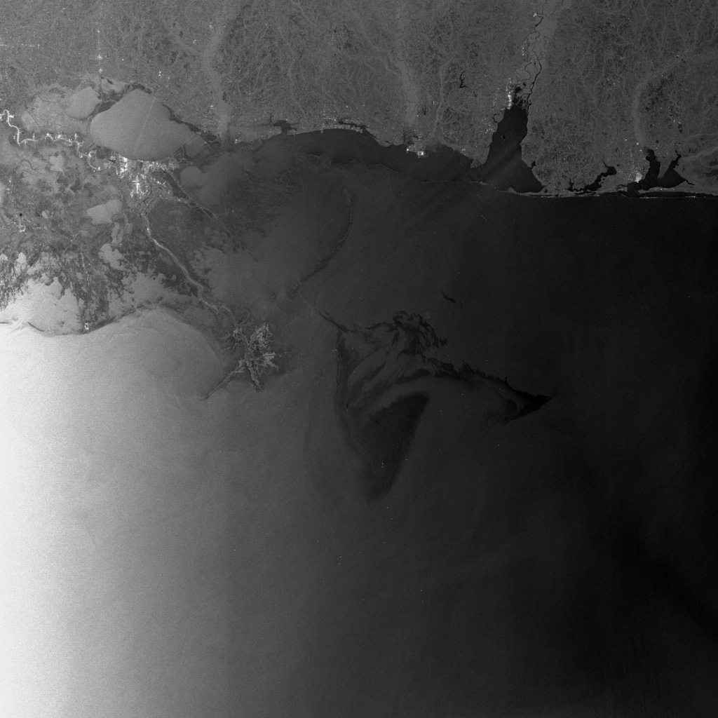
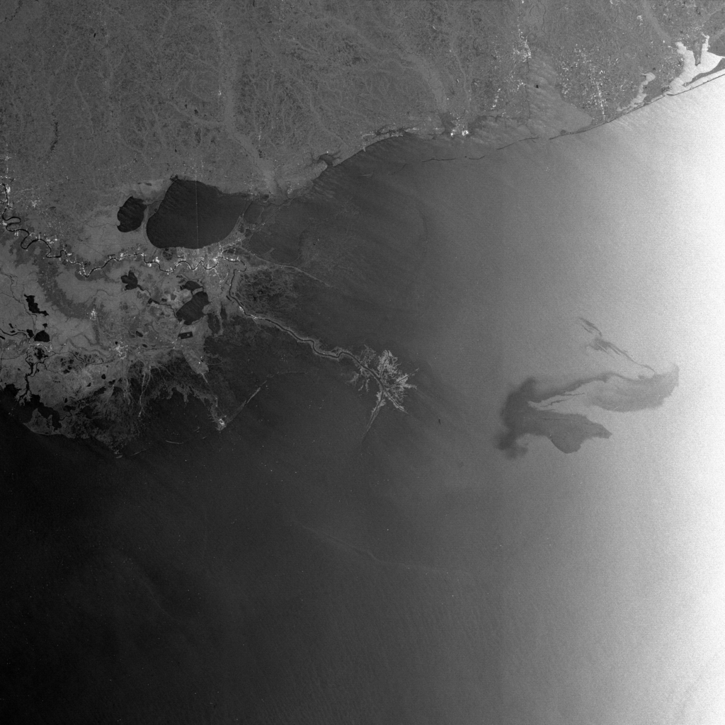
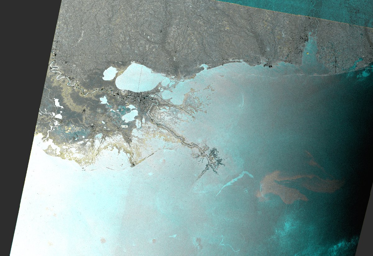
Oil Spill in the Gulf of Mexico - Color composite image. ENVISAT ASAR WS acquired on 26/04/2010 superimposed to a reference ENVISAT ASAR WS acquired on 28/09/2009. The oil slick appears in light gray while light blue features correspond to the reference image.

Direitos autorais: European Space Agency
Image processing, map created by ESA

Information about the Product

Adquirida: 26/04/2010

Fonte: Envisat ASAR WS

Oil Spill in the Gulf of Mexico

Direitos autorais: European Space Agency
Image processing, map created by ESA

Information about the Product

Adquirida: 02/05/2010

Fonte: Envisat ASAR

Oil Spill in the Gulf of Mexico

Direitos autorais: European Space Agency
Image processing, map created by ESA

Information about the Product

Adquirida: 29/04/2010

Fonte: Envisat ASAR WSM

Voltar ao arquivo completo da Ativação