Charter activations
Floods in Ethiopia
More than 364 people were killed in southern Ethiopia due to flooding of the Omo river. Major loss of life is also feared in the area of the Awash river. According to Reliefweb, some 870 have died since heavy rains began to fall in Ethiopia starting early August. The death toll is feared to be very high as access to affected regions is extremely difficult.
| Tipo de evento: | Floods |
| Local do evento: | Ethiopia |
| Data da Ativação da Carta: | 16/08/2006 |
| Requisitante da Carta: | UN OOSA on behalf of WFP |
| Gerenciamento de projeto: | UNOSAT |
Products

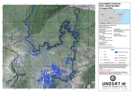
SW Ethiopia Post Disaster Likely flood affected areas have been extracted from SPOT-5 image acquired on 13 August 2006. On this map also figure human settlements, main roads, and elevation contour lines.
Direitos autorais: CNES 2006
Image processing, map created 22/08/2006 by UNOSAT in the framework of GMES Respond.
10.5m resolution
Information about the Product
Adquirida: 13/08/2006
Fonte: SPOT-5

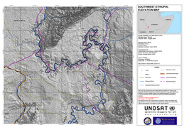
SW Ethiopia Elevation Map Altitude map (contour lines every 100m) of South Omo province, Ethiopia. On this map also figure human settlements and main roads.
Direitos autorais: NASA 2006 Image processing, map created 22/08/2006 by UNOSAT in the framework of GMES Respond.
90 m resolution
Information about the Product
Adquirida: 13/08/2006
Fonte: Elevation data: SRTM

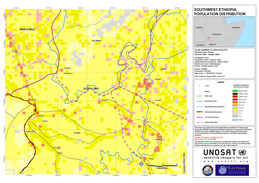
SW Ethiopia Population distribution Population distribution of South Omo Province, Ethiopia. The map shows roads, rivers, main human settlements, and administrative boundaries.
Direitos autorais: Population data: Landscan 2002; Administrative boundaries: USAID/ OFDA; Roads and rivers: GlobalInsight; Places: GeoNet Names, NGA Image processing, map created 21/08/2006 by UNOSAT in the framework of GMES Respond.
90 m resolution
Information about the Product
Adquirida: 21/08/2006
Fonte: Landscan 2002
 Voltar ao arquivo completo da Ativação

 English
 Spanish
 French
 Chinese
 Russian
 Portuguese


