 English
 Spanish
 French
 Chinese
 Russian
 Portuguese
 Latest Activation
Charter activations
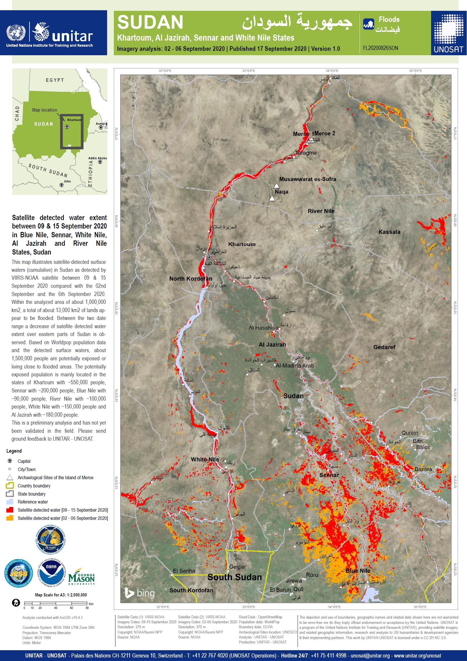
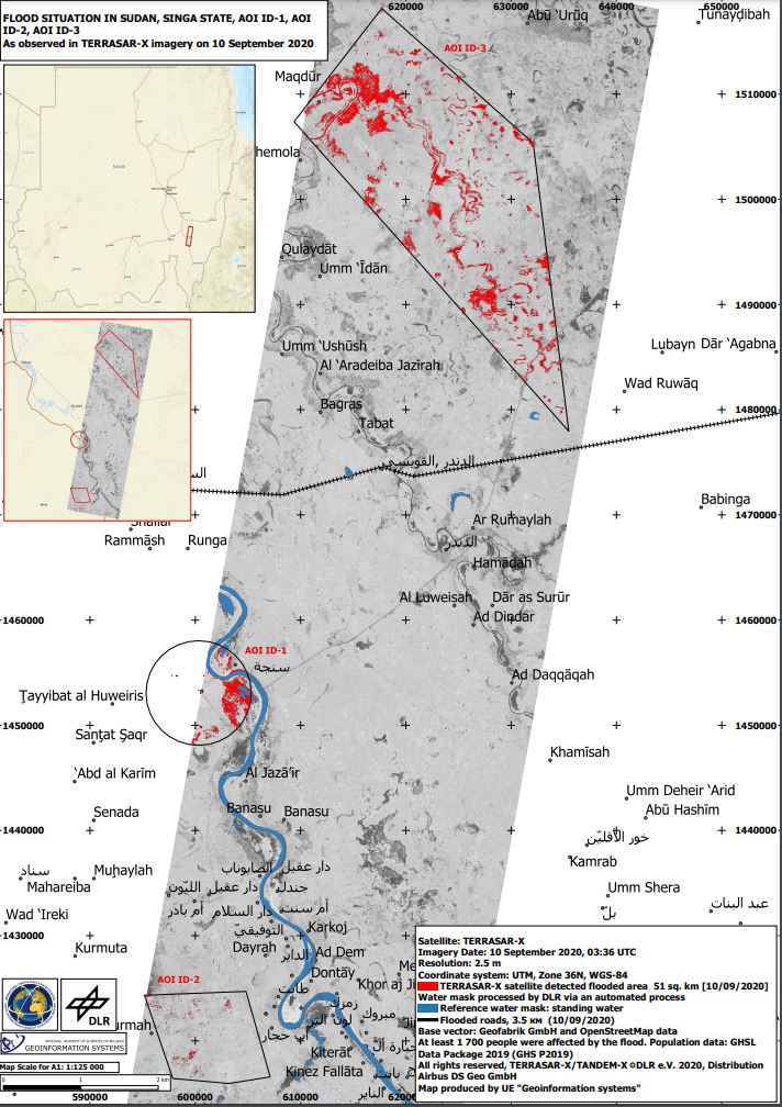
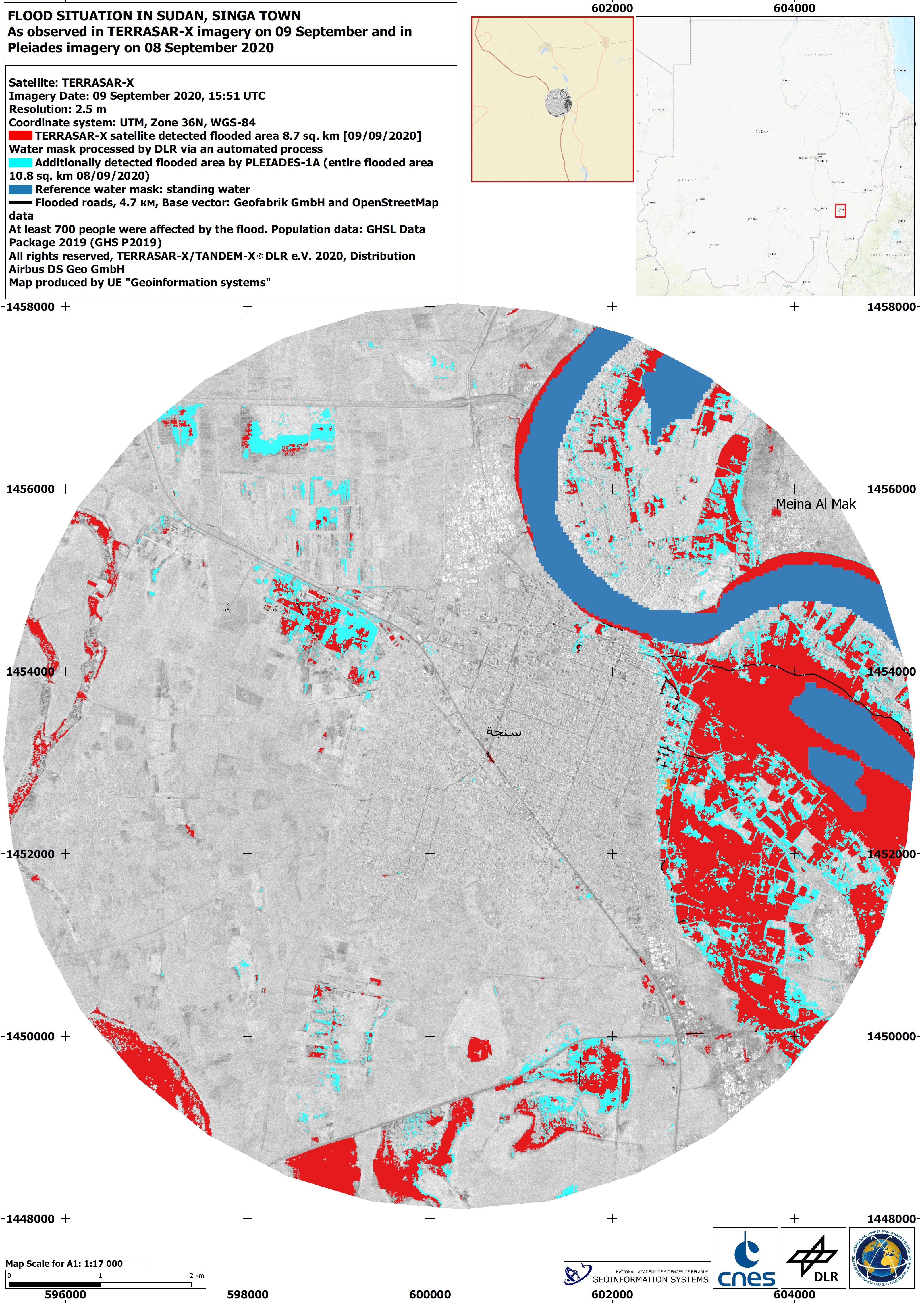
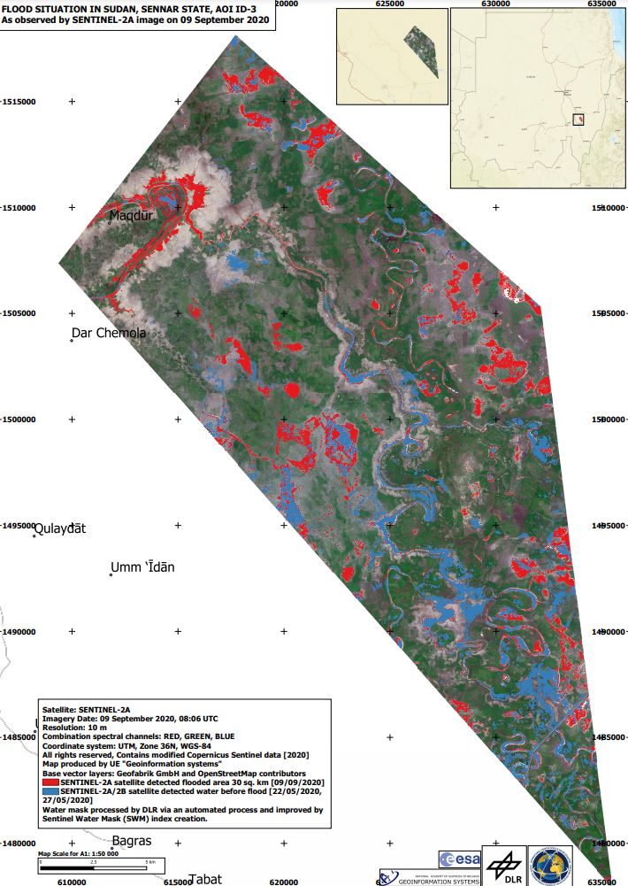
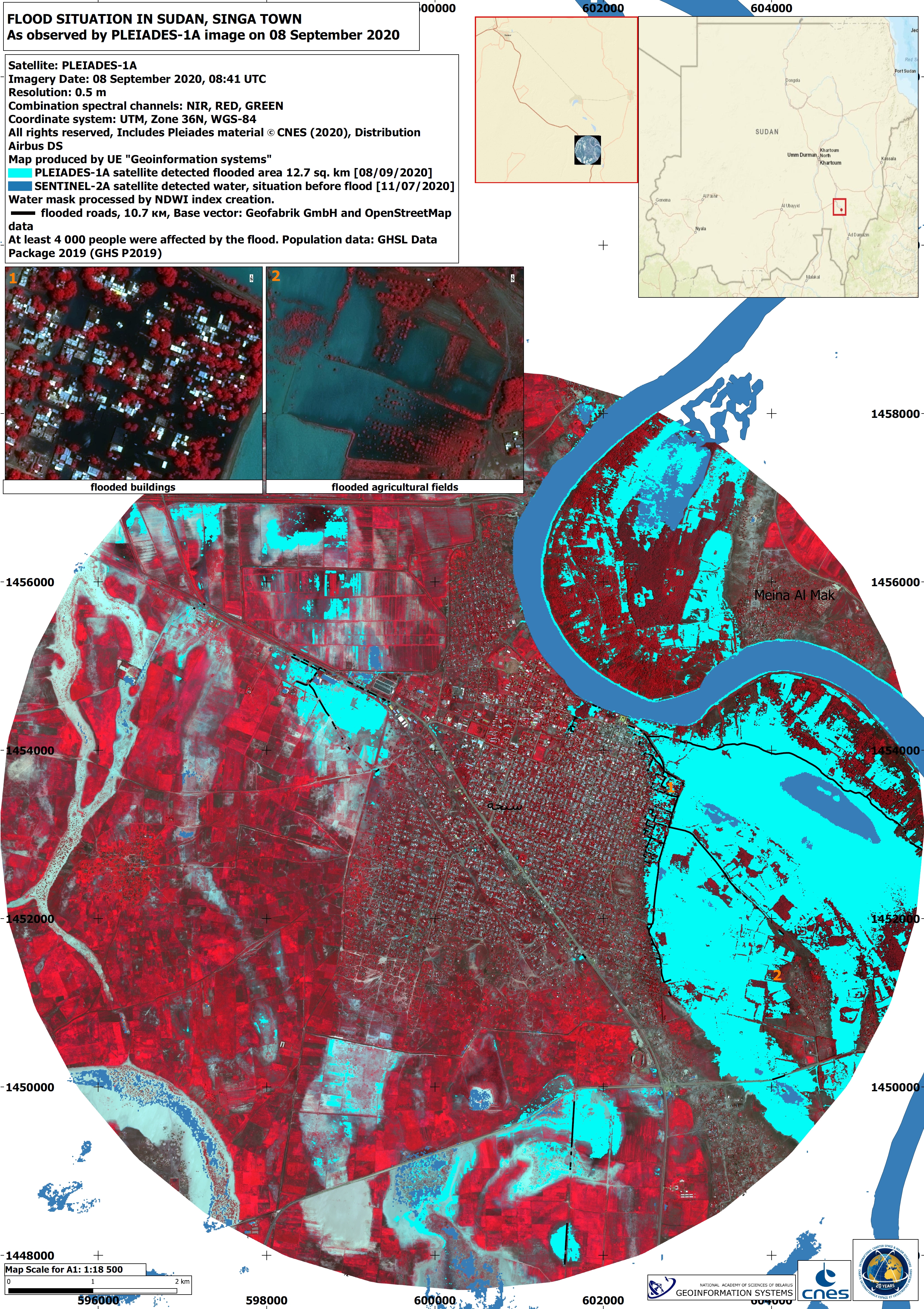
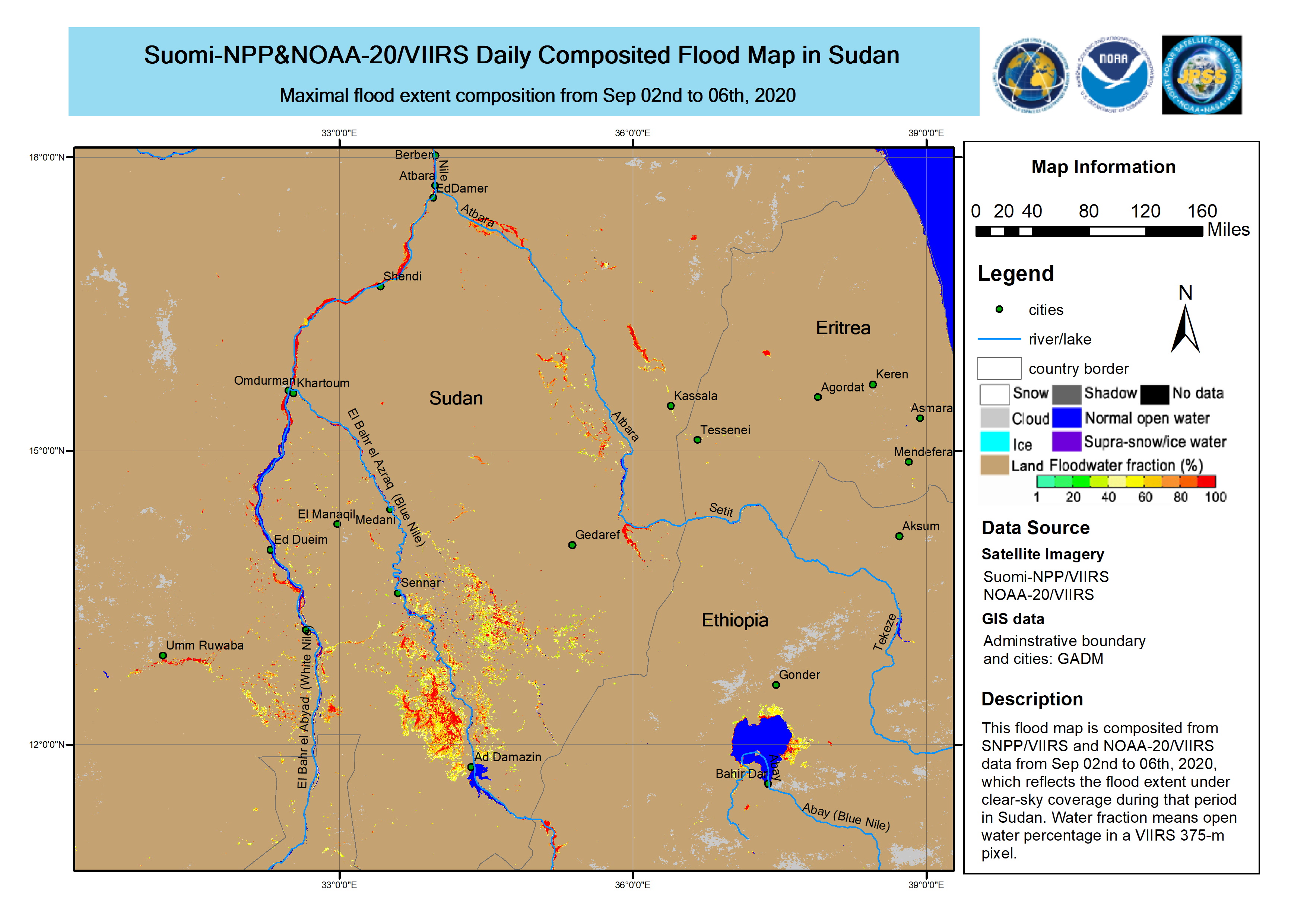
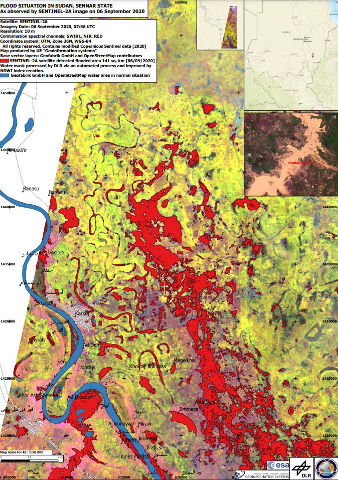
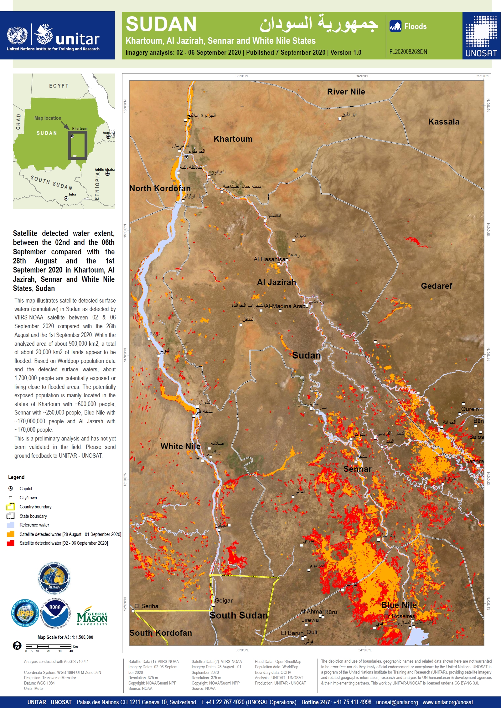
Flood in Sudan
Heavy rainfall has caused severe flooding across parts of Sudan, with authorities declaring a national state of emergency for 3 months.
At least 99 people have been killed, 46 injured and more than 100,000 homes have been affected as the River Nile burst its banks after record levels of rainfall.
The states of Khartoum, Blue Nile and River Nile are among the hardest-hit by the floods, while damage has also been reported in the Gezira, Gadarif, West Kordofan and South Darfur regions.
The UN has supported a national response, bringing supplies and emergency shelters to aid some 250,000 people that have been displaced.
| Tipo de evento: | Floods |
| Local do evento: | Sudan |
| Data da Ativação da Carta: | 2020-09-07 |
| Tempo de Ativação da Carta: | 10:52 |
| Zona de Tempo da Ativação da Carta: | UTC+02:00 |
| Requisitante da Carta: | Ministry of Agriculture and Natural Resources in Sudan |
| ID da Ativação: | 675 |
| Gerenciamento de projeto: | DLR |
Products
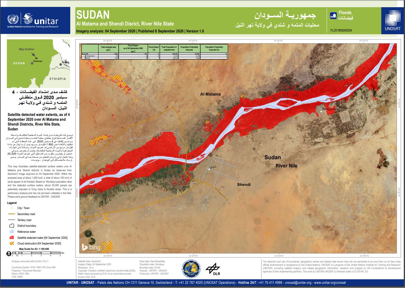
Satellite detected water extents, as of 4 September 2020 over Al Matama and Shendi Districts, River Nile State, Sudan
Direitos autorais: Contains modified Copernicus Sentinel data (2020) / Water mask processed by DLR via an automated process
Map produced by UNOSAT
Information about the Product
Adquirida: 04/09/2020
Fonte: Sentinel-2
 Voltar ao arquivo completo da Ativação

