Charter activations
Typhoon Yagi in Thailand
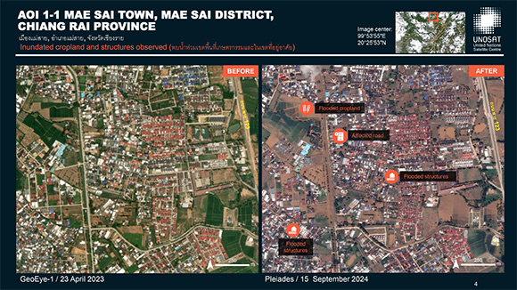
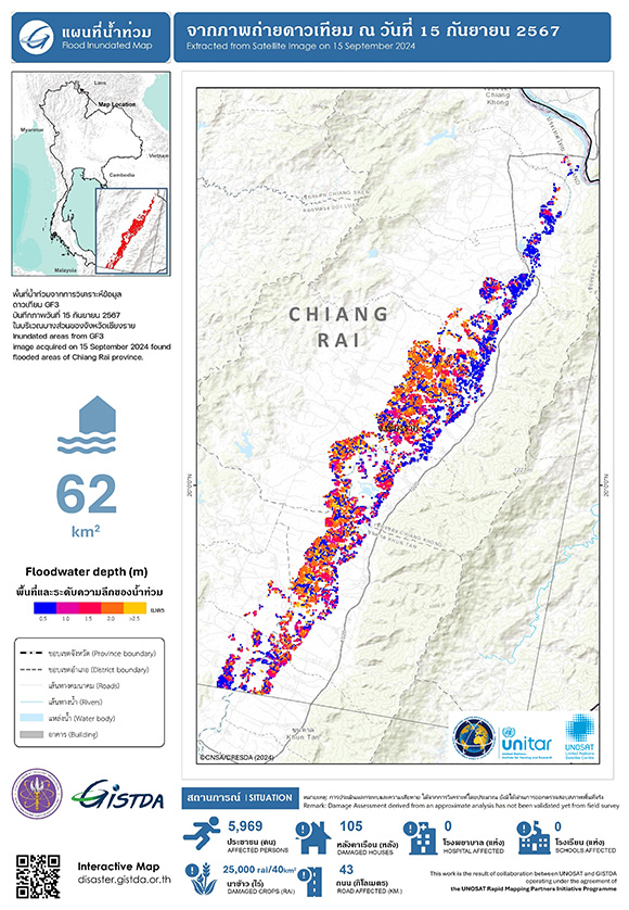
Northern Thailand, especially Chiang Rai, is experiencing significant flooding as a result of continuous heavy rainfall intensified by Typhoon Yagi.
The Mae Sai district has suffered the most severe impact, with the Sai River overflowing and flooding the Thai-Myanmar border.
Rescue teams are struggling to reach residents who have been cut off for days without food or water. The situation is dire, compounded by power outages that hinder relief operations.
Additionally, numerous regions are reporting landslides and flash floods, leading to further complications.
Typhoon Yagi is the strongest storm to hit Asia this year.
| Tipo de evento: | Flood |
| Local do evento: | Thailand |
| Data da Ativação da Carta: | 2024-09-12 |
| Tempo de Ativação da Carta: | 16:14 |
| Zona de Tempo da Ativação da Carta: | UTC+07:00 |
| Requisitante da Carta: | UNOSAT on behalf of UN Resident Coordinator Office in Thailand |
| ID da Ativação: | 912 |
| Gerenciamento de projeto: | Surassawadee Phoompanich (Geo-Informatics & Space Technology Development Agency) |
| act-value-adders: | AIT |
Products

Preliminary Satellite-derived Flood Impact Assessment, Mae Sai, Chiang Saen, and Mueang Chiang Rai Districts, Chiang Rai Province, Thailand
Download full product
Direitos autorais: Includes Pleiades material © CNES (2024), Distribution Airbus DS.
Map produced by UNITAR/ UNOSAT
Information about the Product
Adquirida: 15/09/2024
Fonte: Pleiades
Categoria: Dossier
 Voltar ao arquivo completo da Ativação

 English
 Spanish
 French
 Chinese
 Russian
 Portuguese


