Charter activations
Flood in south-west England
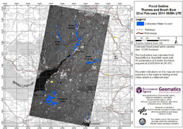
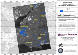
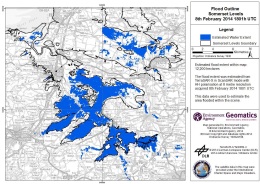
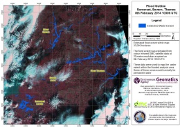
Ongoing storms and heavy rainfall have brought further flooding to southern England since 31 January 2014. Several major rivers are now flooding, or are at risk of doing so over the next five to ten days.
This latest series of storms following on from earlier ones that have affected the United Kingdom as far back as December 2013. See the two previous related Charter activations: 469 and 472.
Some areas of southern England, such as the Somerset Levels and Moors, have now been flooded for over five weeks. It is estimated that 413 homes have been flooded across the country and farmland has also been inundated with no sign of immediate relief from the continuing weather conditions. With the ground already saturated, further rainfall will prolong the difficult conditions.
People have evacuated their homes in some of the worst affected areas, and livestock has been moved to safer locations.
The Environment Agency has issued two severe flood warnings for the latest storms, and continue to update their flood warning maps with the latest information.
Existing flood defences are limiting the damage, and it is estimated that over a million buildings have been protected from flooding by the infrastructure in place. The army has been providing assistance and relief operations to complement the many emergency services personnel and volunteers across the country.
| Tipo de evento: | Flood |
| Local do evento: | Southern England, United Kingdom |
| Data da Ativação da Carta: | 06 February 2014 |
| Requisitante da Carta: | Environment Agency (of England and Wales) |
| Gerenciamento de projeto: | Environment Agency (of England and Wales) |
Products
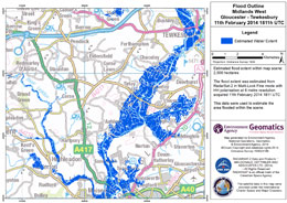
Flood outline - Midlands West Gloucester - Tewkesbury
Direitos autorais: RADARSAT-2 Data and Products © MacDonald, Dettwiler and Associates Ltd. (2014) - All Rights Reserved. RADARSAT is an official trademark of the Canadian Space Agency.
Map produced by Environment Agency Geomatics
Information about the Product
Adquirida: 11/02/2014
Fonte: RADARSAT-2
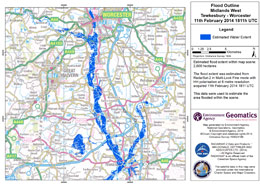
Flood outline - Midlands West Tewkesbury - Worcester
Direitos autorais: RADARSAT-2 Data and Products © MacDonald, Dettwiler and Associates Ltd. (2014) - All Rights Reserved. RADARSAT is an official trademark of the Canadian Space Agency.
Map produced by Environment Agency Geomatics
Information about the Product
Adquirida: 11/02/2014
Fonte: RADARSAT-2
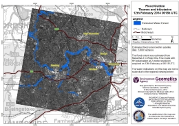
Flood outline - Thames and tributaries
Direitos autorais: RADARSAT-2 Data and Products © MacDonald, Dettwiler and Associates Ltd. (2014) - All Rights Reserved. RADARSAT is an official trademark of the Canadian Space Agency.
Map produced by Environment Agency Geomatics
Information about the Product
Adquirida: 12/02/2014
Fonte: RADARSAT-2
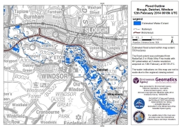
Flood outline - Slough, Datchet, Windsor
Direitos autorais: RADARSAT-2 Data and Products © MacDonald, Dettwiler and Associates Ltd. (2014) - All Rights Reserved. RADARSAT is an official trademark of the Canadian Space Agency.
Map produced by Environment Agency Geomatics
Information about the Product
Adquirida: 12/02/2014
Fonte: RADARSAT-2
 Voltar ao arquivo completo da Ativação

 English
 Spanish
 French
 Chinese
 Russian
 Portuguese
