Minimizar Latest Activation

Charter activations

Flood in Nepal

Monsoon rains produced floods which have submerged most of the settlements in southern Kanchanpur, Nepal.

Three villages from the Dodhara Chandani region have been inundated after the Mahakali and Jogbuda Rivers entered them.

The heavy rain has triggered flash floods and landslides, 14 people reported to have been killed. Police are working with local agencies to find missing people. 1,622 people who were affected by the floods across the district have been rescued and moved to safer places.


Related Resources:


Sentinel Asia activation for Flood in Western Region, Nepal

Shape files for flooding in Nepal

Local do evento:Nepal
Data da Ativação da Carta:2024-07-08
Tempo de Ativação da Carta:17:12
Zona de Tempo da Ativação da Carta:UTC+09:00
Requisitante da Carta:ADRC on behalf of DHM
ID da Ativação:895
Gerenciamento de projeto:Kabir Uddin (International Centre for Integrated Mountain Development (ICIMOD))
act-value-adders:Thanaphol Boodchuang (Asian Institute of Technology (AIT))
Geoniformation systems
Alia Mohammad Al Mekhyat (Mohammed Bin Rashid Space Centre)
UFRRJ

Products

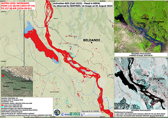
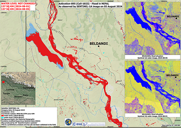
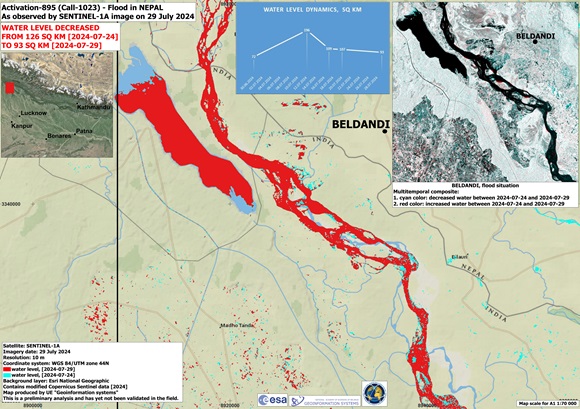
Flood situation in Beldandi, Nepal

Direitos autorais: Contains modified Copernicus Sentinel data (2024)
Map produced by UE "Geoinformation systems"

Information about the Product

Adquirida: 05/08/2024 / 01/08/2024

Fonte: Sentinel-1

Categoria: Delineation Monitoring Maps

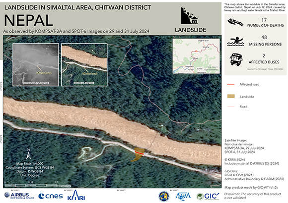
Landslide in Simaltal area, Chitwan district, Nepal

Direitos autorais: Includes material © AIRBUS DS (2024)
KOMPSAT-3 © KARI (2024)
Map produced by GIC-AIT

Information about the Product

Adquirida: SPOT-6: 31/07/2024
KOMPSAT-3: 29/07/2024

Fonte: SPOT-6 / KOMPSAT-3

Categoria: Delineation Map

Flood situation in Beldandi, Nepal

Direitos autorais: Contains modified Copernicus Sentinel data (2024)
Landsat data and products © NASA/USGS (2024) - All Rights Reserved
Map produced by UE "Geoinformation systems"

Information about the Product

Adquirida: Sentinel-1: 24/07/2024 / 01/08/2024
Landsat 8: 01/08/2024

Fonte: Sentinel-1 / Landsat 8

Categoria: Delineation Monitoring Maps
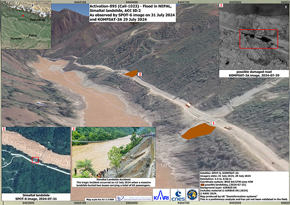
Simaltal landslide from flood situation in Nepal

Direitos autorais: © KARI (2024)
Includes material © AIRBUS DS (2024)
Map produced by UE "Geoinformation systems"

Information about the Product

Adquirida: KOMPSAT-3: 29/07/2024
SPOT-6: 31/07/2024

Fonte: KOMPSAT-3 / SPOT-6

Categoria: Delineation Map

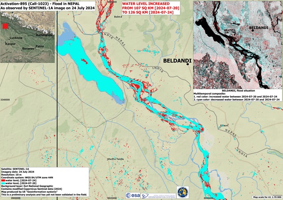
Flood situation in Beldandi, Nepal

Direitos autorais: Contains modified Copernicus Sentinel data (2024)
Map produced by Geo-information Systems

Information about the Product

Adquirida: 24/07/2024

Fonte: Sentinel-1

Categoria: Delineation Monitoring Maps

Flood situation in Belandi, Nepal

Direitos autorais: Contains modified Copernicus Sentinel data (2024)
Map produced by Geo-information Systems

Information about the Product

Adquirida: 20/07/2024

Fonte: Sentinel-1

Categoria: Delineation Monitoring Maps

Flood situation in Beldandi, Nepal

Direitos autorais: Contains modified Copernicus Sentinel data (2024)
Map produced by UE "Geoinformation systems"

Information about the Product

Adquirida: 20/07/2024
17/07/2024

Fonte: Sentinel-1

Categoria: Delineation Map

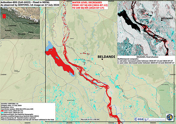
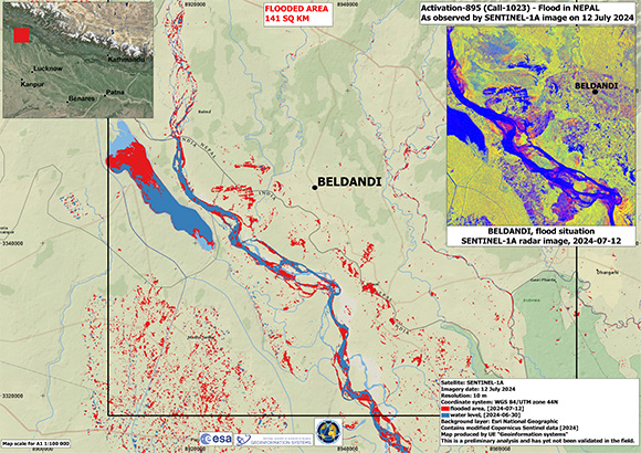
Flood situation in Beldandi, Nepal

Direitos autorais: Contains modified Copernicus Sentinel data (2024)
Map produced by UE "Geoinformation systems"

Information about the Product

Adquirida: 12/07/2024
17/07/2024

Fonte: Sentinel-1

Categoria: Delineation Monitoring Maps

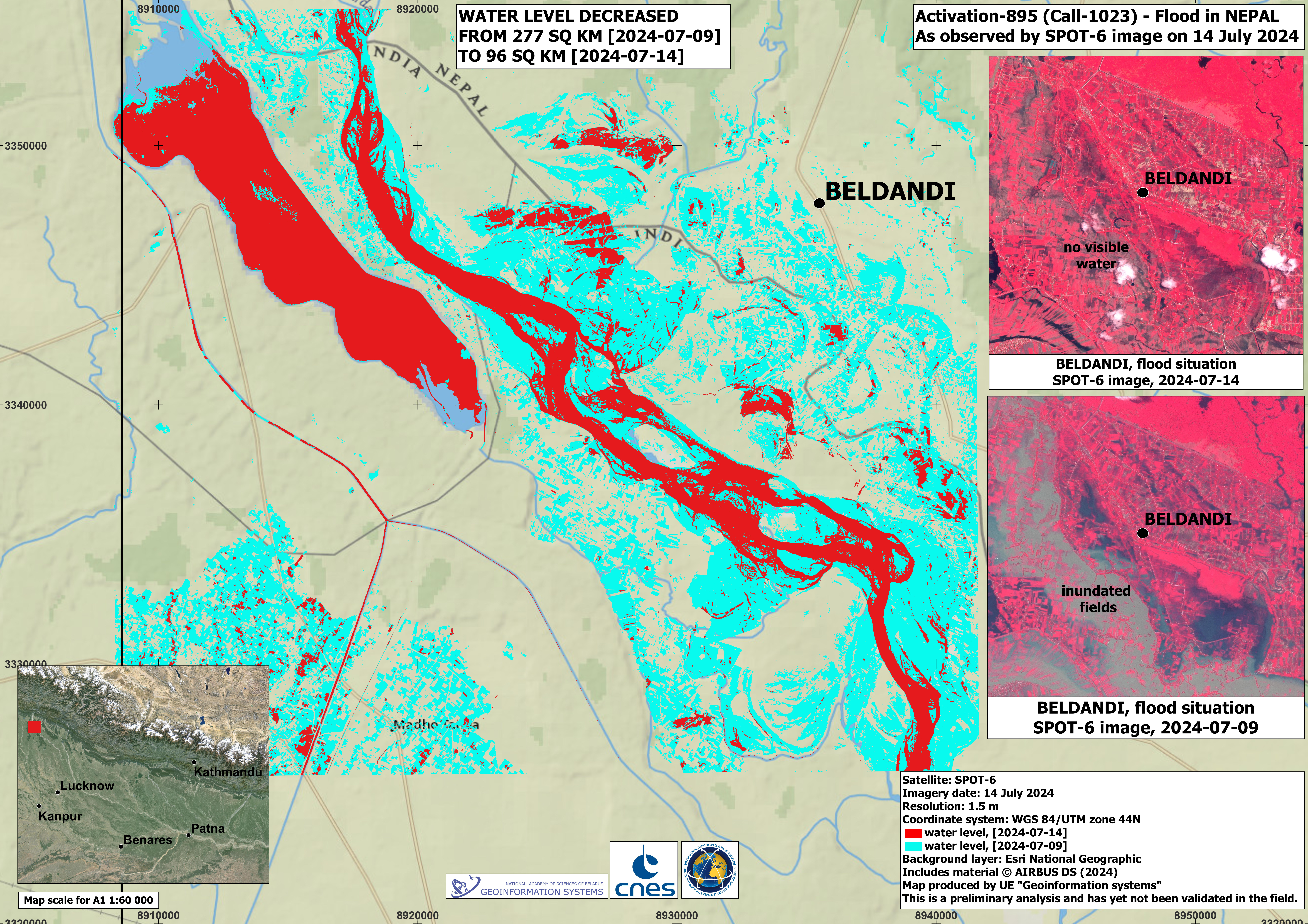
Flood situation in Beldandi, Nepal

Direitos autorais: Includes material © AIRBUS DS (2024)
Map produced by UE "Geoinformation systems"

Information about the Product

Adquirida: 14/07/2024
09/07/2024

Fonte: SPOT-6

Categoria: Delineation Map

Flood situation in Beldandi, Nepal

Direitos autorais: Contains modified Copernicus Sentinel data (2024)
Map produced by UE "Geoinformation systems"

Information about the Product

Adquirida: 30/06/2024
12/07/2024

Fonte: Sentinel-1

Categoria: Reference Map

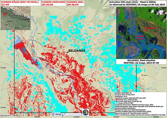
Flood situation in Beldandi, Nepal

Direitos autorais: Contains modified Copernicus Sentinel data (2024)
Map produced by UE "Geoinformation systems"

Information about the Product

Adquirida: 09/07/2024

Fonte: Sentinel-2

Categoria: Reference Map

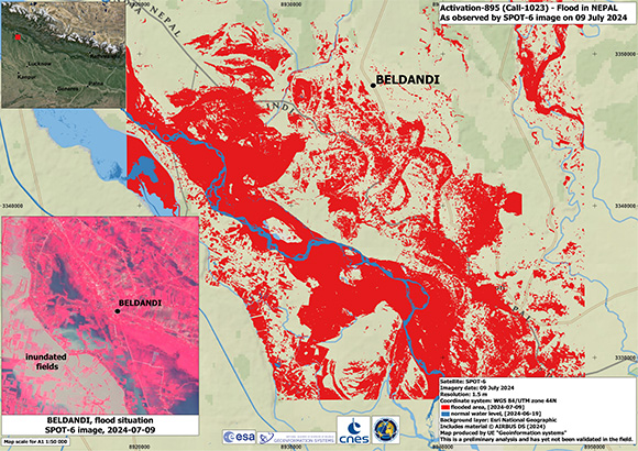
Flood situation in Beldandi, Nepal

Direitos autorais: Includes material © AIRBUS DS (2024)
Map produced by UE "Geoinformation systems"

Information about the Product

Adquirida: 09/07/2024

Fonte: SPOT-6

Categoria: Reference Map

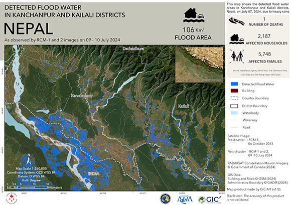
Detected flood water in kanchanpur and kailali districts, Nepal

Direitos autorais: RADARSAT Constellation Mission Imagery © Government of Canada (2023) - RADARSAT is an official mark of the Canadian Space Agency
Map produced by GIC-AIT

Information about the Product

Adquirida: 06/10/2023
10/07/2024

Fonte: RCM

Categoria: Delineation Map

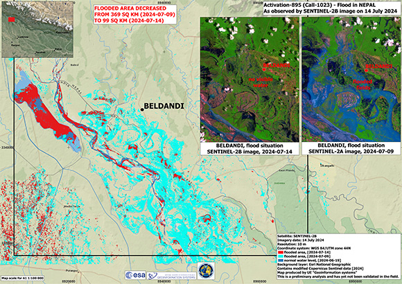
Flood situation in Beldandi, Nepal

Direitos autorais: Contains modified Copernicus Sentinel data (2024)
Map produced by UE "Geoinformation systems"

Information about the Product

Adquirida: 14/07/2024

Fonte: Sentinel-2

Categoria: Delineation Map

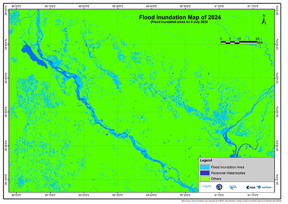
Flood Inundation Map: India and Nepal Inundated Areas

Direitos autorais: Contains modified Copernicus Sentinel 1 data (2024)
Map produced by ICIMOD

Information about the Product

Adquirida: 08/07/2024

Fonte: Sentinel-1

Categoria: Delineation Map

Voltar ao arquivo completo da Ativação