 English
 Spanish
 French
 Chinese
 Russian
 Portuguese
 Latest Activation
Charter activations
Flood in Huancavelica, Peru
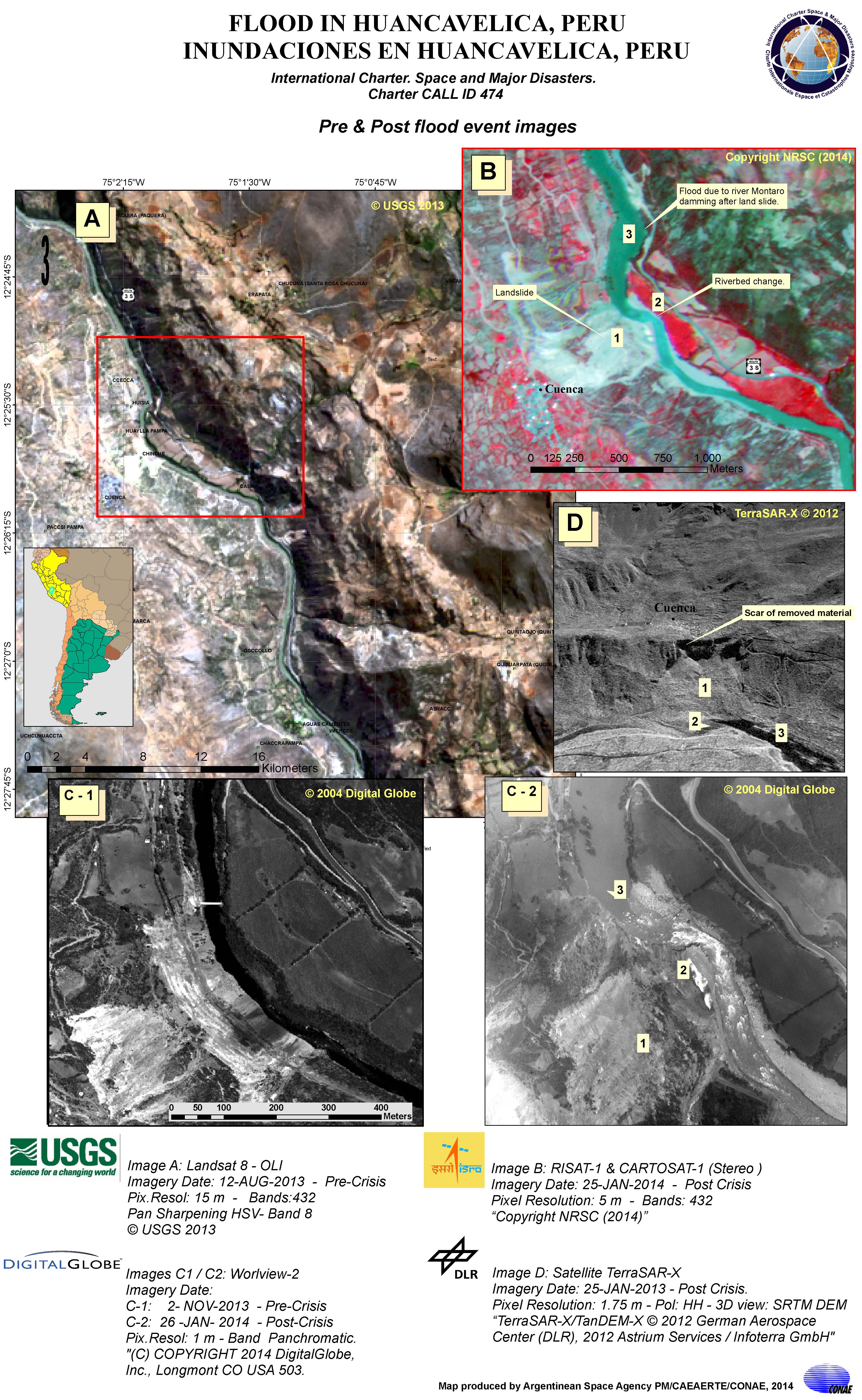
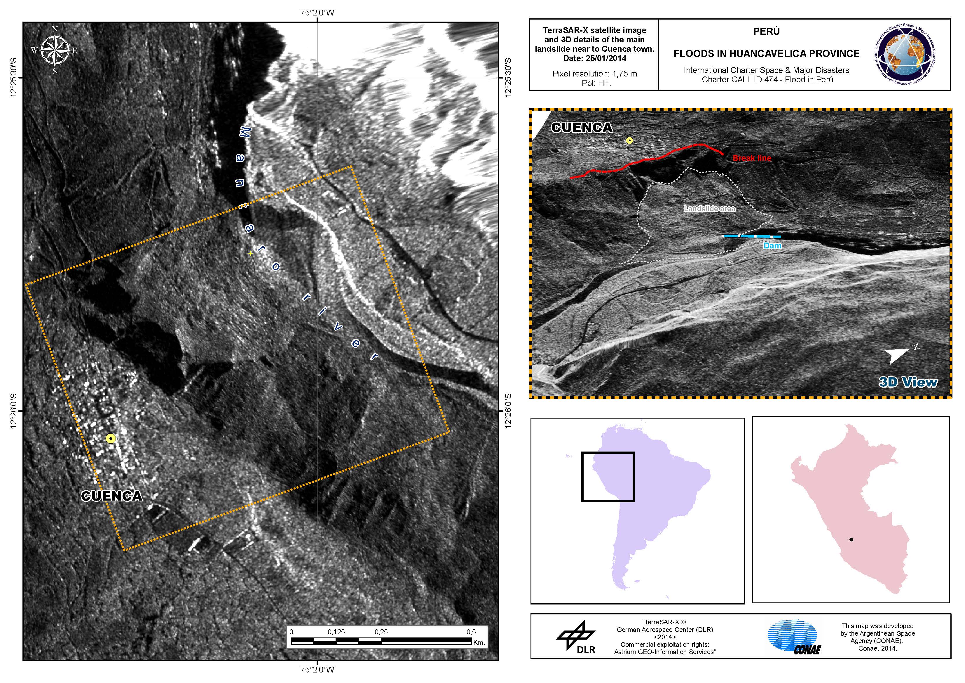
At 04:00 hours, local time, on 20 January 2014, a landslide occurred over the River Mantaro in the Huancavelica Province of Peru. The landslide and potential mudslides in the area have disrupted transport and it is expected that flooding will follow along riverside villages.
Caused by several days of heavy rain, the landslide occurred in Huayllapampa and the Civil Protection Agency of Peru's initial evaluation estimates that 33 people in the area were affected, 33 houses had collapsed and one railway was affected. 2430 people were considered at risk as well as 1065 houses.
The heavy rain has caused disruption in nearby Cuzco, where several people have died and almost 2000 tourists were stranded at Machu Pichu when the railway was cut off to the Incan tourist destination. It is forecast that 15 of Peru's 25 regions will be affected by the rain, which is expected to end on 21 January.
| Tipo de evento: | Flood |
| Local do evento: | Huancavelica, Peru |
| Data da Ativação da Carta: | 21 January 2014 |
| Requisitante da Carta: | CONAE on behalf of National Civil Protection Agency of Peru (INDECI) |
| Gerenciamento de projeto: | CONAE |
Products
Flood in Huancavelica, Peru
Pre and post flood images
Direitos autorais: Landsat 8 data and products © USGS (2013) - All rights reserved
RISAT-1 and CartoSat-1 data and products © NRSC (2014) - All rights reserved
WorldView-2 © DigitalGlobe Inc. 2014
TerraSAR-X © German Aerospace Center (DLR), 2013 Astrium Services / Infoterra GmbH
Map produced by CONAE
Information about the Product
Adquirida: Landsat 8: 12/08/2013
RISAT-1 and CartoSat-1: 25/01/2014
WorldView-2: 02/11/2013 and 26/01/2014
TerraSAR-X: 25/01/2013
Fonte: Landsat 8 OLI
RISAT-1 / CartoSat-1
WorldView-2
TerraSAR-X

Mantaro riverbed changes after landslide and flood due to damming
Direitos autorais: KARI 2014
© CNES 2013 - Distribution: Astrium Services / Spot Image S.A., all rights reserved
Map produced by CONAE
Information about the Product
Adquirida: KOMPSAT-2: 13/10/2013
Pleiades: 25/01/2014
Fonte: KOMPSAT-2 / Pleiades
 Voltar ao arquivo completo da Ativação

