 English
 Spanish
 French
 Chinese
 Russian
 Portuguese
 Latest Activation
Charter activations
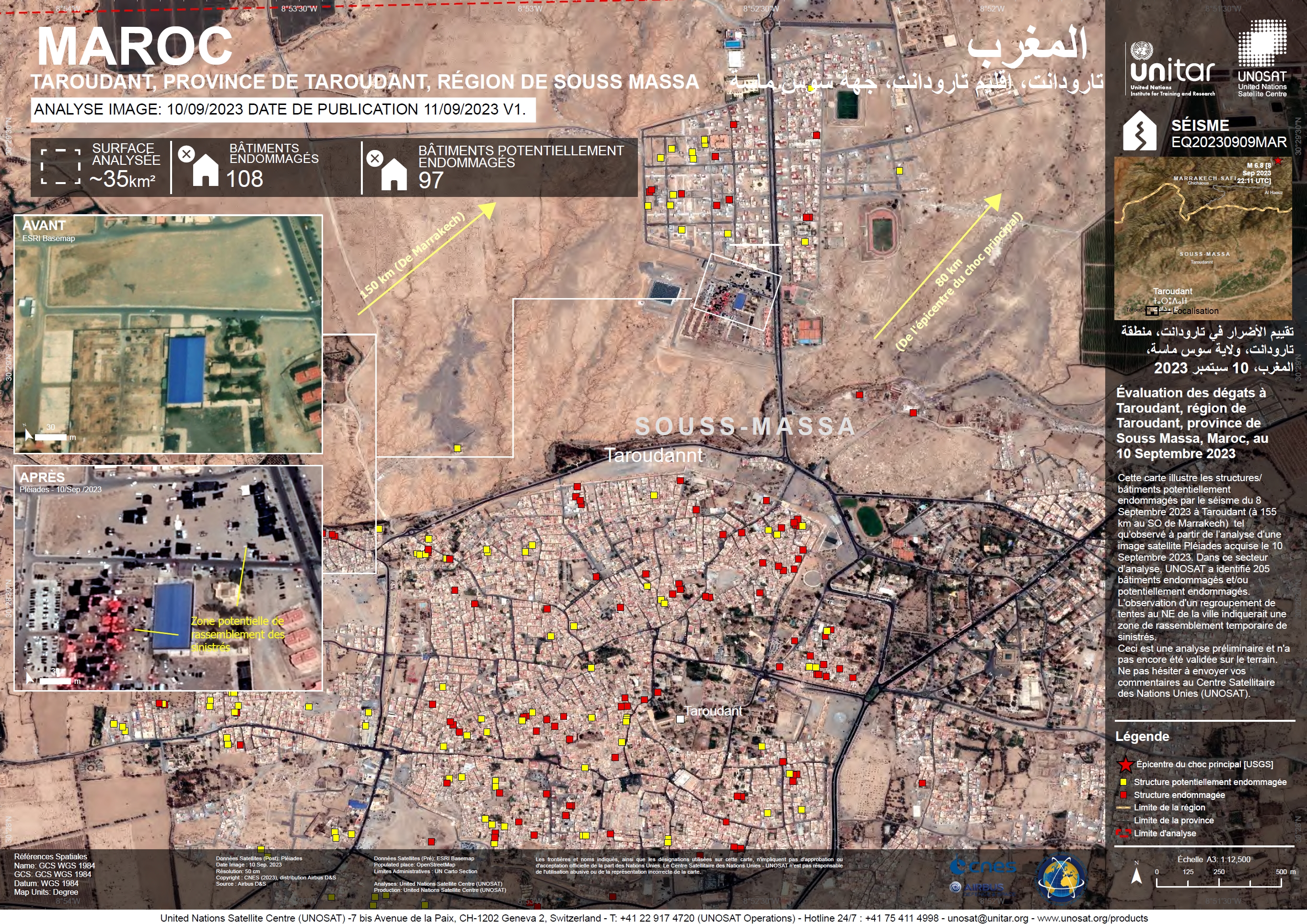
Earthquake in Morocco
A rare powerful 6.8 magnitude earthquake struck Morocco at around 11pm local time on the 8th September claiming over 3000 lives, affecting 30,000 people, collapsing homes, blocking roads and causing buildings to sway as far away as the country's northern coast. The shaking only lasted for several seconds but caused unimaginable devastation.
The tectonic activity in Morocco primarily involves the convergence of the Eurasian and the Nubian (African) plates. The Eurasian Plate pushing against the Nubian Plate is what led to the formation of the Atlas Mountains, which run through Morocco, Algeria and Tunisia.
The epicentre was located in the Ighil area, a mountainous rural commune home to small farming villages in the Al-Haouz province near the ski resort of Oukaimeden in the Atlas Mountains 70 kilometres from Marrakesh. The earthquake was felt all over the country, including in the provinces of Ouarzazate, Marrakesh, Azilal, Chichaoua and Taroudant with tremors being felt as far away as Huelva and Jaen in southern Spain.
The Moroccan armed forces deployed rescue teams to provide affected areas with clean drinking water, food supplies, tents and blankets. However, some remote areas were hard to reach due to obstructed roads and the fact that they are so isolated. Several other countries, including Israel, France, Spain, Italy and the US, offered aid.
Earthquakes of this size are uncommon in the region but not unexpected, according to experts. Since 1900, there have been 9 magnitude 5 and stronger earthquakes within 500km (311 miles) of this disaster, none of which exceeded magnitude 6 on the richter scale.
Related News and Resources
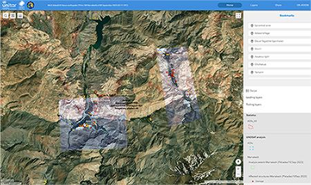
- View satellite analysis of the earthquake in UNOSAT's Live Web Map
- Download kml file for Earthquakes in Morocco, commune Anougal, Haouz
| Tipo de evento: | Earthquake |
| Local do evento: | Morocco |
| Data da Ativação da Carta: | 2023-09-09 |
| Tempo de Ativação da Carta: | 15:46 |
| Zona de Tempo da Ativação da Carta: | UTC+07:00 |
| Requisitante da Carta: | UNITAR on behalf of International Federation of Red Cross and Red Crescent Societies (IFRC) |
| ID da Ativação: | 838 |
| Gerenciamento de projeto: | UNITAR |
| act-value-adders: | IFRC Copernicus EMS (Copernicus EMS) UAESA Moroccan Space Agency (CRTS) Mohammed Bin Rashid Space Centre Konstantin Homenkov (Geoniformation systems) SERTIT Lahache Guillaume (Predict Services) British Geological Survey Corné van der Sande (eLEAF) K-water Research Institute Hamza Ait Zamzami (Reising) |
| Activation handled in collaboration with Copernicus Emergency Management Service |
Products
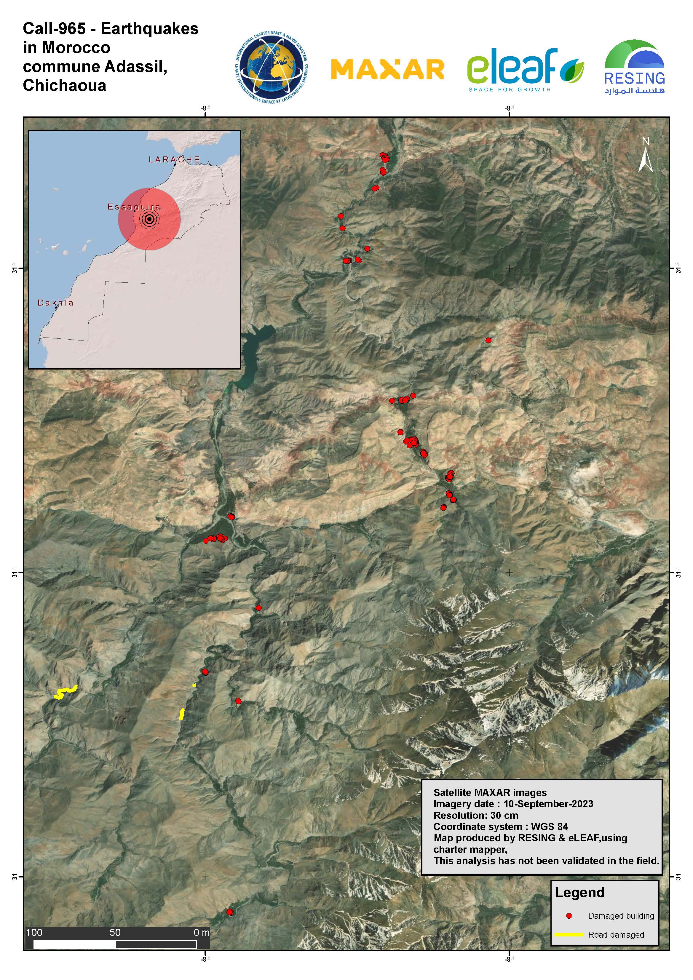
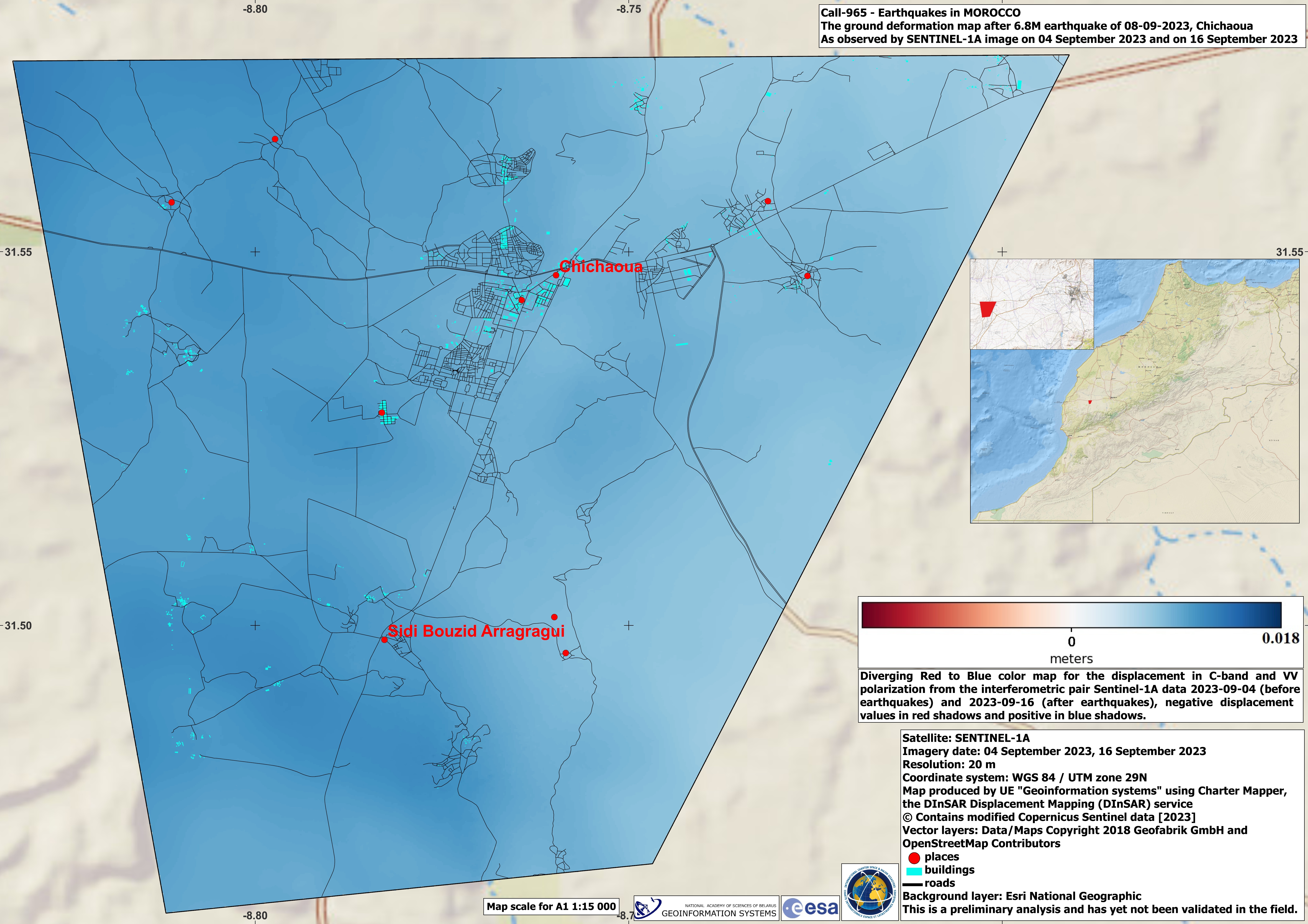
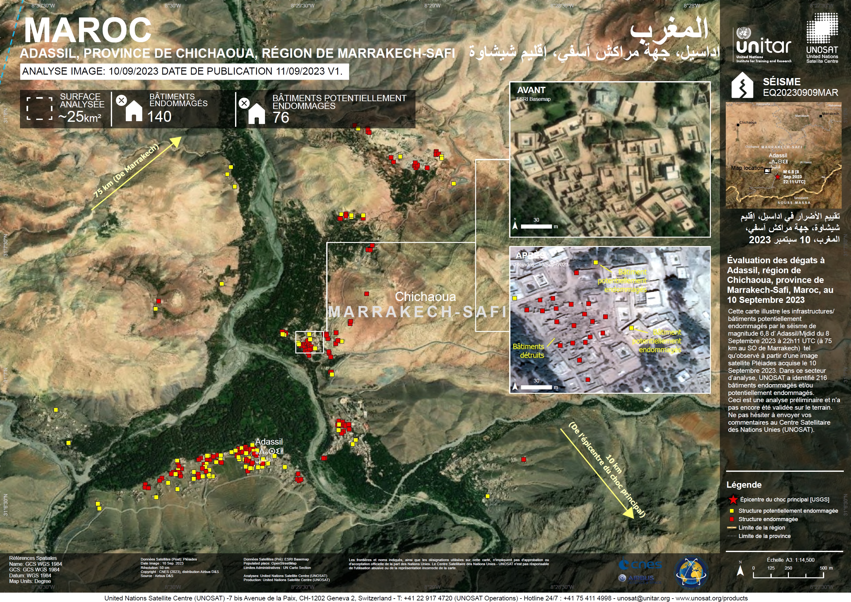
Earthquake in Commune Adassil - Chichaoua, Morocco
Direitos autorais: © (2023) DigitalGlobe, Inc., Longmont CO USA 80503. DigitalGlobe and the DigitalGlobe logos are trademarks of DigitalGlobe, Inc. The use and/or dissemination of this data and/or of any product in any way derived there from are restricted. Unauthorized use and/or dissemination is prohibited.
Map produced by RESING and eLEAF
Information about the Product
Adquirida: 10/09/2023
Fonte: WorldView-2
Categoria: Reference Map
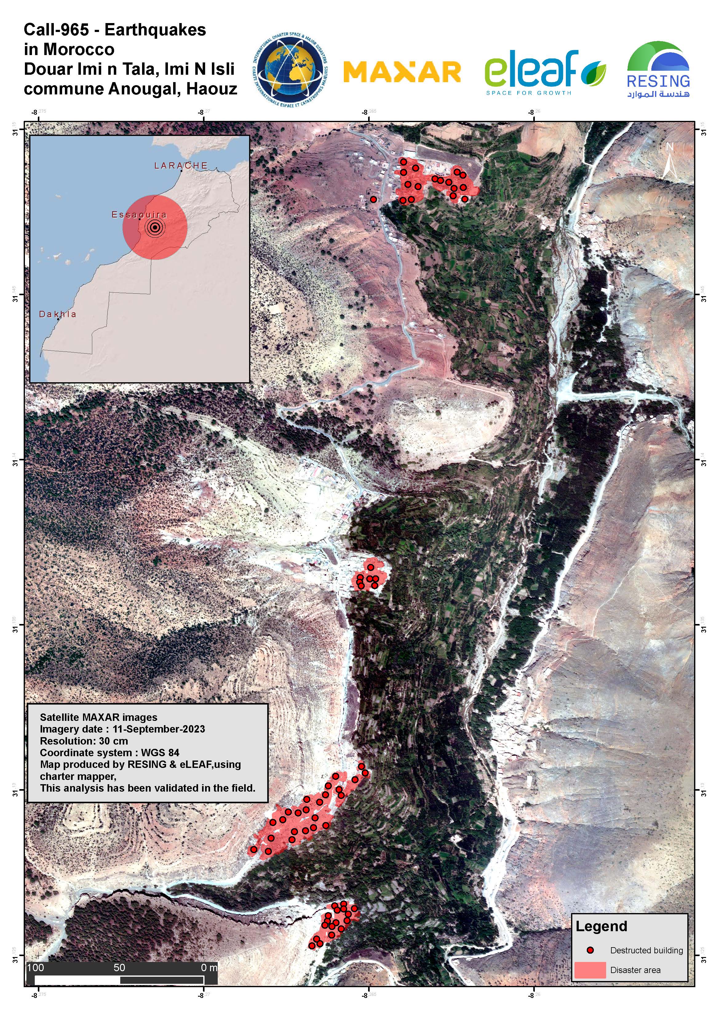
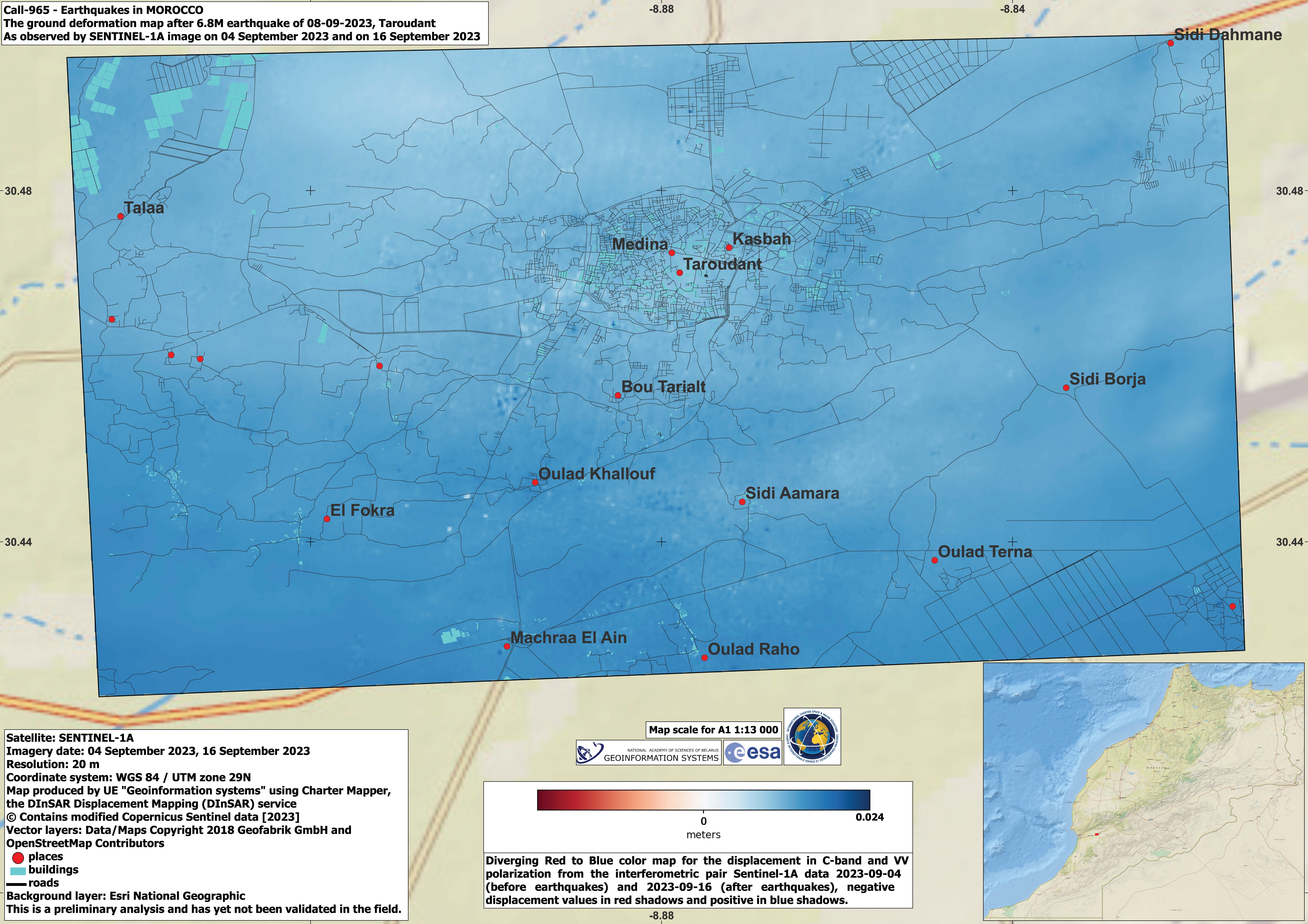
Earthquakes in Morocco, commune Anougal, Haouz
Direitos autorais: © (2023) DigitalGlobe, Inc., Longmont CO USA 80503. DigitalGlobe and the DigitalGlobe logos are trademarks of DigitalGlobe, Inc. The use and/or dissemination of this data and/or of any product in any way derived there from are restricted. Unauthorized use and/or dissemination is prohibited.
Map produced by RESING and eLEAF
Information about the Product
Adquirida: 11/09/2023
Fonte: WorldView-2
Categoria: Reference Map
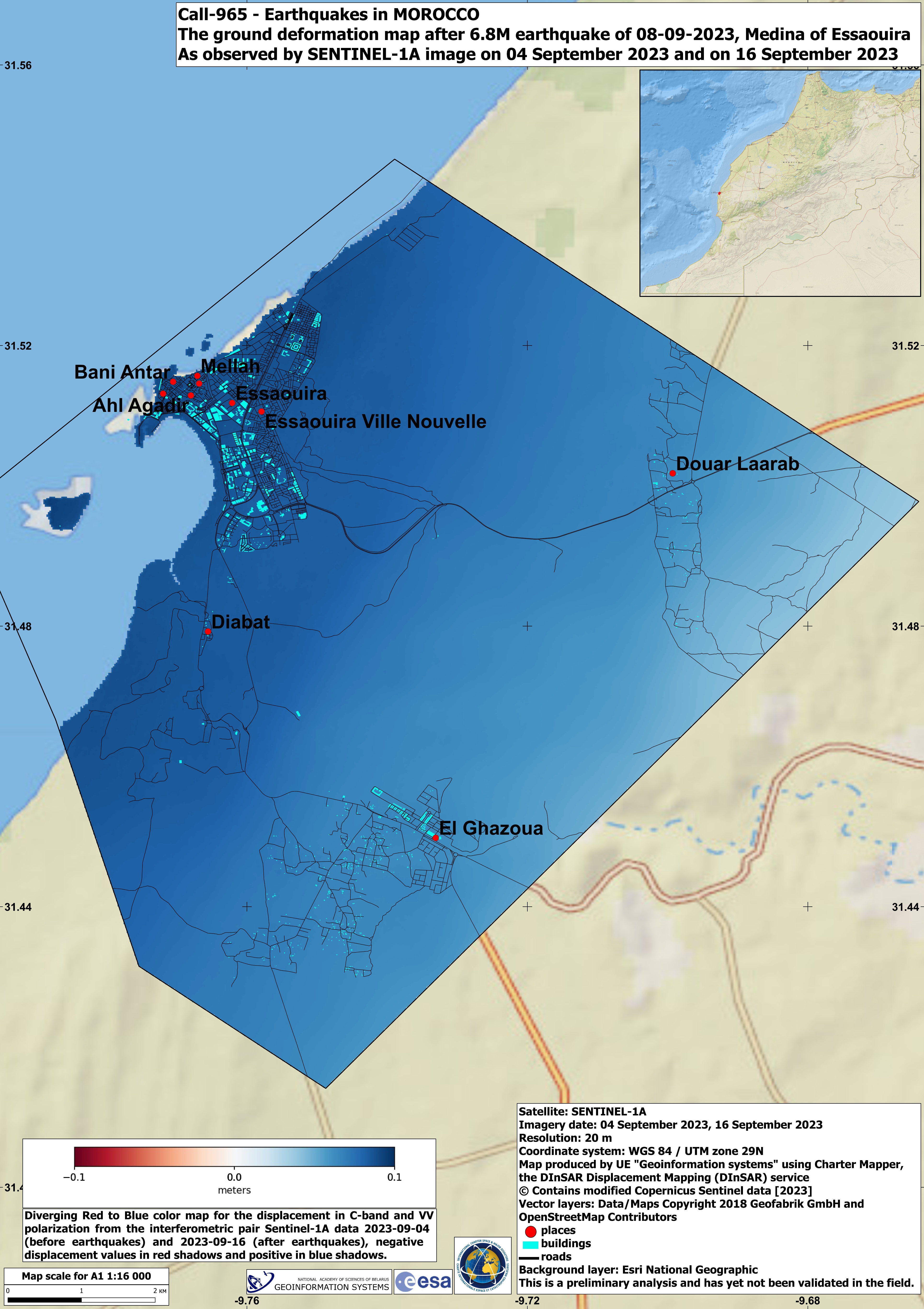
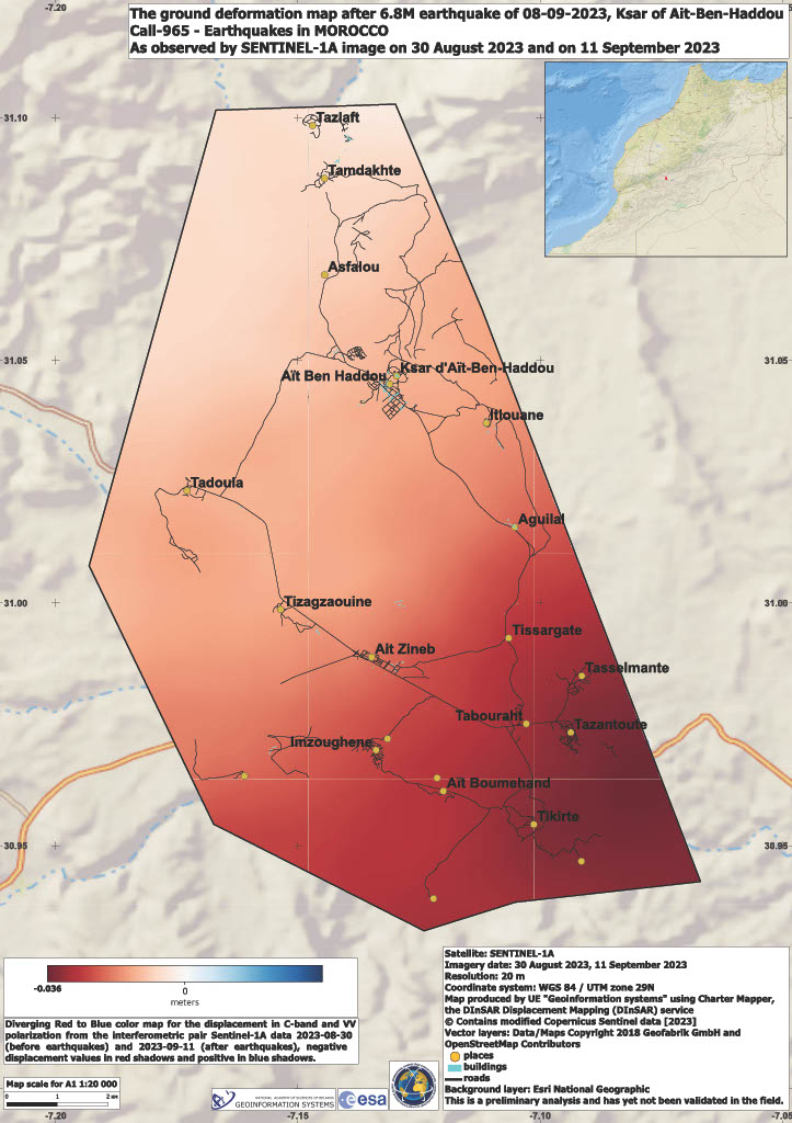
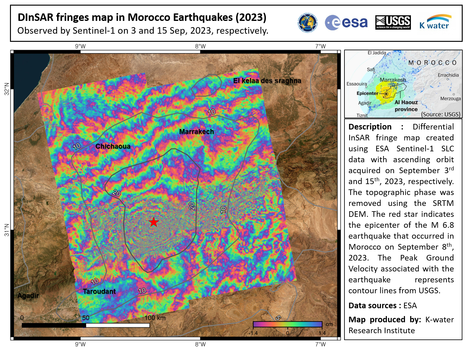
A Ground Deformation Map after the Earthquake in Medina of Essaouira, Morocco
Direitos autorais: Contains modified Copernicus Sentinel data (2023)
Map produced by UE Geoinformation Systems.
Information about the Product
Adquirida: 04/09/2023 and 16/09/2023
Fonte: Sentinel-1
Categoria: Delineation Map
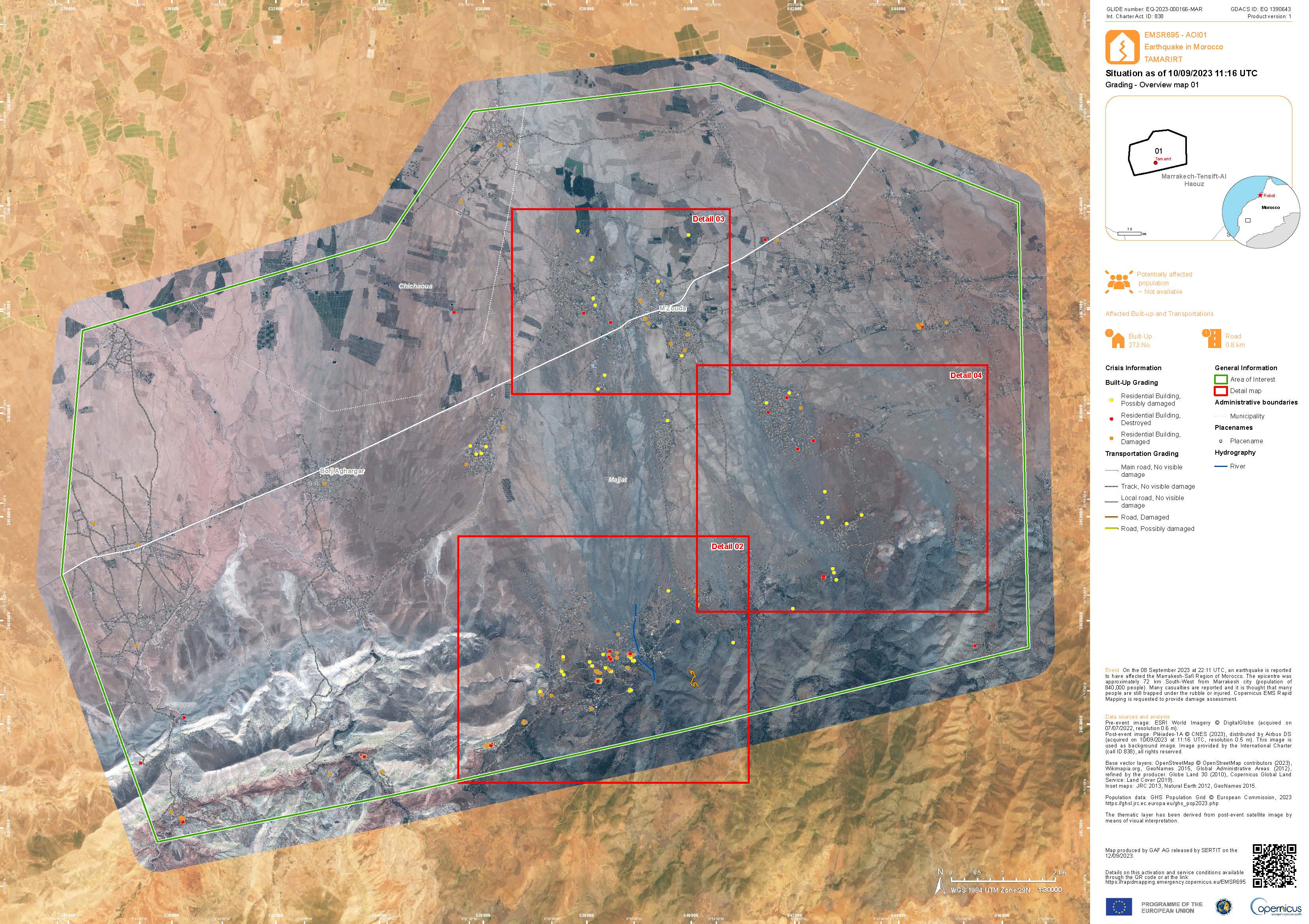
Grading Product with the damage grade assessment over Tamarirt
Download the full report
Direitos autorais: Includes Pleiades material © CNES (2023), Distribution Airbus DS.
Report produced by Copernicus EMS
Information about the Product
Adquirida: 10/09/2023
Fonte: Pleiades
Categoria: Grading Map
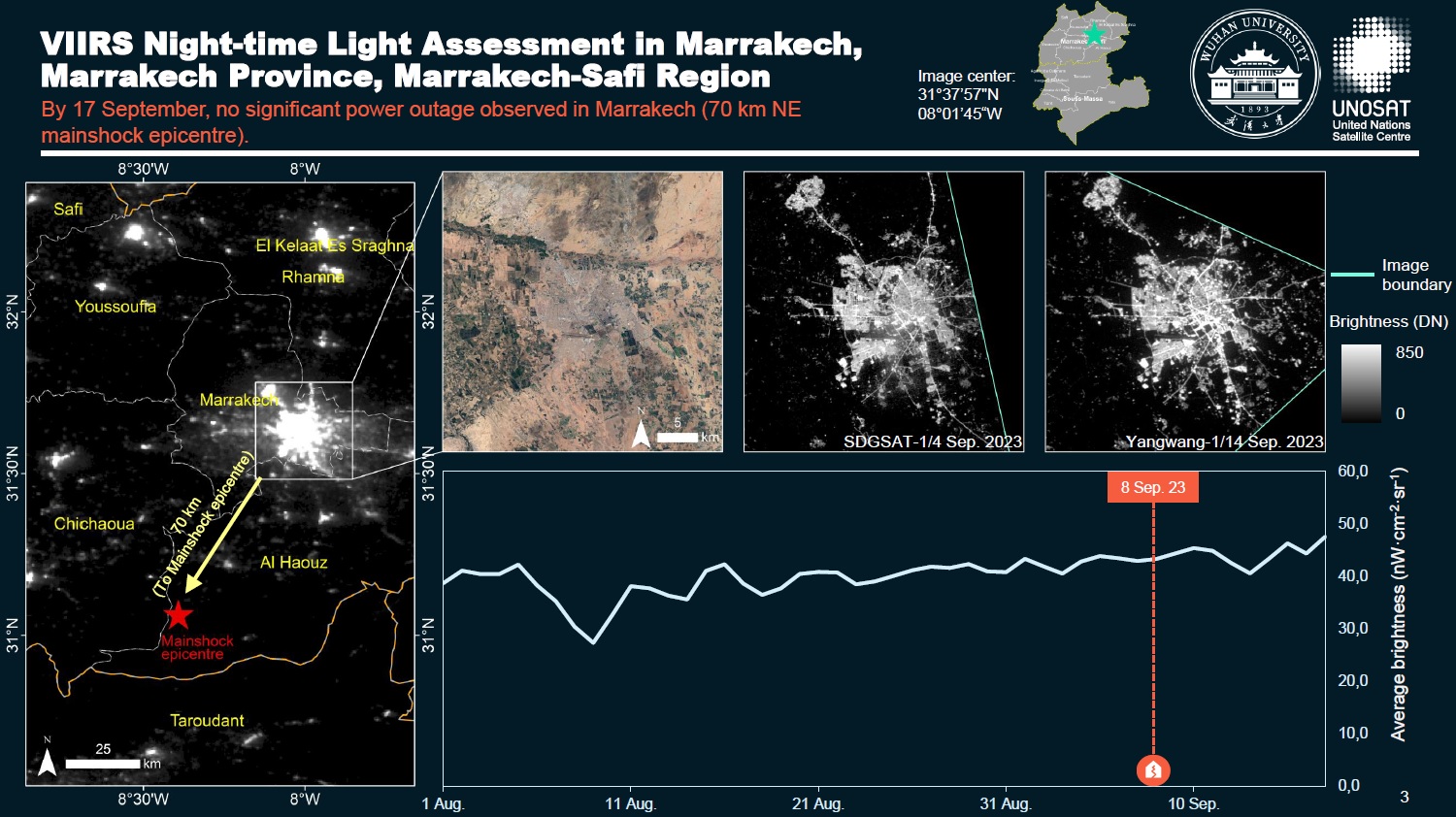
Power Supply Assessment Following the earthquake in Adassil/Al Haouz
Download the full report
Direitos autorais: SDGSAT-1 © International Research Center of Big Data for Sustainable Development Goals (CBAS)
VIIRS © NASA
Yangwang-1 Space Telescope © Origin Space Co., Ltd., China
Report created by UNITAR / UNOSAT
Information about the Product
Adquirida: Suomi NPP: 31/08/2023
SDGSAT-1: 04/09/2023
Yangwang-1 Space Telescope: 14/09/2023
VIIRS: 01/07/2023 - 17/09/2023
Fonte: Suomi NPP, Yangwang-1 Space Telescope, VIIRS and SDGSAT-1
Categoria: Delineation Monitoring Maps
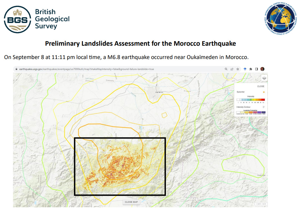
Preliminary Landslides Assessment for the Morocco Earthquake
Download the full report
Direitos autorais: WorldView-2 © (2023) DigitalGlobe, Inc., Longmont CO USA 80503. DigitalGlobe and the DigitalGlobe logos are trademarks of DigitalGlobe, Inc. The use and/or dissemination of this data and/or of any product in any way derived there from are restricted. Unauthorized use and/or dissemination is prohibited.
Includes Pleiades material © CNES (2023), Distribution Airbus DS.
GeoEye-1 © 2004 GeoEye NextView License
Report created by The British Geological Survey
Information about the Product
Adquirida: WorldView-2: 25/03/2023, 07/07/2022, 13/09/2023, 14/09/2023
Pleiades: 10/09/2023
GeoEye-1: 13/09/2023
Fonte: WorldView-2, Pleiades, GeoEye-1
Categoria: Dossier
Satellite Imagery Derived Earthquake Damage Assessment of the Al Haouz Region, Morocco
Download the Full Report
Direitos autorais: © (2023) DigitalGlobe, Inc., Longmont CO USA 80503. DigitalGlobe and the DigitalGlobe logos are trademarks of DigitalGlobe, Inc. The use and/or dissemination of this data and/or of any product in any way derived there from are restricted. Unauthorized use and/or dissemination is prohibited.
Report produced by the Mohammed bin Rashid Space Centre.
Information about the Product
Adquirida: WorldView-3: 10/09/2023
WorldView-2: 13/09/2023
Fonte: WorldView-2 and WorldView-3
Categoria: Delineation Map
Preliminary satellite flood assessment report of the earthquake in the Chichaoua Province, Marrakech-Safi Region, Morocco
Download the full report
Direitos autorais: Includes Pleiades material © CNES (2023), Distribution Airbus DS.
WorldView-2 © (2023) DigitalGlobe, Inc., Longmont CO USA 80503. DigitalGlobe and the DigitalGlobe logos are trademarks of DigitalGlobe, Inc. The use and/or dissemination of this data and/or of any product in any way derived there from are restricted. Unauthorized use and/or dissemination is prohibited.
Report produced by UNITAR/UNOSAT
Information about the Product
Adquirida: WorldView-2: 25/03/2023 Pleiades: 10/09/2023
Fonte: Pleiades / WorldView-2
Categoria: Reference Map
Preliminary Night-time Light Loss Assessment Following the Adassil/Al Haouz Earthquake in the Marrakech-Safi Region
Download Full Report
Direitos autorais: Suomi NPP/VIIRS © NASA/NOAA (2023)
Report produced by UNITAR/UNOSAT
Information about the Product
Adquirida: 10/09/2023
Fonte: Suomi NPP
Categoria: Reference Map
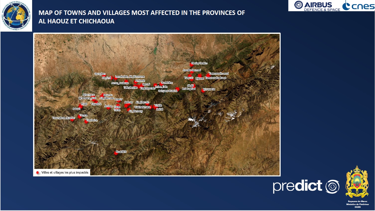
Initial assessment of towns and villages affected by the earthquake, based on available satellite imagery
Download the full report
Direitos autorais: Includes Pleiades material © CNES (2023), Distribution Airbus DS.
Report produced by Predict
Information about the Product
Adquirida: 10/09/2023
Fonte: Pleiades
Categoria: Grading Map
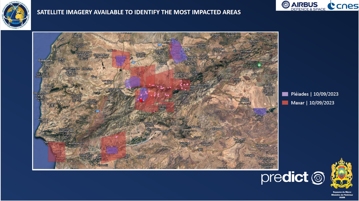
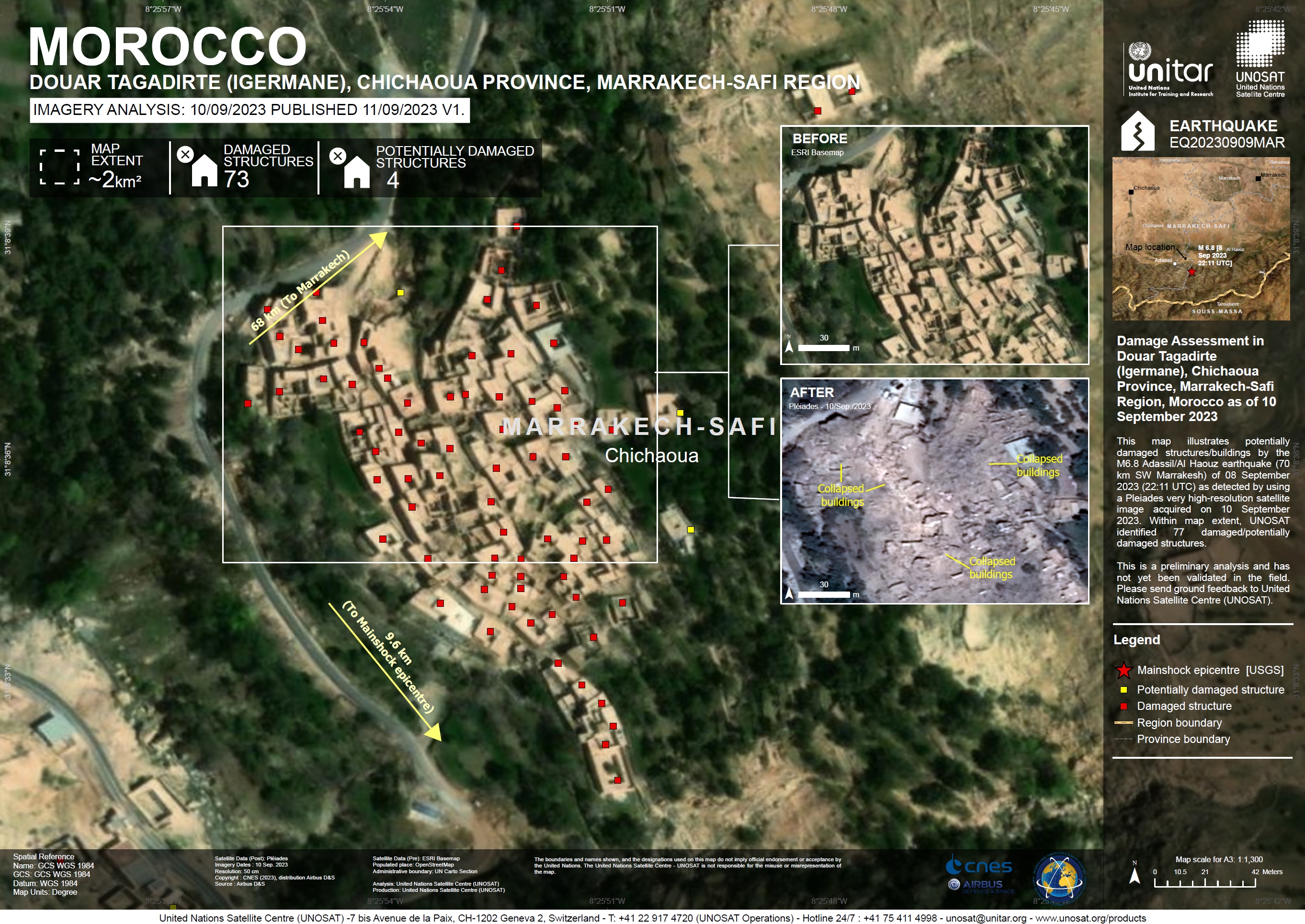
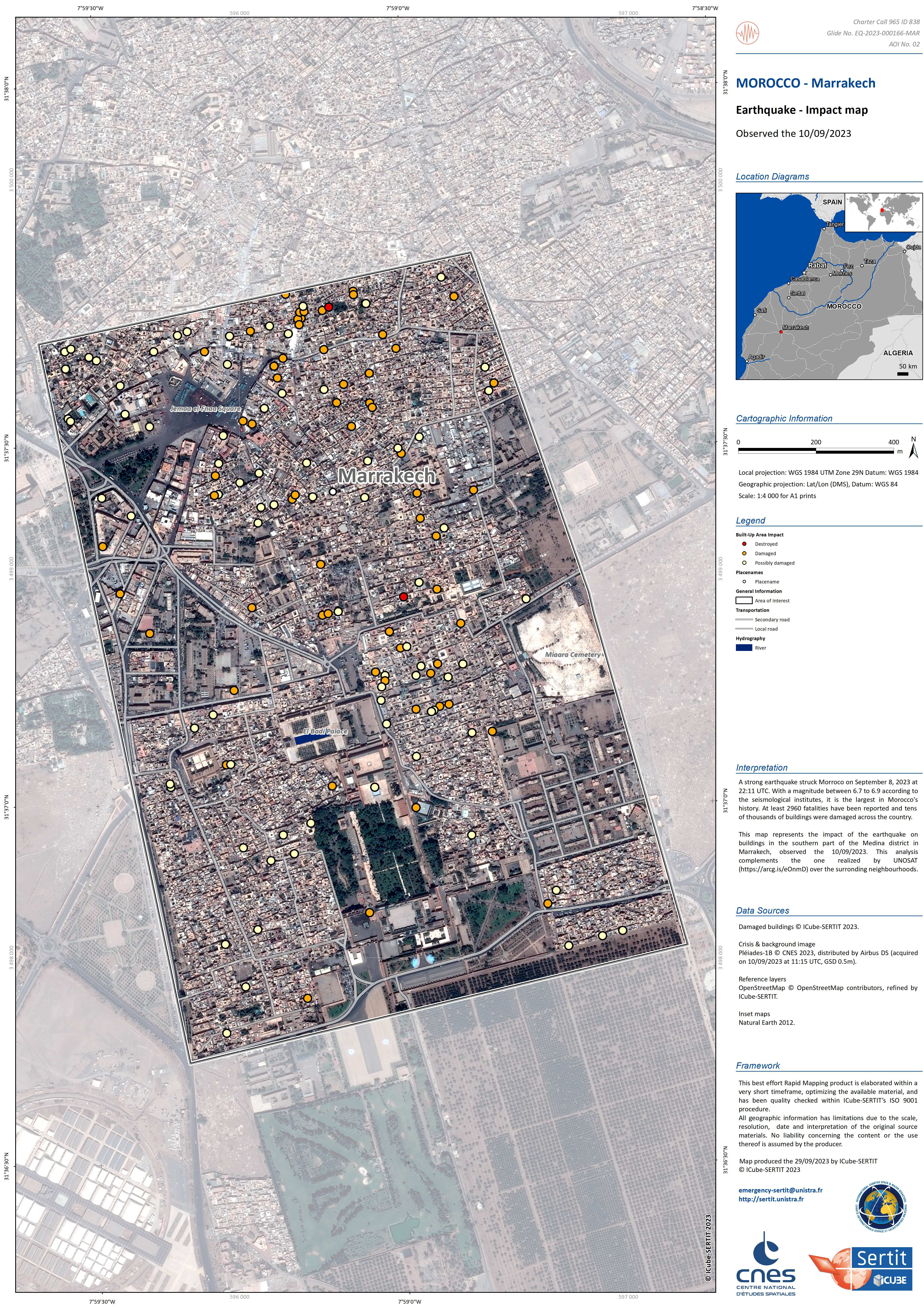
Damage Assessment in Douar Tagadirte (Igermane), Chichaoua Province, Marrakech-Safi Region, Morocco
Direitos autorais: Includes Pleiades material © CNES (2023), Distribution Airbus DS.
Map produced by UNITAR/UNOSAT
Information about the Product
Adquirida: 10/09/2023
Fonte: Pleiades
Categoria: Reference Map
 Voltar ao arquivo completo da Ativação

