Charter activations
Earthquake in Ecuador
A 7.8 magnitude earthquake struck Ecuador on 16 April at 23:58 UTC (18:58 local time) and has caused severe damage in the country.
At least 659 people are known to have been killed, and almost thirty thousand more were injured.
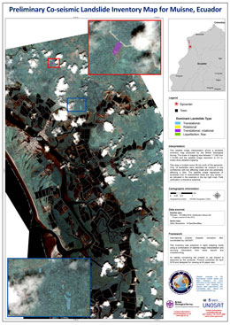
The shallow earthquake, the worst to affect the country in almost forty years, struck near the town of Muisne on the western coast of Ecuador, and there were concerns of potential tsunami in the aftermath. While the risk of tsunami has now passed the earthquake has still caused widespread damage. Over a hundred aftershocks have been reported.
A state of emergency has been declared in the Guayas, Manabi, Santo Domingo, Los Rios, Esmeraldas and Galapagos Provinces, all of which are on the coast of the nation. Rescue operations and the search for survivors are ongoing. Soldiers have been deployed to aid the rescue operations in the north-west, but landslides have made it difficult to reach some areas. Ecuador is receiving international aid and relief from eight separate countries.
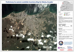
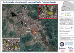
The Manabi Province suffered the most damage, with the town of Pedernales, which was close to the earthquake, reportedly flattened and further south the cities of Manta and Portoviejo have also suffered severe damage.
Thousands of people have been left homeless, and it is estimated it will take years for the worst-affected areas to recover and rebuild.
| Tipo de evento: | Earthquake |
| Local do evento: | Ecuador |
| Data da Ativação da Carta: | 17 April 2016 |
| Tempo de Ativação da Carta: | 15:58:10 |
| Zona de Tempo da Ativação da Carta: | UTC+02:00 |
| Requisitante da Carta: | UNITAR/UNOSAT on behalf of UN OCHA |
| Gerenciamento de projeto: | UNITAR |
Products
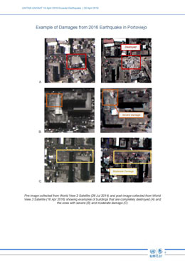
Preliminary satellite based damage assessment report of the earthquake
Download the full report
Direitos autorais: DigitalGlobe Inc.
Report produced by UNITAR/UNOSAT
Information about the Product
Adquirida: WorldView-2: 26/07/2014
WorldView-3: 16/04/2016
Fonte: WorldView-2 / WorldView-3
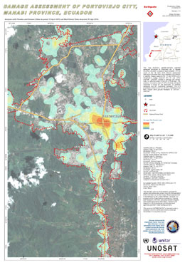
Damage assessment of Portoviejo City, Manabi Province, Ecuador
Direitos autorais: Pleiades © CNES 2016 - Distribution: Airbus Defence and Space, all rights reserved
Deimos-2 © Deimos Imaging
WorldView-2 © DigitalGlobe Inc.
Map produced by UNITAR/UNOSAT
Information about the Product
Adquirida: Pleiades: 19/04/2016
Deimos-2: 19/04/2016
WorldView-2: 26/07/2014
Fonte: Pleiades / Deimos-2 / WorldView-2
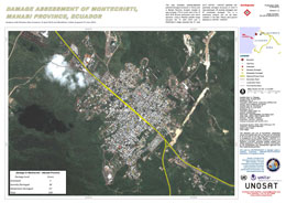
Damage assessment of Montecristi, Manabi Province, Ecuador
Direitos autorais: Pleiades © CNES 2016 - Distribution: Airbus Defence and Space, all rights reserved
WorldView-3 © DigitalGlobe Inc.
Map produced by UNITAR/UNOSAT
Information about the Product
Adquirida: Pleiades: 19/04/2016
WorldView-3: 27/06/2015
Fonte: Pleiades / WorldView-3
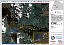
Preliminary co-seismic landslide inventory map for Bahía de Caráquez, Ecuador
Direitos autorais: Pleiades © CNES 2016 - Distribution: Airbus Defence and Space, all rights reserved
Map produced by British Geological Survey and UNITAR/UNOSAT
Information about the Product
Adquirida: 19/04/2016
Fonte: Pleiades
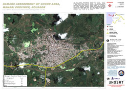
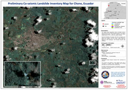
Damage assessment of Chone area in Manabi Province, Ecuador
Direitos autorais: Pleiades © CNES 2016 - Distribution: Airbus Defence and Space, all rights reserved
WorldView-2 © DigitalGlobe Inc.
Map produced by UNITAR/UNOSAT
Information about the Product
Adquirida: Pleiades: 19/04/2016
WorldView-2: 02/12/2016
Fonte: Pleiades / WorldView-2

Damage assessment of Muisne in Esmeraldas Province, Ecuador
Direitos autorais: Pleiades © CNES 2016 - Distribution: Airbus Defence and Space, all rights reserved
WorldView-3 © DigitalGlobe Inc.
Map produced by UNITAR/UNOSAT
Information about the Product
Adquirida: Pleiades: 20/04/2016
WorldView-3: 12/03/2016
Fonte: Pleaides / WorldView-3
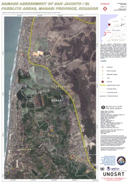
Damage assessment of San Jacinto / El Pueblito areas, Manabi Province, Ecuador
Direitos autorais: Pleiades © CNES 2016 - Distribution: Airbus Defence and Space, all rights reserved
WorldView-2 © DigitalGlobe Inc.
Map produced by UNITAR/UNOSAT
Information about the Product
Adquirida: Pleiades: 19/04/2016
WorldView-2: 23/04/2015
Fonte: Pleiades / WorldView-2
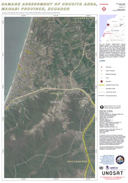
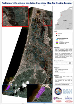
Damage assessment of Crucita area, in Manabi Province, Ecuador
Direitos autorais: Pleiades © CNES 2016 - Distribution: Airbus Defence and Space, all rights reserved
WorldView-2 © DigitalGlobe Inc.
Map produced by UNITAR/UNOSAT
Information about the Product
Adquirida: Pleiades: 19/04/2016
WorldView-2: 23/04/2015
Fonte: Pleiades / WorldView-2
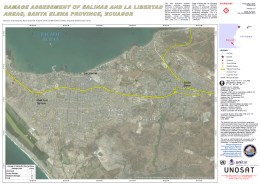
Damage assessment of Salinas and La Libertad in Santa Elena Province, Ecuador
Direitos autorais: Pleiades © CNES 2016 - Distribution: Airbus Defence and Space, all rights reserved
WorldView-2 © DigitalGlobe Inc.
Map produced by UNITAR/UNOSAT
Information about the Product
Adquirida: Pleiades: 18/04/2016
WorldView-2: 26/12/2015
Fonte: Pleiades / WorldView-2
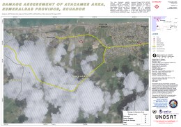
Damage assessment of Atacames area in Esmeraldas Province, Ecuador
Direitos autorais: Pleiades © CNES 2016 - Distribution: Airbus Defence and Space, all rights reserved
WorldView-2 © DigitalGlobe Inc.
Map produced by UNITAR/UNOSAT
Information about the Product
Adquirida: Pleiades: 18/04/2016
WorldView-2: 18/08/2013
Fonte: Pleiades / WorldView-2
 Voltar ao arquivo completo da Ativação

 English
 Spanish
 French
 Chinese
 Russian
 Portuguese
