Charter activations
Cyclone Filipo in Mozambique
Tropical Cyclone Filipo made landfall in Mozambique on 12 March, after strengthening off the coast of southeast Africa, bringing strong winds and heavy rain to the Inhambane and Gaza provinces.
Government authorities estimated that over 525,000 people, 856 schools and 145 health centres that are in the areas were considered most at risk. At least two deaths were reported.
Filipo came while the country is still recovering from Cyclone Freddy, the longest lasting cyclone on record which struck over a year ago.
| Type of Event: | Cyclone |
| Location of Event: | Mozambique |
| Date of Charter Activation: | 2024-03-14 |
| Time of Charter Activation: | 18:14 |
| Time zone of Charter Activation: | UTC+01:00 |
| Charter Requestor: | UNITAR on behalf of United Nations Office for the Coordination of Humanitarian Affairs (OCHA) |
| Activation ID: | 868 |
| Project Management: | Ida Svendsen (UNOSAT) |
| act-value-adders: | NOAA SERTIT Rapid Mapping Service |
Products
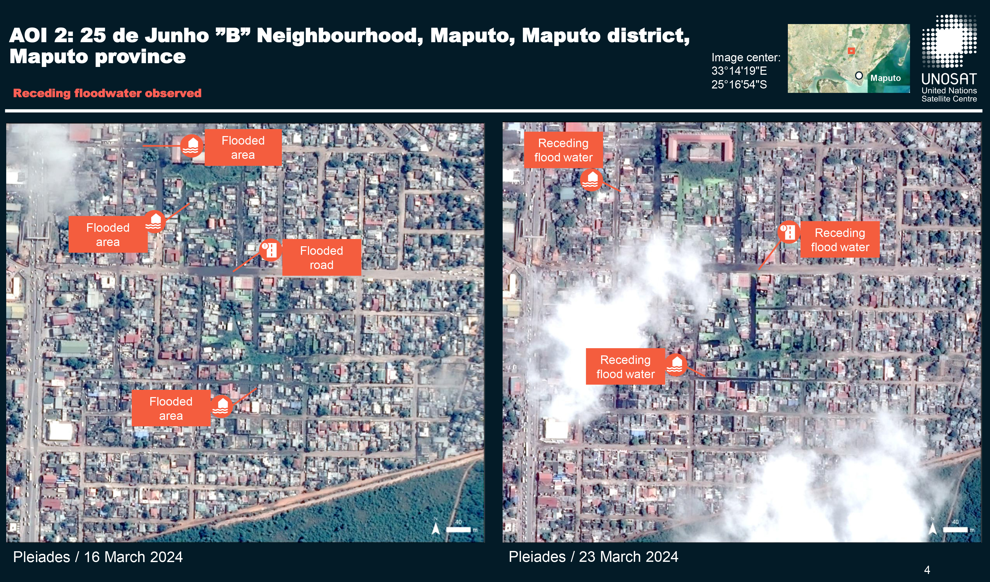
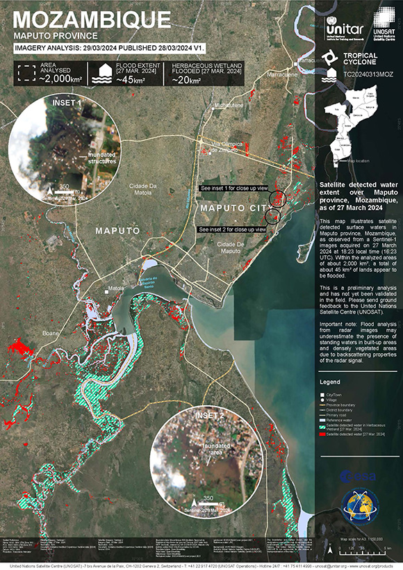
Preliminary Satellite-derived Flood Assessment Report, Maputo City, Mozambique
Download full report
Copyright: Includes Pleiades material © CNES (2024), Distribution Airbus DS.
Report produced by UNITAR / UNOSAT
Information about the Product
Acquired: 23/03/2024
Source: Pleiades
Category: Reference Map
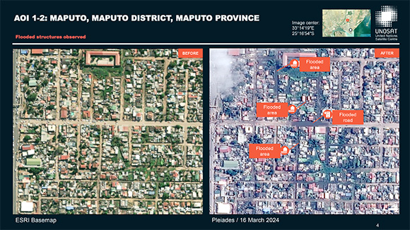
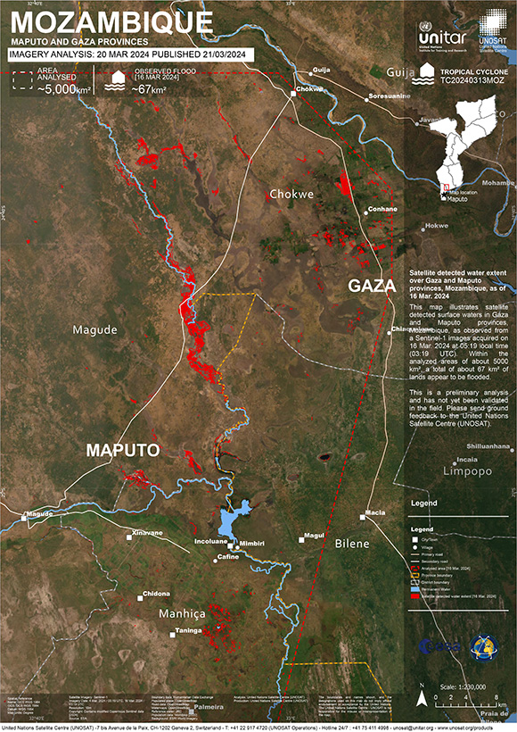
Preliminary Satellite-derived Flood Impact Assessment, Maputo City, Praia De Bilene in Gaza Province and Cidade De Inhambane, Mozambique.
Download full report
Copyright: Includes Pleiades material © CNES (2024), Distribution Airbus DS.
Report produced by UNITAR / UNOSAT
Information about the Product
Acquired: 16/03/2024,18/03/2024
Source: Pleiades
Category: Dossier
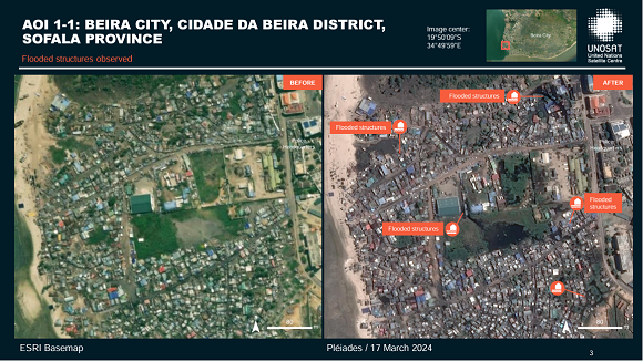
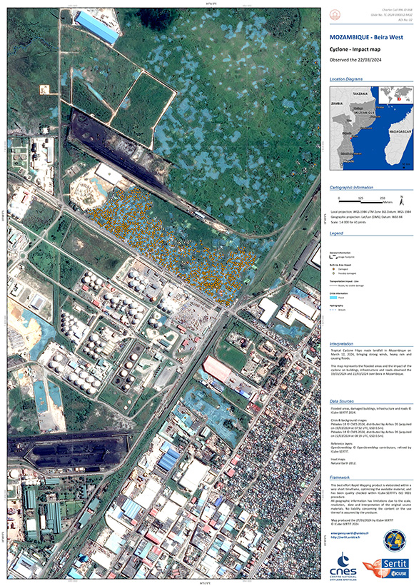
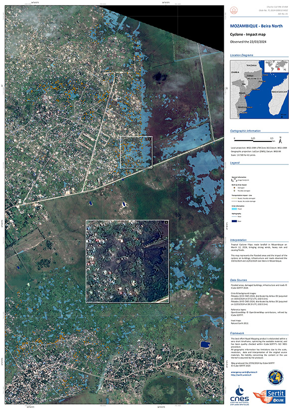
Preliminary Satellite-derived Flood Impact Assessment, Vilankulos Town, Vilankulo Disrict, Inhambane Province and Beira City, Cidade Da Beira District, Sofala Province Mozambique
Download the full report
Copyright: Includes Pleiades material © CNES (2024), Distribution Airbus DS.
Report produced by UNITAR / UNOSAT
Information about the Product
Acquired: 17/03/2024
Source: Pleiades
Category: Reference Map
Quickviews
Quickviews are produced for illustration purposes only and do not contain any verified analysis of the disaster.


The banks of the Tembe river, which flows inland from Maputo bay, flooded in several areas due to Tropical Storm Filipo. The black areas represent low backscatter of the radar signal and therefore potential standing water.
Copyrights: Contains modified Copernicus Sentinel data (2024)
Information about the Quickview
Acquired: 04-03-2024 / 16-03-2024
Source(s): Sentinel-1
 Back to the full activation archive

 English
 Spanish
 French
 Chinese
 Russian
 Portuguese
