Charter activations
Cyclone Harold in Vanuatu
Cyclone Harold a category 5 cyclone tracked across the southern-tip of Vanuatu with wind speeds of over 130mph. Vanuatu was already in a state of emergency as it prepares for the coronavirus outbreak.
Tens of thousands of people have been affected, with many on the island of Santo moving into sheltered accommodation. Social distancing measures have been relaxed by the government so people could be evacuated safely.
The strong winds have brought down many trees and damaged hectares of crops. Communications to Santo and Malekula [Vanuatu's two largest islands] have been cut off. Flash flooding is also a problem in some areas. The Vanuatu meteorology and geo-hazards department warned that the seas are "very rough to phenomenal".
Recovery efforts will be hampered by the restrictions on international travel due to the coronavirus. Humanitarian workers are not able to travel to Vanuatu as they would be required to do 14 days quarantine.
Related News and Resources
| Type of Event: | Cyclone |
| Location of Event: | Vanuatu |
| Date of Charter Activation: | 2020-04-03 |
| Time of Charter Activation: | 15:58 |
| Time zone of Charter Activation: | UTC+02:00 |
| Charter Requestor: | UNITAR on behalf of United Nations Office for the Coordination of Humanitarian Affairs (OCHA) | Regional Office for Asia and the Pacific (ROAP) Direction de la sécurité civile et de la gestion des risques on behalf of Gouvernement de Vanuatu et de ses services |
| Activation ID: | 647 |
| Project Management: | UNITAR/UNOSAT |
Products
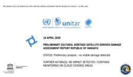
Preliminary Cultural Heritage Satellite-Derived Damage Assessment Report, Vanuatu
Download the full report
Copyright: Report produced by UNITAR/UNOSAT
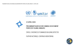
Preliminary agriculture damage assessment, Pentecost Island, Vanuatu
Download the full report
Copyright: Includes Pleiades material © CNES (2020), Distribution Airbus DS.
Report produced by UNITAR/UNOSAT
Information about the Product
Source: Pleiades

Damage assessment in West Santo and South Santo Municipality, Sanma Province, Vanuatu
Copyright: © (2020) DigitalGlobe, Inc., Longmont CO USA 80503. DigitalGlobe and the DigitalGlobe logos are trademarks of DigitalGlobe, Inc. The use and/or dissemination of this data and/or of any product in any way derived there from are restricted. Unauthorized use and/or dissemination is prohibited
Map produced by UNITAR/UNOSAT
Information about the Product
Acquired: 17/04/2020 and 19/04/2020
Source: WorldView-2
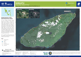
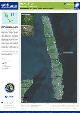
Damage assessment in Ambae Island, Penama Province, Vanuatu
Copyright: WorldView-2 © (2020) DigitalGlobe, Inc., Longmont CO USA 80503. DigitalGlobe and the DigitalGlobe logos are trademarks of DigitalGlobe, Inc. The use and/or dissemination of this data and/or of any product in any way derived there from are restricted. Unauthorized use and/or dissemination is prohibited
Includes Pleiades material © CNES (2020), Distribution Airbus DS
Map produced by UNITAR/UNOSAT
Information about the Product
Acquired: WorldView-2: 20/04/2020
Pleiades: 21/04/2020
Source: WorldView-2 / Pleiades
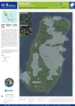
Damage asessment in Paama Island, Malampa Province, Vanuatu
Copyright: Includes Pleiades material © CNES (2020), Distribution Airbus DS
Map produced by UNITAR/UNOSAT
Information about the Product
Acquired: 21/04/2020
Source: Pleiades
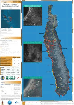
Damage assessment - Pentecost Island, Vanuatu
Copyright: WorldView © (2020) DigitalGlobe, Inc., Longmont CO USA 80503. DigitalGlobe and the DigitalGlobe logos are trademarks of DigitalGlobe, Inc. The use and/or dissemination of this data and/or of any product in any way derived there from are restricted. Unauthorized use and/or dissemination is prohibited.
Resurs-P © ROSCOSMOS (2020). All Rights Reserved
Map produced by BLUECHAM SAS/SAU
Information about the Product
Acquired: WorldView-1: 13/04/2020
WorldView-2: 09/04/2020 and 15/04/2020
Resurs-P: 10/04/2020
Source: WorldView-1 / WorldView-2 / Resurs-P
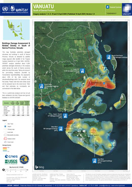
Buildings damage assessment and related density in South of Sanma Province, Vanuatu
Copyright: Includes Pleiades material © CNES (2020), Distribution Airbus DS.
WorldView-2 © (2020) DigitalGlobe, Inc., Longmont CO USA 80503. DigitalGlobe and the DigitalGlobe logos are trademarks of DigitalGlobe, Inc. The use and/or dissemination of this data and/or of any product in any way derived there from are restricted. Unauthorized use and/or dissemination is prohibited
Map produced by UNITAR/UNOSAT
Information about the Product
Acquired: Pleiades: 07/04/2020, 08/04/2020, 09/04/2020, 10/04/2020, 12/04/2020
WorldView-2: 24/02/2019
Source: Pleiades / WorldView-2
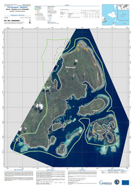
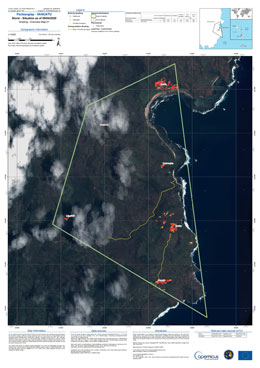
Damage grading assessment over Port Sandwich, Vanuatu
Copyright: Includes Pleiades material © CNES (2020), Distribution Airbus DS
WorldView-3 © (2019) DigitalGlobe, Inc., Longmont CO USA 80503. DigitalGlobe and the DigitalGlobe logos are trademarks of DigitalGlobe, Inc. The use and/or dissemination of this data and/or of any product in any way derived there from are restricted. Unauthorized use and/or dissemination is prohibited
Map produced by Copernicus EMS
Information about the Product
Acquired: Pleiades: 09/04/2020 and 10/04/2020
WorldView-3: 18/03/2019
Source: Pleiades / WorldView-3

Damage grading assessment over Olal, Vanuatu
Copyright: Includes Pleiades material © CNES (2020), Distribution Airbus DS
WorldView-2 © (2019) DigitalGlobe, Inc., Longmont CO USA 80503. DigitalGlobe and the DigitalGlobe logos are trademarks of DigitalGlobe, Inc. The use and/or dissemination of this data and/or of any product in any way derived there from are restricted. Unauthorized use and/or dissemination is prohibited
Map produced by Copernicus EMS
Information about the Product
Acquired: Pleiades: 09/04/2020
WorldView-2: 17/08/2019
Source: Pleiades / WorldView-2

Damage assessment in Malampa Province, Vanuatu
Copyright: WorldView-2 © (2019) DigitalGlobe, Inc., Longmont CO USA 80503. DigitalGlobe and the DigitalGlobe logos are trademarks of DigitalGlobe, Inc. The use and/or dissemination of this data and/or of any product in any way derived there from are restricted. Unauthorized use and/or dissemination is prohibited
Includes Pleiades material © CNES (2020), Distribution Airbus DS.
Map produced by UNITAR/UNOSAT
Information about the Product
Acquired: WorldView-2: 03/04/2019
Pleiades: 07/04/2020, 08/04/2020, 09/04/2020
Source: WorldView-2 / Pleiades
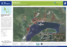
Damage assessment of Luganville municipality, Sanma province, Vanuatu
Copyright: WorldView-2 © DigitalGlobe Inc.
Pleiades © CNES (2020) - Distribution: Airbus Defence and Space, all rights reserved
Map produced by UNITAR/UNOSAT
Information about the Product
Acquired: WorldView-2: 24/02/2019
Pleiades: 07/04/2020
Source: WorldView-2 / Pleiades
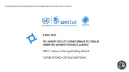
Preliminary damage assessment of Sanma and Malampa provinces in Vanuatu
Download the full report
Copyright: Report produced by UNITAR/UNOSAT
 Back to the full activation archive

 English
 Spanish
 French
 Chinese
 Russian
 Portuguese
