 English
 Spanish
 French
 Chinese
 Russian
 Portuguese
 最新宪章启动
Charter activations
多哥洪灾
1万多人遭遇洪灾,6人死亡。公路铁路无法通行,致使无法进入所有社区,将该国分割成南北两部分。另外,约400座房屋被毁,在某些受灾地区电话网络无法运行。
| 事件类型: | 洪水 |
| 事件地点: | 多哥 |
| 启动宪章的日期: | 2008年7月31日 |
| 宪章要求者: | UNOOSA代表UNOCHA-ROWA |
| 项目经理: | 美国对外灾害援助办公室 |
Products
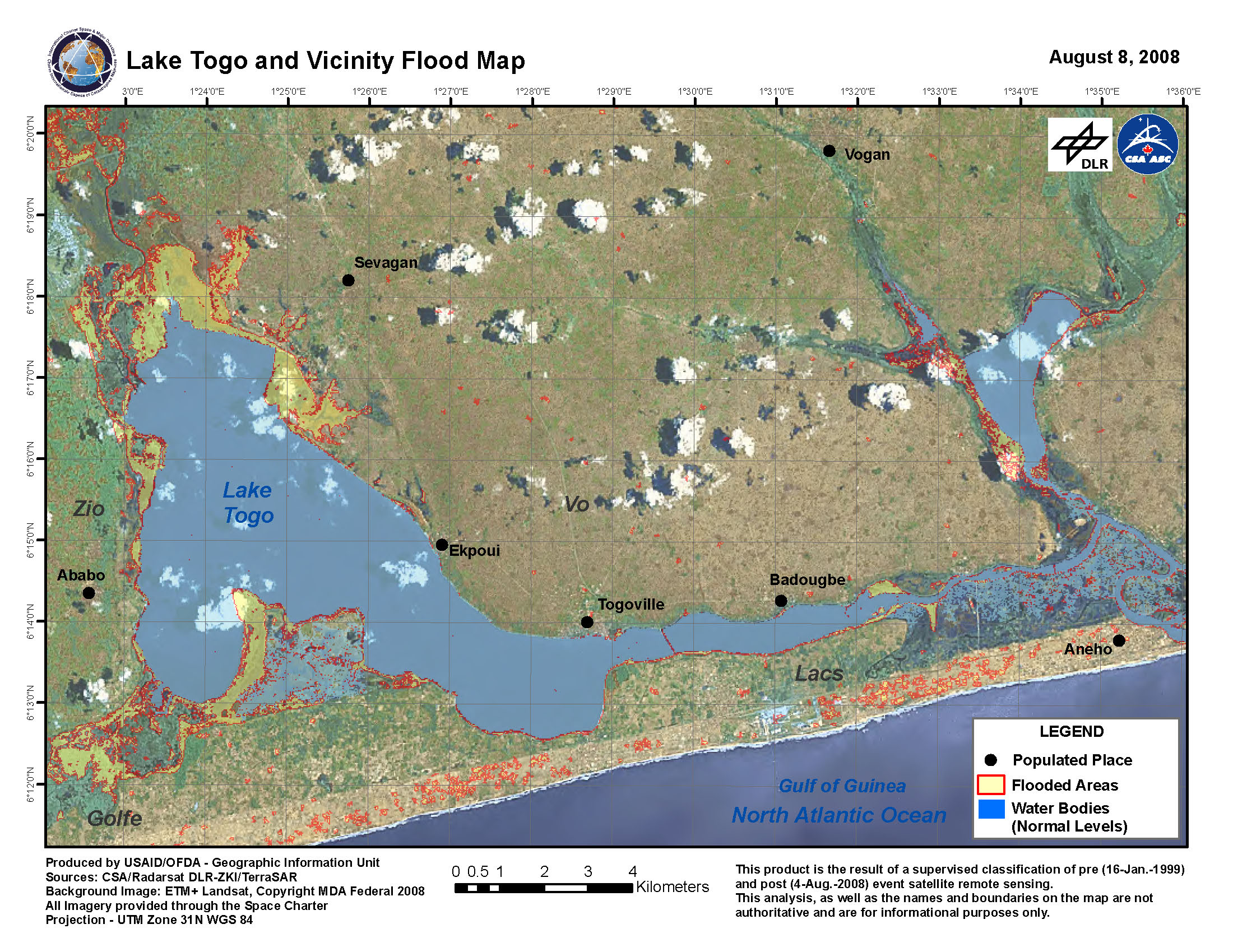
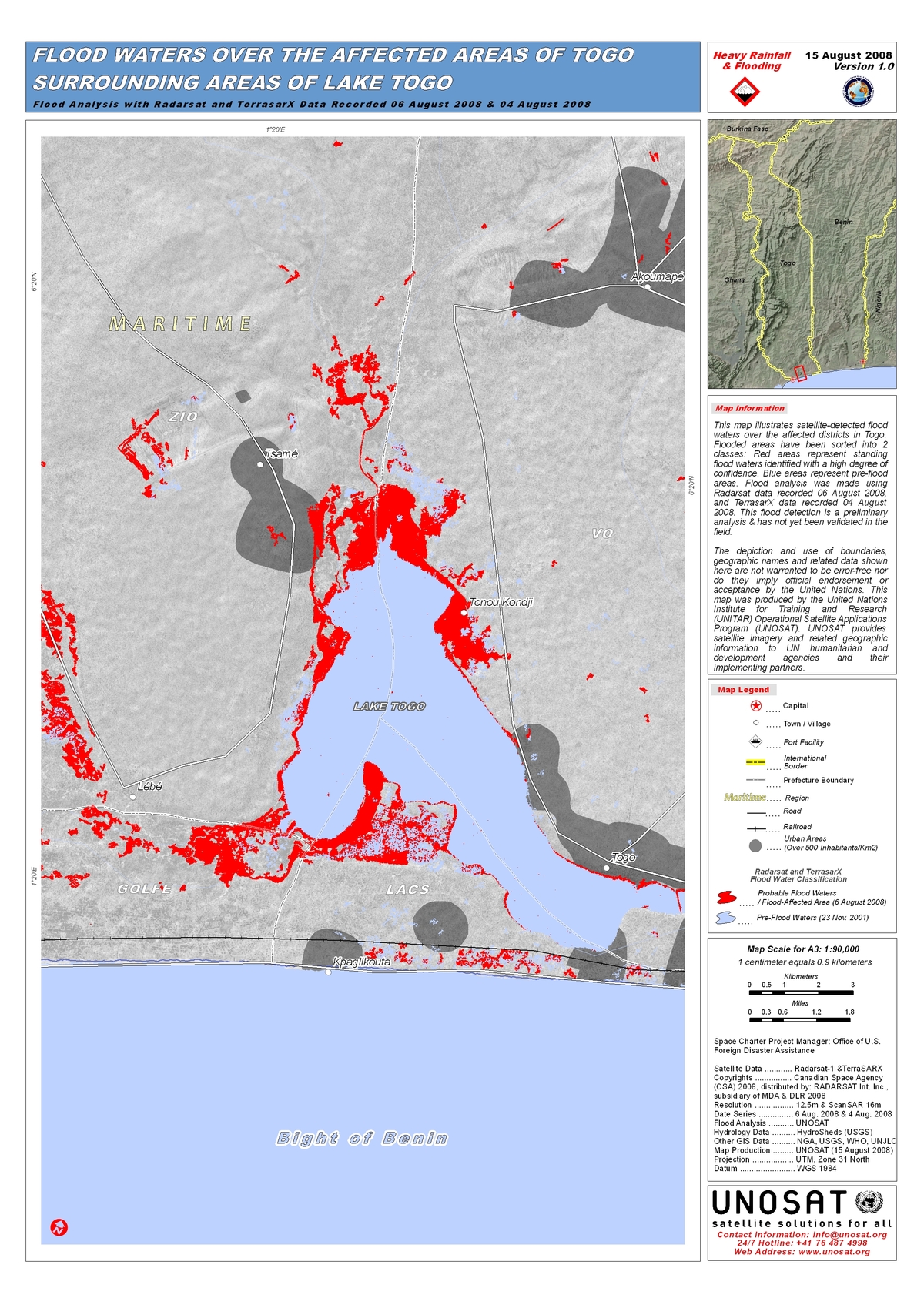
Flooded areas have been sorted into 2 classes: Red areas represent standing flood waters identified with a high degree of confidence. Blue areas represent pre-flood areas. Flood analysis was made using Radarsat data recorded 06 August 2008, and TerrasarX data recorded 04 August 2008. Preliminary analysis not yet validated in the field.
版权: CSA 2008, DLR 2008 Image processing, map created 15/08/2008 by UNOSAT.
Information about the Product
已获得: 04/08/2008, 06/08/2008
源: Radarsat-1, TerraSAR-X
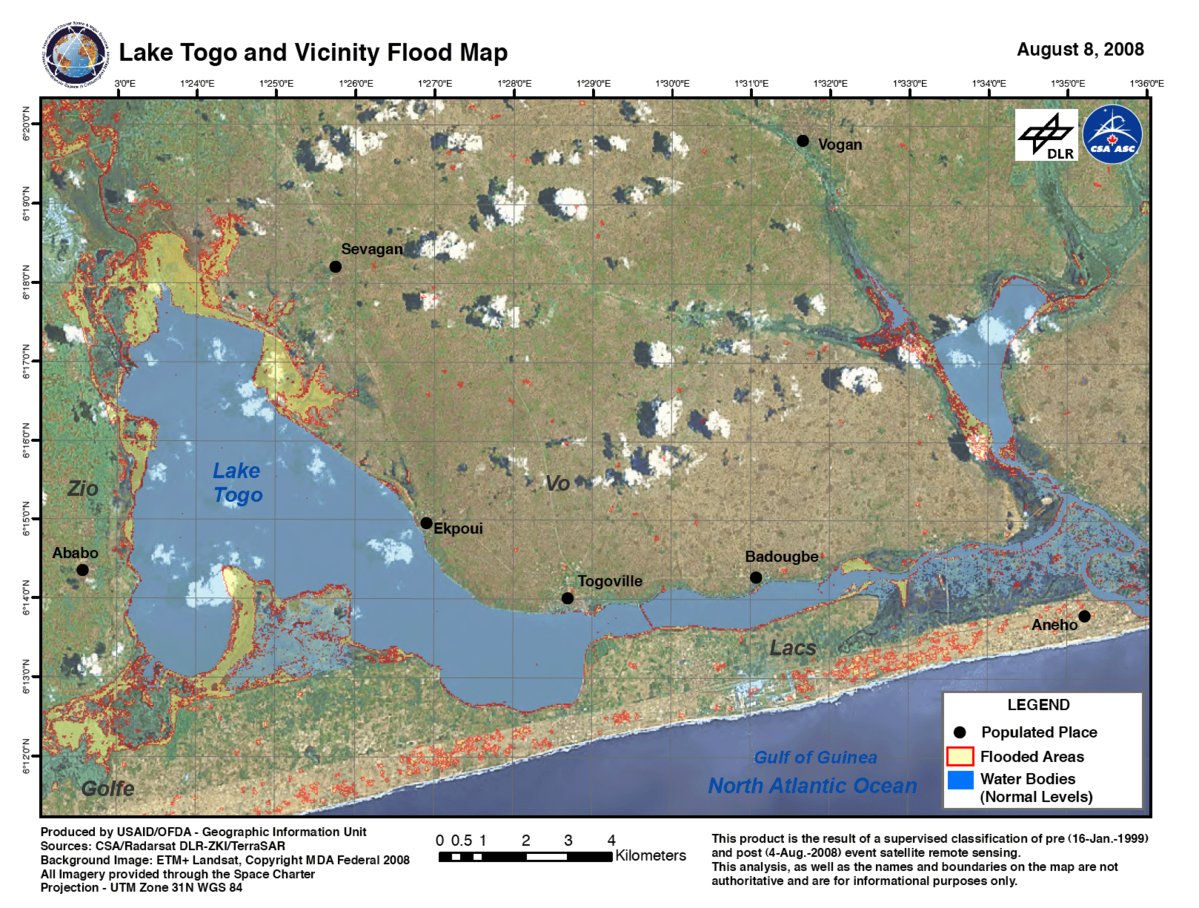
Flooded Areas around Lake Togo, Radarsat/TerraSAR-X, 04/08/2008
版权: CSA 2008, DLR 2008, MDA Federal 2008 Image processing, map created 05/08/2008 by USAID/OFDA.
Information about the Product
已获得: 04/08/2008, 16/01/1999 Supervised classification of pre- (16/01/1999) and post- (04/08/2008) event satellite remote sensing. In red, flooded areas; blue, pre-flood surface water levels.
源: Radarsat-1 and TerraSAR-X; Landsat ETM, 12.5m/pixel and 16m/pixel (ScanSAR) resolution.
 返回完整的响应档案

