Charter activations
奥地利洪灾
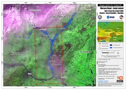
奥地利东部洪水造成3人死亡和约1200户人家撤离。
| 事件类型: | 洪灾 |
| 事件地点: | 奥地利 |
| 启动宪章的日期: | 2006年4月7日 |
| 宪章要求者: | 下奥地利州区域报警中心 |
| 项目经理: | ESA |
Products
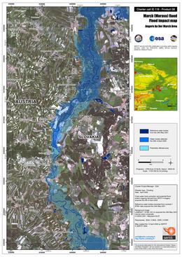
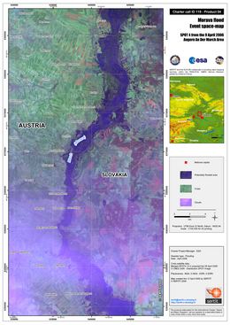
Angern Flood Impact Map Spot 4, Scale 1:100,000, with flood mapping and interpretation derived from SPOT 4 (20 m) data acquired on 09 April 2006 draped over Landsat 7 ETM+ natural colours data of 24th May 2001
版权: CNES 2006, USGS 2001 Image processing, map created 12/04/2006 by SERTIT in the framework of GMES RISKEOS.
Information about the Product
已获得: 09/04/2006, 24/05/2001
源: Spot 4, Landsat 7 ETM+
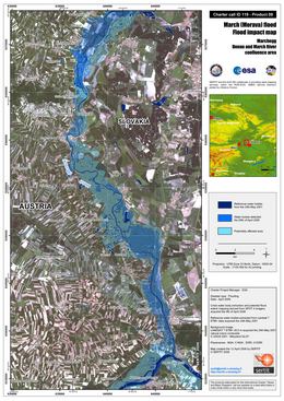
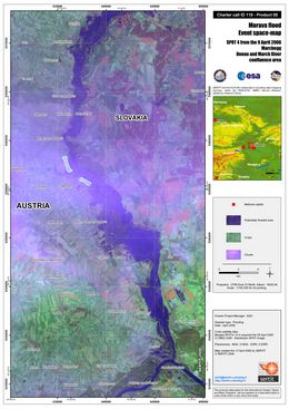
Marchegg Flood Impact Map Spot 4, Scale 1:100,000, with flood mapping and interpretation derived from SPOT 4 (20 m) data acquired on 09 April 2006 draped over Landsat 7 ETM+ natural colours data of 24th May 2001
版权: CNES 2006, USGS 2001 Image processing, map created 12/04/2006 by SERTIT in the framework of GMES RISKEOS.
Information about the Product
已获得: 09/04/2006, 24/05/2001
源: Spot 4, Landsat 7 ETM+
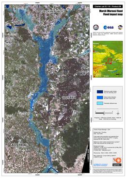
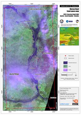
Flood Impact Map Spot 4, Scale 1:200,000, with flood mapping and interpretation derived from SPOT 4 (20 m) data acquired on 09 April 2006 draped over Landsat 7 ETM+ natural colours data of 24th May 2001
版权: CNES 2006, USGS 2001 Image processing, map created 12/04/2006 by SERTIT in the framework of GMES RISKEOS.
Information about the Product
已获得: 09/04/2006, 24/05/2001
源: Spot 4, Landsat 7 ETM+
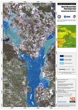
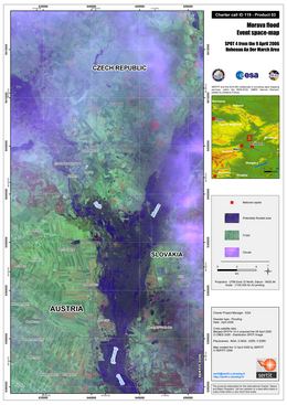
Hohenau Flood Impact Map Spot 4, Scale 1:100,000, with flood mapping and interpretation derived from SPOT 4 (20 m) data acquired on 09 April 2006 draped over Landsat 7 ETM+ natural colours data of 24th May 2001
版权: CNES 2006, USGS 2001 Image processing, map created 12/04/2006 by SERTIT in the framework of GMES RISKEOS.
Information about the Product
已获得: 09/04/2006, 24/05/2001
源: Spot 4, Landsat 7 ETM+
 返回完整的响应档案

 English
 Spanish
 French
 Chinese
 Russian
 Portuguese
