 English
 Spanish
 French
 Chinese
 Russian
 Portuguese
 最新宪章启动
Charter activations
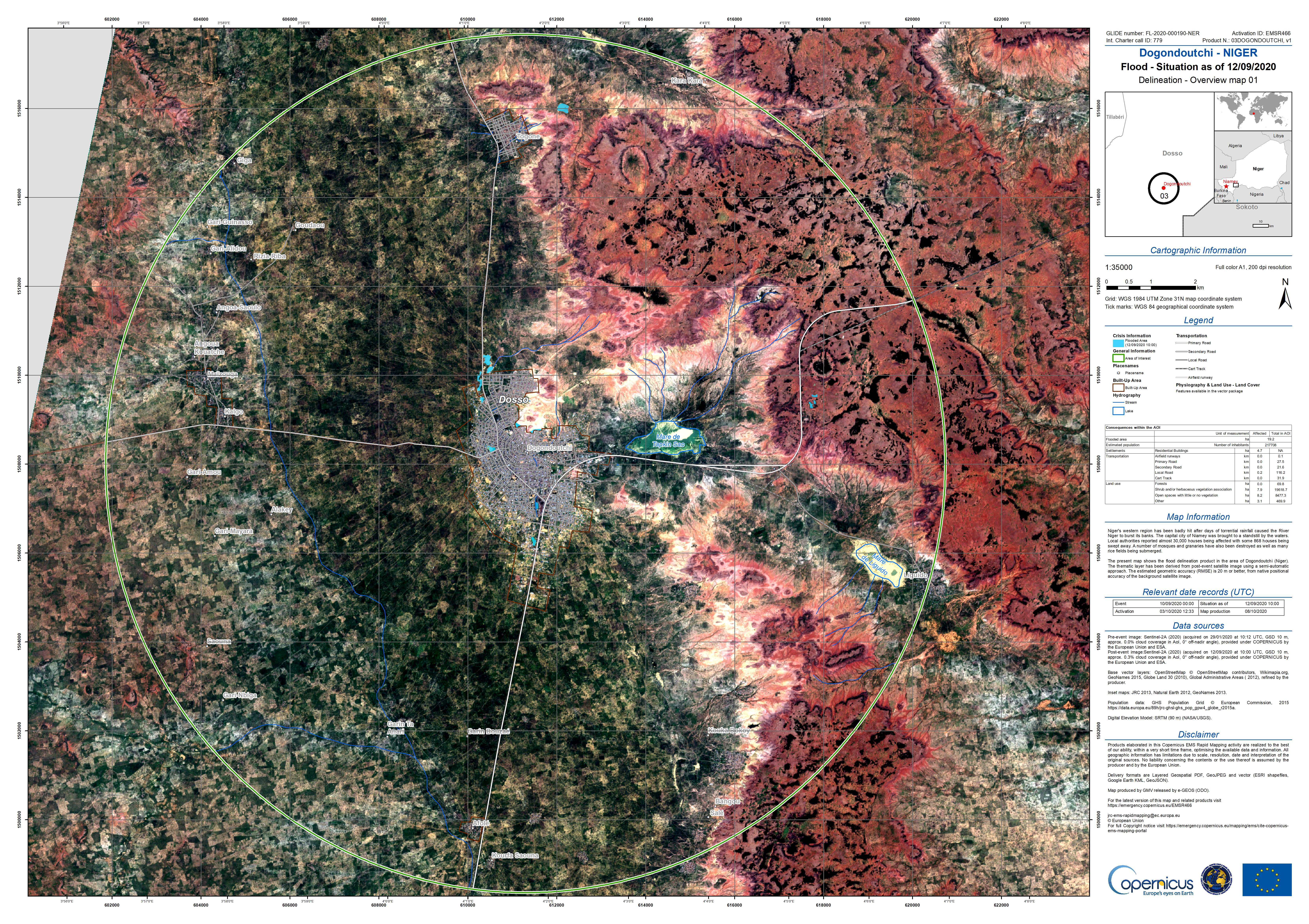
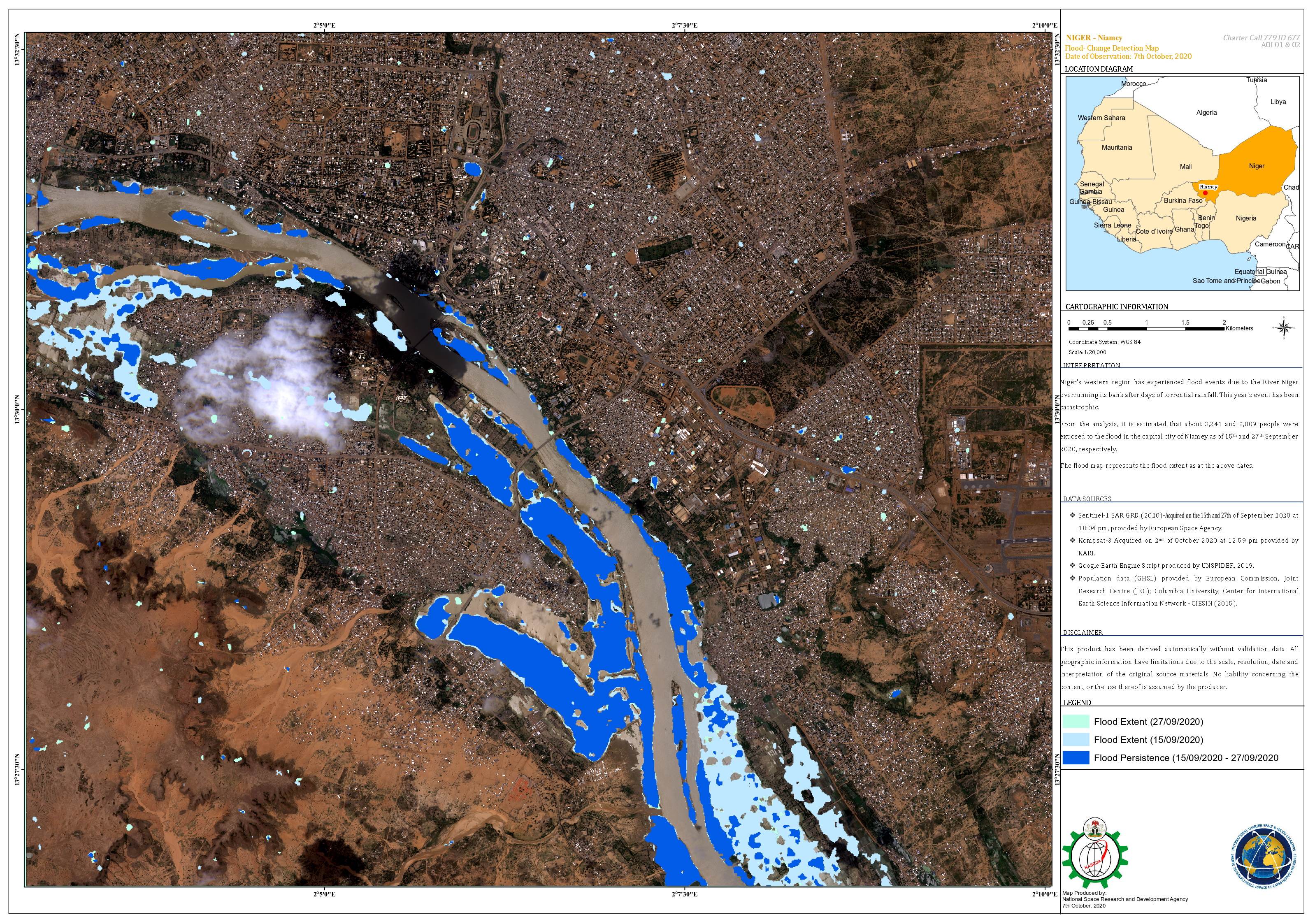
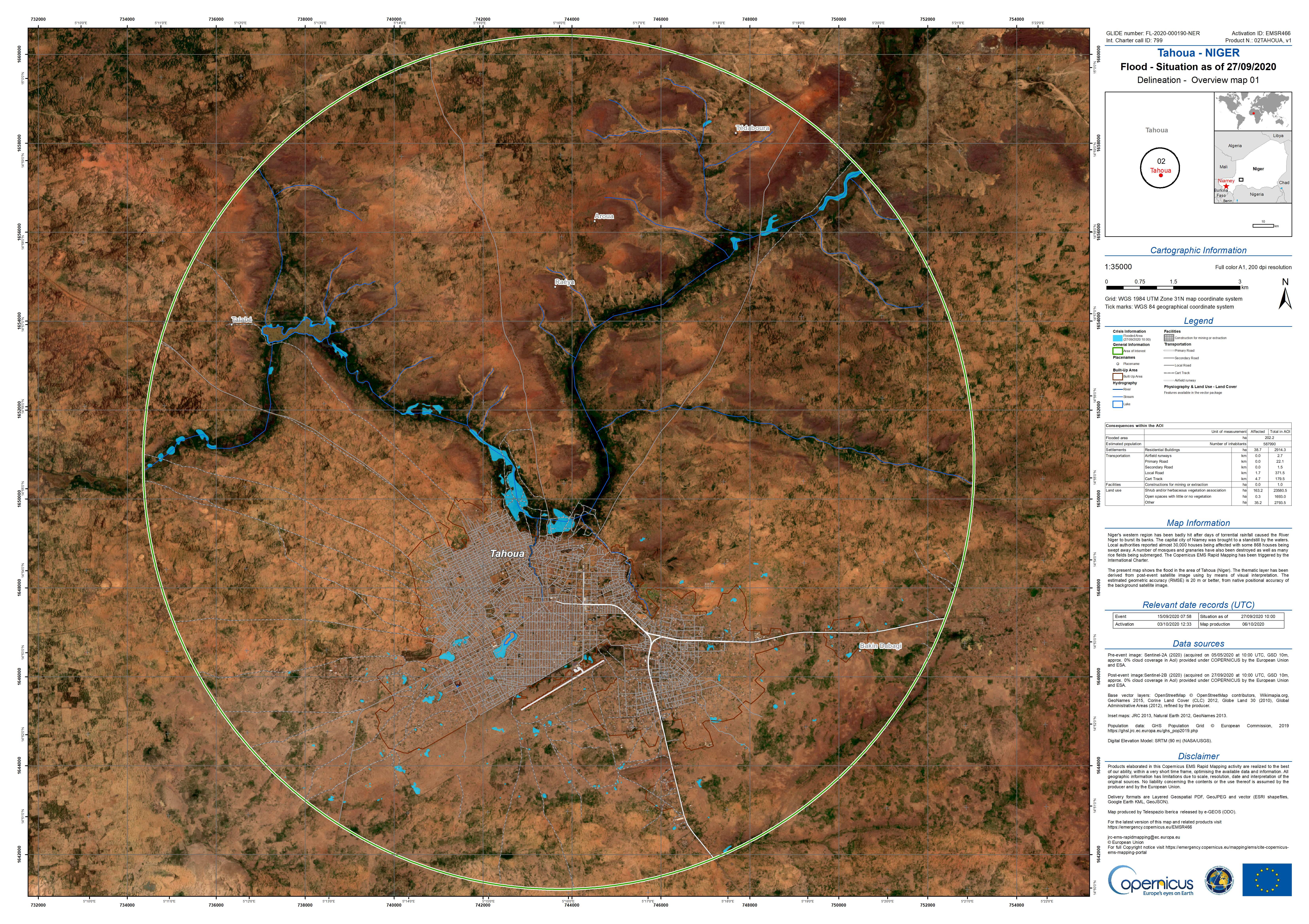
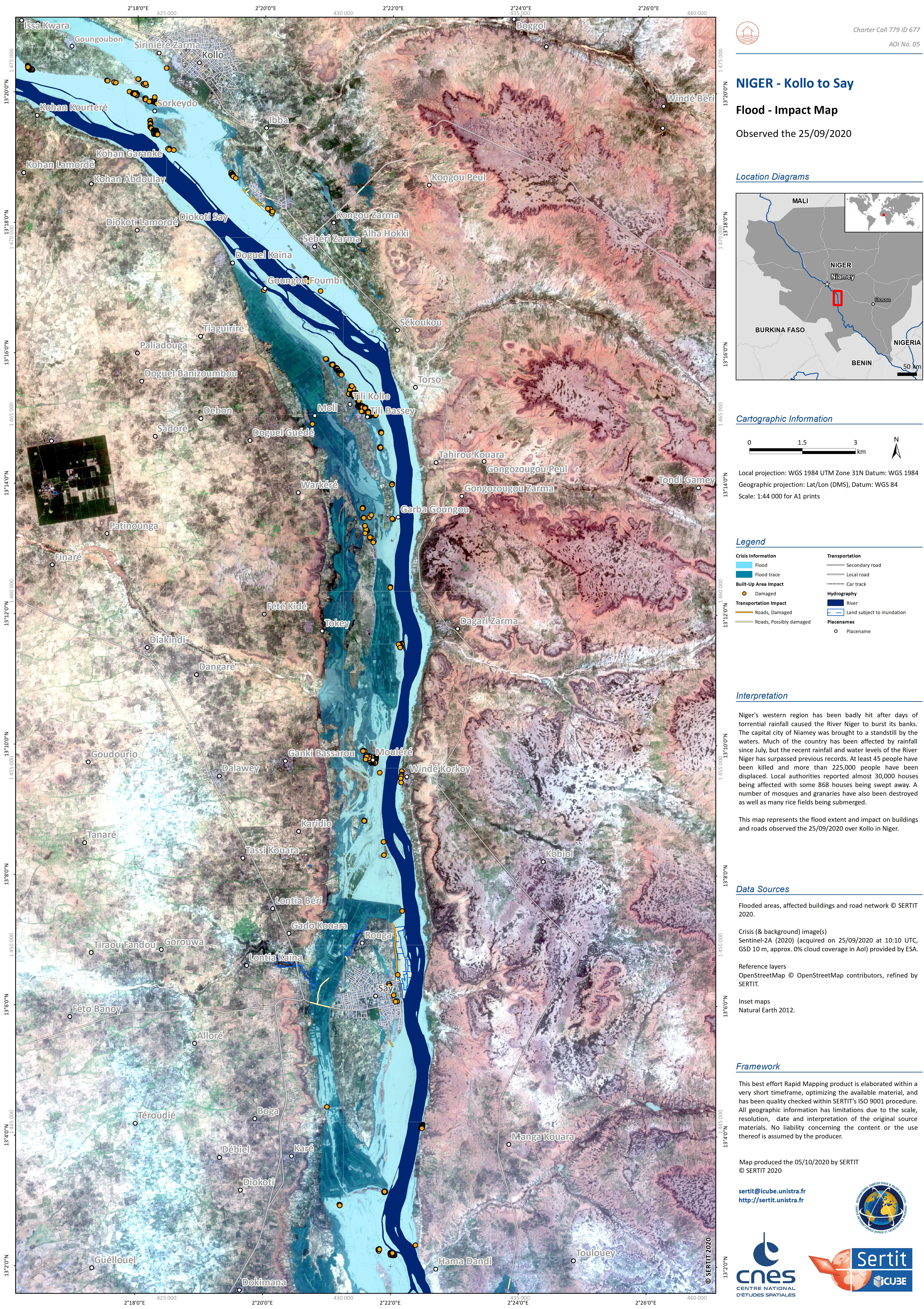
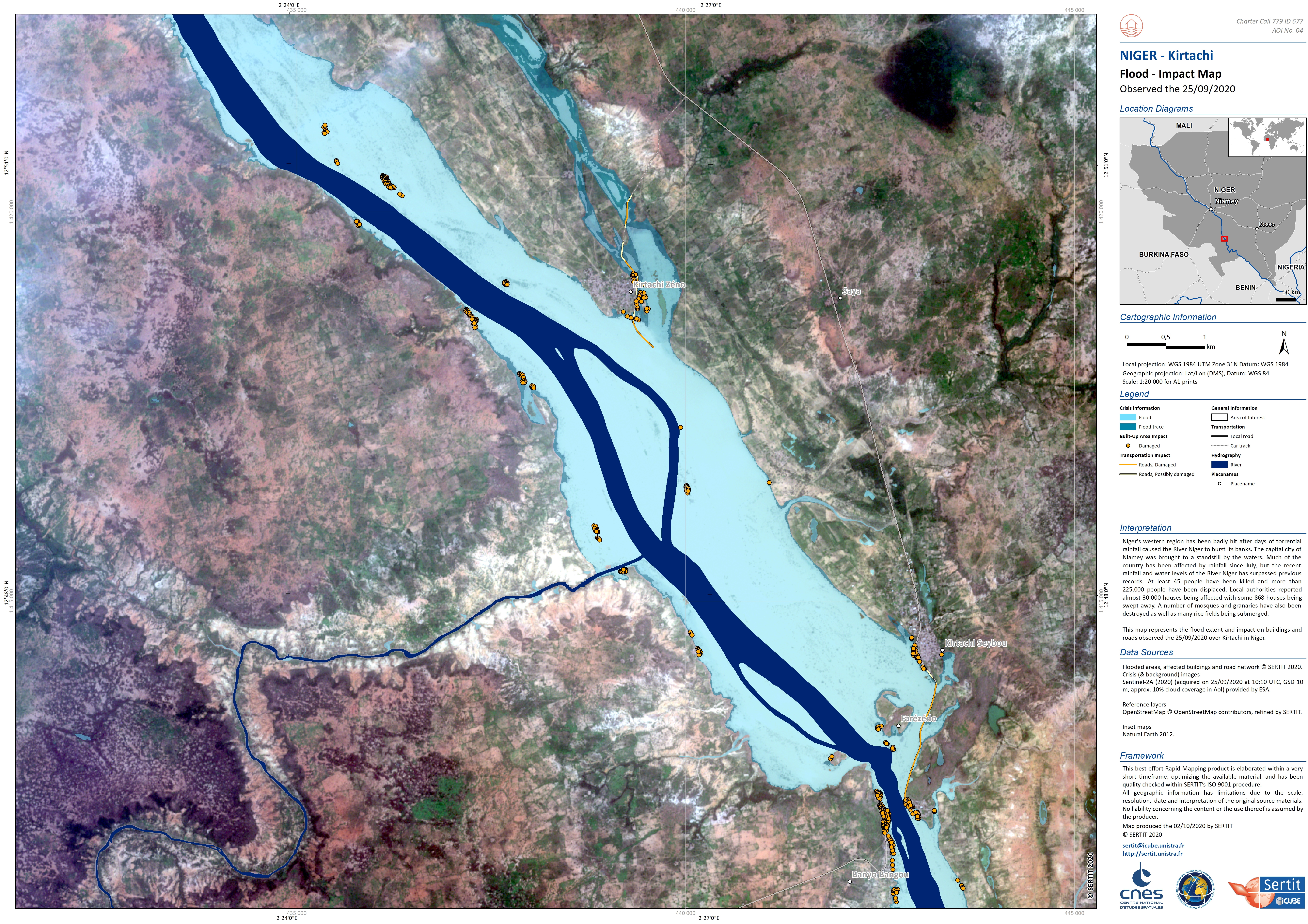
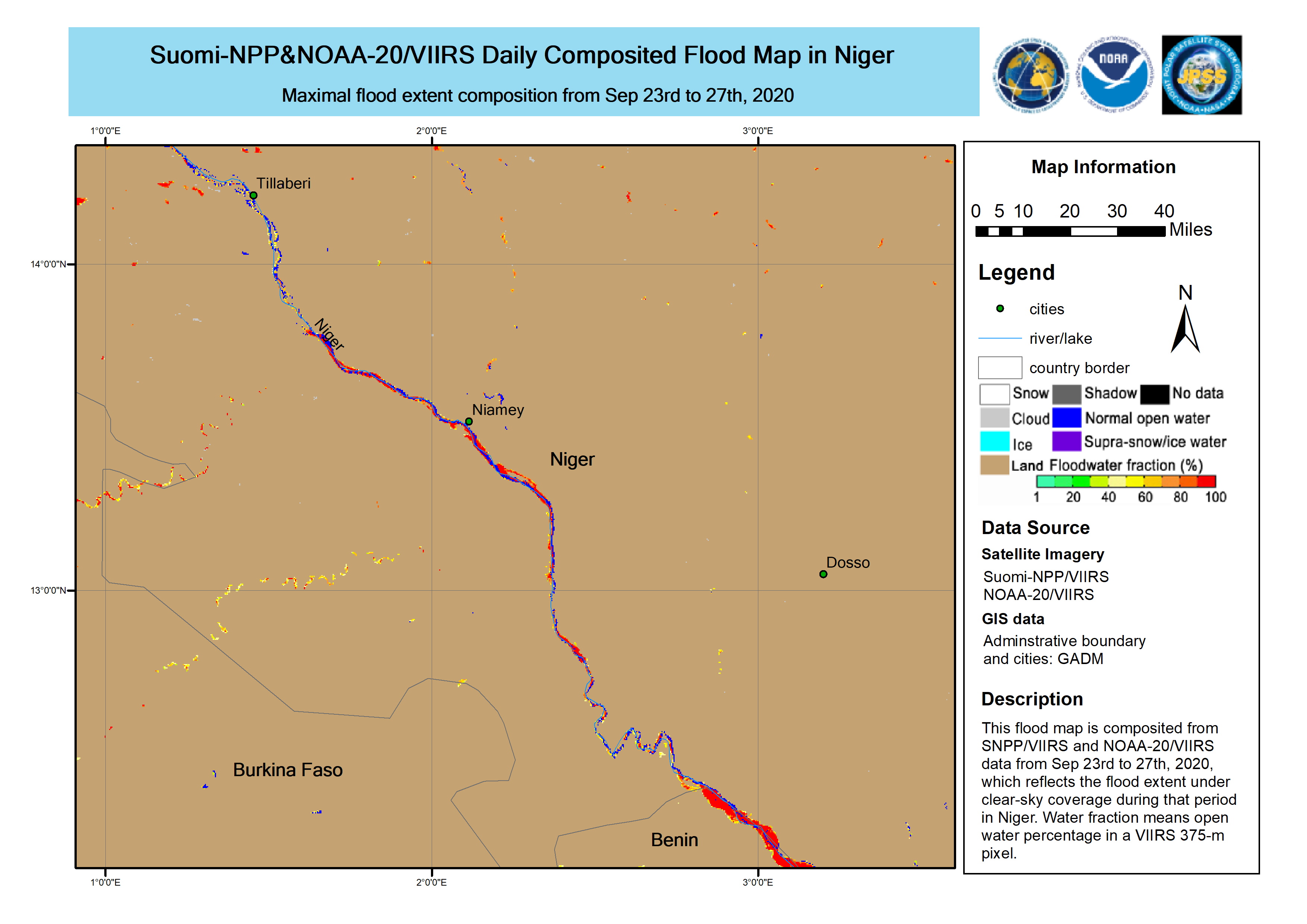
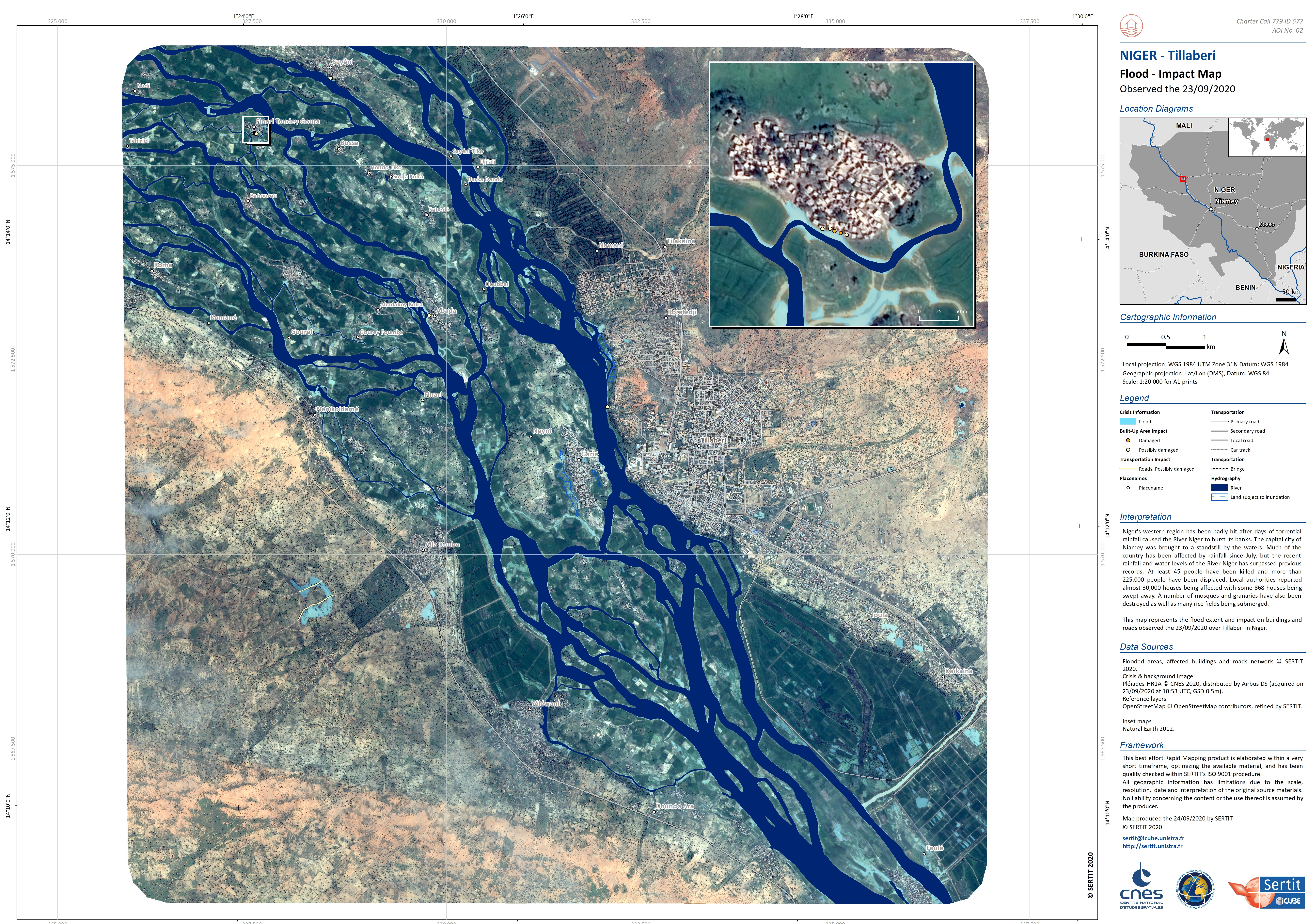
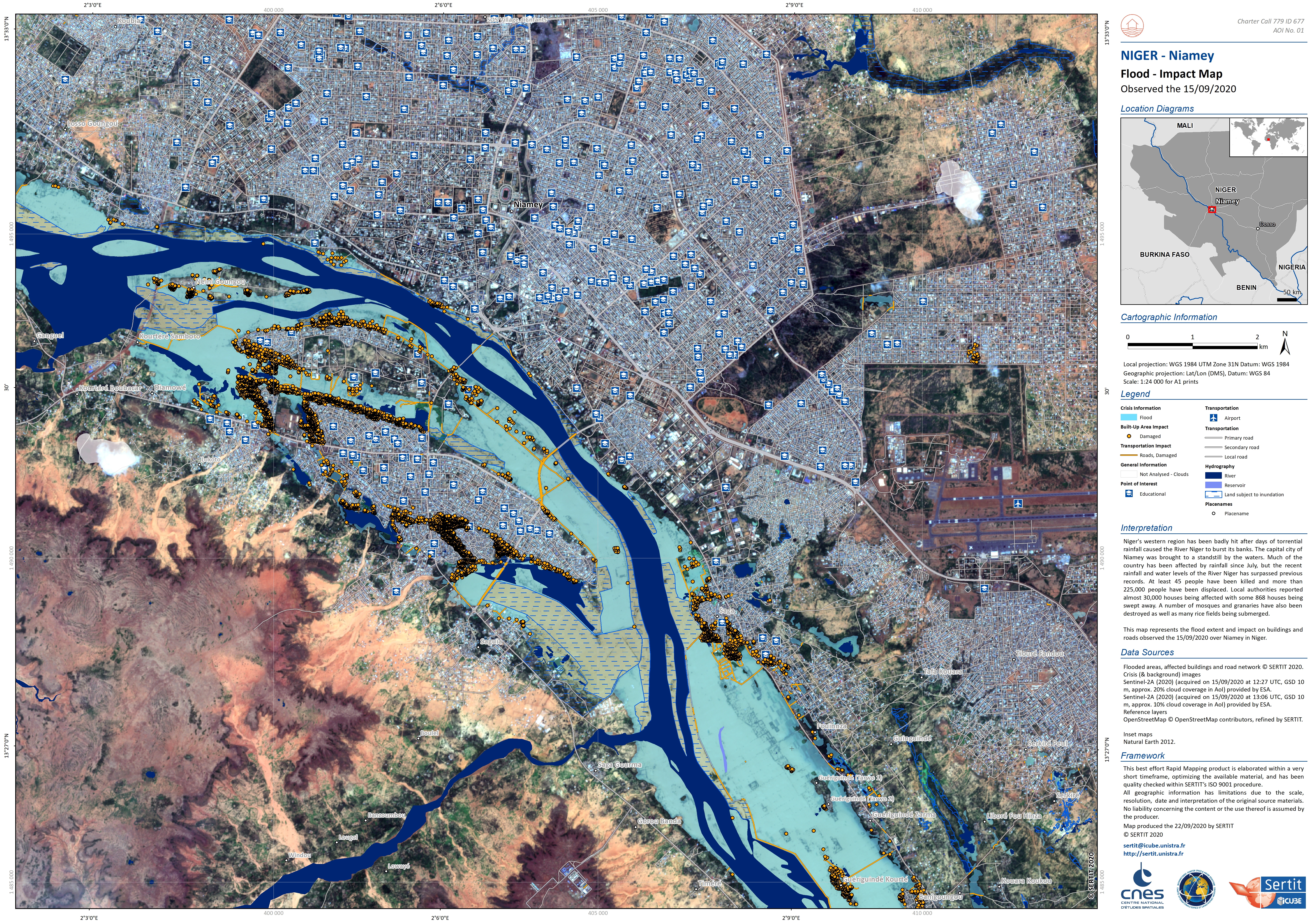
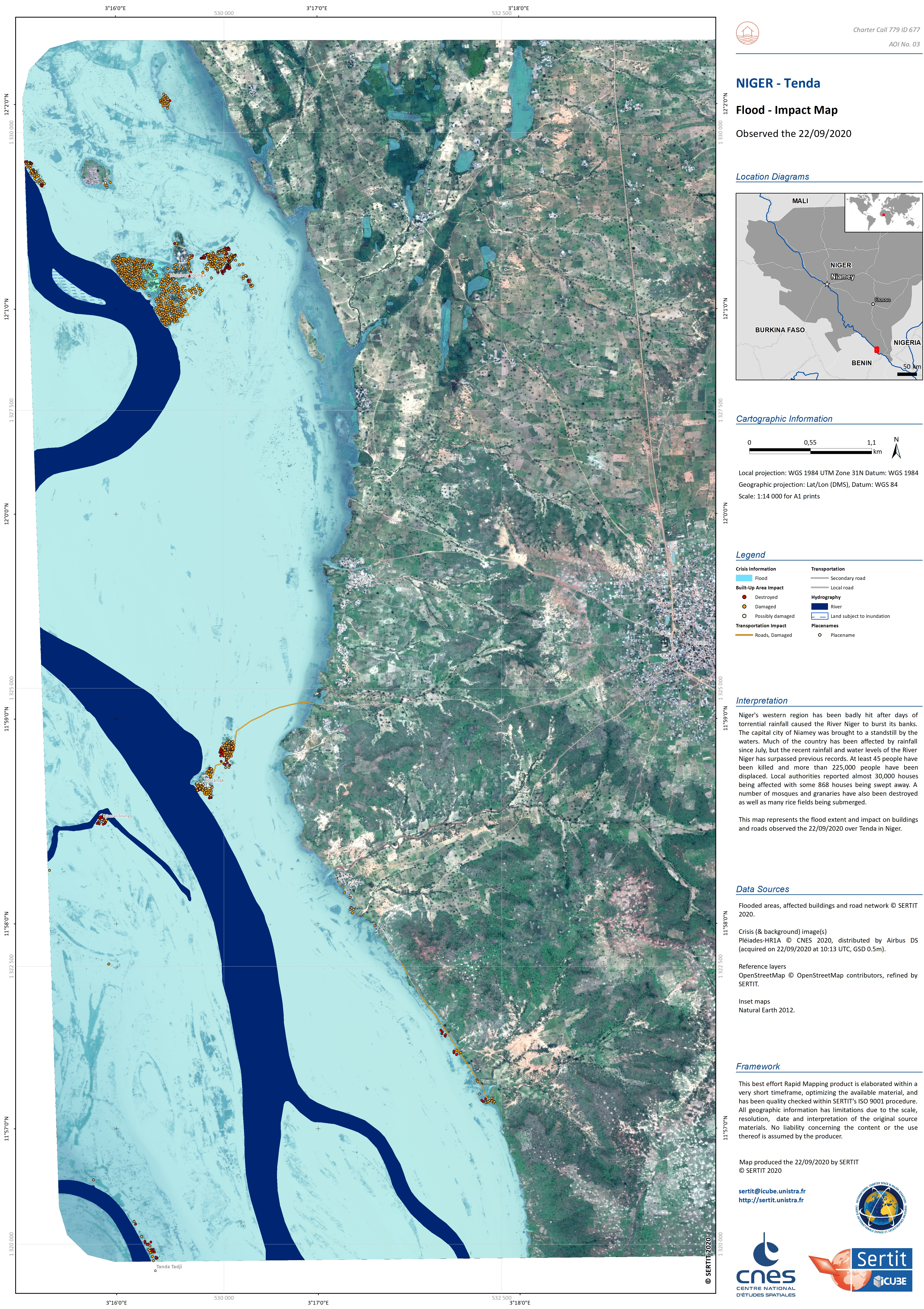
Flood in Niger
At least 45 people have been killed and more than 225,000 people have been displaced by flooding caused by heavy rainfall in Niger.
Niger's western region has been badly hit after days of torrential rainfall caused the River Niger to burst its banks. The capital city of Niamey was brought to a standstill by the waters.
Local authorities reported almost 30,000 houses being affected with some 868 houses being swept away. A number of mosques and granaries have also been destroyed as well as many rice fields being submerged.
Much of Niger has been affected by rainfall since July, but the recent rainfall and water levels of the River Niger has surpassed previous records.
| 事件类型: | Floods |
| 事件地点: | Niger |
| 启动宪章的日期: | 2020-09-21 |
| 宪章启动时间: | 10:46 |
| 宪章启动时区: | UTC+02:00 |
| 宪章要求者: | UNOOSA/UN-SPIDER on behalf of Direction Générale de la Protection Civile (DGPC) - NIGER |
| 启动ID: | 677 |
| 项目经理: | ICube SERTIT |
Products
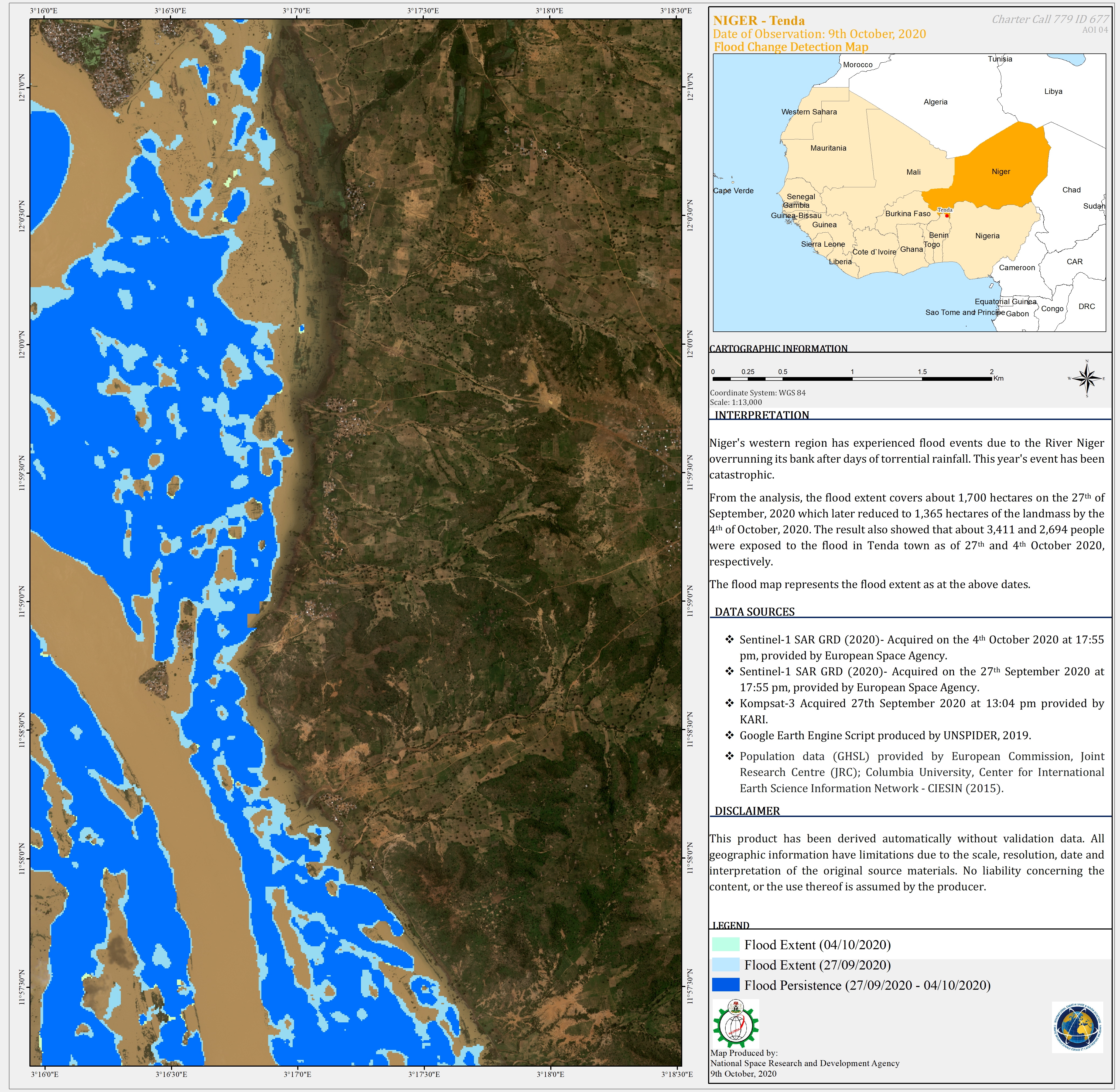
Flood Change Detection Map of Tenda, Niger as Observed on 9 October 2020
版权: © KARI (2020)
Contains modified Copernicus Sentinel data (2020)
Map produced by National Space Research and Development Agency (NASRDA)
Information about the Product
已获得: Sentinel-1: 27/09/2020
KOMPSAT-3: 27/09/2020
源: KOMPSAT-3 / Sentinel-1
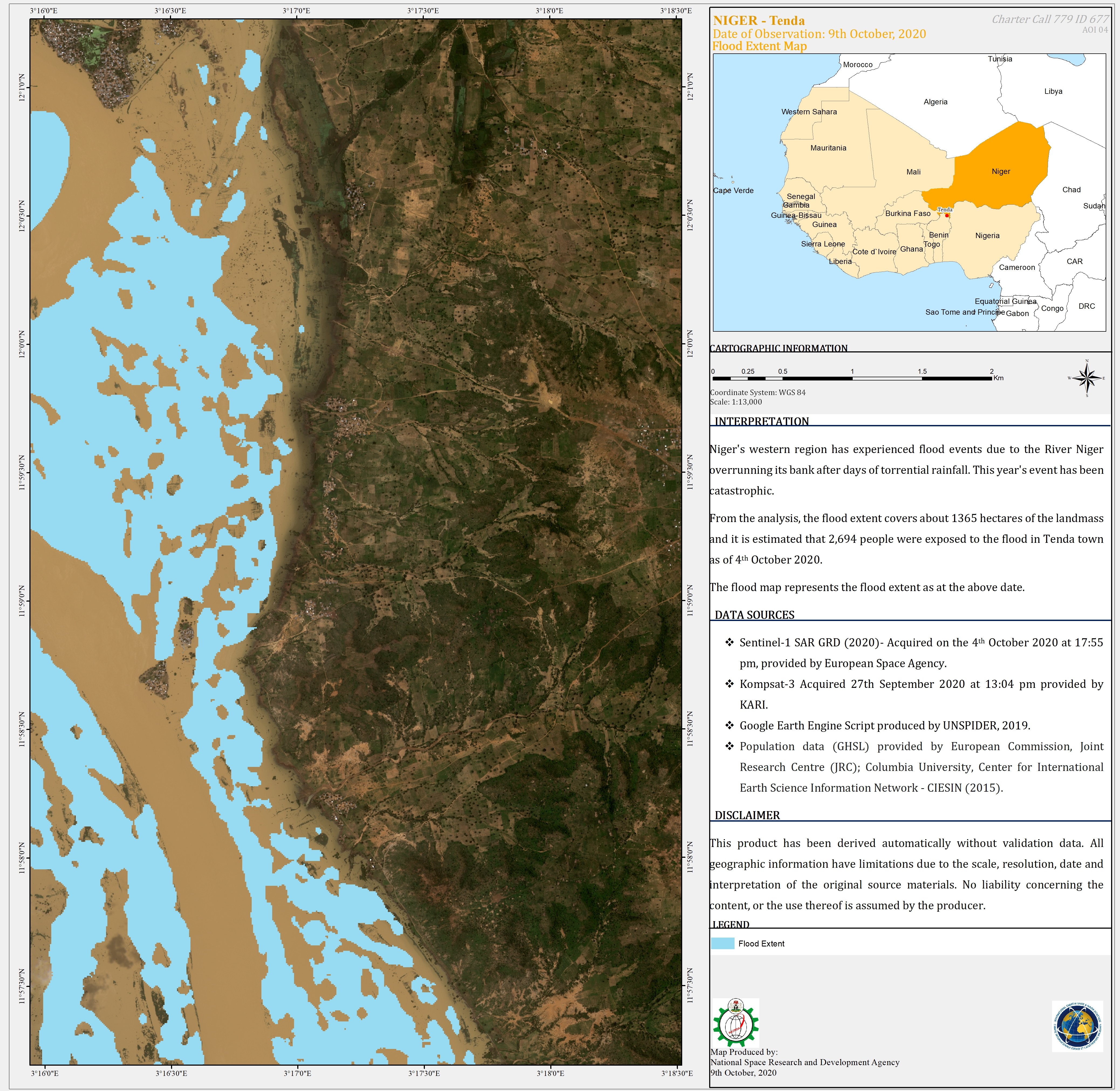
Flood Extent Map of Tenda, Niger, Observed on 09/10/2020
版权: © KARI (2020)
Contains modified Copernicus Sentinel data (2020)
Map produced by National Space Research and Development Agency (NASRDA)
Information about the Product
已获得: KOMPSAT-3: 27/09/2020
Sentinel-1: 04/10/2020
源: KOMPSAT-3 / Sentinel-1


 返回完整的响应档案

