 English
 Spanish
 French
 Chinese
 Russian
 Portuguese
 最新宪章启动
Charter activations
Cyclone Gombe in Mozambique
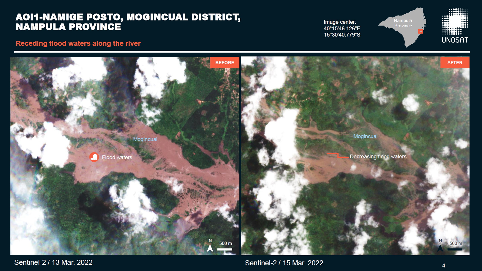
According to the National Institute for Disaster Risk Reduction of Mozambique (INGD), Cyclone Gombe made landfall as a Category 3 Tropical Cyclone on 11 March on the coast of Mozambique between Mossuril and Mogincual districts (Nampula Province).
Preliminary impacts reported by INGD indicate that many houses and power lines were destroyed or damaged; twelve people have been reported killed, several have been injured, and overall more than thirty thousand people have been affected. Over one hundred schools were reported damaged or destroyed, one bridge collapsed, and several roads were affected.
| 事件类型: | Ocean Storm - Cyclone |
| 事件地点: | Mozambique |
| 启动宪章的日期: | 2022-03-13 |
| 宪章启动时间: | 17:08 |
| 宪章启动时区: | UTC+01:00 |
| 宪章要求者: | UNOOSA/UN-SPIDER on behalf of National Institute for Disaster Risk Reduction of Mozambique (INGD) |
| 启动ID: | 753 |
| 项目经理: | UNITAR/UNOSAT |
Products
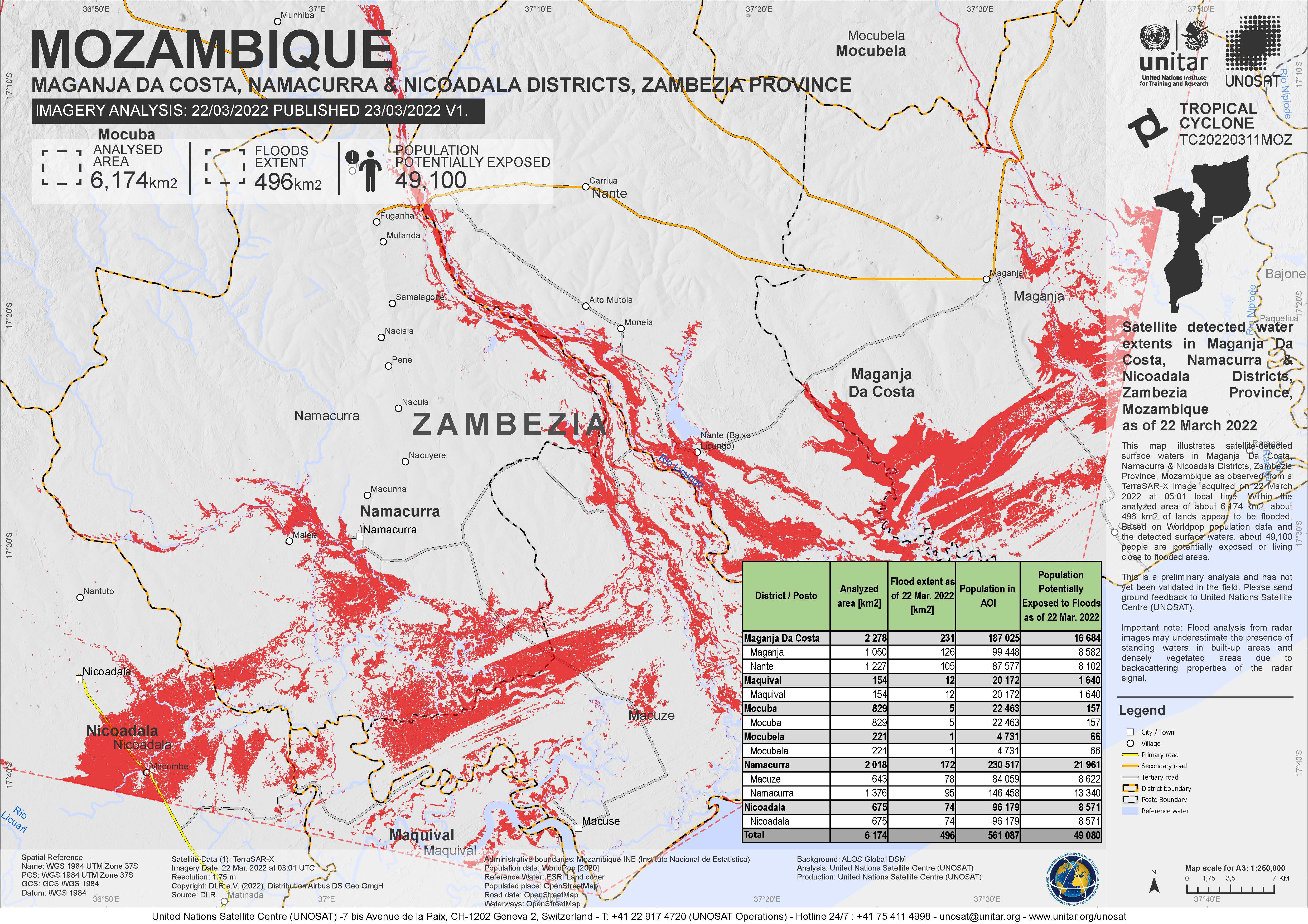
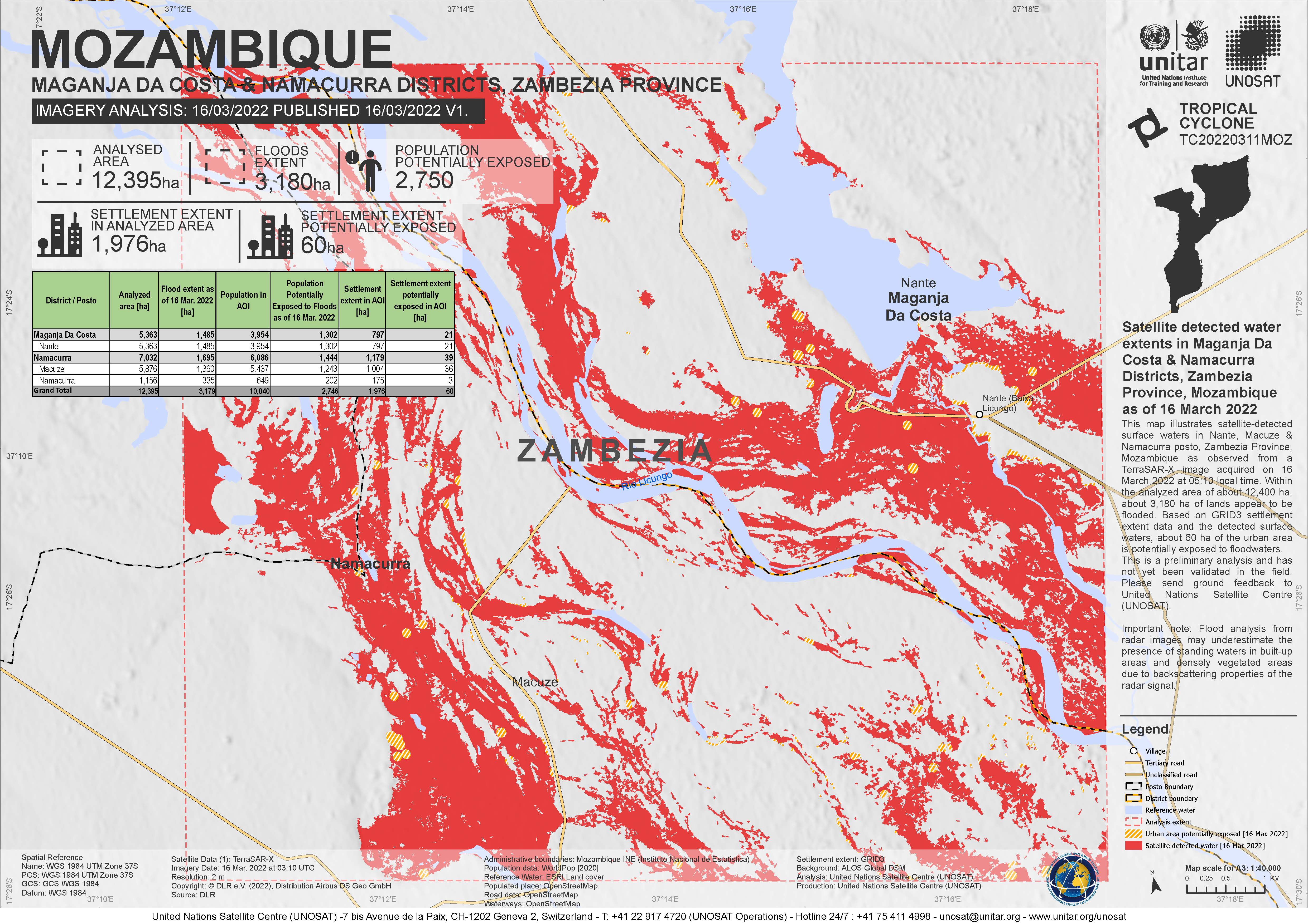
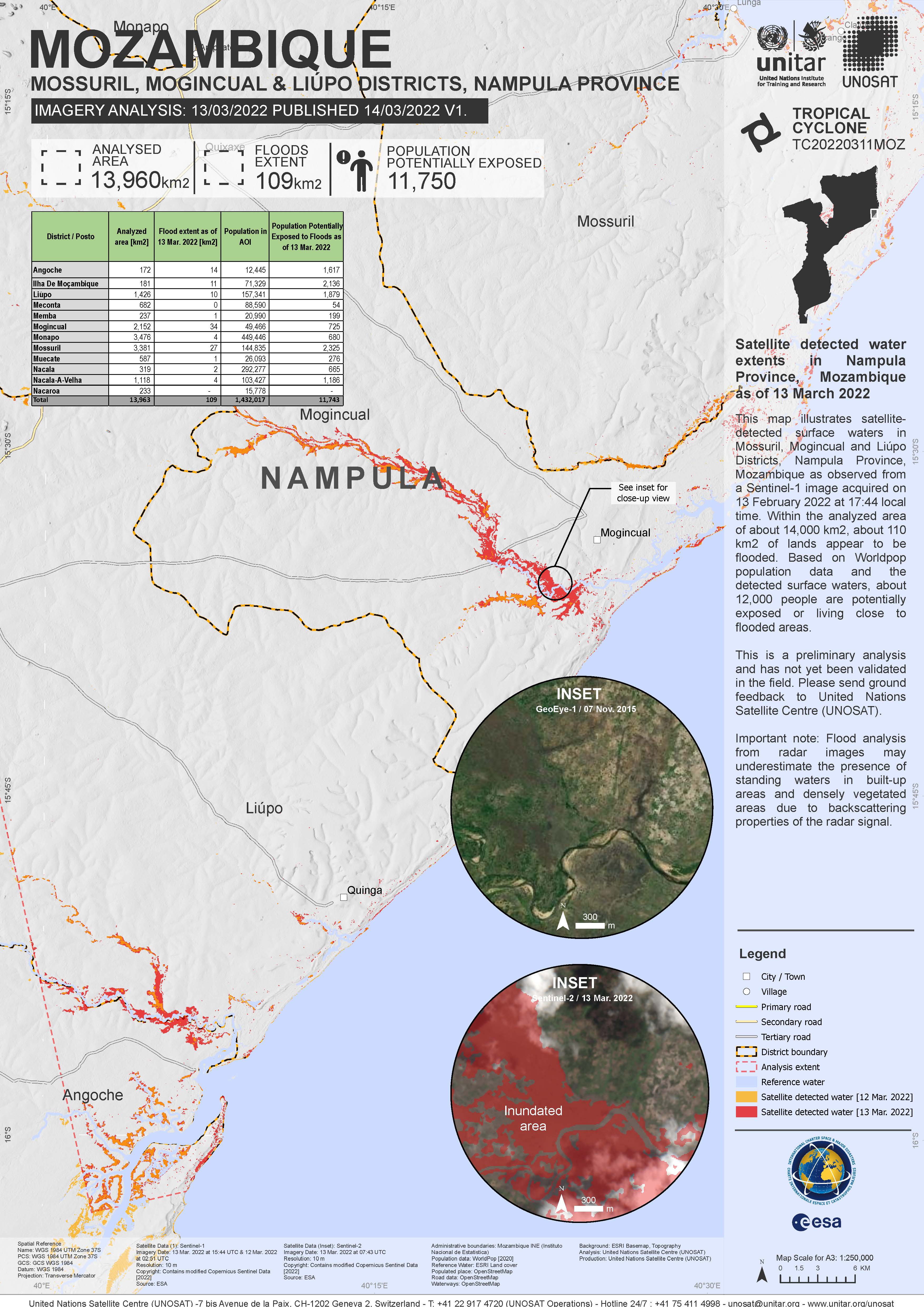
Preliminary satellite-derived flood assessment, Mogincual District, Nampula Province, Mozambique
Download full report
版权: Contains modified Copernicus Sentinel data (2022)
Map produced by UNITAR / UNOSAT
Information about the Product
已获得: 13/03/2022, 15/03/2022
源: Sentinel-2
类别: Delineation Map
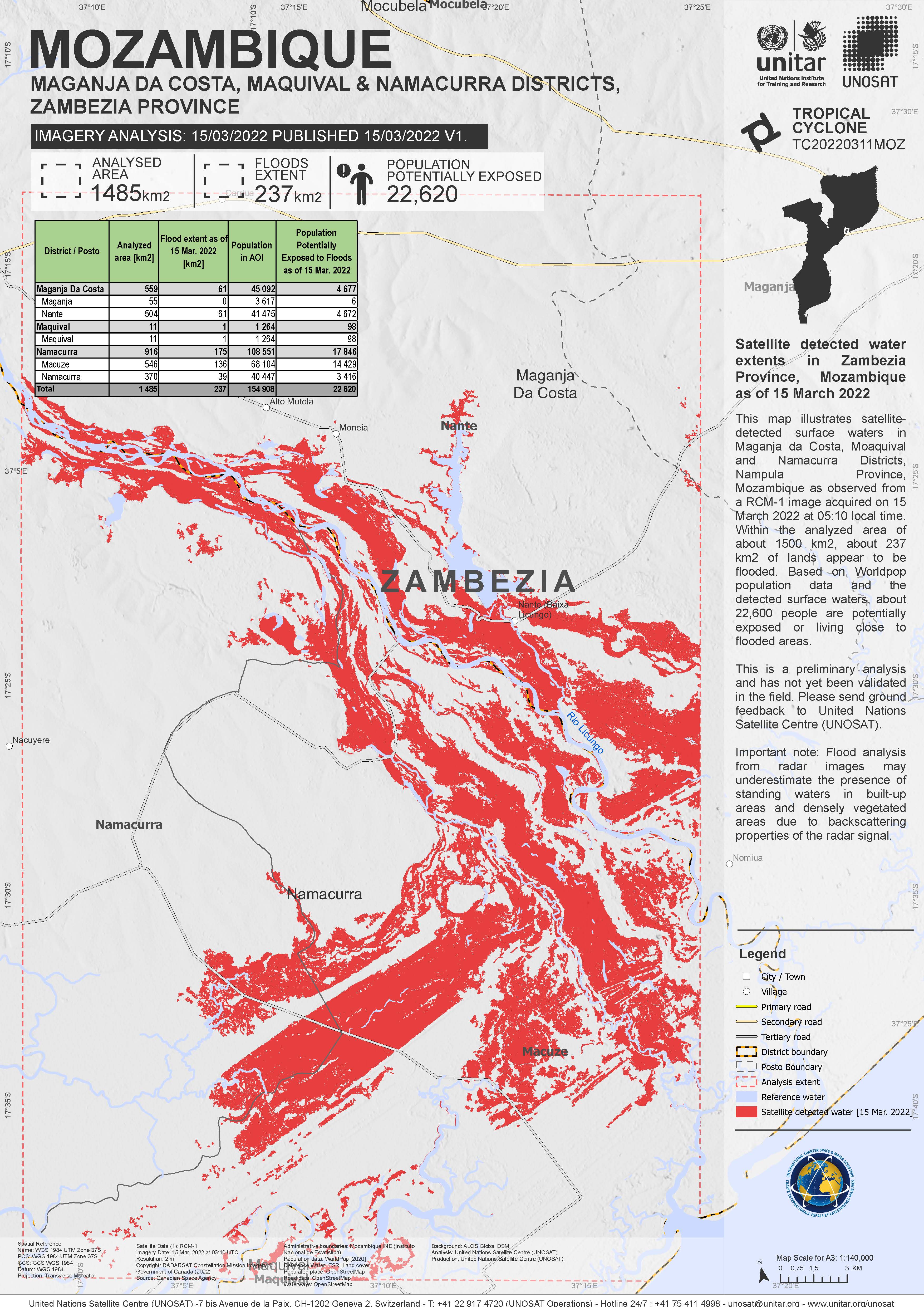
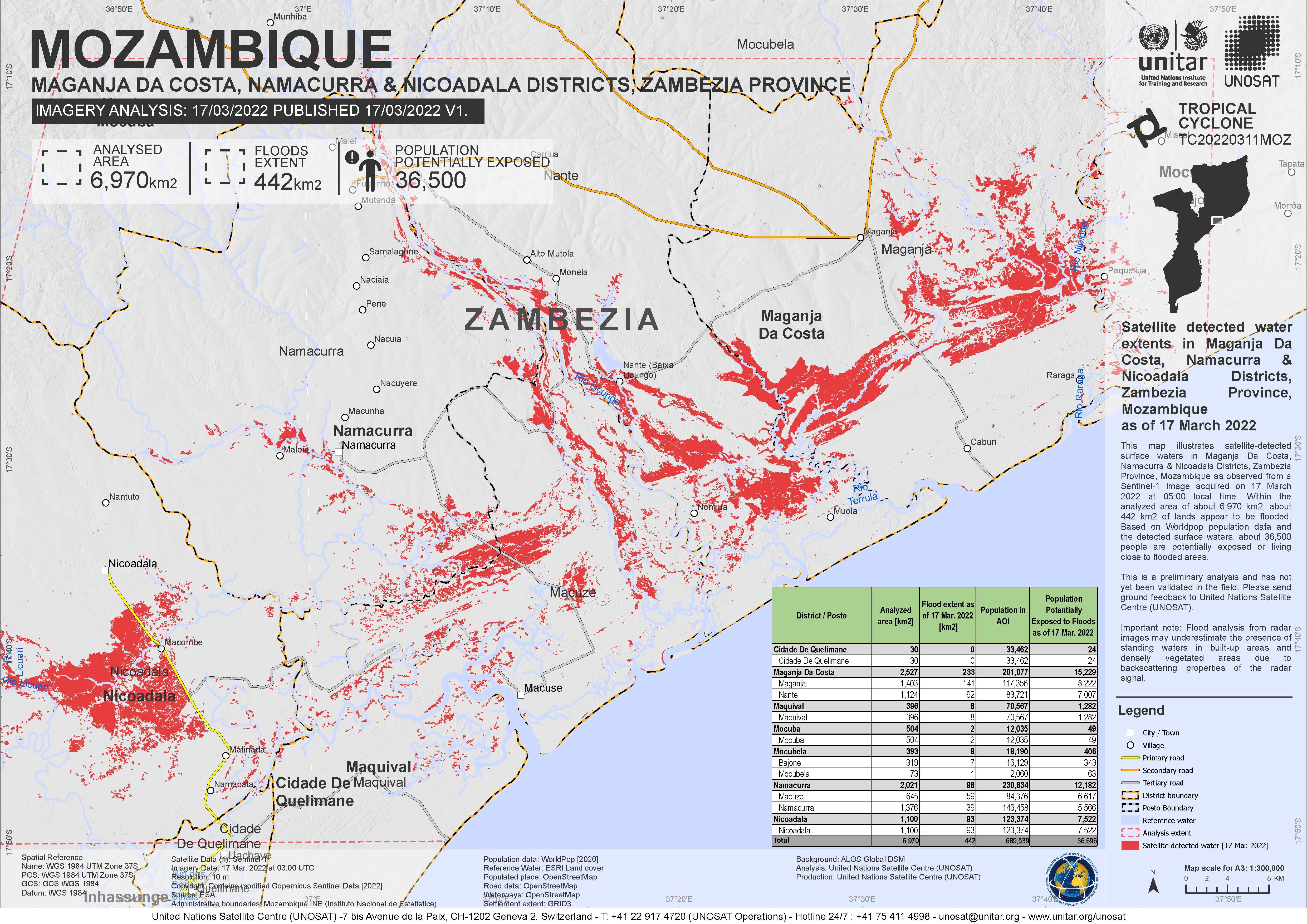
Satellite detected water extent in Zambezia Province, Mozambique
版权: RADARSAT Constellation Mission Imagery © Government of Canada (2022) - RADARSAT is an official mark of the Canadian Space Agency
Map produced by UNITAR / UNOSAT
Information about the Product
已获得: 15/03/2022
源: RCM
类别: Reference Map
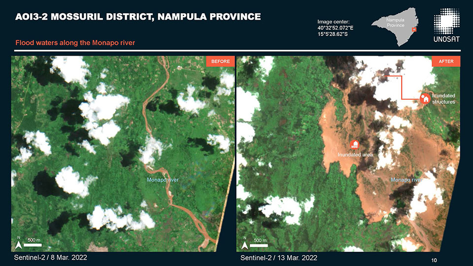
Preliminary flood assessment of Nampula Province, Mozambique
Download the full report
版权: Contains modified Copernicus Sentinel data (2022)
Report produced by UNITAR/UNOSAT
Information about the Product
已获得: 13/03/2022
源: Sentinel-2
类别: Dossier
 返回完整的响应档案

