Charter activations
Flooding in Madagascar
Intense rainfall caused by two different tropical weather systems which have impacted Madagascar over the last week has driven flooding, landslides, destruction of infrastructure and loss of life, particularly affecting the country's capitalAntananarivo, and other areas of Analamanga Region, in the centre of the country.
The rains were initially driven by an Intertropical Convergence Zone around 17 January and increased when a Tropical Depression made landfall in the east of the country on 22 January.
More than 62,000 people have been affected in 7 regions, including more than 58,000 in Analamanga Region—mainly in Antananarivo-Renivohitra districts—according to authorities. At least 34 people have died—24 during the weekend— almost all of them in the capital, where traditional houses collapsed, and others were swept away by landslides.
Over 6,800 houses are under water and many others are at risk of flooding or collapsing, forcing over 35,260 people to take shelter in 62 displacement sites established by the authorities, according to the National Office for Risk and Disaster Management (BNGRC). Nearly 27,000 people were displaced or evacuated this past weekend (22-23 January) alone, and the Government continues to carry out preventive evacuations in Antananarivo, which is on red alert for further flooding as the levels of rivers are increasing and reaching the emergency threshold.
| 事件地点: | Madagascar |
| 启动宪章的日期: | 2022-01-24 |
| 宪章启动时间: | 20:29 |
| 宪章启动时区: | UTC+01:00 |
| 宪章要求者: | BUREAU NATIONAL DE GESTION DES RISQUES ET DES CATASTROPHES (BNGRC) |
| 启动ID: | 747 |
| 项目经理: | ICube-SERTIT |
Products
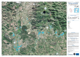
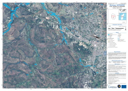
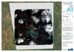
Amparafaravola, Madagascar - flood situation
版权: Includes Pleiades material © CNES (2022), Distribution Airbus DS.
WorldView-2 © (2021) DigitalGlobe, Inc., Longmont CO USA 80503. DigitalGlobe and the DigitalGlobe logos are trademarks of DigitalGlobe, Inc. The use and/or dissemination of this data and/or of any product in any way derived there from are restricted. Unauthorized use and/or dissemination is prohibited.
Map produced by ITHACA
Information about the Product
已获得: WorldView-2: 10/01/2021
Pleiades: 29/01/2022
源: Pleiades / WorldView-2
类别: Gradient Monitoring Maps
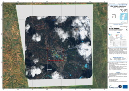
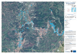
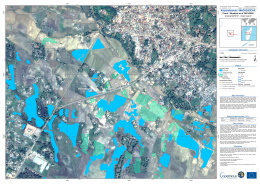
Amparafaravola, Madagascar - flood situation
版权: Includes Pleiades material © CNES (2022), Distribution Airbus DS.
WorldView-2 © (2021) DigitalGlobe, Inc., Longmont CO USA 80503. DigitalGlobe and the DigitalGlobe logos are trademarks of DigitalGlobe, Inc. The use and/or dissemination of this data and/or of any product in any way derived there from are restricted. Unauthorized use and/or dissemination is prohibited Maxar Technologies, Inc. (2021).
Map produced by ITHACA
Information about the Product
已获得: WorldView-2 10/01/2021
Pleiades: 27/01/2022
源: Pleiades, WorldView-2
类别: Grading Map

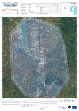
Grading Product with the damage grade assessment over Amparafaravola, Madagascar, as of 29/01/2022 (map 1)
版权: Copernicus EMS (© 2022 European Union).
WorldView © (2021) DigitalGlobe, Inc., Longmont CO USA 80503. DigitalGlobe and the DigitalGlobe logos are trademarks of DigitalGlobe, Inc. The use and/or dissemination of this data and/or of any product in any way derived there from are restricted. Unauthorized use and/or dissemination is prohibited.
Includes Pleiades material © CNES (2022), Distribution Airbus DS.
Map produced by ITHACA
Information about the Product
已获得: WorldView-2 and -3: 10/01/21
Pleiades: 27/01/2022, 29/01/2022
源: Pleiades / WorldView-2 / WorldView-3
类别: Gradient Monitoring Maps
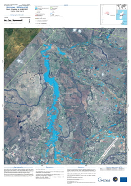
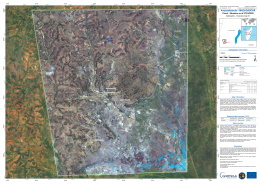
Grading Product with the damage grade assessment over Amparafaravola, Madagascar, as of 29/01/2022 (map 2)
版权: Copernicus EMS (© 2022 European Union).
WorldView © (2021) DigitalGlobe, Inc., Longmont CO USA 80503. DigitalGlobe and the DigitalGlobe logos are trademarks of DigitalGlobe, Inc. The use and/or dissemination of this data and/or of any product in any way derived there from are restricted. Unauthorized use and/or dissemination is prohibited.
Includes Pleiades material © CNES (2022), Distribution Airbus DS.
Map produced by ITHACA
Information about the Product
已获得: WorldView-2 and -3: 10/01/21
Pleiades: 27/01/2022, 29/01/2022
源: Pleiades / WorldView-2 / WorldView-3
类别: Gradient Monitoring Maps
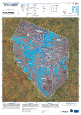
Amparafaravola, Madagascar - flood situation
版权: RADARSAT Constellation Mission Imagery © Government of Canada (2022) - RADARSAT is an official mark of the Canadian Space Agency
Maxar Technologies, Inc. (2021)
Map produced by ITHACA
Information about the Product
已获得: 10/01/2021, 27/01/2022
源: RCM
类别: Delineation Map
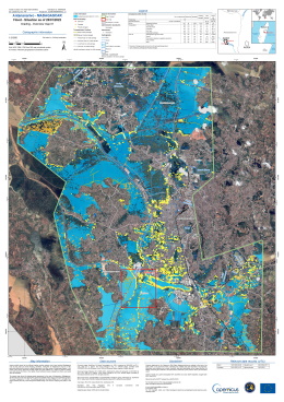
Flooding in Antananarivo, Madagascar, as of 28/01/2022
版权: Includes Pleiades material © CNES (2022), Distribution Airbus DS.
WorldView-2 © Maxar Technologies, Inc. (2021)
Map produced by SERTIT
Information about the Product
已获得: WorldView-2: 28/05/2021
Pleiades: 28/01/2022
源: Pleiades / WorldView-2
类别: Grading Map

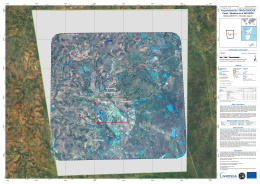
Floods in Ambatoboeny et Marovoay, Madagascar
版权: RADARSAT Constellation Mission Imagery © Government of Canada (2022) - RADARSAT is an official mark of the Canadian Space Agency
Contains modified Copernicus Sentinel data (2021)
Map produced by GAF
Information about the Product
已获得: Sentinel-2 10/10/2021
RCM: 27/01/2022
源: RCM / Sentinel-2
类别: Delineation Map
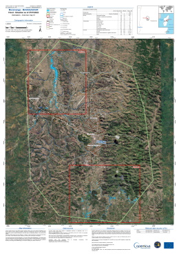
Delineation Product with the identification of the affected areas over Moramanga, Madagascar
版权: ESRI World Imagery © DigitalGlobe
Contains modified Copernicus Sentinel data (2022)
Map produced by e-GEOS
Information about the Product
已获得: ESRI World Imagery: 16/08/2020
Sentinel-1: 27/01/2022
源: Sentinel-1
类别: Delineation Map
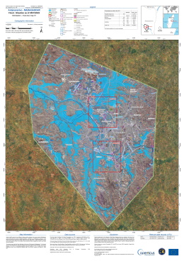
Delineation Product with the identification of the affected areas over Antananarivo, Madagascar
版权: WorldView-2 © (2021) DigitalGlobe, Inc., Longmont CO USA 80503. DigitalGlobe and the DigitalGlobe logos are trademarks of DigitalGlobe, Inc. The use and/or dissemination of this data and/or of any product in any way derived there from are restricted. Unauthorized use and/or dissemination is prohibited.
SAOCOM © CONAE (2022)
Map produced by GAF - AG
Information about the Product
已获得: WorldView-2: 28/05/2021
SAOCOM: 25/01/2022
源: WorldView-2, SAOCOM
类别: Delineation Map
 返回完整的响应档案

 English
 Spanish
 French
 Chinese
 Russian
 Portuguese
