 English
 Spanish
 French
 Chinese
 Russian
 Portuguese
 最新宪章启动
Charter activations
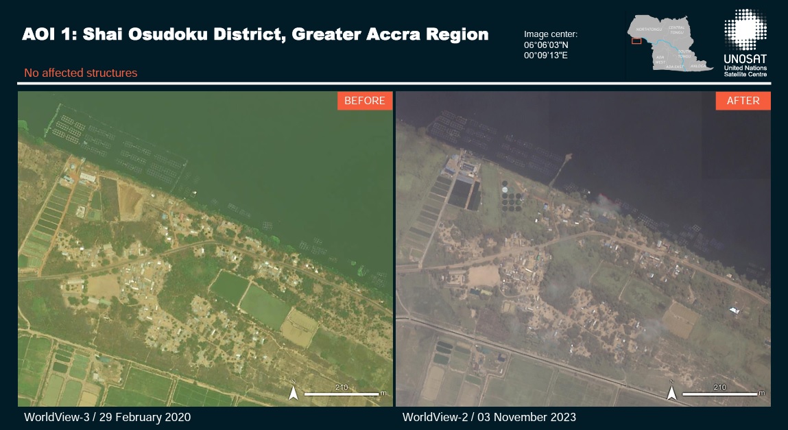
Flooding in Ghana
Over 4,000 residents in Ghana's south eastern region have been forced to abandon their homes due to widespread flooding. The crisis has been triggered by the overflowing of the Akosombo Dam, resulting in the devastating destruction of homes and farmlands along the banks of the River Volta.
The deluge has led to the disruption of essential services, leaving some areas without access to water and electricity. Ghana's Volta River Authority had previously asked residents to move to higher ground as water levels upstream of the dam continued to rise due to heavy rains.
| 事件类型: | Floods |
| 事件地点: | Ghana |
| 启动宪章的日期: | 2023-10-14 |
| 宪章启动时间: | 20:57 |
| 宪章启动时区: | UTC+02:00 |
| 宪章要求者: | UNOOSA/UN-SPIDER on behalf of National Disaster Management Organization |
| 启动ID: | 844 |
| 项目经理: | Oyewumi Ademuyiwa (National Space Research and Development Agency (NASRDA)) |
| act-value-adders: | UN-SPIDER Silvia Pardi LaCruz (Federal University of Santa Maria) Caleb Odiji (NASDRA) Elikem Harvor Timothy (National Disaster Management Organisation) Ida Svendsen (UNITAR) |
Products
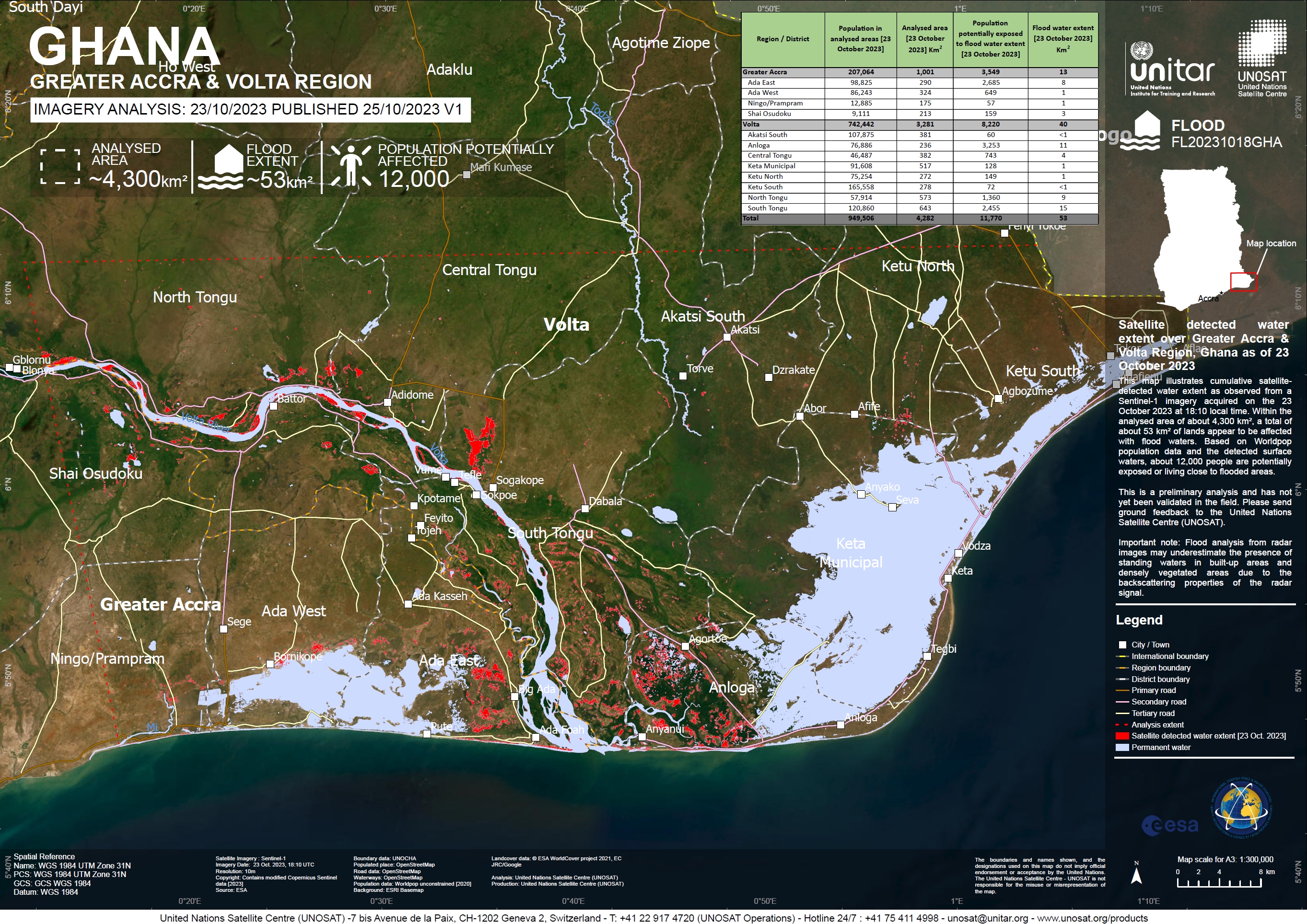
Preliminary satellite-derived flood assessment, Volta River, Volta Region and Greater Accra Region, Ghana - 06 November 2023.
Download the full report
版权: Contains modified Copernicus Sentinel data (2023)
Report produced by UNITAR / UNOSAT
Information about the Product
已获得: 04/11/2023
源: Sentinel-2
类别: Reference Map
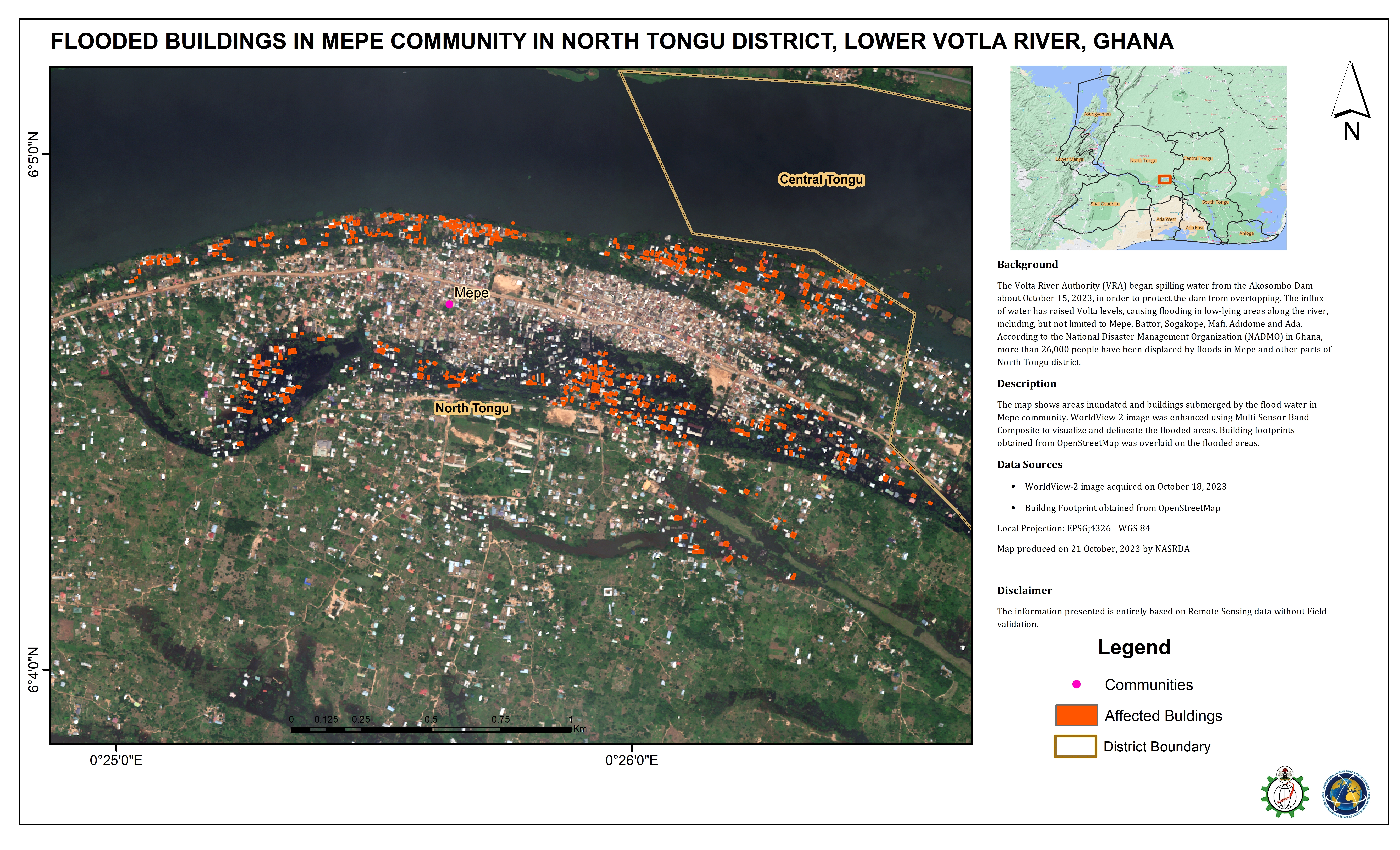
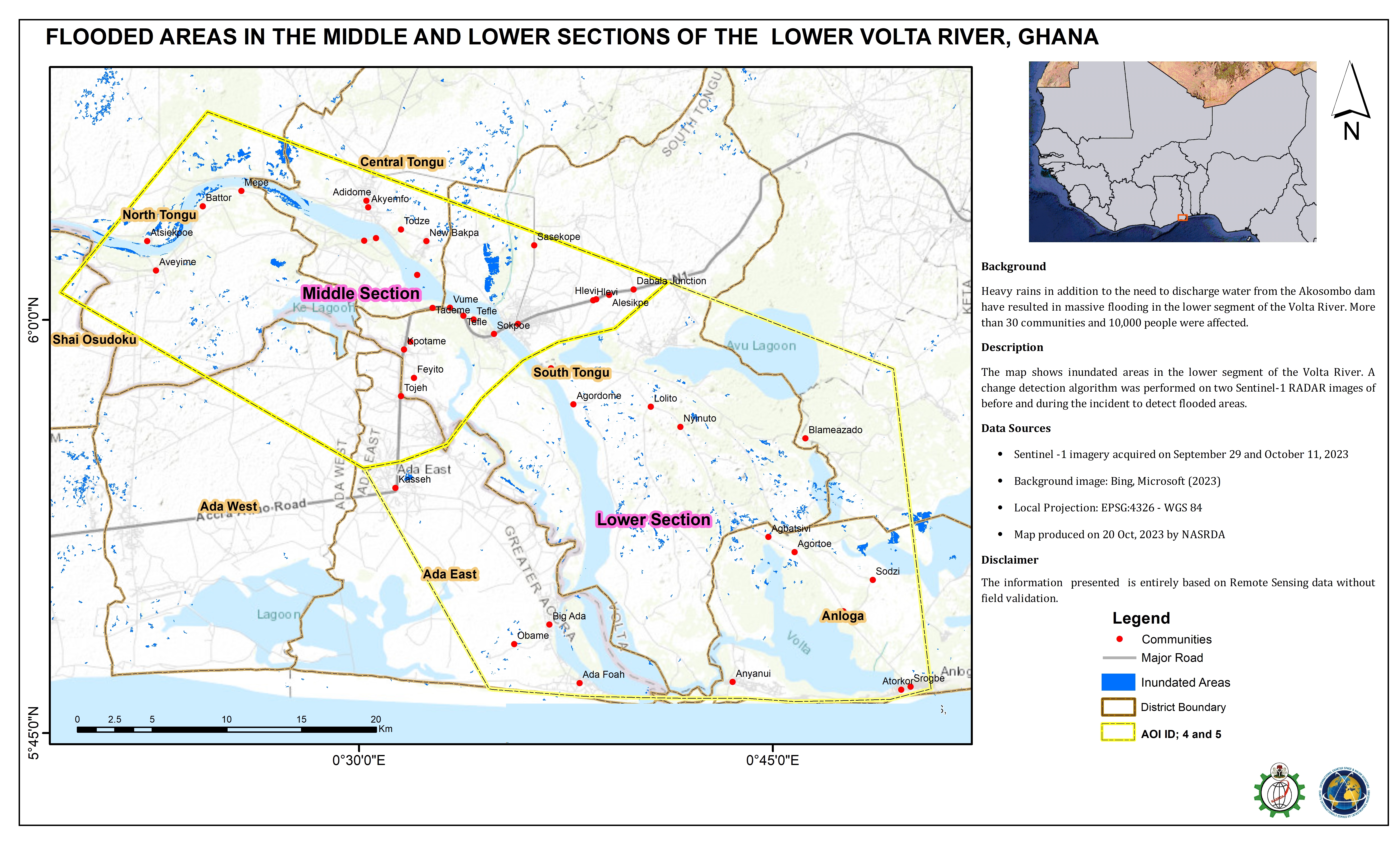
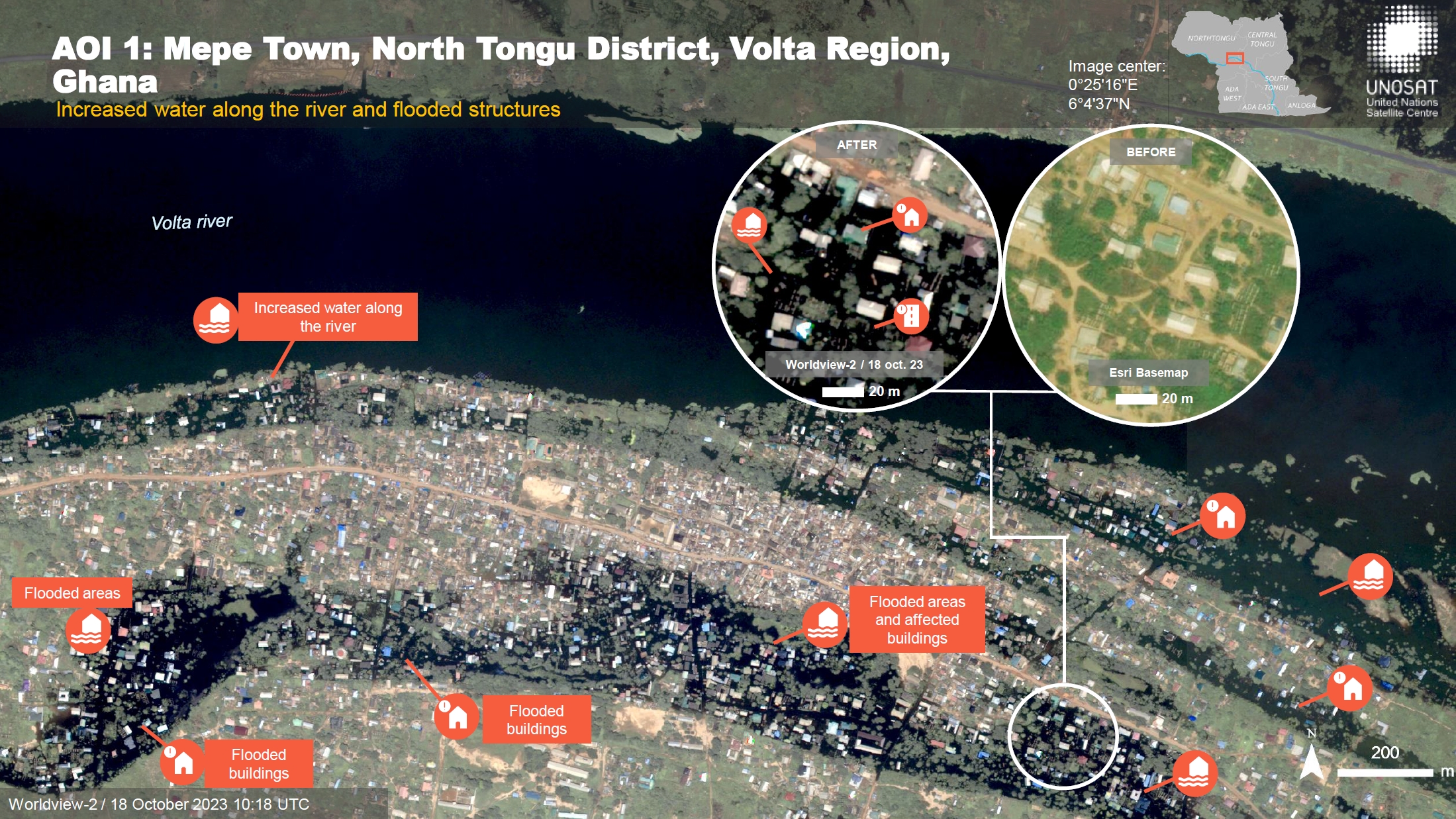
Flooded buildings in Mepe community in North Tongu district, lower Volta river, Ghana
版权: © (2023) DigitalGlobe, Inc., Longmont CO USA 80503. DigitalGlobe and the DigitalGlobe logos are trademarks of DigitalGlobe, Inc. The use and/or dissemination of this data and/or of any product in any way derived there from are restricted. Unauthorized use and/or dissemination is prohibited.
© OpenStreetMap (2023)
Map produced by NASRDA
Information about the Product
已获得: 18/10/2023, 21/10/2023
源: WorldView-2
类别: Reference Map
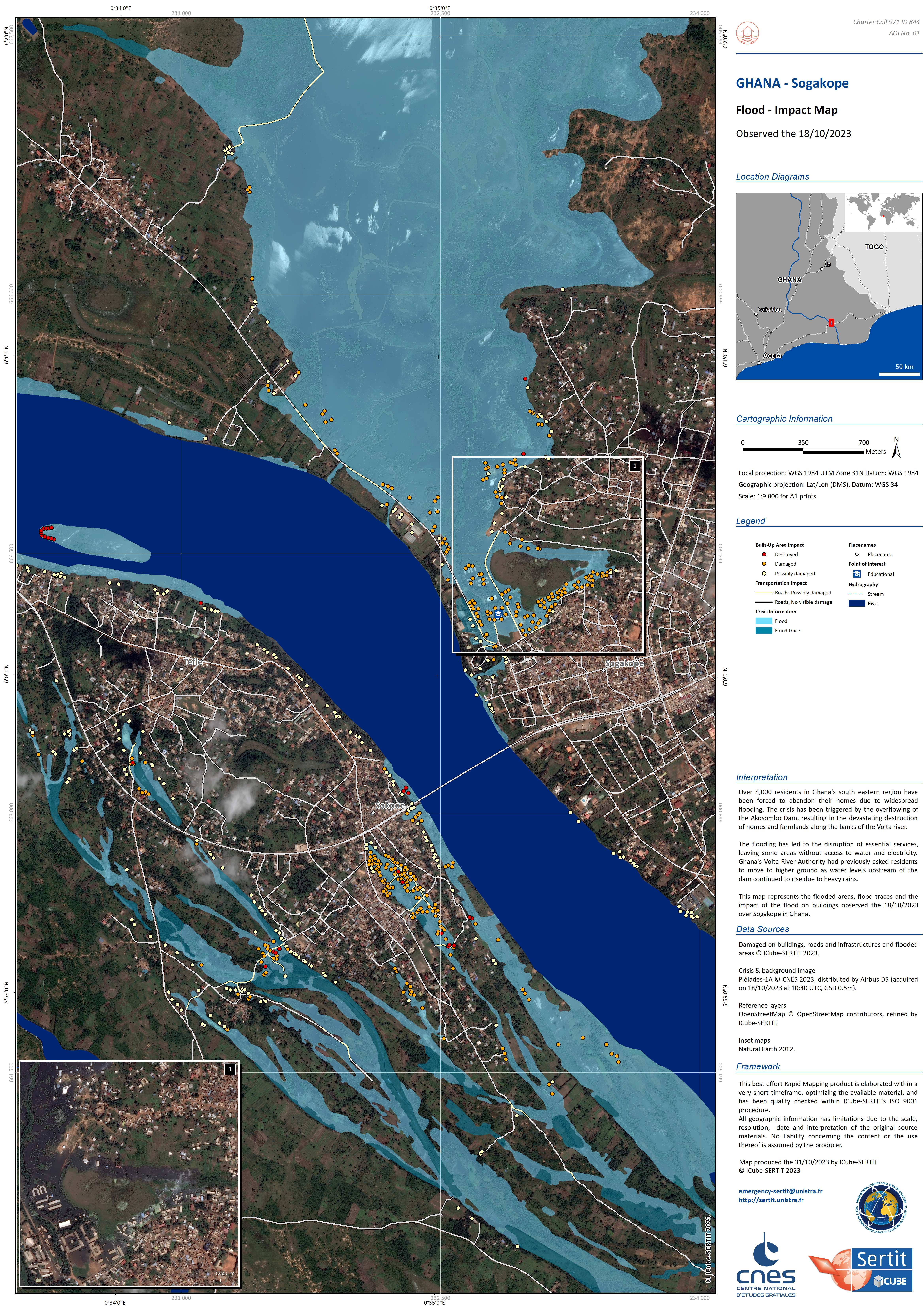
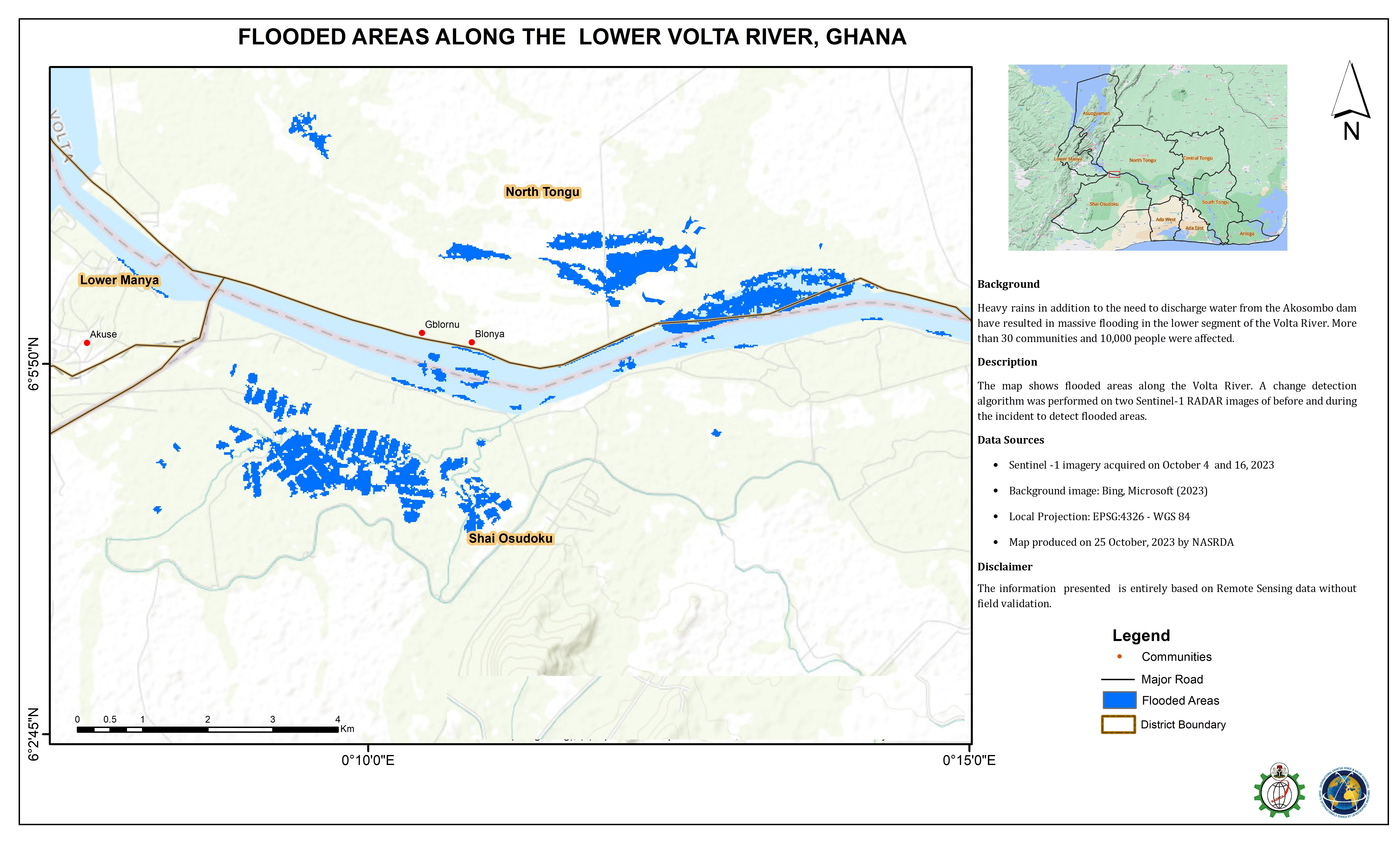
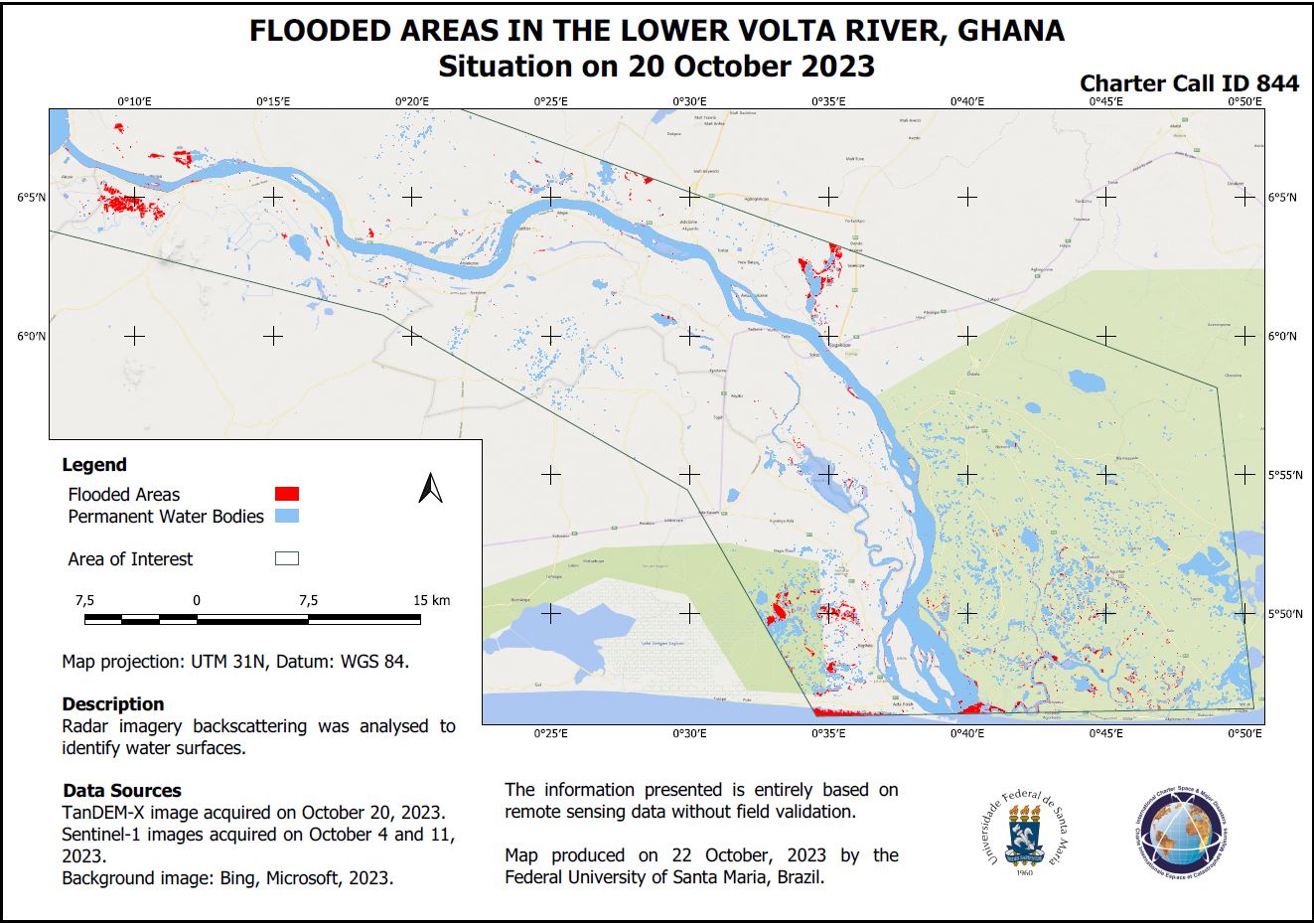
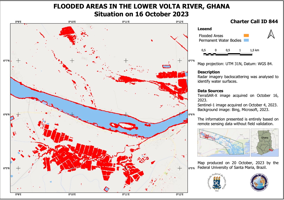
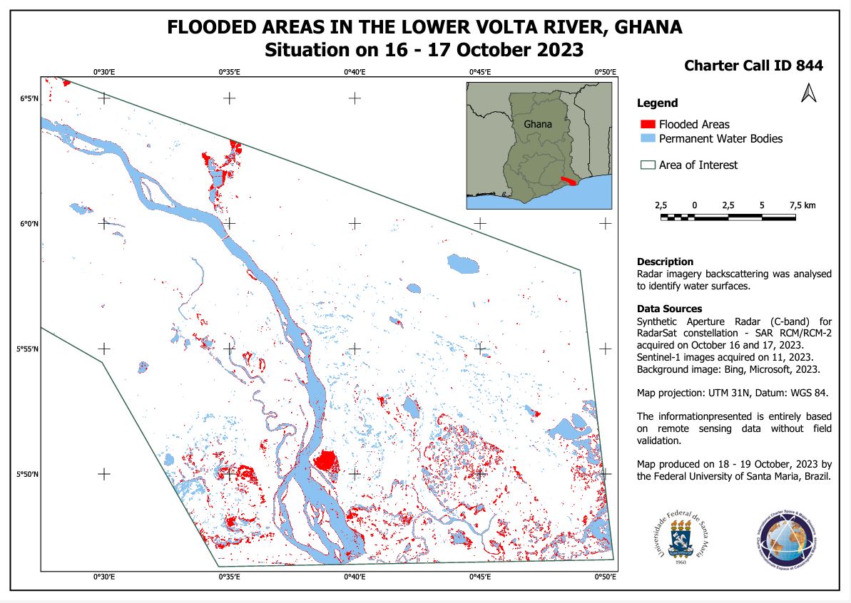
Flooded Areas in the Lower Volta River, Ghana
版权: RADARSAT Constellation Mission Imagery © Government of Canada (2023) - RADARSAT is an official mark of the Canadian Space Agency
Map produced by the Federal University of Santa Maria, Brazil
Information about the Product
已获得: 15/10/2023
源: RCM
类别: Reference Map
Preliminary Satellite Flood Assessment Report around the Volta River, Volta Region and Greater Accra Region, Ghana
Download the Full Report
版权: WorldView © (2023) DigitalGlobe, Inc., Longmont CO USA 80503.
DigitalGlobe and the DigitalGlobe logos are trademarks of DigitalGlobe, Inc. The use and/or dissemination of this data and/or of any product in any way derived there from are restricted. Unauthorized use and/or dissemination is prohibited.
Contains modified Copernicus Sentinel data (2023)
Includes Pleiades material © CNES (2023), Distribution Airbus DS.
Report produced by UNITAR/UNOSAT
Information about the Product
已获得: WorldView-2: 18/10/2023
WorldView-3: 06/03/2023
Sentinel-2: 15/10/2023
Pleiades: 18/10/2023
源: WorldView-2, WorldView-3, Sentinel-2 and Pleiades
类别: Reference Map
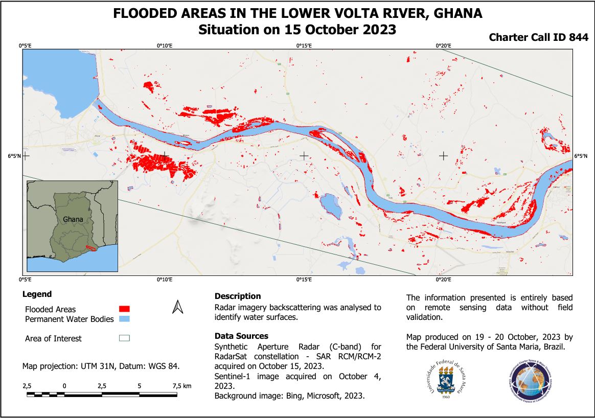
Flooded areas in the lower Volta river, Ghana
版权: RADARSAT Constellation Mission Imagery © Government of Canada (2023) - RADARSAT is an official mark of the Canadian Space Agency
Map produced by the Federal University of Santa Maria, Brazil
Information about the Product
已获得: 16/10/2023, 17/10/2023
源: RCM
类别: Delineation Monitoring Maps
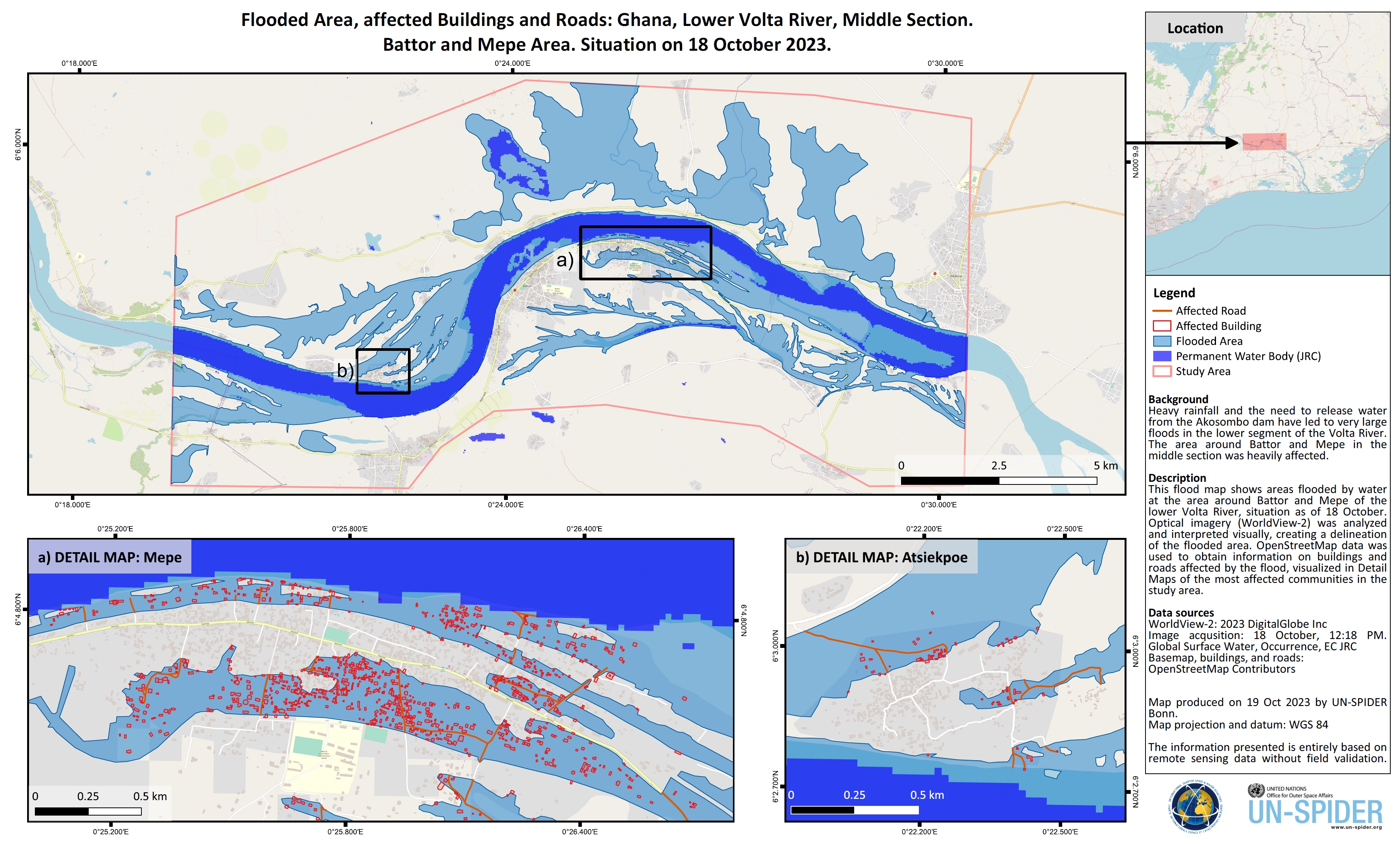
Buildings and Roads affected by Flooding around the Lower Volta River in the Battor and Mepe Area, Ghana
版权: WorldView-2 © (2023) DigitalGlobe, Inc., Longmont CO USA 80503. DigitalGlobe and the DigitalGlobe logos are trademarks of DigitalGlobe, Inc. The use and/or dissemination of this data and/or of any product in any way derived there from are restricted. Unauthorized use and/or dissemination is prohibited.
Map produced by UN-SPIDER
Information about the Product
已获得: 18/10/2023
源: WorldView-2
类别: Delineation Map
 返回完整的响应档案

